
Districts of Nauru
Encyclopedia
| |
|
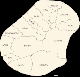
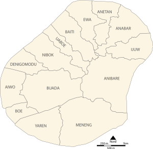
There are 14 district
s in the Republic of Nauru
. Each one consists of a number of traditional villages, many of which are uninhabited or destroyed nowadays.
There are 14 district
District
Districts are a type of administrative division, in some countries managed by a local government. They vary greatly in size, spanning entire regions or counties, several municipalities, or subdivisions of municipalities.-Austria:...
s in the Republic of Nauru
Nauru
Nauru , officially the Republic of Nauru and formerly known as Pleasant Island, is an island country in Micronesia in the South Pacific. Its nearest neighbour is Banaba Island in Kiribati, to the east. Nauru is the world's smallest republic, covering just...
. Each one consists of a number of traditional villages, many of which are uninhabited or destroyed nowadays.
| Nr. | District | Old Name | Area(ha Hectare The hectare is a metric unit of area defined as 10,000 square metres , and primarily used in the measurement of land. In 1795, when the metric system was introduced, the are was defined as being 100 square metres and the hectare was thus 100 ares or 1/100 km2... ) |
Population(2005) | No. of villages |
|---|---|---|---|---|---|
| 1 | Aiwo | Aiue | 100 | 1,092 | 8 |
| 2 | Anabar | Anabar | 143 | 502 | 15 |
| 3 | Anetan | Añetañ | 100 | 516 | 12 |
| 4 | Anibare | Anybody | 314 | 160 | 17 |
| 5 | Baiti | Beidi | 123 | 572 | 15 |
| 6 | Boe | Boi | 66 | 795 | 4 |
| 7 | Buada | Buada | 266 | 716 | 14 |
| 8 | Denigomodu | Denikomotu | 118 | 2,827 | 17 |
| 9 | Ewa | Eoa | 117 | 318 | 12 |
| 10 | Ijuw | Ijub | 112 | 303 | 13 |
| 11 | Meneng | Meneñ | 288 | 1,830 | 18 |
| 12 | Nibok | Ennibeck | 136 | 432 | 11 |
| 13 | Uaboe | Ueboi | 97 | 335 | 6 |
| 14 | Yaren | Moqua | 150 | 820 | 7 |
| Nauru | Naoero | 2,130 | 11,218 | 169 |
See also
- List of cities in Nauru
- ISO 3166-2:NRISO 3166-2:NRISO 3166-2:NR is the entry for Nauru in ISO 3166-2, part of the ISO 3166 standard published by the International Organization for Standardization , which defines codes for the names of the principal subdivisions of all countries coded in ISO 3166-1.Currently for Nauru, ISO 3166-2 codes are defined...