
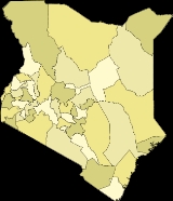
Districts of Kenya
Overview
The provinces of Kenya
Kenya
Kenya , officially known as the Republic of Kenya, is a country in East Africa that lies on the equator, with the Indian Ocean to its south-east...
are subdivided into number of districts (wilaya).
Following a High Court ruling in September 2009, there are 46 legal districts in Kenya (district headquarters are in parenthesis):
Coast Province:
- Kilifi DistrictKilifi DistrictKilifi District is an administrative district in the Coast Province of Kenya. Its capital is coastal town Kilifi. The district has a population of 281,552 .The district is located north and northeast of Mombasa...
(KilifiKilifiKilifi is a town on the Kenyan coast, home to many resorts. It sits on the estuary of the Rare River in Kenya. The beach itself is known as Bofa Beach and is said to be one of the best beaches in Kenya. The town lies on the Kilifi Creek between Malindi and Mombasa. Kilifi is capital of the Kilifi...
) - Kwale DistrictKwale DistrictKwale District is an administrative district in the Coast Province of Kenya. Its capital town is Kwale, although Msambweni and Ukunda are larger.The district has a population of 496.133 ....
(KwaleKwaleKwale is a small town in Coast Province, Kenya. It is located at around ; 30 km southwest of Mombasa and 15 km inland. It is capital of the Kwale District. The town has an urban population of 4,200 . It is next to the Shimba Hills National Reserve...
) - Lamu DistrictLamu DistrictLamu District is a district of Kenya's Coast Province. Its district headquarters is Lamu town. The district covers a strip of northeastern coastal mainland and the Lamu Archipelago. Lamu District has a population of 72,686 and its land area is 6,167 km².There are extensive mangrove forests in...
(LamuLamu-Threats to Lamu:In a 2010 report titled Saving Our Vanishing Heritage, Global Heritage Fund identified Lamu as one of 12 worldwide sites most "On the Verge" of irreparable loss and damage, citing insufficient management and development pressure as primary causes.- See also :* Juma and the Magic...
) - Mombasa DistrictMombasa DistrictMombasa District is one of the 71 districts of Kenya. Its capital and the only town is Mombasa.Kenya is divided into eight provinces, which are subdivided into 71 districts. In Coast Province there are seven districts, Mombasa District being one of them. It is situated in the southeast of Coast...
(MombasaMombasaMombasa is the second-largest city in Kenya. Lying next to the Indian Ocean, it has a major port and an international airport. The city also serves as the centre of the coastal tourism industry....
) - Taita-Taveta DistrictTaita-Taveta DistrictTaita Taveta-District is one of the seventy-one districts of Kenya, located in the Coast Province of that country. It lies approximately 200 km northwest of Mombasa and 360 km southeast of Nairobi city....
(WundanyiWundanyiWundanyi is a town lying in the Taita Hills of southern Kenya, west of Voi and near Ngerenyi. It is also the Headquarters of Taita-Taveta District...
) - Tana River DistrictTana River DistrictTana River District is a district of Coast Province, Kenya. It is named after the Tana River itself. It has an area of and a population of 180,901 according to the 1999 census. The district capital is Hola ....
(Tana RiverTana River (Kenya)The long Tana River is the longest river in Kenya, and gives its name to the Tana River District. Its tributaries include the Thika. The river rises in the Aberdare Mountains to the west of Nyeri. Initially it runs east before turning south around the massif of Mount Kenya. The river then runs...
)
North Eastern Province:
- Garissa DistrictGarissa DistrictGarissa District is an administrative district in the North Eastern Province of Kenya. Its capital town is Garissa. The district has a population of 329,939...
(GarissaGarissaGarissa is a city in the North Eastern Province of Kenya. It is the capital of both the province and Garissa District.-Overview:Garissa is located at and has a population of 65,881 inhabitants . The Tana River flows through the city....
) - Mandera DistrictMandera DistrictMandera District is an administrative district in the North Eastern Province of Kenya. Its capital town is Mandera. The district has a population of 250,372 and an area of 26,744 km² .The district has three constituencies:...
(ManderaManderaMandera is a town in North Eastern Province, Kenya. It is capital of the Mandera District. The town is located at around , near the borders with Ethiopia and Somalia. It has a population of 30,433 ....
) - Wajir DistrictWajir DistrictWajir District is an administrative district in the North Eastern Province of Kenya. Its capital town is Wajir. The district has a population of 319,261 and an area of 55,501 km² . Wajir district has only one local authority: Wajir county council. The district has four constituencies: Wajir North,...
(WajirWajirWajir is a town in the North Eastern Province of Kenya. It is the capital of Wajir County.-History:A cluster of cairns near Wajir are generally ascribed by the local inhabitants to the Madanle, a semi-legendary people of high stature, who are associated with the Somali Ajuuraan. A. T...
)
Eastern Province:
- Embu DistrictEmbu DistrictEmbu District is an administrative district in the Eastern Province of Kenya. Its capital town is Embu. The district has a population of 278,196 The district has two constituencies: Manyatta Constituency and Runyenjes Constituency.- External links :*...
(Embu) - Isiolo DistrictIsiolo DistrictIsiolo District is an administrative district inEastern Province of Kenya. Its population is 100.861 , and its capital is Isiolo town. Isiolo District is to be the first district to be developed as part of the Kenya Vision 2030 program....
(IsioloIsioloIsiolo is a town in the Eastern Province, Kenya. It is situated in the Upper Eastern sub-region, and lies 285 kilometres north of Nairobi, the capital city of Kenya. The town grew around the local military camps, much of the population being descended from former Somali soldiers who had fought in...
) - Kitui DistrictKitui DistrictKitui District is an administrative district in the Eastern Province of Kenya. Its capital town is Kitui. The district has a population of 515,422 and an area of 20,402 km² .- Government :...
(KituiKituiKitui is a town in Kenya, 130 kilometers east of Nairobi and 75 kilometers east of Machakos. It used to be the capital of the Kitui District in Eastern Province of Kenya. Due to political reforms, Kitui is now the headquarters of Kitui County, which covers a larger area than the former district did...
) - Machakos DistrictMachakos DistrictMachakos District is an administrative district in the Eastern Province of Kenya. Its capital town is Machakos. The district has a population of 906,644 ....
(MachakosMachakosMachakos is a town in Kenya, 64 kilometres southeast of Nairobi. It is the capital of the Machakos District in Eastern Province of Kenya. Machakos Town is a major rural centre, and also a satellite town due to its proximity to Nairobi. Its population is rapidly growing and is 192,117...
) - Makueni DistrictMakueni DistrictMakueni District is an administrative district in the Eastern Province of Kenya. Its capital town is Wote. The district has a population of 771,545 and an area of 7,966 km² .The district has five constituencies:*Mbooni Constituency...
(Makueni) - Marsabit DistrictMarsabit DistrictMarsabit District is an administrative district in the Eastern Province of Kenya. Its capital town is Marsabit. The district has a population of 121,478 The district is located in northern Kenya. It borders the eastern shore of Lake Turkana....
(MarsabitMarsabitMarsabit is a town in northern Kenya, located 170 km east of the center of the East African Rift at 37°58' E, 2°19' N . It is located in the Eastern Province and is almost surrounded by the Marsabit National Park and Reserve...
) - Mbeere DistrictMbeere DistrictMbeere District is an administrative district in the Eastern Province of Kenya. Its capital town is Siakago. The district has a population of 170,950 and an area of 2,093 km². The district was split from Embu District in 1996...
(SiakagoSiakagoSiakago is a town in Kenya. It is the capital of Mbeere District of Eastern Province. It hosts Mbeere county council and is also headquarters of Siakago division of Mbeere District. Siakago division has a population of 34,330, of whom 2,312 are classified urban Siakago is a town in Kenya. It is the...
) - Meru DistrictMeru DistrictMeru Central District is one of the seventy-one districts of Kenya, located in that country's Eastern Province. In 1992, it was split from the large Meru District, along with Meru North District, Meru South District, and Tharaka District....
(MeruMeru, Kenya-Transport:The City of Meru is linked to Nairobi by a paved road, whether from the south around the east side of Mount Kenya, via Embu, or from the northwest around the west and north side of Mount Kenya, via Nanyuki and Timau....
) - Tharaka-Nithi District
Central Province:
- Kiambu DistrictKiambu DistrictKiambu District is an administrative district in the Central Province of Kenya. Its capital town is Kiambu. The district is adjacent to the northern border of Nairobi and has a population of 744,010....
(KiambuKiambuKiambu is a town in Central Province, Kenya. It is located at around , in the elevation of about 1,720 m. It has an urban population of 13,814. It is the capital of the Kiambu District, which bounds the northern border of Nairobi...
) - Kirinyaga DistrictKirinyaga DistrictKirinyaga District is an administrative district in the Central Province of Kenya. Its capital town is Kerugoya. The district has a population of 457,105 and an area of 1,478 km² .The district has four constituencies:*Mwea Constituency...
(KerugoyaKerugoyaKerugoya is a town in Kenya. It is the capital of Kirinyaga District of Central Province. Kerugoya is located 10 kilometres east of Karatina and 40 kilometres west of Embu....
/Kutus) - Murang'a District (Murang'aMurang'aMurang'a is a town in Central Province of Kenya. The town was previously called Fort Hall. It is the administrative centre of Murang'a District and is mainly inhabited by the Kikuyu community....
) - Nyandarua DistrictNyandarua DistrictNyandarua District is an administrative district in the Central Province of Kenya. Its capital town is Ol Kalou. Formerly the capital was Nyahururu, but it is now part of the Laikipia District. Nyandarua District has population of 479,902 and an area of 3,304 km²...
(NyahururuNyahururuNyahururu is a town in Kenya, lying east of Nakuru. It is part of Laikipia District in Rift Valley Province. Despite this, Nyahururu formerly functioned as the administrative capital of Nyandarua District, one of seven districts that constitute Central Province in Kenya, until the headquarters...
) - Nyeri DistrictNyeri DistrictNyeri District is a district in the Central Province of Kenya. Its headquarters is in Nyeri town. It has a population of 661,156 and an area of 3,356 km².The district is located on the southwest flank of Mount Kenya...
(NyeriNyeriNyeri is a town in situated in the Central Highlands of Kenya Kenya, which was the administrative headquarters of the country's former Central Province...
)
Rift Valley Province:
- Baringo DistrictBaringo DistrictBaringo District is an administrative district in the Rift Valley Province of Kenya. Its capital town is Kabarnet. The district has a population of 264,978 and an area of 8,646 km² ....
(KabarnetKabarnetKabarnet is a town in the Rift Valley Province of Kenya. The town has an urban population of 9,583 and a total population of 24,661 - Geography :...
) - Bomet DistrictBomet DistrictBomet District is an administrative district in the Rift Valley Province of Kenya. Its capital town is Bomet. The district has a population of 382,794 and an area of 1,882 km² .The district has three electoral constituencies:...
(BometBometBomet is a city in the Rift Valley Province, Kenya. It is the capital of Bomet District. Bomet has an urban population of 4426 and a total population of 42,024 . It is located along the B3 road between Nairobi and Kisii via Narok....
) - Elgeyo-Marakwet District
- Kajiado DistrictKajiado DistrictKajiado District is an administrative district in the Rift Valley Province of Kenya. It has a population of 406,054 and an area of 21,903 km². The district borders Nairobi city and extends to the Kenya-Tanzania border further south. The district capital is Kajiado.The district is divided into seven...
(KajiadoKajiadoKajiado is a town in the Rift Valley Province, Kenya. The town is located south of Nairobi, along the Nairobi – Arusha highway. Kajiado has an urban population of 8128 . Local people are predominantly of the Maasai tribe....
) - Kericho DistrictKericho DistrictKericho is a district in the Rift Valley Province of Kenya. Its capital town is Kericho. It has a population of 468,493 and an area of 2,111 km² .The district has three constituencies:*Belgut Constituency*Ainamoi Constituency...
(KerichoKerichoKericho is a Kenyan County located to the South West of the country and lies within the highlands west of The Great Rift Valley. The capital of the district is Kericho town. The district home to the best of Kenyan Tea which is world famous for its brightness, attractive color, brisk flavor and...
) - Laikipia District (NanyukiNanyukiNanyuki is a market town in central-east Rift Valley region of Kenya lying northwest of Mount Kenya along the A2 road and at the terminus of the branch railway from Nairobi. It is situated just north of the Equator . It was founded in 1907 by British settlers, some of whose descendants still live...
) - Nakuru DistrictNakuru DistrictNakuru District is a district in the Rift Valley Province, Kenya. The district capital is Nakuru. With a population of 1,187,039 , it is the second largest district in Kenya after Nairobi. Nakuru District has an area of 7,242 km²....
(NakuruNakuruNakuru, the provincial capital of Kenya's Rift Valley province, with roughly 300,000 inhabitants, and currently the fourth largest urban centre in the country, lies about 1850 m above sea level...
) - Nandi DistrictNandi DistrictNandi District is an administrative district in the Rift Valley Province of Kenya. Its capital town is Kapsabet. The district has a population of 578,751 .The topography of the district is dominated by the Nandi Hills...
(KapsabetKapsabetKapsabet is a town in the Rift Valley Province, Kenya. It is the capital of Nandi Central District. Kapsabet hosts a municipal council and divisional headquarters of Kapsabet administrative division...
) - Narok DistrictNarok DistrictNarok District is an administrative district in Kenya. The Narok District is located in the Rift Valley Province, and has a population of 365,750...
(NarokNarokNarok is an town west of Nairobi that supports Kenya's economy in south-west Kenya, along the Great Rift Valley. Narok is the district capital of the Narok County and stands as the major centre of commerce in the district. Narok has a population of around 40,000 people, mostly Maasai...
) - Samburu DistrictSamburu DistrictSamburu District is a district in Rift Valley Province, Kenya. It covers an area of roughly 21,000 km² in northern Kenya where the Samburu tribe live...
(MaralalMaralalMaralal is a small hillside market town in northern Kenya, lying east of the Loroghi Plateau within the Samburu District. It is the administrative headquarters of the Samburu people. The town has an urban population of 16,281 . The market was pioneered by some Somali settlers in the 1920s.Nearby...
) - Trans Nzoia District (KitaleKitaleKitale is an agricultural town in western Kenya situated between Mount Elgon and the Cherengani Hills at an elevation of around . Its urban population was estimated at 220,000 in 2007....
) - Turkana DistrictTurkana DistrictTurkana District is an administrative district in the Rift Valley Province of Kenya. Turkana is the northwesternmost district in Kenya. It is bordered by the countries of Uganda to the west; South Sudan and Ethiopia, including the disputed Ilemi Triangle, to the north and northeast; and Lake...
(LodwarLodwarLodwar is the largest town in northwestern Kenya, located west of Lake Turkana on the A1 road. Its main industries are basket weaving and tourism. The Loima Hills lie to its west. Lodwar is the capital of Turkana District...
) - Uasin Gishu DistrictUasin Gishu DistrictUasin Gishu District is one of the seventy-one districts of Kenya, located in the Rift Valley Province. The city of Eldoret is its capital, administrative center and commercial center....
(EldoretEldoretEldoret is a town in western Kenya and the administrative centre of Uasin Gishu District of Rift Valley Province. Lying south of the Cherangani Hills, the local elevation varies from about 2100 metres above sea level at the airport to more than 2700 metres in nearby areas...
) - West Pokot DistrictWest Pokot DistrictWest Pokot District is an administrative district in the Rift Valley Province of Kenya. Its capital town is Kapenguria. The district has a population of 308,086 and an area of 9,064 km² . Pokot people inhabit the area....
(KapenguriaKapenguriaKapenguria is a town lying north east of Kitale on the A1 road in Kenya. Kapenguria is capital of the West Pokot District. Kapenguria forms a municipality with an urban population of 13,000 and a total population of 56,000 ....
)
Western Province:
- Bungoma DistrictBungoma DistrictBungoma District is a district in the Western Province of Kenya. Its capital town is Bungoma. It has a population of 876,491 and an area of 2,069 km².The economy of Bungoma district is mainly agricultural, centering on the sugar cane and maize industries...
(BungomaBungomaBungoma is a town in Western Province of Kenya, bordered by Uganda in the west. Bungoma town was established as a trading centre in the early 20th century. The town is the headquarters of Kenya's Bungoma District and it hosts a municipal council...
) - BusiaBusia District, KenyaBusia is a district in the Western Province of Kenya. It borders Kakamega District to the east, Bungoma District and Teso district to the north, Busia District, Uganda to the west, and Lake Victoria to the south....
(BusiaBusia townBusia town may refer to:* Busia, Uganda, a town in Uganda at the border with Kenya* Busia, Kenya, a town in Kenya at the border with Uganda...
) - Kakamega DistrictKakamega DistrictKakamega District is a district in the Western Province of Kenya. Its capital town is Kakamega. It has a population of 603,422 and an area of 1,395 km² .The district has four constituencies:*Malava Constituency*Lurambi Constituency...
(KakamegaKakamegaKakamega is a town in western Kenya lying about 30 km north of the Equator. It is the headquarters of . The town has a population of 73,607 ....
) - Vihiga DistrictVihiga DistrictVihiga District is an administrative district in the Western Province of Kenya. Its capital town is Mbale, which is located in Vihiga Division. The district has a population of 498,883 and an area of 563 km²...
(VihigaVihiga-Geography:The town is along the road between Kisumu and Kakamega, and only five kilometres north of the equator. Vihiga bears the same name as its district, Vihiga District, which is one of the eight districts in Kenya's Western Province...
)
Nyanza Province:
- Homa Bay DistrictHoma Bay DistrictHoma Bay District is an administrative district in the Nyanza Province of Kenya. Its capital town is Homa Bay. The district has a population of 288,540 and an area of 1,160 km² .The district has two constituencies:*Ndhiwa Constituency...
(Homa BayHoma BayHoma Bay is a bay and town on the south shore of Winam Gulf of Lake Victoria, in western Kenya. It lies near Mount Homa and Ruma National Park, the latter noted for Jackson's hartebeests and roan antelope .Homa Bay was once the District...
) - Kisii CentralKisii DistrictKisii District is a district in the Nyanza Province in southwestern Kenya. Its capital town is Kisii. The district is inhabited mostly by the Gusii people.- Subdivisions :The County has 4 electoral Constituencies:*Bonchari Constituency...
(Kisii) - Kisumu DistrictKisumu DistrictKisumu District is an administrative district of Nyanza Province in western Kenya. Its headquarters is Kisumu City. It has a population of 504,359 and a land area of 919 km² . The main industries are subsistence agriculture and fishery on Lake Victoria. Kisumu Town is the main commercial...
(KisumuKisumuKisumu is a port city in western Kenya at , with a population of 355,024 . It is the third largest city in Kenya, the principal city of western Kenya, the immediate former capital of Nyanza Province and the headquarters of Kisumu County. It has a municipal charter but no city charter...
) - Migori DistrictMigori DistrictMigori District is an administrative district in the Nyanza Province of Kenya. It is located in southwestern Kenya. Its capital town is Migori. The district has a population of 514,897 and an area of 2,005 km² ....
(MigoriMigoriMigori is a town in Nyanza Province of Kenya. Migori is capital of the Migori District. The town is located 63 km south of Kisii and 22 km north of the Tanzanian border. The town has an urban population of 31,644 and total population of 46,576 ....
) - Nyamira District (NyamiraNyamiraNyamira District is an administrative district in the Nyanza Province of Kenya. It was formerly part of the Kisii District and is sometimes called as North Kisii District. The district has a population of 492,102...
) - Siaya DistrictSiaya DistrictSiaya District is one of the twelve districts that make up Nyanza Province in the southwest part of Kenya. It is bordered by Busia District to the North, Vihiga and Butere/Mumias Districts to the North-East, Bondo District to the South, and Kisumu District to the South-East. The total area of the...
(SiayaSiayaSiaya is a town in Nyanza Province of Kenya. It is the capital of Siaya District. It is located 50 kilometres Northwest of Kisumu, the provincial capital. Siaya forms munipical council with population of 41,174, of whom 13,787 are classified urban ....
)
- Baringo DistrictBaringo DistrictBaringo District is an administrative district in the Rift Valley Province of Kenya. Its capital town is Kabarnet. The district has a population of 264,978 and an area of 8,646 km² ....
(Kabarrnet) - Bomet DistrictBomet DistrictBomet District is an administrative district in the Rift Valley Province of Kenya. Its capital town is Bomet. The district has a population of 382,794 and an area of 1,882 km² .The district has three electoral constituencies:...
(BometBometBomet is a city in the Rift Valley Province, Kenya. It is the capital of Bomet District. Bomet has an urban population of 4426 and a total population of 42,024 . It is located along the B3 road between Nairobi and Kisii via Narok....
) - Bondo DistrictBondo DistrictBondo District is an administrative district in the Nyanza Province of Kenya. Its capital town is Bondo. The Bondo District has a population of 238,780 . The district is relatively new; it was created in 1998 from southern parts of the Siaya District...
(BondoBondo, KenyaBondo is a town in Nyanza Province of Kenya. It the capital of Bondo District. Bondo is located 50 kilometres west of Kisumu, the provincial capital. Bondo forms a town council with a population of 29,165, of whom 7,797 are classified urban ....
) - Bungoma DistrictBungoma DistrictBungoma District is a district in the Western Province of Kenya. Its capital town is Bungoma. It has a population of 876,491 and an area of 2,069 km².The economy of Bungoma district is mainly agricultural, centering on the sugar cane and maize industries...
(BungomaBungomaBungoma is a town in Western Province of Kenya, bordered by Uganda in the west. Bungoma town was established as a trading centre in the early 20th century. The town is the headquarters of Kenya's Bungoma District and it hosts a municipal council...
) - Buret DistrictBuret DistrictBuret District is an administrative district in the Rift Valley Province of Kenya. Its capital town is Litein. The district has a population of 316,882 and an area of 955 km² . The district has two electoral constituencies: Konoin Constituency and Bureti Constituency ....
(LiteinLitein'Litein' is a small town in the Rift Valley Province, Kenya. It is the capital of the Buret District. Litein has an urban population of 2300.The town is along the Kericho-Sotik road...
) - BusiaBusia District, KenyaBusia is a district in the Western Province of Kenya. It borders Kakamega District to the east, Bungoma District and Teso district to the north, Busia District, Uganda to the west, and Lake Victoria to the south....
(BusiaBusia townBusia town may refer to:* Busia, Uganda, a town in Uganda at the border with Kenya* Busia, Kenya, a town in Kenya at the border with Uganda...
) - Butere/Mumias DistrictButere/Mumias DistrictButere/Mumias District is an administrative district in the Western Province of Kenya. Its capital town is Butere. The district has a population of 476,928 and an area of 939 km² .The district has four constituencies:*Butere Constituency...
(ButereButereButere is a town in the Western Province of Kenya. It has an urban population of 8636 The town is the capital of Butere District formerly Butere/Mumias District.-Transportation Links:...
) - Embu DistrictEmbu DistrictEmbu District is an administrative district in the Eastern Province of Kenya. Its capital town is Embu. The district has a population of 278,196 The district has two constituencies: Manyatta Constituency and Runyenjes Constituency.- External links :*...
(Embu) - Garissa DistrictGarissa DistrictGarissa District is an administrative district in the North Eastern Province of Kenya. Its capital town is Garissa. The district has a population of 329,939...
(GarissaGarissaGarissa is a city in the North Eastern Province of Kenya. It is the capital of both the province and Garissa District.-Overview:Garissa is located at and has a population of 65,881 inhabitants . The Tana River flows through the city....
) - Gucha DistrictGucha DistrictGucha District is a district in Nyanza Province, western Kenya. It is also known by the name: South Kisii District or Ogembo District. Its population is approximately 461,000...
(OgemboOgemboOgembo is a town, capital of the Gucha District of Nyanza Province, Kenya....
) - Homa Bay DistrictHoma Bay DistrictHoma Bay District is an administrative district in the Nyanza Province of Kenya. Its capital town is Homa Bay. The district has a population of 288,540 and an area of 1,160 km² .The district has two constituencies:*Ndhiwa Constituency...
(Homa BayHoma BayHoma Bay is a bay and town on the south shore of Winam Gulf of Lake Victoria, in western Kenya. It lies near Mount Homa and Ruma National Park, the latter noted for Jackson's hartebeests and roan antelope .Homa Bay was once the District...
) - Ijara DistrictIjara DistrictIjara is an administrative district in the North Eastern Province of Kenya. On May 20, 2000, it was carved out from another and larger Garissa District. It covers an area of 11’332 km² and, according to the population census of 1999, has a population of 62,571...
(IjaraIjaraIjara is a town in the North Eastern Province of Kenya. It is capital of the Ijara District. Ijara is a very remote town; it is located 100 km north of Lamu and 180 km south of Garissa....
) - Isiolo DistrictIsiolo DistrictIsiolo District is an administrative district inEastern Province of Kenya. Its population is 100.861 , and its capital is Isiolo town. Isiolo District is to be the first district to be developed as part of the Kenya Vision 2030 program....
(IsioloIsioloIsiolo is a town in the Eastern Province, Kenya. It is situated in the Upper Eastern sub-region, and lies 285 kilometres north of Nairobi, the capital city of Kenya. The town grew around the local military camps, much of the population being descended from former Somali soldiers who had fought in...
) - Kajiado DistrictKajiado DistrictKajiado District is an administrative district in the Rift Valley Province of Kenya. It has a population of 406,054 and an area of 21,903 km². The district borders Nairobi city and extends to the Kenya-Tanzania border further south. The district capital is Kajiado.The district is divided into seven...
(KajiadoKajiadoKajiado is a town in the Rift Valley Province, Kenya. The town is located south of Nairobi, along the Nairobi – Arusha highway. Kajiado has an urban population of 8128 . Local people are predominantly of the Maasai tribe....
) - Kakamega DistrictKakamega DistrictKakamega District is a district in the Western Province of Kenya. Its capital town is Kakamega. It has a population of 603,422 and an area of 1,395 km² .The district has four constituencies:*Malava Constituency*Lurambi Constituency...
(KakamegaKakamegaKakamega is a town in western Kenya lying about 30 km north of the Equator. It is the headquarters of . The town has a population of 73,607 ....
) - Keiyo DistrictKeiyo DistrictKeiyo District is an administrative district in the Rift Valley Province of Kenya. The district was formed in 1994, when Elgeyo/Marakwet-District was split into two, the other half is Marakwet District of today. Keiyo District has a population of 143.865...
(ItenItenIten is a town in Rift Valley Province of Kenya. It is located along the road between Eldoret and Kabarnet. Elgeyo escarpment and Kerio River are located east of Iten. The town has a population of 4000 ....
/Tambach) - Kericho DistrictKericho DistrictKericho is a district in the Rift Valley Province of Kenya. Its capital town is Kericho. It has a population of 468,493 and an area of 2,111 km² .The district has three constituencies:*Belgut Constituency*Ainamoi Constituency...
(KerichoKerichoKericho is a Kenyan County located to the South West of the country and lies within the highlands west of The Great Rift Valley. The capital of the district is Kericho town. The district home to the best of Kenyan Tea which is world famous for its brightness, attractive color, brisk flavor and...
) - Kiambu DistrictKiambu DistrictKiambu District is an administrative district in the Central Province of Kenya. Its capital town is Kiambu. The district is adjacent to the northern border of Nairobi and has a population of 744,010....
(KiambuKiambuKiambu is a town in Central Province, Kenya. It is located at around , in the elevation of about 1,720 m. It has an urban population of 13,814. It is the capital of the Kiambu District, which bounds the northern border of Nairobi...
) - Kilifi DistrictKilifi DistrictKilifi District is an administrative district in the Coast Province of Kenya. Its capital is coastal town Kilifi. The district has a population of 281,552 .The district is located north and northeast of Mombasa...
(KilifiKilifiKilifi is a town on the Kenyan coast, home to many resorts. It sits on the estuary of the Rare River in Kenya. The beach itself is known as Bofa Beach and is said to be one of the best beaches in Kenya. The town lies on the Kilifi Creek between Malindi and Mombasa. Kilifi is capital of the Kilifi...
) - Kirinyaga DistrictKirinyaga DistrictKirinyaga District is an administrative district in the Central Province of Kenya. Its capital town is Kerugoya. The district has a population of 457,105 and an area of 1,478 km² .The district has four constituencies:*Mwea Constituency...
(KerugoyaKerugoyaKerugoya is a town in Kenya. It is the capital of Kirinyaga District of Central Province. Kerugoya is located 10 kilometres east of Karatina and 40 kilometres west of Embu....
/Kutus) - Kisii CentralKisii DistrictKisii District is a district in the Nyanza Province in southwestern Kenya. Its capital town is Kisii. The district is inhabited mostly by the Gusii people.- Subdivisions :The County has 4 electoral Constituencies:*Bonchari Constituency...
(Kisii) - Kisumu DistrictKisumu DistrictKisumu District is an administrative district of Nyanza Province in western Kenya. Its headquarters is Kisumu City. It has a population of 504,359 and a land area of 919 km² . The main industries are subsistence agriculture and fishery on Lake Victoria. Kisumu Town is the main commercial...
(KisumuKisumuKisumu is a port city in western Kenya at , with a population of 355,024 . It is the third largest city in Kenya, the principal city of western Kenya, the immediate former capital of Nyanza Province and the headquarters of Kisumu County. It has a municipal charter but no city charter...
) - Kitui DistrictKitui DistrictKitui District is an administrative district in the Eastern Province of Kenya. Its capital town is Kitui. The district has a population of 515,422 and an area of 20,402 km² .- Government :...
(KituiKituiKitui is a town in Kenya, 130 kilometers east of Nairobi and 75 kilometers east of Machakos. It used to be the capital of the Kitui District in Eastern Province of Kenya. Due to political reforms, Kitui is now the headquarters of Kitui County, which covers a larger area than the former district did...
) - Koibatek DistrictKoibatek DistrictKoibatek District is an administrative district in the Rift Valley Province of Kenya. Its capital town is Eldama Ravine. The district has a population of 138,163 and an area of 2,306 km² .The district has two electoral constituencies:*Mogotio Constituency...
(Eldama RavineEldama RavineEldama Ravine is a kenyan town a few miles north of the equator,geographical coordinates 0° 30' 0" North, 35° 43' 0" East. It was established as an administrative point by British colonialists and later served as a transit route for lumber harvested from surrounding forests.It is the headquarters...
) - Kuria DistrictKuria DistrictKuria District is an administrative district in the Nyanza Province of Kenya. Its capital town is Kehancha . The district has a population of 256,086 and an area of 581 km²...
(Kehancha) - Kwale DistrictKwale DistrictKwale District is an administrative district in the Coast Province of Kenya. Its capital town is Kwale, although Msambweni and Ukunda are larger.The district has a population of 496.133 ....
(KwaleKwaleKwale is a small town in Coast Province, Kenya. It is located at around ; 30 km southwest of Mombasa and 15 km inland. It is capital of the Kwale District. The town has an urban population of 4,200 . It is next to the Shimba Hills National Reserve...
) - Laikipia District (NanyukiNanyukiNanyuki is a market town in central-east Rift Valley region of Kenya lying northwest of Mount Kenya along the A2 road and at the terminus of the branch railway from Nairobi. It is situated just north of the Equator . It was founded in 1907 by British settlers, some of whose descendants still live...
) - Lamu DistrictLamu DistrictLamu District is a district of Kenya's Coast Province. Its district headquarters is Lamu town. The district covers a strip of northeastern coastal mainland and the Lamu Archipelago. Lamu District has a population of 72,686 and its land area is 6,167 km².There are extensive mangrove forests in...
(LamuLamu-Threats to Lamu:In a 2010 report titled Saving Our Vanishing Heritage, Global Heritage Fund identified Lamu as one of 12 worldwide sites most "On the Verge" of irreparable loss and damage, citing insufficient management and development pressure as primary causes.- See also :* Juma and the Magic...
) - Lugari DistrictLugari DistrictLugari District is one of the seventy-one districts of Kenya, located in that country's Western Province. Its capital is Lugari.- Lugari District :Lugari District has a population of 215,920 and an area of 670 km² ....
(LugariLugariLugari is a town in the Western Province of Kenya. It is the capital of Lugari District. The town is located 10 kilometres east of Webuye. Lugari has an urban population of 5000 ....
) - Machakos DistrictMachakos DistrictMachakos District is an administrative district in the Eastern Province of Kenya. Its capital town is Machakos. The district has a population of 906,644 ....
(MachakosMachakosMachakos is a town in Kenya, 64 kilometres southeast of Nairobi. It is the capital of the Machakos District in Eastern Province of Kenya. Machakos Town is a major rural centre, and also a satellite town due to its proximity to Nairobi. Its population is rapidly growing and is 192,117...
) - Makueni DistrictMakueni DistrictMakueni District is an administrative district in the Eastern Province of Kenya. Its capital town is Wote. The district has a population of 771,545 and an area of 7,966 km² .The district has five constituencies:*Mbooni Constituency...
(Makueni) - Malindi DistrictMalindi DistrictMalindi District is an administrative district in the Coast Province of Kenya. Its capital is the coastal town of Malindi. The district has a population of 544,303 . Malindi Town is increasingly becoming known as Kenya’s version of "Little Italy"...
(MalindiMalindiMalindi is a town on Malindi Bay at the mouth of the Galana River, lying on the Indian Ocean coast of Kenya. It is 120 kilometres northeast of Mombasa. The population of Malindi is 117,735 . It is the capital of the Malindi District.Tourism is the major industry in Malindi. The city is...
) - Mandera DistrictMandera DistrictMandera District is an administrative district in the North Eastern Province of Kenya. Its capital town is Mandera. The district has a population of 250,372 and an area of 26,744 km² .The district has three constituencies:...
(ManderaManderaMandera is a town in North Eastern Province, Kenya. It is capital of the Mandera District. The town is located at around , near the borders with Ethiopia and Somalia. It has a population of 30,433 ....
) - Maragua DistrictMaragua DistrictMaragua District is one of the seventy-one districts of Kenya, located in the Central Province. Its capital is the town of Maragua. Maragua District has a population of 387,969 and an area of 868 km²...
(MaraguaMaraguaMaragua is a town in the Central Province of Kenya. It is the capital of the Maragua District. The town is located along Thika–Sagana road just 10 km south of Murang'a. Maragua town has an urban population of 4,286 and a total population of 27,384 . Norwegian-Kenyan singer Stella Mwangi was...
) - Marakwet DistrictMarakwet DistrictMarakwet District is an administrative district in the Rift Valley Province of Kenya. Its capital town is Kapsowar. The district has a population of 140.629 . Local people are predominantly of the Marakwet tribe....
(KapsowarKapsowarKapsowar is a small town in the Rift Valley Province, Kenya. In 1994 Kapsowar became the headquarters of the Marakwet District. Prior to this, the Marakwet and Keiyo tribes were collectively grouped into the Elgeiyo-Markwet District...
) - Marsabit DistrictMarsabit DistrictMarsabit District is an administrative district in the Eastern Province of Kenya. Its capital town is Marsabit. The district has a population of 121,478 The district is located in northern Kenya. It borders the eastern shore of Lake Turkana....
(MarsabitMarsabitMarsabit is a town in northern Kenya, located 170 km east of the center of the East African Rift at 37°58' E, 2°19' N . It is located in the Eastern Province and is almost surrounded by the Marsabit National Park and Reserve...
) - Mbeere DistrictMbeere DistrictMbeere District is an administrative district in the Eastern Province of Kenya. Its capital town is Siakago. The district has a population of 170,950 and an area of 2,093 km². The district was split from Embu District in 1996...
(Mbeere) - Meru Central District (MeruMeru, Kenya-Transport:The City of Meru is linked to Nairobi by a paved road, whether from the south around the east side of Mount Kenya, via Embu, or from the northwest around the west and north side of Mount Kenya, via Nanyuki and Timau....
) - Meru North DistrictMeru North DistrictMeru North District is one of the seventy-one districts of Kenya, located in that country's Eastern Province. In 1992, it was split from the large Meru District, along with Meru Central District, Meru South District, and Tharaka District....
(MauaMauaMaua is a town in the Eastern Province of Kenya. It is the capital of Meru North District . Maua hosts a municipal council and headquarters Igembe Central, one of 15 administrative divisions in the district....
) - Meru South DistrictMeru South DistrictMeru South District is one of the seventy-one districts of Kenya, located in that country's Eastern Province. In 1992, it was split from the large Meru District, along with Meru Central District, Meru North District, and Tharaka District....
(ChukaChukaChuka may refer to:*Chuka, Kenya, a town*Chuka, Tibet, a village*Chuka Umunna , British Member of Parliament, commentator and lawyer*Stefano Okaka Chuka , Italian football player*Chuka , a 1967 western starring Rod Taylor...
) - Migori DistrictMigori DistrictMigori District is an administrative district in the Nyanza Province of Kenya. It is located in southwestern Kenya. Its capital town is Migori. The district has a population of 514,897 and an area of 2,005 km² ....
(MigoriMigoriMigori is a town in Nyanza Province of Kenya. Migori is capital of the Migori District. The town is located 63 km south of Kisii and 22 km north of the Tanzanian border. The town has an urban population of 31,644 and total population of 46,576 ....
) - Mombasa DistrictMombasa DistrictMombasa District is one of the 71 districts of Kenya. Its capital and the only town is Mombasa.Kenya is divided into eight provinces, which are subdivided into 71 districts. In Coast Province there are seven districts, Mombasa District being one of them. It is situated in the southeast of Coast...
(MombasaMombasaMombasa is the second-largest city in Kenya. Lying next to the Indian Ocean, it has a major port and an international airport. The city also serves as the centre of the coastal tourism industry....
) - Mount Elgon DistrictMount Elgon DistrictMount Elgon District is an administrative district in the Western Province of Kenya. Its capital town is Kapsokwony.-Geography and demographics:The district is located on southeastern slopes of Mount Elgon...
(Mount ElgonMount ElgonMount Elgon is an extinct shield volcano on the border of Uganda and Kenya, north of Kisumu and west of Kitale.- Physical features :It is the oldest and largest solitary volcano in East Africa, covering an area of around 3500 km²....
) - Moyale DistrictMoyale DistrictMoyale District is an administrative district in the Eastern Province of Kenya. Its capital town is Moyale. It has population of 53,479 and an area of 9,390 km² . The district has only one local authority, Moyale county council. The district has one electoral constituency, the Moyale Constituency.-...
(MoyaleMoyaleMoyale is a market town on the border of Ethiopia and Kenya, which is split between the two countries: the larger portion is in Ethiopia , and the smaller is in Kenya . There are four disputed locations within the Moyale district between the Somali and Oromo regions...
) - Murang'a District (Murang'aMurang'aMurang'a is a town in Central Province of Kenya. The town was previously called Fort Hall. It is the administrative centre of Murang'a District and is mainly inhabited by the Kikuyu community....
) - Mwingi District (MwingiMwingiMwingi District is one of the seventy-one districts of Kenya, located in that country's Eastern Province. The district has a population of 303.828 . Its capital is the Mwingi town.Local people are mostly of the Akamba tribe...
) - Nairobi DistrictNairobiNairobi is the capital and largest city of Kenya. The city and its surrounding area also forms the Nairobi County. The name "Nairobi" comes from the Maasai phrase Enkare Nyirobi, which translates to "the place of cool waters". However, it is popularly known as the "Green City in the Sun" and is...
(NairobiNairobiNairobi is the capital and largest city of Kenya. The city and its surrounding area also forms the Nairobi County. The name "Nairobi" comes from the Maasai phrase Enkare Nyirobi, which translates to "the place of cool waters". However, it is popularly known as the "Green City in the Sun" and is...
) - Nakuru DistrictNakuru DistrictNakuru District is a district in the Rift Valley Province, Kenya. The district capital is Nakuru. With a population of 1,187,039 , it is the second largest district in Kenya after Nairobi. Nakuru District has an area of 7,242 km²....
(NakuruNakuruNakuru, the provincial capital of Kenya's Rift Valley province, with roughly 300,000 inhabitants, and currently the fourth largest urban centre in the country, lies about 1850 m above sea level...
) - NandiNandi DistrictNandi District is an administrative district in the Rift Valley Province of Kenya. Its capital town is Kapsabet. The district has a population of 578,751 .The topography of the district is dominated by the Nandi Hills...
(KapsabetKapsabetKapsabet is a town in the Rift Valley Province, Kenya. It is the capital of Nandi Central District. Kapsabet hosts a municipal council and divisional headquarters of Kapsabet administrative division...
) - Narok DistrictNarok DistrictNarok District is an administrative district in Kenya. The Narok District is located in the Rift Valley Province, and has a population of 365,750...
(NarokNarokNarok is an town west of Nairobi that supports Kenya's economy in south-west Kenya, along the Great Rift Valley. Narok is the district capital of the Narok County and stands as the major centre of commerce in the district. Narok has a population of around 40,000 people, mostly Maasai...
) - Nyamira District (NyamiraNyamiraNyamira District is an administrative district in the Nyanza Province of Kenya. It was formerly part of the Kisii District and is sometimes called as North Kisii District. The district has a population of 492,102...
) - Nyandarua DistrictNyandarua DistrictNyandarua District is an administrative district in the Central Province of Kenya. Its capital town is Ol Kalou. Formerly the capital was Nyahururu, but it is now part of the Laikipia District. Nyandarua District has population of 479,902 and an area of 3,304 km²...
(Ol KalouOl KalouOl Kalou is a town in Kenya. It is the headquarters of Nyandarua District of Central Province. It is located west of Aberdare range and 40 kilometres east of Nakuru. Ol Kalou is connected by road to Gilgil, Nyahururu and Nakuru...
) - Nyando DistrictNyando DistrictNyando district is a fairly new district in Kenya which broke away from Kisumu District in Nyanza Province in 1998. Nyando district borders the Rift Valley Province. The district is named after the Nyando River....
(Awasi) - Nyeri DistrictNyeri DistrictNyeri District is a district in the Central Province of Kenya. Its headquarters is in Nyeri town. It has a population of 661,156 and an area of 3,356 km².The district is located on the southwest flank of Mount Kenya...
(NyeriNyeriNyeri is a town in situated in the Central Highlands of Kenya Kenya, which was the administrative headquarters of the country's former Central Province...
) - Rachuonyo DistrictRachuonyo DistrictRachuonyo District is an administrative district in the Nyanza Province of Kenya. Its capital town is Kosele, formerly it was located in Oyugis. The district has a population of 307,126 and an area of 945 km² . The district has two constituencies: Kasipul Kabondo and Karachuonyo.- External links :*...
(OyugisOyugisOyugis is a town in Kenya. It is the commercial and financial centre of Rachuonyo District in Nyanza Province, whose administrative headquarters are located some twenty kilometres away at Kosele. Oyugis is located 20 kilometres north of Kisii town along the major A1 highway...
) - Samburu DistrictSamburu DistrictSamburu District is a district in Rift Valley Province, Kenya. It covers an area of roughly 21,000 km² in northern Kenya where the Samburu tribe live...
(MaralalMaralalMaralal is a small hillside market town in northern Kenya, lying east of the Loroghi Plateau within the Samburu District. It is the administrative headquarters of the Samburu people. The town has an urban population of 16,281 . The market was pioneered by some Somali settlers in the 1920s.Nearby...
) - Siaya DistrictSiaya DistrictSiaya District is one of the twelve districts that make up Nyanza Province in the southwest part of Kenya. It is bordered by Busia District to the North, Vihiga and Butere/Mumias Districts to the North-East, Bondo District to the South, and Kisumu District to the South-East. The total area of the...
(SiayaSiayaSiaya is a town in Nyanza Province of Kenya. It is the capital of Siaya District. It is located 50 kilometres Northwest of Kisumu, the provincial capital. Siaya forms munipical council with population of 41,174, of whom 13,787 are classified urban ....
) - Suba DistrictSuba DistrictSuba District is an administrative district in the Nyanza Province of Kenya. Its capital town is Mbita Point. The district has a population of 155,666 and an area of 1,055 km² . Suba district is named after the Suba people, who inhabit local Rusinga and Mfangano Islands.The district has two...
(Mbita) - Taita-Taveta DistrictTaita-Taveta DistrictTaita Taveta-District is one of the seventy-one districts of Kenya, located in the Coast Province of that country. It lies approximately 200 km northwest of Mombasa and 360 km southeast of Nairobi city....
(WundanyiWundanyiWundanyi is a town lying in the Taita Hills of southern Kenya, west of Voi and near Ngerenyi. It is also the Headquarters of Taita-Taveta District...
) - Tana River DistrictTana River DistrictTana River District is a district of Coast Province, Kenya. It is named after the Tana River itself. It has an area of and a population of 180,901 according to the 1999 census. The district capital is Hola ....
(Tana RiverTana River (Kenya)The long Tana River is the longest river in Kenya, and gives its name to the Tana River District. Its tributaries include the Thika. The river rises in the Aberdare Mountains to the west of Nyeri. Initially it runs east before turning south around the massif of Mount Kenya. The river then runs...
) - Teso DistrictTeso District, KenyaTeso District is an administrative district in the Western Province of Kenya. Its capital town is Amagoro, next to Malaba a border town between Kenya and Uganda. The district has a population of 181,491 and an area of . The district has one electoral constituency, Amagoro Constituency . Alupe...
(MalabaMalabaMalaba may refer to:*Malaba, Kenya, a town in Teso District, western Kenya, on the border with Uganda*Malaba, Uganda, a town in Tororo District, eastern Uganda on the border with Kenya*Malaba, Ngounié, Gabon*Malaba, Nyanga, Gabon*Malaba, Cameroon...
) - Tharaka DistrictTharaka DistrictTharaka District is one of the seventy-one districts of Kenya located in that country's Eastern Province. The district has an area of 1570 km² and a population of 100,992 , none of them classified as urban...
(TharakaTharakaTharaka was a mythological king from Sri Lanka.According to legend, he designed the craft "Dandu Monara", which was able to fly, but he was unable to build it. Instead the king Ravana built it, and stories from Ramayana tell of him using it to abduct queen Seetha from Rama....
) - Thika DistrictThika DistrictThika District is an administrative district in the Central Province of Kenya. Its capital town is Thika. The district is adjacent to the northeastern border of Nairobi. The district has a population of 645.713 ....
(ThikaThikaThika is an industrial town in Central Province, Kenya, lying on the A2 road 40 km north east of Nairobi, near the confluence of Thika River & Chania River. Thika has a population of 200,000and is growing rapidly, as is the entire greater Nairobi area...
) - Trans Mara DistrictTrans Mara DistrictTrans Mara District is an administrative district in the Rift Valley Province of Kenya. Its capital town is Kilgoris. The district has a population of 170,591 and an area of 2,846 km²...
(KilgorisKilgorisKilgoris is a town in the Rift Valley Province, Kenya. It is the capital of the Trans Mara District. The town has a population of 4500 ....
) - Trans Nzoia District (KitaleKitaleKitale is an agricultural town in western Kenya situated between Mount Elgon and the Cherengani Hills at an elevation of around . Its urban population was estimated at 220,000 in 2007....
) - Turkana DistrictTurkana DistrictTurkana District is an administrative district in the Rift Valley Province of Kenya. Turkana is the northwesternmost district in Kenya. It is bordered by the countries of Uganda to the west; South Sudan and Ethiopia, including the disputed Ilemi Triangle, to the north and northeast; and Lake...
(LodwarLodwarLodwar is the largest town in northwestern Kenya, located west of Lake Turkana on the A1 road. Its main industries are basket weaving and tourism. The Loima Hills lie to its west. Lodwar is the capital of Turkana District...
) - Uasin Gishu DistrictUasin Gishu DistrictUasin Gishu District is one of the seventy-one districts of Kenya, located in the Rift Valley Province. The city of Eldoret is its capital, administrative center and commercial center....
(EldoretEldoretEldoret is a town in western Kenya and the administrative centre of Uasin Gishu District of Rift Valley Province. Lying south of the Cherangani Hills, the local elevation varies from about 2100 metres above sea level at the airport to more than 2700 metres in nearby areas...
) - Vihiga DistrictVihiga DistrictVihiga District is an administrative district in the Western Province of Kenya. Its capital town is Mbale, which is located in Vihiga Division. The district has a population of 498,883 and an area of 563 km²...
(VihigaVihiga-Geography:The town is along the road between Kisumu and Kakamega, and only five kilometres north of the equator. Vihiga bears the same name as its district, Vihiga District, which is one of the eight districts in Kenya's Western Province...
) - Wajir DistrictWajir DistrictWajir District is an administrative district in the North Eastern Province of Kenya. Its capital town is Wajir. The district has a population of 319,261 and an area of 55,501 km² . Wajir district has only one local authority: Wajir county council. The district has four constituencies: Wajir North,...
(WajirWajirWajir is a town in the North Eastern Province of Kenya. It is the capital of Wajir County.-History:A cluster of cairns near Wajir are generally ascribed by the local inhabitants to the Madanle, a semi-legendary people of high stature, who are associated with the Somali Ajuuraan. A. T...
) - West Pokot DistrictWest Pokot DistrictWest Pokot District is an administrative district in the Rift Valley Province of Kenya. Its capital town is Kapenguria. The district has a population of 308,086 and an area of 9,064 km² . Pokot people inhabit the area....
(KapenguriaKapenguriaKapenguria is a town lying north east of Kitale on the A1 road in Kenya. Kapenguria is capital of the West Pokot District. Kapenguria forms a municipality with an urban population of 13,000 and a total population of 56,000 ....
)
In early 2007 37 new districts were created by the government..