

District of West Augusta
Encyclopedia
West Virginia
West Virginia is a state in the Appalachian and Southeastern regions of the United States, bordered by Virginia to the southeast, Kentucky to the southwest, Ohio to the northwest, Pennsylvania to the northeast and Maryland to the east...
and southwestern Pennsylvania
Pennsylvania
The Commonwealth of Pennsylvania is a U.S. state that is located in the Northeastern and Mid-Atlantic regions of the United States. The state borders Delaware and Maryland to the south, West Virginia to the southwest, Ohio to the west, New York and Ontario, Canada, to the north, and New Jersey to...
.
History
Before the Colony of Virginia and the Province of PennsylvaniaProvince of Pennsylvania
The Province of Pennsylvania, also known as Pennsylvania Colony, was founded in British America by William Penn on March 4, 1681 as dictated in a royal charter granted by King Charles II...
agreed to extend the Mason-Dixon line
Mason-Dixon line
The Mason–Dixon Line was surveyed between 1763 and 1767 by Charles Mason and Jeremiah Dixon in the resolution of a border dispute between British colonies in Colonial America. It forms a demarcation line among four U.S. states, forming part of the borders of Pennsylvania, Maryland, Delaware, and...
westward from the western boundary line of the Province of Maryland
Province of Maryland
The Province of Maryland was an English and later British colony in North America that existed from 1632 until 1776, when it joined the other twelve of the Thirteen Colonies in rebellion against Great Britain and became the U.S...
, both claimed a large area of what is now southwestern Pennsylvania
Pennsylvania
The Commonwealth of Pennsylvania is a U.S. state that is located in the Northeastern and Mid-Atlantic regions of the United States. The state borders Delaware and Maryland to the south, West Virginia to the southwest, Ohio to the west, New York and Ontario, Canada, to the north, and New Jersey to...
.
The area was sparsely populated in the years following the French and Indian War
French and Indian War
The French and Indian War is the common American name for the war between Great Britain and France in North America from 1754 to 1763. In 1756, the war erupted into the world-wide conflict known as the Seven Years' War and thus came to be regarded as the North American theater of that war...
(1754–63), and neither colony made any serious attempts at forming a local government until the early 1770s. Virginia administered the region as a part of Augusta County, Virginia
Augusta County, Virginia
As of the census of 2000, there were 65,615 people, 24,818 households, and 18,911 families residing in the county. The population density was 68 people per square mile . There were 26,738 housing units at an average density of 28 per square mile...
. Pennsylvania later established Westmoreland County
Westmoreland County, Pennsylvania
-Demographics:As of the census of 2000, there were 369,993 people, 149,813 households, and 104,569 families residing in the county. The population density was 361 people per square mile . There were 161,058 housing units at an average density of 157 per square mile...
with its seat at Hannastown
Hannastown, Pennsylvania
Hannastown is an unincorporated community and important historical and archaeological site located in Hempfield Township, Westmoreland County, Pennsylvania. Although the village is not tracked by the Census Bureau, it has been assigned the ZIP code 15635....
, overlapping Virginia's claims.
Virginia's governor, Lord Dunmore
John Murray, 4th Earl of Dunmore
John Murray, 4th Earl of Dunmore was a British peer and colonial governor. He was the son of William Murray, 3rd Earl of Dunmore, and his wife Catherine . He is best remembered as the last royal governor of the Colony of Virginia.John was the eldest son of William and Catherine Murray, and nephew...
, traveled to Pittsburgh
Pittsburgh, Pennsylvania
Pittsburgh is the second-largest city in the US Commonwealth of Pennsylvania and the county seat of Allegheny County. Regionally, it anchors the largest urban area of Appalachia and the Ohio River Valley, and nationally, it is the 22nd-largest urban area in the United States...
, which Virginia claimed as part of its territory, to appoint government officials under the Virginia charter. In 1774, the Virginia assembly separated the western portion of Augusta County's territory and formed the District of West Augusta.
The preamble to a later act defined the boundaries of West Augusta as follows:
- Whereas, it is expedient to ascertain the boundary between the county of Augusta and the district of West Augusta-Be it therefore enacted by the General Assembly of the Commonwealth of Virginia, that the boundary between the said district and county shall be as follows:
- Beginning on the Alleghany Mountains, between the heads of the Potomac, Cheat and Green Briar Rivers (Haystack Knob, or north end of Pocahontas County);
- thence along the ridge of mountains which divides the waters of Cheat River from those of Green Briar, and that branch of the Monongahela River called Tyger's Valley River, to the Monongahela River;
- thence up the said river, and the west fork thereof, to Bingerman's Creek, on the northwest side of the said west fork;
- thence up the said creek to the head thereof,
- thence in a direct course to the head of Middle Island Creek, a branch of the Ohio,
- and thence to the Ohio, including all the waters of said creek in the aforesaid District of West Augusta, all that territory lying to the northward of the aforesaid boundary, and to the westward of the States of Pennsylvania and Maryland, shall be deemed, and is hereby declared to be, within the District of West Augusta.
The following several years were contentious. Local officials from Virginia arrested their counterparts from Pennsylvania and vice versa. Each state made movements to stem settlers' coming in from the other state.
The government of West Augusta was administered from Fort Dunmore
Fort Pitt (Pennsylvania)
Fort Pitt was a fort built at the location of Pittsburgh, Allegheny County, Pennsylvania.-French and Indian War:The fort was built from 1759 to 1761 during the French and Indian War , next to the site of former Fort Duquesne, at the confluence the Allegheny River and the Monongahela River...
in what is now Pittsburgh
Pittsburgh, Pennsylvania
Pittsburgh is the second-largest city in the US Commonwealth of Pennsylvania and the county seat of Allegheny County. Regionally, it anchors the largest urban area of Appalachia and the Ohio River Valley, and nationally, it is the 22nd-largest urban area in the United States...
. The seat of government was later moved to Augusta Town in what is now Washington County, Pennsylvania
Washington County, Pennsylvania
-Government and politics:As of November 2008, there are 152,534 registered voters in Washington County .* Democratic: 89,027 * Republican: 49,025 * Other Parties: 14,482...
.
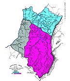
In 1776, the District of West Augusta was divided into three counties: Ohio County
Ohio County, West Virginia
As of the census of 2000, there were 47,427 people, 19,733 households, and 12,155 families residing in the county. The population density was 447 people per square mile . There were 22,166 housing units at an average density of 209 per square mile...
, Monongalia County
Monongalia County, West Virginia
As of the census of 2000, there were 81,866 people, 33,446 households, and 18,495 families residing in the county. The population density was 227 people per square mile . There were 36,695 housing units at an average density of 102 per square mile...
, and Yohogania County
Yohogania County
Yohogania County was created by the new state of Virginia in 1776, in an area long disputed between Virginia and Pennsylvania. The county ceased to exist after the border dispute between the two states was resolved in the 1780s...
. Ohio County encompassed most of the western region of the district bordering the Ohio River, including parts of what are now Washington and Greene Counties in Pennsylvania. Monongalia County encompassed much of what is now north-central West Virginia, and parts of what are now Washington, Greene and Fayette Counties in Pennsylvania. Yohogania County consisted of much of what is now southwestern Pennsylvania, including all of what is now Westmoreland County, Pennsylvania, parts of the present counties of Washington
Washington County, Pennsylvania
-Government and politics:As of November 2008, there are 152,534 registered voters in Washington County .* Democratic: 89,027 * Republican: 49,025 * Other Parties: 14,482...
, Fayette
Fayette County, Pennsylvania
Fayette County is a county located in the U.S. state of Pennsylvania. As of the2010 census, the population was 136,606. The county is part of the Pittsburgh Metropolitan Statistical Area....
, Allegheny
Allegheny County, Pennsylvania
Allegheny County is a county in the southwestern part of the U.S. state of Pennsylvania. As of the 2010 census, the population was 1,223,348; making it the second most populous county in Pennsylvania, following Philadelphia County. The county seat is Pittsburgh...
, and Beaver
Beaver County, Pennsylvania
-Demographics:As of the census of 2000, there were 181,412 people, 72,576 households, and 50,512 families residing in the county. The population density was 418 people per square mile . There were 77,765 housing units at an average density of 179 per square mile...
, and the counties of Hancock County, West Virginia
Hancock County, West Virginia
As of the census of 2000, there were 32,667 people, 13,678 households, and 9,506 families residing in the county. The population density was 394 people per square mile . There were 14,728 housing units at an average density of 178 per square mile...
and the northern part of Brooke County, West Virginia
Brooke County, West Virginia
As of the census of 2000, there were 25,447 people, 10,396 households, and 7,152 families residing in the county. The population density was 286 people per square mile . There were 11,150 housing units at an average density of 126 per square mile...
.
In 1780, the boundary dispute between Virginia and Pennsylvania was finally settled when both sides agreed to extend the Mason-Dixon line westward from Maryland to 80° 31′ west, the current western border of Pennsylvania.
Most of Yohogania County became part of Pennsylvania; that section of its lands was divided between Westmoreland County and the newly formed Washington County in Pennsylvania; Beaver and Allegheny were later created from those counties. The relatively small part of Yohogania that remained in Virginia was subsumed into Ohio County. That area is now divided between Brooke County and Hancock County, Virginia (now West Virginia), which were later formed from Ohio County, at the northernmost tip of West Virginia's Northern Panhandle.