
Davis County, Utah
Encyclopedia
Davis County is a county
located in the U.S. state
of Utah
. As of 2010 the population was 306,479, a 28.2% increase over the 2000 figure of 238,994. It was named for Daniel C. Davis
, captain in the Mormon Battalion
. The county is part of the Ogden
–Clearfield
Metropolitan Statistical Area
as well as the Salt Lake City
–Ogden–Clearfield Combined Statistical Area. Its county seat
is Farmington
and its largest city is Layton
.
Davis County also contains the Lagoon Amusement Park
in Farmington
, the main amusement park serving the Wasatch Front
.
on the north and the Jordan River
on the south. During its first 50 years, Davis County grew slowly. With the advent of the Utah Central Rail Road in 1870, a transition to mechanized agriculture and a surge of commerce, banking, improved roads, new water systems, and electrification of homes began. However, by 1940, the population was barely 16,000.
With the establishment of Hill Air Force Base
in northern Davis County, there was a surge of civilian employment after World War II
. The county doubled in population between 1940 and 1950, and doubled again between 1950 and 1960 as part of the nationwide suburb
boom that was occurring at the time. By 1990 there were 188,000 residents, and in 2000, there were 239,000. By 2030, the county is expected to have a population of about 360,000.
Today, most of the population resides in Layton
, Bountiful
, Kaysville
, and Clearfield
while most of the growth is concentrated in the northwest, northeast, and southwest portions of the county, and especially in such cities as Syracuse
, Clinton
, West Point
, South Weber
, and Woods Cross
.

is the county's governing body. Each of these commissioners serve four-year terms, which overlap for the sake of continuity. They are responsible for all county services and operations. They approve, adopt, and amend the budget; they also serve as the legislative body and regulate business licensing in the county's unincorporated areas. The current county commissioners are John Petroff, Louenda Downs, and Bret Millburn, with Commissioner Petroff currently serving as Commission Chair and Commissioner Downs serving as Vice Chair.
The assessor is responsible for the valuing of all real property in the county. The current assessor is James B. Ivie.
The clerk/auditor serves as the county's chief financial and budget officer. The current Clerk/Auditor is Steve Rawlings.
The treasurer is responsible for collection and investing of county funds. The current Treasurer is Mark Altom.
, the county has a total area of 634 square miles (1,642.1 km²), the smallest county in Utah, of which 304 square miles (787.4 km²) is land and 329 square miles (852.1 km²) (51.95%) is water.
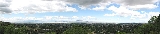
The county lies generally between the Great Salt Lake
on the west and the Wasatch Range
on the east, which rises to a height of 9707 feet (2,958.7 m) in the county at Thurston Peak. The Great Salt Lake in the west, which is surrounded by marshland and mudflat
s, lies at an average elevation
of approximately 4200 feet (1,280.2 m), varying depending on the water level, which can lead to drastic changes in the lake size due to its shallowness. Davis County includes Antelope Island
, which is the largest island in the lake. The entire island is a state park, designated to protect natural scenery and especially wildlife on the island, which includes bighorn sheep
, pronghorn antelope, and a bison
herd. The narrow, populated portion that lies between the Great Salt Lake and the Wasatch Range is a portion of the Wasatch Front
, which is very narrow at this point, complicating north-south transportation in the county.
Davis County lies in a semiarid climate zone. Snow is frequent during winter, with up to 90 in (228.6 cm) annually on high bench areas in the east and at least 60 inches (152.4 cm) on the valley floor. Annual precipitation averages between 18 and 25 in (457.2 and 635 mm) in the county, with spring being the wettest season and summer the driest. Summers are hot, with several days each year averaging above 95 °F (35 °C). However, the humidity is low, making for comparatively comfortable temperatures. In winter, temperatures sometimes drop below 0 °F (-17.8 °C), but rarely for extended periods of time. Compared to Salt Lake County
to the south, the weather in Davis County is extreme. Lake-effect snows hit the southern portion of the county harder, and even in non-lake-effect storms, the lack of a rain shadow
in Davis County (much of Salt Lake County lies in the rain shadow of the Oquirrh Mountains
) means that storms often hit Davis County harder. In addition, canyon winds from the east can sometimes cause devastating wind damage, and wind gusts above 100 mph (160.9 km/h) have been reported. This occurs when a powerful high pressure system situates itself over Wyoming
, and is a common occurrence. Extreme wind events, however, have seemed to decline in frequency in recent years.
, which runs north-south through the center of the county. US-89 enters parallel to I-15 from Salt Lake County
to the south and runs north through North Salt Lake
and Bountiful
as a city road before merging with I-15. It re-emerges again in Farmington
near the Lagoon Amusement Park
, heading along the eastern benches on the slopes of the Wasatch Range, entering Weber County
near South Weber
. US-89 is planned to eventually be upgraded to a freeway through eastern Layton
north to its interchange with I-84
near the Weber County border. Congestion is a significant problem in the county, as east-west transportation is restricted by the narrow urban corridor and many of its citizens commute south to Salt Lake County.
To relieve congestion in the county, the Legacy Parkway
began construction in March 2006. Construction began near the US-89/I-15 interchange in Farmington in 2004, but was soon halted due to a lawsuit filed by environmentalist
s, who were concerned that the road would harm marshlands along the eastern edge of the Great Salt Lake and asked for a review of the completeness of the environmental impact statement
. A settlement was reached in November 2005 and the final injunction was lifted in February 2006. The Legacy Parkway opened on September 13, 2008, running from the US-89/I-15 interchange in Farmington southward to connect with I-215
near the border with Salt Lake County. An extensive trail system, wetland protection measures, and landscaping were implemented along the highway in response to the environmentalist's concerns, in addition to a lower speed limit and a ban of semi-trailer trucks on the highway.
On April 28, 2008, the Utah Transit Authority
opened the FrontRunner
commuter rail line from Salt Lake City north to Ogden
, serving the length of Davis County with stations in Woods Cross
, Farmington
, Layton
, and Clearfield
.
frequently encounter commuting time traffic bottlenecks between Davis and Salt Lake
Counties. The Legacy Parkway
and FrontRunner
commuter rail project recently finished construction to combat this problem.
The commuter rail stations in the county have spurred plans for extensive transit-oriented development (TOD), including the Station Park development in Farmington
, which, when completed, is expected to be the largest shopping center in Utah. Farmington is also the home of the Lagoon Amusement Park
, the primary amusement park located along the Wasatch Front.
Davis County's largest employer is Hill Air Force Base
. Hill AFB is a dominant feature of the economy of Davis County. Earnings of civilians at Hill AFB are almost double the state average. Hill AFB accounts for about 12% of the economy of Davis County and about 2.6% of the economy of Utah. Hill AFB provides employment for nearly 23,000 military and civilian personnel (approximately 4,500 active duty, 1,200 reservists, 13,000 federal civil servants, and 4,000 civilian contractors). Other large employers include Davis School District
, Lagoon Amusement Park
, and Lifetime Products
.
. There are currently 59 elementary schools, 16 junior high schools, 8 high schools, and 3 alternative schools in the school district. The high schools are as follows:
The Utah College of Applied Technology operates a campus in Kaysville known as the Davis Applied Technology College (DATC).
Utah State University
owns and operates the Utah Botanical Center
in Kaysville, which includes an education center. Weber State University
also operates a campus in Layton
.
As of the census
of 2010, there were 306,479 people, 93,545 households, and 76,205 families residing in the county. The population density
was 1,008.15 people per square mile (388.44/km²). There were 97,570 housing units at an average density of 320.95 per square mile (123.66/km²). The racial makeup of the county was 90.04% White
, 1.21% Black
or African American
, 0.46% Native American
, 1.77% Asian
, 0.59% Pacific Islander
, 3.24% from other races
, and 2.69% from two or more races. 8.42% of the population were Hispanic
or Latino
of any race.
There were 93,545 households out of which 45.1% had children under the age of 18 living with them, 67.99% were married couples
living together, 9.59% had a female householder with no husband present, and 18.54% were non-families. 15.23% of all households were made up of individuals and 5.27% had someone living alone who was 65 years of age or older. The average household size was 3.24 and the average family size was 3.63.
In the county, the population was spread out with 37.23% under the age of 20, 6.56% from 20 to 24, 28.13% from 25 to 44, 19.92% from 45 to 64, and 8.15% who were 65 years of age or older. The median age was 29.2 years. For every 100 females there were 100.85 males. For every 100 females age 18 and over, there were 97.09 males.
County (United States)
In the United States, a county is a geographic subdivision of a state , usually assigned some governmental authority. The term "county" is used in 48 of the 50 states; Louisiana is divided into parishes and Alaska into boroughs. Parishes and boroughs are called "county-equivalents" by the U.S...
located in the U.S. state
U.S. state
A U.S. state is any one of the 50 federated states of the United States of America that share sovereignty with the federal government. Because of this shared sovereignty, an American is a citizen both of the federal entity and of his or her state of domicile. Four states use the official title of...
of Utah
Utah
Utah is a state in the Western United States. It was the 45th state to join the Union, on January 4, 1896. Approximately 80% of Utah's 2,763,885 people live along the Wasatch Front, centering on Salt Lake City. This leaves vast expanses of the state nearly uninhabited, making the population the...
. As of 2010 the population was 306,479, a 28.2% increase over the 2000 figure of 238,994. It was named for Daniel C. Davis
Daniel C. Davis
Daniel Coon Davis was the captain of Company E in the Mormon Battalion. He became an early leader of Davis County, Utah, which is named after him.Davis was born in Petersburg, New York....
, captain in the Mormon Battalion
Mormon Battalion
The Mormon Battalion was the only religiously based unit in United States military history, and it served from July 1846 to July 1847 during the Mexican-American War. The battalion was a volunteer unit of between 534 and 559 Latter-day Saints men led by Mormon company officers, commanded by regular...
. The county is part of the Ogden
Ogden, Utah
Ogden is a city in Weber County, Utah, United States. Ogden serves as the county seat of Weber County. The population was 82,825 according to the 2010 Census. The city served as a major railway hub through much of its history, and still handles a great deal of freight rail traffic which makes it a...
–Clearfield
Clearfield, Utah
Clearfield is a city in Davis County, Utah, United States. The population was 25,974 at the 2000 census. The city grew drastically during the 1940s, with the formation of Hill Air Force Base, and in the 1950s with the nation-wide increase in suburb and "bedroom" community populations and has been...
Metropolitan Statistical Area
Ogden-Clearfield metropolitan area
The Ogden-Clearfield Metropolitan Statistical Area, as defined by the United States Census Bureau, is an area consisting of three counties in north central Utah, anchored by the cities of Ogden and Clearfield...
as well as the Salt Lake City
Salt Lake City, Utah
Salt Lake City is the capital and the most populous city of the U.S. state of Utah. The name of the city is often shortened to Salt Lake or SLC. With a population of 186,440 as of the 2010 Census, the city lies in the Salt Lake City metropolitan area, which has a total population of 1,124,197...
–Ogden–Clearfield Combined Statistical Area. Its county seat
County seat
A county seat is an administrative center, or seat of government, for a county or civil parish. The term is primarily used in the United States....
is Farmington
Farmington, Utah
Farmington is a city in Davis County, Utah, United States. It is part of the Ogden–Clearfield, Utah Metropolitan Statistical Area. The population was 18,255 at the 2010 census. It is the county seat of Davis County...
and its largest city is Layton
Layton, Utah
-External links:*...
.
Davis County also contains the Lagoon Amusement Park
Lagoon Amusement Park
Lagoon is an amusement park in Farmington, Utah, United States located about seventeen miles north of Salt Lake City. It is privately owned...
in Farmington
Farmington, Utah
Farmington is a city in Davis County, Utah, United States. It is part of the Ogden–Clearfield, Utah Metropolitan Statistical Area. The population was 18,255 at the 2010 census. It is the county seat of Davis County...
, the main amusement park serving the Wasatch Front
Wasatch Front
The Wasatch Front is a metropolitan region in the north-central part of the U.S. state of Utah. It consists of a chain of cities and towns stretched along the Wasatch Range from approximately Santaquin in the south to Brigham City in the north...
.
History
Davis County was created on October 5, 1850, with Farmington designated as its county seat, because of its geographic location midway between boundaries at the Weber RiverWeber River
The Weber River is a c. long river of northern Utah, USA. It begins in the northwest of the Uinta Mountains and empties into the Great Salt Lake. The Weber River was named for American fur trapper John Henry Weber.-Weber River:...
on the north and the Jordan River
Jordan River (Utah)
The Jordan River in the U.S. state of Utah is a river about long. Regulated by pumps at its headwaters at Utah Lake, it flows northward through the Salt Lake Valley and empties into the Great Salt Lake. Four of Utah's five largest cities—Salt Lake City, West Valley City, West Jordan and...
on the south. During its first 50 years, Davis County grew slowly. With the advent of the Utah Central Rail Road in 1870, a transition to mechanized agriculture and a surge of commerce, banking, improved roads, new water systems, and electrification of homes began. However, by 1940, the population was barely 16,000.
With the establishment of Hill Air Force Base
Hill Air Force Base
Hill Air Force Base is a major U.S. Air Force Base located in northern Utah, just south of the city of Ogden, and near the towns of Clearfield, Riverdale, Roy, Sunset, and Layton. It is about north of Salt Lake City. The base was named in honor of Major Ployer Peter Hill of the U.S. Army Air...
in northern Davis County, there was a surge of civilian employment after World War II
World War II
World War II, or the Second World War , was a global conflict lasting from 1939 to 1945, involving most of the world's nations—including all of the great powers—eventually forming two opposing military alliances: the Allies and the Axis...
. The county doubled in population between 1940 and 1950, and doubled again between 1950 and 1960 as part of the nationwide suburb
Suburb
The word suburb mostly refers to a residential area, either existing as part of a city or as a separate residential community within commuting distance of a city . Some suburbs have a degree of administrative autonomy, and most have lower population density than inner city neighborhoods...
boom that was occurring at the time. By 1990 there were 188,000 residents, and in 2000, there were 239,000. By 2030, the county is expected to have a population of about 360,000.
Today, most of the population resides in Layton
Layton, Utah
-External links:*...
, Bountiful
Bountiful, Utah
Bountiful is a city in Davis County, Utah, United States. As of the 2010 census, the city population was 42,552, a three percent increase over the 2000 figure of 41,301...
, Kaysville
Kaysville, Utah
Kaysville is a city in Davis County, Utah, United States. It is part of the Ogden–Clearfield, Utah Metropolitan Statistical Area. The population was 20,351 at the 2000 census, and 25,820 as of the 2008 estimates.-History:...
, and Clearfield
Clearfield, Utah
Clearfield is a city in Davis County, Utah, United States. The population was 25,974 at the 2000 census. The city grew drastically during the 1940s, with the formation of Hill Air Force Base, and in the 1950s with the nation-wide increase in suburb and "bedroom" community populations and has been...
while most of the growth is concentrated in the northwest, northeast, and southwest portions of the county, and especially in such cities as Syracuse
Syracuse, Utah
Syracuse is a city in Davis County, Utah, United States, between the Great Salt Lake and Interstate 15, about north of Salt Lake City. It is part of the Ogden–Clearfield, Utah Metropolitan Statistical Area.Syracuse was incorporated on September 3, 1935....
, Clinton
Clinton, Utah
Clinton is a city in Davis County, Utah, United States. It is part of the Ogden–Clearfield, Utah Metropolitan Statistical Area. The population was 12,585 at the 2000 census, while the 2008 estimates placed it at 19,855...
, West Point
West Point, Utah
West Point is a city in Davis County, Utah, United States. It is part of the Ogden–Clearfield, Utah Metropolitan Statistical Area. The population was 6,033 at the 2000 census....
, South Weber
South Weber, Utah
South Weber is a city in Davis County, Utah, United States. It is part of the Ogden–Clearfield, Utah Metropolitan Statistical Area. The population was 4,260 at the 2000 census.-History:...
, and Woods Cross
Woods Cross, Utah
Woods Cross is a city in Davis County, Utah, United States. It is part of the Ogden–Clearfield, Utah Metropolitan Statistical Area. The population was 9,761 as of the 2010 census...
.
Law and Government
A three-member board of commissionersCounty commission
A county commission is a group of elected officials charged with administering the county government in local government in some states of the United States. County commissions are usually made up of three or more individuals...
is the county's governing body. Each of these commissioners serve four-year terms, which overlap for the sake of continuity. They are responsible for all county services and operations. They approve, adopt, and amend the budget; they also serve as the legislative body and regulate business licensing in the county's unincorporated areas. The current county commissioners are John Petroff, Louenda Downs, and Bret Millburn, with Commissioner Petroff currently serving as Commission Chair and Commissioner Downs serving as Vice Chair.
The assessor is responsible for the valuing of all real property in the county. The current assessor is James B. Ivie.
The clerk/auditor serves as the county's chief financial and budget officer. The current Clerk/Auditor is Steve Rawlings.
The treasurer is responsible for collection and investing of county funds. The current Treasurer is Mark Altom.
Geography
According to the U.S. Census BureauUnited States Census Bureau
The United States Census Bureau is the government agency that is responsible for the United States Census. It also gathers other national demographic and economic data...
, the county has a total area of 634 square miles (1,642.1 km²), the smallest county in Utah, of which 304 square miles (787.4 km²) is land and 329 square miles (852.1 km²) (51.95%) is water.
The county lies generally between the Great Salt Lake
Great Salt Lake
The Great Salt Lake, located in the northern part of the U.S. state of Utah, is the largest salt water lake in the western hemisphere, the fourth-largest terminal lake in the world. In an average year the lake covers an area of around , but the lake's size fluctuates substantially due to its...
on the west and the Wasatch Range
Wasatch Range
The Wasatch Range is a mountain range that stretches approximately from the Utah-Idaho border, south through central Utah in the western United States. It is generally considered the western edge of the greater Rocky Mountains, and the eastern edge of the Great Basin region...
on the east, which rises to a height of 9707 feet (2,958.7 m) in the county at Thurston Peak. The Great Salt Lake in the west, which is surrounded by marshland and mudflat
Mudflat
Mudflats or mud flats, also known as tidal flats, are coastal wetlands that form when mud is deposited by tides or rivers. They are found in sheltered areas such as bays, bayous, lagoons, and estuaries. Mudflats may be viewed geologically as exposed layers of bay mud, resulting from deposition of...
s, lies at an average elevation
Elevation
The elevation of a geographic location is its height above a fixed reference point, most commonly a reference geoid, a mathematical model of the Earth's sea level as an equipotential gravitational surface ....
of approximately 4200 feet (1,280.2 m), varying depending on the water level, which can lead to drastic changes in the lake size due to its shallowness. Davis County includes Antelope Island
Antelope Island
Antelope Island, with an area of , is the largest island of 10 islands located within the Great Salt Lake, Utah, United States. The island lies in the southeastern portion of the lake, near Salt Lake City and Davis County, and becomes a peninsula when the lake is at extremely low levels. Antelope...
, which is the largest island in the lake. The entire island is a state park, designated to protect natural scenery and especially wildlife on the island, which includes bighorn sheep
Bighorn Sheep
The bighorn sheep is a species of sheep in North America named for its large horns. These horns can weigh up to , while the sheep themselves weigh up to . Recent genetic testing indicates that there are three distinct subspecies of Ovis canadensis, one of which is endangered: Ovis canadensis sierrae...
, pronghorn antelope, and a bison
Bison
Members of the genus Bison are large, even-toed ungulates within the subfamily Bovinae. Two extant and four extinct species are recognized...
herd. The narrow, populated portion that lies between the Great Salt Lake and the Wasatch Range is a portion of the Wasatch Front
Wasatch Front
The Wasatch Front is a metropolitan region in the north-central part of the U.S. state of Utah. It consists of a chain of cities and towns stretched along the Wasatch Range from approximately Santaquin in the south to Brigham City in the north...
, which is very narrow at this point, complicating north-south transportation in the county.
Adjacent counties
- Salt Lake CountySalt Lake County, UtahSalt Lake County is a county located in the U.S. state of Utah. It had a population of 1,029,655 at the 2010 census. Its county seat and largest city is Salt Lake City, the state capital. It occupies Salt Lake Valley, as well as parts of the surrounding mountains, the Oquirrh Mountains to the west...
- south - Morgan CountyMorgan County, UtahMorgan County is a county located in the U.S. state of Utah. As of 2010 the population was 9,469. It was named for Jedediah Morgan Grant, father of Heber J. Grant, who served as president of the Church of Jesus Christ of Latter-day Saints...
- east - Weber CountyWeber County, UtahWeber County is a county located in the U.S. state of Utah, occupying a stretch of the Wasatch Front, part of the eastern shores of Great Salt Lake, and much of the rugged Wasatch Mountains. As of the 2000 census, the population was 196,533, an increase of 24.1% over its population in 1990. By...
- north - Box Elder CountyBox Elder County, UtahBox Elder County is a county located in the U.S. state of Utah. It lies on the north end of the Great Salt Lake, covering a large area north to the Idaho border and west to the Nevada border. Included in this area are large tracts of barren desert, contrasted by high, forested mountains. The...
- northwest - (water) - Tooele CountyTooele County, UtahTooele County is a county located in the U.S. state of Utah. As of 2000, the population was 40,735 and by 2005 was estimated at 51,311. Its county seat and largest city is Tooele....
- west - (water)
Davis County lies in a semiarid climate zone. Snow is frequent during winter, with up to 90 in (228.6 cm) annually on high bench areas in the east and at least 60 inches (152.4 cm) on the valley floor. Annual precipitation averages between 18 and 25 in (457.2 and 635 mm) in the county, with spring being the wettest season and summer the driest. Summers are hot, with several days each year averaging above 95 °F (35 °C). However, the humidity is low, making for comparatively comfortable temperatures. In winter, temperatures sometimes drop below 0 °F (-17.8 °C), but rarely for extended periods of time. Compared to Salt Lake County
Salt Lake County, Utah
Salt Lake County is a county located in the U.S. state of Utah. It had a population of 1,029,655 at the 2010 census. Its county seat and largest city is Salt Lake City, the state capital. It occupies Salt Lake Valley, as well as parts of the surrounding mountains, the Oquirrh Mountains to the west...
to the south, the weather in Davis County is extreme. Lake-effect snows hit the southern portion of the county harder, and even in non-lake-effect storms, the lack of a rain shadow
Rain shadow
A rain shadow is a dry area on the lee side of a mountainous area. The mountains block the passage of rain-producing weather systems, casting a "shadow" of dryness behind them. As shown by the diagram to the right, the warm moist air is "pulled" by the prevailing winds over a mountain...
in Davis County (much of Salt Lake County lies in the rain shadow of the Oquirrh Mountains
Oquirrh Mountains
The Oquirrh Mountains is a mountain range that run north-south for approximately 30 miles to form the west side of Utah's Salt Lake Valley, separating it from Tooele Valley. The range begins in northwest Utah County and stops at the south shore of the Great Salt Lake. The highest elevation is...
) means that storms often hit Davis County harder. In addition, canyon winds from the east can sometimes cause devastating wind damage, and wind gusts above 100 mph (160.9 km/h) have been reported. This occurs when a powerful high pressure system situates itself over Wyoming
Wyoming
Wyoming is a state in the mountain region of the Western United States. The western two thirds of the state is covered mostly with the mountain ranges and rangelands in the foothills of the Eastern Rocky Mountains, while the eastern third of the state is high elevation prairie known as the High...
, and is a common occurrence. Extreme wind events, however, have seemed to decline in frequency in recent years.
Transportation
The most important road in the county is Interstate 15Interstate 15 in Utah
In the U.S. state of Utah, Interstate 15 runs north–south through the southwestern and central portions of the state, passing through many of the population centers of that state, including St. George, Provo, Salt Lake City, and Ogden, the latter three being part of the urban area known as...
, which runs north-south through the center of the county. US-89 enters parallel to I-15 from Salt Lake County
Salt Lake County, Utah
Salt Lake County is a county located in the U.S. state of Utah. It had a population of 1,029,655 at the 2010 census. Its county seat and largest city is Salt Lake City, the state capital. It occupies Salt Lake Valley, as well as parts of the surrounding mountains, the Oquirrh Mountains to the west...
to the south and runs north through North Salt Lake
North Salt Lake, Utah
North Salt Lake is a city in Davis County, Utah, United States. It is part of the Ogden–Clearfield, Utah Metropolitan Statistical Area. The population was 8,749 at the 2000 census.-Geography:North Salt Lake is located at ....
and Bountiful
Bountiful, Utah
Bountiful is a city in Davis County, Utah, United States. As of the 2010 census, the city population was 42,552, a three percent increase over the 2000 figure of 41,301...
as a city road before merging with I-15. It re-emerges again in Farmington
Farmington, Utah
Farmington is a city in Davis County, Utah, United States. It is part of the Ogden–Clearfield, Utah Metropolitan Statistical Area. The population was 18,255 at the 2010 census. It is the county seat of Davis County...
near the Lagoon Amusement Park
Lagoon Amusement Park
Lagoon is an amusement park in Farmington, Utah, United States located about seventeen miles north of Salt Lake City. It is privately owned...
, heading along the eastern benches on the slopes of the Wasatch Range, entering Weber County
Weber County, Utah
Weber County is a county located in the U.S. state of Utah, occupying a stretch of the Wasatch Front, part of the eastern shores of Great Salt Lake, and much of the rugged Wasatch Mountains. As of the 2000 census, the population was 196,533, an increase of 24.1% over its population in 1990. By...
near South Weber
South Weber, Utah
South Weber is a city in Davis County, Utah, United States. It is part of the Ogden–Clearfield, Utah Metropolitan Statistical Area. The population was 4,260 at the 2000 census.-History:...
. US-89 is planned to eventually be upgraded to a freeway through eastern Layton
Layton, Utah
-External links:*...
north to its interchange with I-84
Interstate 84 in Utah
In the U.S. state of Utah, Interstate 84 heads southeast from the Idaho state line, overlapping Interstate 15 between Tremonton and Ogden and ending at Interstate 80 at Echo.-Western segment:...
near the Weber County border. Congestion is a significant problem in the county, as east-west transportation is restricted by the narrow urban corridor and many of its citizens commute south to Salt Lake County.
To relieve congestion in the county, the Legacy Parkway
Legacy Parkway
Legacy Parkway is a four-lane freeway completely within Davis County in the northern part of the U.S. state of Utah, running from Interstate 215 in North Salt Lake to Interstate 15 and US-89 in Farmington. Construction began in 2006 and was completed in 2008, with the freeway opening in September...
began construction in March 2006. Construction began near the US-89/I-15 interchange in Farmington in 2004, but was soon halted due to a lawsuit filed by environmentalist
Environmentalist
An environmentalist broadly supports the goals of the environmental movement, "a political and ethical movement that seeks to improve and protect the quality of the natural environment through changes to environmentally harmful human activities"...
s, who were concerned that the road would harm marshlands along the eastern edge of the Great Salt Lake and asked for a review of the completeness of the environmental impact statement
Environmental impact statement
An environmental impact statement , under United States environmental law, is a document required by the National Environmental Policy Act for certain actions "significantly affecting the quality of the human environment". An EIS is a tool for decision making...
. A settlement was reached in November 2005 and the final injunction was lifted in February 2006. The Legacy Parkway opened on September 13, 2008, running from the US-89/I-15 interchange in Farmington southward to connect with I-215
Interstate 215 (Utah)
Interstate 215 , also known locally as the belt route or two-fifteen, is an auxiliary interstate in the U.S. state of Utah that forms a 270-degree loop around Salt Lake City and many of its suburbs...
near the border with Salt Lake County. An extensive trail system, wetland protection measures, and landscaping were implemented along the highway in response to the environmentalist's concerns, in addition to a lower speed limit and a ban of semi-trailer trucks on the highway.
On April 28, 2008, the Utah Transit Authority
Utah Transit Authority
The Utah Transit Authority operates a public transportation system throughout the Wasatch Front of Utah, United States. It operates fixed route buses, express buses, ski buses, three light rail lines , and a commuter rail line from Salt Lake City to Pleasant View, north of Ogden. UTA is based in...
opened the FrontRunner
FrontRunner
FrontRunner is a commuter rail system operated by the Utah Transit Authority , serving the northern portion of the Wasatch Front from Salt Lake Central Station to Ogden Union Station. The system opened 26 April 2008...
commuter rail line from Salt Lake City north to Ogden
Ogden, Utah
Ogden is a city in Weber County, Utah, United States. Ogden serves as the county seat of Weber County. The population was 82,825 according to the 2010 Census. The city served as a major railway hub through much of its history, and still handles a great deal of freight rail traffic which makes it a...
, serving the length of Davis County with stations in Woods Cross
Woods Cross, Utah
Woods Cross is a city in Davis County, Utah, United States. It is part of the Ogden–Clearfield, Utah Metropolitan Statistical Area. The population was 9,761 as of the 2010 census...
, Farmington
Farmington, Utah
Farmington is a city in Davis County, Utah, United States. It is part of the Ogden–Clearfield, Utah Metropolitan Statistical Area. The population was 18,255 at the 2010 census. It is the county seat of Davis County...
, Layton
Layton, Utah
-External links:*...
, and Clearfield
Clearfield, Utah
Clearfield is a city in Davis County, Utah, United States. The population was 25,974 at the 2000 census. The city grew drastically during the 1940s, with the formation of Hill Air Force Base, and in the 1950s with the nation-wide increase in suburb and "bedroom" community populations and has been...
.
Major Highways
 - Interstate 15
 - Interstate 84Interstate 84 in UtahIn the U.S. state of Utah, Interstate 84 heads southeast from the Idaho state line, overlapping Interstate 15 between Tremonton and Ogden and ending at Interstate 80 at Echo.-Western segment:...
 - Interstate 215Interstate 215 (Utah)Interstate 215 , also known locally as the belt route or two-fifteen, is an auxiliary interstate in the U.S. state of Utah that forms a 270-degree loop around Salt Lake City and many of its suburbs...
 - U.S. Route 89
 - State Route 193Utah State Route 193State Route 193 is an east and west highway located completely in Davis County, Utah that begins at SR-126, runs through the south entrance of Hill Air Force Base and ends at US-89.-Route description:...
- Bernard Fisher Highway - State Route 67Utah State Route 67Utah State Route 67 may refer to:*An internal designation for the recently constructed Legacy Parkway*Utah State Route 67 *Utah State Route 67 *Utah State Route 67...
- Legacy ParkwayLegacy ParkwayLegacy Parkway is a four-lane freeway completely within Davis County in the northern part of the U.S. state of Utah, running from Interstate 215 in North Salt Lake to Interstate 15 and US-89 in Farmington. Construction began in 2006 and was completed in 2008, with the freeway opening in September...
Economy
Davis County is often characterized as a bedroom community. According to the U.S. Census Bureau's 2004 American Community Survey, 42.3% of the population work in another county. South Davis County commuters who work in Salt Lake CountySalt Lake County, Utah
Salt Lake County is a county located in the U.S. state of Utah. It had a population of 1,029,655 at the 2010 census. Its county seat and largest city is Salt Lake City, the state capital. It occupies Salt Lake Valley, as well as parts of the surrounding mountains, the Oquirrh Mountains to the west...
frequently encounter commuting time traffic bottlenecks between Davis and Salt Lake
Salt Lake County, Utah
Salt Lake County is a county located in the U.S. state of Utah. It had a population of 1,029,655 at the 2010 census. Its county seat and largest city is Salt Lake City, the state capital. It occupies Salt Lake Valley, as well as parts of the surrounding mountains, the Oquirrh Mountains to the west...
Counties. The Legacy Parkway
Legacy Parkway
Legacy Parkway is a four-lane freeway completely within Davis County in the northern part of the U.S. state of Utah, running from Interstate 215 in North Salt Lake to Interstate 15 and US-89 in Farmington. Construction began in 2006 and was completed in 2008, with the freeway opening in September...
and FrontRunner
FrontRunner
FrontRunner is a commuter rail system operated by the Utah Transit Authority , serving the northern portion of the Wasatch Front from Salt Lake Central Station to Ogden Union Station. The system opened 26 April 2008...
commuter rail project recently finished construction to combat this problem.
The commuter rail stations in the county have spurred plans for extensive transit-oriented development (TOD), including the Station Park development in Farmington
Farmington, Utah
Farmington is a city in Davis County, Utah, United States. It is part of the Ogden–Clearfield, Utah Metropolitan Statistical Area. The population was 18,255 at the 2010 census. It is the county seat of Davis County...
, which, when completed, is expected to be the largest shopping center in Utah. Farmington is also the home of the Lagoon Amusement Park
Lagoon Amusement Park
Lagoon is an amusement park in Farmington, Utah, United States located about seventeen miles north of Salt Lake City. It is privately owned...
, the primary amusement park located along the Wasatch Front.
Davis County's largest employer is Hill Air Force Base
Hill Air Force Base
Hill Air Force Base is a major U.S. Air Force Base located in northern Utah, just south of the city of Ogden, and near the towns of Clearfield, Riverdale, Roy, Sunset, and Layton. It is about north of Salt Lake City. The base was named in honor of Major Ployer Peter Hill of the U.S. Army Air...
. Hill AFB is a dominant feature of the economy of Davis County. Earnings of civilians at Hill AFB are almost double the state average. Hill AFB accounts for about 12% of the economy of Davis County and about 2.6% of the economy of Utah. Hill AFB provides employment for nearly 23,000 military and civilian personnel (approximately 4,500 active duty, 1,200 reservists, 13,000 federal civil servants, and 4,000 civilian contractors). Other large employers include Davis School District
Davis School District
Davis School District is a school district serving Davis County, Utah. Headquartered in the county seat of Farmington, it is the 61st largest school district in the United States and the 3rd largest school district in Utah with 66,579 students attending Davis schools as of 2011 . It is located...
, Lagoon Amusement Park
Lagoon Amusement Park
Lagoon is an amusement park in Farmington, Utah, United States located about seventeen miles north of Salt Lake City. It is privately owned...
, and Lifetime Products
Lifetime Products
-Tables and chairs:*Folding Chair*Stacking Chair*Folding tables*Round tables*Personal tables*Picnic tables*Camp and sport tables-Basketball Systems:*Portable Residential Basketball Systems*In-ground Residential Basketball Systems...
.
Education
Public education in Davis County is served by the Davis School DistrictDavis School District
Davis School District is a school district serving Davis County, Utah. Headquartered in the county seat of Farmington, it is the 61st largest school district in the United States and the 3rd largest school district in Utah with 66,579 students attending Davis schools as of 2011 . It is located...
. There are currently 59 elementary schools, 16 junior high schools, 8 high schools, and 3 alternative schools in the school district. The high schools are as follows:
- BountifulBountiful High SchoolBountiful High School is located in Bountiful, Utah on Orchard Drive. The school mascot is the Brave. BHS is part of the Davis School District, and competes in 4A sports. The Braves won back-to-back state football championships in 2002 and 2003. Bountiful also won the girls soccer state...
- BountifulBountiful, UtahBountiful is a city in Davis County, Utah, United States. As of the 2010 census, the city population was 42,552, a three percent increase over the 2000 figure of 41,301... - ClearfieldClearfield High SchoolClearfield High School is a secondary school in Clearfield, Utah, and part of the Davis School District. The Clearfield High School mascot is the Peregrine Falcon. The school colors are green and white. In 1960-61 students opened the doors of the new Clearfield High School with the first class...
- ClearfieldClearfield, UtahClearfield is a city in Davis County, Utah, United States. The population was 25,974 at the 2000 census. The city grew drastically during the 1940s, with the formation of Hill Air Force Base, and in the 1950s with the nation-wide increase in suburb and "bedroom" community populations and has been... - DavisDavis High School (Kaysville, Utah)Davis High School is a public school located in Kaysville, Utah, United States. It is a member of the Davis School District. The mascot of Davis High School is a Dart...
- KaysvilleKaysville, UtahKaysville is a city in Davis County, Utah, United States. It is part of the Ogden–Clearfield, Utah Metropolitan Statistical Area. The population was 20,351 at the 2000 census, and 25,820 as of the 2008 estimates.-History:... - LaytonLayton High SchoolLayton High School is a secondary school located in Layton, Utah. Part of the Davis School District, Layton High School educates students in grades 10 to 12. As of 2002, 1,805 students were enrolled and actively attending the school.-School Year:...
- LaytonLayton, Utah-External links:*... - Northridge - LaytonLayton, Utah-External links:*...
- SyracuseSyracuse High SchoolSyracuse High School consists of grades 10-12. The school is located in Syracuse, Utah, in the Davis School District. The school's official mascot has been selected as the Titan along with school colors blue, green, black and white...
- SyracuseSyracuse, UtahSyracuse is a city in Davis County, Utah, United States, between the Great Salt Lake and Interstate 15, about north of Salt Lake City. It is part of the Ogden–Clearfield, Utah Metropolitan Statistical Area.Syracuse was incorporated on September 3, 1935.... - ViewmontViewmont High SchoolViewmont High School is a public high school located in Bountiful, Utah. The school is a member of the Davis School District. The principal, as of 2011, is Dan Linford. In 2011, VHS was identified by Newsweek Magazine and the Washington Post as being in the top 5% of all public high schools in...
- BountifulBountiful, UtahBountiful is a city in Davis County, Utah, United States. As of the 2010 census, the city population was 42,552, a three percent increase over the 2000 figure of 41,301... - Woods Cross - Woods CrossWoods Cross, UtahWoods Cross is a city in Davis County, Utah, United States. It is part of the Ogden–Clearfield, Utah Metropolitan Statistical Area. The population was 9,761 as of the 2010 census...
The Utah College of Applied Technology operates a campus in Kaysville known as the Davis Applied Technology College (DATC).
Utah State University
Utah State University
Utah State University is a public university located in Logan, Utah. It is a land-grant and space-grant institution and is accredited by the Northwest Commission on Colleges and Universities....
owns and operates the Utah Botanical Center
Utah Botanical Center
The Utah Botanical Center is a botanical garden affiliated with the Utah State University. Located in Kaysville, Utah, Utah, the botanical garden offers classes for USU students at the Utah House, a home demonstrating sustainable building....
in Kaysville, which includes an education center. Weber State University
Weber State University
Weber State University is a public university located in the city of Ogden in Weber County, Utah, USA. It was founded in 1889 and is a coeducational, publicly supported university offering professional, liberal arts and technical certificates, as well as associate, bachelor's and master's degrees...
also operates a campus in Layton
Layton, Utah
-External links:*...
.
Demographics
By 2006 276,259 people lived in Davis County, representing a growth of 15.6% since the last census, slightly more than the growth rate for Utah overall.As of the census
Census
A census is the procedure of systematically acquiring and recording information about the members of a given population. It is a regularly occurring and official count of a particular population. The term is used mostly in connection with national population and housing censuses; other common...
of 2010, there were 306,479 people, 93,545 households, and 76,205 families residing in the county. The population density
Population density
Population density is a measurement of population per unit area or unit volume. It is frequently applied to living organisms, and particularly to humans...
was 1,008.15 people per square mile (388.44/km²). There were 97,570 housing units at an average density of 320.95 per square mile (123.66/km²). The racial makeup of the county was 90.04% White
Race (United States Census)
Race and ethnicity in the United States Census, as defined by the Federal Office of Management and Budget and the United States Census Bureau, are self-identification data items in which residents choose the race or races with which they most closely identify, and indicate whether or not they are...
, 1.21% Black
Race (United States Census)
Race and ethnicity in the United States Census, as defined by the Federal Office of Management and Budget and the United States Census Bureau, are self-identification data items in which residents choose the race or races with which they most closely identify, and indicate whether or not they are...
or African American
Race (United States Census)
Race and ethnicity in the United States Census, as defined by the Federal Office of Management and Budget and the United States Census Bureau, are self-identification data items in which residents choose the race or races with which they most closely identify, and indicate whether or not they are...
, 0.46% Native American
Race (United States Census)
Race and ethnicity in the United States Census, as defined by the Federal Office of Management and Budget and the United States Census Bureau, are self-identification data items in which residents choose the race or races with which they most closely identify, and indicate whether or not they are...
, 1.77% Asian
Race (United States Census)
Race and ethnicity in the United States Census, as defined by the Federal Office of Management and Budget and the United States Census Bureau, are self-identification data items in which residents choose the race or races with which they most closely identify, and indicate whether or not they are...
, 0.59% Pacific Islander
Race (United States Census)
Race and ethnicity in the United States Census, as defined by the Federal Office of Management and Budget and the United States Census Bureau, are self-identification data items in which residents choose the race or races with which they most closely identify, and indicate whether or not they are...
, 3.24% from other races
Race (United States Census)
Race and ethnicity in the United States Census, as defined by the Federal Office of Management and Budget and the United States Census Bureau, are self-identification data items in which residents choose the race or races with which they most closely identify, and indicate whether or not they are...
, and 2.69% from two or more races. 8.42% of the population were Hispanic
Race (United States Census)
Race and ethnicity in the United States Census, as defined by the Federal Office of Management and Budget and the United States Census Bureau, are self-identification data items in which residents choose the race or races with which they most closely identify, and indicate whether or not they are...
or Latino
Race (United States Census)
Race and ethnicity in the United States Census, as defined by the Federal Office of Management and Budget and the United States Census Bureau, are self-identification data items in which residents choose the race or races with which they most closely identify, and indicate whether or not they are...
of any race.
There were 93,545 households out of which 45.1% had children under the age of 18 living with them, 67.99% were married couples
Marriage
Marriage is a social union or legal contract between people that creates kinship. It is an institution in which interpersonal relationships, usually intimate and sexual, are acknowledged in a variety of ways, depending on the culture or subculture in which it is found...
living together, 9.59% had a female householder with no husband present, and 18.54% were non-families. 15.23% of all households were made up of individuals and 5.27% had someone living alone who was 65 years of age or older. The average household size was 3.24 and the average family size was 3.63.
In the county, the population was spread out with 37.23% under the age of 20, 6.56% from 20 to 24, 28.13% from 25 to 44, 19.92% from 45 to 64, and 8.15% who were 65 years of age or older. The median age was 29.2 years. For every 100 females there were 100.85 males. For every 100 females age 18 and over, there were 97.09 males.
Cities and towns
- BountifulBountiful, UtahBountiful is a city in Davis County, Utah, United States. As of the 2010 census, the city population was 42,552, a three percent increase over the 2000 figure of 41,301...
- CentervilleCenterville, UtahCenterville is a city in Davis County, Utah, United States. It is part of the Ogden-Clearfield Metropolitan Statistical Area. The population was 15,335 at the 2010 census...
- ClearfieldClearfield, UtahClearfield is a city in Davis County, Utah, United States. The population was 25,974 at the 2000 census. The city grew drastically during the 1940s, with the formation of Hill Air Force Base, and in the 1950s with the nation-wide increase in suburb and "bedroom" community populations and has been...
- ClintonClinton, UtahClinton is a city in Davis County, Utah, United States. It is part of the Ogden–Clearfield, Utah Metropolitan Statistical Area. The population was 12,585 at the 2000 census, while the 2008 estimates placed it at 19,855...
- FarmingtonFarmington, UtahFarmington is a city in Davis County, Utah, United States. It is part of the Ogden–Clearfield, Utah Metropolitan Statistical Area. The population was 18,255 at the 2010 census. It is the county seat of Davis County...
- Fruit HeightsFruit Heights, UtahFruit Heights is a city in Davis County, Utah, United States. It is part of the Ogden–Clearfield, Utah Metropolitan Statistical Area. One of the suburbs of Farmington and Kaysville, its population was 4,701 at the 2000 census. In 2000, Fruit Heights was the 63rd-largest incorporated place in...
- KaysvilleKaysville, UtahKaysville is a city in Davis County, Utah, United States. It is part of the Ogden–Clearfield, Utah Metropolitan Statistical Area. The population was 20,351 at the 2000 census, and 25,820 as of the 2008 estimates.-History:...
- LaytonLayton, Utah-External links:*...
- North Salt LakeNorth Salt Lake, UtahNorth Salt Lake is a city in Davis County, Utah, United States. It is part of the Ogden–Clearfield, Utah Metropolitan Statistical Area. The population was 8,749 at the 2000 census.-Geography:North Salt Lake is located at ....
- South WeberSouth Weber, UtahSouth Weber is a city in Davis County, Utah, United States. It is part of the Ogden–Clearfield, Utah Metropolitan Statistical Area. The population was 4,260 at the 2000 census.-History:...
- SunsetSunset, UtahSunset is a city in Davis County, Utah, United States. It is part of the Ogden–Clearfield, Utah Metropolitan Statistical Area. The population was 5,204 at the 2000 census...
- SyracuseSyracuse, UtahSyracuse is a city in Davis County, Utah, United States, between the Great Salt Lake and Interstate 15, about north of Salt Lake City. It is part of the Ogden–Clearfield, Utah Metropolitan Statistical Area.Syracuse was incorporated on September 3, 1935....
- West BountifulWest Bountiful, UtahWest Bountiful is a city in Davis County, Utah, United States. It is part of the Ogden–Clearfield, Utah Metropolitan Statistical Area. The population was 5,265 at the 2010 census....
- West PointWest Point, UtahWest Point is a city in Davis County, Utah, United States. It is part of the Ogden–Clearfield, Utah Metropolitan Statistical Area. The population was 6,033 at the 2000 census....
- Woods CrossWoods Cross, UtahWoods Cross is a city in Davis County, Utah, United States. It is part of the Ogden–Clearfield, Utah Metropolitan Statistical Area. The population was 9,761 as of the 2010 census...
External links
- Official website
- Davis County Visitor and Relocation Guide, Davis Chamber of Commerce
- Aerial photo of Davis County from USGS via Microsoft Research Maps