

Crosby, Texas
Encyclopedia
Crosby is a census-designated place
in Harris County
, Texas
, United States
. The population was 1,714 at the 2000 census.
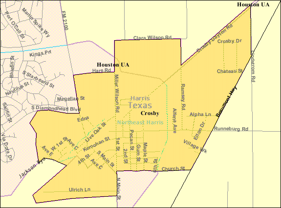 Crosby is located at 29.910577°N 95.060882°W (29.910577, -95.060882).
According to the United States Census Bureau
, the CDP has a total area of 2.3 square miles (6 km²), all of it land.
Humphrey Jackson (1784-1833) moved to Texas
from Louisiana
in September 1823 and built a log cabin outside Austin
's colony on the San Jacinto River, 0.5 miles (804.7 m) west of the site of present Crosby
. On August 16, 1824 the Baron de Bastrop granted him title to a league and a labor of land, including the place where he had settled, in what is now Harris County
. Jackson next petitioned the Mexican government to form the San Jacinto District under control of the Austin
colony; he was elected alcalde of the new district in 1824, 1825, and 1827, and served as ex officio militia captain of the San Jacinto
area. Jackson was buried at Crosby. Jackson's Bayou in eastern Harris County is probably named for him.
Near what is now the Southern Pacific Railroad
, the town was named for G.J. Crosby, a railroad construction engineer. In 1861, the Sabine and Galveston Bay Railroad and Lumber Company installed tracks through this site. The first general store was built in 1865 by Charlie Karcher, and thereafter the town would become a shipping and retail center for lumber and agricultural products. The post office was established in 1877. In 1884 Crosby reported a population of 50, a school, a Baptist church, and a general store. In 1905 it had one school with four teachers and 122 students. As of 1929, the population was about 600, but the Great Depression
reduced this number by half. World War II
brought the population to over 900, and the population continues to grow.
The site south of highway 90 is historical Barrett Station
. Barrett's Settlement was founded by Harrison Barrett
(1845-1917) and has been registered in the Texas Family Land Heritage as Texas Century Farm. Born into slavery, Barrett was the son of Simon and Lisa Barrett who came to Texas
from Louisiana
. He had two brothers and two sisters.
Following the emancipation of Texas slaves in 1865, Barrett spent several years gathering his family together. He eventually found all of them except one sister, and they settled on land east of the San Jacinto River. He purchased this land in 1889 and began a community that later would be known as Barrett's Settlement. Beginning with seven houses, the community grew to include additional homes, farms, and businesses. Barrett established a school, church, and cemetery. After a post office station was opened there in 1947, the area became known as Barrett Station.
Harrison Barret's homestead, twice rebuilt by his descendants, stands on its original location.
of 2000, there were 1,714 people, 662 households, and 464 families residing in the CDP. The population density
was 758.2 people per square mile (292.8/km2). There were 743 housing units at an average density of 328.7 per square mile (126.9/km2). The racial makeup of the CDP was 74.15% White, 12.72% African American, 0.76% Native American, 0.41% Asian, 10.79% from other races
, and 1.17% from two or more races. Hispanic or Latino of any race were 18.38% of the population.
There were 666 households out of which 35.4% had children under the age of 18 living with them, 49.4% were married couples
living together, 15.8% had a female householder with no husband present, and 30.3% were non-families. 26.1% of all households were made up of individuals and 11.1% had someone living alone who was 65 years of age or older. The average household size was 2.57 and the average family size was 3.09.
In the CDP the population was spread out with 28.2% under the age of 18, 10.1% from 18 to 24, 29.1% from 25 to 44, 19.8% from 45 to 64, and 12.8% who were 65 years of age or older. The median age was 32 years. For every 100 females there were 100 males. For every 100 females age 18 and over, there were 96.2 males.
The median income for a household in the CDP was $35,508, and the median income for a family was $41,458. Males had a median income of $37,244 versus $25,500 for females. The per capita income
for the CDP was $14,851. About 9.2% of families and 13.4% of the population were below the poverty line, including 16.7% of those under age 18 and 20.1% of those age 65 or over.
The community is served by the Harris County Sheriff's Office
http://www.hcso.hctx.net/.
.
According to the Texas Education Agency AEIS report in 2007-2008, Crosby ISD served 4,855 students in ZIP code 77532. 21% were African-American, 22.2% Hispanic, 56.1% White, 0.3% Native American, 0.4% Asian.
, adjacent to and outside of the CDP.
The Barrett Station/Riley Chambers Community Center is located at 808 Magnoli. Facilities include restrooms, picnic, playground, trails, open shelter, basketball, baseball, riding arena, and football fields.
Crosby Sports Complex is located at 8600 Miller-Wilson Road. It is a 12 acres (48,562.3 m²) facility with six lighted softball fields, picnic tables, and restrooms. Crosby Sports Complex softball fields are maintained by the Crosby Sports Association.
Census-designated place
A census-designated place is a concentration of population identified by the United States Census Bureau for statistical purposes. CDPs are delineated for each decennial census as the statistical counterparts of incorporated places such as cities, towns and villages...
in Harris County
Harris County, Texas
As of the 2010 Census, the population of the county was 4,092,459, White Americans made up 56.6% of Harris County's population; non-Hispanic whites represented 33.0% of the population. Black Americans made up 18.9% of the population. Native Americans made up 0.7% of Harris County's population...
, Texas
Texas
Texas is the second largest U.S. state by both area and population, and the largest state by area in the contiguous United States.The name, based on the Caddo word "Tejas" meaning "friends" or "allies", was applied by the Spanish to the Caddo themselves and to the region of their settlement in...
, United States
United States
The United States of America is a federal constitutional republic comprising fifty states and a federal district...
. The population was 1,714 at the 2000 census.
Geography
According to the United States Census Bureau
United States Census Bureau
The United States Census Bureau is the government agency that is responsible for the United States Census. It also gathers other national demographic and economic data...
, the CDP has a total area of 2.3 square miles (6 km²), all of it land.
Historical development
The site north of US Route 90 (according to some) was an encampment nicknamed Lick Skillet in 1823 by Humphrey Jackson, one of the 300 original colonists to settle Texas. The name Lick Skillet came from the phrase "The East Texas oxen team drivers sipped the spring sweet water and licked their skillets clean."Humphrey Jackson (1784-1833) moved to Texas
Texas
Texas is the second largest U.S. state by both area and population, and the largest state by area in the contiguous United States.The name, based on the Caddo word "Tejas" meaning "friends" or "allies", was applied by the Spanish to the Caddo themselves and to the region of their settlement in...
from Louisiana
Louisiana
Louisiana is a state located in the southern region of the United States of America. Its capital is Baton Rouge and largest city is New Orleans. Louisiana is the only state in the U.S. with political subdivisions termed parishes, which are local governments equivalent to counties...
in September 1823 and built a log cabin outside Austin
Austin, Texas
Austin is the capital city of the U.S. state of :Texas and the seat of Travis County. Located in Central Texas on the eastern edge of the American Southwest, it is the fourth-largest city in Texas and the 14th most populous city in the United States. It was the third-fastest-growing large city in...
's colony on the San Jacinto River, 0.5 miles (804.7 m) west of the site of present Crosby
Crosby
- Geography :Canada*Crosby, Ontario, part of the township of Rideau Lakes, Ontario*Crosby, Ontario, a neighbourhood in the town of Markham, OntarioEngland*Crosby, Cumbria*Crosby, Lincolnshire*Crosby, Merseyside**Crosby...
. On August 16, 1824 the Baron de Bastrop granted him title to a league and a labor of land, including the place where he had settled, in what is now Harris County
Harris County, Texas
As of the 2010 Census, the population of the county was 4,092,459, White Americans made up 56.6% of Harris County's population; non-Hispanic whites represented 33.0% of the population. Black Americans made up 18.9% of the population. Native Americans made up 0.7% of Harris County's population...
. Jackson next petitioned the Mexican government to form the San Jacinto District under control of the Austin
Austin, Texas
Austin is the capital city of the U.S. state of :Texas and the seat of Travis County. Located in Central Texas on the eastern edge of the American Southwest, it is the fourth-largest city in Texas and the 14th most populous city in the United States. It was the third-fastest-growing large city in...
colony; he was elected alcalde of the new district in 1824, 1825, and 1827, and served as ex officio militia captain of the San Jacinto
San Jacinto
San Jacinto is Spanish for Saint Hyacinth; as a place name, it may refer to:* San Jacinto, Bolívar, Colombia* San Jacinto, Chiquimula, Guatemala* San Jacinto, Comondú, Mexico* San Jacinto, Lerdo, Mexico* San Jacinto, Ancash Region, Peru...
area. Jackson was buried at Crosby. Jackson's Bayou in eastern Harris County is probably named for him.
Near what is now the Southern Pacific Railroad
Southern Pacific Railroad
The Southern Pacific Transportation Company , earlier Southern Pacific Railroad and Southern Pacific Company, and usually simply called the Southern Pacific or Espee, was an American railroad....
, the town was named for G.J. Crosby, a railroad construction engineer. In 1861, the Sabine and Galveston Bay Railroad and Lumber Company installed tracks through this site. The first general store was built in 1865 by Charlie Karcher, and thereafter the town would become a shipping and retail center for lumber and agricultural products. The post office was established in 1877. In 1884 Crosby reported a population of 50, a school, a Baptist church, and a general store. In 1905 it had one school with four teachers and 122 students. As of 1929, the population was about 600, but the Great Depression
Great Depression
The Great Depression was a severe worldwide economic depression in the decade preceding World War II. The timing of the Great Depression varied across nations, but in most countries it started in about 1929 and lasted until the late 1930s or early 1940s...
reduced this number by half. World War II
World War II
World War II, or the Second World War , was a global conflict lasting from 1939 to 1945, involving most of the world's nations—including all of the great powers—eventually forming two opposing military alliances: the Allies and the Axis...
brought the population to over 900, and the population continues to grow.
The site south of highway 90 is historical Barrett Station
Barrett, Texas
Barrett is a census-designated place in Harris County, Texas, United States. The population was 2,872 at the 2000 census. It was founded in 1889 by Harrison Barrett, a former slave.-Geography:Barrett is located at ....
. Barrett's Settlement was founded by Harrison Barrett
Harrison Barrett
Harrison Barrett was a former slave born in 1845 to slave parents from Louisiana, Simon and Eliza Barrett. He had two brothers and two sisters. After the emancipation of the slaves in 1865, Barrett searched for his family members. He was able to gather all together except for one sister...
(1845-1917) and has been registered in the Texas Family Land Heritage as Texas Century Farm. Born into slavery, Barrett was the son of Simon and Lisa Barrett who came to Texas
Texas
Texas is the second largest U.S. state by both area and population, and the largest state by area in the contiguous United States.The name, based on the Caddo word "Tejas" meaning "friends" or "allies", was applied by the Spanish to the Caddo themselves and to the region of their settlement in...
from Louisiana
Louisiana
Louisiana is a state located in the southern region of the United States of America. Its capital is Baton Rouge and largest city is New Orleans. Louisiana is the only state in the U.S. with political subdivisions termed parishes, which are local governments equivalent to counties...
. He had two brothers and two sisters.
Following the emancipation of Texas slaves in 1865, Barrett spent several years gathering his family together. He eventually found all of them except one sister, and they settled on land east of the San Jacinto River. He purchased this land in 1889 and began a community that later would be known as Barrett's Settlement. Beginning with seven houses, the community grew to include additional homes, farms, and businesses. Barrett established a school, church, and cemetery. After a post office station was opened there in 1947, the area became known as Barrett Station.
Harrison Barret's homestead, twice rebuilt by his descendants, stands on its original location.
Demographics
As of the censusCensus
A census is the procedure of systematically acquiring and recording information about the members of a given population. It is a regularly occurring and official count of a particular population. The term is used mostly in connection with national population and housing censuses; other common...
of 2000, there were 1,714 people, 662 households, and 464 families residing in the CDP. The population density
Population density
Population density is a measurement of population per unit area or unit volume. It is frequently applied to living organisms, and particularly to humans...
was 758.2 people per square mile (292.8/km2). There were 743 housing units at an average density of 328.7 per square mile (126.9/km2). The racial makeup of the CDP was 74.15% White, 12.72% African American, 0.76% Native American, 0.41% Asian, 10.79% from other races
Race (United States Census)
Race and ethnicity in the United States Census, as defined by the Federal Office of Management and Budget and the United States Census Bureau, are self-identification data items in which residents choose the race or races with which they most closely identify, and indicate whether or not they are...
, and 1.17% from two or more races. Hispanic or Latino of any race were 18.38% of the population.
There were 666 households out of which 35.4% had children under the age of 18 living with them, 49.4% were married couples
Marriage
Marriage is a social union or legal contract between people that creates kinship. It is an institution in which interpersonal relationships, usually intimate and sexual, are acknowledged in a variety of ways, depending on the culture or subculture in which it is found...
living together, 15.8% had a female householder with no husband present, and 30.3% were non-families. 26.1% of all households were made up of individuals and 11.1% had someone living alone who was 65 years of age or older. The average household size was 2.57 and the average family size was 3.09.
In the CDP the population was spread out with 28.2% under the age of 18, 10.1% from 18 to 24, 29.1% from 25 to 44, 19.8% from 45 to 64, and 12.8% who were 65 years of age or older. The median age was 32 years. For every 100 females there were 100 males. For every 100 females age 18 and over, there were 96.2 males.
The median income for a household in the CDP was $35,508, and the median income for a family was $41,458. Males had a median income of $37,244 versus $25,500 for females. The per capita income
Per capita income
Per capita income or income per person is a measure of mean income within an economic aggregate, such as a country or city. It is calculated by taking a measure of all sources of income in the aggregate and dividing it by the total population...
for the CDP was $14,851. About 9.2% of families and 13.4% of the population were below the poverty line, including 16.7% of those under age 18 and 20.1% of those age 65 or over.
Government and infrastructure
The community is within Harris County Precinct 4. As of 2008 Jerry Eversole is the head of the precinct. The precinct operates the Crosby Community Center at 409 Hare Road.The community is served by the Harris County Sheriff's Office
Harris County Sheriff's Office
The Harris County Sheriff's Office is a local law enforcement agency serving the over three million citizens of Harris County, Texas, United States. It is headquartered in the 1200 Jail in Downtown Houston.As of the 2000 U.S...
http://www.hcso.hctx.net/.
Crosby Volunteer Fire Department
The Crosby Volunteer Fire Department, officially the Harris County Emergency Services District # 80 was formed in 1942.Mission statement
The Crosby Volunteer Fire Department is dedicated to protecting life and property by providing effective public education, fire prevention and emergency services.Protection area
The Crosby Volunteer Fire Department protects the unincorporated communities of Crosby and Barrett Station, Texas. The district consists of 102.8 square miles (266 km²) and over 22,000 people approximately 22 miles (35 km) east-northeast of Houston. The protection area is split into two response districts covered by five stations manned entirely by volunteers from the community.Public schools
Crosby students attend school in the Crosby Independent School DistrictCrosby Independent School District
Crosby Independent School District is a public school district based in Crosby—an unincorporated area of northeastern Harris County, Texas within the Houston–Sugar Land–Baytown metropolitan area....
.
According to the Texas Education Agency AEIS report in 2007-2008, Crosby ISD served 4,855 students in ZIP code 77532. 21% were African-American, 22.2% Hispanic, 56.1% White, 0.3% Native American, 0.4% Asian.
Private schools
The Crosby International Academy serving K - 12th http://www.crosbyinternationalacademy.com, The Crosby Christian Academy serving infants - Pre-kindergarten http://www.crosbychristianacademy.com & Sacred Heart Catholic School http://home.houston.rr.com/sacredheartchurc are in Crosby.Public libraries
Crosby is served by the Crosby Branch of Harris County Public LibraryHarris County Public Library
Harris County Public Library is a public library system serving Harris County, Texas, United States. The county library system is headquartered at 8080 El Rio in Houston....
, adjacent to and outside of the CDP.
Parks and recreation
Crosby Park and Crosby Community Center are located at 419 Hare Road. It is a 46 acres (186,155.6 m²) facility with two lighted softball fields, three lighted soccer fields, two lighted tennis courts, one basketball pavilion, a playground, paved trail of 0.726 miles (1.2 km), picnic tables, barbecue grills, a barbecue pavilion, and restrooms.The Barrett Station/Riley Chambers Community Center is located at 808 Magnoli. Facilities include restrooms, picnic, playground, trails, open shelter, basketball, baseball, riding arena, and football fields.
Crosby Sports Complex is located at 8600 Miller-Wilson Road. It is a 12 acres (48,562.3 m²) facility with six lighted softball fields, picnic tables, and restrooms. Crosby Sports Complex softball fields are maintained by the Crosby Sports Association.