
Coconino National Forest
Encyclopedia
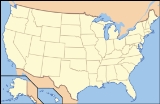
The Coconino National Forest is a 1.856-million acre (7,511 km2) United States
National Forest located in northern Arizona
in the vicinity of Flagstaff
. Originally established in 1898 as the "San Francisco Mountains National Forest Reserve", the area was designated a U.S. National Forest in 1908 when the San Francisco Mountains National Forest Reserve was merged with lands from other surrounding forest reserves to create the Coconino National Forest. Today, the Coconino National Forest contains diverse landscapes, including desert
s, ponderosa pine
forests, flatlands, mesa
s, alpine tundra
, and ancient volcanic
peaks. The forest surrounds the towns of Sedona and Flagstaff and borders four other national forests; the Kaibab National Forest
to the west and northwest, the Prescott National Forest
to the southwest, the Tonto National Forest
to the south, and the Apache-Sitgreaves National Forest
to the southeast. The forest contains all or parts of ten designated wilderness areas, including the Kachina Peaks Wilderness
, which includes the summit of the San Francisco Peaks
. The headquarters are in Flagstaff. There are local ranger
district offices in Flagstaff, Happy Jack
, and Sedona
.
to 12,633 feet (3,851 m) at the summit of Humphreys Peak
, the highest point in the state of Arizona. Much of the forest is a high altitude plateau
(average elevation is roughly 7,000 feet (2,100 m) on the plateau) that is located in the midst of the largest contiguous ponderosa pine
forest in North America
. The southern border of this plateau is the Mogollon Rim
, a nearly 400 mile (640 km) long escarpment running across central Arizona that also marks the southern boundary of the Colorado Plateau
. The Coconino National Forest is divided into four districts that each possess their own distinct geography and environments.
The northern most district, known as the Flagstaff District, is home to the San Francisco Peaks
, an ancient group of volcanic summits. The highest peak, Humphreys Peak
, is the highest point in Arizona at 12,633 feet (3,851 m). The second, third, and fourth highest peaks in Arizona are found nearby. The San Francisco Peaks are the dominant structure of the San Francisco Volcanic Field
, an 1,800 square mile (4,700 km2) volcanic field
that contains more than 600 volcanic features. The Coconino National Forest encompasses a large portion of the volcanic field and so the forest landscape around Flagstaff is dotted with tree-covered cinder cone
s, lava flows, and underground lava tube
s (such as Lava River Cave
). The Flagstaff District surrounds two United States National Monuments near Flagstaff, Walnut Canyon National Monument
and Sunset Crater Volcano National Monument the latter of which preserves the youngest cinder cone in the San Francisco Volcanic Field, Sunset Crater
. The forest borders another National Monument, Wupatki National Monument
on its northeast corner.
Located in the southern portion of the Flagstaff District is Mormon Lake, the largest natural lake in the state of Arizona. Several other natural lakes, including Ashurst Lake
and Marshall Lake, dot the top of Anderson Mesa
, an approximately 20-mile (30 km) long ridge that rises 200 to 400 feet (60−120 m) above the surrounding landscape. Anderson Mesa is best known for the branch of Lowell Observatory
located along the edge of the mesa. At the base of the southwest side of Anderson Mesa are two narrow, manmade reservoir
s constructed in the early 1900s, Upper Lake Mary
and Lower Lake Mary
. Upper Lake Mary contains water year round in all but the very driest years while Lower Lake Mary, located just to the northwest of Upper Lake Mary, usually resembles a wet meadow
rather than a lake.
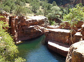
The Red Rock district, centered on the town of Sedona, encompasses many of the famous red rock butte
s and mesa
s, and canyon
s that have made Sedona famous as a resort town. Just north of Sedona is Oak Creek Canyon
, one of the many large canyon located along the Mogollon Rim. Oak Creek Canyon is one of the most popular recreation destinations in the Coconino National Forest and along with Sedona is Arizona's second most popular tourist attraction, second only to the Grand Canyon
. Oak Creek Canyon is also a popular leaf peeping
area in the fall as it is one of the few areas in the forest where decidious trees are the dominant vegetation type. This region is also home to Sycamore Canyon
, the second largest canyon in Arizona. Elevations in this part of the forest are substantially lower (Sedona is at 4,500 feet (1,400 m) above sea level) than the rest of the forest resulting in higher temperatures year round.
The fourth district is the Mogollon Rim District, located along the Mogollon Rim
south of the Mormon Lake District and east of the Red Rock District. The landscape here resembles the Mormon Lake District with a number of small lakes and perennial streams scattered among a dense ponderosa pine forest. The southern boundary of the district is the edge of the Mogollon Rim where the Coconino National Forest borders the Tonto National Forest
and Coconino County
borders Gila County
.
plants are the dominant type of vegetation in the Coconino National Forest. Due in part to the dry climate, deciduous
trees are rare except for in some moist areas along creeks and streams. While the ponderosa pine
is by far the most common tree species in the Coconino National Forest, vegetation type varies depending on the elevation of a certain area.
At the lowest elevations, in the extreme southwestern portion of the forest, actual trees are scarce and the landscape is dominated by various small shrub
s and sagebrush
es. At elevations between 4,500 feet and 6,500 feet (1,400−2,000 m), which includes the area surrounding Sedona, various species of juniper
including the alligator juniper
and the Utah Juniper are predominant. Other common tree and shrubs of this environment, often classified as the "Juniper-Pinyon woodlands", include Arizona Cypress, manzanita
, and pinyon pine
. Hikers often encounter Parry's Agave
, yucca
s, and prickly pear
cacti
in this region as well.
The huge stands of ponderosa pine on the forest are found primarily at elevations between 6,500 feet and 8,000 feet (2,000−2,400 m). Other species scattered among this region include gambel oak
, quaking aspen, and Rocky Mountain Juniper.
The highest elevations in the forest are located in the San Francisco Peaks area north of Flagstaff. Here grow large conifers such as engelmann spruce
, blue spruce
, subalpine fir
, corkbark fir (a variety of subalpine fir found only in isolated areas of Arizona and New Mexico
), douglas fir, bristlecone pine
, and limber pine
. Isolated stands of quaking aspen, usually the first tree to regenerate following a severe wildfire, are scattered across the mountain.
Above 11,000 feet (3,400 m) is found the only alpine tundra
region in Arizona. Vegetation is scarce in this region. A few small bristlecone pines are found otherwise the area is above tree line and inhabited by small grasses, lichen
s, and alpine wildflower
s.
is a major concern across the Coconino National Forest. Despite the abundance of green vegetation throughout the forest, the region is classified as a high desert
. Flagstaff, located in the northern part of the forest, receives approximately 22 inches (560 mm) of precipitation annually (including an average annual snowfall of 100 inches (2,500 mm)) while other areas of the forest receive even less. The lack of any significant rainfall during the spring and early summer combined with the high temperatures and strong winds that are commonplace during that time of year results in fire danger that is usually defined as "very high" or "extreme" during the months of May through July. The danger of a major wildfire is increased by the fact that there are a number of cities and communities surrounded by forest land. Restrictions on campfires and smoking in the forest are common during peak fire season. Occasionally, the fire danger will become so great that the forest is closed to all public entry until substantial precipitation is received to minimize the danger of a stray spark setting off a destructive wildfire.
Over the past few years, the Coconino National Forest has increased its use of prescribed burns as a tool to prevent major wildfires. This strategy, along with forest thinning
, has been especially widespread in areas of the forest that surround urban area
s.
 There are ten federally designated U.S. Wilderness Areas within or partially within the Coconino National Forest:
acquired the territory comprising Arizona and New Mexico by treaty with Mexico
in 1848, those lands not already privately owned, including Spanish and Mexican land grants, nor reserved by treaty for the various Indian tribes, became a part of the “public domain
” and open under various laws to settlement, purchase, and use.
In 1898, President William McKinley
established the San Francisco Mountain Forest Reserve, at the request of Gifford Pinchot
, head of the US Division of Forestry. Local reaction was hostile—citizens of Williams, Arizona
held a mass protest, and the Williams News editorialized that the reserve "virtually destroys Coconino County."
In 1905, the Forest Reserves were transferred to the Department of Agriculture. Some 21 million acres (85,000 km2) of public lands, almost one-eighth of the area of Arizona and New Mexico, were now to be administered by the new Forest Service.
In 1908, the Coconino National Forest was established from parts of the Tonto
, Black Mesa
, Grand Canyon, and entire San Francisco Mountains National Forest
s.
United States
The United States of America is a federal constitutional republic comprising fifty states and a federal district...
National Forest located in northern Arizona
Arizona
Arizona ; is a state located in the southwestern region of the United States. It is also part of the western United States and the mountain west. The capital and largest city is Phoenix...
in the vicinity of Flagstaff
Flagstaff, Arizona
Flagstaff is a city located in northern Arizona, in the southwestern United States. In 2010, the city's population was 65,870. The population of the Metropolitan Statistical Area was at 134,421 in 2010. It is the county seat of Coconino County...
. Originally established in 1898 as the "San Francisco Mountains National Forest Reserve", the area was designated a U.S. National Forest in 1908 when the San Francisco Mountains National Forest Reserve was merged with lands from other surrounding forest reserves to create the Coconino National Forest. Today, the Coconino National Forest contains diverse landscapes, including desert
Desert
A desert is a landscape or region that receives an extremely low amount of precipitation, less than enough to support growth of most plants. Most deserts have an average annual precipitation of less than...
s, ponderosa pine
Ponderosa Pine
Pinus ponderosa, commonly known as the Ponderosa Pine, Bull Pine, Blackjack Pine, or Western Yellow Pine, is a widespread and variable pine native to western North America. It was first described by David Douglas in 1826, from eastern Washington near present-day Spokane...
forests, flatlands, mesa
Mesa
A mesa or table mountain is an elevated area of land with a flat top and sides that are usually steep cliffs. It takes its name from its characteristic table-top shape....
s, alpine tundra
Tundra
In physical geography, tundra is a biome where the tree growth is hindered by low temperatures and short growing seasons. The term tundra comes through Russian тундра from the Kildin Sami word tūndâr "uplands," "treeless mountain tract." There are three types of tundra: Arctic tundra, alpine...
, and ancient volcanic
Volcano
2. Bedrock3. Conduit 4. Base5. Sill6. Dike7. Layers of ash emitted by the volcano8. Flank| 9. Layers of lava emitted by the volcano10. Throat11. Parasitic cone12. Lava flow13. Vent14. Crater15...
peaks. The forest surrounds the towns of Sedona and Flagstaff and borders four other national forests; the Kaibab National Forest
Kaibab National Forest
At 1.6 million acres the Kaibab National Forest borders both the north and south rims of the Grand Canyon, in north-central Arizona. It is divided into three major sections: the North Kaibab Ranger District and the South Kaibab and are managed by USDA Forest Service...
to the west and northwest, the Prescott National Forest
Prescott National Forest
The Prescott National Forest is a 1.25 million acre United States National Forest located in north central Arizona in the vicinity of Prescott. The forest is located in the mountains southwest of Flagstaff and north of Phoenix in Yavapai County, with a small portion extending into southwestern...
to the southwest, the Tonto National Forest
Tonto National Forest
The Tonto National Forest, encompassing 2,873,200 acres , is the largest of the six national forests in Arizona and is the fifth largest national forest in the United States. The Tonto National Forest has diverse scenery, with elevations ranging from 1,400 feet in the Sonoran Desert to 7,400 feet...
to the south, and the Apache-Sitgreaves National Forest
Apache-Sitgreaves National Forest
The Apache-Sitgreaves National Forest is a United States National Forest which runs along the Mogollon Rim and the White Mountains in east-central Arizona and extending into New Mexico, USA. Both forests are managed as one unit by USDA Forest Service from the forest headquarters in Springerville,...
to the southeast. The forest contains all or parts of ten designated wilderness areas, including the Kachina Peaks Wilderness
Kachina Peaks Wilderness
Kachina Peaks Wilderness is a wilderness area located approximately north of Flagstaff within the Coconino National Forest in the U.S. state of Arizona....
, which includes the summit of the San Francisco Peaks
San Francisco Peaks
The San Francisco Peaks are a volcanic mountain range located in north central Arizona, just north of Flagstaff.The highest summit in the range, Humphreys Peak, is the highest point in the state of Arizona at in elevation. The San Francisco Peaks are the remains of an eroded stratovolcano...
. The headquarters are in Flagstaff. There are local ranger
National Park Ranger
National Park Service Rangers are among the uniformed employees charged with protecting and preserving areas set aside in the National Park System by the United States Congress and/or the President of the United States...
district offices in Flagstaff, Happy Jack
Happy Jack, Arizona
Happy Jack is an unincorporated town and camping ground located in the Mogollon Rim Region of Coconino County, Arizona, United States. It is at an elevation of approximately . The Discovery Channel Telescope is located there.-External links:*...
, and Sedona
Sedona, Arizona
Sedona is a city that straddles the county line between Coconino and Yavapai counties in the northern Verde Valley region of the U.S. state of Arizona...
.
Geography
The elevation in the forest ranges from 2,600 feet (800 m) in the southern part of the forest near the Verde RiverVerde River
The Verde River is the north and northwestern watershed of the Salt River–Verde River Watershed that co-join and enter the Gila River at Phoenix, Arizona, located in the U.S. state of Arizona...
to 12,633 feet (3,851 m) at the summit of Humphreys Peak
Humphreys Peak
Humphreys Peak is the highest natural point in the U.S. state of Arizona, with an elevation of and is located within the Kachina Peaks Wilderness in the Coconino National Forest, about north of Flagstaff, Arizona. Humphreys Peak is the highest of a group of extinct volcanic peaks known as the...
, the highest point in the state of Arizona. Much of the forest is a high altitude plateau
Plateau
In geology and earth science, a plateau , also called a high plain or tableland, is an area of highland, usually consisting of relatively flat terrain. A highly eroded plateau is called a dissected plateau...
(average elevation is roughly 7,000 feet (2,100 m) on the plateau) that is located in the midst of the largest contiguous ponderosa pine
Ponderosa Pine
Pinus ponderosa, commonly known as the Ponderosa Pine, Bull Pine, Blackjack Pine, or Western Yellow Pine, is a widespread and variable pine native to western North America. It was first described by David Douglas in 1826, from eastern Washington near present-day Spokane...
forest in North America
North America
North America is a continent wholly within the Northern Hemisphere and almost wholly within the Western Hemisphere. It is also considered a northern subcontinent of the Americas...
. The southern border of this plateau is the Mogollon Rim
Mogollon Rim
The Mogollon Rim is a topographical and geological feature running across the U.S. state of Arizona. It extends approximately from northern Yavapai County eastward to near the border with New Mexico.-Description:...
, a nearly 400 mile (640 km) long escarpment running across central Arizona that also marks the southern boundary of the Colorado Plateau
Colorado Plateau
The Colorado Plateau, also called the Colorado Plateau Province, is a physiographic region of the Intermontane Plateaus, roughly centered on the Four Corners region of the southwestern United States. The province covers an area of 337,000 km2 within western Colorado, northwestern New Mexico,...
. The Coconino National Forest is divided into four districts that each possess their own distinct geography and environments.
The northern most district, known as the Flagstaff District, is home to the San Francisco Peaks
San Francisco Peaks
The San Francisco Peaks are a volcanic mountain range located in north central Arizona, just north of Flagstaff.The highest summit in the range, Humphreys Peak, is the highest point in the state of Arizona at in elevation. The San Francisco Peaks are the remains of an eroded stratovolcano...
, an ancient group of volcanic summits. The highest peak, Humphreys Peak
Humphreys Peak
Humphreys Peak is the highest natural point in the U.S. state of Arizona, with an elevation of and is located within the Kachina Peaks Wilderness in the Coconino National Forest, about north of Flagstaff, Arizona. Humphreys Peak is the highest of a group of extinct volcanic peaks known as the...
, is the highest point in Arizona at 12,633 feet (3,851 m). The second, third, and fourth highest peaks in Arizona are found nearby. The San Francisco Peaks are the dominant structure of the San Francisco Volcanic Field
San Francisco volcanic field
The San Francisco volcanic field is an area of volcanoes in northern Arizona, north of Flagstaff, USA. The field covers 1,800 square miles of the southern boundary of the Colorado Plateau. The field contains 600 volcanoes ranging in age from less than 6 million years old to less than 1,000 years ,...
, an 1,800 square mile (4,700 km2) volcanic field
Volcanic field
A volcanic field is an area of the Earth's crust that is prone to localized volcanic activity. They usually contain 10 to 100 volcanoes, such as cinder cones and are usually in clusters. Lava flows may also occur...
that contains more than 600 volcanic features. The Coconino National Forest encompasses a large portion of the volcanic field and so the forest landscape around Flagstaff is dotted with tree-covered cinder cone
Cinder cone
According to the , Cinder Cone is the proper name of 1 cinder cone in Canada and 7 cinder cones in the United States:In Canada: Cinder Cone In the United States:...
s, lava flows, and underground lava tube
Lava tube
Lava tubes are natural conduits through which lava travels beneath the surface of a lava flow, expelled by a volcano during an eruption. They can be actively draining lava from a source, or can be extinct, meaning the lava flow has ceased and the rock has cooled and left a long, cave-like...
s (such as Lava River Cave
Lava River Cave (Arizona)
Lava River Cave is a lava tube cave in northern Arizona's Coconino National Forest. At approximately long, it is the longest cave of this kind known in Arizona. The cave was discovered by some lumbermen in 1915. The cave has also historically been referred to as "Government Cave" due to its...
). The Flagstaff District surrounds two United States National Monuments near Flagstaff, Walnut Canyon National Monument
Walnut Canyon National Monument
Walnut Canyon National Monument is a United States National Monument located about southeast of downtown Flagstaff, Arizona, just off Interstate 40. The canyon rim lies at ; the canyon's floor is 350 ft lower...
and Sunset Crater Volcano National Monument the latter of which preserves the youngest cinder cone in the San Francisco Volcanic Field, Sunset Crater
Sunset Crater
Sunset Crater is a volcanic cinder cone located north of Flagstaff in U.S. State of Arizona. The crater is within the Sunset Crater Volcano National Monument....
. The forest borders another National Monument, Wupatki National Monument
Wupatki National Monument
The Wupatki National Monument is a National Monument located in north-central Arizona, near Flagstaff. Rich in Native American ruins, the monument is administered by the National Park Service in close conjunction with the nearby Sunset Crater Volcano National Monument.Wupatki was listed on the...
on its northeast corner.
Located in the southern portion of the Flagstaff District is Mormon Lake, the largest natural lake in the state of Arizona. Several other natural lakes, including Ashurst Lake
Ashurst Lake
Ashurst Lake is a small lake located on the Anderson Mesa southeast of Flagstaff. It is one of the few natural lakes in the state of Arizona, the bulk of which reside in the area....
and Marshall Lake, dot the top of Anderson Mesa
Anderson Mesa
Lowell Observatory, Anderson Mesa Station, USA, was established in 1959 as a dark-sky observing site for Lowell Observatory. Anderson Mesa is now home to several large reflecting telescopes that are used for observing programs such as LONEOS...
, an approximately 20-mile (30 km) long ridge that rises 200 to 400 feet (60−120 m) above the surrounding landscape. Anderson Mesa is best known for the branch of Lowell Observatory
Lowell Observatory
Lowell Observatory is an astronomical observatory in Flagstaff, Arizona. Lowell Observatory was established in 1894, placing it among the oldest observatories in the United States, and was designated a National Historic Landmark in 1965....
located along the edge of the mesa. At the base of the southwest side of Anderson Mesa are two narrow, manmade reservoir
Reservoir
A reservoir , artificial lake or dam is used to store water.Reservoirs may be created in river valleys by the construction of a dam or may be built by excavation in the ground or by conventional construction techniques such as brickwork or cast concrete.The term reservoir may also be used to...
s constructed in the early 1900s, Upper Lake Mary
Lake Mary (Arizona)
Lake Mary may refer to one of two reservoirs in northern Arizona, southeast of Flagstaff. The name may also be used to refer to the two lakes as a whole. The pair of lakes impound the intermittent Walnut Creek upstream from Walnut Canyon...
and Lower Lake Mary
Lake Mary (Arizona)
Lake Mary may refer to one of two reservoirs in northern Arizona, southeast of Flagstaff. The name may also be used to refer to the two lakes as a whole. The pair of lakes impound the intermittent Walnut Creek upstream from Walnut Canyon...
. Upper Lake Mary contains water year round in all but the very driest years while Lower Lake Mary, located just to the northwest of Upper Lake Mary, usually resembles a wet meadow
Meadow
A meadow is a field vegetated primarily by grass and other non-woody plants . The term is from Old English mædwe. In agriculture a meadow is grassland which is not grazed by domestic livestock but rather allowed to grow unchecked in order to make hay...
rather than a lake.
The Red Rock district, centered on the town of Sedona, encompasses many of the famous red rock butte
Butte
A butte is a conspicuous isolated hill with steep, often vertical sides and a small, relatively flat top; it is smaller than mesas, plateaus, and table landform tables. In some regions, such as the north central and northwestern United States, the word is used for any hill...
s and mesa
Mesa
A mesa or table mountain is an elevated area of land with a flat top and sides that are usually steep cliffs. It takes its name from its characteristic table-top shape....
s, and canyon
Canyon
A canyon or gorge is a deep ravine between cliffs often carved from the landscape by a river. Rivers have a natural tendency to reach a baseline elevation, which is the same elevation as the body of water it will eventually drain into. This forms a canyon. Most canyons were formed by a process of...
s that have made Sedona famous as a resort town. Just north of Sedona is Oak Creek Canyon
Oak Creek Canyon
Oak Creek Canyon is a river gorge located along the Mogollon Rim in northern Arizona located between the cities of Flagstaff and Sedona. The canyon is often described as a smaller cousin of the Grand Canyon because of its scenic beauty...
, one of the many large canyon located along the Mogollon Rim. Oak Creek Canyon is one of the most popular recreation destinations in the Coconino National Forest and along with Sedona is Arizona's second most popular tourist attraction, second only to the Grand Canyon
Grand Canyon
The Grand Canyon is a steep-sided canyon carved by the Colorado River in the United States in the state of Arizona. It is largely contained within the Grand Canyon National Park, the 15th national park in the United States...
. Oak Creek Canyon is also a popular leaf peeping
Leaf peeping
Leaf peeping is an informal term, commonly used in the United States, for people who travel to view and photograph the fall foliage in areas where foliage changes colors, particularly New England.The origin of the term "leaf peeping" is not well known....
area in the fall as it is one of the few areas in the forest where decidious trees are the dominant vegetation type. This region is also home to Sycamore Canyon
Sycamore Canyon
Sycamore Canyon is the second largest canyon in the Arizona redrock country, after Oak Creek Canyon. The long scenic canyon reaches a maximum width of about and is located in North Central Arizona below the Mogollon Rim west and northwest of Sedona. Located within three different U.S...
, the second largest canyon in Arizona. Elevations in this part of the forest are substantially lower (Sedona is at 4,500 feet (1,400 m) above sea level) than the rest of the forest resulting in higher temperatures year round.
The fourth district is the Mogollon Rim District, located along the Mogollon Rim
Mogollon Rim
The Mogollon Rim is a topographical and geological feature running across the U.S. state of Arizona. It extends approximately from northern Yavapai County eastward to near the border with New Mexico.-Description:...
south of the Mormon Lake District and east of the Red Rock District. The landscape here resembles the Mormon Lake District with a number of small lakes and perennial streams scattered among a dense ponderosa pine forest. The southern boundary of the district is the edge of the Mogollon Rim where the Coconino National Forest borders the Tonto National Forest
Tonto National Forest
The Tonto National Forest, encompassing 2,873,200 acres , is the largest of the six national forests in Arizona and is the fifth largest national forest in the United States. The Tonto National Forest has diverse scenery, with elevations ranging from 1,400 feet in the Sonoran Desert to 7,400 feet...
and Coconino County
Coconino County, Arizona
-2010:Whereas according to the 2010 U.S. Census Bureau:*61.7% White*1.2% Black*27.3% Native American*1.4% Asian*0.1% Native Hawaiian or Pacific Islander*3.1% Two or more races*5.2% Other races*13.5% Hispanic or Latino -2000:...
borders Gila County
Gila County, Arizona
-2010:Whereas according to the 2010 U.S. Census Bureau:*76.8% White*0.4% Black*14.8% Native American*0.5% Asian*0.1% Native Hawaiian or Pacific Islander*2.0% Two or more races*5.4% Other races*17.9% Hispanic or Latino -2000:...
.
Flora
Conifers and other evergreenEvergreen
In botany, an evergreen plant is a plant that has leaves in all seasons. This contrasts with deciduous plants, which completely lose their foliage during the winter or dry season.There are many different kinds of evergreen plants, both trees and shrubs...
plants are the dominant type of vegetation in the Coconino National Forest. Due in part to the dry climate, deciduous
Deciduous
Deciduous means "falling off at maturity" or "tending to fall off", and is typically used in reference to trees or shrubs that lose their leaves seasonally, and to the shedding of other plant structures such as petals after flowering or fruit when ripe...
trees are rare except for in some moist areas along creeks and streams. While the ponderosa pine
Ponderosa Pine
Pinus ponderosa, commonly known as the Ponderosa Pine, Bull Pine, Blackjack Pine, or Western Yellow Pine, is a widespread and variable pine native to western North America. It was first described by David Douglas in 1826, from eastern Washington near present-day Spokane...
is by far the most common tree species in the Coconino National Forest, vegetation type varies depending on the elevation of a certain area.
At the lowest elevations, in the extreme southwestern portion of the forest, actual trees are scarce and the landscape is dominated by various small shrub
Shrub
A shrub or bush is distinguished from a tree by its multiple stems and shorter height, usually under 5–6 m tall. A large number of plants may become either shrubs or trees, depending on the growing conditions they experience...
s and sagebrush
Sagebrush
Sagebrush is a common name of a number of shrubby plant species in the genus Artemisia native to western North America;Or, the sagebrush steppe ecoregion, having one or more kinds of sagebrush, bunchgrasses and others;...
es. At elevations between 4,500 feet and 6,500 feet (1,400−2,000 m), which includes the area surrounding Sedona, various species of juniper
Juniper
Junipers are coniferous plants in the genus Juniperus of the cypress family Cupressaceae. Depending on taxonomic viewpoint, there are between 50-67 species of juniper, widely distributed throughout the northern hemisphere, from the Arctic, south to tropical Africa in the Old World, and to the...
including the alligator juniper
Juniperus deppeana
Juniperus deppeana is a small to medium-sized tree reaching 10-15 m tall. It is native to central and northern Mexico and the southwestern United States...
and the Utah Juniper are predominant. Other common tree and shrubs of this environment, often classified as the "Juniper-Pinyon woodlands", include Arizona Cypress, manzanita
Manzanita
Manzanita is a common name for many species of the genus Arctostaphylos. They are evergreen shrubs or small trees present in the chaparral biome of western North America, where they occur from southern British Columbia, Washington to California, Arizona and New Mexico in the United States, and...
, and pinyon pine
Pinyon pine
The pinyon pine group grows in the southwestern United States and in Mexico. The trees yield edible pinyon nuts, which were a staple of the Native Americans, and are still widely eaten...
. Hikers often encounter Parry's Agave
Parry's Agave
Agave parryi, known as Parry's agave or mescal agave, is a slow-growing agave native to Arizona, New Mexico, and northern Mexico....
, yucca
Yucca
Yucca is a genus of perennial shrubs and trees in the family Asparagaceae, subfamily Agavoideae. Its 40-50 species are notable for their rosettes of evergreen, tough, sword-shaped leaves and large terminal panicles of white or whitish flowers. They are native to the hot and dry parts of North...
s, and prickly pear
Opuntia
Opuntia, also known as nopales or paddle cactus , is a genus in the cactus family, Cactaceae.Currently, only prickly pears are included in this genus of about 200 species distributed throughout most of the Americas. Chollas are now separated into the genus Cylindropuntia, which some still consider...
cacti
Cacti
-See also:* RRDtool The underlying software upon which Cacti is built* MRTG The original Multi Router Traffic Grapher from which RRDtool was "extracted".* Munin -External links:******...
in this region as well.
The huge stands of ponderosa pine on the forest are found primarily at elevations between 6,500 feet and 8,000 feet (2,000−2,400 m). Other species scattered among this region include gambel oak
Gambel oak
Quercus gambelii, or Gambel oak, is a deciduous small tree or large shrub widespread in the foothills and lower mountain elevations of the central southwestern United States and northwestern Mexico: its range is centered on the Colorado Plateau–Four Corners states of Utah-Colorado,...
, quaking aspen, and Rocky Mountain Juniper.
The highest elevations in the forest are located in the San Francisco Peaks area north of Flagstaff. Here grow large conifers such as engelmann spruce
Engelmann Spruce
Picea engelmannii is a species of spruce native to western North America, from central British Columbia and southwest Alberta, southwest to northern California and southeast to Arizona and New Mexico; there are also two isolated populations in northern Mexico...
, blue spruce
Blue Spruce
Picea pungens is a species of spruce native to western North America, from southeast Idaho and southwest Wyoming, south through Utah and Colorado to Arizona and New Mexico. It grows at high altitudes from altitude, though unlike Engelmann Spruce in the same area, it does not reach the alpine...
, subalpine fir
Subalpine Fir
The Subalpine Fir or Rocky Mountain Fir is a western North American fir, native to the mountains of Yukon, British Columbia and western Alberta in Canada; southeastern Alaska, Washington, Oregon, Idaho, western Montana, Wyoming, Utah, Colorado, New Mexico, Arizona, northeastern Nevada, and the...
, corkbark fir (a variety of subalpine fir found only in isolated areas of Arizona and New Mexico
New Mexico
New Mexico is a state located in the southwest and western regions of the United States. New Mexico is also usually considered one of the Mountain States. With a population density of 16 per square mile, New Mexico is the sixth-most sparsely inhabited U.S...
), douglas fir, bristlecone pine
Bristlecone pine
The bristlecone pines are a small group of pine trees that are thought to reach an age far greater than that of any other single living organism known, up to nearly 5,000 years....
, and limber pine
Limber Pine
The Limber Pine, Pinus flexilis, is a species of pine tree-the family Pinaceae that occurs in the mountains of the Western United States, Mexico, and Canada. It is also called Southwestern White Pine and Rocky Mountain White Pine...
. Isolated stands of quaking aspen, usually the first tree to regenerate following a severe wildfire, are scattered across the mountain.
Above 11,000 feet (3,400 m) is found the only alpine tundra
Alpine tundra
Alpine tundra is a natural region that does not contain trees because it is at high altitude. Alpine tundra is distinguished from arctic tundra, because alpine soils are generally better drained than arctic soils...
region in Arizona. Vegetation is scarce in this region. A few small bristlecone pines are found otherwise the area is above tree line and inhabited by small grasses, lichen
Lichen
Lichens are composite organisms consisting of a symbiotic organism composed of a fungus with a photosynthetic partner , usually either a green alga or cyanobacterium...
s, and alpine wildflower
Wildflower
A wildflower is a flower that grows wild, meaning it was not intentionally seeded or planted. Yet "wildflower" meadows of a few mixed species are sold in seed packets. The term "wildflower" has been made vague by commercial seedsmen who are interested in selling more flowers or seeds more...
s.
Wildfire
WildfireWildfire
A wildfire is any uncontrolled fire in combustible vegetation that occurs in the countryside or a wilderness area. Other names such as brush fire, bushfire, forest fire, desert fire, grass fire, hill fire, squirrel fire, vegetation fire, veldfire, and wilkjjofire may be used to describe the same...
is a major concern across the Coconino National Forest. Despite the abundance of green vegetation throughout the forest, the region is classified as a high desert
Colorado Plateau
The Colorado Plateau, also called the Colorado Plateau Province, is a physiographic region of the Intermontane Plateaus, roughly centered on the Four Corners region of the southwestern United States. The province covers an area of 337,000 km2 within western Colorado, northwestern New Mexico,...
. Flagstaff, located in the northern part of the forest, receives approximately 22 inches (560 mm) of precipitation annually (including an average annual snowfall of 100 inches (2,500 mm)) while other areas of the forest receive even less. The lack of any significant rainfall during the spring and early summer combined with the high temperatures and strong winds that are commonplace during that time of year results in fire danger that is usually defined as "very high" or "extreme" during the months of May through July. The danger of a major wildfire is increased by the fact that there are a number of cities and communities surrounded by forest land. Restrictions on campfires and smoking in the forest are common during peak fire season. Occasionally, the fire danger will become so great that the forest is closed to all public entry until substantial precipitation is received to minimize the danger of a stray spark setting off a destructive wildfire.
Over the past few years, the Coconino National Forest has increased its use of prescribed burns as a tool to prevent major wildfires. This strategy, along with forest thinning
Thinning
Thinning is a term used in agricultural sciences to mean the removal of some plants, or parts of plants, to make room for the growth of others.- Forestry :...
, has been especially widespread in areas of the forest that surround urban area
Urban area
An urban area is characterized by higher population density and vast human features in comparison to areas surrounding it. Urban areas may be cities, towns or conurbations, but the term is not commonly extended to rural settlements such as villages and hamlets.Urban areas are created and further...
s.
Wilderness areas
- Fossil Springs WildernessFossil Springs WildernessFossil Springs Wilderness is a wilderness area within the Coconino National Forest in Arizona, USA. It is located at the bottom of a steep canyon at the edge of the Colorado Plateau, just south of the Mogollon Rim. Here, water is pumped to the surface at the rate of about 20,000 gallons per minute...
- Kachina Peaks WildernessKachina Peaks WildernessKachina Peaks Wilderness is a wilderness area located approximately north of Flagstaff within the Coconino National Forest in the U.S. state of Arizona....
- Kendrick Mountain WildernessKendrick Mountain WildernessKendrick Mountain Wilderness is a wilderness area in the U.S. State of Arizona. It lies north of the city of Flagstaff on the Coconino Plateau in Coconino County. Kendrick Mountain Wilderness was designated a protected Wilderness area by Congress in 1984. About two thirds of the wilderness is...
- Mazatzal Wilderness
- Munds Mountain Wilderness
- Red Rock-Secret Mountain WildernessRed Rock-Secret Mountain WildernessThe Red Rock-Secret Mountain Wilderness is a wilderness area located within the Coconino National Forest in the U.S. state of Arizona.The Wilderness is predominantly wind and water sculpted pinnacles, windows, arches, and slot canyons, and the red-rock cliffs of the Mogollon Rim that mark the edge...
- Strawberry Crater Wilderness
- Sycamore Canyon Wilderness
- West Clear Creek WildernessWest Clear Creek WildernessThe West Clear Creek Wilderness is a wilderness area in the U.S. state of Arizona. West Clear Creek is formed by the junction of Willow Creek and Clover Creek in the Mogollon Rim, which is part of the Colorado Plateau; the Mogollon Rim is the major part of the Arizona transition zone at the...
- Wet Beaver WildernessWet Beaver WildernessWet Beaver Wilderness is a wilderness area located in the Coconino National Forest in the U.S. state of Arizona.Wet Beaver Creek is a perennial stream with one major tributary, Dry Beaver Creek. The confluence of the two is at McGuireville, Arizona...
History
When the United StatesUnited States
The United States of America is a federal constitutional republic comprising fifty states and a federal district...
acquired the territory comprising Arizona and New Mexico by treaty with Mexico
Mexico
The United Mexican States , commonly known as Mexico , is a federal constitutional republic in North America. It is bordered on the north by the United States; on the south and west by the Pacific Ocean; on the southeast by Guatemala, Belize, and the Caribbean Sea; and on the east by the Gulf of...
in 1848, those lands not already privately owned, including Spanish and Mexican land grants, nor reserved by treaty for the various Indian tribes, became a part of the “public domain
Public domain
Works are in the public domain if the intellectual property rights have expired, if the intellectual property rights are forfeited, or if they are not covered by intellectual property rights at all...
” and open under various laws to settlement, purchase, and use.
In 1898, President William McKinley
William McKinley
William McKinley, Jr. was the 25th President of the United States . He is best known for winning fiercely fought elections, while supporting the gold standard and high tariffs; he succeeded in forging a Republican coalition that for the most part dominated national politics until the 1930s...
established the San Francisco Mountain Forest Reserve, at the request of Gifford Pinchot
Gifford Pinchot
Gifford Pinchot was the first Chief of the United States Forest Service and the 28th Governor of Pennsylvania...
, head of the US Division of Forestry. Local reaction was hostile—citizens of Williams, Arizona
Williams, Arizona
Williams is a city in Coconino County, Arizona, United States west of Flagstaff. Its population was 2,842 at the 2000 census; according to 2006 Census Bureau estimates, the population of the city is 3,094. It lies on the route of Historic Route 66, Interstate 40, and the Southwest Chief Amtrak...
held a mass protest, and the Williams News editorialized that the reserve "virtually destroys Coconino County."
In 1905, the Forest Reserves were transferred to the Department of Agriculture. Some 21 million acres (85,000 km2) of public lands, almost one-eighth of the area of Arizona and New Mexico, were now to be administered by the new Forest Service.
In 1908, the Coconino National Forest was established from parts of the Tonto
Tonto National Forest
The Tonto National Forest, encompassing 2,873,200 acres , is the largest of the six national forests in Arizona and is the fifth largest national forest in the United States. The Tonto National Forest has diverse scenery, with elevations ranging from 1,400 feet in the Sonoran Desert to 7,400 feet...
, Black Mesa
Black Mesa National Forest
Black Mesa National Forest was established as the Black Mesa Forest Reserve by the General Land Office in Arizona on February 22, 1897 with . After the transfer of federal forests to the U.S. Forest Service in 1905, it became a National Forest on March 4, 1907...
, Grand Canyon, and entire San Francisco Mountains National Forest
San Francisco Mountains National Forest
San Francisco Mountains National Forest was established as the San Francisco Mountains Forest Reserve by the General Land Office in Arizona on August 17, 1898 with . After the transfer of federal forests to the U.S. Forest Service in 1905,it became a National Forest on March 4, 1907...
s.
External links
- U.S. Forest Service site: Coconino National Forest
- Coconino National Forest photostream at FlickrFlickrFlickr is an image hosting and video hosting website, web services suite, and online community that was created by Ludicorp in 2004 and acquired by Yahoo! in 2005. In addition to being a popular website for users to share and embed personal photographs, the service is widely used by bloggers to...
- Red Rock Ranger District photos
- Flagstaff Ranger District photos
- Mogollon Rim Ranger District photos