
City Terrace, California
Encyclopedia
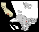
City Terrace is an unincorporated community in Los Angeles County, California
. It is considered part of the East Los Angeles region
. The U.S. census numbers are included with East Los Angeles
.
on the north and west, Floral Drive on the south, and the city limits of Monterey Park
on the east. Boyle Heights
is on the west, Lincoln Heights
is to the northwest, University Hills
is to the north, California State University, Los Angeles
is to the northeast, Monterey Park is to the east, and East Los Angeles
is to the south. Major thoroughfares include City Terrace Drive, Eastern and Medford Avenues, and Herbert Street. The community is part of ZIP code
90063 and area code 323
.
. The district's steep, winding streets are lined with generally well-preserved Spanish Colonial
houses.
operates the Central Health Center in Downtown Los Angeles
, serving City Terrace.
serves City Terrace. The district operates City Terrace Elementary School.
County of Los Angeles Public Library
operates the City Terrace Library. The library has been in its current location since 1979.
Los Angeles County, California
Los Angeles County is a county in the U.S. state of California. As of 2010 U.S. Census, the county had a population of 9,818,605, making it the most populous county in the United States. Los Angeles County alone is more populous than 42 individual U.S. states...
. It is considered part of the East Los Angeles region
East Los Angeles (region)
East Los Angeles is the portion of the City of Los Angeles that lies east of Downtown Los Angeles, the Los Angeles River and the unincorporated areas of Lincoln Heights, west of the San Gabriel Valley, East Los Angeles and City Terrace, south of Cypress Park, and north of Vernon, California and...
. The U.S. census numbers are included with East Los Angeles
East Los Angeles, California
East Los Angeles is an unincorporated area and census-designated place in Los Angeles County, California, United States...
.
Geography and transportation
City Terrace is bounded by the city limits of Los AngelesLos Angeles, California
Los Angeles , with a population at the 2010 United States Census of 3,792,621, is the most populous city in California, USA and the second most populous in the United States, after New York City. It has an area of , and is located in Southern California...
on the north and west, Floral Drive on the south, and the city limits of Monterey Park
Monterey Park, California
Monterey Park is a city in Los Angeles County, California, United States, east of downtown Los Angeles. The city's motto is "Pride in the past, Faith in the future"...
on the east. Boyle Heights
Boyle Heights, Los Angeles, California
Boyle Heights is a neighborhood east of Downtown Los Angeles on the East Side of Los Angeles. For much of the twentieth century, Boyle Heights was a gateway for new immigrants. This resulted in diverse demographics, including Jewish American, Japanese American and Mexican American populations,...
is on the west, Lincoln Heights
Lincoln Heights, Los Angeles, California
-Geography and transportation:Lincoln Heights is bounded by the Los Angeles River on the west, the San Bernardino Freeway on the south, and Indiana Street on the east; the district's Eastern border is unclear due to the area's uneven terrain...
is to the northwest, University Hills
University Hills, Los Angeles, California
University Hills is a district on the East Side of Los Angeles, California. It is the site of California State University, Los Angeles.-Geography and transportation:...
is to the north, California State University, Los Angeles
California State University, Los Angeles
California State University, Los Angeles is a public comprehensive university, part of the California State University system...
is to the northeast, Monterey Park is to the east, and East Los Angeles
East Los Angeles, California
East Los Angeles is an unincorporated area and census-designated place in Los Angeles County, California, United States...
is to the south. Major thoroughfares include City Terrace Drive, Eastern and Medford Avenues, and Herbert Street. The community is part of ZIP code
ZIP Code
ZIP codes are a system of postal codes used by the United States Postal Service since 1963. The term ZIP, an acronym for Zone Improvement Plan, is properly written in capital letters and was chosen to suggest that the mail travels more efficiently, and therefore more quickly, when senders use the...
90063 and area code 323
Area code 323
North American area code 323 is a California telephone area code which covers, roughly, the area of central Los Angeles . 323 also includes several gateway cities of the region, including Bell and Huntington Park...
.
Community description
City Terrace is located atop the Monterey HillsMonterey Hills, Los Angeles, California
Monterey Hills is a small, diverse, middle-class community within the city of Los Angeles, California located about 4 miles ENE of downtown Los Angeles and about 3 miles from Pasadena off of the 110 Freeway. It is surrounded by El Sereno to the southeast, Hermon to the east, Montecito Heights to...
. The district's steep, winding streets are lined with generally well-preserved Spanish Colonial
Spanish Colonial Revival Style architecture
The Spanish Colonial Revival Style was a United States architectural stylistic movement that came about in the early 20th century, starting in California and Florida as a regional expression related to history, environment, and nostalgia...
houses.
Government and infrastructure
The Los Angeles County Department of Health ServicesLos Angeles County Department of Health Services
Health services to over 10 million residents in the Los Angeles County are provided by the Los Angeles County Department of Health Services and the Los Angeles County Department of Public Health. Mental health services are provided by the County Department of Mental Health...
operates the Central Health Center in Downtown Los Angeles
Downtown Los Angeles
Downtown Los Angeles is the central business district of Los Angeles, California, United States, located close to the geographic center of the metropolitan area...
, serving City Terrace.
Education
The Los Angeles Unified School DistrictLos Angeles Unified School District
Los Angeles Unified School District is the largest public school system in California. It is the 2nd largest public school district in the United States. Only the New York City Department of Education has a larger student population...
serves City Terrace. The district operates City Terrace Elementary School.
County of Los Angeles Public Library
County of Los Angeles Public Library
-Library System:The County of Los Angeles Public Library is the 4th largest public library system in the United States which serves residents living in 51 of the 88 incorporated cities of Los Angeles County, California...
operates the City Terrace Library. The library has been in its current location since 1979.
External links
- Map of City Terrace Google MapsGoogle MapsGoogle Maps is a web mapping service application and technology provided by Google, free , that powers many map-based services, including the Google Maps website, Google Ride Finder, Google Transit, and maps embedded on third-party websites via the Google Maps API...