

Christchurch Central City
Encyclopedia
Christchurch Central City is the geographical centre and the heart of Christchurch
, New Zealand
. It is defined as the area within the four avenues (Bealey Avenue, Fitzgerald Avenue, Moorhouse Avenue and Deans Avenue) and thus includes the densely built up central city, some less dense surrounding areas of residential, educational and industrial usage, and green space including Hagley Park
, the Christchurch Botanic Gardens
and the Barbadoes Street Cemetery
.
It suffered heavy damage in the 2010 Canterbury earthquake
and was devastated in the 2011 Christchurch earthquake
. As of mid 2011, much of the city centre, the "red zone", remains inaccessible except to authorised contractors - as many of the larger, and most heavily hit, buildings of the city are still being demolished, including many heritage buildings. However, proposals to relocate the city centre elsewhere, to avoid future damage, were considered both uneconomical (as much of the infrastructure was still mainly intact) and unnecessary, as the rebuilt city centre would be to modern building standards so as to be able to withstand similar quakes and liquifaction in the future.
, surrounding the Anglican
cathedral, Christ Church. The area around this square and within the four avenues of Christchurch is considered the central business district
of the city.
The city centre is laid out in a grid pattern, interrupted only by the curvilinear alignment of the Avon River
, and the two diagonals High Street and Victoria Street. Christchurch has four pairs of one-way streets. The grid pattern within the outermost one-way streets is very regular, as this is the area that was laid out in the original survey. The surrounding area, i.e. the belt between the outer one-way streets and the avenues, was developed later in a progressive fashion and does not have the regularity of the core area.
Like most of the city, the centre is relatively flat.
, which was founded in London
in 1848. That year, the Canterbury Association sent out Captain Joseph Thomas, accompanied by surveyors, to select and prepare a site for settlement. Thomas originally placed the principal town of the proposed settlement at the head of Lyttelton Harbour
, but when he realised there was insufficient flat land there to meet the Canterbury Association’s requirements, he relocated Christchurch to where he had previously placed a town called ‘Stratford’ at a point on the Avon where those coming up the river first encountered slightly higher, drier ground. Back then, the Avon River was navigable as far as ‘The Bricks’ just upstream of the Barbadoes Street bridge. The site is these days marked by a riverbank cairn. The site got its name when the Deans Brothers in the 1840s had shipped bricks for their Riccarton
homestead up the Avon River, which they unloaded in this location.

Thomas’ plan for Christchurch (laid out by the surveyor Edward Jollie
by March 1850) was the ‘standard’ rectangular grid of colonial settlement (adopted for ease of survey and to facilitate land sales). Thomas did not allow Jollie to include crescents to provide variety, but the Avon River ran eccentrically across the site. Two diagonal streets (High Street/Ferry Road leading to Ferrymead
, Heathcote
and Sumner
and Victoria Street/Papanui Road leading to the Papanui
Bush) also broke the regularity of the grid. At the very centre of the city was a ‘Square’ (which is actually cross-shaped) intended as a grand centre for the city and the site of the proposed cathedral and grammar school. East and north-west of the Square were two more ‘squares’ (Latimer and Cranmer Squares, which are actually rectangles) which were placed more or less regularly in relation to the diagonal line of the Avon running in a north-easterly direction across the city to the west and north of the central square.
The grid was laid out originally between Salisbury Street to the north and St Asaph Street to the south and between Barbadoes Street to the east and Rolleston Avenue/Park Terrace to the west. Between Salisbury, Barbadoes and St Asaph Streets and (respectively) the North, East and South Town Belts (these days called Bealey, Fitzgerald and Moorhouse Avenues) were 'town reserves', i.e. land with-held from immediate sale, which was sold off by the Provincial Government later in the 1850s to overcome cash flow problems. The streets of the original grid were mostly projected out to the Town Belts, but the street system is less systematic in the former 'town reserves'. The names chosen for the streets of the inner city almost all commemorate the English colonial origins of the settlement. The names chosen later for the town belts commemorate important personalities of early Christchurch. Jollie explains in his diary how the streets got their names:
The original plan from 1850 shows the north-west corner of the 'town reserves' (surrounded by the Avon River, Fitzgerald and Bealey Avenues and Barbadoes Street, with an additional small rectangular area to the west of Barbadoes Street) as the cemetery for the settlement.
The following streets were those laid out in the 1850 survey (listed east to west, then north to south, then diagonals). Where a street name is one of the original names as devised by surveyors Joseph Thomas and Edward Jollie, this is marked as such.
and John Robert Godley. Godley, with his family, went out to New Zealand in early 1850 to oversee the preparations for the settlement (surveying, roads, accommodation, etc.) undertaken by Captain Joseph Thomas' team. These preparations were advanced, but incomplete when the first ships of settlers arrived on December 16, 1850, having been halted by Godley shortly after his arrival in April due to the mounting debts of the Association. The Charlotte-Jane
and Randolph
arrived in Lyttelton Harbour on the 16th, the Sir George Seymour
on the 17th, and Cressy
on the 27th, having set sail from England in September 1850. The settlers on these First Four Ships were dubbed the Canterbury Pilgrims by the British press. A further 24 shiploads of Canterbury Association settlers, making a total of approximately 3,500, arrived over the next two and a half years.
. Many building façades collapsed into the streets and authorities cordoned of large areas of the central city following the event. Manchester Courts
, a commercial high-rise building built in 1905–06, was at the time the tallest commercial building in Christchurch. A Category I heritage building, it suffered serious structural damage and was the first major building that was demolished.
The central city was badly damaged by the 22 February 2011 Christchurch earthquake and 181 people died. One further death has also been referred to the Coroner. The spire of ChristChurch Cathedral collapsed during the earthquake.
.
The central city has a number of residential areas, including Inner City East, Inner City West, Avon Loop, Moa Neighbourhood & Victoria. South of Tuam Street, commercial usage and some light industries are present. With over 6,000 full-time equivalent students, the Christchurch Polytechnic Institute of Technology
is the major education provider in the city centre.
Cathedral Square is a popular destination and hosts attractions such as the speakers' corner made famous by the Wizard of New Zealand, Ian Brackenbury Channell, and evangelist Ray Comfort
.
A central city heritage tram
system has been operated since 1995. In 2010, the system is being extended to the south to form a figure of eight. The tram system does not fulfil a transport function and is aimed at the tourism market.
In 2010 the Christchurch City Council released "A City For People Action Plan", a program of work through to 2022 to improve public spaces within the central city to entice more inner city residents and visitors. A primary action is to reduce the impact of motorised private vehicles and increase the comfort of pedestrians and cyclists. The plan is based on a report prepared for the council by renowned Danish design firm Gehl Architects.
; and the portion of High Street up to the junction of Colombo and Hereford Streets forms the remaining part of the mall. The concept of a pedestrian mall originated in 1965 as part of a central city redevelopment study. The project was publicly notified in the 1968 District Scheme, and again in the 1979 review. In 1981, the Christchurch City Council, in collaboration with the Cashel and High Street Businessmen's Associations, adopted a design and authorised implementation. The streets were closed to traffic on 11 January 1982 and the Mall was opened by the former Mayor, Sir Hamish Hay
, on 7 August 1982.
On 17 December 2009, a revamped City Mall was opened by mayor Bob Parker, incorporating the tourist tram through the mall.
The Bridge of Remembrance was opened on Armistice Day, 11 November 1924 by the Governor-General, Admiral of the Fleet, Lord Jellicoe, who had previously laid the foundation stone on Anzac Day, 25 April 1923. The road through the bridge was removed and the short stretch between Oxford Terrace and Cambridge Terrace opened as a pedestrian precinct on 25 April 1977 (Anzac Day) by Captain Charles Upham
, i.e. this stretch became a pedestrian precinct some five years before the establishment of City Mall.
Another pedestrianised street is New Regent Street, which has building facades in the Spanish Mission style. It became a pedestrian mall as part of the heritage tram loop in 1995.
The Christchurch City Council
is currently considering turning a section of Oxford Terrace (the section between Cashel Street and Hereford Street, known as the Strip) into a part-time pedestrian mall (nightly from 11 pm to 5 am).
Since around 2005, two precincts have developed in small central city lanes, known as Poplar Lane and South of Lichfield or SOL Square. A large number of bars are accommodated in these two areas, with a very active night life. These areas complement The Strip, a part of Oxford Terrace that started to support outdoor dining during the day and night time entertainment in the 1990s.
The Cultural Precinct http://www.culturalprecinct.co.nz/ provides a backdrop to a vibrant scene of ever-changing arts, cultural, and heritage attractions within an area of less than one square kilometre. The Arts Centre
, the Canterbury Museum, the Christchurch Art Gallery and the Centre of Contemporary Art
(CoCA) are located in the Cultural Precinct. The majority of the activities are free.
or are noted in the Christchurch City Plan. A large number of these buildings have been significantly damaged by the recent earthquakes. Some heritage buildings collapsed during the February earthquake (e.g. the Stone Chamber of the Canterbury Provincial Council Buildings
), many have been demolished already (e.g. St Elmo Courts
) while other buildings await their demolition (e.g. The Press Building
), and for many heritage buildings, the fate is as yet unclear (e.g. the Peterborough Centre
).
had the usual resident population on 30 June recorded as follows:
The Christchurch City Council is trying to revitalise the central city. One focus for that is the southern part of the central city, where the Council has controversially purchased properties from developer David Henderson
. The Council aspires to have 30,000 residents living within the Four Avenues by 2026. When the historic census population (for 1996, 2001 and 2006) is plotted and extrapolated to 2026, and compared to the required growth to reach a projected population of 30,000 residents by 2026, it becomes clear that this is an ambitious goal.
(FTE) employees, and with much of the floor area taken up by office space. One of the biggest employers is Christchurch City Council with 800 FTE at the civic offices.
The southern part of the central city has traditionally been home to manufacturing, but there has been a decline in this area, with many companies either moving to commercial subdivisions, closing, or relocating overseas.
There are several schools in the central city.
in Christchurch. The park was created in 1855 by the Provincial Government. According to the government's decree at that time, Hagley Park is "reserved forever as a public park, and shall be open for the recreation and enjoyment of the public." Hagley Park is characterised by its trees and broad open spaces. Hagley Park was named after the country estate of Lord Lyttelton
, who became chairman of the Canterbury Association in March 1850.
The Christchurch Botanic Gardens are botanical gardens founded in 1863, when on 9 July an English oak was planted to commemorate the solemnisation of marriage between Prince Albert
and Princess Alexandra
of Denmark
. The Gardens cover an area of 21 hectares, and lie adjacent to the loop of the Avon River next to Hagley Park.
The Barbadoes Street Cemetery is a large green space in the north-east of the central city. It is the city’s oldest cemetery and opened in 1851. It is the final resting place of many of Christchurch’s early leading citizens. The cemetery itself is divided by Barbadoes Street separating the Anglican (Church of England) section, on the eastern side, from the Roman Catholic and Dissenters (others) section on the west. The cemetery was initially envisaged to be much larger, but with the establishment of suburbs and villages with their own cemeteries, it became clear that less land was needed. The cemetery was subdivided in 1896 and Churchill Street was formed, with the eastern part of the original cemetery thus becoming a residential area.
With about 30,000 car parks (both public and private), the central city has one of the highest ratios of car parking and employment of the OECD countries. As both driving and parking is relatively easy, Christchurch has a high car ownership rate.
Cycling is reasonably popular in central Christchurch, with the second highest rate of commuter cycling in New Zealand (after Nelson). Free covered bike lock-ups are located in six City Council-run car parking buildings.
Public transport in Christchurch
is mainly based on buses and supported by taxis. There is a functioning tram service in Christchurch, but as a tourist attraction, its loop is restricted to a circuit of the central city and it does not fulfil a public transport function.
The city council provided the current Bus Exchange between Lichfield and Cashel Streets in November 2000. A new Transport Interchange is planned for the block surrounded by Lichfield, Colombo, Tuam and Durham Streets, as the existing Bus Exchange is nearing capacity.
Long distance buses depart mostly from Worcester Street near Cathedral Square. All local buses that go through the central city use the Bus Exchange. It is envisaged that long distance and local services will all use the Transport Interchange. In addition to normal bus services, the central city has a zero-fare hybrid
bus service, the Shuttle.
The railway station
used to be located on the southern boundary of the central city on Moorhouse Avenue, but has been relocated to the suburb of Riccarton
.
Christchurch
Christchurch is the largest city in the South Island of New Zealand, and the country's second-largest urban area after Auckland. It lies one third of the way down the South Island's east coast, just north of Banks Peninsula which itself, since 2006, lies within the formal limits of...
, New Zealand
New Zealand
New Zealand is an island country in the south-western Pacific Ocean comprising two main landmasses and numerous smaller islands. The country is situated some east of Australia across the Tasman Sea, and roughly south of the Pacific island nations of New Caledonia, Fiji, and Tonga...
. It is defined as the area within the four avenues (Bealey Avenue, Fitzgerald Avenue, Moorhouse Avenue and Deans Avenue) and thus includes the densely built up central city, some less dense surrounding areas of residential, educational and industrial usage, and green space including Hagley Park
Hagley Park
Hagley Park is the largest urban open space in Christchurch, New Zealand, and was created in 1855 by the Provincial Government. According to the government's decree at that time, Hagley Park is "reserved forever as a public park, and shall be open for the recreation and enjoyment of the public."...
, the Christchurch Botanic Gardens
Christchurch Botanic Gardens
The Christchurch Botanic Gardens, located in the central city of Christchurch, New Zealand are botanical gardens founded in 1863, when an English oak was planted on 9 July 1863 to commemorate the solemnisation of marriage between Prince Albert and Princess Alexandra of Denmark.The Gardens sprawl...
and the Barbadoes Street Cemetery
Barbadoes Street Cemetery
-Description:Some of the notable people buried at the cemetery include William Armson, William Montgomery, Frederic Jones and Henry Tancred. Six former Mayors of Christchurch are buried at the Barbadoes Street Cemetery:* Henry Sawtell...
.
It suffered heavy damage in the 2010 Canterbury earthquake
2010 Canterbury earthquake
The 2010 Canterbury earthquake was a 7.1 magnitude earthquake, which struck the South Island of New Zealand at 4:35 am on local time ....
and was devastated in the 2011 Christchurch earthquake
2011 Christchurch earthquake
The February 2011 Christchurch earthquake was a magnitude 6.3 earthquake that struck the Canterbury region in New Zealand's South Island at on local time , The earthquake was centred west of the town of Lyttelton, and south-east of the centre of Christchurch, New Zealand's second-most populous...
. As of mid 2011, much of the city centre, the "red zone", remains inaccessible except to authorised contractors - as many of the larger, and most heavily hit, buildings of the city are still being demolished, including many heritage buildings. However, proposals to relocate the city centre elsewhere, to avoid future damage, were considered both uneconomical (as much of the infrastructure was still mainly intact) and unnecessary, as the rebuilt city centre would be to modern building standards so as to be able to withstand similar quakes and liquifaction in the future.
Geography
At the centre of the city is Cathedral SquareCathedral Square, Christchurch
Cathedral Square, locally known simply as the Square, is the geographical centre and heart of Christchurch, New Zealand, where the city's Anglican cathedral, ChristChurch Cathedral is located...
, surrounding the Anglican
Anglicanism
Anglicanism is a tradition within Christianity comprising churches with historical connections to the Church of England or similar beliefs, worship and church structures. The word Anglican originates in ecclesia anglicana, a medieval Latin phrase dating to at least 1246 that means the English...
cathedral, Christ Church. The area around this square and within the four avenues of Christchurch is considered the central business district
Central business district
A central business district is the commercial and often geographic heart of a city. In North America this part of a city is commonly referred to as "downtown" or "city center"...
of the city.
The city centre is laid out in a grid pattern, interrupted only by the curvilinear alignment of the Avon River
Avon River, Canterbury
The Avon River flows through the centre of the city of Christchurch, New Zealand, and out to an estuary, which it shares with the Heathcote River, the Avon Heathcote Estuary.- Geology :...
, and the two diagonals High Street and Victoria Street. Christchurch has four pairs of one-way streets. The grid pattern within the outermost one-way streets is very regular, as this is the area that was laid out in the original survey. The surrounding area, i.e. the belt between the outer one-way streets and the avenues, was developed later in a progressive fashion and does not have the regularity of the core area.
Like most of the city, the centre is relatively flat.
European settlement
The European settlement of Christchurch was undertaken by the Canterbury AssociationCanterbury Association
The Canterbury Association was formed in order to establish a colony in what is now the Canterbury Region in the South Island of New Zealand.- Formation of the Association :...
, which was founded in London
London
London is the capital city of :England and the :United Kingdom, the largest metropolitan area in the United Kingdom, and the largest urban zone in the European Union by most measures. Located on the River Thames, London has been a major settlement for two millennia, its history going back to its...
in 1848. That year, the Canterbury Association sent out Captain Joseph Thomas, accompanied by surveyors, to select and prepare a site for settlement. Thomas originally placed the principal town of the proposed settlement at the head of Lyttelton Harbour
Lyttelton Harbour
Lyttelton Harbour is one of two major inlets in Banks Peninsula, on the coast of Canterbury, New Zealand. The other is Akaroa Harbour.Approximately 15 km in length from its mouth to Teddington, the harbour was formed from a series of ancient volcanic eruptions that created a caldera, the...
, but when he realised there was insufficient flat land there to meet the Canterbury Association’s requirements, he relocated Christchurch to where he had previously placed a town called ‘Stratford’ at a point on the Avon where those coming up the river first encountered slightly higher, drier ground. Back then, the Avon River was navigable as far as ‘The Bricks’ just upstream of the Barbadoes Street bridge. The site is these days marked by a riverbank cairn. The site got its name when the Deans Brothers in the 1840s had shipped bricks for their Riccarton
Riccarton, New Zealand
Riccarton is a suburb of Christchurch. It is due west of the city centre, separated from it by Hagley Park. Upper Riccarton is to the west of Riccarton.-History:...
homestead up the Avon River, which they unloaded in this location.
Survey layout
Christchurch is one of a group of only four cities in the world that have been carefully planned following the same layout of a central city square, four complimenting city squares surrounding it and a parklands area that embrace the city centre. The first city built with this pattern was Philadelphia, later came Savannah and Adelaide. The fourth city using this pattern was Christchurch. As such Christchurch holds an important legacy and a strong platform for future development.Thomas’ plan for Christchurch (laid out by the surveyor Edward Jollie
Edward Jollie
Edward Jollie was a pioneer land surveyor in New Zealand, initially as a cadet surveyor with the New Zealand Company. He followed his elder brother Francis Jollie to New Zealand, arriving on the barque Brougham in Wellington in 1842...
by March 1850) was the ‘standard’ rectangular grid of colonial settlement (adopted for ease of survey and to facilitate land sales). Thomas did not allow Jollie to include crescents to provide variety, but the Avon River ran eccentrically across the site. Two diagonal streets (High Street/Ferry Road leading to Ferrymead
Ferrymead
-Geography:Ferrymead is located on the Avon Heathcote Estuary, close to the point where the Heathcote River drains into the estuary, and three km west of the eventual outflow into Pegasus Bay. To the north lie the oxidation ponds from Christchurch's main sewage treatment works, which are within a...
, Heathcote
Heathcote Valley
-Location:The suburb is dominated by the approaches to the Lyttelton road tunnel, a major arterial that passes through the Port Hills. The road is part of the State Highway 74 network...
and Sumner
Sumner, New Zealand
Sumner is a coastal seaside suburb of Christchurch, New Zealand and was surveyed and named in 1849 in honour of John Bird Sumner, the then newly appointed Archbishop of Canterbury and president of the Canterbury Association...
and Victoria Street/Papanui Road leading to the Papanui
Papanui
Papanui is a major suburb of Christchurch New Zealand. It is sited five kilometers to the northwest of the city centre. Papanui is a middle socio-economic area with a population of 3,543 consisting predominantly of Pākehā 92.3%, Māori 5.7%, Pacific peoples 2.5%, Asian 5.0%, Middle Eastern/Latin...
Bush) also broke the regularity of the grid. At the very centre of the city was a ‘Square’ (which is actually cross-shaped) intended as a grand centre for the city and the site of the proposed cathedral and grammar school. East and north-west of the Square were two more ‘squares’ (Latimer and Cranmer Squares, which are actually rectangles) which were placed more or less regularly in relation to the diagonal line of the Avon running in a north-easterly direction across the city to the west and north of the central square.
The grid was laid out originally between Salisbury Street to the north and St Asaph Street to the south and between Barbadoes Street to the east and Rolleston Avenue/Park Terrace to the west. Between Salisbury, Barbadoes and St Asaph Streets and (respectively) the North, East and South Town Belts (these days called Bealey, Fitzgerald and Moorhouse Avenues) were 'town reserves', i.e. land with-held from immediate sale, which was sold off by the Provincial Government later in the 1850s to overcome cash flow problems. The streets of the original grid were mostly projected out to the Town Belts, but the street system is less systematic in the former 'town reserves'. The names chosen for the streets of the inner city almost all commemorate the English colonial origins of the settlement. The names chosen later for the town belts commemorate important personalities of early Christchurch. Jollie explains in his diary how the streets got their names:
The names of the streets of the three towns I surveyed were taken from Bishoprics and the way it was done was this; as soon as I completed the map I took it to Thomas who putting on his gold spectacles and opening his would read out a Bishop's name to hear if it sounded well. If I agreed with him that it did, I put the name to one of the streets requiring baptism.
Lyttelton being the first born town got the best names for its streets, Sumner being next had the next best and Christchurch being the youngest had to be content with chiefly Irish and Colonial bishoprics as names for its streets. This accounts for, what to anyone not knowing the circumstances, appears strange, viz: that many of the best English Bishoprics are not represented while Irish and Colonial ones are. Sumner in fact died too late for the names there used to be again employed in Christchurch.
The original plan from 1850 shows the north-west corner of the 'town reserves' (surrounded by the Avon River, Fitzgerald and Bealey Avenues and Barbadoes Street, with an additional small rectangular area to the west of Barbadoes Street) as the cemetery for the settlement.
The following streets were those laid out in the 1850 survey (listed east to west, then north to south, then diagonals). Where a street name is one of the original names as devised by surveyors Joseph Thomas and Edward Jollie, this is marked as such.
Streets running north-south
- Deans Avenue - the original name for this street was West Belt. In 1905, it got renamed to Rolleston Avenue, but was called West Belt again in 1906. Deans Avenue is named after the Deans family, who farmed at Riccarton from 1843 onwards.
- Harper Avenue - this street was formerly called Park Road and North Park Road. It was so named because it runs alongside Hagley Park. It was renamed Harper Avenue by city council resolution on 18 May 1931 in honour of the retiring chairman of the Christchurch Domains Board George Harper (1843–1937).
- Rolleston Avenue - this street formerly belonged to Antigua Street. The section between Cambridge Terrace and Armagh Street was renamed in honour of William RollestonWilliam RollestonWilliam Rolleston was a New Zealand politician, public administrator, educationalist and Canterbury provincial superintendent.-Early life:...
on 11 January 1903, about one month before his passing. This street was chosen because of his association with Canterbury College (now the Christchurch Arts CentreChristchurch Arts CentreThe Christchurch Arts Centre is a hub for arts, crafts and entertainment in Christchurch, New Zealand. It is located in the neo-gothic former University of Canterbury buildings, the majority of which were designed by Benjamin Mountfort...
, which adjoined Antigua Street and also because it was proposed to erect his statueRolleston StatueThe Rolleston Statue is a white marble statue situated outside Canterbury Museum in Christchurch, New Zealand. It commemorates William Rolleston, who was Superintendent of the Canterbury Province from 1868 until 1877.-History:...
there. - Park Terrace - this street appears as Mill Road on an 1862 map. Park Terrace, named because it runs adjacent to Hagley Park, first appears in street directories in 1880.
- Cranmer Square (original street name) - Cranmer Square is adjacent to the square of the same name and is named after the martyred OxfordOxfordThe city of Oxford is the county town of Oxfordshire, England. The city, made prominent by its medieval university, has a population of just under 165,000, with 153,900 living within the district boundary. It lies about 50 miles north-west of London. The rivers Cherwell and Thames run through...
bishop Thomas CranmerThomas CranmerThomas Cranmer was a leader of the English Reformation and Archbishop of Canterbury during the reigns of Henry VIII, Edward VI and, for a short time, Mary I. He helped build a favourable case for Henry's divorce from Catherine of Aragon which resulted in the separation of the English Church from...
. - Montreal Street (original street name) - this street is named after the Anglican Diocese of MontrealAnglican Diocese of MontrealThe Diocese of Montreal is a diocese of the Ecclesiastical Province of Canada of the Anglican Church of Canada, in turn a province of the Anglican Communion. The diocese comprises the 21,400 square kilometres encompassing the City and Island of Montreal, the Laurentians, the South Shore opposite...
in CanadaCanadaCanada is a North American country consisting of ten provinces and three territories. Located in the northern part of the continent, it extends from the Atlantic Ocean in the east to the Pacific Ocean in the west, and northward into the Arctic Ocean...
. The surveyors ran out of English bishoprics to use as street names so moved on to other colonies. - Durham Street (original street name) - the street was named after the Diocese of DurhamDiocese of DurhamThe Diocese of Durham is a Church of England diocese, based in Durham, and covering the historic County Durham . It was created in AD 1000 to replace the Diocese of Lindisfarne...
. On 21 October 1985 the council resolved for the two separate sections of Durham Street (between Gloucester Street and Cashel Street, which is part of Cambridge Terrace) to be re-named Durham Street North and South. - Colombo StreetColombo StreetColombo Street is a main road of the city of Christchurch, New Zealand. It runs south-north through the centre of Christchurch with a break at Cathedral Square. As with many other central Christchurch streets, it is named for a colonial Anglican bishopric, Colombo, in what at the time was known as...
(original street name) - this street is named after the colonial Anglican bishopric ColomboColomboColombo is the largest city of Sri Lanka. It is located on the west coast of the island and adjacent to Sri Jayawardenapura Kotte, the capital of Sri Lanka. Colombo is often referred to as the capital of the country, since Sri Jayawardenapura Kotte is a satellite city of Colombo...
in what at the time was known as CeylonSri LankaSri Lanka, officially the Democratic Socialist Republic of Sri Lanka is a country off the southern coast of the Indian subcontinent. Known until 1972 as Ceylon , Sri Lanka is an island surrounded by the Indian Ocean, the Gulf of Mannar and the Palk Strait, and lies in the vicinity of India and the...
. - Manchester Street (original street name) - this street is named after William Montagu, 7th Duke of ManchesterWilliam Montagu, 7th Duke of ManchesterWilliam Drogo Montagu, 7th Duke of Manchester, KP , known as Lord Kimbolton from 1823 to 1843 and as Viscount Mandeville from 1843 to 1855, was a British peer and Conservative Member of Parliament.William Montagu was the eldest son of George Montagu, 6th Duke of Manchester...
, who was a member of the Canterbury association in 1848. - Latimer Square (original street name) - the street adjacent to Latimer Square is named after the martyred OxfordOxfordThe city of Oxford is the county town of Oxfordshire, England. The city, made prominent by its medieval university, has a population of just under 165,000, with 153,900 living within the district boundary. It lies about 50 miles north-west of London. The rivers Cherwell and Thames run through...
bishop Hugh LatimerHugh LatimerHugh Latimer was a Fellow of Clare College, Cambridge, Bishop of Worcester before the Reformation, and later Church of England chaplain to King Edward VI. In 1555, under Queen Mary, he was burnt at the stake, becoming one of the three Oxford Martyrs of Anglicanism.-Life:Latimer was born into a...
. - Madras Street (original street name) - this street is named after the colonial Anglican bishopric of MadrasChennaiChennai , formerly known as Madras or Madarasapatinam , is the capital city of the Indian state of Tamil Nadu, located on the Coromandel Coast off the Bay of Bengal. Chennai is the fourth most populous metropolitan area and the sixth most populous city in India...
(now known as Chennai) in IndiaIndiaIndia , officially the Republic of India , is a country in South Asia. It is the seventh-largest country by geographical area, the second-most populous country with over 1.2 billion people, and the most populous democracy in the world...
. - Barbadoes Street (original street name) - this street is named after the Anglican colonial Diocese of Barbados in the West IndiesCaribbeanThe Caribbean is a crescent-shaped group of islands more than 2,000 miles long separating the Gulf of Mexico and the Caribbean Sea, to the west and south, from the Atlantic Ocean, to the east and north...
, now known as the Caribbean. The Christchurch spelling of Barbados with an additional 'e' is as per the original survey plan drawn by Edward Jollie. - Fitzgerald Ave - the original names for this street were East Town Belt and East Belt. The street was renamed by council on 11 January 1904 in honour of James FitzGeraldJames FitzGeraldJames Edward FitzGerald was a New Zealand politician. According to some historians, he should be considered the country's first Prime Minister, although a more conventional view is that neither he nor his successor should properly be given that title. He was a notable campaigner for New Zealand...
.
Streets running east-west
- Bealey Avenue - the original name for this street was North Belt and North Town Belt. On 11 January 1904, it got renamed in honour of Canterbury's third SuperintendentSuperintendent (politics)Superintendent was the elected head of each Provincial Council in New Zealand from 1853 to 1876.-Historical context:Provinces existed in New Zealand from 1841 until 1876 as a form of sub-national government. After the initial provinces pre-1853, new provinces were formed by the New Zealand...
Samuel BealeySamuel BealeySamuel Bealey was a 19th century Canterbury, New Zealand politician.He came out to Canterbury in 1851, a pastoralist with capital to invest in farming. He married Rose Ann, daughter of Archdeacon Paul in 1852. Having made money, he returned to England, in 1867 and died there...
, who owned land in this area. - Salisbury Street (original street name) - the street is named after the English Diocese of SalisburyDiocese of SalisburyThe Diocese of Salisbury is a Church of England diocese in the south of England. The diocese covers Dorset and most of Wiltshire and is a constituent diocese of the Province of Canterbury. The diocese is led by the Bishop of Salisbury and the diocesan synod...
. - Peterborough Street (original street name) - the street is named after the Anglican Diocese of Peterborough.
- Kilmore Street (original street name) - the street is named after the IrishIrelandIreland is an island to the northwest of continental Europe. It is the third-largest island in Europe and the twentieth-largest island on Earth...
Diocese of Kilmore. - Chester Street (original street name) - the street is named after the English Anglican Diocese of ChesterDiocese of ChesterThe Diocese of Chester is a Church of England diocese in the Province of York based in Chester, covering the county of Cheshire in its pre-1974 boundaries...
. It appears in 1883 street directories as Chester Street between East Town Belt and Colombo Street, and Chester Street West between Cambridge Terrace and Park Terrace. Chester Street West was re-named Cranmer Terrace for a short time in the 1950s because of the gap in Chester Street between Colombo Street and Cambridge Terrace. It reverted to its earlier name when the residents found that there was confusion with Cranmer Square. - Armagh Street (original street name) - the street is named after the Diocese of ArmaghDiocese of Armagh (Church of Ireland)The Diocese of Armagh is the Metropolitan head of the Ecclesiastical province of Armagh. The province is one of two such provinces of the Church of Ireland in the island of Ireland...
. - Gloucester Street (original street name) - the street is named after the Diocese of GloucesterDiocese of GloucesterThe Diocese of Gloucester is a Church of England diocese based in Gloucester, covering the non-metropolitan county of Gloucestershire. The cathedral is Gloucester Cathedral and the bishop is the Bishop of Gloucester...
. - Worcester Street (original street name) - the street is named after the Anglican Diocese of WorcesterAnglican Diocese of WorcesterThe Diocese of Worcester forms part of the Province of Canterbury in England.The diocese was founded in around 679 by St Theodore of Canterbury at Worcester to minister to the kingdom of the Hwicce, one of the many Anglo Saxon petty-kingdoms of that time...
. - Hereford Street (original street name) - the street is named after the Diocese of HerefordDiocese of HerefordThe Diocese of Hereford is a Church of England diocese based in Hereford, covering Herefordshire, southern Shropshire and a few parishes within Worcestershire in England; and a few parishes within Powys and Monmouthshire in Wales....
. - Cashel Street (original street name) - the street is named after the bishopric of CashelBishop of Cashel and WaterfordThe Bishop of Cashel and Waterford was the Ordinary of the Church of Ireland diocese of Cashel and Waterford; comprising all of County Waterford, the southern part of County Tipperary and a small part of County Limerick, Ireland.-History:In the Church of Ireland, although not in the Roman Catholic...
. - Lichfield Street (original street name) - the street is named after the Diocese of LichfieldDiocese of LichfieldThe Diocese of Lichfield is a Church of England diocese in the Province of Canterbury, England. The bishop's seat is located in the Cathedral Church of the Blessed Virgin Mary and Saint Chad in the city of Lichfield. The diocese covers 4,516 km² The Diocese of Lichfield is a Church of England...
. - Tuam Street (original street name) - the street is named after the Irish Diocese of Tuam.
- St Asaph Street (original street name) - the street is named after the Diocese of St AsaphDiocese of St AsaphThe Diocese of Saint Asaph is a diocese in north-east Wales, named after Saint Asaph, its second bishop.-Geography:The Anglican Diocese of St Asaph in the north-east corner of Wales stretches from the borders of Chester in the east, to the Conwy valley in the west, to Bala in the south-west, and...
in WalesWalesWales is a country that is part of the United Kingdom and the island of Great Britain, bordered by England to its east and the Atlantic Ocean and Irish Sea to its west. It has a population of three million, and a total area of 20,779 km²...
. - Moorhouse Avenue - the original name for this street was South Belt and South Town Belt. On 11 January 1904, it got renamed in honour of Canterbury's second superintendent William Sefton MoorhouseWilliam Sefton MoorhouseWilliam Sefton Moorhouse was a New Zealand politician. He was the second Superintendent of Canterbury Province.-Early life:...
, who had championed the development of Christchurch-Lyttelton railway and the Lyttelton rail tunnelLyttelton rail tunnelThe Lyttelton Rail Tunnel, initially called the Moorhouse Tunnel, links the city of Christchurch with the port of Lyttelton in the Canterbury region of New Zealand’s South Island. It is the country’s oldest operational rail tunnel, and is on one of the first railway lines in the district...
. It was thus thought appropriate that the avenue adjacent to the railway be named after him.
Other streets
- Cambridge Terrace (original street name) - the street is named after the University of CambridgeUniversity of CambridgeThe University of Cambridge is a public research university located in Cambridge, United Kingdom. It is the second-oldest university in both the United Kingdom and the English-speaking world , and the seventh-oldest globally...
in England. Waterloo Terrace was the name on the first plan of the road along the Avon River from Market Place (now Victoria Square) to past the Foresters' Hall, i.e. from near the Oxford-on-Avon and the Plunket SocietyPlunket SocietyThe Royal New Zealand Plunket Society is an incorporated society in New Zealand which provides a range of health services to healthy babies and young children...
round to near the Centennial Leisure Centre. Avonside Road was the section just south of the Barbadoes Street Cemetery, adjacent to the river bank and the river, across the river from the Avon Loop, east of Barbadoes Street and round to Fitzgerald Avenue. - Oxford Terrace (original street name) - the street is named after the University of OxfordUniversity of OxfordThe University of Oxford is a university located in Oxford, United Kingdom. It is the second-oldest surviving university in the world and the oldest in the English-speaking world. Although its exact date of foundation is unclear, there is evidence of teaching as far back as 1096...
. John Robert GodleyJohn Robert GodleyJohn Robert Godley was an Irish statesman and bureaucrat. Godley is considered to be the founder of Canterbury, New Zealand, although he lived there for only two years.-Early life:...
, considered to be the founder of Christchurch, had studied at Christ ChurchChrist Church, OxfordChrist Church or house of Christ, and thus sometimes known as The House), is one of the largest constituent colleges of the University of Oxford in England...
, one of the colleges of the University of Oxford. - Victoria Street - this street was originally named Whately Road after Richard WhatelyRichard WhatelyRichard Whately was an English rhetorician, logician, economist, and theologian who also served as the Church of Ireland Archbishop of Dublin.-Life and times:...
, who was a member of the Canterbury Association. It was re-named Victoria Street in 1877 after a petition signed by 61 residents was presented asking that the name be changed. The current street name commemorates Queen Victoria. - High Street - this street was originally named Sumner Road, as it connected to the village of Sumner. At the time, Sumner was of great importance to Christchurch, as a road over the Port HillsPort HillsThe Port Hills form the northern rim of the ancient Lyttelton volcano, separating the port of Lyttelton from the city of Christchurch in Canterbury, New Zealand...
was to be built connecting LytteltonLyttelton, New ZealandLyttelton is a port town on the north shore of Lyttelton Harbour close to Banks Peninsula, a suburb of Christchurch on the eastern coast of the South Island of New Zealand....
with Sumner. The section north of St Asaph Street was renamed High Street. - Ferry Road - the CBD end of Ferry Road was originally called Sumner Road. The section south of St Asaph Street was renamed Lower High Street, and then Ferry Road.
Important Canterbury Association members
The prime movers of the Canterbury Association were Edward Gibbon WakefieldEdward Gibbon Wakefield
Edward Gibbon Wakefield was a British politician, the driving force behind much of the early colonisation of South Australia, and later New Zealand....
and John Robert Godley. Godley, with his family, went out to New Zealand in early 1850 to oversee the preparations for the settlement (surveying, roads, accommodation, etc.) undertaken by Captain Joseph Thomas' team. These preparations were advanced, but incomplete when the first ships of settlers arrived on December 16, 1850, having been halted by Godley shortly after his arrival in April due to the mounting debts of the Association. The Charlotte-Jane
Charlotte-Jane
The Charlotte Jane was one of the First Four Ships in 1850 to carry emigrants from England to the new colony of Canterbury in New Zealand.-Arrival in Lyttelton:...
and Randolph
Randolph (ship)
Randolph was a 664-ton ship-rigged merchant vessel constructed in 1849 in Sunderland. She was one of the first four ships to settle Christchurch, New Zealand ....
arrived in Lyttelton Harbour on the 16th, the Sir George Seymour
Sir George Seymour (ship)
The Sir George Seymour was one of the first four ships in 1850 to carry emigrants from England to the new colony of Canterbury in New Zealand. The other three ships were Cressy, Charlotte-Jane and Randolph.-Voyage:...
on the 17th, and Cressy
Cressy (ship)
The Cressy was one of the first four ships in 1850 to carry emigrants from England to the new colony of Canterbury in New Zealand. The Cressy was the last to arrive on 27 December. The other ships were Charlotte-Jane, Sir George Seymour and Randolph.The passengers aboard these four ships were...
on the 27th, having set sail from England in September 1850. The settlers on these First Four Ships were dubbed the Canterbury Pilgrims by the British press. A further 24 shiploads of Canterbury Association settlers, making a total of approximately 3,500, arrived over the next two and a half years.
2010/11 earthquakes
The central city was among the most heavily damaged areas of Christchurch following the 2010 Canterbury earthquake2010 Canterbury earthquake
The 2010 Canterbury earthquake was a 7.1 magnitude earthquake, which struck the South Island of New Zealand at 4:35 am on local time ....
. Many building façades collapsed into the streets and authorities cordoned of large areas of the central city following the event. Manchester Courts
Manchester Courts
Manchester Courts, earlier known as the MLC Building, was a commercial high-rise building in the Christchurch Central City. Built in 1905–1906 for the New Zealand Express Company, it was at the time the tallest commercial building in Christchurch...
, a commercial high-rise building built in 1905–06, was at the time the tallest commercial building in Christchurch. A Category I heritage building, it suffered serious structural damage and was the first major building that was demolished.
The central city was badly damaged by the 22 February 2011 Christchurch earthquake and 181 people died. One further death has also been referred to the Coroner. The spire of ChristChurch Cathedral collapsed during the earthquake.
Overview
The Central City offers well over 450 unique retail businesses and over 130 cafes, restaurants, bars and clubs. It has the largest selection of fashion, food, cafe and entertainment in the South IslandSouth Island
The South Island is the larger of the two major islands of New Zealand, the other being the more populous North Island. It is bordered to the north by Cook Strait, to the west by the Tasman Sea, to the south and east by the Pacific Ocean...
.
The central city has a number of residential areas, including Inner City East, Inner City West, Avon Loop, Moa Neighbourhood & Victoria. South of Tuam Street, commercial usage and some light industries are present. With over 6,000 full-time equivalent students, the Christchurch Polytechnic Institute of Technology
Christchurch Polytechnic Institute of Technology
The Christchurch Polytechnic Institute of Technology , formerly the Christchurch Technical College, is an institute of technology in Christchurch, New Zealand...
is the major education provider in the city centre.
Cathedral Square is a popular destination and hosts attractions such as the speakers' corner made famous by the Wizard of New Zealand, Ian Brackenbury Channell, and evangelist Ray Comfort
Ray Comfort
Ray Comfort is a New Zealand-born Christian minister and evangelist. Comfort started Living Waters Publications and The Way of the Master in Bellflower, California and has written a number of books.-Early life and career:...
.
A central city heritage tram
Christchurch tramway system
The Christchurch tramway system was an extensive network in Christchurch, New Zealand, with steam and horse trams from 1882. Electric trams ran from 1905 to 1954, when the last line to Papanui was replaced by buses...
system has been operated since 1995. In 2010, the system is being extended to the south to form a figure of eight. The tram system does not fulfil a transport function and is aimed at the tourism market.
In 2010 the Christchurch City Council released "A City For People Action Plan", a program of work through to 2022 to improve public spaces within the central city to entice more inner city residents and visitors. A primary action is to reduce the impact of motorised private vehicles and increase the comfort of pedestrians and cyclists. The plan is based on a report prepared for the council by renowned Danish design firm Gehl Architects.
Precincts
The central city includes the pedestrianised Cashel and High Streets, known as 'City Mall'. At one end of the mall stands the Bridge Of Remembrance; at the intersection of Cashel and High Streets is the old location of the amphitheatre known as the Hack CircleHack Circle
The Hack Circle or Hack was a nickname given to an amphitheatre in central Christchurch, New Zealand. It was built as part of the second phase of developing a pedestrian mall in the central city in 1989 and was officially opened on 6 December of that same year by then mayor Vicki Buck...
; and the portion of High Street up to the junction of Colombo and Hereford Streets forms the remaining part of the mall. The concept of a pedestrian mall originated in 1965 as part of a central city redevelopment study. The project was publicly notified in the 1968 District Scheme, and again in the 1979 review. In 1981, the Christchurch City Council, in collaboration with the Cashel and High Street Businessmen's Associations, adopted a design and authorised implementation. The streets were closed to traffic on 11 January 1982 and the Mall was opened by the former Mayor, Sir Hamish Hay
Hamish Hay
Sir Hamish Grenfell Hay was a New Zealand politician, who served as Mayor of Christchurch for fifteen years, from 1974 to 1989.-Early life:...
, on 7 August 1982.
On 17 December 2009, a revamped City Mall was opened by mayor Bob Parker, incorporating the tourist tram through the mall.
The Bridge of Remembrance was opened on Armistice Day, 11 November 1924 by the Governor-General, Admiral of the Fleet, Lord Jellicoe, who had previously laid the foundation stone on Anzac Day, 25 April 1923. The road through the bridge was removed and the short stretch between Oxford Terrace and Cambridge Terrace opened as a pedestrian precinct on 25 April 1977 (Anzac Day) by Captain Charles Upham
Charles Upham
Captain Charles Hazlitt Upham VC and Bar was a New Zealand soldier who earned the Victoria Cross twice during the Second World War: in Crete in May 1941, and at Ruweisat Ridge, Egypt, in July 1942...
, i.e. this stretch became a pedestrian precinct some five years before the establishment of City Mall.
Another pedestrianised street is New Regent Street, which has building facades in the Spanish Mission style. It became a pedestrian mall as part of the heritage tram loop in 1995.
The Christchurch City Council
Christchurch City Council
The Christchurch City Council is the local government authority for Christchurch in New Zealand. It is a territorial authority elected to represent the people of Christchurch. Since 2007, the Mayor of Christchurch is Bob Parker, who stood as an independent candidate...
is currently considering turning a section of Oxford Terrace (the section between Cashel Street and Hereford Street, known as the Strip) into a part-time pedestrian mall (nightly from 11 pm to 5 am).
Since around 2005, two precincts have developed in small central city lanes, known as Poplar Lane and South of Lichfield or SOL Square. A large number of bars are accommodated in these two areas, with a very active night life. These areas complement The Strip, a part of Oxford Terrace that started to support outdoor dining during the day and night time entertainment in the 1990s.
The Cultural Precinct http://www.culturalprecinct.co.nz/ provides a backdrop to a vibrant scene of ever-changing arts, cultural, and heritage attractions within an area of less than one square kilometre. The Arts Centre
Christchurch Arts Centre
The Christchurch Arts Centre is a hub for arts, crafts and entertainment in Christchurch, New Zealand. It is located in the neo-gothic former University of Canterbury buildings, the majority of which were designed by Benjamin Mountfort...
, the Canterbury Museum, the Christchurch Art Gallery and the Centre of Contemporary Art
Centre of Contemporary Art
The Centre of Contemporary Art is an art gallery in the central city of Christchurch, New Zealand....
(CoCA) are located in the Cultural Precinct. The majority of the activities are free.
Heritage buildings
The central city has a large number of registered heritage buildings that are either listed with the New Zealand Historic Places TrustNew Zealand Historic Places Trust
The New Zealand Historic Places Trust is a non-profit trust that advocates for the protection of ancestral sites and heritage buildings in New Zealand...
or are noted in the Christchurch City Plan. A large number of these buildings have been significantly damaged by the recent earthquakes. Some heritage buildings collapsed during the February earthquake (e.g. the Stone Chamber of the Canterbury Provincial Council Buildings
Canterbury Provincial Council Buildings
The Canterbury Provincial Council Buildings were the buildings of the Canterbury Provincial Council that administered the Canterbury Province from 1853 until the abolition of provincial government in 1876. The buildings are the only purpose-built provincial government buildings in New Zealand still...
), many have been demolished already (e.g. St Elmo Courts
St Elmo Courts
St Elmo Courts was a residential high rise building constructed in 1930 in the city centre of Christchurch, New Zealand. Used mainly as an office building in later years, it had a Category II heritage listing by the New Zealand Historic Places Trust...
) while other buildings await their demolition (e.g. The Press Building
The Press Building, Christchurch
The Press Building located in Cathedral Square in Christchurch was the home of The Press between 1909 and February 2011. The building in perpendicular Gothic is registered with the New Zealand Historic Places Trust as a Category I heritage item, with the registration number 302...
), and for many heritage buildings, the fate is as yet unclear (e.g. the Peterborough Centre
Peterborough Centre
The Peterborough Centre, the former Teachers' College Building, is located on the corner of Peterborough and Montreal Streets in Christchurch, New Zealand. It is a Category II heritage building...
).
Population
The central city has an increasing residential population. The last three censusesNew Zealand Census of Population and Dwellings
The New Zealand government department Statistics New Zealand conducts a census of population and dwellings every five years. The census scheduled for 2011 was cancelled due to circumstances surrounding the February 2011 Christchurch earthquake, however, and legislation introduced to hold the next...
had the usual resident population on 30 June recorded as follows:
| Census | 1996 | 2001 | 2006 |
| Resident population | 6600 | 7266 | 7653 |
The Christchurch City Council is trying to revitalise the central city. One focus for that is the southern part of the central city, where the Council has controversially purchased properties from developer David Henderson
David Henderson (Christchurch, New Zealand)
David Henderson is a Christchurch, New Zealand based property developer.In 1994 he founded the Libertarian magazine the Free Radical. He was also a student of Zenith Applied Philosophy, "It really sparked my interest. I found it greatly stimulating and inspiring, immensely so...
. The Council aspires to have 30,000 residents living within the Four Avenues by 2026. When the historic census population (for 1996, 2001 and 2006) is plotted and extrapolated to 2026, and compared to the required growth to reach a projected population of 30,000 residents by 2026, it becomes clear that this is an ambitious goal.
Economy
The central city is an important employment area supporting 26,000 full-time equivalentFull-time equivalent
Full-time equivalent , is a unit to measure employed persons or students in a way that makes them comparable although they may work or study a different number of hours per week. FTE is often used to measure a worker's involvement in a project, or to track cost reductions in an organization...
(FTE) employees, and with much of the floor area taken up by office space. One of the biggest employers is Christchurch City Council with 800 FTE at the civic offices.
The southern part of the central city has traditionally been home to manufacturing, but there has been a decline in this area, with many companies either moving to commercial subdivisions, closing, or relocating overseas.
Education
Many education providers are located in the city centre. Christchurch Polytechnic with 6000 students is the largest of these. There are numerous language schools, providing a platform for an important market of attracting mainly Asian students to the city.There are several schools in the central city.
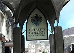
- Christ's CollegeChrist's College, CanterburyChrist's College, Christchurch is an independent, Anglican, secondary, day and boarding school for boys, located in the central city of Christchurch, New Zealand....
is an independentIndependent schoolAn independent school is a school that is independent in its finances and governance; it is not dependent upon national or local government for financing its operations, nor reliant on taxpayer contributions, and is instead funded by a combination of tuition charges, gifts, and in some cases the...
, Anglican, secondarySecondary schoolSecondary school is a term used to describe an educational institution where the final stage of schooling, known as secondary education and usually compulsory up to a specified age, takes place...
, dayDay schoolA day school—as opposed to a boarding school—is an institution where children are given educational instruction during the day and after which children/teens return to their homes...
and boarding schoolBoarding schoolA boarding school is a school where some or all pupils study and live during the school year with their fellow students and possibly teachers and/or administrators. The word 'boarding' is used in the sense of "bed and board," i.e., lodging and meals...
for boys. Founded in 1850 at LytteltonLyttelton, New ZealandLyttelton is a port town on the north shore of Lyttelton Harbour close to Banks Peninsula, a suburb of Christchurch on the eastern coast of the South Island of New Zealand....
as a school for early settlers, Christ's is the oldest independent school in the country. The collegeCollegeA college is an educational institution or a constituent part of an educational institution. Usage varies in English-speaking nations...
currently caters for approximately 647 students from Year 9 to Year 13. - St Michael's Church SchoolSt Michael's Church SchoolSt Michael's is a co-educational Anglican primary and intermediate day school situated in the city centre of Christchurch, New Zealand. The school provides an education for year zero to year eight. It is associated with the St Michael and All Angels church....
is a co-educational Anglican primary and intermediate day school. - Hagley Community CollegeHagley Community CollegeHagley Community College, is a non-integrated state secondary school in inner-city Christchurch, New Zealand.Prior to 1965 the school was Christchurch West High School, which was founded in 1858....
is a non-integrated state secondary school. Prior to 1965 the school was Christchurch West High School, which was founded in 1858. - The Cathedral Grammar SchoolCathedral Grammar SchoolThe Cathedral Grammar School is an independent, Anglican preparatory day school in Christchurch, New Zealand. The school is situated on a spacious inner-city site covering two blocks in the heart of Christchurch next to the Avon River and adjacent to Hagley Park, which it uses for its playing fields...
is an independent, Anglican preparatory day school. It was founded in 1881 to educate 24 scholarship boys, who sang in the choir of Christchurch Cathedral. It is one of only a small number of 'choir schools' in the Southern HemisphereSouthern HemisphereThe Southern Hemisphere is the part of Earth that lies south of the equator. The word hemisphere literally means 'half ball' or "half sphere"...
. - Unlimited Paenga TawhitiUnlimited paenga tawhitiUnlimited Paenga Tawhiti is a state secondary school located in the city centre of Christchurch, New Zealand.It was established in 2003 by the Christchurch-based Learning Discovery Trust which had earlier set up the primary Discovery 1 School, and is one of just eleven schools running under the...
(UPT) is a state secondary school based in the heart of the Christchurch Central Business District. It was established in 2003 by the Christchurch-based Learning Discovery Trust, which had earlier set up the Discovery 1 school. - Discovery 1 SchoolDiscovery 1 SchoolDiscovery 1 School is located in the central city of Christchurch, New Zealand. The school is state funded and offers individual, discovery based learning programmes...
is a special character, state funded primary school based in the heart of the Christchurch Central Business District. It is an innovative learning community where all key stakeholders (children, parents & staff) take an active part in the creation of a child's learning journey. - Christchurch East SchoolChristchurch East SchoolChristchurch East School is located in the central city of Christchurch, New Zealand.-History:The school was founded in 1873 and had its centennial celebrations from 5 to 7 October 1973...
is a non-integrated state co-educational primary school. - Catholic Cathedral CollegeCatholic Cathedral College, ChristchurchCatholic Cathedral College, Christchurch is an integrated Catholic co-educational secondary school in Christchurch, New Zealand. It was founded in 1987 but its origins go back to more than a 100 years earlier...
is an integrated co-educational secondary school. It was founded in 1987 from the amalgamation of two schools: Sacred Heart College for girls, and Xavier College for boys.
Green space
Hagley Park is, at 165 ha, the largest urban open spaceUrban open space
In land use planning, urban open space is open space areas for “parks”, “green spaces”, and other open areas. The landscape of urban open spaces can range from playing fields to highly maintained environments to relatively natural landscapes. They are commonly open to public access, however, urban...
in Christchurch. The park was created in 1855 by the Provincial Government. According to the government's decree at that time, Hagley Park is "reserved forever as a public park, and shall be open for the recreation and enjoyment of the public." Hagley Park is characterised by its trees and broad open spaces. Hagley Park was named after the country estate of Lord Lyttelton
George Lyttelton, 4th Baron Lyttelton
George William Lyttelton, 4th Baron Lyttelton , was a British aristocrat and Conservative politician.-Early life:...
, who became chairman of the Canterbury Association in March 1850.
The Christchurch Botanic Gardens are botanical gardens founded in 1863, when on 9 July an English oak was planted to commemorate the solemnisation of marriage between Prince Albert
Edward VII of the United Kingdom
Edward VII was King of the United Kingdom and the British Dominions and Emperor of India from 22 January 1901 until his death in 1910...
and Princess Alexandra
Alexandra of Denmark
Alexandra of Denmark was the wife of Edward VII of the United Kingdom...
of Denmark
Denmark
Denmark is a Scandinavian country in Northern Europe. The countries of Denmark and Greenland, as well as the Faroe Islands, constitute the Kingdom of Denmark . It is the southernmost of the Nordic countries, southwest of Sweden and south of Norway, and bordered to the south by Germany. Denmark...
. The Gardens cover an area of 21 hectares, and lie adjacent to the loop of the Avon River next to Hagley Park.
The Barbadoes Street Cemetery is a large green space in the north-east of the central city. It is the city’s oldest cemetery and opened in 1851. It is the final resting place of many of Christchurch’s early leading citizens. The cemetery itself is divided by Barbadoes Street separating the Anglican (Church of England) section, on the eastern side, from the Roman Catholic and Dissenters (others) section on the west. The cemetery was initially envisaged to be much larger, but with the establishment of suburbs and villages with their own cemeteries, it became clear that less land was needed. The cemetery was subdivided in 1896 and Churchill Street was formed, with the eastern part of the original cemetery thus becoming a residential area.
Transport
Due to the grid pattern of the roads, the central city has a high number of traffic signals. Four pairs of one-way streets are located only a few hundred metres away from Cathedral Square, making it easy to drive through the city centre. The avenues in the north, east and south surrounding the central city are generally six-lane median divided. Fitzgerald and Bealey Avenues stand out due to the trees in those central medians.With about 30,000 car parks (both public and private), the central city has one of the highest ratios of car parking and employment of the OECD countries. As both driving and parking is relatively easy, Christchurch has a high car ownership rate.
Cycling is reasonably popular in central Christchurch, with the second highest rate of commuter cycling in New Zealand (after Nelson). Free covered bike lock-ups are located in six City Council-run car parking buildings.
Public transport in Christchurch
Public transport in Christchurch
Public transport in Christchurch, New Zealand consists of bus services operated by three bus companies supported by a ferry, all jointly marketed as Metro.-Overview:...
is mainly based on buses and supported by taxis. There is a functioning tram service in Christchurch, but as a tourist attraction, its loop is restricted to a circuit of the central city and it does not fulfil a public transport function.
The city council provided the current Bus Exchange between Lichfield and Cashel Streets in November 2000. A new Transport Interchange is planned for the block surrounded by Lichfield, Colombo, Tuam and Durham Streets, as the existing Bus Exchange is nearing capacity.
Long distance buses depart mostly from Worcester Street near Cathedral Square. All local buses that go through the central city use the Bus Exchange. It is envisaged that long distance and local services will all use the Transport Interchange. In addition to normal bus services, the central city has a zero-fare hybrid
Hybrid vehicle
A hybrid vehicle is a vehicle that uses two or more distinct power sources to move the vehicle. The term most commonly refers to hybrid electric vehicles , which combine an internal combustion engine and one or more electric motors.-Power:...
bus service, the Shuttle.
The railway station
Christchurch Railway Station
Christchurch railway station is an urban railway station serving the city of Christchurch, in the Canterbury region of New Zealand’s South Island. It is located on the Main North Line at Addington Junction, and is the only remaining operational passenger railway station in the city, after suburban...
used to be located on the southern boundary of the central city on Moorhouse Avenue, but has been relocated to the suburb of Riccarton
Riccarton, New Zealand
Riccarton is a suburb of Christchurch. It is due west of the city centre, separated from it by Hagley Park. Upper Riccarton is to the west of Riccarton.-History:...
.