
Chesapeake Bay Bridge-Tunnel
Encyclopedia
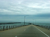
The Chesapeake Bay Bridge-Tunnel (CBBT) is a 23 miles (37 km) long fixed link crossing the mouth of the Chesapeake Bay
and connecting the Delmarva Peninsula
's Eastern Shore of Virginia
with Virginia Beach
and the metropolitan area of Hampton Roads
, Virginia
. It replaced vehicle ferry services which operated from South Hampton Roads
and from the Virginia Peninsula
from the 1930s until completion of the bridge-tunnel in 1964.
The bridge-tunnel
originally combined 12 miles (19.3 km) of trestle, two 1 miles (1.6 km) long tunnels, four artificial islands, two high-level bridges, approximately 2 miles (3.2 km) of causeway, and 5.5 miles (8.9 km) of approach roads—crossing the Chesapeake Bay and preserving traffic on the Thimble Shoals and Chesapeake shipping channels. The system remains one of only eight bridge-tunnel systems in the world, three of which are located in Hampton Roads
, Virginia.
Since it opened, the Chesapeake Bay Bridge-Tunnel has been crossed by more than 100 million vehicles. The CBBT complex carries U.S. Route 13, the main north–south highway on Virginia's Eastern Shore, and, as part of the East Coast's longstanding Ocean Highway
, provides the only direct link between Virginia's Eastern Shore
and South Hampton Roads
regions, as well as an alternate route to link the Northeast and points in between with Norfolk and the Carolinas. The bridge-tunnel saves motorists 95 miles (152.9 km) and 1½ hours on a trip between Virginia Beach
/Norfolk
and points north and east of the Delaware Valley
without going through the traffic congestion in the Baltimore–Washington Metropolitan Area. The $12 toll is partially offset by some savings of tolls in Maryland and Delaware on I-95
.
Financed by toll revenue bond
s, the bridge-tunnel was opened on April 15, 1964. It was officially named the Lucius J. Kellam Jr. Bridge-Tunnel in August 1987 after one of the civic leaders who had long worked for its development and operation. However, it continues to be best known as the Chesapeake Bay Bridge-Tunnel.
From 1995 to 1999, at a cost of almost $200 million, the capacity of the above-water portion was increased to four lanes. An upgrade of the two-lane tunnels was proposed but has not been carried out.
The CBBT was built by and is operated by the Chesapeake Bay Bridge and Tunnel District
, a political subdivision of the Commonwealth of Virginia governed by the Chesapeake Bay Bridge and Tunnel Commission. The CBBT's costs are recovered through toll
collections. In 2002, a Joint Legislative Audit and Review Commission (JLARC) study commissioned by the Virginia General Assembly
concluded that "given the inability of the state to fund future capital requirements of the CBBT, the District and Commission should be retained to operate and maintain the Bridge-Tunnel as a toll facility in perpetuity."
sent an expedition to North America
to establish a settlement in the Colony of Virginia. After sailing across the Atlantic Ocean
from England
, they reached the New World at the southern edge of the mouth of what is now known as the Chesapeake Bay
. They named the Virginia capes after the sons of their king, the southern Cape Henry
, for Henry Frederick, Prince of Wales
, and the northern Cape Charles
, for his younger brother, Charles, Duke of York
. A few weeks later they established their first permanent settlement on the southern, mainland, side of the bay, along the James River
at Jamestown
.
Across the bay, the area north of Cape Charles was located along what became known later as the Delmarva Peninsula
. As it bordered the bay to its east, the region became known as Virginia's Eastern Shore
. As the entire colony grew, the bay was a formidable transportation obstacle for exchanges with the Virginia mainland. One of the eight original shires of Virginia
was established there in 1634, eventually becoming the two counties of modern times. However, in comparison to mainland regions, commerce and growth was limited by the need to cross the bay. Consequently, little industrial base grew there, and most residents made their living by farming and working as watermen, both on the Bay (locally known as the "bay side") and in the Atlantic Ocean ("sea side").
For the first 350 years, ships and ferry systems provided the primary transportation
managed a scheduled vehicular (car, bus, truck) and passenger ferry
service between the Virginia Eastern Shore and Princess Anne County
(now part of Virginia Beach) in the South Hampton Roads
area. This system, a portion of U.S. Route 13, was known as the Little Creek-Cape Charles Ferry. In 1951, the Northern terminus was relocated to a location now within Kiptopeke State Park
.
Despite an expanded fleet of large and modern ships eventually capable of as many as 90 one-way trips each day, the lengthy crossing suffered delays due to heavy traffic and inclement weather.
In 1954, the Virginia General Assembly
(state legislature) created a political subdivision, the Chesapeake Bay Ferry District and its governing body, the Chesapeake Bay Ferry Commission. The Commission was authorized to acquire the private ferry corporation through bond financing, to improve the existing ferry service.
Once the bridge-tunnel was built, much of the ferry equipment used by the Little Creek-Cape Charles Ferry service was then sold and redeployed to start the Cape May-Lewes Ferry
across the 17 miles (27.4 km) mouth of the Delaware Bay
between Cape May
, New Jersey and Lewes
, Delaware.
Consideration was given to service between the Eastern Shore and both the Peninsula and South Hampton Roads. Eventually, the shortest route, extending between the Eastern Shore and a point in Princess Anne County
at Chesapeake Beach (east of Little Creek, west of Lynnhaven Inlet), was selected. An option to also provide a fixed crossing link to Hampton and the Peninsula was not pursued.
Initially, high-level bridges were contemplated to cross over the two main shipping channels on the selected route, Thimble Shoals Channel, which leads to Hampton Roads
, and the Chesapeake Channel, which leads to points north in the Bay, notably the Port of Baltimore. However, the U.S. Navy objected, due to concerns that collapse of high level bridge(s) (due to either accidental or deliberate action) could cause a large portion of the Atlantic fleet based at the Norfolk Navy Base
at Sewell's Point
and other craft within the Hampton Roads harbor area to be blocked from access to the Atlantic Ocean.
To address these concerns, the engineers recommended a series of bridges and tunnels known as a bridge-tunnel
, similar in design to the Hampton Roads Bridge-Tunnel
, which had been completed in 1957, but a considerably longer and larger facility. The tunnel portions, anchored by four man-made islands of approximately 5.25 acres (2.1 ha) each, would be extended under the two main shipping channels. The CBBT was designed by the engineering firm Sverdrup & Parcel
of St. Louis, Missouri
, who also served as the construction manager for the project.
s to private investors, and the proceeds were used to finance the construction of the Bridge-Tunnel. Funds collected by future tolls were pledged to pay the principal and interest on the bonds. No local, state or federal tax funds were used in the construction of the project.
Construction contracts were awarded to a consortium of Tidewater Construction Corporation and Merritt-Chapman & Scott
Corporation. The steel superstructure for the high-level bridges near the north end of the crossing were fabricated by the American Bridge Division
of United States Steel Corporation. Construction of the Bridge-Tunnel began in October 1960 after a six month process of assembling necessary equipment from worldwide sources.
The tunnels were constructed using the technique refined by Ole Singstad
with the Baltimore Harbor Tunnel, whereby a large ditch was first dug for each tunnel, into which was lowered pre-fabricated tunnel sections cable-suspended from overhead barges. Interior chambers were filled with water to lower the sections, the sections then aligned, bolted together by divers, the water pumped out, and the tunnels finally covered with earth.
The construction was accomplished under the severe conditions imposed by nor'easter
s, hurricanes, and the unpredictable Atlantic Ocean
. During the Ash Wednesday Storm of 1962
, much of the work partially completed and a major piece of custom-built pile driver barge called "The Big D" were destroyed. Seven workers were killed at various times during the construction. In April 1964, 42 months after construction began, the Chesapeake Bay Bridge-Tunnel opened to traffic, and the ferry service was discontinued.
Eastern Shore native, businessman, and civic leader Lucius J. Kellam Jr. (1911–1995) was the original Commission's first chairman. In a commentary at the time of his death in 1995, the Norfolk-based Virginian-Pilot newspaper recalled that Kellam had been involved in bringing the multi-million-dollar bridge-tunnel project from dream to reality.
Before it was built, Kellam handled a political fight over the location, and addressed concerns of the U.S. Navy about prospective hazards to navigation to and from the Norfolk Navy Base
at Sewell's Point
.
Kellam was also directly involved in the negotiations to finance the ambitious crossing with bonds. According to the newspaper article, "there were not-unfounded fears that (1) storm-driven seas and drifting or off-course vessels could damage, if not destroy, the span and (2) traffic might not be sufficient to service the entire debt in an orderly way. Sure enough, bridge portions of the crossing have occasionally been damaged by vessels, and there was a long period when holders of the riskiest bonds received no interest on their investment."
An icon of eastern Virginia politics, Kellam remained chairman and champion of the CBBT throughout the hard times, and the bondholders were eventually paid as toll revenues caught up with expenses. He continued to serve until he was over 80 years old, finally retiring in 1993. He had held the post for 39 years.
The facility was renamed in his honor in 1987, over 20 years after it was first opened to traffic.
(ASCE) as "One of the Seven Engineering Wonders of the Modern World" in a worldwide competition that included more than one hundred major projects.
The individual components of the Bridge-Tunnel are not the longest or the largest ever built. However, the total project was unique in the number and different types of major structures included in one crossing — including trestles, tunnels, artificial islands, bridges, causeway and approach roads — and that it was built under adverse conditions and for adverse conditions.
The CBBT is no longer on the ASCE list, having been replaced by a more recent engineering wonder.
two-lane trestle
s were built both to alleviate traffic and for safety reasons. Immediately after completion of the parallel trestles, traffic was diverted to them and the original trestles and roadway underwent a $20 million retrofit, repairing the wear and tear of 35 years of service and upgrading certain features, such as repaving the road surface. The older portion of the facility was then reopened on April 19, 1999.
The 1995–1999 project increased the capacity of the above-water portion of the facility to four lanes, added wider shoulders for the new southbound portion, facilitated needed repairs, and provided protection against a total closure should a trestle be struck by a ship or otherwise damaged (which had occurred twice in the past); partially for this reason, the parallel trestles are not located immediately adjacent to each other, reducing the chance that both would be damaged during a single incident.
Plans to replace the two-lane tunnels with new and deeper four-lane versions were postponed indefinitely in 2005 at the direction of the Virginia General Assembly. Debate centered around the facts that while greater bay shipping and security would be enhanced by replacing the existing tunnels, the traffic counts and substantial cost estimates dictate that improvements for other water crossings in the Hampton Roads area may become higher priorities. The estimated cost of replacing the tunnels was $900 million.
Despite Virginia's deepening unmet transportation needs in the years since, the finances of the Chesapeake Bay Bridge-Tunnel Commission have been kept separately as recommended to the General Assembly in a 2002 report of the Joint Legislative Audit and Review Commission (JLARC). The study concluded that "given the inability of the state to fund future capital requirements of the CBBT, the District and Commission should be retained to operate and maintain the Bridge-Tunnel as a toll facility in perpetuity."
collection facilities are located at the both ends of the facility. Tolls are paid in each direction. As of 2010, the toll for cars (without trailers) traveling along the CBBT is $12. However, should a car make a return trip within 24 hours of the first, the second trip across only costs $5. Motorcycles pay the same toll as cars without trailers. All other vehicles are charged based on size and purpose and are not subject to the return trip discount. All tolls must be paid either in cash, by scrip tickets issued by the CBBT, or via E-ZPass
electronic toll collection
. The Bridge-Tunnel began accepting Smart Tag
/E-ZPass
payments on November 1, 2007.
All toll lanes including E-ZPass-only lanes are gated for several safety concerns and to turn around inadmissible vehicles. For example:
The bridge-tunnel management prohibits bicycles but offers a shuttle van for $12 USD. Cyclists must call ahead.
It is mandatory that the bridge be checked and serviced every five years. Since servicing the bridge takes about five years, the work never stops.
The Chesapeake Bay Bridge-Tunnel is the only transportation facility in Virginia that employs its own police department which, by original charter from the Commonwealth, has authority to enforce the laws of Virginia. Emergency call boxes are spaced every half mile along the bridge. The toll schedule, weather advisories and other information are available at the official website for the bridge.
of North Carolina, according to the CBBT district. Unlike the Interstate highways that travelers would avoid by taking the bridge-tunnel, however, the roads in the shortcut have traffic lights.
On the Delmarva peninsula to the north of the bridge, travelers may visit nearby Kiptopeke State Park
, Eastern Shore National Wildlife Refuge, Fisherman Island National Wildlife Refuge, campgrounds and other vacation destinations. To the south are tourist destinations around Virginia Beach, including First Landing State Park
, Norfolk Botanical Garden
, Virginia Beach Maritime Historical Museum, Atlantic Wildfowl Heritage Museum and Virginia Aquarium and Maritime Science Center
.
Drivers may stop at both the scenic overlook at the north end of the bridge and at Sea Gull Island, near the south end. At Sea Gull Island, passing ships may include U.S. Navy warships, nuclear submarines and aircraft carriers, as well as large cargo vessels and sailing ships. The CBBT authority runs a restaurant and gift shop on the island. Fishing is encouraged from the 625 feet (190.5 m)-long pier, which is open 24 hours a day, year-round. Restrooms, fish-cleaning stations and a certified weighing station are at the pier. Bluefish, trout, croaker, flounder and other species have been caught from the pier. Since birds use the habitat created by the bridges and islands of the CBBT, birders have travelled to the bridge-tunnel to see them at Sea Gull Island and the scenic overlook at the north end.
s beneath Thimble Shoals and Chesapeake navigation channels and two high-level bridges (75 ft or 22.9 m over two other navigation channels: North Channel Bridge and Fisherman Inlet Bridge. The remaining portion comprises 12 miles (19.3 km) of low-level trestle, 2 miles (3.2 km) of causeway
, and four man-made island
s.
The CBBT is 17.6 miles (28.3 km) long from shore to shore, crossing what is essentially an ocean strait. Including land-approach highways, the overall facility is 23 miles (37 km) long (20 miles or 32.2 km from toll-plaza to toll-plaza) and despite its length, there is only a height difference of 6 inches (152 mm) from the south to north end of the bridge-tunnel.
Man-made islands, each approximately 5.25 acres (2.1 ha) in size, are located at each end of the two tunnels. Between North Channel and Fisherman Inlet, the facility crosses at-grade over Fisherman Island
, a barrier island
which is part of the Eastern Shore of Virginia National Wildlife Refuge
administered by the U.S. Fish and Wildlife Service
.
The Bridge-Tunnel's concrete supporting columns are called piles. If placed end to end, the piles would stretch for about 100 miles (160.9 km), roughly the distance from New York City
to Philadelphia.
Chesapeake Bay
The Chesapeake Bay is the largest estuary in the United States. It lies off the Atlantic Ocean, surrounded by Maryland and Virginia. The Chesapeake Bay's drainage basin covers in the District of Columbia and parts of six states: New York, Pennsylvania, Delaware, Maryland, Virginia, and West...
and connecting the Delmarva Peninsula
Delmarva Peninsula
The Delmarva Peninsula is a large peninsula on the East Coast of the United States, occupied by most of Delaware and portions of Maryland and Virginia...
's Eastern Shore of Virginia
Eastern Shore of Virginia
The Eastern Shore of Virginia consists of two counties on the Atlantic coast of the Commonwealth of Virginia in the United States. The region is part of the Delmarva Peninsula and is separated from the rest of Virginia by the Chesapeake Bay. Its population was 45,553 as of 2010...
with Virginia Beach
Virginia Beach, Virginia
Virginia Beach is an independent city located in the Hampton Roads metropolitan area of Virginia, on the Atlantic Ocean at the mouth of the Chesapeake Bay...
and the metropolitan area of Hampton Roads
Hampton Roads
Hampton Roads is the name for both a body of water and the Norfolk–Virginia Beach metropolitan area which surrounds it in southeastern Virginia, United States...
, Virginia
Virginia
The Commonwealth of Virginia , is a U.S. state on the Atlantic Coast of the Southern United States. Virginia is nicknamed the "Old Dominion" and sometimes the "Mother of Presidents" after the eight U.S. presidents born there...
. It replaced vehicle ferry services which operated from South Hampton Roads
South Hampton Roads
South Hampton Roads is a region located in the extreme southeastern portion of Virginia in the United States, and is part of the Virginia Beach-Norfolk-Newport News, VA-NC MSA with a population about 1.7 million....
and from the Virginia Peninsula
Virginia Peninsula
The Virginia Peninsula is a peninsula in southeast Virginia, USA, bounded by the York River, James River, Hampton Roads and Chesapeake Bay.Hampton Roads is the common name for the metropolitan area that surrounds the body of water of the same name...
from the 1930s until completion of the bridge-tunnel in 1964.
The bridge-tunnel
Bridge-tunnel
A fixed link, fixed crossing, or bridge-tunnel is a persistent, unbroken road or rail connection across water that uses some combination of bridges, tunnels, and causeways and does not involve intermittent connections such as drawbridges or ferries.The Confederation Bridge was commonly referred to...
originally combined 12 miles (19.3 km) of trestle, two 1 miles (1.6 km) long tunnels, four artificial islands, two high-level bridges, approximately 2 miles (3.2 km) of causeway, and 5.5 miles (8.9 km) of approach roads—crossing the Chesapeake Bay and preserving traffic on the Thimble Shoals and Chesapeake shipping channels. The system remains one of only eight bridge-tunnel systems in the world, three of which are located in Hampton Roads
Hampton Roads
Hampton Roads is the name for both a body of water and the Norfolk–Virginia Beach metropolitan area which surrounds it in southeastern Virginia, United States...
, Virginia.
Since it opened, the Chesapeake Bay Bridge-Tunnel has been crossed by more than 100 million vehicles. The CBBT complex carries U.S. Route 13, the main north–south highway on Virginia's Eastern Shore, and, as part of the East Coast's longstanding Ocean Highway
Ocean Highway
Ocean Highway was a designation established early in the 20th century for a combination of roadways and water-crossings for motor vehicles which would generally traverse as close as possible to the Atlantic Ocean along the East Coast of the United States from Jacksonville, Florida to New Brunswick,...
, provides the only direct link between Virginia's Eastern Shore
Eastern Shore of Virginia
The Eastern Shore of Virginia consists of two counties on the Atlantic coast of the Commonwealth of Virginia in the United States. The region is part of the Delmarva Peninsula and is separated from the rest of Virginia by the Chesapeake Bay. Its population was 45,553 as of 2010...
and South Hampton Roads
South Hampton Roads
South Hampton Roads is a region located in the extreme southeastern portion of Virginia in the United States, and is part of the Virginia Beach-Norfolk-Newport News, VA-NC MSA with a population about 1.7 million....
regions, as well as an alternate route to link the Northeast and points in between with Norfolk and the Carolinas. The bridge-tunnel saves motorists 95 miles (152.9 km) and 1½ hours on a trip between Virginia Beach
Virginia Beach, Virginia
Virginia Beach is an independent city located in the Hampton Roads metropolitan area of Virginia, on the Atlantic Ocean at the mouth of the Chesapeake Bay...
/Norfolk
Norfolk, Virginia
Norfolk is an independent city in the Commonwealth of Virginia in the United States. With a population of 242,803 as of the 2010 Census, it is Virginia's second-largest city behind neighboring Virginia Beach....
and points north and east of the Delaware Valley
Delaware Valley
The Delaware Valley is a term used to refer to the valley where the Delaware River flows, along with the surrounding communities. This includes the metropolitan area centered on the city of Philadelphia. Such educational institutions as Delaware Valley Regional High School in Alexandria Township...
without going through the traffic congestion in the Baltimore–Washington Metropolitan Area. The $12 toll is partially offset by some savings of tolls in Maryland and Delaware on I-95
Interstate 95
Interstate 95 is the main highway on the East Coast of the United States, running parallel to the Atlantic Ocean from Maine to Florida and serving some of the most populated urban areas in the country, including Boston, Providence, New Haven, New York City, Newark, Philadelphia, Baltimore,...
.
Financed by toll revenue bond
Toll revenue bond
A toll revenue bond is a financial promissory note usually issued to generate funds for the construction and/or operation of a public accommodation such as an expressway, bridge, or tunnel...
s, the bridge-tunnel was opened on April 15, 1964. It was officially named the Lucius J. Kellam Jr. Bridge-Tunnel in August 1987 after one of the civic leaders who had long worked for its development and operation. However, it continues to be best known as the Chesapeake Bay Bridge-Tunnel.
From 1995 to 1999, at a cost of almost $200 million, the capacity of the above-water portion was increased to four lanes. An upgrade of the two-lane tunnels was proposed but has not been carried out.
The CBBT was built by and is operated by the Chesapeake Bay Bridge and Tunnel District
Chesapeake Bay Bridge and Tunnel District
Chesapeake Bay Bridge and Tunnel District is a political subdivision of the Commonwealth of Virginia. It is overseen by the Chesapeake Bay Bridge and Tunnel Commission, and operates the Chesapeake Bay Bridge-Tunnel between the Hampton Roads and Eastern Shore regions of the state...
, a political subdivision of the Commonwealth of Virginia governed by the Chesapeake Bay Bridge and Tunnel Commission. The CBBT's costs are recovered through toll
Toll road
A toll road is a privately or publicly built road for which a driver pays a toll for use. Structures for which tolls are charged include toll bridges and toll tunnels. Non-toll roads are financed using other sources of revenue, most typically fuel tax or general tax funds...
collections. In 2002, a Joint Legislative Audit and Review Commission (JLARC) study commissioned by the Virginia General Assembly
Virginia General Assembly
The Virginia General Assembly is the legislative body of the Commonwealth of Virginia, and the oldest legislative body in the Western Hemisphere, established on July 30, 1619. The General Assembly is a bicameral body consisting of a lower house, the Virginia House of Delegates, with 100 members,...
concluded that "given the inability of the state to fund future capital requirements of the CBBT, the District and Commission should be retained to operate and maintain the Bridge-Tunnel as a toll facility in perpetuity."
Settling both sides of the Chesapeake Bay
In December 1606, the Virginia Company of LondonLondon Company
The London Company was an English joint stock company established by royal charter by James I of England on April 10, 1606 with the purpose of establishing colonial settlements in North America.The territory granted to the London Company included the coast of North America from the 34th parallel ...
sent an expedition to North America
North America
North America is a continent wholly within the Northern Hemisphere and almost wholly within the Western Hemisphere. It is also considered a northern subcontinent of the Americas...
to establish a settlement in the Colony of Virginia. After sailing across the Atlantic Ocean
Atlantic Ocean
The Atlantic Ocean is the second-largest of the world's oceanic divisions. With a total area of about , it covers approximately 20% of the Earth's surface and about 26% of its water surface area...
from England
England
England is a country that is part of the United Kingdom. It shares land borders with Scotland to the north and Wales to the west; the Irish Sea is to the north west, the Celtic Sea to the south west, with the North Sea to the east and the English Channel to the south separating it from continental...
, they reached the New World at the southern edge of the mouth of what is now known as the Chesapeake Bay
Chesapeake Bay
The Chesapeake Bay is the largest estuary in the United States. It lies off the Atlantic Ocean, surrounded by Maryland and Virginia. The Chesapeake Bay's drainage basin covers in the District of Columbia and parts of six states: New York, Pennsylvania, Delaware, Maryland, Virginia, and West...
. They named the Virginia capes after the sons of their king, the southern Cape Henry
Cape Henry
Cape Henry is a cape on the Atlantic shore of Virginia north of Virginia Beach. It is the southern boundary of the entrance to Chesapeake Bay.Across the mouth of the bay to the north is Cape Charles...
, for Henry Frederick, Prince of Wales
Henry Frederick, Prince of Wales
Henry Frederick Stuart, Prince of Wales was the elder son of King James I & VI and Anne of Denmark. His name derives from his grandfathers: Henry Stuart, Lord Darnley and Frederick II of Denmark. Prince Henry was widely seen as a bright and promising heir to his father's throne...
, and the northern Cape Charles
Cape Charles (headland)
Cape Charles is a headland, or cape, in Northampton County, Virginia. Located at the southern tip of Northampton County, it forms the northern side of the entrance to the Chesapeake Bay....
, for his younger brother, Charles, Duke of York
Charles I of England
Charles I was King of England, King of Scotland, and King of Ireland from 27 March 1625 until his execution in 1649. Charles engaged in a struggle for power with the Parliament of England, attempting to obtain royal revenue whilst Parliament sought to curb his Royal prerogative which Charles...
. A few weeks later they established their first permanent settlement on the southern, mainland, side of the bay, along the James River
James River (Virginia)
The James River is a river in the U.S. state of Virginia. It is long, extending to if one includes the Jackson River, the longer of its two source tributaries. The James River drains a catchment comprising . The watershed includes about 4% open water and an area with a population of 2.5 million...
at Jamestown
Jamestown, Virginia
Jamestown was a settlement in the Colony of Virginia. Established by the Virginia Company of London as "James Fort" on May 14, 1607 , it was the first permanent English settlement in what is now the United States, following several earlier failed attempts, including the Lost Colony of Roanoke...
.
Across the bay, the area north of Cape Charles was located along what became known later as the Delmarva Peninsula
Delmarva Peninsula
The Delmarva Peninsula is a large peninsula on the East Coast of the United States, occupied by most of Delaware and portions of Maryland and Virginia...
. As it bordered the bay to its east, the region became known as Virginia's Eastern Shore
Eastern Shore of Virginia
The Eastern Shore of Virginia consists of two counties on the Atlantic coast of the Commonwealth of Virginia in the United States. The region is part of the Delmarva Peninsula and is separated from the rest of Virginia by the Chesapeake Bay. Its population was 45,553 as of 2010...
. As the entire colony grew, the bay was a formidable transportation obstacle for exchanges with the Virginia mainland. One of the eight original shires of Virginia
Shires of Virginia
The eight Shires of Virginia were formed in 1634 in the Virginia Colony. These shires were based on a form of local government used in England at the time, and were redesignated as counties a few years later...
was established there in 1634, eventually becoming the two counties of modern times. However, in comparison to mainland regions, commerce and growth was limited by the need to cross the bay. Consequently, little industrial base grew there, and most residents made their living by farming and working as watermen, both on the Bay (locally known as the "bay side") and in the Atlantic Ocean ("sea side").
For the first 350 years, ships and ferry systems provided the primary transportation
1930s–1960s ferry system
From the early 1930s to 1954, Virginia Ferry Corporation, a privately-owned public service companyPublic service company
A public service company is a corporation or other non-governmental business entity which delivers public services - certain services considered essential to the public interest...
managed a scheduled vehicular (car, bus, truck) and passenger ferry
Ferry
A ferry is a form of transportation, usually a boat, but sometimes a ship, used to carry primarily passengers, and sometimes vehicles and cargo as well, across a body of water. Most ferries operate on regular, frequent, return services...
service between the Virginia Eastern Shore and Princess Anne County
Princess Anne County, Virginia
Princess Anne County is a former county which was created in the British Colony of Virginia and the Commonwealth of Virginia in the United States in 1691. The county was merged into the city of Virginia Beach...
(now part of Virginia Beach) in the South Hampton Roads
South Hampton Roads
South Hampton Roads is a region located in the extreme southeastern portion of Virginia in the United States, and is part of the Virginia Beach-Norfolk-Newport News, VA-NC MSA with a population about 1.7 million....
area. This system, a portion of U.S. Route 13, was known as the Little Creek-Cape Charles Ferry. In 1951, the Northern terminus was relocated to a location now within Kiptopeke State Park
Kiptopeke State Park
Kiptopeke State Park is a state park located in the southern end of the Eastern Shore of Virginia. From 1949, the site was owned by the Virginia Ferry Corporation and used through 1964 as the northern terminus for the Little Creek-Cape Charles Ferry service. The park has a number of recreational...
.
Despite an expanded fleet of large and modern ships eventually capable of as many as 90 one-way trips each day, the lengthy crossing suffered delays due to heavy traffic and inclement weather.
In 1954, the Virginia General Assembly
Virginia General Assembly
The Virginia General Assembly is the legislative body of the Commonwealth of Virginia, and the oldest legislative body in the Western Hemisphere, established on July 30, 1619. The General Assembly is a bicameral body consisting of a lower house, the Virginia House of Delegates, with 100 members,...
(state legislature) created a political subdivision, the Chesapeake Bay Ferry District and its governing body, the Chesapeake Bay Ferry Commission. The Commission was authorized to acquire the private ferry corporation through bond financing, to improve the existing ferry service.
Once the bridge-tunnel was built, much of the ferry equipment used by the Little Creek-Cape Charles Ferry service was then sold and redeployed to start the Cape May-Lewes Ferry
Cape May-Lewes Ferry
The Cape May – Lewes Ferry is a ferry system that traverses a 17-mile crossing of the Delaware Bay to connect Cape May, New Jersey with Lewes, Delaware. The ferry doubles as a section of U.S. Route 9.-The system:...
across the 17 miles (27.4 km) mouth of the Delaware Bay
Delaware Bay
Delaware Bay is a major estuary outlet of the Delaware River on the Northeast seaboard of the United States whose fresh water mixes for many miles with the waters of the Atlantic Ocean. It is in area. The bay is bordered by the State of New Jersey and the State of Delaware...
between Cape May
Cape May, New Jersey
Cape May is a city at the southern tip of Cape May Peninsula in Cape May County, New Jersey, where the Delaware Bay meets the Atlantic Ocean and is one of the country's oldest vacation resort destinations. It is part of the Ocean City Metropolitan Statistical Area. As of the 2010 United States...
, New Jersey and Lewes
Lewes, Delaware
Lewes is an incorporated city in Sussex County, Delaware, USA, on the Delmarva Peninsula. According to the 2010 census, the population is 2,747, a decrease of 6.3% from 2000....
, Delaware.
Studying a fixed crossing
In 1956, the General Assembly authorized the Ferry Commission to conduct feasibility studies for the construction of a fixed crossing. The conclusion of the study indicated that a vehicular crossing was feasible.Consideration was given to service between the Eastern Shore and both the Peninsula and South Hampton Roads. Eventually, the shortest route, extending between the Eastern Shore and a point in Princess Anne County
Princess Anne County, Virginia
Princess Anne County is a former county which was created in the British Colony of Virginia and the Commonwealth of Virginia in the United States in 1691. The county was merged into the city of Virginia Beach...
at Chesapeake Beach (east of Little Creek, west of Lynnhaven Inlet), was selected. An option to also provide a fixed crossing link to Hampton and the Peninsula was not pursued.
Initially, high-level bridges were contemplated to cross over the two main shipping channels on the selected route, Thimble Shoals Channel, which leads to Hampton Roads
Hampton Roads
Hampton Roads is the name for both a body of water and the Norfolk–Virginia Beach metropolitan area which surrounds it in southeastern Virginia, United States...
, and the Chesapeake Channel, which leads to points north in the Bay, notably the Port of Baltimore. However, the U.S. Navy objected, due to concerns that collapse of high level bridge(s) (due to either accidental or deliberate action) could cause a large portion of the Atlantic fleet based at the Norfolk Navy Base
Naval Station Norfolk
Naval Station Norfolk, in Norfolk, Virginia, is a base of the United States Navy, supporting naval forces in the United States Fleet Forces Command, those operating in the Atlantic Ocean, Mediterranean Sea, and Indian Ocean...
at Sewell's Point
Sewell's Point
Sewells Point is a peninsula of land in the independent city of Norfolk, Virginia in the United States, located at the mouth of the salt-water port of Hampton Roads. Sewells Point is bordered by water on three sides, with Willoughby Bay to the north, Hampton Roads to the west, and the Lafayette...
and other craft within the Hampton Roads harbor area to be blocked from access to the Atlantic Ocean.
To address these concerns, the engineers recommended a series of bridges and tunnels known as a bridge-tunnel
Bridge-tunnel
A fixed link, fixed crossing, or bridge-tunnel is a persistent, unbroken road or rail connection across water that uses some combination of bridges, tunnels, and causeways and does not involve intermittent connections such as drawbridges or ferries.The Confederation Bridge was commonly referred to...
, similar in design to the Hampton Roads Bridge-Tunnel
Hampton Roads Bridge-Tunnel
The Hampton Roads Bridge-Tunnel is the -long Hampton Roads crossing for Interstate 64 and U.S. Route 60. It is a four-lane facility comprising bridges, trestles, man-made islands, and tunnels under the main shipping channels for Hampton Roads harbor in the southeastern portion of Virginia in the...
, which had been completed in 1957, but a considerably longer and larger facility. The tunnel portions, anchored by four man-made islands of approximately 5.25 acres (2.1 ha) each, would be extended under the two main shipping channels. The CBBT was designed by the engineering firm Sverdrup & Parcel
Leif J. Sverdrup
Leif Johan Sverdrup was a Norwegian born, American civil engineer and general with the U.S. Army Corps of Engineers in the first half of the 20th century...
of St. Louis, Missouri
St. Louis, Missouri
St. Louis is an independent city on the eastern border of Missouri, United States. With a population of 319,294, it was the 58th-largest U.S. city at the 2010 U.S. Census. The Greater St...
, who also served as the construction manager for the project.
1960–1964 building the CBBT
In the summer of 1960, the Chesapeake Bay Ferry Commission sold $200 million in toll revenue bondToll revenue bond
A toll revenue bond is a financial promissory note usually issued to generate funds for the construction and/or operation of a public accommodation such as an expressway, bridge, or tunnel...
s to private investors, and the proceeds were used to finance the construction of the Bridge-Tunnel. Funds collected by future tolls were pledged to pay the principal and interest on the bonds. No local, state or federal tax funds were used in the construction of the project.
Construction contracts were awarded to a consortium of Tidewater Construction Corporation and Merritt-Chapman & Scott
Merritt-Chapman & Scott
Merritt-Chapman & Scott, nicknamed "The Black Horse of the Sea", was a noted marine salvage and construction firm of the United States, with worldwide operations. The chief predecessor company was founded in the 1860s by Israel Merritt, but a large number of other firms were merged in over the...
Corporation. The steel superstructure for the high-level bridges near the north end of the crossing were fabricated by the American Bridge Division
American Bridge Company
The American Bridge Company is a privately held civil engineering firm specializing in the construction and renovation of bridges and other large civil engineering projects, founded in 1900, and headquartered in Coraopolis, Pennsylvania, a suburb of Pittsburgh.-Products and industry positioning:The...
of United States Steel Corporation. Construction of the Bridge-Tunnel began in October 1960 after a six month process of assembling necessary equipment from worldwide sources.
The tunnels were constructed using the technique refined by Ole Singstad
Ole Singstad
Ole Knutsen Singstad was a Norwegian-American civil engineer who innovated the ventilation system for the Holland Tunnel and advanced the use of the "Sunk-tube" method of underwater vehicular tunnel building, a system of constructing the tunnels with prefabricated sections.By 1950...
with the Baltimore Harbor Tunnel, whereby a large ditch was first dug for each tunnel, into which was lowered pre-fabricated tunnel sections cable-suspended from overhead barges. Interior chambers were filled with water to lower the sections, the sections then aligned, bolted together by divers, the water pumped out, and the tunnels finally covered with earth.
The construction was accomplished under the severe conditions imposed by nor'easter
Nor'easter
A nor'easter is a type of macro-scale storm along the East Coast of the United States and Atlantic Canada, so named because the storm travels to the northeast from the south and the winds come from the northeast, especially in the coastal areas of the Northeastern United States and Atlantic Canada...
s, hurricanes, and the unpredictable Atlantic Ocean
Atlantic Ocean
The Atlantic Ocean is the second-largest of the world's oceanic divisions. With a total area of about , it covers approximately 20% of the Earth's surface and about 26% of its water surface area...
. During the Ash Wednesday Storm of 1962
Ash Wednesday Storm of 1962
The Ash Wednesday Storm of 1962 occurred on March 6–8, 1962 along the mid-Atlantic coast of the United States. It was considered by the U.S. Geological Survey to be one of the most destructive storms ever to affect the mid-Atlantic states...
, much of the work partially completed and a major piece of custom-built pile driver barge called "The Big D" were destroyed. Seven workers were killed at various times during the construction. In April 1964, 42 months after construction began, the Chesapeake Bay Bridge-Tunnel opened to traffic, and the ferry service was discontinued.
CBBT and Lucius J. Kellam Jr.
The Ferry Commission and transportation district it oversees, created in 1954, were later renamed for the revised mission of building and operating the Chesapeake Bay Bridge-Tunnel. The CBBT district is a public agency and it is a legal subdivision of the Commonwealth of Virginia. However, the Bridge-Tunnel is supported financially by the tolls collected from the motorists who use the facility.Eastern Shore native, businessman, and civic leader Lucius J. Kellam Jr. (1911–1995) was the original Commission's first chairman. In a commentary at the time of his death in 1995, the Norfolk-based Virginian-Pilot newspaper recalled that Kellam had been involved in bringing the multi-million-dollar bridge-tunnel project from dream to reality.
Before it was built, Kellam handled a political fight over the location, and addressed concerns of the U.S. Navy about prospective hazards to navigation to and from the Norfolk Navy Base
Naval Station Norfolk
Naval Station Norfolk, in Norfolk, Virginia, is a base of the United States Navy, supporting naval forces in the United States Fleet Forces Command, those operating in the Atlantic Ocean, Mediterranean Sea, and Indian Ocean...
at Sewell's Point
Sewell's Point
Sewells Point is a peninsula of land in the independent city of Norfolk, Virginia in the United States, located at the mouth of the salt-water port of Hampton Roads. Sewells Point is bordered by water on three sides, with Willoughby Bay to the north, Hampton Roads to the west, and the Lafayette...
.
Kellam was also directly involved in the negotiations to finance the ambitious crossing with bonds. According to the newspaper article, "there were not-unfounded fears that (1) storm-driven seas and drifting or off-course vessels could damage, if not destroy, the span and (2) traffic might not be sufficient to service the entire debt in an orderly way. Sure enough, bridge portions of the crossing have occasionally been damaged by vessels, and there was a long period when holders of the riskiest bonds received no interest on their investment."
An icon of eastern Virginia politics, Kellam remained chairman and champion of the CBBT throughout the hard times, and the bondholders were eventually paid as toll revenues caught up with expenses. He continued to serve until he was over 80 years old, finally retiring in 1993. He had held the post for 39 years.
The facility was renamed in his honor in 1987, over 20 years after it was first opened to traffic.
One of the Seven Engineering Wonders of the Modern World
Following the CBBT's opening in 1964, it was selected by the American Society of Civil EngineersAmerican Society of Civil Engineers
The American Society of Civil Engineers is a professional body founded in 1852 to represent members of the civil engineering profession worldwide. It is the oldest national engineering society in the United States. ASCE's vision is to have engineers positioned as global leaders who strive toward...
(ASCE) as "One of the Seven Engineering Wonders of the Modern World" in a worldwide competition that included more than one hundred major projects.
The individual components of the Bridge-Tunnel are not the longest or the largest ever built. However, the total project was unique in the number and different types of major structures included in one crossing — including trestles, tunnels, artificial islands, bridges, causeway and approach roads — and that it was built under adverse conditions and for adverse conditions.
The CBBT is no longer on the ASCE list, having been replaced by a more recent engineering wonder.
1995–1999 additional trestles and lanes added
At a cost of $197 million, new parallelParallel (geometry)
Parallelism is a term in geometry and in everyday life that refers to a property in Euclidean space of two or more lines or planes, or a combination of these. The assumed existence and properties of parallel lines are the basis of Euclid's parallel postulate. Two lines in a plane that do not...
two-lane trestle
Trestle
A trestle is a rigid frame used as a support, especially referring to a bridge composed of a number of short spans supported by such frames. In the context of trestle bridges, each supporting frame is generally referred to as a bent...
s were built both to alleviate traffic and for safety reasons. Immediately after completion of the parallel trestles, traffic was diverted to them and the original trestles and roadway underwent a $20 million retrofit, repairing the wear and tear of 35 years of service and upgrading certain features, such as repaving the road surface. The older portion of the facility was then reopened on April 19, 1999.
The 1995–1999 project increased the capacity of the above-water portion of the facility to four lanes, added wider shoulders for the new southbound portion, facilitated needed repairs, and provided protection against a total closure should a trestle be struck by a ship or otherwise damaged (which had occurred twice in the past); partially for this reason, the parallel trestles are not located immediately adjacent to each other, reducing the chance that both would be damaged during a single incident.
Into the future: CBBT tunnel needs and options
While there has been planning work done to expand tunnel capacities as well, the facility currently continues to utilize only the original two-lane tunnels.Plans to replace the two-lane tunnels with new and deeper four-lane versions were postponed indefinitely in 2005 at the direction of the Virginia General Assembly. Debate centered around the facts that while greater bay shipping and security would be enhanced by replacing the existing tunnels, the traffic counts and substantial cost estimates dictate that improvements for other water crossings in the Hampton Roads area may become higher priorities. The estimated cost of replacing the tunnels was $900 million.
Despite Virginia's deepening unmet transportation needs in the years since, the finances of the Chesapeake Bay Bridge-Tunnel Commission have been kept separately as recommended to the General Assembly in a 2002 report of the Joint Legislative Audit and Review Commission (JLARC). The study concluded that "given the inability of the state to fund future capital requirements of the CBBT, the District and Commission should be retained to operate and maintain the Bridge-Tunnel as a toll facility in perpetuity."
Operations, maintenance and regulations
TollToll bridge
A toll bridge is a bridge over which traffic may pass upon payment of a toll, or fee.- History :The practice of collecting tolls on bridges probably harks back to the days of ferry crossings where people paid a fee to be ferried across stretches of water. As boats became impractical to carry large...
collection facilities are located at the both ends of the facility. Tolls are paid in each direction. As of 2010, the toll for cars (without trailers) traveling along the CBBT is $12. However, should a car make a return trip within 24 hours of the first, the second trip across only costs $5. Motorcycles pay the same toll as cars without trailers. All other vehicles are charged based on size and purpose and are not subject to the return trip discount. All tolls must be paid either in cash, by scrip tickets issued by the CBBT, or via E-ZPass
E-ZPass
E-ZPass is an electronic toll-collection system used on most tolled roads, bridges, and tunnels in the northeastern US, south to Virginia and West Virginia, and west to Illinois. Currently, there are 25 agencies spread across 14 states that make up the . All member agencies use the same technology,...
electronic toll collection
Electronic toll collection
Electronic toll collection , an adaptation of military "identification friend or foe" technology, aims to eliminate the delay on toll roads by collecting tolls electronically. It is thus a technological implementation of a road pricing concept...
. The Bridge-Tunnel began accepting Smart Tag
Smart Tag
Smart Tag is the former name of a transponder-based electronic toll collection system implemented by the Virginia Department of Transportation . It was launched as Fastoll on April 15, 1996...
/E-ZPass
E-ZPass
E-ZPass is an electronic toll-collection system used on most tolled roads, bridges, and tunnels in the northeastern US, south to Virginia and West Virginia, and west to Illinois. Currently, there are 25 agencies spread across 14 states that make up the . All member agencies use the same technology,...
payments on November 1, 2007.
All toll lanes including E-ZPass-only lanes are gated for several safety concerns and to turn around inadmissible vehicles. For example:
- Strong winds have blown over certain vehicles. Therefore, some vehicles are banned when the wind speed exceeds 40 miles per hour (64.4 km/h) and level 5 wind restrictions with hurricane force winds and other inclement weather conditions ban all traffic.
- Hazardous materials and compressed gas require various restrictions and inspections to safeguard the tunnels.
- Both tunnels have the height limit of 13 in 6 in (4.11 m). An over-height truck in April 2007 severely damaged the tunnels. Repairs took three weeks.
- Should police activities, accidents, or closures stop traffic from moving freely, gates prevent drivers from entering and then being forced to turn around within the narrow space or to wait too long in the middle of the bridge-tunnel.
The bridge-tunnel management prohibits bicycles but offers a shuttle van for $12 USD. Cyclists must call ahead.
It is mandatory that the bridge be checked and serviced every five years. Since servicing the bridge takes about five years, the work never stops.
The Chesapeake Bay Bridge-Tunnel is the only transportation facility in Virginia that employs its own police department which, by original charter from the Commonwealth, has authority to enforce the laws of Virginia. Emergency call boxes are spaced every half mile along the bridge. The toll schedule, weather advisories and other information are available at the official website for the bridge.
Tourism
The CBBT promotes the bridge-tunnel as not only a transportation facility to tourist destinations to the north and south, but as a destination itself. For travelers headed elsewhere, the bridge-tunnel can save more than 90 miles (144.8 km) of driving for those headed between Wilmington, Delaware (and points north) and the Virginia Beach area or the Outer BanksOuter Banks
The Outer Banks is a 200-mile long string of narrow barrier islands off the coast of North Carolina, beginning in the southeastern corner of Virginia Beach on the east coast of the United States....
of North Carolina, according to the CBBT district. Unlike the Interstate highways that travelers would avoid by taking the bridge-tunnel, however, the roads in the shortcut have traffic lights.
On the Delmarva peninsula to the north of the bridge, travelers may visit nearby Kiptopeke State Park
Kiptopeke State Park
Kiptopeke State Park is a state park located in the southern end of the Eastern Shore of Virginia. From 1949, the site was owned by the Virginia Ferry Corporation and used through 1964 as the northern terminus for the Little Creek-Cape Charles Ferry service. The park has a number of recreational...
, Eastern Shore National Wildlife Refuge, Fisherman Island National Wildlife Refuge, campgrounds and other vacation destinations. To the south are tourist destinations around Virginia Beach, including First Landing State Park
First Landing State Park
First Landing State Park offers recreational opportunities at Cape Henry in the independent city of Virginia Beach, Virginia....
, Norfolk Botanical Garden
Norfolk Botanical Garden
The Norfolk Botanical Garden is a botanical garden with arboretum located at 6700 Azalea Garden Road, Norfolk, Virginia.- Hours of operation :April 1st - October 16th*Gate is open from 9am - 7pm*Garden is open from 9am - 7pm...
, Virginia Beach Maritime Historical Museum, Atlantic Wildfowl Heritage Museum and Virginia Aquarium and Maritime Science Center
Virginia Aquarium
The Virginia Aquarium & Marine Science Center, formerly known as the Virginia Marine Science Museum, is an aquarium and marine science museum located in Virginia Beach, Virginia, just south of Rudee Inlet...
.
Drivers may stop at both the scenic overlook at the north end of the bridge and at Sea Gull Island, near the south end. At Sea Gull Island, passing ships may include U.S. Navy warships, nuclear submarines and aircraft carriers, as well as large cargo vessels and sailing ships. The CBBT authority runs a restaurant and gift shop on the island. Fishing is encouraged from the 625 feet (190.5 m)-long pier, which is open 24 hours a day, year-round. Restrooms, fish-cleaning stations and a certified weighing station are at the pier. Bluefish, trout, croaker, flounder and other species have been caught from the pier. Since birds use the habitat created by the bridges and islands of the CBBT, birders have travelled to the bridge-tunnel to see them at Sea Gull Island and the scenic overlook at the north end.
Dimensions
Among the key features of the Chesapeake Bay Bridge Tunnel are two 1 miles (1.6 km) tunnelTunnel
A tunnel is an underground passageway, completely enclosed except for openings for egress, commonly at each end.A tunnel may be for foot or vehicular road traffic, for rail traffic, or for a canal. Some tunnels are aqueducts to supply water for consumption or for hydroelectric stations or are sewers...
s beneath Thimble Shoals and Chesapeake navigation channels and two high-level bridges (75 ft or 22.9 m over two other navigation channels: North Channel Bridge and Fisherman Inlet Bridge. The remaining portion comprises 12 miles (19.3 km) of low-level trestle, 2 miles (3.2 km) of causeway
Causeway
In modern usage, a causeway is a road or railway elevated, usually across a broad body of water or wetland.- Etymology :When first used, the word appeared in a form such as “causey way” making clear its derivation from the earlier form “causey”. This word seems to have come from the same source by...
, and four man-made island
Island
An island or isle is any piece of sub-continental land that is surrounded by water. Very small islands such as emergent land features on atolls can be called islets, cays or keys. An island in a river or lake may be called an eyot , or holm...
s.
The CBBT is 17.6 miles (28.3 km) long from shore to shore, crossing what is essentially an ocean strait. Including land-approach highways, the overall facility is 23 miles (37 km) long (20 miles or 32.2 km from toll-plaza to toll-plaza) and despite its length, there is only a height difference of 6 inches (152 mm) from the south to north end of the bridge-tunnel.
Man-made islands, each approximately 5.25 acres (2.1 ha) in size, are located at each end of the two tunnels. Between North Channel and Fisherman Inlet, the facility crosses at-grade over Fisherman Island
Fisherman Island
Fisherman Island is the southernmost island on the Delmarva Peninsula chain of barrier islands. Located at the entrance to the Chesapeake Bay, the island is subject to great changes in its landscape from waves and runoff...
, a barrier island
Barrier island
Barrier islands, a coastal landform and a type of barrier system, are relatively narrow strips of sand that parallel the mainland coast. They usually occur in chains, consisting of anything from a few islands to more than a dozen...
which is part of the Eastern Shore of Virginia National Wildlife Refuge
Eastern Shore of Virginia National Wildlife Refuge
The Eastern Shore of Virginia National Wildlife Refuge is a wildlife refuge located in Northampton County, Virginia, at the southern end of the Eastern Shore and near the tip of the Delmarva Peninsula, and managed by the United States Fish and Wildlife Service. in size, it was established in 1984...
administered by the U.S. Fish and Wildlife Service
United States Fish and Wildlife Service
The United States Fish and Wildlife Service is a federal government agency within the United States Department of the Interior dedicated to the management of fish, wildlife, and natural habitats...
.
The Bridge-Tunnel's concrete supporting columns are called piles. If placed end to end, the piles would stretch for about 100 miles (160.9 km), roughly the distance from New York City
New York City
New York is the most populous city in the United States and the center of the New York Metropolitan Area, one of the most populous metropolitan areas in the world. New York exerts a significant impact upon global commerce, finance, media, art, fashion, research, technology, education, and...
to Philadelphia.
See also
- List of bridges
- List of bridge-tunnels
- List of tunnels
- Oresund BridgeOresund BridgeThe Øresund or Öresund Bridge is a combined twin-track railway and dual carriageway bridge-tunnel across the Øresund strait.The bridge connects Sweden and Denmark, and it is the longest road and rail bridge in Europe. The Øresund Bridge also connects two major Metropolitan Areas: those of the...
- Tokyo Bay Aqua-LineTokyo Bay Aqua-LineThe , also known as the Trans-Tokyo Bay Highway, is a bridge-tunnel combination across Tokyo Bay in Japan.It connects the city of Kawasaki in Kanagawa Prefecture with the city of Kisarazu in Chiba Prefecture, and forms part of National Route 409...
External links
- Chesapeake Bay Bridge-Tunnel official website
- Chesapeake Bay Bridge-Tunnel on Google Maps
- Roads to the Future: Chesapeake Bay Bridge Tunnel
- information from Norfolk Convention and Visitors Bureau
- Virginian-Pilot newspaper commentary on long-time CBBT Chairman Lucius J. Kellam Jr. at the time of his death in 1995
- Fisherman's Island National Wildlife Refuge, U.S. Fish and Wildlife Service
- General Assembly JLARC study of the CBBT in 2002