
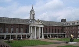
Chelsea, London
Overview
West London
West London generally refers to the western portions of London, and may refer specifically to:*West *West End of London*W postcode area...
, England, bounded to the south by the River Thames
River Thames
The River Thames flows through southern England. It is the longest river entirely in England and the second longest in the United Kingdom. While it is best known because its lower reaches flow through central London, the river flows alongside several other towns and cities, including Oxford,...
, where its frontage runs from Chelsea Bridge
Chelsea Bridge
Chelsea Bridge is a bridge over the River Thames in west London, connecting Chelsea on the north bank to Battersea on the south bank. There have been two Chelsea Bridges, on the site of what was an ancient ford....
along the Chelsea Embankment
Chelsea Embankment
Chelsea Embankment is part of the Thames Embankment, a road and walkway along the north bank of the River Thames in central London, England.The western end of Chelsea Embankment, including a stretch of Cheyne Walk, is in the Royal Borough of Kensington and Chelsea; the eastern end, including...
, Cheyne Walk
Cheyne Walk
Cheyne Walk , is a historic street in Chelsea, the Royal Borough of Kensington and Chelsea. It takes its name from William Lord Cheyne who owned the manor of Chelsea until 1712. Most of the houses were built in the early 18th century. Before the construction in the 19th century of the busy...
, Lots Road
Lots Road Power Station
Lots Road Power Station is a disused coal and later oil-fired power station on the River Thames at Lots Road in Chelsea, London in the south-west of The Royal Borough of Kensington and Chelsea, which supplied electricity to the London Underground system...
and Chelsea Harbour
Chelsea Harbour
Chelsea Harbour is a mixed-use development in Central London, situated on the north bank of the River Thames, in the Sands End area. It lies within the eastern boundary of the London Borough of Hammersmith and Fulham and on the southwestern boundary of the Royal Borough of Kensington and...
. Its eastern boundary was once defined by the River Westbourne
River Westbourne
The River Westbourne is a river in London, England. It flows from Hampstead down through Hyde Park to Sloane Square and into the River Thames at Chelsea...
, which is now in a pipe above Sloane Square tube station
Sloane Square tube station
Sloane Square is a London Underground station in Sloane Square, in the Chelsea district of The Royal Borough of Kensington and Chelsea. It is served by the District and Circle Lines and is between South Kensington and Victoria. It is in Travelcard Zone 1....
. The modern eastern boundary is Chelsea Bridge Road
Chelsea Bridge Road
Chelsea Bridge Road is the modern eastern boundary of Chelsea, in the Royal Borough of Kensington and Chelsea...
and the lower half of Sloane Street
Sloane Street
Sloane Street is a major London street which runs north to south, from Knightsbridge to Sloane Square, crossing Pont Street about half way along, entirely in The Royal Borough of Kensington and Chelsea. Sloane Street takes its name from Sir Hans Sloane, who purchased the surrounding area in 1712...
, including Sloane Square
Sloane Square
Sloane Square is a small hard-landscaped square on the boundaries of the fashionable London districts of Knightsbridge, Belgravia and Chelsea, located southwest of Charing Cross, in the Royal Borough of Kensington and Chelsea. The square is part of the Hans Town area designed in 1771 by Henry...
, along with parts of Belgravia
Belgravia
Belgravia is a district of central London in the City of Westminster and the Royal Borough of Kensington and Chelsea. Noted for its immensely expensive residential properties, it is one of the wealthiest districts in the world...
. To the north and northwest, the area fades into Knightsbridge
Knightsbridge
Knightsbridge is a road which gives its name to an exclusive district lying to the west of central London. The road runs along the south side of Hyde Park, west from Hyde Park Corner, spanning the City of Westminster and the Royal Borough of Kensington and Chelsea...
and South Kensington
South Kensington
South Kensington is a district in the Royal Borough of Kensington and Chelsea in London. It is a built-up area located 2.4 miles west south-west of Charing Cross....
, but it is safe to say that the area north of King's Road
King's Road
King's Road is a street in Chelsea, London, England.King's Road or Kings Road may also refer to:* King's Road * King's Road * King's Road * King's Road...
as far northwest as Fulham Road
Fulham Road
Fulham Road is a street in London, England, that runs from the A219 road in right in the centre of Fulham, in the London Borough of Hammersmith and Fulham, through Chelsea to Brompton Road Knightsbridge and the A4 in Brompton, in the Royal Borough of Kensington and Chelsea.Fulham Road runs parallel...
is part of Chelsea.
The district is part of the Royal Borough of Kensington and Chelsea
Royal Borough of Kensington and Chelsea
The Royal Borough of Kensington and Chelsea is a central London borough of Royal borough status. After the City of Westminster, it is the wealthiest borough in England....
.