
Chattahoochee River
Encyclopedia
The Chattahoochee River flows through or along the borders of the U.S. state
s of Georgia
, Alabama
, and Florida
. It is a tributary of the Apalachicola River
, a relatively short river formed by the confluence of the Chattahoochee and Flint Rivers and emptying into Apalachicola Bay
in the Gulf of Mexico
. The Chattahoochee River is about 430 miles (692 km) long. The Chattahoochee, Flint, and Apalachicola Rivers together make up the Apalachiacola-Chattahoochee-Flint River Basin (ACF River Basin
). The Chattahoochee makes up the largest part of the ACF's drainage basin
.
from a spring on Coon Den Ridge,
near Jacks Knob
, in the southern Blue Ridge Mountains
, a sub-range of the Appalachian Mountains
. Its headwaters flow south from ridges that form the Tennessee Valley Divide
. The Appalachian Trail
crosses the river's uppermost headwaters. The Chattahoochee's source and upper course lies within Chattahoochee National Forest.
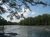
From its source in the Blue Ridge Mountains the Chattahoochee River flows southwesterly to Atlanta and through its suburb
s. It eventually turns due south to form the southern half of the Georgia/Alabama state line. Flowing through a series of reservoir
s, it flows by Columbus, Georgia
, the third-largest city in Georgia, and Fort Benning
of the U.S. Army. At Columbus, it crosses the Fall Line
of the eastern United States. From Lake Oliver
to Fort Benning, the Chattahoochee Riverwalk
provides cycling, rollerblading, and walking along 15 miles (24.1 km) of the river's banks. Farther south it merges with the Flint River
and other tributaries at Lake Seminole
, near Bainbridge to form the Florida Panhandle's
Apalachicola River. Although it is the same river, this portion acquired a different name in colonial times.
word meaning "rocks-marked" (or "painted"), from chato ("rock) plus huchi ("marked"). This possibly refers to the many colorful granite
outcroppings along the northeast-to-southwest segment of the river. Much of that segment of the river runs through the Brevard fault zone. Another common name for the Chattahoochee River is 'The Hooch'
near present-day Blakey, GA in Early County in southwest Georgia, were built during that era.
and the Muscogee (Creek) nations. The removal of Native Americans for European-American settlement in the land adjacent to the river took place during a series of treaties, land lotteries, and forced removals lasting from 1820 through 1832, resulting first in the removal of Muscogee from the southeastern side of the river, and then the Cherokee from the northwest.
of the American Civil War
.
The portion of the Chattahoochee between the tributaries of Proctor Creek and Nickajack Creek on the Cobb County and Fulton County lines in metropolitan Atlanta are the site of the nine remaining "Shoupades". The Shoupades were fortifications named after their designer, Confederate Brigadier General Francis A. Shoup
. That portion of the Confederate line was known as Johnston's River Line after General Joseph E. Johnston
. Shoup approached Johnston on June 18, 1864, a month prior to the Battle of Atlanta
about building fortifications. Johnston agreed, and Shoup supervised the building of 36 small elevated earth and wooden triangular fortifications, arranged in a saw tooth pattern to maximize the crossfire. The Shoupades were impressive enough that Sherman made a decision to cross the river at a point to the northeast. The nine remaining Shoupades (which consist of the earthworks portion of the original earth and wooden structures) are endangered by development.
. Lake Lanier
on the Chattahoochee is named for him.
" oversees the northern half of the river.
lakes, including Lake Lanier
, Walter F. George Lake
, West Point Lake
, George W. Andrews Lake
, and others are controlled by the United States Army Corps of Engineers
, which provides hydroelectricity
, flood control
, domestic and industrial water, recreation, and navigation for river barge. The Georgia Power Company
also owns a small series of dams along the middle portion of the river (the Columbus area) between West Point Lake and Lake Walter F. George. Several smaller and older lakes and dams also provide these services on a much smaller and more localized scale, including Bull Sluice Lake
, which is held by Morgan Falls Dam. This dam was built by the Georgia Railway and Power Company in 1902 to provide electric power for the Atlanta trolley
system, long since replaced by other forms of transportation.
Within Georgia, it divides:
which is spread across several disconnected areas.
The river traverses through much of Atlanta's wealthy northern suburbs, contributing to the hilly topography the city's northern suburbs are famous for. Wealthy suburban communities in northern metro Atlanta that abut the river include: Vinings
, Buckhead
, Sandy Springs
, East Cobb
, Roswell
, Dunwoody, Peachtree Corners
, Johns Creek
, and Berkeley Lake
.
Controversy has come to the river rather recently because of the enormous growth of metropolitan Atlanta, and the resulting great increase in water withdrawals from the river. Oysters in the Apalachicola Bay, Florida, depend on the brackish water mixture of river and ocean water, and the alternating freshwater and saltwater flows that the river and the tides provide. Interbasin water transfers also occur, where water is withdrawn from the Chattahoochee, but then discharged as treated sewage
water into another river, such as the Oconee River
, which flows to the Atlantic Seaboard. The Congress of the United States has been asked to intervene to put navigation of the lower Chattahoochee, south of Columbus, by river barge last on the priority lists, since many people consider this to be a waste of water during droughts, and an aggravation of the fight between Georgia, Florida, and Alabama over rights to the river water. The lawsuit is now in court, and that may take quite a few years to resolve.
tore through the Piedmont. Then, downstream from Roswell the Chattahoochee River remained in moderate flood. Streams affected by the Early November 2009 Floods:
The second most recent major flood along the river occurred during the 2009 Georgia floods
, with 28.1 feet (8.6 m) of water recorded at Vinings at the northwestern Atlanta city limit. The flood was over 5 feet (1.5 m) higher than the previous flood recorded in September 2004, as a result of Hurricane Fred
. Numerous tributaries also swelled far over and beyond their banks. These were the highest water levels seen since 1990, and the second-highest ever since the large Buford Dam was built upstream. The National Weather Service
in Peachtree City estimated that this was a 500-year flood event.
s are located:
Water-level forecasts are regularly issued only at Vinings/Atlanta. Forecasts are issued only during high water at Norcross, Whitesburg, West Point, and the Lake Walter F. George and Andrews dams. All other locations have observations only.
 Tributary
creeks, stream
s, and river
s, as well as lakes, along with the county they are in:
Note that the above list is incomplete, and that each item is not in the exact order in which it joins the Chattahoochee. (For confluences now inundated by lakes, it may be impossible to determine from current maps exactly where they were.)
Country music
artist Alan Jackson
released his song "Chattahoochee
" in 1993 as a single off his album A Lot About Livin' (And a Little 'bout Love)
. "Chattahoochee" received CMA
awards for Single of the Year and Song of the Year.
In Backyard Baseball 2003, Tim Hudson mentions the Chattahoochee River.
Rapper Yung Berg
in an online video, tosses his 'Transformers' chain into the Chattahoochee River.
U.S. state
A U.S. state is any one of the 50 federated states of the United States of America that share sovereignty with the federal government. Because of this shared sovereignty, an American is a citizen both of the federal entity and of his or her state of domicile. Four states use the official title of...
s of Georgia
Georgia (U.S. state)
Georgia is a state located in the southeastern United States. It was established in 1732, the last of the original Thirteen Colonies. The state is named after King George II of Great Britain. Georgia was the fourth state to ratify the United States Constitution, on January 2, 1788...
, Alabama
Alabama
Alabama is a state located in the southeastern region of the United States. It is bordered by Tennessee to the north, Georgia to the east, Florida and the Gulf of Mexico to the south, and Mississippi to the west. Alabama ranks 30th in total land area and ranks second in the size of its inland...
, and Florida
Florida
Florida is a state in the southeastern United States, located on the nation's Atlantic and Gulf coasts. It is bordered to the west by the Gulf of Mexico, to the north by Alabama and Georgia and to the east by the Atlantic Ocean. With a population of 18,801,310 as measured by the 2010 census, it...
. It is a tributary of the Apalachicola River
Apalachicola River
The Apalachicola River is a river, approximately 112 mi long in the State of Florida. This river's large watershed, known as the ACF River Basin for short, drains an area of approximately into the Gulf of Mexico. The distance to its farthest headstream in northeast Georgia is approximately 500...
, a relatively short river formed by the confluence of the Chattahoochee and Flint Rivers and emptying into Apalachicola Bay
Apalachicola Bay
Apalachicola Bay is an estuary and lagoon located on Florida's northwest coast renowned for its oysters. The Apalachicola Bay system also includes St. Georges Sound, St. Vincent Sound and East Bay, covering an area of about . Four islands St. Vincent Island to the west, Cape St. George Island and St...
in the Gulf of Mexico
Gulf of Mexico
The Gulf of Mexico is a partially landlocked ocean basin largely surrounded by the North American continent and the island of Cuba. It is bounded on the northeast, north and northwest by the Gulf Coast of the United States, on the southwest and south by Mexico, and on the southeast by Cuba. In...
. The Chattahoochee River is about 430 miles (692 km) long. The Chattahoochee, Flint, and Apalachicola Rivers together make up the Apalachiacola-Chattahoochee-Flint River Basin (ACF River Basin
ACF River Basin
The ACF River Basin is the watershed of the Apalachicola/Chattahoochee/Flint River Basin, in the United States, that begins in northern Georgia and flows into the Gulf of Mexico at Apalachicola Bay, near Apalachicola, Florida...
). The Chattahoochee makes up the largest part of the ACF's drainage basin
Drainage basin
A drainage basin is an extent or an area of land where surface water from rain and melting snow or ice converges to a single point, usually the exit of the basin, where the waters join another waterbody, such as a river, lake, reservoir, estuary, wetland, sea, or ocean...
.
Course
The Chattahoochee River originates in northeastern GeorgiaGeorgia (U.S. state)
Georgia is a state located in the southeastern United States. It was established in 1732, the last of the original Thirteen Colonies. The state is named after King George II of Great Britain. Georgia was the fourth state to ratify the United States Constitution, on January 2, 1788...
from a spring on Coon Den Ridge,
near Jacks Knob
Jacks Knob
Jacks Knob is a mountain located on the border of Towns County and Union County, Georgia, with a peak elevation of 3,805 feet. The Appalachian Trail crosses the southern flank of the mountain and Jacks Knob Trail ends here at an intersection with the Appalachian Trail. Jacks Knob is in the Mark...
, in the southern Blue Ridge Mountains
Blue Ridge Mountains
The Blue Ridge Mountains are a physiographic province of the larger Appalachian Mountains range. This province consists of northern and southern physiographic regions, which divide near the Roanoke River gap. The mountain range is located in the eastern United States, starting at its southern-most...
, a sub-range of the Appalachian Mountains
Appalachian Mountains
The Appalachian Mountains #Whether the stressed vowel is or ,#Whether the "ch" is pronounced as a fricative or an affricate , and#Whether the final vowel is the monophthong or the diphthong .), often called the Appalachians, are a system of mountains in eastern North America. The Appalachians...
. Its headwaters flow south from ridges that form the Tennessee Valley Divide
Tennessee Valley Divide
The Tennessee Valley Divide is the eastern and southern boundary of the drainage basin of the Tennessee River and its tributaries.The Tennessee Valley Divide begins near the northeasternmost source of the Tennessee River, in the vicinity of Bluefield, West Virginia. From there, the divide...
. The Appalachian Trail
Appalachian Trail
The Appalachian National Scenic Trail, generally known as the Appalachian Trail or simply the AT, is a marked hiking trail in the eastern United States extending between Springer Mountain in Georgia and Mount Katahdin in Maine. It is approximately long...
crosses the river's uppermost headwaters. The Chattahoochee's source and upper course lies within Chattahoochee National Forest.
From its source in the Blue Ridge Mountains the Chattahoochee River flows southwesterly to Atlanta and through its suburb
Suburb
The word suburb mostly refers to a residential area, either existing as part of a city or as a separate residential community within commuting distance of a city . Some suburbs have a degree of administrative autonomy, and most have lower population density than inner city neighborhoods...
s. It eventually turns due south to form the southern half of the Georgia/Alabama state line. Flowing through a series of reservoir
Reservoir
A reservoir , artificial lake or dam is used to store water.Reservoirs may be created in river valleys by the construction of a dam or may be built by excavation in the ground or by conventional construction techniques such as brickwork or cast concrete.The term reservoir may also be used to...
s, it flows by Columbus, Georgia
Columbus, Georgia
Columbus is a city in and the county seat of Muscogee County, Georgia, United States, with which it is consolidated. As of the 2010 census, the city had a population of 189,885. It is the principal city of the Columbus, Georgia metropolitan area, which, in 2009, had an estimated population of 292,795...
, the third-largest city in Georgia, and Fort Benning
Fort Benning
Fort Benning is a United States Army post located southeast of the city of Columbus in Muscogee and Chattahoochee counties in Georgia and Russell County, Alabama...
of the U.S. Army. At Columbus, it crosses the Fall Line
Fall line
A fall line is a geomorphologic unconformity between an upland region of relatively hard crystalline basement rock and a coastal plain of softer sedimentary rock. A fall line is typically prominent when crossed by a river, for there will often be rapids or waterfalls...
of the eastern United States. From Lake Oliver
Lake Oliver
Lake Oliver is a reservoir on the Chattahoochee River, which lies south of Goat Rock Dam . The lake is created by the Oliver Dam and Generating Plant, which was completed in 1959 by Georgia Power. The lake was named for James McCoy Oliver, an executive of Georgia Power at the time. Oliver Dam...
to Fort Benning, the Chattahoochee Riverwalk
Chattahoochee RiverWalk
The Chattahoochee RiverWalk is a 22 mile walking and biking area along the Chattahoochee River in Columbus, Georgia, United States. The entire trail is paved with either asphalt, concrete, or brick...
provides cycling, rollerblading, and walking along 15 miles (24.1 km) of the river's banks. Farther south it merges with the Flint River
Flint River (Georgia)
The Flint River is a river in the U.S. state of Georgia. The river drains of western Georgia, flowing south from the upper Piedmont region south of Atlanta to the wetlands of the Gulf Coastal Plain in the southwestern corner of the state. Along with the Apalachicola and the Chattahoochee rivers,...
and other tributaries at Lake Seminole
Lake Seminole
Lake Seminole is a reservoir located in the southwest corner of Georgia along its border with Florida, maintained by the U.S. Army Corps of Engineers. The Chattahoochee and Flint rivers join in the lake, before flowing from the Jim Woodruff Lock and Dam, which impounds the lake, as the Apalachicola...
, near Bainbridge to form the Florida Panhandle's
Florida Panhandle
The Florida Panhandle, an informal, unofficial term for the northwestern part of Florida, is a strip of land roughly 200 miles long and 50 to 100 miles wide , lying between Alabama on the north and the west, Georgia also on the north, and the Gulf of Mexico to the south. Its eastern boundary is...
Apalachicola River. Although it is the same river, this portion acquired a different name in colonial times.
Name
The name Chattahoochee is thought to come from a MuskogeanMuskogean languages
Muskogean is an indigenous language family of the Southeastern United States. Though there is an ongoing debate concerning their interrelationships, the Muskogean languages are generally divided into two branches, Eastern Muskogean and Western Muskogean...
word meaning "rocks-marked" (or "painted"), from chato ("rock) plus huchi ("marked"). This possibly refers to the many colorful granite
Granite
Granite is a common and widely occurring type of intrusive, felsic, igneous rock. Granite usually has a medium- to coarse-grained texture. Occasionally some individual crystals are larger than the groundmass, in which case the texture is known as porphyritic. A granitic rock with a porphyritic...
outcroppings along the northeast-to-southwest segment of the river. Much of that segment of the river runs through the Brevard fault zone. Another common name for the Chattahoochee River is 'The Hooch'
Early History
The vicinity of the Chattahoochee River has been inhabited since at least 1000 BC. The Kolomoki mounds located in the Kolomoki Mounds Historic ParkKolomoki Mounds Historic Park
The Kolomoki Mounds are the largest and oldest Woodland period mound complex in the Southeastern United States and currently stand in present day Early County, Georgia, near the Chattahoochee River. The mounds were named a National Historic Landmark in 1964...
near present-day Blakey, GA in Early County in southwest Georgia, were built during that era.
Removal of Native Americans
In more recent Native American history the Chattahoochee served as a dividing line between the CherokeeCherokee
The Cherokee are a Native American people historically settled in the Southeastern United States . Linguistically, they are part of the Iroquoian language family...
and the Muscogee (Creek) nations. The removal of Native Americans for European-American settlement in the land adjacent to the river took place during a series of treaties, land lotteries, and forced removals lasting from 1820 through 1832, resulting first in the removal of Muscogee from the southeastern side of the river, and then the Cherokee from the northwest.
The American Civil War
The Chattahoochee River was of considerable strategic importance during the Atlanta CampaignAtlanta Campaign
The Atlanta Campaign was a series of battles fought in the Western Theater of the American Civil War throughout northwest Georgia and the area around Atlanta during the summer of 1864. Union Maj. Gen. William T. Sherman invaded Georgia from the vicinity of Chattanooga, Tennessee, beginning in May...
of the American Civil War
American Civil War
The American Civil War was a civil war fought in the United States of America. In response to the election of Abraham Lincoln as President of the United States, 11 southern slave states declared their secession from the United States and formed the Confederate States of America ; the other 25...
.
The portion of the Chattahoochee between the tributaries of Proctor Creek and Nickajack Creek on the Cobb County and Fulton County lines in metropolitan Atlanta are the site of the nine remaining "Shoupades". The Shoupades were fortifications named after their designer, Confederate Brigadier General Francis A. Shoup
Francis A. Shoup
Francis Asbury Shoup was a lawyer from Indianapolis, Indiana, who decided to become a brigadier general for the Confederate States Army during the American Civil War.-Pre-war:...
. That portion of the Confederate line was known as Johnston's River Line after General Joseph E. Johnston
Joseph E. Johnston
Joseph Eggleston Johnston was a career U.S. Army officer, serving with distinction in the Mexican-American War and Seminole Wars, and was also one of the most senior general officers in the Confederate States Army during the American Civil War...
. Shoup approached Johnston on June 18, 1864, a month prior to the Battle of Atlanta
Battle of Atlanta
The Battle of Atlanta was a battle of the Atlanta Campaign fought during the American Civil War on July 22, 1864, just southeast of Atlanta, Georgia. Continuing their summer campaign to seize the important rail and supply center of Atlanta, Union forces commanded by William T. Sherman overwhelmed...
about building fortifications. Johnston agreed, and Shoup supervised the building of 36 small elevated earth and wooden triangular fortifications, arranged in a saw tooth pattern to maximize the crossfire. The Shoupades were impressive enough that Sherman made a decision to cross the river at a point to the northeast. The nine remaining Shoupades (which consist of the earthworks portion of the original earth and wooden structures) are endangered by development.
Sidney Lanier
The beauty of the Chattahoochee River is commemorated in the epic poem The Song of the Chattahoochee, (1877) by the noted Georgian poet Sidney LanierSidney Lanier
Sidney Lanier was an American musician and poet.-Biography:Sidney Lanier was born February 3, 1842, in Macon, Georgia, to parents Robert Sampson Lanier and Mary Jane Anderson; he was mostly of English ancestry. His distant French Huguenot ancestors immigrated to England in the 16th century...
. Lake Lanier
Lake Lanier
Lake Lanier is a reservoir in the northern portion of the U.S. state of Georgia. It was created by the completion of Buford Dam on the Chattahoochee River in 1956, and is also fed by the waters of the Chestatee River. The lake encompasses of water, and of shoreline at normal level, a "full...
on the Chattahoochee is named for him.
Recent History
The non-profit organization "Upper Chattahoochee RiverkeeperUpper Chattahoochee Riverkeeper
The Upper Chattahoochee Riverkeeper is an environmental advocacy organization with more than 5,000 members dedicated solely to protecting and restoring the Chattahoochee River Basin, specifically between the Buford Dam and West Point Lake...
" oversees the northern half of the river.
Modifications
Several reservoirReservoir
A reservoir , artificial lake or dam is used to store water.Reservoirs may be created in river valleys by the construction of a dam or may be built by excavation in the ground or by conventional construction techniques such as brickwork or cast concrete.The term reservoir may also be used to...
lakes, including Lake Lanier
Lake Lanier
Lake Lanier is a reservoir in the northern portion of the U.S. state of Georgia. It was created by the completion of Buford Dam on the Chattahoochee River in 1956, and is also fed by the waters of the Chestatee River. The lake encompasses of water, and of shoreline at normal level, a "full...
, Walter F. George Lake
Walter F. George Lake
The Walter F. George Lake, named for Walter F. George , a United States Senator from Georgia, is formed on the Chattahoochee River along the border between Alabama and Georgia. It is also widely known by the unofficial name, Lake Eufaula — particularly on the Alabama side. The lake extends north...
, West Point Lake
West Point Lake
West Point Lake is a man-made reservoir formed by the damming of the Chattahoochee River by the U.S. Army Corps of Engineers. This reservoir extends for about along the Chattahoochee River near the Alabama-Georgia state boundary....
, George W. Andrews Lake
George W. Andrews Lake
George W. Andrews Lake is an U.S. Army Corps of Engineers 29 miles south of Walter F. George Lake and north of Lake Seminole. The lake is very riverine in nature but is noted for good fishing. The purpose of the dam is for river navigation via the lock at George W. Andrews Dam. There is no...
, and others are controlled by the United States Army Corps of Engineers
United States Army Corps of Engineers
The United States Army Corps of Engineers is a federal agency and a major Army command made up of some 38,000 civilian and military personnel, making it the world's largest public engineering, design and construction management agency...
, which provides hydroelectricity
Hydroelectricity
Hydroelectricity is the term referring to electricity generated by hydropower; the production of electrical power through the use of the gravitational force of falling or flowing water. It is the most widely used form of renewable energy...
, flood control
Flood control
In communications, flood control is a feature of many communication protocols designed to prevent overwhelming of a destination receiver. Such controls can be implemented either in software or in hardware, and will often request that the message be resent after the receiver has finished...
, domestic and industrial water, recreation, and navigation for river barge. The Georgia Power Company
Georgia Power
Georgia Power is an electric utility headquartered in Atlanta, Georgia, United States. It is the largest of the four electric utilities that are owned and operated by Southern Company....
also owns a small series of dams along the middle portion of the river (the Columbus area) between West Point Lake and Lake Walter F. George. Several smaller and older lakes and dams also provide these services on a much smaller and more localized scale, including Bull Sluice Lake
Bull Sluice Lake
Bull Sluice Lake is a small reservoir located along the Chattahoochee River in northern Georgia, in the northern suburbs of metro Atlanta. It is , and is impounded by Morgan Falls Dam. Besides the hydroelectric power produced by the dam, the lake's primary use is recreation, including fishing and...
, which is held by Morgan Falls Dam. This dam was built by the Georgia Railway and Power Company in 1902 to provide electric power for the Atlanta trolley
Tram
A tram is a passenger rail vehicle which runs on tracks along public urban streets and also sometimes on separate rights of way. It may also run between cities and/or towns , and/or partially grade separated even in the cities...
system, long since replaced by other forms of transportation.
River borders
At various points, the Chattahoochee serves as the boundary between several counties and cities, as well as forming the lower half of the boundary between Alabama and Georgia.Within Georgia, it divides:
- Habersham CountyHabersham County, GeorgiaHabersham County is a county located in the U.S. state of Georgia. It was created on December 15, 1818, and named for Colonel Joseph Habersham. As of 2000, the population was 35,902. The 2007 Census Estimate shows a population of 42,272. Clarkesville is the county seat.Chartered in 1823, the...
and White CountyWhite County, GeorgiaWhite County is a county located in the northeast corner of the U.S. state of Georgia. It was created on December 22, 1857, from part of Habersham County. The county was named for Newton County Representative David T. White, who helped a Habersham representative successfully attain passage of an... - Forsyth CountyForsyth County, GeorgiaForsyth County is a county located in the U.S. state of Georgia. The county seat is Cumming, Georgia. Forsyth County is a part of the Atlanta metropolitan area...
and Gwinnett CountyGwinnett County, Georgia, Gwinnett County had a population of 805,321. The racial and ethnic composition of the population was 53.3% white , 23.6% black , 2.7% Korean, 2.6% Asian Indian, 2.0% Vietnamese, 3.3% other Asian, 0.1% Pacific Islander, 8.8% some other race and 3.1% from two or more races... - Fulton CountyFulton County, GeorgiaFulton County is a county located in the U.S. state of Georgia. Its county seat is Atlanta, the state capital since 1868 and the principal county of the Atlanta metropolitan area...
and Gwinnett County - Sandy SpringsSandy Springs, GeorgiaSandy Springs is a city in north Georgia, United States. It is a northern suburb of Atlanta. With a 2010 population of 93,853, Sandy Springs is the sixth-largest city in the state and the second-largest city in Metro Atlanta. Sandy Springs is located in north Fulton County, Georgia, just south of...
and RoswellRoswell, GeorgiaRoswell is a city located in northern Fulton County; it is a suburb of northern Atlanta, Georgia, United States. The 2010 Census population was 88,346. It is the eighth largest city in Georgia... - Cobb CountyCobb County, GeorgiaCobb County is a county located in the U.S. state of Georgia. Its county seat and largest city is Marietta, which is located in the center of the county. The county was named for Thomas Willis Cobb, who in the early 19th century was a United States representative and senator from Georgia...
and Fulton County - Douglas CountyDouglas County, GeorgiaDouglas County, Georgia has been experiencing numerous natural disasters over the most recent decades. Being located in the South Eastern United States the county experiences strong storms and tornadoes often because of its location in Dixie Alley....
and Fulton County - Carroll CountyCarroll County, GeorgiaCarroll County is a county located in the U.S. state of Georgia. As of the 2000 census, the population was 87,268. The 2007 Census Estimate shows a population of 111,954...
and Fulton County - Carroll County and Coweta CountyCoweta County, GeorgiaCoweta County is a county located in the U.S. state of Georgia. As of 2000, the population was 89,215. The 2009 Census Estimate placed the population at 131,936...
Atlanta
Atlanta itself is built upon the crest of a large ridge, rather than on the river proper. This has contributed to keeping much of the natural scenic beauty of the section that runs through metropolitan Atlanta safe. Other sections of the river bank north of the metropolis are protected by the boundaries of the Chattahoochee River National Recreation AreaChattahoochee River National Recreation Area
Chattahoochee River National Recreation Area preserves a series of sites between Atlanta in the United States and Lake Sidney Lanier along the Chattahoochee River. The 48-mile stretch of the river affords public recreation opportunities and access to historic spots...
which is spread across several disconnected areas.
The river traverses through much of Atlanta's wealthy northern suburbs, contributing to the hilly topography the city's northern suburbs are famous for. Wealthy suburban communities in northern metro Atlanta that abut the river include: Vinings
Vinings, Georgia
Vinings is a census-designated place and an unincorporated town in Cobb County, Georgia, just across the Chattahoochee River from Atlanta. As of the 2010 census, the town had a total population of 9,734. It is located between the affluent West Paces Ferry section of Buckhead in northwest Atlanta,...
, Buckhead
Buckhead (Atlanta)
Buckhead is the uptown district of Atlanta, Georgia, United States, comprising approximately the northern one-fifth of the city. Buckhead is a major commercial and financial center of the Southeast, and it is the third-largest business district in Atlanta, behind Downtown and Midtown...
, Sandy Springs
Sandy Springs, Georgia
Sandy Springs is a city in north Georgia, United States. It is a northern suburb of Atlanta. With a 2010 population of 93,853, Sandy Springs is the sixth-largest city in the state and the second-largest city in Metro Atlanta. Sandy Springs is located in north Fulton County, Georgia, just south of...
, East Cobb
East Cobb, Georgia
East Cobb is an unincorporated community in Cobb County, Georgia, United States. With over 169,000 people, it is one of the largest suburbs in Metro Atlanta...
, Roswell
Roswell, Georgia
Roswell is a city located in northern Fulton County; it is a suburb of northern Atlanta, Georgia, United States. The 2010 Census population was 88,346. It is the eighth largest city in Georgia...
, Dunwoody, Peachtree Corners
Peachtree Corners, Georgia
Peachtree Corners is a city in western Gwinnett County, Georgia, United States. It is a northern suburb of Atlanta, located east of Dunwoody and south of Johns Creek. Out of all of Atlanta's northern suburbs, Peachtree Corners is the only one that was developed as a planned community...
, Johns Creek
Johns Creek, Georgia
Johns Creek is a suburban city in Fulton County, Georgia, USA, which incorporated December 1, 2006. It is named for a tributary that runs through the area. The city was created out of the northeastern part of unincorporated Fulton County...
, and Berkeley Lake
Berkeley Lake, Georgia
Berkeley Lake is a city in Gwinnett County, Georgia, United States. From its 1956 origins as a summer retreat, Berkeley Lake has grown into a thriving community centered on its namesake lake...
.
Controversy has come to the river rather recently because of the enormous growth of metropolitan Atlanta, and the resulting great increase in water withdrawals from the river. Oysters in the Apalachicola Bay, Florida, depend on the brackish water mixture of river and ocean water, and the alternating freshwater and saltwater flows that the river and the tides provide. Interbasin water transfers also occur, where water is withdrawn from the Chattahoochee, but then discharged as treated sewage
Sewage
Sewage is water-carried waste, in solution or suspension, that is intended to be removed from a community. Also known as wastewater, it is more than 99% water and is characterized by volume or rate of flow, physical condition, chemical constituents and the bacteriological organisms that it contains...
water into another river, such as the Oconee River
Oconee River
The Oconee River is a river which has its origin in Hall County, Georgia, and terminates where it joins the Ocmulgee River to form the Altamaha River near Lumber City at the borders of Montgomery County, Wheeler County, and Jeff Davis County. South of Athens, two forks, known as the North Oconee...
, which flows to the Atlantic Seaboard. The Congress of the United States has been asked to intervene to put navigation of the lower Chattahoochee, south of Columbus, by river barge last on the priority lists, since many people consider this to be a waste of water during droughts, and an aggravation of the fight between Georgia, Florida, and Alabama over rights to the river water. The lawsuit is now in court, and that may take quite a few years to resolve.
Flooding
The most recent floods on the Chattahoochee River were the Early November 2009 floods. The flooding was caused when Tropical Storm IdaHurricane Ida (2009)
Hurricane Ida was the strongest landfalling tropical cyclone during the 2009 Atlantic hurricane season, crossing the coastline of Nicaragua with winds of 80 mph . The remnants of the storm became a powerful nor'easter that caused widespread damage along coastal areas of the Mid-Atlantic States...
tore through the Piedmont. Then, downstream from Roswell the Chattahoochee River remained in moderate flood. Streams affected by the Early November 2009 Floods:
- Chattahoochee River
- Vickery CreekVickery CreekBig Creek is a stream in Forsyth and Fulton counties in Georgia. The creek mouth into the Chattahoochee River is located at the southern border of Roswell where State Route 9 crosses the river...
- Johns Creek
- Sweetwater Creek
- Nancy CreekNancy Creek (Atlanta)Nancy Creek is a stream in northern Atlanta, Georgia, United States. It begins in far northern DeKalb County, just north of Chamblee, and flows southwestward into Fulton County, through the far southeast corner of Sandy Springs, then through the Buckhead area of Atlanta. It empties into...
- Peachtree CreekPeachtree CreekPeachtree Creek is a major stream in Atlanta. It flows for almost due west into the Chattahoochee River just south of Vinings. Like other "Peachtree" names in the area, the name is most likely a corruption of "pitch tree", from the area's many pines and their sticky sap.Peachtree Creek is an...
- Oconee RiverOconee RiverThe Oconee River is a river which has its origin in Hall County, Georgia, and terminates where it joins the Ocmulgee River to form the Altamaha River near Lumber City at the borders of Montgomery County, Wheeler County, and Jeff Davis County. South of Athens, two forks, known as the North Oconee...
The second most recent major flood along the river occurred during the 2009 Georgia floods
2009 Georgia (U.S. state) floods
The 2009 Southeastern United States floods were a group of floods that affected several counties throughout northern Georgia, Tennessee, Alabama, Mississippi and Arkansas. Some of the worst flooding took place most around the Atlanta metropolitan area...
, with 28.1 feet (8.6 m) of water recorded at Vinings at the northwestern Atlanta city limit. The flood was over 5 feet (1.5 m) higher than the previous flood recorded in September 2004, as a result of Hurricane Fred
Hurricane Fred (2009)
Hurricane Fred was one of the easternmost forming major hurricanes in the North Atlantic basin on record. Forming out of a strong tropical wave on September 7 near the Cape Verde Islands, Fred gradually organized within an area of moderate wind shear. The following day, decreasing shear...
. Numerous tributaries also swelled far over and beyond their banks. These were the highest water levels seen since 1990, and the second-highest ever since the large Buford Dam was built upstream. The National Weather Service
National Weather Service
The National Weather Service , once known as the Weather Bureau, is one of the six scientific agencies that make up the National Oceanic and Atmospheric Administration of the United States government...
in Peachtree City estimated that this was a 500-year flood event.
Gauges
Stream gaugeStream gauge
A stream gauge, stream gage or gauging station is a location used by hydrologists or environmental scientists to monitor and test terrestrial bodies of water. Hydrometric measurements of water surface elevation and/or volumetric discharge are generally taken and observations of biota may also be...
s are located:
- at HelenHelen, GeorgiaHelen is a city located on the Chattahoochee River in White County in the north of the U.S. state of Georgia. As of the 2000 census, the city's population was 420.-History:...
(near downtown) HELG1 - near CorneliaCornelia, GeorgiaCornelia is a city in Habersham County, Georgia, United States. The population was 3,834 at the 2010 census. It is home to one of the world's largest apple sculptures, which is displayed on top of an obelisk shaped monument...
(6 miles or 10 km northwest of) DCNG1 - near BufordBuford, GeorgiaAs of 2010 Buford had a population of 12,225. The racial and ethnic composition of the population was 65.8% white, 13.8% black or African American, 0.3% Native American, 2.9% Asian, 14.7% reporting some other race and 2.5% reproting two or more races...
(4 miles or 6 km northwest of) immediately down from Buford Dam BUFG1 - near NorcrossNorcross, GeorgiaAs of 2010 Norcross had a population of 9,116. The racial and ethnic composition of the population was 40.8% white , 19.8% black or African American , 0.7% Native American, 2.1% Asian Indian, 10.7% Asian, 0.1% Pacific Islander, 21.5% from some other race and 4.3% reporting two or more races...
(5 miles or 8 km north of) on Medlock Bridge Road NCRG1 - near RoswellRoswell, GeorgiaRoswell is a city located in northern Fulton County; it is a suburb of northern Atlanta, Georgia, United States. The 2010 Census population was 88,346. It is the eighth largest city in Georgia...
(4 miles or 6 km southeast of) just off old Riverside Road RWLG1 - below Morgan Falls Dam TW MGFG1
- at ViningsVinings, GeorgiaVinings is a census-designated place and an unincorporated town in Cobb County, Georgia, just across the Chattahoochee River from Atlanta. As of the 2010 census, the town had a total population of 9,734. It is located between the affluent West Paces Ferry section of Buckhead in northwest Atlanta,...
(3 miles or 5 km southwest of) and Atlanta on Pace's FerryPace's FerryThrough much of the 19th century, Pace's Ferry was an important ferry across the Chattahoochee River near Atlanta. Started in the early 1830s near Peachtree Creek, it was run by Hardy Pace, one of the city's founders...
Road bridge VING1 - near CampbelltonCampbellton, GeorgiaCampbellton is an unincorporated town in southwestern Fulton County, Georgia, that lies along the banks of the Chattahoochee River. The area prior to white settlement was populated by the Creek Indians. Campbellton was settled by several families. The Beavers Family owned and farmed a large...
(1 mile or 2 km northwest of) and Fairburn on Georgia 92Georgia State Route 92State Route 92 is a highway in the U.S. state of Georgia. The road runs for from Griffin to Roswell. Primarily signed from south to north, Route 92 is a rural route that passes through three county seats.- Route description :...
bridge FBNG1 - at WhitesburgWhitesburg, GeorgiaWhitesburg is a town in Carroll County, Georgia, United States. The population was 596 at the 2000 census. It is the home of McIntosh Reserve, site of the death of Chief William McIntosh of the Creek Indians.-Geography:...
(2 miles or 3 km southeast of) at Main Street (Georgia 18) bridge WHTG1 - at Franklin at Main Street (U.S. 27) bridge in downtown FRNG1
- at West PointWest Point, GeorgiaWest Point is a town in Troup County, with a small tail of the south end of town in Harris County, in the U.S. state of Georgia. As of the 2000 U.S. Census, this town had a total population of just 3,382 people...
(1 mile or 2 km "northeast", actually north, of the center of town) WTPG1 - at ColumbusColumbus, GeorgiaColumbus is a city in and the county seat of Muscogee County, Georgia, United States, with which it is consolidated. As of the 2010 census, the city had a population of 189,885. It is the principal city of the Columbus, Georgia metropolitan area, which, in 2009, had an estimated population of 292,795...
on 4th Street N (U.S. 280) bridge to Phenix City, AlabamaPhenix City, AlabamaPhenix City is a city and the county seat in Russell County in the U.S. state of Alabama. Portions of Lee County are addressed as Phenix City, 36870 ZIP code, for the sole purpose that Smiths Station does not have full incorporation to annex the area...
CMUG1 - at Walter F. George DamWalter F. George LakeThe Walter F. George Lake, named for Walter F. George , a United States Senator from Georgia, is formed on the Chattahoochee River along the border between Alabama and Georgia. It is also widely known by the unofficial name, Lake Eufaula — particularly on the Alabama side. The lake extends north...
(USACE) in Fort GainesFort Gaines, GeorgiaFort Gaines is a city in Clay County, Georgia, United States. The population was 1,110 at the 2000 census. The city is the county seat of Clay County.-Geography:Fort Gaines is located at ....
FOGG1 - at George W. Andrews LakeGeorge W. Andrews LakeGeorge W. Andrews Lake is an U.S. Army Corps of Engineers 29 miles south of Walter F. George Lake and north of Lake Seminole. The lake is very riverine in nature but is noted for good fishing. The purpose of the dam is for river navigation via the lock at George W. Andrews Dam. There is no...
& dam (USACE) south of Columbia, AlabamaColumbia, AlabamaColumbia is a town in Houston County, Alabama, United States. It is part of the Dothan, Alabama Metropolitan Statistical Area. At the 2000 census the population was 804.-Geography:Columbia is located at . According to the U.S...
then recent in ]November 11, 2009it flooded Vinnings again. COLA1
Water-level forecasts are regularly issued only at Vinings/Atlanta. Forecasts are issued only during high water at Norcross, Whitesburg, West Point, and the Lake Walter F. George and Andrews dams. All other locations have observations only.
Tributaries
Tributary
A tributary or affluent is a stream or river that flows into a main stem river or a lake. A tributary does not flow directly into a sea or ocean...
creeks, stream
Stream
A stream is a body of water with a current, confined within a bed and stream banks. Depending on its locale or certain characteristics, a stream may be referred to as a branch, brook, beck, burn, creek, "crick", gill , kill, lick, rill, river, syke, bayou, rivulet, streamage, wash, run or...
s, and river
River
A river is a natural watercourse, usually freshwater, flowing towards an ocean, a lake, a sea, or another river. In a few cases, a river simply flows into the ground or dries up completely before reaching another body of water. Small rivers may also be called by several other names, including...
s, as well as lakes, along with the county they are in:
- Soque RiverSoque RiverThe Soque River and its watershed are located entirely within the county boundaries of Habersham County in northeast Georgia. The Soque is a tributary of the Chattahoochee River. Portions of the river run along State Route 197.The highest point in the watershed occurs on Tray Mountain...
(Habersham) - HelenHelen, GeorgiaHelen is a city located on the Chattahoochee River in White County in the north of the U.S. state of Georgia. As of the 2000 census, the city's population was 420.-History:...
gauge (HDCG1) - Big Creek (Hall)
- Lake LanierLake LanierLake Lanier is a reservoir in the northern portion of the U.S. state of Georgia. It was created by the completion of Buford Dam on the Chattahoochee River in 1956, and is also fed by the waters of the Chestatee River. The lake encompasses of water, and of shoreline at normal level, a "full...
and Buford Dam (DawsonDawson County, GeorgiaDawson County is a county located in the U.S. state of Georgia. It was created on December 3, 1857 from Gilmer and Lumpkin counties. As of 2000, the population is 15,999. The 2007 Census Estimate showed a population of 21,484...
, Forsyth, Gwinnett, HallHall County, GeorgiaHall County is a county located in the U.S. state of Georgia. In 2000, the population was 139,277. It is included in the Gainesville, Georgia, Metropolitan Statistical Area...
, and LumpkinLumpkin County, GeorgiaLumpkin County is a county located in the U.S. state of Georgia. As of the 2010 census, the population was 29,966. Its county seat is Dahlonega.- History :...
)- Chestatee RiverChestatee RiverThe Chestatee River is a river in the Appalachian Mountains of northern Georgia, USA. It begins at the confluence of Dicks Creek and Frogtown Creek The Chestatee River (variant spellings Chestatie, Chestetee, Chostatee, Chosteta, none in modern use) is a river in the Appalachian Mountains of...
(Dawson/Hall border, Forsyth/Hall border, and Lumpkin)
- Chestatee River
- Six Mile Creek (Forsyth)
- James Creek (Forsyth)
- Johns Creek (Forsyth and north Fulton, city of Johns Creek, GeorgiaJohns Creek, GeorgiaJohns Creek is a suburban city in Fulton County, Georgia, USA, which incorporated December 1, 2006. It is named for a tributary that runs through the area. The city was created out of the northeastern part of unincorporated Fulton County...
) - Bald Ridge Creek (Forsyth)
- Audry Mill Creek (North Fulton)
- Crooked Creek (DeKalb)
- Young Deer Creek (Forsyth)
- Four Mile Creek (Forsyth)
- Dick Creek (Forsyth)
- Level Creek (Gwinnett)
- Haw Creek (Forsyth)
- Two Mile Creek (Forsyth)
- Shoal Creek (Gwinnett and Hall)
- Suwanee Creek (Gwinnett)
- Brushy Creek (Gwinnett)
- Richland Creek (Gwinnett)
- Rogers Creek (Gwinnett)
- NorcrossNorcross, GeorgiaAs of 2010 Norcross had a population of 9,116. The racial and ethnic composition of the population was 40.8% white , 19.8% black or African American , 0.7% Native American, 2.1% Asian Indian, 10.7% Asian, 0.1% Pacific Islander, 21.5% from some other race and 4.3% reporting two or more races...
gauge (NCRG1) - Mavern Creek (north Fulton)
- Old Mill Creek (north Fulton)
- Vickery CreekVickery CreekBig Creek is a stream in Forsyth and Fulton counties in Georgia. The creek mouth into the Chattahoochee River is located at the southern border of Roswell where State Route 9 crosses the river...
(Forsyth, north Fulton) - RoswellRoswell, GeorgiaRoswell is a city located in northern Fulton County; it is a suburb of northern Atlanta, Georgia, United States. The 2010 Census population was 88,346. It is the eighth largest city in Georgia...
gauge (RWLG1) - Willeo CreekWilleo CreekWilleo Creek is a stream in the U.S. state of Georgia, and is located in the north-northwestern part of metro Atlanta. It is a significant tributary of the Chattahoochee River, into which it flows at Bull Sluice Lake, just upstream from Morgan Falls Dam and downstream from the Chattahoochee...
(Cobb/Fulton border) - Bull Sluice LakeBull Sluice LakeBull Sluice Lake is a small reservoir located along the Chattahoochee River in northern Georgia, in the northern suburbs of metro Atlanta. It is , and is impounded by Morgan Falls Dam. Besides the hydroelectric power produced by the dam, the lake's primary use is recreation, including fishing and...
and Morgan Falls Dam - Ball Mill Creek (DeKalbDeKalb County, GeorgiaDeKalb County is a county located in the U.S. state of Georgia. The population of the county was 691,893 at the 2010 census. Its county seat is the city of Decatur. It is bordered to the west by Fulton County and contains roughly 10% of the city of Atlanta...
and Fulton) - Beech Creek (Fulton)
- Summerbrook Creek (Fulton)
- Mountain Health Creek (Fulton)
- Arrowhead Creek (Cobb)
- Mulberry Creek (Cobb)
- Nancy CreekNancy Creek (Atlanta)Nancy Creek is a stream in northern Atlanta, Georgia, United States. It begins in far northern DeKalb County, just north of Chamblee, and flows southwestward into Fulton County, through the far southeast corner of Sandy Springs, then through the Buckhead area of Atlanta. It empties into...
(DeKalb and Fulton) - Nannyberry Creek (Cobb)
- Nickajack Creek (Cobb)
- Owl Creek (Cobb)
- Rottenwood Creek (Cobb)
- Sope CreekSope CreekSope Creek is an stream located in Cobb County, Georgia, United States. It is a significant tributary of the Chattahoochee River, and under high water levels it can be used for extreme whitewater kayaking...
(Cobb) - Trout Lily Creek (Cobb)
- Vinings gauge at Pace's FerryPace's FerryThrough much of the 19th century, Pace's Ferry was an important ferry across the Chattahoochee River near Atlanta. Started in the early 1830s near Peachtree Creek, it was run by Hardy Pace, one of the city's founders...
(VING1) - Peachtree CreekPeachtree CreekPeachtree Creek is a major stream in Atlanta. It flows for almost due west into the Chattahoochee River just south of Vinings. Like other "Peachtree" names in the area, the name is most likely a corruption of "pitch tree", from the area's many pines and their sticky sap.Peachtree Creek is an...
(Fulton) - Proctor Creek (Fulton)
- Cabin Creek (Fulton)
- Camp CreekCamp Creek (Fulton County, Georgia)Camp Creek is a tributary of the Chattahoochee River in Fulton County, Georgia. Rising in College Park, the creek flows west to join the Chattahoochee northeast of Campbellton....
(Fulton) - Charlie's Trapping Creek (Fulton)
- Crooked Creek (Fulton and Gwinnett)
- Dog RiverDog River (Georgia)The Dog River is a river in Georgia. The river rises south of Villa Rica in Carroll County, flows west into Douglas County, then turns southwestward into Dog River Reservoir. The reservoir, completed in 1992, impounded of water before the dam and water level were increased in 2009. The reservoir...
(Douglas) - Hewlett Creek (Fulton)
- Long Island Creek (Fulton)
- Marsh Creek (Fulton)
- Whitewater CreekWhitewater CreekWhitewater Creek is a stream in Mesa County, Colorado with elevations that range from to . The traverses from Land's End to Whitewater, Colorado....
(Fulton) - Sandy Creek (Fulton)
- Sweetwater Creek (Cobb, Douglas, and PauldingPaulding County, GeorgiaPaulding County is a county located in the U.S. state of Georgia. As of the 2010 census, the population was 142,324. The county seat is Dallas....
) - Pea Creek (south Fulton)
- Pine Creek (south Fulton)
- Deep Creek (south Fulton)
- Mill Branch (south Fulton)
- Brock Branch (south Fulton)
- Browns Lake (south Fulton)
- Anneewakee Creek (Douglas)
- Basket Creek (Douglas)
- Bear Creek (Douglas)
- Bear Creek (south Fulton)
- Tuggle Creek (south Fulton)
- White Oak Creek (south Fulton)
- Turkey Creek (south Fulton)
- Gilberts Branch (Douglas)
- Hurricane Creek (Carroll and Douglas)
- Wolf Creek (Carroll)
- Snake Creek (Carroll)
- Wahoo Creek (Coweta)
- WhitesburgWhitesburg, GeorgiaWhitesburg is a town in Carroll County, Georgia, United States. The population was 596 at the 2000 census. It is the home of McIntosh Reserve, site of the death of Chief William McIntosh of the Creek Indians.-Geography:...
gauge (WHTG1) - Mulberry Creek (HarrisHarris County, GeorgiaHarris County is located in the U.S. state of Georgia. It was created on December 14, 1827. As of 2000, the population was 23,695. The 2007 Census Estimate shows a population of 29,073. The county seat is Hamilton...
and TalbotTalbot County, GeorgiaTalbot County is a county located in the U.S. state of Georgia. The 2000 Census showed a population of 6,498. The 2009 Census Estimate showed a population of 6,355. The county seat is Talbotton.-History:...
) - Pataula Creek (Clay, Quitman, Randolph, and Stewart)
- Bull Creek (Muscogee)
- Upatoi CreekUpatoi CreekUpatoi Creek is a river in western Georgia, just outside of Columbus. It runs from Upatoi, through South Columbus, and to the Chattahoochee River.- References :*USGS Hydrologic Unit Map - State of Georgia...
(Chattahoochee/Muscogee border and Marion/Talbot border) - West PointWest Point, GeorgiaWest Point is a town in Troup County, with a small tail of the south end of town in Harris County, in the U.S. state of Georgia. As of the 2000 U.S. Census, this town had a total population of just 3,382 people...
gauge (WTPG1) - West Point LakeWest Point LakeWest Point Lake is a man-made reservoir formed by the damming of the Chattahoochee River by the U.S. Army Corps of Engineers. This reservoir extends for about along the Chattahoochee River near the Alabama-Georgia state boundary....
(Chambers, AL, Heard, GA, and Troup, GA) - Lake HardingLake HardingLake Harding, also known as Bartlett's Ferry Lake, is a reservoir on the Chattahoochee River. The lake is formed by Bartlett's Ferry Dam, and the lake is located in Harris County, Georgia with some portions of the lake going into Alabama. Lake Harding is a deep lake with a depth of over at the...
(Harris, GA and Lee, AL) - Goat Rock LakeGoat Rock LakeGoat Rock Lake is a reservoir on the Chattahoochee River, which lies directly south of Bartlett's Ferry Dam and north of Lake Oliver. The lake is created by the Goat Rock Dam and Generating Plant. The name of the dam and lake date to the construction of the dam in 1912...
(Harris, GA and Lee, AL) - Lake OliverLake OliverLake Oliver is a reservoir on the Chattahoochee River, which lies south of Goat Rock Dam . The lake is created by the Oliver Dam and Generating Plant, which was completed in 1959 by Georgia Power. The lake was named for James McCoy Oliver, an executive of Georgia Power at the time. Oliver Dam...
(Lee, AL, Russell, AL, and Muscogee, GA) - ColumbusColumbus, GeorgiaColumbus is a city in and the county seat of Muscogee County, Georgia, United States, with which it is consolidated. As of the 2010 census, the city had a population of 189,885. It is the principal city of the Columbus, Georgia metropolitan area, which, in 2009, had an estimated population of 292,795...
gauge (CMUG1) - Walter F. George LakeWalter F. George LakeThe Walter F. George Lake, named for Walter F. George , a United States Senator from Georgia, is formed on the Chattahoochee River along the border between Alabama and Georgia. It is also widely known by the unofficial name, Lake Eufaula — particularly on the Alabama side. The lake extends north...
(Barbour, Henry, Houston, and Russell, AL and Clay, Quitman, and Stewart, GA) - Omussee Creek (Houston, AL)
- Lake SeminoleLake SeminoleLake Seminole is a reservoir located in the southwest corner of Georgia along its border with Florida, maintained by the U.S. Army Corps of Engineers. The Chattahoochee and Flint rivers join in the lake, before flowing from the Jim Woodruff Lock and Dam, which impounds the lake, as the Apalachicola...
(Jackson, FL, Decatur, GA, and Seminole, GA)
Note that the above list is incomplete, and that each item is not in the exact order in which it joins the Chattahoochee. (For confluences now inundated by lakes, it may be impossible to determine from current maps exactly where they were.)
Popular culture
The Chattahoochee River was featured in Call of Juarez: Bound In Blood.Country music
Country music
Country music is a popular American musical style that began in the rural Southern United States in the 1920s. It takes its roots from Western cowboy and folk music...
artist Alan Jackson
Alan Jackson
Alan Eugene Jackson is an American country music singer, known for blending traditional honky tonk and mainstream country sounds and penning many of his own hits. He has recorded 13 studio albums, 3 Greatest Hits albums, 2 Holiday albums, 1 Gospel album and several compilations, all on the Arista...
released his song "Chattahoochee
Chattahoochee (song)
"Chattahoochee" is the title of a song co-written and recorded by American country music artist Alan Jackson. It was released in May 1993 as the third single from his 1992 album A Lot About Livin' ...
" in 1993 as a single off his album A Lot About Livin' (And a Little 'bout Love)
A Lot About Livin' (And a Little 'Bout Love)
A Lot About Livin' is the third studio album by American country music artist Alan Jackson. It was released on October 9, 1992, and produced the singles "Chattahoochee", "She's Got the Rhythm ", "Tonight I Climbed the Wall", " You Can't Have It All" and "Mercury Blues"...
. "Chattahoochee" received CMA
Country Music Association
The Country Music Association was founded in 1958 in Nashville, Tennessee. It originally consisted of only 233 members and was the first trade organization formed to promote a music genre...
awards for Single of the Year and Song of the Year.
In Backyard Baseball 2003, Tim Hudson mentions the Chattahoochee River.
Rapper Yung Berg
Yung Berg
Christian Ward , better known by his stage name Yung Berg, is an American rapper from Chicago. He is of African American and Puerto Rican descent. His first single was "Sexy Lady" which features R&B singer Junior. Yung Berg had been previously signed to DMX's Bloodline Records as Ice Berg. He is...
in an online video, tosses his 'Transformers' chain into the Chattahoochee River.
See also
- Metropolitan River Protection ActMetropolitan River Protection ActMetropolitan River Protection Act was enacted in 1973 by the Georgia General Assembly to establish a 2000-foot Corridor along the banks of the Chattahoochee River and its impoundments for the 48 miles between Buford Dam and Peachtree Creek.The Act was amended in 1998 to extend the Corridor an...
- List of Alabama rivers
- List of Florida rivers
- List of Georgia rivers