

Charles River Reservation
Encyclopedia
The Charles River Reservation is a 17 miles (27.4 km)-long Massachusetts
state park
located along the banks of the Charles River
in Boston, Cambridge
, Watertown
, and Newton
. The park is managed by the Department of Conservation and Recreation
("DCR"). The portion of the Reservation between the Charles River Dam
and the Eliot Bridge
is a Historic District. The portions of the Charles River above the Watertown Dam
are managed as the Upper Charles River Reservation
.
Features of the park include the Charles River Dam, the Charles River Basin and Esplanade, and John F. Kennedy
Park, a small memorial park to the late president
.
, located behind the TD Garden, controls the water level in the river basin. An earlier dam (see Charles River Dam Bridge
), located beneath the Museum of Science
, was completed in 1910 with the purpose of creating a fresh water river basin and riverfront park in Boston. The newly landscaped banks of the river became known as the Charles River Esplanade. The modern dam houses six pumps that provide flood control protection. The dam's lock system permits travel of recreational and commercial vessels from the river to the harbor year round. A fish ladder
allows for passage of anadromous fish
(alewife
, rainbow smelt
and shad
) during the migration season in late spring.
and mud flats, the Charles River Basin was designed to provide city dwellers access to outstanding river scenery and recreational opportunities on both water and land. Though entirely designed—and in that sense artificial—the Basin is also a wildlife
habitat
for hundreds of animal and plant species that play a role in the ecology of the region and enrich the experience of urban park users. Water quality in the once heavily polluted Basin has improved dramatically in recent years, creating better habitat for wildlife and attracting people back to the river.
The character of the Basin changes along this 8.5 miles (13.7 km) stretch, forming three discernible zones: the Lower Basin, from the historic Charles River Dam to the Boston University Bridge
; the Middle Basin, from the BU Bridge to Herter Park, and the Upper Basin, from Herter Park to the Watertown Dam. The Lower Basin is 2.5 miles (4 km) long and up to 2000 feet (609.6 m) wide. The panoramas in the Lower Basin define the image of Boston and Cambridge. The Longfellow Bridge
is a powerful presence in the Lower Basin, as are the slope of Beacon Hill
and the gold dome of the State House
. Particular park sections within the Reservation, such as Magazine Beach and Herter Park, provide intensely used open space for the bordering urban neighborhoods.
The Middle Basin is a zone of transition from urban and formal to rural and natural. Parkways lining the Charles River Basin separate it from contiguous open spaces. The largest open space is between the Harvard University
athletic fields on the south and Mount Auburn
and Cambridge cemeteries on the north. Together, these areas form a critical oasis for migrating birds.
's 1889 design for Charlesbank included the first public outdoor gym
nasium in the United States. The Esplanade, then known as the Boston Embankment, was created along with the construction of the 1910 Charles River Dam
(today the site of the Museum of Science). The parkland was criticized for its lack of shade trees, refreshment stands, recreation facilities, transportation utility, and visitors. It extended to Charlesgate (upstream of the Harvard Bridge) and connected with Olmsted's Emerald Necklace. To address criticism, trees, a refreshment pavilion, and concerts were brought to the park.
The Esplanade went through a major expansion from 1928 to 1936, widening and lengthening the park land. These improvements were aided by a one million dollar donation from Helen Osbourne Storrow
, in memory of her husband James
. The Storrow Memorial Embankment, designed by Arthur Shurcliff added beaches, the first lagoon
, boat landings, plazas, playgrounds, and the Music Oval, where a temporary bandshell was placed. The summer of 1929 was the first year Arthur Fiedler
and the Boston Pops performed on the Esplanade.
In 1941, the construction of the Hatch Memorial Shell gave the Pops, and a wide range of other artists and performers, a first class stage for popular summer events. In the 2000s, half a million people attend the Boston Pops concert and fireworks display held there every Independence Day
. The Hatch Shell also hosts more than seventy free public concerts and movies, and special events—walkathons, races, and festivals such as Earth Day
—draw hundreds of thousands of additional spectators each year.
Sailing on the Charles began in the 1930s, and the boathouse on the Esplanade was built in 1941. Organized in 1946, Community Boating
was the country's first public boating program. For a modest fee, thousands of people have learned to sail on the Charles River. For those who prefer rowing, Community Rowing, located at Harry Parker Boathouse on Nonantum Broad in Brighton, offers instruction to the public.
The next major change to the Esplanade began in 1949, with the construction of Storrow Drive
. To make up for park land lost to the new road, additional islands including multiple paths were built along the Esplanade, also designed by Arthur Shurcliff and his son Sydney. In the 1960s, the Esplanade was linked to Herter Park in Brighton, and other upstream parks, with the construction of the Dr. Paul Dudley White Bike Path. This 18 miles (29 km) loop travels along the entire basin on both the North and South sides of the river, and makes it especially suitable for biking, inline skating
, and running
.
 A memorial to President Kennedy, this 5 acres (2 ha) site near Harvard Square
is landscaped with plants that bloom at the time of the President's May birthday
and a memorial fountain
. The park uses materials indigenous to New England
including native trees, and the granite
fountain and the entrance pillars are inscribed with quotations from the President's speeches.
to Western Ave. in Cambridge. Memorial Drive here is closed to automobile traffic on Sundays during warmer months.
Massachusetts
The Commonwealth of Massachusetts is a state in the New England region of the northeastern United States of America. It is bordered by Rhode Island and Connecticut to the south, New York to the west, and Vermont and New Hampshire to the north; at its east lies the Atlantic Ocean. As of the 2010...
state park
State park
State parks are parks or other protected areas managed at the federated state level within those nations which use "state" as a political subdivision. State parks are typically established by a state to preserve a location on account of its natural beauty, historic interest, or recreational...
located along the banks of the Charles River
Charles River
The Charles River is an long river that flows in an overall northeasterly direction in eastern Massachusetts, USA. From its source in Hopkinton, the river travels through 22 cities and towns until reaching the Atlantic Ocean at Boston...
in Boston, Cambridge
Cambridge, Massachusetts
Cambridge is a city in Middlesex County, Massachusetts, United States, in the Greater Boston area. It was named in honor of the University of Cambridge in England, an important center of the Puritan theology embraced by the town's founders. Cambridge is home to two of the world's most prominent...
, Watertown
Watertown, Massachusetts
The Town of Watertown is a city in Middlesex County, Massachusetts, United States. The population was 31,915 at the 2010 census.- History :Archeological evidence suggests that Watertown was inhabited for thousands of years before the arrival of settlers from England...
, and Newton
Newton, Massachusetts
Newton is a city in Middlesex County, Massachusetts, United States bordered to the east by Boston. According to the 2010 U.S. Census, the population of Newton was 85,146, making it the eleventh largest city in the state.-Villages:...
. The park is managed by the Department of Conservation and Recreation
Department of Conservation and Recreation (Massachusetts)
The Department of Conservation and Recreation is a state agency of the Commonwealth of Massachusetts, situated in the Executive Office of Energy and Environmental Affairs. It is best known for its parks and parkways. As of May 24, 2011 the Commissioner of the DCR is Edward M. Lambert, Jr...
("DCR"). The portion of the Reservation between the Charles River Dam
Charles River Dam
The Charles River Dam is a flood control structure on the Charles River in Boston, Massachusetts, located just downstream of the Leonard P. Zakim Bunker Hill Memorial Bridge, near Lovejoy Wharf, on the former location of the Warren Bridge.-History:...
and the Eliot Bridge
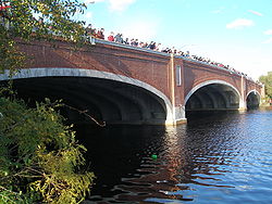
Eliot Bridge
The Eliot Bridge is a bridge over the Charles River between Cambridge, Massachusetts and Allston, Boston, Massachusetts. It connects Soldiers Field Road in Allston with Gerry's Landing Road, Memorial Drive, Greenough Boulevard, and the Fresh Pond Parkway in Cambridge.The bridge was built in 1950...
is a Historic District. The portions of the Charles River above the Watertown Dam
Watertown Dam
The Watertown Dam spans the Charles River upstream from the Watertown Bridge near Watertown Square in the Town of Watertown, Massachusetts where the Charles River tidal estuary ends. Watertown Dam is of earthen construction, a gravity dam. Its length is . Its capacity is . Normal storage is...
are managed as the Upper Charles River Reservation
Upper Charles River Reservation
The Upper Charles River Reservation is a Massachusetts state park encompassing portions of the banks of the Charles River between the Watertown Dam in Watertown and Riverdale park in the West Roxbury neighborhood of Boston. The park is managed by the state Department of Conservation and Recreation...
.
Features of the park include the Charles River Dam, the Charles River Basin and Esplanade, and John F. Kennedy
John F. Kennedy
John Fitzgerald "Jack" Kennedy , often referred to by his initials JFK, was the 35th President of the United States, serving from 1961 until his assassination in 1963....
Park, a small memorial park to the late president
President of the United States
The President of the United States of America is the head of state and head of government of the United States. The president leads the executive branch of the federal government and is the commander-in-chief of the United States Armed Forces....
.
Charles River Dam
The 1978 Charles River DamCharles River Dam
The Charles River Dam is a flood control structure on the Charles River in Boston, Massachusetts, located just downstream of the Leonard P. Zakim Bunker Hill Memorial Bridge, near Lovejoy Wharf, on the former location of the Warren Bridge.-History:...
, located behind the TD Garden, controls the water level in the river basin. An earlier dam (see Charles River Dam Bridge
Charles River Dam Bridge
The Charles River Dam Bridge, officially the Craigie Bridge, also called Craigie's Bridge or the Canal Bridge, is a six-lane bascule bridge across the Charles River, connecting Leverett Circle in downtown Boston, to Monsignor O'Brien Highway in East Cambridge, Massachusetts...
), located beneath the Museum of Science
Museum of Science, Boston
The Museum of Science is a Boston, Massachusetts landmark, located in Science Park, a plot of land spanning the Charles River. Along with over 500 interactive exhibits, the Museum features a number of live presentations throughout the building every day, along with shows at the Charles Hayden...
, was completed in 1910 with the purpose of creating a fresh water river basin and riverfront park in Boston. The newly landscaped banks of the river became known as the Charles River Esplanade. The modern dam houses six pumps that provide flood control protection. The dam's lock system permits travel of recreational and commercial vessels from the river to the harbor year round. A fish ladder
Fish ladder
A fish ladder, also known as a fishway, fish pass or fish steps, is a structure on or around artificial barriers to facilitate diadromous fishes' natural migration. Most fishways enable fish to pass around the barriers by swimming and leaping up a series of relatively low steps into the waters on...
allows for passage of anadromous fish
Fish
Fish are a paraphyletic group of organisms that consist of all gill-bearing aquatic vertebrate animals that lack limbs with digits. Included in this definition are the living hagfish, lampreys, and cartilaginous and bony fish, as well as various extinct related groups...
(alewife
Alewife
The alewife is a species of herring. There are anadromous and landlocked forms. The landlocked form is also called a sawbelly or mooneye...
, rainbow smelt
Rainbow smelt
The rainbow smelt, Osmerus mordax, is an anadromous species of fish of the family Osmeridae. The distribution of Osmerus mordax is circumpolar. The rainbow smelt was introduced to the Great Lakes, and from there has made its way to various other places. Walleye, trout, and other larger fish prey on...
and shad
Shad
The shads or river herrings comprise the genus Alosa, fish related to herring in the family Clupeidae. They are distinct from others in that family by having a deeper body and spawning in rivers. The several species frequent different areas on both sides of the Atlantic Ocean, Mediterranean Sea....
) during the migration season in late spring.
Charles River Basin and Esplanade
Created in the early 20th-century from tidal marshesSalt marsh
A salt marsh is an environment in the upper coastal intertidal zone between land and salt water or brackish water, it is dominated by dense stands of halophytic plants such as herbs, grasses, or low shrubs. These plants are terrestrial in origin and are essential to the stability of the salt marsh...
and mud flats, the Charles River Basin was designed to provide city dwellers access to outstanding river scenery and recreational opportunities on both water and land. Though entirely designed—and in that sense artificial—the Basin is also a wildlife
Wildlife
Wildlife includes all non-domesticated plants, animals and other organisms. Domesticating wild plant and animal species for human benefit has occurred many times all over the planet, and has a major impact on the environment, both positive and negative....
habitat
Habitat (ecology)
A habitat is an ecological or environmental area that is inhabited by a particular species of animal, plant or other type of organism...
for hundreds of animal and plant species that play a role in the ecology of the region and enrich the experience of urban park users. Water quality in the once heavily polluted Basin has improved dramatically in recent years, creating better habitat for wildlife and attracting people back to the river.
The character of the Basin changes along this 8.5 miles (13.7 km) stretch, forming three discernible zones: the Lower Basin, from the historic Charles River Dam to the Boston University Bridge
Boston University Bridge
The Boston University Bridge , and commonly referred to as the BU Bridge, is a steel truss bridge with a suspended deck carrying Route 2 over the Charles River, connecting Boston to Cambridge, Massachusetts. According to the American Association of State Highway and Transportation Officials route...
; the Middle Basin, from the BU Bridge to Herter Park, and the Upper Basin, from Herter Park to the Watertown Dam. The Lower Basin is 2.5 miles (4 km) long and up to 2000 feet (609.6 m) wide. The panoramas in the Lower Basin define the image of Boston and Cambridge. The Longfellow Bridge
Longfellow Bridge
The Longfellow Bridge, also known to locals as the "Salt-and-Pepper Bridge" or the "Salt-and-Pepper-Shaker Bridge" due to the shape of its central towers, carries Route 3 and the Massachusetts Bay Transportation Authority's Red Line across the Charles River to connect Boston's Beacon Hill...
is a powerful presence in the Lower Basin, as are the slope of Beacon Hill
Beacon Hill, Boston, Massachusetts
Beacon Hill is a historic neighborhood of Boston, Massachusetts, that along with the neighboring Back Bay is home to about 26,000 people. It is a neighborhood of Federal-style rowhouses and is known for its narrow, gas-lit streets and brick sidewalks...
and the gold dome of the State House
Massachusetts State House
The Massachusetts State House, also known as the Massachusetts Statehouse or the "New" State House, is the state capitol and house of government of the Commonwealth of Massachusetts. It is located in Boston in the neighborhood Beacon Hill...
. Particular park sections within the Reservation, such as Magazine Beach and Herter Park, provide intensely used open space for the bordering urban neighborhoods.
The Middle Basin is a zone of transition from urban and formal to rural and natural. Parkways lining the Charles River Basin separate it from contiguous open spaces. The largest open space is between the Harvard University
Harvard University
Harvard University is a private Ivy League university located in Cambridge, Massachusetts, United States, established in 1636 by the Massachusetts legislature. Harvard is the oldest institution of higher learning in the United States and the first corporation chartered in the country...
athletic fields on the south and Mount Auburn
Mount Auburn Cemetery
Mount Auburn Cemetery was founded in 1831 as "America's first garden cemetery", or the first "rural cemetery", with classical monuments set in a rolling landscaped terrain...
and Cambridge cemeteries on the north. Together, these areas form a critical oasis for migrating birds.
History
Frederick Law OlmstedFrederick Law Olmsted
Frederick Law Olmsted was an American journalist, social critic, public administrator, and landscape designer. He is popularly considered to be the father of American landscape architecture, although many scholars have bestowed that title upon Andrew Jackson Downing...
's 1889 design for Charlesbank included the first public outdoor gym
Gym
The word γυμνάσιον was used in Ancient Greece, that mean a locality for both physical and intellectual education of young men...
nasium in the United States. The Esplanade, then known as the Boston Embankment, was created along with the construction of the 1910 Charles River Dam
Charles River Dam
The Charles River Dam is a flood control structure on the Charles River in Boston, Massachusetts, located just downstream of the Leonard P. Zakim Bunker Hill Memorial Bridge, near Lovejoy Wharf, on the former location of the Warren Bridge.-History:...
(today the site of the Museum of Science). The parkland was criticized for its lack of shade trees, refreshment stands, recreation facilities, transportation utility, and visitors. It extended to Charlesgate (upstream of the Harvard Bridge) and connected with Olmsted's Emerald Necklace. To address criticism, trees, a refreshment pavilion, and concerts were brought to the park.
The Esplanade went through a major expansion from 1928 to 1936, widening and lengthening the park land. These improvements were aided by a one million dollar donation from Helen Osbourne Storrow
Helen Storrow
Helen Osborne Storrow was a prominent American philanthropist, early Girl Scout leader, and chair of the World Committee of the World Association of Girl Guides and Girl Scouts for eight years...
, in memory of her husband James
James J. Storrow
James Jackson Storrow II was a Boston-area investment banker instrumental in forming General Motors and its third president . He was a business partner of Henry Lee Higginson, founder of the Boston Symphony Orchestra...
. The Storrow Memorial Embankment, designed by Arthur Shurcliff added beaches, the first lagoon
Lagoon
A lagoon is a body of shallow sea water or brackish water separated from the sea by some form of barrier. The EU's habitat directive defines lagoons as "expanses of shallow coastal salt water, of varying salinity or water volume, wholly or partially separated from the sea by sand banks or shingle,...
, boat landings, plazas, playgrounds, and the Music Oval, where a temporary bandshell was placed. The summer of 1929 was the first year Arthur Fiedler
Arthur Fiedler
Arthur Fiedler was a long-time conductor of the Boston Pops Orchestra, a symphony orchestra that specializes in popular and light classical music. With a combination of musicianship and showmanship, he made the Boston Pops one of the best-known orchestras in the country...
and the Boston Pops performed on the Esplanade.
In 1941, the construction of the Hatch Memorial Shell gave the Pops, and a wide range of other artists and performers, a first class stage for popular summer events. In the 2000s, half a million people attend the Boston Pops concert and fireworks display held there every Independence Day
Independence Day (United States)
Independence Day, commonly known as the Fourth of July, is a federal holiday in the United States commemorating the adoption of the Declaration of Independence on July 4, 1776, declaring independence from the Kingdom of Great Britain...
. The Hatch Shell also hosts more than seventy free public concerts and movies, and special events—walkathons, races, and festivals such as Earth Day
Earth Day
Earth Day is a day that is intended to inspire awareness and appreciation for the Earth's natural environment. The name and concept of Earth Day was allegedly pioneered by John McConnell in 1969 at a UNESCO Conference in San Francisco. The first Proclamation of Earth Day was by San Francisco, the...
—draw hundreds of thousands of additional spectators each year.
Sailing on the Charles began in the 1930s, and the boathouse on the Esplanade was built in 1941. Organized in 1946, Community Boating
Community Boating, Inc
Community Boating, Inc. is a private not-for-profit corporation run in association with the Massachusetts Department of Conservation and Recreation. Organized as a company in 1946, it is the oldest continuously operating community sailing program in the United States. It is located in Boston along...
was the country's first public boating program. For a modest fee, thousands of people have learned to sail on the Charles River. For those who prefer rowing, Community Rowing, located at Harry Parker Boathouse on Nonantum Broad in Brighton, offers instruction to the public.
The next major change to the Esplanade began in 1949, with the construction of Storrow Drive
Storrow Drive
Storrow Drive is a major cross town expressway in Boston, Massachusetts, running south and west from Leverett Circle along the Charles River. It is a parkway—it is restricted to cars; trucks and buses are not permitted on it...
. To make up for park land lost to the new road, additional islands including multiple paths were built along the Esplanade, also designed by Arthur Shurcliff and his son Sydney. In the 1960s, the Esplanade was linked to Herter Park in Brighton, and other upstream parks, with the construction of the Dr. Paul Dudley White Bike Path. This 18 miles (29 km) loop travels along the entire basin on both the North and South sides of the river, and makes it especially suitable for biking, inline skating
Inline skating
Inline skating is a recreational sport practiced widely internationally. Inline skates typically have 2 to 5 polyurethane wheels, arranged in a single line. The in-line design allows for greater speed than roller skates and better maneuverability...
, and running
Running
Running is a means of terrestrial locomotion allowing humans and other animals to move rapidly on foot. It is simply defined in athletics terms as a gait in which at regular points during the running cycle both feet are off the ground...
.
John F. Kennedy Park
Harvard Square
Harvard Square is a large triangular area in the center of Cambridge, Massachusetts, United States, at the intersection of Massachusetts Avenue, Brattle Street, and John F. Kennedy Street. It is the historic center of Cambridge...
is landscaped with plants that bloom at the time of the President's May birthday
Birthday
A birthday is a day or anniversary where a person celebrates his or her date of birth. Birthdays are celebrated in numerous cultures, often with a gift, party or rite of passage. Although the major religions celebrate the birth of their founders , Christmas – which is celebrated widely by...
and a memorial fountain
Fountain
A fountain is a piece of architecture which pours water into a basin or jets it into the air either to supply drinking water or for decorative or dramatic effect....
. The park uses materials indigenous to New England
New England
New England is a region in the northeastern corner of the United States consisting of the six states of Maine, New Hampshire, Vermont, Massachusetts, Rhode Island, and Connecticut...
including native trees, and the granite
Granite
Granite is a common and widely occurring type of intrusive, felsic, igneous rock. Granite usually has a medium- to coarse-grained texture. Occasionally some individual crystals are larger than the groundmass, in which case the texture is known as porphyritic. A granitic rock with a porphyritic...
fountain and the entrance pillars are inscribed with quotations from the President's speeches.
Riverbend Park
Riverbend Park extends on the north side of the Charles, from the Eliot BridgeEliot Bridge
The Eliot Bridge is a bridge over the Charles River between Cambridge, Massachusetts and Allston, Boston, Massachusetts. It connects Soldiers Field Road in Allston with Gerry's Landing Road, Memorial Drive, Greenough Boulevard, and the Fresh Pond Parkway in Cambridge.The bridge was built in 1950...
to Western Ave. in Cambridge. Memorial Drive here is closed to automobile traffic on Sundays during warmer months.
Recreational opportunities
- Charles River Bike PathCharles River Bike PathThe Charles River Bike Path is a mixed-use path in the Boston, Massachusetts area. It follows both shores of the Charles River from Boston, Massachusetts to Norumbega Park in Newton, passing through Watertown and Waltham...
s - Boat ramp
- Boat tours
- Canoeing
- Concerts
- Exercise area
- Ice skating
- Picnicking
- Playing fields
- Rowing
- Sailing, e.g. with rental from Community Boating, IncCommunity Boating, IncCommunity Boating, Inc. is a private not-for-profit corporation run in association with the Massachusetts Department of Conservation and Recreation. Organized as a company in 1946, it is the oldest continuously operating community sailing program in the United States. It is located in Boston along...