

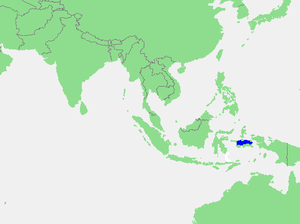
. It is a section of the Pacific Ocean
with an area of approximately 12,000 square kilometers located between Buru
and Seram
, which are two of the islands once called the South Moluccas
. These islands are the native habitat of plants long coveted for their use as spice
s, such as nutmeg
, clove
s, and black pepper
corns, and the seas surrounding them were busy shipping routes. The Ceram Sea is also the habitat of several species of tropical goby
and many other fish. Like many other small Indonesian seas, the Ceram Sea is rocky and very tectonically
active.
Extent
The International Hydrographic Organization(IHO) defines the Ceram Sea as being one of the waters of the East Indian Archipelago
. The IHO defines its limits as follows:
On the North and Northeast. A line from Tanjong Dehekolano, the Eastern extreme of the Soela[ SulaSula IslandsThe Sula Islands are a group of islands in North Maluku in Indonesia. Its three main islands are Mangole, Sanae and Taliabu, with smaller islands Lifamatola and Seho. It is administered as Kepulauan Sula Regency...] Islands to the Western extreme of Obi Major, along its Southern coast to Tanjong Seranmaloleo its Eastern extreme, thence through Tobalai, Kekek, Pisang and KofiauKofiauKofiau is an island in the Raja Ampat Islands, in West Papua, Indonesia. The island is primarily raised coral limestone with some volcanic hills, covered in low forest. The island is home to the endemic Kofiau Paradise Kingfisher and Black-backed Monarch....
Islands to Tanjong Sele (1°26′S 130°55′E), the Western point of New GuineaNew GuineaNew Guinea is the world's second largest island, after Greenland, covering a land area of 786,000 km2. Located in the southwest Pacific Ocean, it lies geographically to the east of the Malay Archipelago, with which it is sometimes included as part of a greater Indo-Australian Archipelago...
, down the coast to Karoefa (3°51.5′S 133°27′E).
On the Southeast. A line from Karoefa, New Guinea, to the Southeastern extreme of Adi Island, thence to Tg. Borang, the Northern point of Noehoe Tjoet
[ Kai BesarKai BesarKai Besar is one of the Kai Islands which are part of the Maluku Islands, Indonesia. Its area is 550 km². The other main island in the Kai Islands group is Kai Kecil . The northern tip is called Tanjung Borang, and southern tip called Tanjung Weduar....] (5°17′S 133°09′E).
On the Southwest and South. From the Northern point of Noehoe Tjoet (Groot Kai) through the Watoebela
Watubela archipelagoWatubela is an archipelago in the Maluku Islands, east of Ceram and north of Kai Islands, and southwest of Bomberai Peninsula of Papua, Indonesia. It includes islands Kasiui and Tioor.-External links:*...
and Gorong IslandsGorong archipelagoGorong archipelago is between Watubela archipelago and Ceram in the Molucca Islands....
to the Southeastern extreme of CeramSeramSeram is an island in the Maluku province of Indonesia. It is located north of Ambon Island. The chief port/town is Masohi.- Geography and geology :...
, along its Northern shore to Tanjong Tandoeroe Besar, the Northwest point, thence a line to Tanjong Batoe Noeham, the Northern extreme of Boeroe[ BuruBuruBuru is the third largest island within Maluku Islands of Malay Archipelago. It lies between the Banda Sea to the south and Seram Sea to the north, west of Ambon and Seram islands. The island belongs to Maluku province of Indonesia and includes the Buru and South Buru regencies...] , and along the coast to Tanjong Palpetoe, the Northwest point of the Island.
On the West. A line from Tanjong Palpetoe to Tanjong Waka, the Southern point of Sanana
Sanana IslandSanana is an island, part of Sula Islands which is part of Maluku Islands in Indonesia. It is also the name of that island's largest settlement, home to the Dutch era fort Benteng De Verlachting....
, through this island to its Northern point, thence across the Mangoli Strait to the South coast of MangoliMangole IslandMangole is a large island in the Sula Islands, which again are part of Maluku Islands in Indonesia. It is located at , east of Taliabu Island and north of Sanana Island. About 38,000 people live on the island of Mangole. Its economy is dominated by the timber industry.- Notes : from BBC News, 30...
(Soela Islands) in [1°56′S 125°55′E].
Further reading
- Fairbridge, R. E. (1966). The Encyclopedia of Oceanography. New York: Halsted.
- Wang, James C. F. (1992). Handbook on Ocean Politics and Law. New York: Greenwood Press.