
Ceará
Encyclopedia
Ceará is one of the 27 states of Brazil
, located in the northeastern part of the country, on the Atlantic
coast. It is currently the 8th largest Brazilian State by population and the 17th by area. It is also one of the main touristic destinations in Brazil
. The state capital is the city of Fortaleza
.
Literally, the name Ceará means "sings the jandaia
". According to José de Alencar
, one of the most important writers of Brazil and an authority in native languages, Ceará is composed of cemo – to sing aloud, to claim – , and ara – little
parakeet in a native language. There are also theories that the state name would derive from Siriará, a reference to the crab
s from the seashore.
The state is best known for its extensive coastline, with 573 kilometres (356 mi) of sand. There are also mountains and valleys producing tropical fruits. To the south, on the border of Paraíba
, Pernambuco
and Piauí
, is the National Forest
of Araripe
.
, on the east by the states of Rio Grande do Norte
and Paraíba
, on the south by Pernambuco
state, and on the west by Piauí
.
Ceará lies partly upon the northeast slope of the Brazilian Highlands
, and partly upon the sandy coastal plain. Its surface is a succession of great terraces, facing north and northeast, formed by the denudation of the ancient sandstone plateau which once covered this part of the continent; the terraces are seamed by watercourses, and their valleys are broken by hills and ranges of highlands. The latter are the remains of the ancient plateau, capped with horizontal strata of sandstone, and having a remarkably uniform altitude of 2000 to 2400 ft (731.5 m) The flat top of such a range is called a chapada or taboleira, and its width in places is from 32 to 56 miles (90.1 km). The boundary line with Piauí follows one of these ranges, the Serra de Ibiapaba
, which unites with another range on the southern boundary of the state, known as the Serra do Araripe. Another range, or escarpment, crosses the state from east to west, but is broken into two principal divisions, each having several local names. These ranges are not continuous, the breaking down of the ancient plateau having been irregular and uneven.
The rivers of the state are small and, with one or two exceptions, become completely dry in the dry season. The largest is the Jaguaribe
, which flows entirely across the state in a northeast direction.
Ceará has a varied environment, with mangrove
s, caatinga
, jungle
, scrubland and tropical forest
. The higher ranges intercept considerable moisture from the prevailing trade winds, and their flanks and valleys are covered with a tropical forest
which is typical of the region, gathering species from tropical forests, caatinga
and cerrado
. The less elevated areas of the plateaus are either thinly wooded or open campo. Most of the region at the lower altitudes is characterized by scrubby forests called caatingas, which is an endemic Brazilian vegetation. The sandy, coastal plain, with a width of 12 to 18 miles (29 km), is nearly bare of vegetation, although the coast has many enclaves of restingas
forests and mangroves.
The soil is, in general, thin and porous and does not retain moisture, consequently the long, dry season turns the country into a barren desert, relieved only by vegetation along the riverways and mountain ranges, and by the hardy, widely distributed Carnauba Palm (Copernicia cerifera), which in places forms groves of considerable extent. Some areas in the higher ranges of Serra da Ibiapaba, Serra do Araripe and others are more appropriate to agriculture as its soil and vegetation are less affected by the dry seasons.
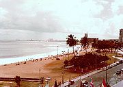
The endless stretch of beaches in the state is a major tourist attraction. Ceará has several famous beaches such as Canoa Quebrada
, Jericoacoara, Morro Branco
, Taíba and Flexeiras
. The beaches are divided into two groups (in relation to the capital Fortaleza
): Sunset Coast (Costa do Sol poente) and Sunrise Coast (Costa do Sol nascente).
The year is divided into a rainy and dry season, the rains beginning in January to March and lasting until June. The dry season, July to December, is sometimes broken by slight showers in September and October, but these are of very slight importance. This environment and temperature attracts many tourists
, especially ecotourists
. The climate is hot almost all year round. The temperature in the state varies from 22 °C to 36 °C with the lowest temperatures not being typical in the capital Fortaleza
but in the numerous mountains in the state.
Sometimes the rains fail altogether, and then a drought ("seca") ensues, causing famine and pestilence throughout the entire region. The most destructive droughts recorded in the 18th and 19th centuries were those of 1711, 1723, 1777–1778, 1790, 1825, 1844–1845, and 1877–1878, the last-mentioned (known by local people as "a Grande Seca", "the Great Drought") destroying nearly all the livestock in the state, and causing the death through starvation and pestilence of nearly half a million people, or over half the population. Because of the constant risk of droughts, nowadays there are lots of dams (called "açudes") throughout Ceará, the largest of them being the Açude Castanhão. Thanks to the dams, the Jaguaribe River
doesn't become completely dry anymore.

.jpg)
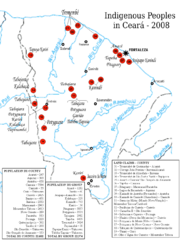 The territory of Ceará was originally inhabited for different Indians people, like Tabajara, Potyguara, Anacés, Kariri, Inhamum, Jucá, Kanindé, Tremembé, Paicaú, etc, and they had commercial activities with other European’ people like de French, before the Portuguese’ plans to this Brazilians’ area.
The first Portuguese crown' plan to inabitagranted Ceará dated from 1534, but the first attempts to settle the territory failed, and the earliest Portuguese settlement was made near the mouth of the Ceará River in 1604, by Pero Coelho de Sousa. His has make the Fortress São Tiago, but one year late his and his family abounded Ceará because the period of drought
. The drought was and is one natural phenomenon in Ceará and the Portuguese didn’t know to survive with the drought.
Portugal wanted to form a military base in Ceará to support the Portuguese operations in the war against the French. The first attempt with Pero Coelho de Sousa in 1603, was not successful, and the French continued operating from Maranhão
and Ibiapaba
, where they had established a base in 1590. The Indians and French formed political and military alliances. In 1607, two Jesuits, Francisco Pinto and Pereira Figueira, arrived in Ceará with a mission to spy in the area of Ibiapaba. In October, that year Franciso Pinto was killed by the Indians and Pereira Filgueira returned with more information about the area and the French and Indian alliance.
The successfully military to banish the French out Ceará and Maranhão, it was possible in 1612 with the command from the Portuguese Martim Soares Moreno
. In the same Yyar his construed the Fortress São Sebastião at the same place from the Fortress São Tiago, and one year later his left Ceará to Portugal. Only in 1618, Martim Soares Moreno returned to Ceará and from this moment the Portuguese presence at Ceará was successfully. The Portuguese presence in Ceará was successfully, but at was restricted at oeuvre form Ceará rivier, Martim Soares Moreno has made one alliance with the Indianans fron Potiguara tribe. In 1631, Martim Soares Moreno left Ceará to help the Portuguese against the Dutch in Pernambuco and the Fortress São Sebastião lost his importance in the contest from Portugal.
At this time, what is today Brazil was hotly contested by the Dutch
and the Portuguese. The area was invaded twice by the Dutch, in 1637 and in 1649. In 1637, the Dutch and the Indians took the Fort of São Sebastião and dominated Ceará. The Dutch has expand his presence in Ceará and they made alliances with different Indian’ tribes. In 1639, Georg Marcgrave
has been in Ceará for one expedition. But in 1644 the Indians fight the Dutch, ane Gideon Morris, the Dutch Governor to Ceará, and the Dutch soldiers are killed, and Fortress São Sebastião is destroyed.
Between 1644 and 1649, the presence of Europeans was zero. But in 1649, before the negotiations with different Indian’ tribes of Ceará, Matias Beck is arrived in Ceará to explore silver mines from Maranguape
. One good silver has been never found, but in this period the Dutch built another fort, by the banks of river Pajeú, and called it Fort Schoonenborch. In 1654, the Dutch are expelled from Brazil; the Portuguese take Schoonenborch, change its name to Fortaleza de Nossa Senhora de Assunção (Fortress of Our Lady of Assumption), and the different Indian’ tribes that make alliance with the Dutch have to escape from the Portuguese persecution.
Before being defeated, however, the Dutch founded what is today Fortaleza where they constructed Fort Schoonenburg, so named after one of their commanders. In 1661, the Netherlands formally ceded their Brazilian territories to the Portuguese crown, ending conflict in the region. Ceará became a dependency of Pernambuco
in 1680; this relationship lasted until 1799, when the Captaincy of Ceará was made independent.
The fight for Brazilian independence in 1822 was fierce in Ceará, with the area being a rebel stronghold that incurred vicious retribution from loyalists. The captaincy became a province in 1822 under Dom Pedro I. A revolution followed in 1824, the president of the province was deposed fifteen days after his arrival, and a republic was proclaimed. Internal dissensions immediately broke out, the new president was assassinated, and after a brief reign of terror the province resumed its allegiance to the empire. Ceará was one of the first provinces of Brazil to abolish slavery.
The reign of Dom Pedro II (see Empire of Brazil) saw great advances in infrastructure
in Ceará, with the commerce increasing by a large amount, and with gas
lighting becoming almost ubiquitous.
The state of Ceara became a bishopric of the Roman Catholic Church in 1853, the bishop residing at Fortaleza.
Two railway lines running inland from the coast (the Baturité line from Fortaleza to Senador Pompeu, 179 miles (288.1 km), and the Sobral line from the port of Camocim to Ipu, 134 miles) by the national government after the drought of 1877–1878 to give work to the starving refugees, and were later operated under leases. Dams were also begun for irrigation purposes.
The population numbered 805,687 in 1890, and 849,127 in 1900. In 1900 approximately five-sixths of the population lived on estates, owned no property, paid no taxes, and derived few benefits from the social and political institutions about them. Education was then confined almost exclusively to the upper classes, from which came some of the most prominent men in Brazilian politics and literature.
In the early 20th century the sandy zone along the coast was nearly barren, but the more elevated region behind the coast with broken surfaces and sandy soil produced fruit and most tropical products when conditions are favourable. The natural vegetable production was important, and included manigoba or Ceara rubber, carnahuba wax and fibre, caju wine and ipecacuanha. The principal agricultural products were cotton, coffee, sugar, mandioca and tropical fruits. The production of cotton increased largely with the development of cotton manufactures in Brazil.
The higher plateau was devoted almost exclusively to cattleraising, once the principal industry of the state, although recurring droughts created an obstacle to its profitable development. The state exported considerable amounts of cattle, hides and skins.
Since 1960, the Orós Dam, comparable in size to the Aswan Dam
has supplied Ceará with much of its water, and in 1995 construction began on the enormous Castanhão Dam, completed in 2003, which is able to hold 6.5 km³ of water.
of 2008, there were 8,472,000 people residing in the state. The population density was 55.2 inh./km².
Urbanization
: 76.4% (2006); Population growth
: 1.7% (1991–2000); House
s: 2,181,000 (2006).
The last PNAD (National Research for Sample of Domiciles) census revealed the following numbers: 5,370,000 Brown (Multiracial) people (63.39%), 2,800,000 White
people (33.05%), 257,000 Black
people (3.03%), 28,000 Asian
people (0.33%), 12,000 Amerindian
people (0.14%).
Mobile phone
s: 3.5 million (April/2007); Telephone
s: 908 thousand (April/2007); Cities: 184 (2007).
represents 5.4% of GDP (2004). Ceará exports: leather
footwear
20.3%, crustacean
s 17.6%, woven
of cotton
16.9%, cashew
14.7%, leather
13.1%, fruit
s , juice
s and honey
5.4% (2002). It is one of only three Brazilian states which together produce the world's entire supply of carnauba wax.
Share of the Brazilian economy: 2,04% (2010).
According to the data from IPECE and IBGE
, the GDP in Ceará reached RS$ 75 billions (about US$ 44 billions) in 2010. The economic growth of the State in 2010 was of 7.9%, higher than the average growth in Brazil, which was of 7.5%. The GDP has grown 6.47% in average in the period 2007-2010.
Traditionally an agriculture
-based state, Ceará began an industrialisation
program under the military regime (1964–1985), and the industrial sector continues to expand annually. In 1999, industry
accounted for 39.3% of the state's GDP
. Tourism also plays a large role in Ceará's economy, with the state's many waterfall
s, beach
es and rainforest
s. On average, Fortaleza
alone receives half a million tourists annually.
 There are more than 53 higher education institutions in the state of Ceará
 The state has several tourist attractions but is famous for its eco-tourism capabilities with hundreds of nearly deserted beaches and sand dunes. Besides the famous coast, Ceará has also a big tourist potential in the countryside, with the rainforests and waterfalls of the Highlands (such as Ibiapaba, Araripe, Meruoca and Guaramiranga) and some semi-arid regions which are ideal for tourists who like extreme sports
and adventure, especially the town of Quixadá
, a famous spot for paragliding
, hang gliding
and climbing
. The city of Santana do Cariri, in the more elevated areas of Serra do Araripe, is also noted for its great paleontological importance, being the place of major searches and discoveries (including a new species of dinosaur, the Santanaraptor placidus).
Fortaleza
's international airport (named Pinto Martins airport) is well served by international flights from North
and Central America
as well as Europe
.
The beach of Cumbuco
, located in the municipality of Caucaia
(neighbour to Fortaleza), is considered one of the best places in the world for the practicing of kitesurfing
.
Main Tourist Attractions
is situated in Fortaleza. The passenger terminal is air conditioned and has four levels. The basement level has parking for 1,000 cars as well as automatic teller machines and a stop for regular city buses.
The ground level has 31 check-in counters, airline offices, car rental agencies, special tourist information, a juvenile court bureau to facilitate travel of minors, a National Civil Aviation Agency
(ANAC) office, information counter, passenger arrival area and access to two taxi stops.
The second level contains shops, a food court
and domestic and international boarding lounges. The top floor has a beer garden and panoramic deck overlooking the maneuvering apron with a view of the Fortaleza skyline
. The apron is 152,857 square meters and can accommodate 14 aircraft at once in pre-established positions (“boxes”).
The scheduled airlines operating out of Fortaleza are Cabo Verde Airlines, TAP, Delta Air Lines, Gol, TAM, Webjet, OceanAir and TAF. The airport also frequently receives domestic and international charter flights. The passenger terminal, opened in 1998, was designed to have a useful life of 50 years. The former terminal, called the General Aviation Terminal, is now used for general aviation and the fire brigade. The control tower
is located alongside.
Construction of a cargo terminal is the next big step planned by Infraero
. The new terminal will have roughly eight thousand square meters, boosting the cargo storage and handling capacity fourfold. Plans then call for the new terminal to be integrated with highway and railroad links.
 Highways in Ceará include:
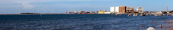 The Port of Pecem
is the other big port facility in the state, located in the municipality of São Gonçalo do Amarante
, about 60 kilometers from Fortaleza.
, is soccer. The Championship of Ceará has its main games in Fortaleza. There are several association football (soccer) clubs, such as Ceará SC
, Fortaleza EC
and Ferroviário AC
. Strong winds make the Praia do Futuro an excellent place for nautical sports, and Fortaleza hosts world competitions of surfing
, windsurfing
and kitesurfing
. Fortaleza appears to have a culture conducive to the production of high-level athletes in combat sports, as evidenced by several Fortalezans' recent success in mixed martial arts.
Fortaleza
will be one of the host cities of 2014 FIFA World Cup
.
.
Brazil
Brazil , officially the Federative Republic of Brazil , is the largest country in South America. It is the world's fifth largest country, both by geographical area and by population with over 192 million people...
, located in the northeastern part of the country, on the Atlantic
Atlantic Ocean
The Atlantic Ocean is the second-largest of the world's oceanic divisions. With a total area of about , it covers approximately 20% of the Earth's surface and about 26% of its water surface area...
coast. It is currently the 8th largest Brazilian State by population and the 17th by area. It is also one of the main touristic destinations in Brazil
Brazil
Brazil , officially the Federative Republic of Brazil , is the largest country in South America. It is the world's fifth largest country, both by geographical area and by population with over 192 million people...
. The state capital is the city of Fortaleza
Fortaleza
Fortaleza is the state capital of Ceará, located in Northeastern Brazil. With a population close to 2.5 million , Fortaleza is the 5th largest city in Brazil. It has an area of and one of the highest demographic densities in the country...
.
Literally, the name Ceará means "sings the jandaia
Aratinga
Aratinga is a genus of American parakeets. They belong to the long-tailed group and are among the genera often called conures in aviculture. Most are predominantly green, although a few are predominantly yellow or orange. They are social and commonly seen in groups in the wild...
". According to José de Alencar
José de Alencar
José Martiniano de Alencar was a Brazilian lawyer, politician, orator, novelist and dramatist. He is one of the most famous writers of the first generation of Brazilian Romanticism, writing historical, regionalist and Indianist romances — being the most famous The Guarani...
, one of the most important writers of Brazil and an authority in native languages, Ceará is composed of cemo – to sing aloud, to claim – , and ara – little
parakeet in a native language. There are also theories that the state name would derive from Siriará, a reference to the crab
Crab
True crabs are decapod crustaceans of the infraorder Brachyura, which typically have a very short projecting "tail" , or where the reduced abdomen is entirely hidden under the thorax...
s from the seashore.
The state is best known for its extensive coastline, with 573 kilometres (356 mi) of sand. There are also mountains and valleys producing tropical fruits. To the south, on the border of Paraíba
Paraíba
Paraíba Paraíba Paraíba (Tupi: pa'ra a'íba: "bad to navigation"; Brazilian Portuguese pronunciation: is a state of Brazil. It is located in the Brazilian Northeast, and is bordered by Rio Grande do Norte to the north, Ceará to the west, Pernambuco to the south and the Atlantic Ocean to the east...
, Pernambuco
Pernambuco
Pernambuco is a state of Brazil, located in the Northeast region of the country. To the north are the states of Paraíba and Ceará, to the west is Piauí, to the south are Alagoas and Bahia, and to the east is the Atlantic Ocean. There are about of beaches, some of the most beautiful in the...
and Piauí
Piauí
Piauí is one of the states of Brazil, located in the northeastern part of the country.Piauí has the shortest coastline of any of the non-landlocked Brazilian states at 66 km , and the capital, Teresina, is the only state capital in the north east to be located inland...
, is the National Forest
Forest
A forest, also referred to as a wood or the woods, is an area with a high density of trees. As with cities, depending where you are in the world, what is considered a forest may vary significantly in size and have various classification according to how and what of the forest is composed...
of Araripe
Araripe
Araripe is a town and municipality in the state of Ceará in the Northeast region of Brazil.-References:...
.
Geography
Ceará has an area of 148,016 km². It is bounded on the north by the Atlantic OceanAtlantic Ocean
The Atlantic Ocean is the second-largest of the world's oceanic divisions. With a total area of about , it covers approximately 20% of the Earth's surface and about 26% of its water surface area...
, on the east by the states of Rio Grande do Norte
Rio Grande do Norte
Rio Grande do Norte is one of the states of Brazil, located in the northeastern region of the country, occupying the northeasternmost tip of the South American continent. Because of its geographic position, Rio Grande do Norte has a strategic importance. The capital and largest city is Natal...
and Paraíba
Paraíba
Paraíba Paraíba Paraíba (Tupi: pa'ra a'íba: "bad to navigation"; Brazilian Portuguese pronunciation: is a state of Brazil. It is located in the Brazilian Northeast, and is bordered by Rio Grande do Norte to the north, Ceará to the west, Pernambuco to the south and the Atlantic Ocean to the east...
, on the south by Pernambuco
Pernambuco
Pernambuco is a state of Brazil, located in the Northeast region of the country. To the north are the states of Paraíba and Ceará, to the west is Piauí, to the south are Alagoas and Bahia, and to the east is the Atlantic Ocean. There are about of beaches, some of the most beautiful in the...
state, and on the west by Piauí
Piauí
Piauí is one of the states of Brazil, located in the northeastern part of the country.Piauí has the shortest coastline of any of the non-landlocked Brazilian states at 66 km , and the capital, Teresina, is the only state capital in the north east to be located inland...
.
Ceará lies partly upon the northeast slope of the Brazilian Highlands
Brazilian Highlands
The Brazilian Highlands or Brazilian Plateau are an extensive geographical region, covering most of the eastern, southern and central portions of Brazil, in all approximately half of the country's land area, or some 4,500,000 km²...
, and partly upon the sandy coastal plain. Its surface is a succession of great terraces, facing north and northeast, formed by the denudation of the ancient sandstone plateau which once covered this part of the continent; the terraces are seamed by watercourses, and their valleys are broken by hills and ranges of highlands. The latter are the remains of the ancient plateau, capped with horizontal strata of sandstone, and having a remarkably uniform altitude of 2000 to 2400 ft (731.5 m) The flat top of such a range is called a chapada or taboleira, and its width in places is from 32 to 56 miles (90.1 km). The boundary line with Piauí follows one of these ranges, the Serra de Ibiapaba
Serra de Ibiapaba
The Serra de Ibiapaba is an upland in northeastern Brazil, which lies on the boundary of Piauí and Ceará states. The range runs north and south, extending from near the Atlantic coast in the north to connect with the Serra do Araripe, which forms the southern boundary of Ceará...
, which unites with another range on the southern boundary of the state, known as the Serra do Araripe. Another range, or escarpment, crosses the state from east to west, but is broken into two principal divisions, each having several local names. These ranges are not continuous, the breaking down of the ancient plateau having been irregular and uneven.
The rivers of the state are small and, with one or two exceptions, become completely dry in the dry season. The largest is the Jaguaribe
Jaguaribe River
The Jaguaribe River is a highly seasonal river in Ceará state of northeastern Brazil. Two large dams were constructed across the Jaguaribe, the Orós Dam, completed in 1960, and the Castanhão Dam, completed in 2003. The Castanhão Dam flooded the city of Jaguaribara, which was rebuilt nearby as the...
, which flows entirely across the state in a northeast direction.
Ceará has a varied environment, with mangrove
Mangrove
Mangroves are various kinds of trees up to medium height and shrubs that grow in saline coastal sediment habitats in the tropics and subtropics – mainly between latitudes N and S...
s, caatinga
Caatinga
Caatinga is a type of vegetation, and an ecoregion characterized by this vegetation in the northeastern part of Brazil. The name "Caatinga" is a Tupi word meaning "white forest" or "white vegetation"...
, jungle
Jungle
A Jungle is an area of land in the tropics overgrown with dense vegetation.The word jungle originates from the Sanskrit word jangala which referred to uncultivated land. Although the Sanskrit word refers to "dry land", it has been suggested that an Anglo-Indian interpretation led to its...
, scrubland and tropical forest
Forest
A forest, also referred to as a wood or the woods, is an area with a high density of trees. As with cities, depending where you are in the world, what is considered a forest may vary significantly in size and have various classification according to how and what of the forest is composed...
. The higher ranges intercept considerable moisture from the prevailing trade winds, and their flanks and valleys are covered with a tropical forest
Caatinga enclaves moist forests
The Caatinga enclaves moist forests are a tropical moist forest ecoregion of northeastern Brazil, which forms a series of discontinuous, island-like enclaves in the dry Caatingas xeric shrubland and thorn forests and Cerrado savannas.-Setting:...
which is typical of the region, gathering species from tropical forests, caatinga
Caatinga
Caatinga is a type of vegetation, and an ecoregion characterized by this vegetation in the northeastern part of Brazil. The name "Caatinga" is a Tupi word meaning "white forest" or "white vegetation"...
and cerrado
Cerrado
The Cerrado, is a vast tropical savanna ecoregion of Brazil, particularly in the states of Gioas and Minas Gerais...
. The less elevated areas of the plateaus are either thinly wooded or open campo. Most of the region at the lower altitudes is characterized by scrubby forests called caatingas, which is an endemic Brazilian vegetation. The sandy, coastal plain, with a width of 12 to 18 miles (29 km), is nearly bare of vegetation, although the coast has many enclaves of restingas
Northeastern Brazil restingas
The Northeastern Brazil restingas are an ecoregion of northeastern Brazil. Restingas are coastal forests which form on sandy, acidic, and nutrient-poor soils, and are characterized by medium sized trees and shrubs adapted to the dry and nutrient-poor conditions found there.-Setting:The ecoregion...
forests and mangroves.
The soil is, in general, thin and porous and does not retain moisture, consequently the long, dry season turns the country into a barren desert, relieved only by vegetation along the riverways and mountain ranges, and by the hardy, widely distributed Carnauba Palm (Copernicia cerifera), which in places forms groves of considerable extent. Some areas in the higher ranges of Serra da Ibiapaba, Serra do Araripe and others are more appropriate to agriculture as its soil and vegetation are less affected by the dry seasons.
The endless stretch of beaches in the state is a major tourist attraction. Ceará has several famous beaches such as Canoa Quebrada
Canoa Quebrada
|thumb|right|200px|Canoa QuebradaCanoa Quebrada , known as the pearl of the east coast of Ceará, Brazil, is an international tourist beach resort 164 km from Fortaleza, in the municipality of Aracati....
, Jericoacoara, Morro Branco
Morro Branco
Morro Branco is a cape located in the northwest of the island of São Vicente nearly 3 km west of the island capital of Mindelo. The point is unaccessed with earthened road. The cape divides the Canal de São Vicente the Mindelo Bay and the rest of the Atlantic Ocean...
, Taíba and Flexeiras
Flexeiras
Flexeiras is a municipality located in the Brazilian state of Alagoas. Its population is 11,905 and its area is 316 km²....
. The beaches are divided into two groups (in relation to the capital Fortaleza
Fortaleza
Fortaleza is the state capital of Ceará, located in Northeastern Brazil. With a population close to 2.5 million , Fortaleza is the 5th largest city in Brazil. It has an area of and one of the highest demographic densities in the country...
): Sunset Coast (Costa do Sol poente) and Sunrise Coast (Costa do Sol nascente).
Climate
The climate is hot and humid on the coast, tempered by the cool trade winds; but in the more elevated, semi-arid regions it is very hot and dry (often above 35 °C, but seldom above 40 °C), although the nights are cool. However, in the higher ranges (Serra da Ibiapaba, Serra do Araripe and several less larger highlands) the temperatures are cooler and vary from about 14 °C to 34 °C (the record minimum temperature registered in Ceará took place in Jardim, a small city in Serra do Araripe: 8 °C).The year is divided into a rainy and dry season, the rains beginning in January to March and lasting until June. The dry season, July to December, is sometimes broken by slight showers in September and October, but these are of very slight importance. This environment and temperature attracts many tourists
Tourism
Tourism is travel for recreational, leisure or business purposes. The World Tourism Organization defines tourists as people "traveling to and staying in places outside their usual environment for not more than one consecutive year for leisure, business and other purposes".Tourism has become a...
, especially ecotourists
Ecotourism
Ecotourism is a form of tourism visiting fragile, pristine, and usually protected areas, intended as a low impact and often small scale alternative to standard commercial tourism...
. The climate is hot almost all year round. The temperature in the state varies from 22 °C to 36 °C with the lowest temperatures not being typical in the capital Fortaleza
Fortaleza
Fortaleza is the state capital of Ceará, located in Northeastern Brazil. With a population close to 2.5 million , Fortaleza is the 5th largest city in Brazil. It has an area of and one of the highest demographic densities in the country...
but in the numerous mountains in the state.
Sometimes the rains fail altogether, and then a drought ("seca") ensues, causing famine and pestilence throughout the entire region. The most destructive droughts recorded in the 18th and 19th centuries were those of 1711, 1723, 1777–1778, 1790, 1825, 1844–1845, and 1877–1878, the last-mentioned (known by local people as "a Grande Seca", "the Great Drought") destroying nearly all the livestock in the state, and causing the death through starvation and pestilence of nearly half a million people, or over half the population. Because of the constant risk of droughts, nowadays there are lots of dams (called "açudes") throughout Ceará, the largest of them being the Açude Castanhão. Thanks to the dams, the Jaguaribe River
Jaguaribe River
The Jaguaribe River is a highly seasonal river in Ceará state of northeastern Brazil. Two large dams were constructed across the Jaguaribe, the Orós Dam, completed in 1960, and the Castanhão Dam, completed in 2003. The Castanhão Dam flooded the city of Jaguaribara, which was rebuilt nearby as the...
doesn't become completely dry anymore.
History
The first Portuguese crown' plan to inabitagranted Ceará dated from 1534, but the first attempts to settle the territory failed, and the earliest Portuguese settlement was made near the mouth of the Ceará River in 1604, by Pero Coelho de Sousa. His has make the Fortress São Tiago, but one year late his and his family abounded Ceará because the period of drought
Drought
A drought is an extended period of months or years when a region notes a deficiency in its water supply. Generally, this occurs when a region receives consistently below average precipitation. It can have a substantial impact on the ecosystem and agriculture of the affected region...
. The drought was and is one natural phenomenon in Ceará and the Portuguese didn’t know to survive with the drought.
Portugal wanted to form a military base in Ceará to support the Portuguese operations in the war against the French. The first attempt with Pero Coelho de Sousa in 1603, was not successful, and the French continued operating from Maranhão
Maranhão
Maranhão is a northeastern state of Brazil. To the north lies the Atlantic Ocean. Maranhão is neighbored by the states of Piauí, Tocantins and Pará. The people of Maranhão have a distinctive accent...
and Ibiapaba
Serra de Ibiapaba
The Serra de Ibiapaba is an upland in northeastern Brazil, which lies on the boundary of Piauí and Ceará states. The range runs north and south, extending from near the Atlantic coast in the north to connect with the Serra do Araripe, which forms the southern boundary of Ceará...
, where they had established a base in 1590. The Indians and French formed political and military alliances. In 1607, two Jesuits, Francisco Pinto and Pereira Figueira, arrived in Ceará with a mission to spy in the area of Ibiapaba. In October, that year Franciso Pinto was killed by the Indians and Pereira Filgueira returned with more information about the area and the French and Indian alliance.
The successfully military to banish the French out Ceará and Maranhão, it was possible in 1612 with the command from the Portuguese Martim Soares Moreno
Martim Soares Moreno
Martim Soares Moreno, probably born in 1586, was a Portuguese explorer who defended the interests of the crown in Brazil, fighting French pirates and Dutch invaders during decades....
. In the same Yyar his construed the Fortress São Sebastião at the same place from the Fortress São Tiago, and one year later his left Ceará to Portugal. Only in 1618, Martim Soares Moreno returned to Ceará and from this moment the Portuguese presence at Ceará was successfully. The Portuguese presence in Ceará was successfully, but at was restricted at oeuvre form Ceará rivier, Martim Soares Moreno has made one alliance with the Indianans fron Potiguara tribe. In 1631, Martim Soares Moreno left Ceará to help the Portuguese against the Dutch in Pernambuco and the Fortress São Sebastião lost his importance in the contest from Portugal.
At this time, what is today Brazil was hotly contested by the Dutch
Netherlands
The Netherlands is a constituent country of the Kingdom of the Netherlands, located mainly in North-West Europe and with several islands in the Caribbean. Mainland Netherlands borders the North Sea to the north and west, Belgium to the south, and Germany to the east, and shares maritime borders...
and the Portuguese. The area was invaded twice by the Dutch, in 1637 and in 1649. In 1637, the Dutch and the Indians took the Fort of São Sebastião and dominated Ceará. The Dutch has expand his presence in Ceará and they made alliances with different Indian’ tribes. In 1639, Georg Marcgrave
Georg Marcgrave
Georg Marcgrave was a German naturalist and astronomer.- Life :Born in Liebstadt in the Electorate of Saxony, Marcgrave studied botany, astronomy, mathematics, and medicine in Germany and Switzerland until 1636 when he journeyed to Leiden in the Netherlands.In 1637, he was appointed astronomer of...
has been in Ceará for one expedition. But in 1644 the Indians fight the Dutch, ane Gideon Morris, the Dutch Governor to Ceará, and the Dutch soldiers are killed, and Fortress São Sebastião is destroyed.
Between 1644 and 1649, the presence of Europeans was zero. But in 1649, before the negotiations with different Indian’ tribes of Ceará, Matias Beck is arrived in Ceará to explore silver mines from Maranguape
Maranguape
Maranguape is a municipality in Ceará with 102,982. The community was founded in 1851 and is currently part of the Fortaleza metropolitan area.- External links :*...
. One good silver has been never found, but in this period the Dutch built another fort, by the banks of river Pajeú, and called it Fort Schoonenborch. In 1654, the Dutch are expelled from Brazil; the Portuguese take Schoonenborch, change its name to Fortaleza de Nossa Senhora de Assunção (Fortress of Our Lady of Assumption), and the different Indian’ tribes that make alliance with the Dutch have to escape from the Portuguese persecution.
Before being defeated, however, the Dutch founded what is today Fortaleza where they constructed Fort Schoonenburg, so named after one of their commanders. In 1661, the Netherlands formally ceded their Brazilian territories to the Portuguese crown, ending conflict in the region. Ceará became a dependency of Pernambuco
Pernambuco
Pernambuco is a state of Brazil, located in the Northeast region of the country. To the north are the states of Paraíba and Ceará, to the west is Piauí, to the south are Alagoas and Bahia, and to the east is the Atlantic Ocean. There are about of beaches, some of the most beautiful in the...
in 1680; this relationship lasted until 1799, when the Captaincy of Ceará was made independent.
The fight for Brazilian independence in 1822 was fierce in Ceará, with the area being a rebel stronghold that incurred vicious retribution from loyalists. The captaincy became a province in 1822 under Dom Pedro I. A revolution followed in 1824, the president of the province was deposed fifteen days after his arrival, and a republic was proclaimed. Internal dissensions immediately broke out, the new president was assassinated, and after a brief reign of terror the province resumed its allegiance to the empire. Ceará was one of the first provinces of Brazil to abolish slavery.
The reign of Dom Pedro II (see Empire of Brazil) saw great advances in infrastructure
Infrastructure
Infrastructure is basic physical and organizational structures needed for the operation of a society or enterprise, or the services and facilities necessary for an economy to function...
in Ceará, with the commerce increasing by a large amount, and with gas
Natural gas
Natural gas is a naturally occurring gas mixture consisting primarily of methane, typically with 0–20% higher hydrocarbons . It is found associated with other hydrocarbon fuel, in coal beds, as methane clathrates, and is an important fuel source and a major feedstock for fertilizers.Most natural...
lighting becoming almost ubiquitous.
The state of Ceara became a bishopric of the Roman Catholic Church in 1853, the bishop residing at Fortaleza.
Two railway lines running inland from the coast (the Baturité line from Fortaleza to Senador Pompeu, 179 miles (288.1 km), and the Sobral line from the port of Camocim to Ipu, 134 miles) by the national government after the drought of 1877–1878 to give work to the starving refugees, and were later operated under leases. Dams were also begun for irrigation purposes.
The population numbered 805,687 in 1890, and 849,127 in 1900. In 1900 approximately five-sixths of the population lived on estates, owned no property, paid no taxes, and derived few benefits from the social and political institutions about them. Education was then confined almost exclusively to the upper classes, from which came some of the most prominent men in Brazilian politics and literature.
In the early 20th century the sandy zone along the coast was nearly barren, but the more elevated region behind the coast with broken surfaces and sandy soil produced fruit and most tropical products when conditions are favourable. The natural vegetable production was important, and included manigoba or Ceara rubber, carnahuba wax and fibre, caju wine and ipecacuanha. The principal agricultural products were cotton, coffee, sugar, mandioca and tropical fruits. The production of cotton increased largely with the development of cotton manufactures in Brazil.
The higher plateau was devoted almost exclusively to cattleraising, once the principal industry of the state, although recurring droughts created an obstacle to its profitable development. The state exported considerable amounts of cattle, hides and skins.
Since 1960, the Orós Dam, comparable in size to the Aswan Dam
Aswan Dam
The Aswan Dam is an embankment dam situated across the Nile River in Aswan, Egypt. Since the 1950s, the name commonly refers to the High Dam, which is larger and newer than the Aswan Low Dam, which was first completed in 1902...
has supplied Ceará with much of its water, and in 1995 construction began on the enormous Castanhão Dam, completed in 2003, which is able to hold 6.5 km³ of water.
Demographics
According to the IBGEIBGE
The Brazilian Institute of Geography and Statistics or IBGE , is the agency responsible for statistical, geographic, cartographic, geodetic and environmental information in Brazil...
of 2008, there were 8,472,000 people residing in the state. The population density was 55.2 inh./km².
Urbanization
Urbanization
Urbanization, urbanisation or urban drift is the physical growth of urban areas as a result of global change. The United Nations projected that half of the world's population would live in urban areas at the end of 2008....
: 76.4% (2006); Population growth
Population growth
Population growth is the change in a population over time, and can be quantified as the change in the number of individuals of any species in a population using "per unit time" for measurement....
: 1.7% (1991–2000); House
House
A house is a building or structure that has the ability to be occupied for dwelling by human beings or other creatures. The term house includes many kinds of different dwellings ranging from rudimentary huts of nomadic tribes to free standing individual structures...
s: 2,181,000 (2006).
The last PNAD (National Research for Sample of Domiciles) census revealed the following numbers: 5,370,000 Brown (Multiracial) people (63.39%), 2,800,000 White
White Brazilian
White Brazilians make up 48.4% of Brazil's population, or around 92 million people, according to the IBGE's 2008 PNAD . Whites are present in the entire territory of Brazil, although the main concentrations are found in the South and Southeastern parts of the country...
people (33.05%), 257,000 Black
Afro-Brazilian
In Brazil, the term "preto" is one of the five categories used by the Brazilian Census, along with "branco" , "pardo" , "amarelo" and "indígena"...
people (3.03%), 28,000 Asian
Asian Brazilian
An Asian Brazilian is is a Brazilian citizen of full or partial Asian ancestry, who remains culturally connected to Asia, or an Asian-born person permanently residing in Brazil. Brazil received many immigrants from Asia, both from Middle East and East Asia...
people (0.33%), 12,000 Amerindian
Indigenous peoples in Brazil
The Indigenous peoples in Brazil comprise a large number of distinct ethnic groups who inhabited the country prior to the European invasion around 1500...
people (0.14%).
Interesting facts
Vehicles: 1,084,991 (March/2007);Mobile phone
Mobile phone
A mobile phone is a device which can make and receive telephone calls over a radio link whilst moving around a wide geographic area. It does so by connecting to a cellular network provided by a mobile network operator...
s: 3.5 million (April/2007); Telephone
Telephone
The telephone , colloquially referred to as a phone, is a telecommunications device that transmits and receives sounds, usually the human voice. Telephones are a point-to-point communication system whose most basic function is to allow two people separated by large distances to talk to each other...
s: 908 thousand (April/2007); Cities: 184 (2007).
Economy
The service sector is the largest component of GDP at 56.7%, followed by the industrial sector at 37.9%. AgricultureAgriculture
Agriculture is the cultivation of animals, plants, fungi and other life forms for food, fiber, and other products used to sustain life. Agriculture was the key implement in the rise of sedentary human civilization, whereby farming of domesticated species created food surpluses that nurtured the...
represents 5.4% of GDP (2004). Ceará exports: leather
Leather
Leather is a durable and flexible material created via the tanning of putrescible animal rawhide and skin, primarily cattlehide. It can be produced through different manufacturing processes, ranging from cottage industry to heavy industry.-Forms:...
footwear
Footwear
Footwear consists of garments worn on the feet, for fashion, protection against the environment, and adornment. Being barefoot is commonly associated with poverty, but some cultures chose not to wear footwear at least in some situations....
20.3%, crustacean
Crustacean
Crustaceans form a very large group of arthropods, usually treated as a subphylum, which includes such familiar animals as crabs, lobsters, crayfish, shrimp, krill and barnacles. The 50,000 described species range in size from Stygotantulus stocki at , to the Japanese spider crab with a leg span...
s 17.6%, woven
Woven
A woven is a cloth formed by weaving. It only stretches in the bias directions , unless the threads are elastic. Woven cloth usually frays at the edges, unless measures are taken to counter this, such as the use of pinking shears or hemming.Woven fabrics are worked on a loom and made of many...
of cotton
Cotton
Cotton is a soft, fluffy staple fiber that grows in a boll, or protective capsule, around the seeds of cotton plants of the genus Gossypium. The fiber is almost pure cellulose. The botanical purpose of cotton fiber is to aid in seed dispersal....
16.9%, cashew
Cashew
The cashew is a tree in the family Anacardiaceae. Its English name derives from the Portuguese name for the fruit of the cashew tree, caju, which in turn derives from the indigenous Tupi name, acajú. It is now widely grown in tropical climates for its cashew nuts and cashew apples.-Etymology:The...
14.7%, leather
Leather
Leather is a durable and flexible material created via the tanning of putrescible animal rawhide and skin, primarily cattlehide. It can be produced through different manufacturing processes, ranging from cottage industry to heavy industry.-Forms:...
13.1%, fruit
Fruit
In broad terms, a fruit is a structure of a plant that contains its seeds.The term has different meanings dependent on context. In non-technical usage, such as food preparation, fruit normally means the fleshy seed-associated structures of certain plants that are sweet and edible in the raw state,...
s , juice
Juice
Juice is the liquid that is naturally contained in fruit or vegetable tissue.Juice is prepared by mechanically squeezing or macerating fruit or vegetable flesh without the application of heat or solvents. For example, orange juice is the liquid extract of the fruit of the orange tree...
s and honey
Honey
Honey is a sweet food made by bees using nectar from flowers. The variety produced by honey bees is the one most commonly referred to and is the type of honey collected by beekeepers and consumed by humans...
5.4% (2002). It is one of only three Brazilian states which together produce the world's entire supply of carnauba wax.
Share of the Brazilian economy: 2,04% (2010).
According to the data from IPECE and IBGE
IBGE
The Brazilian Institute of Geography and Statistics or IBGE , is the agency responsible for statistical, geographic, cartographic, geodetic and environmental information in Brazil...
, the GDP in Ceará reached RS$ 75 billions (about US$ 44 billions) in 2010. The economic growth of the State in 2010 was of 7.9%, higher than the average growth in Brazil, which was of 7.5%. The GDP has grown 6.47% in average in the period 2007-2010.
Traditionally an agriculture
Agriculture
Agriculture is the cultivation of animals, plants, fungi and other life forms for food, fiber, and other products used to sustain life. Agriculture was the key implement in the rise of sedentary human civilization, whereby farming of domesticated species created food surpluses that nurtured the...
-based state, Ceará began an industrialisation
Industrialisation
Industrialization is the process of social and economic change that transforms a human group from an agrarian society into an industrial one...
program under the military regime (1964–1985), and the industrial sector continues to expand annually. In 1999, industry
Industry
Industry refers to the production of an economic good or service within an economy.-Industrial sectors:There are four key industrial economic sectors: the primary sector, largely raw material extraction industries such as mining and farming; the secondary sector, involving refining, construction,...
accounted for 39.3% of the state's GDP
Gross domestic product
Gross domestic product refers to the market value of all final goods and services produced within a country in a given period. GDP per capita is often considered an indicator of a country's standard of living....
. Tourism also plays a large role in Ceará's economy, with the state's many waterfall
Waterfall
A waterfall is a place where flowing water rapidly drops in elevation as it flows over a steep region or a cliff.-Formation:Waterfalls are commonly formed when a river is young. At these times the channel is often narrow and deep. When the river courses over resistant bedrock, erosion happens...
s, beach
Beach
A beach is a geological landform along the shoreline of an ocean, sea, lake or river. It usually consists of loose particles which are often composed of rock, such as sand, gravel, shingle, pebbles or cobblestones...
es and rainforest
Rainforest
Rainforests are forests characterized by high rainfall, with definitions based on a minimum normal annual rainfall of 1750-2000 mm...
s. On average, Fortaleza
Fortaleza
Fortaleza is the state capital of Ceará, located in Northeastern Brazil. With a population close to 2.5 million , Fortaleza is the 5th largest city in Brazil. It has an area of and one of the highest demographic densities in the country...
alone receives half a million tourists annually.
Education
Higher education institutions
- Universidade Federal do CearáUniversidade Federal do CearáFederal University of Ceará is a federal university with campuses in the cities of Fortaleza, Sobral and Barbalha, in the state of Ceará, Brazil...
(UFC) (Federal University of Ceará); - Universidade Estadual do CearáUniversidade Estadual do CearáThe Universidade Estadual do Ceará is the second largest university in theState of Ceará, Brazil. The university has 26 undergraduate academic programs, and severalgraduate-level programs.-Location:...
(UECE) (State University of Ceará); - Faculdade 7 de Setembro (FA7);
- Centro Federal de Educação Tecnológica do Ceará (Cefet-CE);
- Universidade de Fortaleza (UNIFOR) (University of Fortaleza);
- Universidade do Vale do Acaraú (Uva) (University of Acaraú Valley);
- Universidade Regional do Cariri (URCA) (Regional University of Cariri);
- and many others.
Tourism and recreation
Extreme sport
An extreme sport is a popular term for certain activities perceived as having a high level of inherent danger...
and adventure, especially the town of Quixadá
Quixadá
Quixadá is a town and municipality in the state of Ceará, in Brazil. Located at around , it was founded in 1870. Its population was of 80,605 residents in 2010, according to the Brazilian census. It is the seat of the Roman Catholic Diocese of Quixadá....
, a famous spot for paragliding
Paragliding
Paragliding is the recreational and competitive adventure sport of flying paragliders: lightweight, free-flying, foot-launched glider aircraft with no rigid primary structure...
, hang gliding
Hang gliding
Hang gliding is an air sport in which a pilot flies a light and unmotorized foot-launchable aircraft called a hang glider ....
and climbing
Climbing
Climbing is the activity of using one's hands and feet to ascend a steep object. It is done both for recreation and professionally, as part of activities such as maintenance of a structure, or military operations.Climbing activities include:* Bouldering: Ascending boulders or small...
. The city of Santana do Cariri, in the more elevated areas of Serra do Araripe, is also noted for its great paleontological importance, being the place of major searches and discoveries (including a new species of dinosaur, the Santanaraptor placidus).
Fortaleza
Fortaleza
Fortaleza is the state capital of Ceará, located in Northeastern Brazil. With a population close to 2.5 million , Fortaleza is the 5th largest city in Brazil. It has an area of and one of the highest demographic densities in the country...
's international airport (named Pinto Martins airport) is well served by international flights from North
North America
North America is a continent wholly within the Northern Hemisphere and almost wholly within the Western Hemisphere. It is also considered a northern subcontinent of the Americas...
and Central America
Central America
Central America is the central geographic region of the Americas. It is the southernmost, isthmian portion of the North American continent, which connects with South America on the southeast. When considered part of the unified continental model, it is considered a subcontinent...
as well as Europe
Europe
Europe is, by convention, one of the world's seven continents. Comprising the westernmost peninsula of Eurasia, Europe is generally 'divided' from Asia to its east by the watershed divides of the Ural and Caucasus Mountains, the Ural River, the Caspian and Black Seas, and the waterways connecting...
.
The beach of Cumbuco
Cumbuco
Cumbuco is a small fishing village situated about North West from the city of Fortaleza, in the state of Ceara, along the north east coast of Brazil. The population is around 1600. The village is regarded as picturesque and scenic and is attracting both domestic and international tourism...
, located in the municipality of Caucaia
Caucaia
Caucaia is a Brazilian city in the state of Ceará of about 300,000 inhabitants.Caucaia sits right next to the capital city of Fortaleza and is also home to a state garden park. There is a market in the center of the town with lots of fish, exotic fruits, and souvenirs for the many tourists that go...
(neighbour to Fortaleza), is considered one of the best places in the world for the practicing of kitesurfing
Kitesurfing
Kitesurfing or Kiteboarding is an adventure surface water sport that has been described as combining wakeboarding, windsurfing, surfing, paragliding, and gymnastics into one extreme sport. Kitesurfing harnesses the power of the wind to propel a rider across the water on a small surfboard or a...
.
Main Tourist Attractions
- Canoa QuebradaCanoa Quebrada|thumb|right|200px|Canoa QuebradaCanoa Quebrada , known as the pearl of the east coast of Ceará, Brazil, is an international tourist beach resort 164 km from Fortaleza, in the municipality of Aracati....
Beach (in AracatiAracatiAracati is a city in the state of Ceará, northeast of Brazil. The population of Aracati is 61,431 . It is part of the microregion of Litoral de Aracati, which is one of the four microregions that make up the macroregion of Jaguaribe. - Notes :...
) - Morro Branco
- Praia Do Futuro
- Jericoacoara Beach (profiled on the E Network's Wild On series, 2000)
International airport
The Pinto Martins International AirportPinto Martins International Airport
Pinto Martins International Airport is the airport serving Fortaleza, Brazil. It is named after Euclides Pinto Martins a Ceará-born aviator, who in 1922 was one of the pioneers of the air-link between New York and Rio de Janeiro....
is situated in Fortaleza. The passenger terminal is air conditioned and has four levels. The basement level has parking for 1,000 cars as well as automatic teller machines and a stop for regular city buses.
The ground level has 31 check-in counters, airline offices, car rental agencies, special tourist information, a juvenile court bureau to facilitate travel of minors, a National Civil Aviation Agency
National Civil Aviation Agency of Brazil
The National Civil Aviation Agency , also known as ANAC, is the Brazilian civil aviation authority, created in 2006...
(ANAC) office, information counter, passenger arrival area and access to two taxi stops.
The second level contains shops, a food court
Food court
A food court is generally an indoor plaza or common area within a facility that is contiguous with the counters of multiple food vendors and provides a common area for self-serve dining. Food courts may be found in shopping malls and airports, and in various regions may be a standalone development...
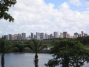
and domestic and international boarding lounges. The top floor has a beer garden and panoramic deck overlooking the maneuvering apron with a view of the Fortaleza skyline
Skyline
A skyline is the overall or partial view of a city's tall buildings and structures consisting of many skyscrapers in front of the sky in the background. It can also be described as the artificial horizon that a city's overall structure creates. Skylines serve as a kind of fingerprint of a city, as...
. The apron is 152,857 square meters and can accommodate 14 aircraft at once in pre-established positions (“boxes”).
The scheduled airlines operating out of Fortaleza are Cabo Verde Airlines, TAP, Delta Air Lines, Gol, TAM, Webjet, OceanAir and TAF. The airport also frequently receives domestic and international charter flights. The passenger terminal, opened in 1998, was designed to have a useful life of 50 years. The former terminal, called the General Aviation Terminal, is now used for general aviation and the fire brigade. The control tower
Control tower
A control tower, or more specifically an Air Traffic Control Tower , is the name of the airport building from which the air traffic control unit controls the movement of aircraft on and around the airport. Control towers are also used to control the traffic for other forms of transportation such...
is located alongside.
Construction of a cargo terminal is the next big step planned by Infraero
Infraero
Empresa Brasileira de Infraestrutura Aeroportuária, Infraero in short, is a Brazilian government corporation created in 1972 and responsible for operating the main Brazilian commercial airports. In 2009, Infraero's airports carried 128,135,616 passengers and 1,114,754 tons of cargo and operated...
. The new terminal will have roughly eight thousand square meters, boosting the cargo storage and handling capacity fourfold. Plans then call for the new terminal to be integrated with highway and railroad links.
Highways
- BR-020
- BR-116
- BR-122
- BR-222
- BR-226
- BR-230
- BR-304
- BR-402
- BR-403
- BR-404
- CE-004
- CE-040
- CE-060
Ports
The Port of Fortaleza is located in the inlet of the Mucuripe and is a man-made port, including an oil platform. The quay stretches 1,054 meters. There are 6,000 square meters of warehouses and more than 100,000 square meters of dock for containers. There are still two wheat mills, interconnected to the railway system by an extensive maneuvering dock.Port of Pecem
The Port of Pecem is one of the two big ports in the state of Ceará, in Brazil. It's located in the municipality of São Gonçalo do Amarante.In the year of 2010 the port handled 3.15 million metric tons of cargo, and the expectation for 2011 is to handle 4 million metric tons. Pecem is the number...
is the other big port facility in the state, located in the municipality of São Gonçalo do Amarante
São Gonçalo do Amarante, Ceará
São Gonçalo do Amarante, Ceará is a town and municipality in the state of Ceará in the Northeast region of Brazil.In this municipality is located the Port of Pecem, one of the two big ports of the state of Ceará.-References:...
, about 60 kilometers from Fortaleza.
Sports
Fortaleza provides visitors and residents with various sport activities. The most popular sport here, as well as in the remainder of BrazilBrazil
Brazil , officially the Federative Republic of Brazil , is the largest country in South America. It is the world's fifth largest country, both by geographical area and by population with over 192 million people...
, is soccer. The Championship of Ceará has its main games in Fortaleza. There are several association football (soccer) clubs, such as Ceará SC
Ceará Sporting Club
Ceará Sporting Club, or Ceará as they are usually called, is a Brazilian football team from Fortaleza in Ceará, founded on June 2, 1914....
, Fortaleza EC
Fortaleza Esporte Clube
Fortaleza Esporte Clube, usually known as Fortaleza, is primarily a football club, but is active in other sports such as futsal, handball and basketball. Fortaleza Esporte Clube is based in Fortaleza, capital of the State of Ceará, Brazil...
and Ferroviário AC
Ferroviário Atlético Clube
Ferroviário Atlético Clube, or Ferroviário as they are usually called, is a Brazilian football team from Fortaleza in Ceará, founded on May 9, 1933...
. Strong winds make the Praia do Futuro an excellent place for nautical sports, and Fortaleza hosts world competitions of surfing
Surfing
Surfing' is a surface water sport in which the surfer rides a surfboard on the crest and face of a wave which is carrying the surfer towards the shore...
, windsurfing
Windsurfing
Windsurfing or sailboarding is a surface water sport that combines elements of surfing and sailing. It consists of a board usually two to four metres long, powered by the orthogonal effect of the wind on a sail. The rig is connected to the board by a free-rotating universal joint and comprises a...
and kitesurfing
Kitesurfing
Kitesurfing or Kiteboarding is an adventure surface water sport that has been described as combining wakeboarding, windsurfing, surfing, paragliding, and gymnastics into one extreme sport. Kitesurfing harnesses the power of the wind to propel a rider across the water on a small surfboard or a...
. Fortaleza appears to have a culture conducive to the production of high-level athletes in combat sports, as evidenced by several Fortalezans' recent success in mixed martial arts.
Fortaleza
Fortaleza
Fortaleza is the state capital of Ceará, located in Northeastern Brazil. With a population close to 2.5 million , Fortaleza is the 5th largest city in Brazil. It has an area of and one of the highest demographic densities in the country...
will be one of the host cities of 2014 FIFA World Cup
2014 FIFA World Cup
The 2014 FIFA World Cup will be the 20th FIFA World Cup, an international association football tournament that will take place in Brazil from 12 June to 13 July 2014....
.
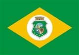
Flag
The flag of Ceará is nearly identical to that of the federal Brazilian flag, the sole difference being the blue hemisphere in the Brazilian flag replaced by the Ceará state coat of armsCoat of arms
A coat of arms is a unique heraldic design on a shield or escutcheon or on a surcoat or tabard used to cover and protect armour and to identify the wearer. Thus the term is often stated as "coat-armour", because it was anciently displayed on the front of a coat of cloth...
.
See also
- Jericoacoara
- Canoa QuebradaCanoa Quebrada|thumb|right|200px|Canoa QuebradaCanoa Quebrada , known as the pearl of the east coast of Ceará, Brazil, is an international tourist beach resort 164 km from Fortaleza, in the municipality of Aracati....
- CumbucoCumbucoCumbuco is a small fishing village situated about North West from the city of Fortaleza, in the state of Ceara, along the north east coast of Brazil. The population is around 1600. The village is regarded as picturesque and scenic and is attracting both domestic and international tourism...
- SertãoSertãoIn Portuguese, the word sertão first referred to the vast hinterlands of Asia that Lusitanian explorers encountered. In Brazil, the geographical term referred to backlands away from the Atlantic coastal regions where the Portuguese first settled in South America in the early sixteenth century...
- Northeast Region of BrazilNortheast Region, BrazilThe Northeast Region of Brazil is composed of the following states: Maranhão, Piauí, Ceará, Rio Grande do Norte, Paraíba, Pernambuco, Alagoas, Sergipe and Bahia, and it represents 18.26% of the Brazilian territory....
External links
Official Website- The Birds of the Interior of Ceará Site about birds of the caatinga, with photos, voice recordings and notes.
- Ceará Photo Gallery by Alex Uchôa at pbase.com