

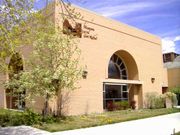
Castle Dale, Utah
Encyclopedia
Emery County, Utah
Emery County is a county located in the U.S. state of Utah. As of 2000 the population was 10,860, and by 2009 had been estimated to decrease to 10,629. It was named for George W. Emery, governor of the Utah Territory in 1875...
, Utah
Utah
Utah is a state in the Western United States. It was the 45th state to join the Union, on January 4, 1896. Approximately 80% of Utah's 2,763,885 people live along the Wasatch Front, centering on Salt Lake City. This leaves vast expanses of the state nearly uninhabited, making the population the...
, United States
United States
The United States of America is a federal constitutional republic comprising fifty states and a federal district...
. The population was 1,657 at the 2000 census. It is the county seat
County seat
A county seat is an administrative center, or seat of government, for a county or civil parish. The term is primarily used in the United States....
of Emery County
Emery County, Utah
Emery County is a county located in the U.S. state of Utah. As of 2000 the population was 10,860, and by 2009 had been estimated to decrease to 10,629. It was named for George W. Emery, governor of the Utah Territory in 1875...
.
History
Castle Dale, the seat of Emery County government, is located on Cottonwood Creek in Castle Valley, a region of benchlands and river valleys bounded by the Wasatch Plateau to the west and the striking buttes, mesas, and canyons of the San Rafael SwellSan Rafael Swell
The San Rafael Swell is a large geologic feature located in south-central Utah, USA about 30 miles west of Green River, Utah. The San Rafael Swell, approximately by , consists of a giant dome-shaped anticline of sandstone, shale, and limestone that was pushed up during the Paleocene Laramide...
to the east. The high plateau barrier and the ruggedness of the Castle Valley landscape delayed settlement of the region until the late 1870s, when population growth and expanding livestock herds in Utah's central valleys stimulated a search for new agricultural and grazing lands. In 1875, brothers Orange Seely and Justus Wellington Seely, Jr., first brought the Mount Pleasant
Mount Pleasant, Utah
Mount Pleasant is a city in Sanpete County, Utah, in the United States. Mt. Pleasant is known for its 19th-century main street buildings, for being home to Wasatch Academy, and for being the largest city in the northern half of the county...
cooperative cattle and sheep herds to winter on Cottonwood Creek. On 22 August 1877 Brigham Young
Brigham Young
Brigham Young was an American leader in the Latter Day Saint movement and a settler of the Western United States. He was the President of The Church of Jesus Christ of Latter-day Saints from 1847 until his death in 1877, he founded Salt Lake City, and he served as the first governor of the Utah...
issued a formal call for settlers to locate in Castle Valley, the last such directive from the "Great Colonizer" before his death on 29 August. Orange Seely
Orange Seely
Orange Seely was a Mormon pioneer and early settler of Utah. He is best known as the settler of the towns of Castle Dale and Orangeville, Utah.Seely was born in Nashville, Lee County, Iowa...
was appointed LDS bishop of the entire region east of the Wasatch Plateau, including present-day Emery, Carbon, and Grand counties. Local tradition describes Bishop Seely as a man of immense girth who made his pastoral rounds riding one mule and leading another laden with staple food items to be distributed to needy families, blacksmith tools for the shoeing of horses and sharpening of plowshares, and dental forceps to remove aching teeth.
The 1880 census found 237 people residing on homesteads strung along more than six miles (10 km) of Cottonwood Creek. In that year two townsites were surveyed, one known as Upper Castle Dale and the other as Lower Castle Dale. In 1882 Upper Castle Dale took the name Orangeville
Orangeville, Utah
Orangeville is a city in northwestern Emery County, Utah, United States, at the edge of the Manti-La Sal National Forest. The city is at the junction of State Routes 29 and 57, straddling the banks of Cottonwood Creek...
in honor of Orange Seely, even though he resided in the lower town. The two communities, only three miles apart, have had closely related histories, but Castle Dale has been home to the main public institutions.
The period from 1890 to 1910 brought a doubling of Castle Dale's population, from 409 to 848. The town expanded from the original plat on a sloping shelf beside the creek onto the adjacent benchlands. A two-story brick courthouse was erected in 1892. The Emery Stake Academy, founded in 1889 as the first high-school level educational institution in southeastern Utah, occupied a new two-story brick building in 1899, then moved in 1910 to a larger three-story building on the bench. This period also saw the town's incorporation (1900), the building of several commercial structures, the establishment (in 1900) of a weekly newspaper, the Emery County Progress, the first electric service (1906), and the Emery County Bank (1906).
The following decades saw little additional growth but did bring improvements in public services. A culinary water system and a telephone system were installed in about 1914. In 1922 the Emery Stake Academy was sold to the Emery County School District and became Central High School
Central High School (South Salt Lake, Utah)
Central High School is a public high school in South Salt Lake, Utah. The enrollment is around 451 students, and the principal is Dr. Susan Brady. Central High belongs to the Granite School District.-External links:***...
.
Like the other communities in western Emery County, for most of its history Castle Dale has depended on an economic base of farming and livestock raising, supplemented by coal mining. The community was hard hit by the Great Depression
Great Depression
The Great Depression was a severe worldwide economic depression in the decade preceding World War II. The timing of the Great Depression varied across nations, but in most countries it started in about 1929 and lasted until the late 1930s or early 1940s...
of the 1930s, when mining unemployment and low prices for farm products combined with a devastating drought. The local bank was merged with a bank in Price, leaving Emery County without banking services. During the same period, however, the Wilberg Resort, situated in a grove of trees four miles (6 km) north of town, enjoyed great success as a recreation center for Emery and Carbon counties, with several hundred people typically attending the Saturday night dances.
The period from 1940 to 1970 saw a decline in Castle Dale's population, from 953 to 541. Once the educational center of the region, the town lost its high school in a county school consolidation in 1943. A portent of a brighter economic future came when Congress approved the Emery County Reclamation Project in 1956. The central feature of the project, the Joe's Valley Reservoir, completed in 1966, for the first time provided long-term water storage, improving the supply for irrigation and making additional water available for industrial uses. The same period brought an improvement in the level of public services throughout western Emery County, with the installation of a modern telephone system, improved water and sewage systems, a relay station to direct television signals from Salt Lake City stations past the barrier of the Wasatch Plateau, as well as upgraded police and fire protection being provided. As the county government center, Castle Dale benefited substantially from the expansion of county services. The town's central place in education was reestablished in 1962 when North and South Emery high schools were consolidated into Emery County High School, located at Castle Dale.

Orangeville, Utah
Orangeville is a city in northwestern Emery County, Utah, United States, at the edge of the Manti-La Sal National Forest. The city is at the junction of State Routes 29 and 57, straddling the banks of Cottonwood Creek...
.
Geography
Castle Dale is located at 39°12′57"N 111°1′15"W (39.215861, -111.020781). It lies on the Cottonwood Creek in Castle Valley and is at 1.760 meters above sea level.According to the United States Census Bureau
United States Census Bureau
The United States Census Bureau is the government agency that is responsible for the United States Census. It also gathers other national demographic and economic data...
, the city has a total area of 1.9 square miles (4.8 km²), all of it land.
Demographics
As of the censusCensus
A census is the procedure of systematically acquiring and recording information about the members of a given population. It is a regularly occurring and official count of a particular population. The term is used mostly in connection with national population and housing censuses; other common...
of 2000 there were 1,657 people, 508 households, and 420 families residing in the city. The population density
Population density
Population density is a measurement of population per unit area or unit volume. It is frequently applied to living organisms, and particularly to humans...
was 887.5 people per square mile (342.1/km²). There were 618 housing units at an average density of 331.0 per square mile (127.6/km²). The racial makeup of the city was 95.47% White, 0.06% African American, 0.66% Native American, 0.54% Asian, 0.18% Pacific Islander, 0.91% from other races
Race (United States Census)
Race and ethnicity in the United States Census, as defined by the Federal Office of Management and Budget and the United States Census Bureau, are self-identification data items in which residents choose the race or races with which they most closely identify, and indicate whether or not they are...
, and 2.17% from two or more races. Hispanic or Latino of any race were 2.17% of the population.
There were 508 households out of which 49.2% had children under the age of 18 living with them, 72.6% were married couples
Marriage
Marriage is a social union or legal contract between people that creates kinship. It is an institution in which interpersonal relationships, usually intimate and sexual, are acknowledged in a variety of ways, depending on the culture or subculture in which it is found...
living together, 7.1% had a female householder with no husband present, and 17.3% were non-families. 15.6% of all households were made up of individuals and 7.9% had someone living alone who was 65 years of age or older. The average household size was 3.22 and the average family size was 3.60.
In the city the population was spread out with 37.2% under the age of 18, 9.7% from 18 to 24, 23.5% from 25 to 44, 21.5% from 45 to 64, and 8.1% who were 65 years of age or older. The median age was 28 years. For every 100 females there were 105.8 males. For every 100 females age 18 and over, there were 100.4 males.
The median income for a household in the city was $44,185, and the median income for a family was $48,603. Males had a median income of $40,515 versus $20,294 for females. The per capita income
Per capita income
Per capita income or income per person is a measure of mean income within an economic aggregate, such as a country or city. It is calculated by taking a measure of all sources of income in the aggregate and dividing it by the total population...
for the city was $14,175. About 6.7% of families and 9.5% of the population were below the poverty line, including 12.4% of those under age 18 and 5.6% of those age 65 or over.
External links
- Castle Dale City at EmeryCounty.com