
Cardwell, Queensland
Encyclopedia
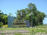
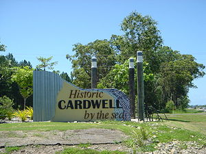
Cardwell is a tropical coastal town in northeastern Queensland
. It is located at the southern extremity of the Cassowary Coast. At the 2006 census
, Cardwell had a population of 1,250. The Bruce Highway National Highway 1
and the North Coast railway line
are the dominant transport routes; connecting with the Queensland provincial cities of Cairns and Townsville. Cardwell suffered significant damage from Cyclone Yasi, a category 5 cyclone, in February 2011.
The Aboriginal heritage is defined by Language Groups; the boundary of the Dyirbal
and Warrgamay lies between Cardwell and Tully in the north. The first Europeans settled in the area in January 1864 in order to create a port initially called "Port Hinchinbrook". Subsequently the town was renamed after Edward Cardwell, 1st Viscount Cardwell
.
 West of Cardwell the rugged topography of the Cardwell Range intercepts the trade winds resulting in high rainfall. The coastal escarpment is covered in rainforest which transitions to the west to eucalypt woodland and tropical savanna. Cardwell Range biodiversity has been protected by the introduction of Forestry Reserves, National Parks and Queensland World Heritage Wet Tropics Areas. Seaward lies the Coral Sea, the Great Barrier Reef and Lagoon, Rockingham Bay and Hinchinbrook Channel. Islands are visible from Cardwell including protected areas i.e. Hinchinbrook Island
, Gould Island and the Brook Islands Group.
Oyster Point
is one kilometre south of Cardwell. This location experienced one of Australia's important conservation battles
. With the establishment of Port Hinchinbrook, the Marina Public Boat Ramp provides year round access to the protected marine environments of Hinchinbrook Channel, Esturaries, Islands and Great Barrier Reef. The Cardwell Jetty is an important infrastructure asset, where visitors can socialize and view the coastal scenery; and Anglers can enjoy both day and evening fishing activities.
Queensland
Queensland is a state of Australia, occupying the north-eastern section of the mainland continent. It is bordered by the Northern Territory, South Australia and New South Wales to the west, south-west and south respectively. To the east, Queensland is bordered by the Coral Sea and Pacific Ocean...
. It is located at the southern extremity of the Cassowary Coast. At the 2006 census
Census in Australia
The Australian census is administered once every five years by the Australian Bureau of Statistics. The most recent census was conducted on 9 August 2011; the next will be conducted in 2016. Prior to the introduction of regular censuses in 1961, they had also been run in 1901, 1911, 1921, 1933,...
, Cardwell had a population of 1,250. The Bruce Highway National Highway 1
Highway 1 (Australia)
Australia's Highway 1 is a network of highways that circumnavigate the Australian continent, joining all mainland state capitals. At a total length of approximately it is the longest national highway in the world, longer than the Trans-Siberian Highway and the Trans-Canada Highway...
and the North Coast railway line
North Coast railway line, Queensland
The North Coast railway line is a narrow gauge railway line in Queensland, Australia. It runs from Brisbane, along the Queensland coast to Cairns in Far North Queensland. The line is electrified between Brisbane and Rockhampton...
are the dominant transport routes; connecting with the Queensland provincial cities of Cairns and Townsville. Cardwell suffered significant damage from Cyclone Yasi, a category 5 cyclone, in February 2011.
The Aboriginal heritage is defined by Language Groups; the boundary of the Dyirbal
Dyirbal language
Dyirbal is an Australian Aboriginal language spoken in northeast Queensland by about 5 speakers of the Dyirbal tribe. It is a member of the small Dyirbalic branch of the Pama–Nyungan family...
and Warrgamay lies between Cardwell and Tully in the north. The first Europeans settled in the area in January 1864 in order to create a port initially called "Port Hinchinbrook". Subsequently the town was renamed after Edward Cardwell, 1st Viscount Cardwell
Edward Cardwell, 1st Viscount Cardwell
Edward Cardwell, 1st Viscount Cardwell PC, PC , FRS was a prominent British politician in the Peelite and Liberal parties during the middle of the 19th century...
.
Hinchinbrook Island
Hinchinbrook Island lies east of Cardwell and north of Lucinda, Queensland Australia. Hinchinbrook Island is part of the Great Barrier Reef Marine Park and wholly protected within the Hinchinbrook Island National Park, except for a small resort. It is the largest island on the Great Barrier Reef...
, Gould Island and the Brook Islands Group.
Oyster Point
Oyster Point
Oyster Point lies at the mouth of Stoney Creek, about one kilometre south of Cardwell in northern Australia. The location provides excellent boating access to the shallow, warm waters of the Hinchinbrook Channel, numerous reefs and many islands including Hinchinbrook Island and Goold Island.The...
is one kilometre south of Cardwell. This location experienced one of Australia's important conservation battles
Conservation in Australia
Conservation in Australia is an issue of state and federal policy. Australia is one of the most biologically diverse countries in the world, with a large portion of species endemic to Australia...
. With the establishment of Port Hinchinbrook, the Marina Public Boat Ramp provides year round access to the protected marine environments of Hinchinbrook Channel, Esturaries, Islands and Great Barrier Reef. The Cardwell Jetty is an important infrastructure asset, where visitors can socialize and view the coastal scenery; and Anglers can enjoy both day and evening fishing activities.