
Capital Hill, Australian Capital Territory
Encyclopedia
Capital Hill ,(postcode
: 2600) is the location of Parliament House, Canberra
, at the south apex of the land axis of the Parliamentary Triangle.
The site was selected as the location of the Capitol in Walter Burley Griffin
's Canberra design in 1912, which he envisaged to be "either a general administration structure for popular receptions and ceremony or for housing archives and commemorating Australian Achievements". The proposed building is commemorated in the name of the Capitol Theatre, Manuka
. However, Griffin's name for the hill was subsequently changed to Capital Hill.
The Parliament buildings were to be located a little further down the hill towards Lake Burley Griffin
at Camp Hill, between Capital Hill and the Provisional Parliament House
. Griffin opposed the plan to build a Provisional Parliament House on the lower slopes of Camp Hill, because he considered that it would make it difficult to build the permanent Parliament House on Camp Hill, as the provisional building would have to be demolished.
In fact, in the 1958 and 1964 Holford plans for the Parliamentary Triangle, the site for the New Parliament House was moved to the lake shore, partly for this reason. Holford also reportedly said that a lakeside site would discourage politicians from seeing themselves as superior to ordinary people.
However, in 1978 Parliament voted to move the Parliament to its permanent location on Capital Hill, which it saw as befitting the eminence of the institution. Construction of the new parliament buildings commenced in 1981 and the new building was officially opened by Queen Elizabeth II in 1988, when the Parliament relocated from the old building.
Capital Hill was previously named Kurrajong Hill and is around 2.5 km², surrounded by a circular road (Capital Circle). Until the construction of the current Parliament House, the hill was covered with scrubby native bushland. The construction of the current parliament building required removing much of the top half of the hill, and after construction, much of the earth was replaced on top of the building. The surrounding hill is landscaped with native plants, while the soil on top of parliament house is planted with lawn
. However, on the western side of the Hill, a small area of the original native bushland has been preserved.
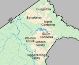
The streets that go out from Capital Hill are named after Australian capitals, and their direction roughly corresponds to the direction of that capital city, Brisbane Avenue, Sydney Avenue, Canberra Avenue, Melbourne Avenue, Adelaide Avenue, Perth Avenue, Hobart Avenue and Darwin Avenue. The streets which surround the hill in concentric circles are named after increasing spheres of influence with the inner-most circle called Parliament drive and then spanning out to Capital Circle, State Circle, National Circuit, Dominion Circuit and Empire Circuit.
 When Griffin
drew up his plans in 1912, there was still some optimism that New Zealand
might join the Federation of Australia
. Griffin's plans included eight avenues radiating out from Capital Hill named after the capitals of the six states, the capital of the Northern Territory
and the capital of New Zealand
.
Before the name Wellington Avenue was gazetted, it was realised that New Zealand was not going to become part of a Confederation of Australasia
and the name was replaced by Canberra Avenue. Griffin planned that the state capital city avenues were terminated with a park named after the generic botanical name for a native plant from that particular site; for example, Telopea Park
is named after the waratah, the floral emblem of New South Wales, and is at the end of Sydney Avenue, named after the capital of New South Wales.
The name of the precinct of Manuka
is a remnant of Griffin's naming scheme. Another remnant of Griffin's nomenclature was the Wellington Hotel, formerly on the corner of Canberra Avenue and National Circuit, which was demolished and replaced by the hotel known as of 2007 as Rydges Capital Hill Canberra.
Canberra Formation, calcareous Shale
is found in the south west and north east. This overlies middle Silurian
Camp Hill
Sandstone
. The sandstone unconformably overlies the early Silurian Black Mountain Sandstone and State Circle
Shale. State Circle Shale is Late Llandovery in a more finely divided time scale and has been dated to 445 7 million years old. The State Circle Shale is
composed of laminated shales and siltstone
. Black Mountain Sandstone
is composed of a white quartz
sandstone.
The Deakin Fault cuts the south west of state circle. Mount Painter acid volcanos are to the south west of this fault.
Postcodes in Australia
Postcodes are used in Australia to sort and send mail to the correct address. All postcodes in Australia have four numbers and are placed at the end of the address...
: 2600) is the location of Parliament House, Canberra
Parliament House, Canberra
Parliament House is the meeting facility of the Parliament of Australia located in Canberra, the capital of Australia. The building was designed by Mitchell/Giurgola Architects and opened on 1988 by Elizabeth II, Queen of Australia...
, at the south apex of the land axis of the Parliamentary Triangle.
The site was selected as the location of the Capitol in Walter Burley Griffin
Walter Burley Griffin
Walter Burley Griffin was an American architect and landscape architect, who is best known for his role in designing Canberra, Australia's capital city...
's Canberra design in 1912, which he envisaged to be "either a general administration structure for popular receptions and ceremony or for housing archives and commemorating Australian Achievements". The proposed building is commemorated in the name of the Capitol Theatre, Manuka
Manuka, Australian Capital Territory
Manuka is an area in the Inner South district of Canberra, Australia covering parts of the suburbs of Griffith and Forrest. Manuka Shops, Manuka Oval, Manuka Swimming Pool, and Manuka Circle take their name from the park in the area.- Origin of name :...
. However, Griffin's name for the hill was subsequently changed to Capital Hill.
The Parliament buildings were to be located a little further down the hill towards Lake Burley Griffin
Lake Burley Griffin
Lake Burley Griffin is an artificial lake in the centre of Canberra, the capital of Australia. It was completed in 1963 after the Molonglo River—which ran between the city centre and Parliamentary Triangle—was dammed...
at Camp Hill, between Capital Hill and the Provisional Parliament House
Old Parliament House, Canberra
Old Parliament House, known formerly as the Provisional Parliament House, was the house of the Parliament of Australia from 1927 to 1988. The building began operation on 9 May 1927 as a temporary base for the Commonwealth Parliament after its relocation from Melbourne to the new capital, Canberra,...
. Griffin opposed the plan to build a Provisional Parliament House on the lower slopes of Camp Hill, because he considered that it would make it difficult to build the permanent Parliament House on Camp Hill, as the provisional building would have to be demolished.
In fact, in the 1958 and 1964 Holford plans for the Parliamentary Triangle, the site for the New Parliament House was moved to the lake shore, partly for this reason. Holford also reportedly said that a lakeside site would discourage politicians from seeing themselves as superior to ordinary people.
However, in 1978 Parliament voted to move the Parliament to its permanent location on Capital Hill, which it saw as befitting the eminence of the institution. Construction of the new parliament buildings commenced in 1981 and the new building was officially opened by Queen Elizabeth II in 1988, when the Parliament relocated from the old building.
Capital Hill was previously named Kurrajong Hill and is around 2.5 km², surrounded by a circular road (Capital Circle). Until the construction of the current Parliament House, the hill was covered with scrubby native bushland.
Lawn
A lawn is an area of aesthetic and recreational land planted with grasses or other durable plants, which usually are maintained at a low and consistent height. Low ornamental meadows in natural landscaping styles are a contemporary option of a lawn...
. However, on the western side of the Hill, a small area of the original native bushland has been preserved.
The streets that go out from Capital Hill are named after Australian capitals, and their direction roughly corresponds to the direction of that capital city, Brisbane Avenue, Sydney Avenue, Canberra Avenue, Melbourne Avenue, Adelaide Avenue, Perth Avenue, Hobart Avenue and Darwin Avenue. The streets which surround the hill in concentric circles are named after increasing spheres of influence with the inner-most circle called Parliament drive and then spanning out to Capital Circle, State Circle, National Circuit, Dominion Circuit and Empire Circuit.
Walter Burley Griffin
Walter Burley Griffin was an American architect and landscape architect, who is best known for his role in designing Canberra, Australia's capital city...
drew up his plans in 1912, there was still some optimism that New Zealand
New Zealand
New Zealand is an island country in the south-western Pacific Ocean comprising two main landmasses and numerous smaller islands. The country is situated some east of Australia across the Tasman Sea, and roughly south of the Pacific island nations of New Caledonia, Fiji, and Tonga...
might join the Federation of Australia
Federation of Australia
The Federation of Australia was the process by which the six separate British self-governing colonies of New South Wales, Queensland, South Australia, Tasmania, Victoria and Western Australia formed one nation...
. Griffin's plans included eight avenues radiating out from Capital Hill named after the capitals of the six states, the capital of the Northern Territory
Darwin, Northern Territory
Darwin is the capital city of the Northern Territory, Australia. Situated on the Timor Sea, Darwin has a population of 127,500, making it by far the largest and most populated city in the sparsely populated Northern Territory, but the least populous of all Australia's capital cities...
and the capital of New Zealand
Wellington
Wellington is the capital city and third most populous urban area of New Zealand, although it is likely to have surpassed Christchurch due to the exodus following the Canterbury Earthquake. It is at the southwestern tip of the North Island, between Cook Strait and the Rimutaka Range...
.
Before the name Wellington Avenue was gazetted, it was realised that New Zealand was not going to become part of a Confederation of Australasia
Australasia
Australasia is a region of Oceania comprising Australia, New Zealand, the island of New Guinea, and neighbouring islands in the Pacific Ocean. The term was coined by Charles de Brosses in Histoire des navigations aux terres australes...
and the name was replaced by Canberra Avenue. Griffin planned that the state capital city avenues were terminated with a park named after the generic botanical name for a native plant from that particular site; for example, Telopea Park
Telopea Park, Canberra
Telopea Park is one of the oldest parks in Canberra, Australia. The name of the park is from Walter Burley Griffin's original plan for Canberra where he planned Telopea Park at the end of Sydney Avenue. The park is named after the floral emblem of New South Wales, also known as the Waratah...
is named after the waratah, the floral emblem of New South Wales, and is at the end of Sydney Avenue, named after the capital of New South Wales.
The name of the precinct of Manuka
Manuka, Australian Capital Territory
Manuka is an area in the Inner South district of Canberra, Australia covering parts of the suburbs of Griffith and Forrest. Manuka Shops, Manuka Oval, Manuka Swimming Pool, and Manuka Circle take their name from the park in the area.- Origin of name :...
is a remnant of Griffin's naming scheme. Another remnant of Griffin's nomenclature was the Wellington Hotel, formerly on the corner of Canberra Avenue and National Circuit, which was demolished and replaced by the hotel known as of 2007 as Rydges Capital Hill Canberra.
Geology
Geology of Capital Hill has been studied in great detail.Canberra Formation, calcareous Shale
Shale
Shale is a fine-grained, clastic sedimentary rock composed of mud that is a mix of flakes of clay minerals and tiny fragments of other minerals, especially quartz and calcite. The ratio of clay to other minerals is variable. Shale is characterized by breaks along thin laminae or parallel layering...
is found in the south west and north east. This overlies middle Silurian
Silurian
The Silurian is a geologic period and system that extends from the end of the Ordovician Period, about 443.7 ± 1.5 Mya , to the beginning of the Devonian Period, about 416.0 ± 2.8 Mya . As with other geologic periods, the rock beds that define the period's start and end are well identified, but the...
Camp Hill
Sandstone
Sandstone
Sandstone is a sedimentary rock composed mainly of sand-sized minerals or rock grains.Most sandstone is composed of quartz and/or feldspar because these are the most common minerals in the Earth's crust. Like sand, sandstone may be any colour, but the most common colours are tan, brown, yellow,...
. The sandstone unconformably overlies the early Silurian Black Mountain Sandstone and State Circle
Shale. State Circle Shale is Late Llandovery in a more finely divided time scale and has been dated to 445 7 million years old. The State Circle Shale is
composed of laminated shales and siltstone
Siltstone
Siltstone is a sedimentary rock which has a grain size in the silt range, finer than sandstone and coarser than claystones.- Description :As its name implies, it is primarily composed of silt sized particles, defined as grains 1/16 - 1/256 mm or 4 to 8 on the Krumbein phi scale...
. Black Mountain Sandstone
Sandstone
Sandstone is a sedimentary rock composed mainly of sand-sized minerals or rock grains.Most sandstone is composed of quartz and/or feldspar because these are the most common minerals in the Earth's crust. Like sand, sandstone may be any colour, but the most common colours are tan, brown, yellow,...
is composed of a white quartz
sandstone.
The Deakin Fault cuts the south west of state circle. Mount Painter acid volcanos are to the south west of this fault.