

California State Route 156
Encyclopedia
State Route 156 is a state highway
in California, USA, running from Castroville
to State Route 152
near Hollister
.
This route is eligible for the State Scenic Highway System
.
in Castroville. The eastern terminus is at State Route 152
near Hollister. It overlaps U.S. Route 101 for 8 miles (12.9 km) between Prunedale
, and San Juan Bautista
. Route 156 passes through Monterey, San Benito, and Santa Clara Counties. Along with US 101, it is the quickest route from the San Francisco Bay Area
to the Monterey Peninsula
.
For its westernmost two miles (3 km), Route 156 is a freeway through Castroville, terminating at a Y-interchange with the Route 1 freeway. There is no direct access from Route 156 West to Route 1 North or Route 1 South to Route 156 East. Motorists who want to go from Route 1 South to Route 156 East can do so by using Route 183 South through Castroville. Traffic heading west on Route 156 can access Route 1 North by exiting at the Route 183 interchange and heading north.
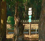
s currently present in the Hollister area.
{| class=wikitable
!County
!Location
!Postmile
!Exit
!Destinations
!Notes
|-
|rowspan=9|Monterey
MON R0.17-101.32Indicates that the postmile represents the distance along US 101 rather than SR 156.
|
|bgcolor=#ffdddd|R0.17
|bgcolor=#ffdddd|
|bgcolor=#ffdddd| – Monterey Peninsula
|bgcolor=#ffdddd|Westbound exit and eastbound entrance
|-
|rowspan=2|Castroville
|R1.11
|
|
|
|-
|colspan=4 align=center|East end of freeway
|-
|
|
|
|Castroville Boulevard
|
|-
|rowspan=2|Prunedale
|
|
|Prunedale Road
|Interchange westbound; at-grade intersection
eastbound
|-bgcolor=#ddffdd
|T5.19
95.44
|
|
|Interchange; west end of US 101 overlap
|-
|
|96.14
|337
|San Miguel Canyon Road (CR G12)
|Interchange
|-
|
|bgcolor=#ffdddd|100.39
|bgcolor=#ffdddd|
|bgcolor=#ffdddd|Dunbarton Road to San Juan Road (CR G11) – Aromas
, Watsonville
|bgcolor=#ffdddd|No eastbound entrance
|-
|
|bgcolor=#ffdddd|
|bgcolor=#ffdddd|
|bgcolor=#ffdddd|San Juan Road (CR G11) – Aromas
, Watsonville
|bgcolor=#ffdddd|No eastbound exit
|-
|rowspan=9|San Benito
SBT 0.00-R18.43
|colspan=5 align=center|West end of freeway on US 101
|-
|colspan=5 align=center|East end of freeway on US 101
|-
|
|bgcolor=#ddffdd|3.00
0.00
|bgcolor=#ddffdd|
|bgcolor=#ddffdd|
|bgcolor=#ddffdd|Interchange; east end of US 101 overlap
|-
|San Juan Bautista
|bgcolor=#ddffdd|3.02
|bgcolor=#ddffdd|
|bgcolor=#ddffdd|
|bgcolor=#ddffdd|West end of CR G1 overlap; former US 101
|-
|
|7.25
|
|Union Road, Mitchell Road
|
|-
|
|bgcolor=#ddffdd|
|bgcolor=#ddffdd|
|bgcolor=#ddffdd|
|bgcolor=#ddffdd|East end of CR G1 overlap; former SR 156 east
|-
|
|R11.37
|
|
|
|-
|
|R13.22
|
|San Felipe Road (SR 156 Bus. west) – Hollister
|Former SR 156 west
|-
|
|R16.54
|
|Fairview Road
|
|-
|Santa Clara
SCL 0.00-R0.60
|
|bgcolor=#ffdddd|R0.60
|bgcolor=#ffdddd|
|bgcolor=#ffdddd|
|bgcolor=#ffdddd|Interchange; eastbound exit and westbound entrance
State highway
State highway, state road or state route can refer to one of three related concepts, two of them related to a state or provincial government in a country that is divided into states or provinces :#A...
in California, USA, running from Castroville
Castroville, California
Castroville is a census-designated place in Monterey County, California, United States. Castroville is located northwest of Salinas, at an elevation of 23 feet . The population was 6,481 at the 2010 census, down from 6,724 at the 2000 census. Castroville calls itself "Artichoke Center of the...
to State Route 152
California State Route 152
State Route 152 is a state highway that runs near the latitudinal middle of the U.S. state of California from Watsonville to Route 99 southeast of Merced...
near Hollister
Hollister, California
Hollister is a city in and the county seat of San Benito County, California, United States. The population was 34,928 at the 2010 census. Hollister is primarily an agricultural town.-History:...
.
This route is eligible for the State Scenic Highway System
State Scenic Highway System (California)
The State Scenic Highway System is a list of highways, mainly state highways, that have been designated by the California Department of Transportation as scenic highways. The California State Legislature, primarily through Section 263 of the Streets and Highways Code, makes highways eligible for...
.
Route description
The western terminus is at State Route 1California State Route 1
State Route 1 , more often called Highway 1, is a state highway that runs along much of the Pacific coast of the U.S. state of California. It is famous for running along some of the most beautiful coastlines in the world, leading to its designation as an All-American Road.Highway 1 does not run...
in Castroville. The eastern terminus is at State Route 152
California State Route 152
State Route 152 is a state highway that runs near the latitudinal middle of the U.S. state of California from Watsonville to Route 99 southeast of Merced...
near Hollister. It overlaps U.S. Route 101 for 8 miles (12.9 km) between Prunedale
Prunedale, California
Prunedale is a census-designated place in Monterey County, California, United States. Prunedale is located north of Salinas, at an elevation of 92 feet . The population was 17,560 residents at the time of the 2010 census, up from 16,432 at the 2000 census...
, and San Juan Bautista
San Juan Bautista, California
San Juan Bautista is a city in San Benito County, California, United States. The population was 1,862 at the 2010 census, up from 1,549 at the 2000 census. The city of San Juan Bautista was named after Mission San Juan Bautista...
. Route 156 passes through Monterey, San Benito, and Santa Clara Counties. Along with US 101, it is the quickest route from the San Francisco Bay Area
San Francisco Bay Area
The San Francisco Bay Area, commonly known as the Bay Area, is a populated region that surrounds the San Francisco and San Pablo estuaries in Northern California. The region encompasses metropolitan areas of San Francisco, Oakland, and San Jose, along with smaller urban and rural areas...
to the Monterey Peninsula
Monterey Peninsula
The Monterey Peninsula is located on the central California coast and comprises the cities of Monterey, Carmel, and Pacific Grove, and unincorporated areas of Monterey County including the resort and community of Pebble Beach.-Monterey:...
.
For its westernmost two miles (3 km), Route 156 is a freeway through Castroville, terminating at a Y-interchange with the Route 1 freeway. There is no direct access from Route 156 West to Route 1 North or Route 1 South to Route 156 East. Motorists who want to go from Route 1 South to Route 156 East can do so by using Route 183 South through Castroville. Traffic heading west on Route 156 can access Route 1 North by exiting at the Route 183 interchange and heading north.
History
The original portion of the route was defined in 1909 and ran from U.S. Route 101 to Hollister. In 1933, the remainder of the route (between Castroville and US 101 and between Hollister and Route 152) was added. It was signed as Route 156 by 1963, but was not part of the original 1934 state signage of routes.Future
Highway 156 experiences heavy truck traffic as it serves as a primary route for moving people and goods between the Monterey Peninsula and the rest of the state. It directly links with Highway 152, one of a small number of passable routes across the Coast Ranges between Monterey Bay and the Central Valley.Monterey County
The westernmost segment from Highway 1 to Highway 101 in Prunedale is a heavily traveled 2-lane section that has experienced numerous fatal crashes in recent years. Environmental studies are underway to upgrade this 5-mile (8 km) section to either a 4-lane highway or fully controlled access expressway. The Transportation Agency for Monterey County and Caltrans have narrowed the list of upgrade alternatives to one freeway and one expressway option. Alternative 11 — the expressway option — will add a second carriageway to the existing road. Interchanges will be constructed at Castroville Boulevard and Cathedral Oaks Road, while Oak Hills Drive will be an at-grade intersection. Alternative 12 — the freeway option — will build a new freeway to the south of the existing roadway with an interchange at Castroville Boulevard. Under this alternative, there will be no interchange with Cathedral Oaks Road or Oak Hills Drive. The existing Route 156 would be converted to a frontage road providing access to Cathedral Oaks Road and Oak Hills Drive. The environmental studies are expected to be complete in 2009, with the project slated for completion in 2015.San Benito County
San Benito County and Caltrans are conducting environmental studies for widening Highway 156 from two to four lanes between Highway 101 near San Juan Bautista and the Santa Clara County line. Interchanges are proposed with Highway 25 northwest of Hollister, Business Route 156 both north and southwest of Hollister, and Highway 101. The entire segment may be upgraded to freeway status to eliminate delays caused by numerous traffic lightTraffic light
Traffic lights, which may also be known as stoplights, traffic lamps, traffic signals, signal lights, robots or semaphore, are signalling devices positioned at road intersections, pedestrian crossings and other locations to control competing flows of traffic...
s currently present in the Hollister area.
Major intersections
- Note: Except where prefixed with a letter, postmiles were measured in 1964, based on the alignment as it existed at that time, and do not necessarily reflect current mileage. The numbers reset at county lines; the start and end postmiles in each county are given in the county column.
{| class=wikitable
!County
!Location
!Postmile
!Exit
Exit number
An exit number is a number assigned to a road junction, usually an exit from a freeway. It is usually marked on the same sign as the destinations of the exit, as well as a sign in the gore....
!Destinations
!Notes
|-
|rowspan=9|Monterey
Monterey County, California
Monterey County is a county located on the Pacific coast of the U.S. state of California, its northwestern section forming the southern half of Monterey Bay. The northern half of the bay is in Santa Cruz County. As of 2010, the population was 415,057. The county seat and largest city is Salinas...
MON R0.17-101.32Indicates that the postmile represents the distance along US 101 rather than SR 156.
|
|bgcolor=#ffdddd|R0.17
|bgcolor=#ffdddd|
|bgcolor=#ffdddd| – Monterey Peninsula
Monterey Peninsula
The Monterey Peninsula is located on the central California coast and comprises the cities of Monterey, Carmel, and Pacific Grove, and unincorporated areas of Monterey County including the resort and community of Pebble Beach.-Monterey:...
|bgcolor=#ffdddd|Westbound exit and eastbound entrance
|-
|rowspan=2|Castroville
Castroville, California
Castroville is a census-designated place in Monterey County, California, United States. Castroville is located northwest of Salinas, at an elevation of 23 feet . The population was 6,481 at the 2010 census, down from 6,724 at the 2000 census. Castroville calls itself "Artichoke Center of the...
|R1.11
|
|
|
|-
|colspan=4 align=center|East end of freeway
|-
|
|
|
|Castroville Boulevard
|
|-
|rowspan=2|Prunedale
Prunedale, California
Prunedale is a census-designated place in Monterey County, California, United States. Prunedale is located north of Salinas, at an elevation of 92 feet . The population was 17,560 residents at the time of the 2010 census, up from 16,432 at the 2000 census...
|
|
|Prunedale Road
|Interchange westbound; at-grade intersection
At-grade intersection
An at-grade intersection is a junction at which two or more transport axes cross at the same level .-Traffic management:With areas of high or fast traffic, an at-grade intersection normally requires a traffic control device such as a stop sign, traffic light or railway signal to manage conflicting...
eastbound
|-bgcolor=#ddffdd
|T5.19
95.44
|
|
|Interchange; west end of US 101 overlap
|-
|
|96.14
|337
|San Miguel Canyon Road (CR G12)
|Interchange
|-
|
|bgcolor=#ffdddd|100.39
|bgcolor=#ffdddd|
|bgcolor=#ffdddd|Dunbarton Road to San Juan Road (CR G11) – Aromas
Aromas, California
Aromas is a census-designated place in Monterey County, and San Benito County, California, United States. The CDP straddles the border of the two counties, with Monterey County to the west and San Benito County to the east. The Santa Cruz County line is less than a mile to the Northwest, and...
, Watsonville
Watsonville, California
Watsonville is a city in Santa Cruz County, California, United States. The population was 51,199 according to the 2010 census.Located on the central coast of California, the economy centers predominantly around the farming industry. It is known for growing strawberries, apples, lettuce and a host...
|bgcolor=#ffdddd|No eastbound entrance
|-
|
|bgcolor=#ffdddd|
|bgcolor=#ffdddd|
|bgcolor=#ffdddd|San Juan Road (CR G11) – Aromas
Aromas, California
Aromas is a census-designated place in Monterey County, and San Benito County, California, United States. The CDP straddles the border of the two counties, with Monterey County to the west and San Benito County to the east. The Santa Cruz County line is less than a mile to the Northwest, and...
, Watsonville
Watsonville, California
Watsonville is a city in Santa Cruz County, California, United States. The population was 51,199 according to the 2010 census.Located on the central coast of California, the economy centers predominantly around the farming industry. It is known for growing strawberries, apples, lettuce and a host...
|bgcolor=#ffdddd|No eastbound exit
|-
|rowspan=9|San Benito
San Benito County, California
San Benito County is a county located in the Coast Range Mountains of the U.S. state of California, south of San Jose. As of 2010 the population was 55,269. The county seat is Hollister, which includes nearly two-thirds of the county's population. El Camino Real passes through the county and...
SBT 0.00-R18.43
|colspan=5 align=center|West end of freeway on US 101
|-
|colspan=5 align=center|East end of freeway on US 101
|-
|
|bgcolor=#ddffdd|3.00
0.00
|bgcolor=#ddffdd|
|bgcolor=#ddffdd|
|bgcolor=#ddffdd|Interchange; east end of US 101 overlap
|-
|San Juan Bautista
San Juan Bautista, California
San Juan Bautista is a city in San Benito County, California, United States. The population was 1,862 at the 2010 census, up from 1,549 at the 2000 census. The city of San Juan Bautista was named after Mission San Juan Bautista...
|bgcolor=#ddffdd|3.02
|bgcolor=#ddffdd|
|bgcolor=#ddffdd|
|bgcolor=#ddffdd|West end of CR G1 overlap; former US 101
|-
|
|7.25
|
|Union Road, Mitchell Road
|
|-
|
|bgcolor=#ddffdd|
|bgcolor=#ddffdd|
|bgcolor=#ddffdd|
|bgcolor=#ddffdd|East end of CR G1 overlap; former SR 156 east
|-
|
|R11.37
|
|
|
|-
|
|R13.22
|
|San Felipe Road (SR 156 Bus. west) – Hollister
Hollister, California
Hollister is a city in and the county seat of San Benito County, California, United States. The population was 34,928 at the 2010 census. Hollister is primarily an agricultural town.-History:...
|Former SR 156 west
|-
|
|R16.54
|
|Fairview Road
|
|-
|Santa Clara
Santa Clara County, California
Santa Clara County is a county located at the southern end of the San Francisco Bay Area in the U.S. state of California. As of 2010 it had a population of 1,781,642. The county seat is San Jose. The highly urbanized Santa Clara Valley within Santa Clara County is also known as Silicon Valley...
SCL 0.00-R0.60
|
|bgcolor=#ffdddd|R0.60
|bgcolor=#ffdddd|
|bgcolor=#ffdddd|
|bgcolor=#ffdddd|Interchange; eastbound exit and westbound entrance