

Broadmoor, New Orleans
Encyclopedia
Broadmoor is a neighborhood
of the city of New Orleans
. A subdistrict of the Uptown
/Carrollton
Area, its boundaries as defined by the City Planning Commission are: Eve Street to the north, Washington Avenue and Toledano Street to the east, South Claiborne Avenue to the south, and Jefferson Avenue, South Rocheblave Street, Nashville Avenue, and Octavia Street to the west. It includes the Broadmoor Historic District which was listed on the National Register of Historic Places
in 2003 and increased in its boundaries in 2007.
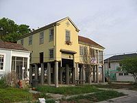
Broadmoor is low lying ground in New Orleans, and was only substantially developed beginning in the early 20th century after improved drainage was initiated (see: Drainage in New Orleans
). Before being developed, the area was a large marsh and was a fishing spot for Uptowners. Early construction were mostly high raised houses for fear of repeats of historic floods, but after decades with little problem more low lying residential structures were built in Broadmoor.
Broadmoor resident musician and producer Dave Bartholomew
named his Broadmoor Records
label after the neighborhood.
Broadmoor was hit hard by the May 8th 1995 Louisiana Flood
, after which extensive improvements of drainage were constructed.
 Broadmoor flooded badly in the aftermath of Hurricane Katrina
in 2005. A Bring New Orleans Back Commission
preliminary report map showed Broadmoor as a suggested area to be turned into park land; this suggestion is strongly objected to by residents, hundreds of whom were already back in their homes by January 2006, many living in the upstairs of two story homes while they worked on gutting and repairing their flooded ground floors.
, the district has a total area of 0.56 square miles (1.5 km²). 0.56 square miles (1.5 km²) of which is land and 0 square mile (0 km²) (0.00%) of which is water.
of 2000, there were 7,232 people, 2,915 households, and 1,788 families residing in the neighborhood. The population density
was 12,914 /mi² (4,986 /km²). The racial makeup of the neighborhood was 68.2% African American, 25.8% White, 0.6% Asian, 0.2% Native American, 0.2% from other races, and 1.3% from two or more races. Hispanic or Latino of any race were 3.7% of the population.
New Orleans neighborhoods
In 1980 the New Orleans City Planning Commission divided the city into 13 planning districts and 72 distinct neighborhoods.While most of these assigned boundaries match with traditional local designations, some others differ from common traditional use...
of the city of New Orleans
New Orleans, Louisiana
New Orleans is a major United States port and the largest city and metropolitan area in the state of Louisiana. The New Orleans metropolitan area has a population of 1,235,650 as of 2009, the 46th largest in the USA. The New Orleans – Metairie – Bogalusa combined statistical area has a population...
. A subdistrict of the Uptown
Uptown New Orleans
Uptown is a section of New Orleans, Louisiana on the East Bank of the Mississippi River encompassing a number of neighborhoods between the French Quarter and the Jefferson Parish line. It remains an area of mixed residential and small commercial properties, with a wealth of 19th century architecture...
/Carrollton
Carrollton, Louisiana
Carrollton is a neighborhood of uptown New Orleans, Louisiana, USA, which includes the Carrollton Historic District. It is the part of Uptown New Orleans farthest up river from the French Quarter...
Area, its boundaries as defined by the City Planning Commission are: Eve Street to the north, Washington Avenue and Toledano Street to the east, South Claiborne Avenue to the south, and Jefferson Avenue, South Rocheblave Street, Nashville Avenue, and Octavia Street to the west. It includes the Broadmoor Historic District which was listed on the National Register of Historic Places
National Register of Historic Places
The National Register of Historic Places is the United States government's official list of districts, sites, buildings, structures, and objects deemed worthy of preservation...
in 2003 and increased in its boundaries in 2007.
Broadmoor is low lying ground in New Orleans, and was only substantially developed beginning in the early 20th century after improved drainage was initiated (see: Drainage in New Orleans
Drainage in New Orleans
Drainage in New Orleans, Louisiana has been a major concern since the founding of the city in the early 18th century, remaining an important factor in the history of New Orleans through today....
). Before being developed, the area was a large marsh and was a fishing spot for Uptowners. Early construction were mostly high raised houses for fear of repeats of historic floods, but after decades with little problem more low lying residential structures were built in Broadmoor.
Broadmoor resident musician and producer Dave Bartholomew
Dave Bartholomew
Dave Bartholomew is a musician, band leader, composer and arranger, prominent in the music of New Orleans throughout the second half of the 20th century...
named his Broadmoor Records
Broadmoor Records
Broadmoor Records was a New Orleans, Louisiana based indie record label. Established by Dave Bartholomew, it was named after his neighborhood Broadmoor, New Orleans....
label after the neighborhood.
Broadmoor was hit hard by the May 8th 1995 Louisiana Flood
May 8th 1995 Louisiana Flood
The May 8th and 9th 1995 New Orleans Flood struck the New Orleans metropolitan area, shutting down the city for two days. It was a two-event phenomenon. Areas south of the lake began receiving tremendous amounts of rain at approximately 5:30 p.m. on May 7th, continuing into the early morning...
, after which extensive improvements of drainage were constructed.
Hurricane Katrina
Hurricane Katrina of the 2005 Atlantic hurricane season was a powerful Atlantic hurricane. It is the costliest natural disaster, as well as one of the five deadliest hurricanes, in the history of the United States. Among recorded Atlantic hurricanes, it was the sixth strongest overall...
in 2005. A Bring New Orleans Back Commission
Bring New Orleans Back Commission
The Bring New Orleans Back Commission was established by Mayor Ray Nagin of New Orleans, Louisiana, after the flooding caused by a major civil engineering failure in the aftermath of Hurricane Katrina in 2005. Aside from one Hispanic, the membership of the commission is half black and half white...
preliminary report map showed Broadmoor as a suggested area to be turned into park land; this suggestion is strongly objected to by residents, hundreds of whom were already back in their homes by January 2006, many living in the upstairs of two story homes while they worked on gutting and repairing their flooded ground floors.
Geography
Broadmoor is located at 29°56′56"N 90°06′15"W and has an elevation of 2 foot (0.6096 m). According to the United States Census BureauUnited States Census Bureau
The United States Census Bureau is the government agency that is responsible for the United States Census. It also gathers other national demographic and economic data...
, the district has a total area of 0.56 square miles (1.5 km²). 0.56 square miles (1.5 km²) of which is land and 0 square mile (0 km²) (0.00%) of which is water.
Adjacent Neighborhoods
- Gert TownGert Town, New OrleansGert Town is a neighborhood of the city of New Orleans. Local traditional definitions of the boundaries vary; this article discusses those designated by the New Orleans City Planning Commission, which includes the right across the Zion City area, which many locals consider a separate neighborhood...
(north) - Central CityCentral City, New OrleansCentral City is a neighborhood of the city of New Orleans. It is located at the lower end of Uptown, just above the New Orleans Central Business District, on the "lakeside" of St. Charles Avenue...
(east) - MilanMilan, New OrleansMilan is a neighborhood of the city of New Orleans. A subdistrict of the Central City/Garden District Area, its boundaries as defined by the City Planning Commission are: South Claiborne Avenue to the north, Toledano Street and Louisiana Avenue to the east, St. Charles Avenue to the south and...
(south) - FreretFreret, New OrleansFreret is a neighborhood of the city of New Orleans. A subdistrict of the Uptown/Carrollton Area, its boundaries as defined by the City Planning Commission are: South Claiborne Avenue to the north, Napoleon Avenue to the east, LaSalle Street to the south and Jefferson Avenue to the...
(south) - Marlyville/FontainebleauFontainebleau, New OrleansFontainebleau and Marlyville are jointly designated as a neighborhood of the city of New Orleans. A subdistrict of the Uptown/Carrollton Area, its boundaries as defined by the City Planning Commission are: Colapissa and Broadway Streets and MLK Boulevard to the north, South Jefferson Davis...
(west)
Boundaries
The City Planning Commission defines the boundaries of Broadmoor as these streets: Eve Street, Washington Avenue, Toledano Street, South Claiborne Avenue, Jefferson Avenue, South Rocheblave Street, Nashville Avenue, and Octavia Street.Demographics
As of the censusCensus
A census is the procedure of systematically acquiring and recording information about the members of a given population. It is a regularly occurring and official count of a particular population. The term is used mostly in connection with national population and housing censuses; other common...
of 2000, there were 7,232 people, 2,915 households, and 1,788 families residing in the neighborhood. The population density
Population density
Population density is a measurement of population per unit area or unit volume. It is frequently applied to living organisms, and particularly to humans...
was 12,914 /mi² (4,986 /km²). The racial makeup of the neighborhood was 68.2% African American, 25.8% White, 0.6% Asian, 0.2% Native American, 0.2% from other races, and 1.3% from two or more races. Hispanic or Latino of any race were 3.7% of the population.