

Brighton Road
Encyclopedia
Croydon
Croydon is a town in South London, England, located within the London Borough of Croydon to which it gives its name. It is situated south of Charing Cross...
and Purley
Purley, London
Purley is a place in the London Borough of Croydon, England. It is a suburban development situated 11.7 miles south of Charing Cross.The name derives from "pirlea", which means 'Peartree lea'. Purley has a population of about 72,000....
, in south London
London
London is the capital city of :England and the :United Kingdom, the largest metropolitan area in the United Kingdom, and the largest urban zone in the European Union by most measures. Located on the River Thames, London has been a major settlement for two millennia, its history going back to its...
, England
England
England is a country that is part of the United Kingdom. It shares land borders with Scotland to the north and Wales to the west; the Irish Sea is to the north west, the Celtic Sea to the south west, with the North Sea to the east and the English Channel to the south separating it from continental...
. The northern part of its length is designated the A235
A235 road
The A235 is a non-primary A road between Purley and Thornton Heath in the London Borough of Croydon. Before the construction of the Purley Way in the 1920s, it was part of the A23 London to Brighton road....
, and further south it becomes the A23
A23 road
The A23 road is a major road in the United Kingdom between London and Brighton, East Sussex. It became an arterial route following the construction of Westminster Bridge in 1750 and the consequent improvement of roads leading to the bridge south of the river by the Turnpike Trusts...
.
The road is likely to follow the route of the Roman road
Roman road
The Roman roads were a vital part of the development of the Roman state, from about 500 BC through the expansion during the Roman Republic and the Roman Empire. Roman roads enabled the Romans to move armies and trade goods and to communicate. The Roman road system spanned more than 400,000 km...
through Croydon and is shown on the earliest maps of the town. In the 18th century it was designated a Turnpike
Turnpike trust
Turnpike trusts in the United Kingdom were bodies set up by individual Acts of Parliament, with powers to collect road tolls for maintaining the principal highways in Britain from the 17th but especially during the 18th and 19th centuries...
, and there was a tollgate at the Selsdon Road junction.
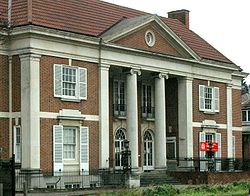
Brighton Road is home to the Purley War Memorial Hospitalhttp://www.nhs.uk/england/hospitals/MapSearch.aspx?id=Q08, Whitgift School
Whitgift School
Whitgift School is an independent day school educating approximately 1,400 boys aged 10 to 18 in South Croydon, London in a parkland site.- History and grounds :...
and the Swan & Sugarloaf public house
Public house
A public house, informally known as a pub, is a drinking establishment fundamental to the culture of Britain, Ireland, Australia and New Zealand. There are approximately 53,500 public houses in the United Kingdom. This number has been declining every year, so that nearly half of the smaller...
.
In 1992 the southern section, in Purley
Purley, London
Purley is a place in the London Borough of Croydon, England. It is a suburban development situated 11.7 miles south of Charing Cross.The name derives from "pirlea", which means 'Peartree lea'. Purley has a population of about 72,000....
, was named as a Local Area of Special Character. Buildings listed as being of local historical or architectural interest include the United Reform Church at number 960, and 1-13 High Street. http://www.croydon.gov.uk/environment/dcande/Conservation/lascrep/purllasc