
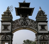
Birganj
Encyclopedia
Birganj is a sub-metropolitan municipality and border town in Parsa District
in the Narayani Zone
of southern Nepal
. It lies 283 km south of the capital Kathmandu, 3 km north of the border of the India
n state
of Bihar
. As an entry point to Nepal from Patna
and Calcutta
it is also known as the gateway to Nepal. The town has significant economic importance for Nepal as a large part of goods enter Nepal through Birganj via Raxaul
on the Indian side. Tribhuvan Highway
links it to Kathmandu.
 According to the 2001 census of Nepal it has a population of 112,484, there are several languages spoken in the town including Bhojpuri, Nepali
, Maithili
, Newari, Marwari
and Hindi
. It is the biggest city in Narayani Zone
and is a headquarter of Parsa District
.
Birganj is a major business centre of Nepal, especially for trade with India. Almost all trade with India occurs through this route. the bordering town Raxaul(India) has become one of the busiest town for heavy transportation due to high trade volume. Also the 29 KM distance from Birgunj to Pathlaiya is the Busiest highway in Nepal. Important industries are sugar refinery, cigarette manufacture, drugs manufacture, chemical industries, paper manufacturing and fish-breeding.
(Nepal).It was built in 1927 AD by the British and discontinued in early 1990s. talks are being held to reopen the route because of the socio-economic importance. But goods are still transported by trains at the Birganj dry port, which is a key point of land line cargo delivery to Nepal. This cargo point on the south connects the heart of the country Kathmandu via another key industrial city Hetauda
.It is also served by Tribhuvan Highway
extending from the Indian border at Raxaul
through Birganj and Hetauda
to Kathmandu with frequent bus service. Simara Airport
-- 18 km (11 mi) north near the highway in Pipara Simara
, Bara district
offers scheduled flights to Kathmandu.
The National Medical College, affiliated to the Tribhuvan University
is also there. Spread out over a huge campus and also having a 1000 bedded hospital adjacent to the medical college, it is one of the premier medical colleges in the country. It has a large number of intermediate colleges and various other professional institution. M.B. Kedia Dental college was also established in 2005 in the city of birgunj.Mount Edmund Secondary School was established in 1985 A.D. Apart from these there are many private colleges that are in operations with affiliations from the government. some of the major institutions include:
Hari Khetan Multiple Campus (HKMC)
Birgunj Public College (BPC)
Birgunj Commerce College (BCC)
om international college (OI)
Mount Edmund Secondary School(MESS)
Sarawagi Group is one of the major thriving business having industries of food ingredients, cooking oil, chemicals, furniture, skimmed milk and various other things. It is based in Birgunj and has connection overseas as per trading.
Parsa District
-Village Development Committees :*Alau*Amarpatti*Auraha*Bagahi*Bagbana*Bageswori*Bahauri Pidari*Bahurbamatha*Basadilwa*Basantpur*Belwa Parsouni*Beriya Birta*Bhawanipur*Bhedihari*Bhisawa*Bijbaniya*Bindabasini*Biranchibarba*Birganj...
in the Narayani Zone
Narayani Zone
- Geography :Narayani contains parts of the Terai, Inner Terai, and Hill regions of Nepal, but it does not contain any of the Mountain or Himalayan region. Narayani is rich in flora and fauna...
of southern Nepal
Nepal
Nepal , officially the Federal Democratic Republic of Nepal, is a landlocked sovereign state located in South Asia. It is located in the Himalayas and bordered to the north by the People's Republic of China, and to the south, east, and west by the Republic of India...
. It lies 283 km south of the capital Kathmandu, 3 km north of the border of the India
India
India , officially the Republic of India , is a country in South Asia. It is the seventh-largest country by geographical area, the second-most populous country with over 1.2 billion people, and the most populous democracy in the world...
n state
States and territories of India
India is a federal union of states comprising twenty-eight states and seven union territories. The states and territories are further subdivided into districts and so on.-List of states and territories:...
of Bihar
Bihar
Bihar is a state in eastern India. It is the 12th largest state in terms of geographical size at and 3rd largest by population. Almost 58% of Biharis are below the age of 25, which is the highest proportion in India....
. As an entry point to Nepal from Patna
Patna
Paṭnā , is the capital of the Indian state of Bihar and the second largest city in Eastern India . Patna is one of the oldest continuously inhabited places in the world...
and Calcutta
Kolkata
Kolkata , formerly known as Calcutta, is the capital of the Indian state of West Bengal. Located on the east bank of the Hooghly River, it was the commercial capital of East India...
it is also known as the gateway to Nepal. The town has significant economic importance for Nepal as a large part of goods enter Nepal through Birganj via Raxaul
Raxaul
Raxaul or Raxaul is a sub-divisional town in the East Champaran district of the Indian state of Bihar. It is situated on the India-Nepal border with Birganj on the other side of the border.-Demographics:...
on the Indian side. Tribhuvan Highway
Tribhuvan Highway
The Tribhuvan Highway connects the outskirts of Kathmandu, the capital of Nepal, with Birganj/ Raxaul on the Nepal-India border. NH 28 and NH 28A links Raxaul with Lucknow/ Barauni and other locations in India.-History:...
links it to Kathmandu.
Nepali language
Nepali or Nepalese is a language in the Indo-Aryan branch of the Indo-European language family.It is the official language and de facto lingua franca of Nepal and is also spoken in Bhutan, parts of India and parts of Myanmar...
, Maithili
Maithili language
Maithili language is spoken in the eastern region of India and South-eastern region of Nepal. The native speakers of Maithili reside in Bihar, Jharkhand,parts of West Bengal and South-east Nepal...
, Newari, Marwari
Marwari language
The Marwari language , also variously Marvari, Marwadi, Marvadi), is spoken in the Indian state of Rajasthan. Marwari is also found in the neighboring state of Gujarat and Haryana and in Eastern Pakistan...
and Hindi
Hindi
Standard Hindi, or more precisely Modern Standard Hindi, also known as Manak Hindi , High Hindi, Nagari Hindi, and Literary Hindi, is a standardized and sanskritized register of the Hindustani language derived from the Khariboli dialect of Delhi...
. It is the biggest city in Narayani Zone
Narayani Zone
- Geography :Narayani contains parts of the Terai, Inner Terai, and Hill regions of Nepal, but it does not contain any of the Mountain or Himalayan region. Narayani is rich in flora and fauna...
and is a headquarter of Parsa District
Parsa District
-Village Development Committees :*Alau*Amarpatti*Auraha*Bagahi*Bagbana*Bageswori*Bahauri Pidari*Bahurbamatha*Basadilwa*Basantpur*Belwa Parsouni*Beriya Birta*Bhawanipur*Bhedihari*Bhisawa*Bijbaniya*Bindabasini*Biranchibarba*Birganj...
.
Birganj is a major business centre of Nepal, especially for trade with India. Almost all trade with India occurs through this route. the bordering town Raxaul(India) has become one of the busiest town for heavy transportation due to high trade volume. Also the 29 KM distance from Birgunj to Pathlaiya is the Busiest highway in Nepal. Important industries are sugar refinery, cigarette manufacture, drugs manufacture, chemical industries, paper manufacturing and fish-breeding.
Transport
Birganj was the only door to and out of Nepal by road at first. It was the only city that connected the country with India.Birganj was served by a station on a branch of Indian Railways which extended to AmlekhganjAmlekhganj
Amlekhganj is a town and Village Development Committee in Bara District in the Narayani Zone of south-eastern Nepal. At the time of the 1991 Nepal census it had a population of 4,006 persons living in 742 individual households.-External links:*...
(Nepal).It was built in 1927 AD by the British and discontinued in early 1990s. talks are being held to reopen the route because of the socio-economic importance. But goods are still transported by trains at the Birganj dry port, which is a key point of land line cargo delivery to Nepal. This cargo point on the south connects the heart of the country Kathmandu via another key industrial city Hetauda
Hetauda
Hetauda is a town in the Makwanpur District of the Narayani Zone in southern Nepal. It is also the administrative headquarters of the Makwanpur district. At the time of the 1991 Nepal census it had a population of 53,836 people living in 10,420 individual households...
.It is also served by Tribhuvan Highway
Tribhuvan Highway
The Tribhuvan Highway connects the outskirts of Kathmandu, the capital of Nepal, with Birganj/ Raxaul on the Nepal-India border. NH 28 and NH 28A links Raxaul with Lucknow/ Barauni and other locations in India.-History:...
extending from the Indian border at Raxaul
Raxaul
Raxaul or Raxaul is a sub-divisional town in the East Champaran district of the Indian state of Bihar. It is situated on the India-Nepal border with Birganj on the other side of the border.-Demographics:...
through Birganj and Hetauda
Hetauda
Hetauda is a town in the Makwanpur District of the Narayani Zone in southern Nepal. It is also the administrative headquarters of the Makwanpur district. At the time of the 1991 Nepal census it had a population of 53,836 people living in 10,420 individual households...
to Kathmandu with frequent bus service. Simara Airport
Simara Airport
Simara Airport is an airport serving Pipara Simara in Nepal. The airport was established July 4, 1958 and is operated by the Civil Aviation Authority of Nepal.-Airlines and destinations:...
-- 18 km (11 mi) north near the highway in Pipara Simara
Pipara Simara
Pipara Simara is a town and Village Development Committee in Bara District in the Narayani Zone of south-eastern Nepal. At the time of the 1991 Nepal census it had a population of 17,122.-External links:*...
, Bara district
Bara District
Bara District of 559,135. Pasaha, Dudhaura and Bangari are the main rivers of Bara. Gamahariya is one of the villages of Bara District which is situated near the border area of India....
offers scheduled flights to Kathmandu.
Educational institutions
Tribhuvan University, Thakur Ram Multiple Campus is the oldest institution in the Terai. The Golden Jubilee of this campus was celebrated in 2003. It has one institute Science and Technology and three faculties Arts, Commerce and Education in one campus.The National Medical College, affiliated to the Tribhuvan University
Tribhuvan University
Tribhuvan University [त्रिभुवन विश्वविध्यालय] is a public university located in Kirtipur, Kathmandu, Nepal. Established in 1959, TU is the oldest of the five universities in Nepal...
is also there. Spread out over a huge campus and also having a 1000 bedded hospital adjacent to the medical college, it is one of the premier medical colleges in the country. It has a large number of intermediate colleges and various other professional institution. M.B. Kedia Dental college was also established in 2005 in the city of birgunj.Mount Edmund Secondary School was established in 1985 A.D. Apart from these there are many private colleges that are in operations with affiliations from the government. some of the major institutions include:
Hari Khetan Multiple Campus (HKMC)
Birgunj Public College (BPC)
Birgunj Commerce College (BCC)
om international college (OI)
Mount Edmund Secondary School(MESS)
Business
Birgunj has a thriving business community and several prominent business houses are headquartered here.Sarawagi Group is one of the major thriving business having industries of food ingredients, cooking oil, chemicals, furniture, skimmed milk and various other things. It is based in Birgunj and has connection overseas as per trading.
2006 unrest
On 18 May 2006 the parliament of Nepal declared that the country would now be a secular state. This led to unrest by Hindu fundamentalist groups across Nepal - the town of Birganj was forced to close for two days.External links
- Birganj at SitaNepal