
Big Pine, California
Encyclopedia
Big Pine is a census-designated place
(CDP) in Inyo County
, California
, United States
. Big Pine is located 15 miles (24 km) south-southeast of Bishop
, at an elevation of 3990 feet (1216 m). The population was 1,756 at the 2010 census, up from 1,350 at the 2000 census. The Big Pine Band of Owens Valley Paiute Shoshone Indians of the Big Pine Reservation
operates their tribal headquarters from here.
of California between the Sierra Nevada
and the White Mountains
, just west of the Owens River
upstream of its diversion into the Los Angeles Aqueduct
. It lies on U.S. Route 395, the main north-south artery through the Owens Valley, connecting the Inland Empire
to Reno, Nevada
. US 395 also connects Big Pine to Los Angeles
via State Route 14
through Palmdale
.
To the East, CA route 168 crosses the White Mountains
over Westgard Pass
to the basin and range province of Nevada, while Death Valley Road lads to Death Valley
. The plaque beneath the young giant sequoia (pictured) at the road junction says it was planted in 1913 to commemorate the opening of Westgaard Pass to auto traffic. North from Westgaard Pass lies the Ancient Bristlecone Pine Forest
, home to the oldest trees in the world.
To the West, Glacier Lodge Road leads high up Big Pine Creek into the Sierra, to lakes, hiking trails, fishing, and rock climbing underneath the Palisades Range
and the Palisade Glacier.
According to the United States Census Bureau
, the CDP has a total area of 3 square miles (7.8 km²), over 99% of it land.
Big Pine has a significant geologic feature (an earthquake scarp
) related to the 1872 Lone Pine earthquake
.
Matt Williams, a professional baseball player, lived there for part of his life.
was 594.0 people per square mile (229.4/km²). The racial makeup of Big Pine was 1,192 (67.9%) White, 3 (0.2%) African American, 438 (24.9%) Native American, 13 (0.7%) Asian, 1 (0.1%) Pacific Islander, 52 (3.0%) from other races
, and 57 (3.2%) from two or more races. Hispanic or Latino of any race were 182 persons (10.4%).
The Census reported that 1,756 people (100% of the population) lived in households, 0 (0%) lived in non-institutionalized group quarters, and 0 (0%) were institutionalized.
There were 764 households, out of which 184 (24.1%) had children under the age of 18 living in them, 360 (47.1%) were opposite-sex married couples
living together, 100 (13.1%) had a female householder with no husband present, 37 (4.8%) had a male householder with no wife present. There were 49 (6.4%) unmarried opposite-sex partnerships
, and 7 (0.9%) same-sex married couples or partnerships. 219 households (28.7%) were made up of individuals and 100 (13.1%) had someone living alone who was 65 years of age or older. The average household size was 2.30. There were 497 families
(65.1% of all households); the average family size was 2.78.
The population was spread out with 341 people (19.4%) under the age of 18, 118 people (6.7%) aged 18 to 24, 381 people (21.7%) aged 25 to 44, 571 people (32.5%) aged 45 to 64, and 345 people (19.6%) who were 65 years of age or older. The median age was 46.6 years. For every 100 females there were 97.1 males. For every 100 females age 18 and over, there were 92.3 males.
There were 871 housing units at an average density of 294.7 per square mile (113.8/km²), of which 586 (76.7%) were owner-occupied, and 178 (23.3%) were occupied by renters. The homeowner vacancy rate was 1.5%; the rental vacancy rate was 6.3%. 1,357 people (77.3% of the population) lived in owner-occupied housing units and 399 people (22.7%) lived in rental housing units.
of 2000, there were 1,350 people, 571 households, and 403 families residing in the CDP. The population density
was 556.4 people per square mile (214.5/km²). There were 668 housing units at an average density of 275.3 per square mile (106.1/km²). The racial makeup of the CDP was 86.07% White
, 0.15% Black
or African American
, 4.30% Native American
, 0.59% Asian
, 3.19% from other races
, and 5.70% from two or more races. 8.00% of the population were Hispanic
or Latino
of any race.
There were 571 households out of which 24.2% had children under the age of 18 living with them, 59.5% were married couples
living together, 5.6% had a female householder with no husband present, and 29.4% were non-families. 24.7% of all households were made up of individuals and 11.9% had someone living alone who was 65 years of age or older. The average household size was 2.29 and the average family size was 2.70.
In the CDP the population was spread out with 20.4% under the age of 18, 3.9% from 18 to 24, 23.0% from 25 to 44, 26.3% from 45 to 64, and 26.4% who were 65 years of age or older. The median age was 47 years. For every 100 females there were 98.8 males. For every 100 females age 18 and over, there were 93.3 males.
The median income for a household in the CDP was $37,115, and the median income for a family was $46,094. Males had a median income of $41,827 versus $26,500 for females. The per capita income
for the CDP was $20,109. About 7.1% of families and 10.1% of the population were below the poverty line, including 7.5% of those under age 18 and 9.0% of those age 65 or over.
Big Pine students are served by Big Pine Unified School District which features an elementary school, middle school, high school and a continuation high school. The Big Pine high school mascot is the Warrior.
Big Pine is located in the 18th Senate
District, represented by Republican
Roy Ashburn
, and in the 18th Assembly
District, represented by Republican Bill Maze
. Federally, Big Pine is located in California's 25th congressional district
, which has a Cook PVI
of R +7 and is represented by Republican Buck McKeon
.
The State Supreme Court ruled that, indeed the law was in violation of the 14th Amendment of the U.S. Constitution, and Piper was invited as a pupil. Because of this, the Big Pine School District is memorialized as a major player in the constitutional battle over the rights of Native Americans to attend public schools segregated for “whites only.”
The Piper case has gone on to became a landmark case and viewed as the legal authority guaranteeing Native American children the right to attend public schools, and has been used as precedence in other cases such as Brown v. Board of Education.
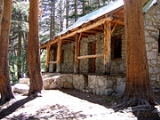
(April 8, 1885–December 23, 1972) was a famous mountaineer, nature photographer, and self trained naturalist. He is well-known for achieving over 100 first ascents, many in California's Sierra Nevada and Montana. He also set a speed climbing record on Mount Shasta in 1923. In the 1950s and 1960s, he lived by himself at the old Baker ranch-house on Baker Creek near Big Pine. He also served as a caretaker of Glacier Lodge on Big Pine Creek and a fishing cabin owned by Lon Chaney Sr. in the Palisades above Big Pine.
Clyde was born in Philadelphia, the son of a Presbyterian minister. He attended Geneva College graduating in the Classics in June 1909. After teaching at several rural schools, including Fargo, North Dakota and Mount Pleasant, Utah, he enrolled at the University of California, Berkeley in 1911. After two years of graduate work he returned to teaching, mostly in northern California. On June 15, 1915, Norman Clyde married Winifred May Bolster in Pasadena, California. Winnie was a nurse at a tuberculosis hospital, and contracted the disease herself. After 4 years of suffering she died at age 28 in 1919. His wife's death appears to have profoundly affected him as he moved to the Eastern Sierra to spend much of his latter life alone.
Clyde spent many summers traveling about in the Sierra Nevada, bagging first ascents. He served as climbing leader at Sierra Club base camps where he became known as "the pack that walks like a man" because of the huge backpacks he carried. In addition to as many as five cameras, he carried a hammer and cobbler's anvil in order to make field repairs to client's boots.
Census-designated place
A census-designated place is a concentration of population identified by the United States Census Bureau for statistical purposes. CDPs are delineated for each decennial census as the statistical counterparts of incorporated places such as cities, towns and villages...
(CDP) in Inyo County
Inyo County, California
-National protected areas:* Death Valley National Park * Inyo National Forest * Manzanar National Historic Site-Major highways:* U.S. Route 6* U.S. Route 395* State Route 127* State Route 136* State Route 168* State Route 178...
, California
California
California is a state located on the West Coast of the United States. It is by far the most populous U.S. state, and the third-largest by land area...
, United States
United States
The United States of America is a federal constitutional republic comprising fifty states and a federal district...
. Big Pine is located 15 miles (24 km) south-southeast of Bishop
Bishop, California
Bishop is a city in Inyo County, California, United States. Though Bishop is the only city and the largest populated place in Inyo County, the county seat is Independence. Bishop is located near the northern end of the Owens Valley, at an elevation of 4147 feet . The population was 3,879 at the...
, at an elevation of 3990 feet (1216 m). The population was 1,756 at the 2010 census, up from 1,350 at the 2000 census. The Big Pine Band of Owens Valley Paiute Shoshone Indians of the Big Pine Reservation
Big Pine Band of Owens Valley Paiute Shoshone Indians of the Big Pine Reservation
The Big Pine Band of Owens Valley Paiute Shoshone Indians of the Big Pine Reservation are a federally recognized tribe of Mono and Timbisha Indians in California.The Big Pine Reservation is located from Bishop, at the eastern base of the Sierra Nevada...
operates their tribal headquarters from here.
Geography
Big Pine is located in the Owens ValleyOwens Valley
Owens Valley is the arid valley of the Owens River in eastern California in the United States, to the east of the Sierra Nevada and west of the White Mountains and Inyo Mountains on the west edge of the Great Basin section...
of California between the Sierra Nevada
Sierra Nevada (US)
The Sierra Nevada is a mountain range in the U.S. states of California and Nevada, between the California Central Valley and the Basin and Range Province. The Sierra runs north-to-south, and is approximately across east-to-west...
and the White Mountains
White Mountains (California)
The White Mountains of California are a triangular fault block mountain range facing the Sierra Nevada across the upper Owens Valley. They extend for approximately as a greatly elevated plateau about wide on the south, narrowing to a point at the north, with elevations generally increasing...
, just west of the Owens River
Owens River
The Owens River is a river in southeastern California in the United States, approximately long. It drains into and through the Owens Valley, an arid basin between the eastern slope of the Sierra Nevada and the western faces of the Inyo and White Mountains. The river terminates at Owens Lake, but...
upstream of its diversion into the Los Angeles Aqueduct
Los Angeles Aqueduct
The Los Angeles Aqueduct system comprising the Los Angeles Aqueduct and the Second Los Angeles Aqueduct, is a water conveyance system operated by the Los Angeles Department of Water and Power...
. It lies on U.S. Route 395, the main north-south artery through the Owens Valley, connecting the Inland Empire
Inland Empire (California)
The Inland Empire is a region in Southern California. The region sits directly east of the Los Angeles metropolitan area. The Inland Empire most commonly is used in reference to the U.S. Census Bureau's federally-defined Riverside-San Bernardino-Ontario metropolitan area, which covers more than...
to Reno, Nevada
Reno, Nevada
Reno is the county seat of Washoe County, Nevada, United States. The city has a population of about 220,500 and is the most populous Nevada city outside of the Las Vegas metropolitan area...
. US 395 also connects Big Pine to Los Angeles
Los Angeles, California
Los Angeles , with a population at the 2010 United States Census of 3,792,621, is the most populous city in California, USA and the second most populous in the United States, after New York City. It has an area of , and is located in Southern California...
via State Route 14
California State Route 14
State Route 14 is a north–south state highway in the U.S. state of California, largely in the Mojave Desert. The southern portion of the highway is signed as the Antelope Valley Freeway. The route connects Interstate 5, or Golden State Freeway, near Santa Clarita and with U.S. Route 395 near...
through Palmdale
Palmdale, California
Palmdale is a city located in the center of northern Los Angeles County, California, United States.Palmdale was the first community within the Antelope Valley to incorporate as a city on August 24, 1962; 47 years later, voters approved creating a charter city in November, 2009. Palmdale is...
.
To the East, CA route 168 crosses the White Mountains
White Mountains (California)
The White Mountains of California are a triangular fault block mountain range facing the Sierra Nevada across the upper Owens Valley. They extend for approximately as a greatly elevated plateau about wide on the south, narrowing to a point at the north, with elevations generally increasing...
over Westgard Pass
Westgard Pass
Westgard Pass is a narrow gap between the White and Inyo mountain ranges in the Basin and Range Province of California. Westgard Pass lies entirely within the Inyo National Forest, in northern Inyo County, California....
to the basin and range province of Nevada, while Death Valley Road lads to Death Valley
Death Valley
Death Valley is a desert valley located in Eastern California. Situated within the Mojave Desert, it features the lowest, driest, and hottest locations in North America. Badwater, a basin located in Death Valley, is the specific location of the lowest elevation in North America at 282 feet below...
. The plaque beneath the young giant sequoia (pictured) at the road junction says it was planted in 1913 to commemorate the opening of Westgaard Pass to auto traffic. North from Westgaard Pass lies the Ancient Bristlecone Pine Forest
Ancient Bristlecone Pine Forest
The Ancient Bristlecone Pine Forest is high in the White Mountains in Inyo County in eastern California. The Great Basin Bristlecone Pine trees grow between 9,800 and 11,000 feet above sea level, in xeric alpine conditions, protected within the Inyo National Forest...
, home to the oldest trees in the world.
To the West, Glacier Lodge Road leads high up Big Pine Creek into the Sierra, to lakes, hiking trails, fishing, and rock climbing underneath the Palisades Range
Palisades (California Sierra)
The Palisades are a group of peaks in the central part of the Sierra Nevada in the US state of California. They are located about southwest of the town of Big Pine, California...
and the Palisade Glacier.
According to the United States Census Bureau
United States Census Bureau
The United States Census Bureau is the government agency that is responsible for the United States Census. It also gathers other national demographic and economic data...
, the CDP has a total area of 3 square miles (7.8 km²), over 99% of it land.
History
The Big Pine post office first opened in 1870, closed for a time during 1877, changed its name to Bigpine in 1895, and reverted to Big Pine in 1962.Big Pine has a significant geologic feature (an earthquake scarp
Fault scarp
A fault scarp is the topographic expression of faulting attributed to the displacement of the land surface by movement along faults. They are exhibited either by differential movement and subsequent erosion along an old inactive geologic fault , or by a movement on a recent active fault...
) related to the 1872 Lone Pine earthquake
1872 Lone Pine earthquake
The Great Lone Pine earthquake was one of the largest earthquakes to hit California in recorded history. The quake struck on March 26, 1872 and its epicenter was near Lone Pine, California in Owens Valley...
.
Matt Williams, a professional baseball player, lived there for part of his life.
2010
The 2010 United States Census reported that Big Pine had a population of 1,756. The population densityPopulation density
Population density is a measurement of population per unit area or unit volume. It is frequently applied to living organisms, and particularly to humans...
was 594.0 people per square mile (229.4/km²). The racial makeup of Big Pine was 1,192 (67.9%) White, 3 (0.2%) African American, 438 (24.9%) Native American, 13 (0.7%) Asian, 1 (0.1%) Pacific Islander, 52 (3.0%) from other races
Race (United States Census)
Race and ethnicity in the United States Census, as defined by the Federal Office of Management and Budget and the United States Census Bureau, are self-identification data items in which residents choose the race or races with which they most closely identify, and indicate whether or not they are...
, and 57 (3.2%) from two or more races. Hispanic or Latino of any race were 182 persons (10.4%).
The Census reported that 1,756 people (100% of the population) lived in households, 0 (0%) lived in non-institutionalized group quarters, and 0 (0%) were institutionalized.
There were 764 households, out of which 184 (24.1%) had children under the age of 18 living in them, 360 (47.1%) were opposite-sex married couples
Marriage
Marriage is a social union or legal contract between people that creates kinship. It is an institution in which interpersonal relationships, usually intimate and sexual, are acknowledged in a variety of ways, depending on the culture or subculture in which it is found...
living together, 100 (13.1%) had a female householder with no husband present, 37 (4.8%) had a male householder with no wife present. There were 49 (6.4%) unmarried opposite-sex partnerships
POSSLQ
POSSLQ is an abbreviation for "Persons of Opposite Sex Sharing Living Quarters," a term coined in the late 1970s by the United States Census Bureau as part of an effort to more accurately gauge the prevalence of cohabitation in American households....
, and 7 (0.9%) same-sex married couples or partnerships. 219 households (28.7%) were made up of individuals and 100 (13.1%) had someone living alone who was 65 years of age or older. The average household size was 2.30. There were 497 families
Family (U.S. Census)
A family or family household is defined by the United States Census Bureau for statistical purposes as "a householder and one or more other people related to the householder by birth, marriage, or adoption. They do not include same-sex married couples even if the marriage was performed in a state...
(65.1% of all households); the average family size was 2.78.
The population was spread out with 341 people (19.4%) under the age of 18, 118 people (6.7%) aged 18 to 24, 381 people (21.7%) aged 25 to 44, 571 people (32.5%) aged 45 to 64, and 345 people (19.6%) who were 65 years of age or older. The median age was 46.6 years. For every 100 females there were 97.1 males. For every 100 females age 18 and over, there were 92.3 males.
There were 871 housing units at an average density of 294.7 per square mile (113.8/km²), of which 586 (76.7%) were owner-occupied, and 178 (23.3%) were occupied by renters. The homeowner vacancy rate was 1.5%; the rental vacancy rate was 6.3%. 1,357 people (77.3% of the population) lived in owner-occupied housing units and 399 people (22.7%) lived in rental housing units.
2000
As of the censusCensus
A census is the procedure of systematically acquiring and recording information about the members of a given population. It is a regularly occurring and official count of a particular population. The term is used mostly in connection with national population and housing censuses; other common...
of 2000, there were 1,350 people, 571 households, and 403 families residing in the CDP. The population density
Population density
Population density is a measurement of population per unit area or unit volume. It is frequently applied to living organisms, and particularly to humans...
was 556.4 people per square mile (214.5/km²). There were 668 housing units at an average density of 275.3 per square mile (106.1/km²). The racial makeup of the CDP was 86.07% White
Race (United States Census)
Race and ethnicity in the United States Census, as defined by the Federal Office of Management and Budget and the United States Census Bureau, are self-identification data items in which residents choose the race or races with which they most closely identify, and indicate whether or not they are...
, 0.15% Black
Race (United States Census)
Race and ethnicity in the United States Census, as defined by the Federal Office of Management and Budget and the United States Census Bureau, are self-identification data items in which residents choose the race or races with which they most closely identify, and indicate whether or not they are...
or African American
Race (United States Census)
Race and ethnicity in the United States Census, as defined by the Federal Office of Management and Budget and the United States Census Bureau, are self-identification data items in which residents choose the race or races with which they most closely identify, and indicate whether or not they are...
, 4.30% Native American
Race (United States Census)
Race and ethnicity in the United States Census, as defined by the Federal Office of Management and Budget and the United States Census Bureau, are self-identification data items in which residents choose the race or races with which they most closely identify, and indicate whether or not they are...
, 0.59% Asian
Race (United States Census)
Race and ethnicity in the United States Census, as defined by the Federal Office of Management and Budget and the United States Census Bureau, are self-identification data items in which residents choose the race or races with which they most closely identify, and indicate whether or not they are...
, 3.19% from other races
Race (United States Census)
Race and ethnicity in the United States Census, as defined by the Federal Office of Management and Budget and the United States Census Bureau, are self-identification data items in which residents choose the race or races with which they most closely identify, and indicate whether or not they are...
, and 5.70% from two or more races. 8.00% of the population were Hispanic
Race (United States Census)
Race and ethnicity in the United States Census, as defined by the Federal Office of Management and Budget and the United States Census Bureau, are self-identification data items in which residents choose the race or races with which they most closely identify, and indicate whether or not they are...
or Latino
Race (United States Census)
Race and ethnicity in the United States Census, as defined by the Federal Office of Management and Budget and the United States Census Bureau, are self-identification data items in which residents choose the race or races with which they most closely identify, and indicate whether or not they are...
of any race.
There were 571 households out of which 24.2% had children under the age of 18 living with them, 59.5% were married couples
Marriage
Marriage is a social union or legal contract between people that creates kinship. It is an institution in which interpersonal relationships, usually intimate and sexual, are acknowledged in a variety of ways, depending on the culture or subculture in which it is found...
living together, 5.6% had a female householder with no husband present, and 29.4% were non-families. 24.7% of all households were made up of individuals and 11.9% had someone living alone who was 65 years of age or older. The average household size was 2.29 and the average family size was 2.70.
In the CDP the population was spread out with 20.4% under the age of 18, 3.9% from 18 to 24, 23.0% from 25 to 44, 26.3% from 45 to 64, and 26.4% who were 65 years of age or older. The median age was 47 years. For every 100 females there were 98.8 males. For every 100 females age 18 and over, there were 93.3 males.
The median income for a household in the CDP was $37,115, and the median income for a family was $46,094. Males had a median income of $41,827 versus $26,500 for females. The per capita income
Per capita income
Per capita income or income per person is a measure of mean income within an economic aggregate, such as a country or city. It is calculated by taking a measure of all sources of income in the aggregate and dividing it by the total population...
for the CDP was $20,109. About 7.1% of families and 10.1% of the population were below the poverty line, including 7.5% of those under age 18 and 9.0% of those age 65 or over.
Big Pine students are served by Big Pine Unified School District which features an elementary school, middle school, high school and a continuation high school. The Big Pine high school mascot is the Warrior.
Politics
In the state legislatureCalifornia State Legislature
The California State Legislature is the state legislature of the U.S. state of California. It is a bicameral body consisting of the lower house, the California State Assembly, with 80 members, and the upper house, the California State Senate, with 40 members...
Big Pine is located in the 18th Senate
California State Senate
The California State Senate is the upper house of the California State Legislature. There are 40 state senators. The state legislature meets in the California State Capitol in Sacramento. The Lieutenant Governor is the ex officio President of the Senate and may break a tied vote...
District, represented by Republican
Republican Party (United States)
The Republican Party is one of the two major contemporary political parties in the United States, along with the Democratic Party. Founded by anti-slavery expansion activists in 1854, it is often called the GOP . The party's platform generally reflects American conservatism in the U.S...
Roy Ashburn
Roy Ashburn
Roy Arthur Ashburn is an American politician from Kern County, California. A Republican, he served as a California State Senator from 2002 to 2010 representing the 18th district. He previously served three terms in the California State Assembly, representing the 32nd district and 12 years on the...
, and in the 18th Assembly
California State Assembly
The California State Assembly is the lower house of the California State Legislature. There are 80 members in the Assembly, representing an approximately equal number of constituents, with each district having a population of at least 420,000...
District, represented by Republican Bill Maze
Bill Maze
Bill Maze is an American politician from California and a member of the Republican Party. Maze is the president of Citizens for Saving California Farming Industries, a non-profit dedicated to dividing California into two states....
. Federally, Big Pine is located in California's 25th congressional district
California's 25th congressional district
California's 25th congressional district is a congressional district in the U.S. state of California that covers part of Los Angeles County and extends out to broad stretches of interior California along the Nevada border. It includes the cities of Santa Clarita, Palmdale, Lancaster, and the...
, which has a Cook PVI
Cook Partisan Voting Index
The Cook Partisan Voting Index , sometimes referred to as simply the Partisan Voting Index , is a measurement of how strongly an American congressional district or state leans toward one political party compared to the nation as a whole...
of R +7 and is represented by Republican Buck McKeon
Howard McKeon
Howard Philip "Buck" McKeon is the U.S. Representative for , serving since 1993. He is a member of the Republican Party.-Early life, education and career:...
.
Piper v. Big Pine (1924) 193 Cal. 664
Alice Piper, a 15-year-old Native American living in Big Pine in 1924, wanted to attend Big Pine school, but was denied on her ethnicity. Piper, the daughter of Pike and Annie Piper, sued the school district claiming the state law establishing separate schools for “Indian children” and other children of Asian parentage was unconstitutional.The State Supreme Court ruled that, indeed the law was in violation of the 14th Amendment of the U.S. Constitution, and Piper was invited as a pupil. Because of this, the Big Pine School District is memorialized as a major player in the constitutional battle over the rights of Native Americans to attend public schools segregated for “whites only.”
The Piper case has gone on to became a landmark case and viewed as the legal authority guaranteeing Native American children the right to attend public schools, and has been used as precedence in other cases such as Brown v. Board of Education.
Norman Clyde
Norman ClydeNorman Clyde
Norman Clyde was a mountaineer, mountain guide, freelance writer, nature photographer, and self trained naturalist. He is well-known for achieving over 130 first ascents, many in California's Sierra Nevada and Montana's Glacier National Park...
(April 8, 1885–December 23, 1972) was a famous mountaineer, nature photographer, and self trained naturalist. He is well-known for achieving over 100 first ascents, many in California's Sierra Nevada and Montana. He also set a speed climbing record on Mount Shasta in 1923. In the 1950s and 1960s, he lived by himself at the old Baker ranch-house on Baker Creek near Big Pine. He also served as a caretaker of Glacier Lodge on Big Pine Creek and a fishing cabin owned by Lon Chaney Sr. in the Palisades above Big Pine.
Clyde was born in Philadelphia, the son of a Presbyterian minister. He attended Geneva College graduating in the Classics in June 1909. After teaching at several rural schools, including Fargo, North Dakota and Mount Pleasant, Utah, he enrolled at the University of California, Berkeley in 1911. After two years of graduate work he returned to teaching, mostly in northern California. On June 15, 1915, Norman Clyde married Winifred May Bolster in Pasadena, California. Winnie was a nurse at a tuberculosis hospital, and contracted the disease herself. After 4 years of suffering she died at age 28 in 1919. His wife's death appears to have profoundly affected him as he moved to the Eastern Sierra to spend much of his latter life alone.
Clyde spent many summers traveling about in the Sierra Nevada, bagging first ascents. He served as climbing leader at Sierra Club base camps where he became known as "the pack that walks like a man" because of the huge backpacks he carried. In addition to as many as five cameras, he carried a hammer and cobbler's anvil in order to make field repairs to client's boots.