
Big Dig
Encyclopedia
Megaproject
A megaproject is an extremely large-scale investment project. Megaprojects are typically defined as costing more than US$1 billion and attracting a lot of public attention because of substantial impacts on communities, environment, and budgets. Megaprojects can also be defined as "initiatives that...
in Boston
Boston
Boston is the capital of and largest city in Massachusetts, and is one of the oldest cities in the United States. The largest city in New England, Boston is regarded as the unofficial "Capital of New England" for its economic and cultural impact on the entire New England region. The city proper had...
that rerouted the Central Artery
Central Artery
The John F. Fitzgerald Expressway, known locally as the Central Artery, is a section of freeway in downtown Boston, Massachusetts, designated as Interstate 93, U.S. Route 1 and Route 3. It was initially constructed in the 1950s as a partly elevated and partly tunneled divided highway...
(Interstate 93
Interstate 93
Interstate 93 is an Interstate Highway in the New England section of the United States. Its southern terminus is in Canton, Massachusetts, in the Boston metropolitan area, at Interstate 95; its northern terminus is near St. Johnsbury, Vermont, at Interstate 91...
), the chief highway
Highway
A highway is any public road. In American English, the term is common and almost always designates major roads. In British English, the term designates any road open to the public. Any interconnected set of highways can be variously referred to as a "highway system", a "highway network", or a...
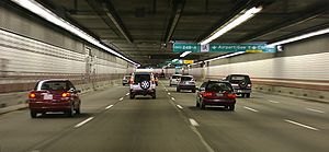
through the heart of the city, into a 3.5-mile (5.6-km) tunnel. The project also included the construction of the Ted Williams Tunnel
Ted Williams Tunnel
The Ted Williams Tunnel, also known as the Williams Tunnel, is the name of the third highway tunnel under Boston Harbor in Boston, Massachusetts, the Sumner and Callahan Tunnels being the other two...
(extending Interstate 90
Interstate 90
Interstate 90 is the longest Interstate Highway in the United States at . It is the northernmost coast-to-coast interstate, and parallels US 20 for the most part. Its western terminus is in Seattle, at Edgar Martinez Drive S. near Safeco Field and CenturyLink Field, and its eastern terminus is in...
to Logan International Airport
Logan International Airport
General Edward Lawrence Logan International Airport is located in the East Boston neighborhood of Boston, Massachusetts . It covers , has six runways, and employs an estimated 16,000 people. It is the 19th busiest airport in the United States.Boston serves as a focus city for JetBlue Airways...
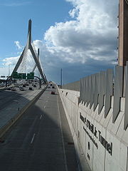
), the Leonard P. Zakim Bunker Hill Memorial Bridge over the Charles River
Charles River
The Charles River is an long river that flows in an overall northeasterly direction in eastern Massachusetts, USA. From its source in Hopkinton, the river travels through 22 cities and towns until reaching the Atlantic Ocean at Boston...
, and the Rose Kennedy Greenway
Rose Kennedy Greenway
The Rose Kennedy Greenway is a roughly 1.5-mile-long long series of parks and public spaces being created in downtown Boston, Massachusetts, USA. It is the final part of the Big Dig that put Interstate 93 underground and removed the elevated freeway that served as the main highway through downtown...
in the space vacated by the previous I-93 elevated roadway. Initially, the plan was also to include a rail connection between Boston's two major train terminals. The project concluded on December 31, 2007, when the partnership between the program manager and the Massachusetts Turnpike Authority ended.
The Big Dig was the most expensive highway project in the U.S. and was plagued by escalating costs, scheduling overruns, leaks, design flaws, charges of poor execution and use of substandard materials, criminal arrests, and even four deaths.
The project was scheduled to be completed in 1998at an estimated cost of $2.8 billion (in 1982 dollars, US$6.0 billion adjusted for inflation ). The project was not completed, however, until December of 2007, at a cost of over $14.6 billion ($8.08 billion in 1982 dollars). The Boston Globe
The Boston Globe
The Boston Globe is an American daily newspaper based in Boston, Massachusetts. The Boston Globe has been owned by The New York Times Company since 1993...
estimated that the project will ultimately cost $22 billion, including interest, and that it will not be paid off until 2038. As a result of the deaths, leaks, and other design flaws, the consortium that oversaw the project agreed to pay $407 million in restitution, and several smaller companies agreed to pay a combined sum of approximately $51 million.
Origin
Automobile
An automobile, autocar, motor car or car is a wheeled motor vehicle used for transporting passengers, which also carries its own engine or motor...
. By mid-20th century, car traffic in the inner city was extremely congested, especially for north–south trips. Commissioner of Public Works William Callahan
William F. Callahan
William Francis Callahan was a Massachusetts civil servant who served as Commissioner of Public Works from 1934-1952 and Chairman of the Massachusetts Turnpike Authority from 1952 until his death in 1964. Callahan developed the Master Highway Plan for Metropolitan Boston, which included the...
pushed through plans for an elevated expressway, which eventually was constructed between the downtown area and the waterfront. This "Central Artery" (known officially as the John F. Fitzgerald
John F. Fitzgerald
John Francis "Honey Fitz" Fitzgerald was an Irish-American politician and the maternal grandfather of three prominent United States politicians—President John Fitzgerald Kennedy and Senators Robert Francis Kennedy and Edward Moore Kennedy.-Early life and family:Fitzgerald was born in...
Expressway) displaced thousands of residents and businesses, and physically divided the historical connection between the downtown and market areas and the waterfront. Governor John Volpe interceded in the 1950s to send the last section of the Central Artery underground, through the Dewey Square
Dewey Square
Dewey Square is a square in downtown Boston, Massachusetts, USA. It lies at the intersection of Atlantic Avenue, Summer Street, Federal Street, Purchase Street and Surface Artery, with the Central Artery passing underneath in the Dewey Square Tunnel and Big Dig...
(or "South Station
South Station (Boston)
South Station, New England's second-largest transportation center , located at the intersection of Atlantic Avenue and Summer Street in Dewey Square, Boston, Massachusetts, is the largest train station and intercity bus terminal in Greater Boston, a prominent train station in the northeastern...
") Tunnel
Dewey Square Tunnel
The Dewey Square Tunnel in Boston, Massachusetts, is part of Interstate 93 , running under the heart of the city's financial district, including Dewey Square...
; while traffic moved somewhat better, the other problems remained. There was chronic congestion on the Central Artery (I-93), an elevated six-lane highway through the center of downtown Boston, which was, in the words of Pete Sigmund, "like a funnel full of slowly-moving, or stopped, cars (and swearing motorists)."
In 1959, the 1.5-mile-long (2.4 km) road section carried approximately 75,000 vehicles a day, but by the 1990s, this had grown to 190,000 vehicles a day. Traffic jams of 16 hours were predicted for 2010.
Built before strict federal Interstate Highway standards
Interstate Highway standards
Standards for Interstate Highways in the United States are defined by the American Association of State Highway and Transportation Officials in the publication A Policy on Design Standards - Interstate System...
were developed during the Dwight D. Eisenhower
Dwight D. Eisenhower
Dwight David "Ike" Eisenhower was the 34th President of the United States, from 1953 until 1961. He was a five-star general in the United States Army...
administration, the expressway was plagued by tight turns, an excessive number of entrances and exits, entrance ramps without merge lanes, and continually escalating vehicular loads. Local businesses again wanted relief, historians sought a reuniting of the waterfront with the city, and nearby residents desired removal of the matte green-painted elevated road, which mayor Thomas Menino
Thomas Menino
Thomas Michael "Tom" Menino is the mayor of Boston, Massachusetts, United States and the city's first Italian-American mayor...
called Boston's "other Green Monster
Green Monster
The Green Monster is a popular nickname for the thirty-seven foot , two-inch high left field wall at Fenway Park, home to the Boston Red Sox baseball team...
". M.I.T.
Massachusetts Institute of Technology
The Massachusetts Institute of Technology is a private research university located in Cambridge, Massachusetts. MIT has five schools and one college, containing a total of 32 academic departments, with a strong emphasis on scientific and technological education and research.Founded in 1861 in...
engineers Bill Reynolds and (eventual state Secretary of Transportation) Frederick P. Salvucci
Frederick P. Salvucci
Frederick Peter Salvucci is a civil engineer specializing in transportation, in particular infrastructure, urban transportation, public transportation and institutional development in decision-making. He was the Secretary of Transportation for the Commonwealth of Massachusetts under Governor...
envisioned moving the whole expressway underground.
Cancellation of the inner belt
Interstate 95 in Massachusetts
Interstate 95 is the main highway on the East Coast of the United States, paralleling the Atlantic Ocean from Florida to Maine. The Massachusetts portion of the highway enters from the state of Rhode Island in Attleboro and travels in a northeasterly direction to the junction with Route 128 in...
, and was signed as such; a bypass road called the Inner Belt (officially Interstate 695
Interstate 695 (Massachusetts)
The Inner Belt in Boston was a planned six-lane, limited-access highway that would have run through parts of Boston, Brookline, Cambridge, and Somerville.-History:...
) was to pass around the downtown core to the west, through the neighborhood of Roxbury
Roxbury, Massachusetts
Roxbury is a dissolved municipality and current neighborhood of Boston, Massachusetts, United States. It was one of the first towns founded in the Massachusetts Bay Colony in 1630, and became a city in 1846 until annexed to Boston on January 5, 1868...
and the cities of Brookline
Brookline, Massachusetts
Brookline is a town in Norfolk County, Massachusetts, United States, which borders on the cities of Boston and Newton. As of the 2010 census, the population of the town was 58,732.-Etymology:...
, Cambridge
Cambridge, Massachusetts
Cambridge is a city in Middlesex County, Massachusetts, United States, in the Greater Boston area. It was named in honor of the University of Cambridge in England, an important center of the Puritan theology embraced by the town's founders. Cambridge is home to two of the world's most prominent...
, and Somerville
Somerville, Massachusetts
Somerville is a city in Middlesex County, Massachusetts, United States, located just north of Boston. As of the 2010 census, the city had a total population of 75,754 and was the most densely populated municipality in New England. It is also the 17th most densely populated incorporated place in...
. However, earlier controversies over impact of the Boston extension of the Massachusetts Turnpike
Massachusetts Turnpike
The Massachusetts Turnpike is the easternmost stretch of Interstate 90. The Turnpike begins at the western border of Massachusetts in West Stockbridge connecting with the Berkshire Connector portion of the New York State Thruway...
, particularly on the heavily populated neighborhood of Brighton
Brighton, Boston, Massachusetts
Brighton is a dissolved municipality and current neighborhood of Boston, Massachusetts, United States, and is located in the northwest corner of the city. It is named after the town of Brighton in the English city of Brighton and Hove...
, and the large number of additional homes that would have had to be destroyed, led to massive community opposition
Freeway and expressway revolts
Many freeway revolts took place in developed countries during the 1960s and 1970s, in response to plans for the construction of new freeways, a significant number of which were abandoned or significantly scaled back due to widespread public opposition; especially of those whose neighborhoods would...
to both the Inner Belt and the Boston section of I-95.
Clearances for I-95 through the neighborhoods of Roxbury, Jamaica Plain
Jamaica Plain, Massachusetts
Jamaica Plain is a historic neighborhood of in Boston, Massachusetts. Founded by Boston Puritans seeking farm land to the south, it was originally part of the city of Roxbury...
, and Roslindale
Roslindale, Boston, Massachusetts
Roslindale is a primarily residential neighborhood of Boston, Massachusetts, bordered by Jamaica Plain, Hyde Park, West Roxbury and Mattapan.It is served by an MBTA Commuter Rail line, several MBTA bus lines and the MBTA Orange Line in nearby Jamaica Plain...
led to secession threats by Hyde Park
Hyde Park, Massachusetts
Hyde Park is a dissolved municipality and currently the southernmost neighborhood of Boston, Massachusetts, United States. Hyde Park is home to a diverse range of people, housing types and social groups. It is an urban location with suburban characteristics...
, Boston's youngest and southernmost neighborhood. By 1972, however, with only a minimum of work done on the I-95 right of way and none on the potentially massively disruptive Inner Belt, Governor Francis Sargent put a moratorium on highway construction within the MA-128 corridor, except for a short stretch of Interstate 93. In 1974 the remainder of the Master Plan was canceled, leaving Boston with a severely overstressed expressway system.
With ever-increasing traffic volumes funneled onto I-93 alone, the Central Artery became chronically gridlocked. The Sargent moratorium led to the rerouting of I-95 away from Boston around the MA-128 beltway and the
conversion of the cleared land in the southern part of the city into the Southwest Corridor linear park and a new right of way for the Orange Line
Orange Line (MBTA)
The Orange Line is one of the four subway lines of the Massachusetts Bay Transportation Authority. It extends from Forest Hills in Jamaica Plain, Boston in the south to Oak Grove in Malden, Massachusetts in the north. It meets the Red Line at Downtown Crossing, the Blue Line at State, and the Green...
subway and Amtrak
Amtrak
The National Railroad Passenger Corporation, doing business as Amtrak , is a government-owned corporation that was organized on May 1, 1971, to provide intercity passenger train service in the United States. "Amtrak" is a portmanteau of the words "America" and "track". It is headquartered at Union...
. Parts of the planned I-695 right of way remain unused and under consideration for future mass transit projects.
The original 1948 Master Plan included a Third Harbor Tunnel plan that was hugely controversial in its own right because it would have disrupted the Maverick Square area of East Boston. It was never built.
Mixing of traffic
A major reason for the all-day congestion was that the Central Artery carried not only north–south traffic, but much east–west traffic as well. Boston's Logan Airport lies across Boston HarborBoston Harbor
Boston Harbor is a natural harbor and estuary of Massachusetts Bay, and is located adjacent to the city of Boston, Massachusetts. It is home to the Port of Boston, a major shipping facility in the northeast.-History:...
in East Boston
East Boston, Massachusetts
East Boston is a neighborhood of Boston, Massachusetts, with approximately 40,000 residents. The community was created by connecting several islands using landfill and was annexed by Boston in 1836. East Boston is separated from the rest of the city by Boston Harbor and bordered by Winthrop,...
, and before the Big Dig the only access from downtown was through the paired Callahan
Callahan Tunnel
The Callahan Tunnel, officially the Lieutenant William F. Callahan Tunnel is one of four tunnels beneath Boston Harbor in Boston, Massachusetts. It carries motor vehicles from the North End to Logan International Airport and Route 1A in East Boston...
and Sumner
Sumner Tunnel
The Sumner Tunnel is a road tunnel in Boston, Massachusetts, USA. It carries traffic under Boston Harbor in one direction, from Logan International Airport and Route 1A in East Boston. The tunnel originally deposited traffic at the west side of the North End but with the completion of the Big Dig,...
tunnels. Traffic on the major highways from west of Boston—the Massachusetts Turnpike and Storrow Drive—mostly traveled on portions of the Central Artery to reach these tunnels. Getting between the Central Artery and the tunnels involved short diversions onto city streets, increasing local congestion.
The final Big Dig plan, then, combined several projects—the depression and improvement of the Central Artery, the construction of a third Harbor tunnel (now known as the Ted Williams Tunnel), and massive interchange improvements to the Massachusetts Turnpike and several other major routes in the area. While only one net lane in each direction was added to the north–south I-93, several new east–west lanes were added to untangle the traffic. East–west traffic on the Massachusetts Turnpike now proceeds directly through the Ted Williams Tunnel to Logan Airport and Route 1A beyond, with new exits in South Boston along the way. Traffic between Storrow Drive and the Callahan and Sumner Tunnels uses a short portion of I-93, but additional lanes and direct connections are provided for this traffic.
Mass transit
A number of public transportation projects were included as part of an environmental mitigationEnvironmental mitigation
Environmental mitigation, compensatory mitigation, or mitigation banking, are terms used primarily by the United States government and the related environmental industry to describe projects or programs intended to offset known impacts to an existing historic or natural resource such as a stream,...
for the Big Dig. The most expensive was the building of the Phase II Silver Line
Silver Line (MBTA)
The Silver Line is the only bus rapid transit line currently operated by the Massachusetts Bay Transportation Authority . It operates in two sections; the first runs from Dudley Square in Roxbury to downtown Boston, Massachusetts and South Station, mostly via Washington Street, with buses...
tunnel under Fort Point Channel
Fort Point Channel
Fort Point Channel is a maritime channel separating South Boston from downtown Boston, Massachusetts, feeding into Boston Harbor. The south part of it has been gradually filled in for use by the South Bay rail yard and several highways...
, done in coordination with Big Dig construction. Silver Line buses now use this tunnel and the Ted Williams Tunnel to link South Station
South Station
South Station, New England's second-largest transportation center , located at the intersection of Atlantic Avenue and Summer Street in Dewey Square, Boston, Massachusetts, is the largest train station and intercity bus terminal in Greater Boston, a prominent train station in the northeastern...
and Logan Airport.
, promised projects to restore the Green Line
Green Line (MBTA)
The Green Line is a streetcar system run by the Massachusetts Bay Transportation Authority in the Boston, Massachusetts area of the United States. It is the oldest line of Boston's subway, which is known locally as the 'T'. The Green Line runs underground downtown and on the surface in outlying...
streetcar service to the Arborway
Forest Hills (MBTA station)
Forest Hills Station is a station on the MBTA Orange Line, located in Forest Hills in the southern part of the Jamaica Plain neighborhood of Boston, Massachusetts at the intersections of Washington Street, Hyde Park Avenue, South Street, The Arborway and Morton Street.Forest Hills is the southern...
in Jamaica Plain, to extend the Green Line beyond Lechmere
Lechmere (MBTA station)
Lechmere is the northern terminus of the MBTA Green Line. It is located in Lechmere Square in East Cambridge, Massachusetts, near the intersection of Cambridge Street and Monsignor O'Brien Highway . The tracks make a loop at Lechmere, with a small yard...
, and to connect the Red
Red Line (MBTA)
The Red Line is a rapid transit line operated by the MBTA running roughly north-south through Boston, Massachusetts into neighboring communities. The line begins west of Boston, in Cambridge, Massachusetts at Alewife station, near the intersection of Alewife Brook Parkway and Route 2...
and Blue
Blue Line (MBTA)
The Blue Line is one of four subway lines of the Massachusetts Bay Transportation Authority serving Downtown, East Boston and the North Shore. It runs from northeast to southwest, extending from Wonderland station in Revere, Massachusetts to Bowdoin station near Beacon Hill in Boston...
subway lines have not been completed. The extension beyond Lechmere is in progress and the Red and Blue subway line connection is being designed; the status of the Arborway Line is unclear.
Yet another plan, the North-South Rail Link
North-South Rail Link
The North–South Rail Link is a proposed pair of approximately 1.5 mile -long rail tunnels below downtown Boston, Massachusetts.The tunnels would serve the goals of better unification for Boston's separate northern and southern MBTA Commuter Rail terminals, and provide direct linkage between...
that would have connected North and South Stations (the major passenger train stations in Boston), was part of the original Big Dig but was ultimately dropped by the Dukakis
Michael Dukakis
Michael Stanley Dukakis served as the 65th and 67th Governor of Massachusetts from 1975–1979 and from 1983–1991, and was the Democratic presidential nominee in 1988. He was born to Greek immigrants in Brookline, Massachusetts, also the birthplace of John F. Kennedy, and was the longest serving...
administration as an impediment to acquiring federal funding for the project.
Early planning
The project was conceived in the 1970s by the Boston Transportation Planning ReviewBoston Transportation Planning Review
Boston Transportation Planning Review is a transportation planning program for metropolitan Boston, United States which was responsible for analyzing and re-designing the entire area-wide transit and highway system in the 1970s. The major contractors involved were Alan M...
to replace the rusting elevated six-lane Central Artery. The expressway separated downtown from the waterfront, and was increasingly choked with bumper-to-bumper traffic. Business leaders were more concerned about access to Logan Airport, and pushed instead for a third harbor tunnel. In their second terms, Michael Dukakis
Michael Dukakis
Michael Stanley Dukakis served as the 65th and 67th Governor of Massachusetts from 1975–1979 and from 1983–1991, and was the Democratic presidential nominee in 1988. He was born to Greek immigrants in Brookline, Massachusetts, also the birthplace of John F. Kennedy, and was the longest serving...
(governor) and Fred Salvucci (secretary of transportation) came up with the strategy of tying the two projects together—thereby combining the project that the business community supported with the project that they and the City of Boston supported.
Planning for the Big Dig as a project officially began in 1982, with environmental impact studies starting in 1983. After years of extensive lobbying for federal dollars, a 1987 public works bill appropriating funding for the Big Dig was passed by U.S. Congress, but it was subsequently vetoed by President Ronald Reagan
Ronald Reagan
Ronald Wilson Reagan was the 40th President of the United States , the 33rd Governor of California and, prior to that, a radio, film and television actor....
as being too expensive. When Congress overrode
Veto override
A veto override is an action by legislators and decision-makers to override an act of veto by someone with such powers - thus forcing through a new decision. The power to override a veto varies greatly in tandem with the veto power itself. The U.S constitution gives a 2/3 majority Congress the...
his veto, the project had its green light and ground was first broken in 1991.
In 1997, the state legislature created the Metropolitan Highway System and transferred responsibility for the Central Artery and Tunnel "CA/T" Project from the Massachusetts Highway Department and the Massachusetts Governor's Office to the Massachusetts Turnpike Authority (MTA).
The Massachusetts Turnpike Authority (MTA), which had little experience in managing an undertaking of the scope and magnitude of the CA/T Project, hired a joint venture to provide preliminary designs, manage design consultants and construction contractors, track the project's cost and schedule, advise MTA on project decisions, and (in some instances) act as the MTA's representative. Eventually, MTA combined some of its employees with joint venture employees in an integrated project organization. This was intended to make management more efficient, but it hindered MTA's ability to independently oversee project activities because MTA and the joint venture had effectively become partners in the project.
Obstacles
In addition to these political and financial difficulties, the project faced several environmental and engineering obstacles.The downtown area through which the tunnels were to be dug was largely landfill, and included existing subway lines as well as innumerable pipes and utility lines that would have to be replaced or moved. Tunnel workers encountered many unexpected geological and archaeological barriers, ranging from glacial debris to foundations of buried houses and a number of sunken ships lying within the reclaimed land.
The project received approval from state environmental agencies in 1991, after satisfying concerns including release of toxins by the excavation and the possibility of disrupting the homes of millions of rats, causing them to roam the streets of Boston in search of new housing. By the time the federal environmental clearances were delivered in 1994, the process had taken some seven years, during which time inflation greatly increased the project's original cost estimates.
Reworking such a busy corridor without seriously restricting traffic flow required a number of state-of-the-art construction techniques. Because the old elevated highway (which remained in operation throughout the construction process) rested on pylons located throughout the designated dig area, engineers first utilized slurry wall
Slurry wall
A slurry wall is a technique used to build reinforced-concrete walls in areas of soft earth close to open water or with a high ground water table. This technique is typically used to build diaphragm walls surrounding tunnels and open cuts, and to lay foundations.A trench is excavated to create a...
techniques to create 120 ft (36.6 m).-deep concrete walls upon which the highway could rest. These concrete walls also stabilized the sides of the site, preventing cave-ins during the excavation process.
The multi-lane interstates also had to pass under South Station's 7 tracks, which carried over 40,000 commuters and 400 trains per day. To avoid multiple relocations of train lines while the tunneling advanced, as had been initially planned, a specially designed jack was constructed to support the ground and tracks to allow the excavation to take place below. Construction crews also used Ground freezing to help stabilize surrounding ground as they excavated the tunnel. This was the largest tunneling project undertaken beneath railway lines anywhere in the world. The ground freezing enabled safer, more efficient excavation
Earthworks (engineering)
Earthworks are engineering works created through the moving or processing of quantities of soil or unformed rock.- Civil engineering use :Typical earthworks include roads, railway beds, causeways, dams, levees, canals, and berms...
, and also assisted in environmental issues, as less contaminated fill needed to be exported than if a traditional cut-and-cover method had been applied.
Other challenges included an existing subway tunnel crossing the path of the underground highway. To build slurry wall
Slurry wall
A slurry wall is a technique used to build reinforced-concrete walls in areas of soft earth close to open water or with a high ground water table. This technique is typically used to build diaphragm walls surrounding tunnels and open cuts, and to lay foundations.A trench is excavated to create a...
s past this tunnel, it was necessary to dig beneath the tunnel and build an underground concrete bridge to support the tunnel's weight.
Construction phase
Parsons Brinckerhoff
Parsons Brinckerhoff is a professional services firm with 14,000 employees in 150 offices providing construction and operation management, planning, design, engineering, program management, strategic consulting, environmental and sustainability services for clients and communities in the Americas,...
. Because of the enormous size of the project—too large for any company to undertake alone—the design and construction of the Big Dig were broken up into dozens of smaller subprojects with well-defined interfaces between contractors. Major heavy-construction contractors on the project included Jay Cashman
Jay Cashman
Jay Cashman, Inc. is an American heavy-construction company based in Quincy, Massachusetts, with satellite offices in Boston, Jupiter, Florida, and Staten Island, New York. , the company has about 1,000 employees. Cashman was one of the major contractors on the Boston's Central Artery/Tunnel...
, Modern Continental
Modern Continental
Modern Continental is a construction company based in Cambridge, Massachusetts that was involved in the Boston "Big Dig" Central Artery/Tunnel Project. On June 23, 2008, the company filed for Chapter 11 bankruptcy in federal court in Boston.-History:...
, Obayashi Corporation, Perini Corporation
Perini
Tutor Perini Corporation is one of the largest general contractors in the United States. At the end of 2010 it reported an annual revenue of approximately $3.2 billion. Tutor Perini is headquartered in Sylmar, California and works on many construction projects throughout the United States and...
, Peter Kiewit Sons' Incorporated, J.F. White, and the Slattery division of Skanska
Skanska
Skanska AB, is a multinational construction and development company based in Sweden, where it also is the largest construction company. The company's head office is in Solna, north of Stockholm.-History:...
USA. (Of those, Modern Continental was awarded the greatest gross value of contracts, joint ventures included.)
The nature of the Charles River crossing had been a source of major controversy throughout the design phase of the project. Many environmental advocates preferred a river crossing entirely in tunnels, but this, along with 27 other plans, was rejected as too costly. Finally, with a deadline looming to begin construction on a separate project that would connect the Tobin Bridge
Tobin Bridge
The Maurice J. Tobin Memorial Bridge is a cantilever truss bridge that spans more than two miles from Charlestown to Chelsea over the Mystic River in Massachusetts. The bridge is the largest in New England...
to the Charles River crossing, Salvucci overrode the objections and chose a variant of the plan known as "Scheme Z". This plan was considered to be reasonably cost-effective, but had the drawback of requiring highway ramps stacked up as high as 100 feet (30 m) immediately adjacent to the Charles River.
The city of Cambridge
Cambridge, Massachusetts
Cambridge is a city in Middlesex County, Massachusetts, United States, in the Greater Boston area. It was named in honor of the University of Cambridge in England, an important center of the Puritan theology embraced by the town's founders. Cambridge is home to two of the world's most prominent...
objected to the visual impact of the chosen Charles River crossing design. It sued to revoke the project's environmental certificate and forced the project to redesign the river crossing again.
Christian Menn
Christian Menn is a bridge designer from Switzerland. He owned his own Engineering Company in Chur, Switzerland from 1957-1971. From 1971 until his retirement in 1992 he became a professor of Structural Engineering at ETH Zurich specializing in Bridge design...
took over the design of the bridge. He suggested a sleek, modern, cable-stayed bridge
Cable-stayed bridge
A cable-stayed bridge is a bridge that consists of one or more columns , with cables supporting the bridge deck....
that would carry 10 lanes of traffic. The plan was accepted and construction began on the Leonard P. Zakim Bunker Hill Memorial Bridge. The bridge employed an asymmetrical design and a hybrid of steel and concrete was used to construct it. The distinctive bridge is supported by two forked towers connected to the span by cables and girders. It was the first bridge in the country to employ this method and it is the widest cable-stayed bridge in the world.
Meanwhile, construction continued on the Tobin Bridge approach. By the time all parties agreed on the I-93 design, construction of the Tobin connector (today known as the "City Square Tunnel" for a Charlestown area it bypasses) was far along, significantly adding to the cost of constructing the U.S. 1
U.S. Route 1 in Massachusetts
In the U.S. state of Massachusetts, U.S. Route 1 is a major north–south state highway through Boston. The portion of US 1 south of Boston is also known as the Boston-Providence Turnpike, and portions north of the city are known as the Northeast Expressway and the Newburyport Turnpike.-Route...
interchange and retrofitting the tunnel.
Boston blue clay
Clay
Clay is a general term including many combinations of one or more clay minerals with traces of metal oxides and organic matter. Geologic clay deposits are mostly composed of phyllosilicate minerals containing variable amounts of water trapped in the mineral structure.- Formation :Clay minerals...
and other soils extracted from the path of the tunnel were used to cap many local landfill
Landfill
A landfill site , is a site for the disposal of waste materials by burial and is the oldest form of waste treatment...
s, fill in the Granite Rail Quarry
Quincy Quarries Reservation
The Quincy Quarries, in Quincy, Massachusetts, were the site of the first railroad in the United States and produced granite for over a century. The quarries are now open to the public as a recreation area.-History:...
in Quincy
Quincy, Massachusetts
Quincy is a city in Norfolk County, Massachusetts, United States. Its nicknames are "City of Presidents", "City of Legends", and "Birthplace of the American Dream". As a major part of Metropolitan Boston, Quincy is a member of Boston's Inner Core Committee for the Metropolitan Area Planning Council...
, and restore the surface of Spectacle Island in the Boston Harbor Islands National Recreation Area
Boston Harbor Islands National Recreation Area
The Boston Harbor Islands National Recreation Area is a National Recreation Area situated among the islands of Boston Harbor of Boston, Massachusetts. The area is made up of a collection of islands, together with a former island and a peninsula, many of which are open for public recreation and some...
.
The Storrow Drive Connector, a companion bridge to the Zakim, began carrying traffic from I-93 to Storrow Drive in 1999. The project had been under consideration for years, but was opposed by the wealthy residents of the Beacon Hill neighborhood. However, it finally was accepted because it would funnel traffic bound for Storrow Drive and downtown Boston away from the mainline roadway. The Connector ultimately used a pair of ramps that had been constructed for Interstate 695
Interstate 695 (Massachusetts)
The Inner Belt in Boston was a planned six-lane, limited-access highway that would have run through parts of Boston, Brookline, Cambridge, and Somerville.-History:...
, enabling the mainline I-93 to carry more traffic that would have used I-695 under the original Master Plan.
When construction began, the project cost, including the Charles River crossing, was estimated at $5.8 billion. Eventual cost overruns were so high that the chairman of the Massachusetts Turnpike Authority, James Kerasiotes
James Kerasiotes
James J. Kerasiotes was the director of the Massachusetts Turnpike Authority and the project manager of the Big Dig in Boston during the 1990s. He was asked to resign by Massachusetts governor Paul Celucci on April 11, 2000, because of cost over runs...
, was fired in 2000. His replacement had to commit to an $8.55 billion cap on federal contributions. Total expenses eventually passed $15 billion. Interest brought this cost to $21.93 billion.
Engineering methods and details
At the beginning of the project, engineers had to figure out the safest way to build the tunnel without endangering the existing elevated highway above. Eventually, they created horizontal braces as wide as the tunnel, then cut away the elevated highway's struts, and lowered it onto the new braces.
Final phases
Ted Williams Tunnel
The Ted Williams Tunnel, also known as the Williams Tunnel, is the name of the third highway tunnel under Boston Harbor in Boston, Massachusetts, the Sumner and Callahan Tunnels being the other two...
, and onwards to Logan Airport. The Ted Williams tunnel had been completed and in limited use for commercial traffic and high-occupancy vehicles since late 1995. The westbound lanes opened on the afternoon of January 18 and the eastbound lanes on January 19.
The next phase, moving the elevated Interstate 93 underground, was completed in two stages: northbound lanes opened in March 2003 and southbound lanes (in a temporary configuration) on December 20, 2003. A tunnel underneath Leverett Circle connecting eastbound Storrow Drive to I-93 North and the Tobin Bridge opened December 19, 2004, easing congestion at the circle. All southbound lanes of I-93 opened to traffic on March 5, 2005, including the left lane of the Zakim Bridge, and all of the refurbished Dewey Square Tunnel.
By the end of December 2004, 95% of the Big Dig was completed. Major construction remained on the surface, including construction of final ramp configurations in the North End
North End, Boston, Massachusetts
The North End is a neighborhood of Boston, Massachusetts. It has the distinction of being the city's oldest residential community, where people have lived continuously since it was settled in the 1630s. Though small , the neighborhood has approximately 100 eating establishments, and a variety of...
and in the South Bay
South Bay, Boston, Massachusetts
South Bay is a 10-acre site in Boston, Massachusetts sandwiched between Chinatown and the Leather District. It is roughly bounded by Kneeland Street, Hudson Street, the Massachusetts Turnpike mainline, and the Interstate 93 mainline. Currently owned by the Massachusetts Turnpike Authority , the...
interchange, and reconstruction of the surface streets.
The final ramp downtown — exit 20B from I-93
Interstate 93
Interstate 93 is an Interstate Highway in the New England section of the United States. Its southern terminus is in Canton, Massachusetts, in the Boston metropolitan area, at Interstate 95; its northern terminus is near St. Johnsbury, Vermont, at Interstate 91...
south to Albany Street — opened January 13, 2006.
In 2006, the two Interstate 93 tunnels were dedicated as the Thomas "Tip" O'Neill
Tip O'Neill
Thomas Phillip "Tip" O'Neill, Jr. was an American politician. O'Neill was an outspoken liberal Democrat and influential member of the U.S. Congress, serving in the House of Representatives for 34 years and representing two congressional districts in Massachusetts...
Tunnel
Thomas P. O'Neill Jr. Tunnel
The Thomas P. "Tip" O'Neill, Jr. Tunnel is a highway tunnel built as part of the Big Dig in Boston, Massachusetts. It carries the Central Artery underneath downtown Boston, and is numbered as Interstate 93, U.S. Route 1, and Route 3. It roughly follows the route of the old elevated Central Artery,...
, after the former Democratic
Democratic Party (United States)
The Democratic Party is one of two major contemporary political parties in the United States, along with the Republican Party. The party's socially liberal and progressive platform is largely considered center-left in the U.S. political spectrum. The party has the lengthiest record of continuous...
speaker of the House of Representatives
United States House of Representatives
The United States House of Representatives is one of the two Houses of the United States Congress, the bicameral legislature which also includes the Senate.The composition and powers of the House are established in Article One of the Constitution...
from Massachusetts who pushed to have the Big Dig funded by the federal government.
Mitigation projects
Many environmental impact mitigation projects (transit, pedestrian, bicycle, and parks) also remain. Although these were legal requirements for approval of the environmental impact statement, many are not funded because of the massive cost overruns on the highway portion of the project. For example, though the North Point Park was created as part of the project, it ended without constructing pedestrian bridges to neighboring parks.
While not a legally mandated requirement, public art
Public art
The term public art properly refers to works of art in any media that have been planned and executed with the specific intention of being sited or staged in the physical public domain, usually outside and accessible to all...
was part of the urban design planning process (and later design development work) through the Artery Arts Program. The intent of the program was to integrate public art into highway infrastructure (retaining walls, fences, and lighting) and the essential elements of the pedestrian environment (walkways, park landscape elements, and bridges). As overall project costs increased, the Artery Arts Program was seen as a potential liability, even though there was support and interest from the public and professional arts organizations in the area.
At the beginning of the highway design process, a temporary arts program was initiated and over 50 proposals were selected. However, development began on only a few projects before funding for the program was cut. Permanent public art that was funded includes: super graphic text and facades of former West End houses cast into the concrete elevated highway abutment support walls near North Station by artist Sheila Levrant de Bretteville
Sheila Levrant de Bretteville
Sheila Levrant de Bretteville is a graphic designer, artist and educator whose work reflects her belief in the importance of feminist principles and user participation in graphic design...
; a historical sculpture about the 18th and 19th century shipbuilding industry and a bust of shipbuilder Donald McKay
Donald McKay
Donald McKay was a Canadian-born American designer and builder of sailing ships.He was born in Jordan Falls, Shelburne County on Nova Scotia's South Shore. In 1826 he moved to New York, working for shipbuilders Brown & Bell and Isaac Webb...
in East Boston; blue interior lighting of the Zakim Bridge; and the Miller's River Littoral Way walkway and lighting under the loop ramps north of the Charles River.
Extensive landscape planting, as well as a maintenance program to support the plantings, was requested by many community members during public meetings.
Impact on traffic
Callahan Tunnel
The Callahan Tunnel, officially the Lieutenant William F. Callahan Tunnel is one of four tunnels beneath Boston Harbor in Boston, Massachusetts. It carries motor vehicles from the North End to Logan International Airport and Route 1A in East Boston...
and Sumner
Sumner Tunnel
The Sumner Tunnel is a road tunnel in Boston, Massachusetts, USA. It carries traffic under Boston Harbor in one direction, from Logan International Airport and Route 1A in East Boston. The tunnel originally deposited traffic at the west side of the North End but with the completion of the Big Dig,...
tunnels under Boston Harbor
Boston Harbor
Boston Harbor is a natural harbor and estuary of Massachusetts Bay, and is located adjacent to the city of Boston, Massachusetts. It is home to the Port of Boston, a major shipping facility in the northeast.-History:...
. To reach these tunnels, traffic on the major highways from west of Boston—the Massachusetts Turnpike and Storrow Drive—traveled on portions of the Central Artery. Getting between the Central Artery and the tunnels also involved short stretches on city streets, increasing local congestion and causing backups on the highway.
The Big Dig untangled this co-mingled traffic. While only one net lane in each direction was added to the north–south I-93, several new east–west lanes became available. East–west traffic on the Massachusetts Turnpike/I-90 now proceeds directly through the Ted Williams Tunnel to Logan Airport and Route 1A beyond. Traffic between Storrow Drive and the Callahan and Sumner Tunnels still uses a short portion of I-93, but additional lanes and direct connections are provided for this traffic.
The result was a 62% reduction in vehicle hours of travel on I-93, the airport tunnels, and the connection from Storrow Drive, from an average 38,200 hours per day before construction (1994–1995) to 14,800 hours per day in 2004–2005, after the project was largely complete. The savings for travelers was estimated at $166 million annually in the same 2004–2005 time frame. Travel times on the Central Artery northbound during the afternoon peak hour were reduced 85.6%.
A 2008 Boston Globe report asserted that waiting time for the majority of trips actually increased as a result of demand induced
Induced demand
Induced demand, or latent demand, is the phenomenon that after supply increases, more of a good is consumed. This is entirely consistent with the economic theory of supply and demand; however, this idea has become important in the debate over the expansion of transportation systems, and is often...
by the increased road capacity. Because more drivers were opting to use the new roads, traffic bottlenecks were only pushed outward from the city, not reduced or eliminated (although some trips are now faster). The report states, "Ultimately, many motorists going to and from the suburbs at peak rush hours are spending more time stuck in traffic, not less." The Globe also asserted that their analysis provides a fuller picture of the traffic situation than a state-commissioned study done two years ago, in which the Big Dig was credited with helping to save at least $167 million a year by increasing economic productivity and decreasing motor vehicle operating costs. That study did not look at highways outside the Big Dig construction area and did not take into account new congestion elsewhere.
"Thousands of leaks"
As far back as 2001, Turnpike Authority officials and private contractors knew of thousands of leaks in the ceiling and wall fissures, extensive water damage to steel supports and fireproofing systems, and overloaded drainage systems. A $10 million contract, signed off as a cost overrunCost overrun
A cost overrun, also known as a cost increase or budget overrun, is an unexpected cost incurred in excess of a budgeted amount due to an under-estimation of the actual cost during budgeting...
, was used to repair these leaks. Many of the leaks were a result of Modern Continental and other subcontractors failing to remove gravel and other debris before pouring concrete. This was not made publicly known to the media, but engineers at MIT (volunteer students and professors) performed several experiments and found serious problems with the tunnel.
On September 15, 2004, a major leak in the Interstate 93
Interstate 93
Interstate 93 is an Interstate Highway in the New England section of the United States. Its southern terminus is in Canton, Massachusetts, in the Boston metropolitan area, at Interstate 95; its northern terminus is near St. Johnsbury, Vermont, at Interstate 91...
north tunnel forced the closure of the tunnel while repairs were conducted. This also forced the Turnpike Authority to release information regarding its non-disclosure of prior leaks. A follow-up reported on "extensive" leaks that were more severe than state authorities had previously acknowledged. The report went on to state that the $14.6 billion tunnel system was riddled with more than 400 leaks. A Boston Globe report, however, countered that by stating there were nearly 700 leaks in a single 1000 feet (304.8 m) section of tunnel beneath South Station. Turnpike officials also stated that the number of leaks being investigated was down from 1,000 to 500.
Substandard materials
Massachusetts State PoliceMassachusetts State Police
The Massachusetts State Police is an agency of the Commonwealth of Massachusetts' Executive Office of Public Safety and Security responsible for criminal law enforcement and traffic vehicle regulation across the state...
searched the offices of Aggregate Industries
Aggregate Industries
Aggregate Industries, a member of the Holcim Group, is an aggregates, construction and building materials group, with its base in the United Kingdom. It was listed on the London Stock Exchange until it was acquired by Holcim in 2005.-History:...
, the largest concrete supplier for the underground portions of the project, in June 2005. They seized evidence that Aggregate delivered concrete that did not meet contract specifications. In May 2006, six employees of the company were arrested and charged with conspiracy to defraud the United States. Immediately after the arrests, Massachusetts Governor Mitt Romney
Mitt Romney
Willard Mitt Romney is an American businessman and politician. He was the 70th Governor of Massachusetts from 2003 to 2007 and is a candidate for the 2012 Republican Party presidential nomination.The son of George W...
announced he would return $3,900 in political contributions from employees of Aggregate Industries.
On March 19, 2006, the International Herald Tribune
International Herald Tribune
The International Herald Tribune is a widely read English language international newspaper. It combines the resources of its own correspondents with those of The New York Times and is printed at 38 sites throughout the world, for sale in more than 160 countries and territories...
reported that Massachusetts Attorney General
Massachusetts Attorney General
The Massachusetts Attorney General is an elected executive officer of the Massachusetts Government. The office of Attorney-General was abolished in 1843 and re-established in 1849. The current Attorney General is Martha Coakley....
Tom Reilly
Thomas Reilly
Thomas F. Reilly is an American attorney and politician who served as the 45th Massachusetts Attorney General. He was born in Springfield, Massachusetts to Irish immigrant parents....
planned to sue project contractors and others because of poor work on the project. Over 200 complaints have been filed by the state of Massachusetts as a result of leaks, cost overruns, quality concerns, and safety violations. In total, the state is seeking approximately $100 million from the contractors ($1 for every $141 spent).
Fatal ceiling collapse
A fatal accident raised safety questions and closed part of the project for most of the summer of 2006. On July 10, 2006, a concrete ceiling panel weighing 3 tons (2722 kg) and measuring 20 by 40 ft (6.1 by 12.2 m) fell on a car traveling on the two-lane ramp connecting northbound I-93 to eastbound I-90Interstate 90
Interstate 90 is the longest Interstate Highway in the United States at . It is the northernmost coast-to-coast interstate, and parallels US 20 for the most part. Its western terminus is in Seattle, at Edgar Martinez Drive S. near Safeco Field and CenturyLink Field, and its eastern terminus is in...
in South Boston, killing Milena Del Valle, who was a passenger, and injuring her husband, Angel Del Valle, who was driving. Immediately following the fatal ceiling collapse, Governor Mitt Romney ordered a stem-to-stern safety audit conducted by the Illinois engineering firm of Wiss, Janney, Elstner Associates, Inc.
Wiss, Janney, Elstner Associates, Inc.
Wiss, Janney, Elstner Associates, Inc. is an American corporation of architects, engineers, and materials scientists specializing in the investigation, analysis, testing, and design of repairs for historic and contemporary buildings and structures...
to look for additional areas of risk. Said Romney: "We simply cannot live in a setting where a project of this scale has the potential of threatening human life, as has already been seen". The collapse and closure of the tunnel greatly snarled traffic in the city. The resulting traffic jams are cited as contributing to the death of another person, a heart attack victim who died en route to Boston Medical Center when his ambulance was caught in one such traffic jam two weeks after the collapse. On September 1, 2006, one eastbound lane of the connector tunnel was re-opened to traffic.
Following extensive inspections and repairs, Interstate 90 east-and westbound lanes reopened in early January 2007. The final piece of the road network, a high occupancy vehicle lane connecting Interstate 93 north to the Ted Williams Tunnel, reopened on June 1, 2007.
On July 10, 2007, after a lengthy investigation, the National Transportation Safety Board
National Transportation Safety Board
The National Transportation Safety Board is an independent U.S. government investigative agency responsible for civil transportation accident investigation. In this role, the NTSB investigates and reports on aviation accidents and incidents, certain types of highway crashes, ship and marine...
found that epoxy
Epoxy
Epoxy, also known as polyepoxide, is a thermosetting polymer formed from reaction of an epoxide "resin" with polyamine "hardener". Epoxy has a wide range of applications, including fiber-reinforced plastic materials and general purpose adhesives....
glue used to hold the roof in place during construction was not appropriate for long-term bonding. This was determined to be the cause of the roof collapse. The Power-Fast Epoxy Adhesive used in the installation was designed for short-term loading, such as wind or earthquake loads, not long-term loading, such as the weight of a panel.
Powers Fasteners, the makers of the adhesive, revised their product specifications on May 15, 2007 to increase the safety factor from 4 to 10 for all of their epoxy products intended for use in overhead applications. The safety factor on Power-Fast Epoxy was increased from 4 to 16. On December 24, 2007, the Del Valle family announced they had reached a settlement with Power Fasteners that would pay the family $6 million. In December 2008, Power Fasteners agreed to pay $16 million to the state to settle manslaughter charges.
Lighting fixtures
In March 2011, it came to light that senior MassDOT officials had been covering up an issue with the lighting fixtures in the O'Neill tunnel. In early February 2011, a maintenance crew found a fixture lying in the middle travel lane on the northbound tunnel. Assuming it to be simple road debris, the maintenance team picked it up and brought it back to its home facility. The next day, a supervisor passing through the yard realized that the 120 lb (54.4 kg) fixture was not road debris but was in fact one of the fixtures used to light the tunnel itself. Further investigation revealed that the fixture's mounting apparatus has failed due to salt water corrosion. After the discovery of the reason why the fixture had failed, a comprehensive inspection of the other fixtures in the tunnel revealed the numerous other fixtures were also in the same state of deterioration. Moving forward with temporary repairs, members of MassDOT administration team decided not to let the news of the systemic failure and repair of the fixtures be released to the public or Governor Deval PatrickDeval Patrick
Deval Laurdine Patrick is the 71st and current Governor of Massachusetts. A member of the Democratic Party, Patrick served as an Assistant United States Attorney General under President Bill Clinton...
's administration.
See also
- Cross City TunnelCross City TunnelThe Cross City Tunnel is a 2.1 km-long tunnel located in Sydney, Australia. It links Darling Harbour on the Western fringe of the central business district to Rushcutters Bay in the Eastern Suburbs...
– similar project in Sydney, Australia - Dublin Port TunnelDublin Port TunnelThe Dublin Port Tunnel is a road traffic tunnel in Dublin, Ireland, that forms part of the M50 motorway....
– similar project on a smaller scale in IrelandIrelandIreland is an island to the northwest of continental Europe. It is the third-largest island in Europe and the twentieth-largest island on Earth... - Carmel TunnelsCarmel TunnelsThe Carmel Tunnels are a set of road tunnels in and around Haifa, Israel. The tunnels' purpose is to reduce road congestion in the Haifa area and to provide an alternate route of reaching the eastern and central parts of the city, Haifa Bay and the Krayot area to and from Israel's central coastal...
– similar project in Haifa, Israel - Massachusetts TurnpikeMassachusetts TurnpikeThe Massachusetts Turnpike is the easternmost stretch of Interstate 90. The Turnpike begins at the western border of Massachusetts in West Stockbridge connecting with the Berkshire Connector portion of the New York State Thruway...
- Massachusetts Bay Transportation AuthorityMassachusetts Bay Transportation AuthorityThe Massachusetts Bay Transportation Authority, often referred to as the MBTA or simply The T, is the public operator of most bus, subway, commuter rail and ferry systems in the greater Boston, Massachusetts, area. Officially a "body politic and corporate, and a political subdivision" of the...
- MegaprojectMegaprojectA megaproject is an extremely large-scale investment project. Megaprojects are typically defined as costing more than US$1 billion and attracting a lot of public attention because of substantial impacts on communities, environment, and budgets. Megaprojects can also be defined as "initiatives that...
- Pork barrel legislation
- Vincent Zarrilli – critic of the Big Dig who proposed the Boston Bypass
- Central-Wan Chai BypassCentral-Wan Chai BypassThe Central-Wan Chai Bypass is a proposed 4 km trunk road running between Central and Causeway Bay, Hong Kong. The original design consists of a 2.3 km dual 3-lane tunnel running under new reclamation areas which will be provided by Central and Wan Chai Reclamation project, and also...
- similar project in the areas of Central, Wan Chai and Causeway Bay, within Victoria City, Hong Kong
External links
- Official site
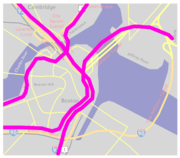
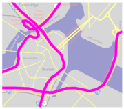
- Project map
- Boston CA/T Project History at MIT Rotch Library
- Steve Anderson's BostonRoads.com
- PBS.org – Central Artery
- Powell, Michael, "Boston's Big Dig Awash in Troubles", Washington Post, 2004-11-19, Retrieved on August 9, 2006.
- Consulting services performed by RWDIRWDIWind Engineering Firm Established in 1972, Rowan Williams Davies & Irwin Inc. is a specialty consulting engineering firm. The RWDI group of companies has over 275 employees with offices in Canada, USA, United Kingdom, India and the Middle East....