
Big Bend National Park
Encyclopedia
Big Bend National Park is a national park
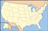
located in the U.S. state of Texas
. Big Bend has national significance as the largest protected area of Chihuahuan Desert
topography
and ecology
in the United States, which includes more than 1,200 species of plants, more than 450 species of birds, 56 species of reptiles, and 75 species of mammals.
The park covers 801163 acre (1,251.8 sq mi; 3,242.2 km²). Few areas exceed the park's value for the protection and study of geologic
and paleontologic
resources. Cretaceous
and Tertiary
fossil
organisms exist in variety and abundance. Archaeologists
have discovered artifacts estimated to be 9,000 years old, and historic buildings and landscapes offer graphic illustration of life along the international border in the 19th century.
For more than 1,000 miles (1,600 km), the Rio Grande/Río Bravo
forms the international boundary between Mexico
and the United States
, and Big Bend National Park administers approximately 244 miles (392.7 km) along that boundary. The park was named after the area, which is bounded by a large bend in the Texas-Mexico border (see map at right below).
Because the Rio Grande serves as an international boundary, the park faces unusual constraints when administering and enforcing park rules, regulations, and policies. In accordance with the Treaty of Guadalupe Hidalgo
, the park has jurisdiction only to the center of the deepest river channel as the river flowed in 1848. The rest of the land south of that channel, and the river, lies within Mexican territory.
in the Chisos Mountains
at 7832 feet (2,387.2 m) a wide variation in available moisture and in temperature exists throughout the park. These variations contribute to an exceptional diversity in plant and animal habitats. Some species in the park, such as the Chisos Oak (Quercus gravesii
), are found nowhere else in the United States.
The 118 miles (189.9 km) of river that form the southern park boundary include the spectacular canyons of Santa Elena, Mariscal, and Boquillas. The Rio Grande, meandering through this portion of the Chihuahuan Desert
, has cut deep canyons with nearly vertical walls through three uplifts made primarily of limestone
. Throughout the open desert
areas, the highly productive Rio Grande riparian zone
includes numerous plant and animal species and significant cultural resources. The vegetative belt extends into the desert along creeks
and arroyo
s.
South of the border lie the Mexican states of Chihuahua and Coahuila
and the new protected areas for flora and fauna, which are regions known as the Maderas del Carmen
and the Cañón de Santa Elena.
 The oldest recorded tectonic activity in the park is related to the Paleozoic
Marathon
orogeny
, although it is possible that Proterozoic
events (over 550 mya) have some deep control. The Marathon orogeny (part of the Ouachita-Marathon-Sonora orogenic belt
) is part of thrusting
of rocks from the South American Plate
over the North American Plate
. This can be best seen in the Persimmon Gap area of the park. This orogenic event is linked to the lack of Triassic
- and Jurassic
-age rocks in the park.
Between the Triassic
and the Cretaceous
the South American Plate rifted from the North American Plate, resulting in the deposition of the Glen Rose Limestone, Del Carmen Limestone, Sue Peaks Formation, Santa Elena Limestone, Del Rio Clay, Buda Limestone and Boquillas formations (preserved in the Sierra del Carmen–Santiago Mountains, Nine Point Mesa, Mariscal Mountain and Mesa de Anguila areas). Also during this time, the Chihuahua trough formed as the Gulf of Mexico
opened, which resulted in east-west striking
normal faulting. As a result of this depositional time, there are dinosaur
, forest and other fossils preserved in the park.
Following the ending of rifting in the Late Cretaceous to the early Tertiary
, the Big Bend area was subjected to the Laramide orogeny
. This period of (now east-west) compression caused the northeast-facing Mesa de Anguila (an uplifted monocline
on the southwest margin of the park), the southwest-facing Sierra del Carmen–Santiago Mountains (an uplifted and thrust-faulted
monocline that forms the boundary of the park on the east) and the Tornillo Basin. During the middle Tertiary most of the volcanic rock
s, including the Chisos group, the Pine Canyon caldera complex and the Burro Mesa Formation, formed.
The most recent tectonic activity in the park is Basin and Range
faulting from the late Tertiary to Quaternary
. This period of east-west extension has resulted in Estufa and Dehalo bolsons in the Chisos Mountains, as well as the Terlingua and Sierra del Carmen, Chalk Draw and Burro Mesa faults. The Rio Grande
has entered the Big Bend area roughly 2 mya, and since then extensive erosion
and down cutting has occurred.
period 10,500 years ago through the historic period represented by Native American
groups, such as the Chisos, Mescalero
s, and Comanche
. More recently, Spanish, Mexican, Anglo and Irish settlers farm
ed, ranch
ed, and mined
in the area.
Throughout the prehistoric period, humans found shelter and maintained open campsites throughout the park. The archeological record reveals an Archaic-period
desert culture, whose inhabitants developed a nomadic hunting and gathering lifestyle that remained virtually unchanged for several thousand years.
The historic cultural landscape centers upon various subsistence or commercial land uses. The riparian and tributary environments were used for subsistence and irrigation farming. Transportation networks, irrigation structures, simple domestic residences and outbuildings, and planed and terraced farm land lining the stream banks characterize these landscapes.
of the U.S.
The Jumano was a nomadic group that traveled and traded throughout west Texas and southeastern New Mexico
, but some historic records indicate that they were enemies of the Chisos. Around the beginning of the 18th century, the Mescalero Apaches
began to invade the Big Bend region and displaced the Chisos Indians. One of the last Native American groups to use the Big Bend was the Comanches, who passed through the park along the Great Comanche Trail on their way to and from periodic raids into the Mexican interior. These raids continued until the mid-19th century. The last of the great military leaders of the native peoples of the region was an Apache of Spanish ancestry named Alzate, who was active as late as the late 1860s.
The European presence in the region begins circa 1535 A.D. with the first Spanish
explorations into this portion of North America. The expedition of Álvar Núñez Cabeza de Vaca
passed near the Big Bend and was followed by other expeditions. Some of these expeditions were searching for gold and silver, and farm and ranch land. Others, such as those by the Franciscan
missionaries, were intended to establish centers in which the natives could be evangelized
. In an attempt to protect the northern frontier of the New Spain
, from which emerged present day Mexico, a line of presidios, or forts, was established along the Rio Grande in the late 18th century. The Presidio de San Vicente was built near present-day San Vicente
, Coahuila
, and the Presidio de San Carlos was built near present-day Manuel Benavides
, Chihuahua. Some of these presidios were soon abandoned, because of financial difficulties and because they could not effectively stop Indian intrusions into Mexico. The soldier
s and settler
s of these presidios moved to other, newer, presidios in the vicinity of the region, from where the interests of the Spanish Empire
were more defensible. Such was the case of Santa Rosa Maria del Sacramento, now Muzquiz, Coahuila.
Very little study has been made of the Spanish occupation of the Big Bend following the abandonment of the Presidios. In 1805, the Spanish settlement called Altares existed 30 miles (48.3 km) south of the Rio Grande. The region became a part of Mexico when this republic consummated its independence from Spain in 1821. Mexican families lived in the area when Anglo settlers began moving in following the secession of Texas during the latter half of the 19th century.
Following the Mexican-American War, which ended in 1848, military surveys
were made of the uncharted land of the Big Bend. Military forts and outposts were established across Trans Pecos Texas to protect migrating settlers from the Indians. A significant proportion of these soldiers were of African American
ancestry and came to be known as the "buffalo soldiers," a name apparently given to them by the Native Americans of the region. Lieutenant Henry Flipper
, the first American of African ancestry to graduate from West Point, served in Shafter, Texas toward the late 19th century. Shafter is just west of the Big Bend along the highway that goes from Presidio
to Marfa
. Around 1880, ranchers began to migrate into the Big Bend, and by 1900, sheep, goat
, and cattle
ranches occupied a majority of the landscape. The delicate desert environment, however, was soon overgrazed
.
In the late 19th and early 20th century, the discovery of valuable mineral
deposits brought more settlers who worked in the mines or supported the mines by farming or by cutting timber
for use in the mines and smelters. Communities sprang up around the mines; development of Boquillas
and Terlingua
directly resulted from mining operations. During this period, the Rio Grande flood plain was settled by farmers. Settlements developed with names like Terlingua Abajo, San Vicente, La Coyota and Castolon. These were often no more than clusters of families living and farming in the same area, and they were successful only to the degree that the land was able to support them.
In the 1930s, many people who loved the Big Bend country saw that it was a land of unique contrast and beauty that was worth preserving for future generations. In 1933, the Texas Legislature
passed legislation to establish Texas Canyons State Park. Later that year, the park was redesignated Big Bend State Park. In 1935, the United States Congress
passed legislation that would enable the acquisition of the land for a national park. The State of Texas deeded the land that it had acquired to the Federal government of the United States
, and on June 12, 1944, Big Bend National Park became a reality. The park opened to visitors on July 1, 1944.
Most of the animals are not visible in the day, particularly in the desert. The park comes alive at night, with many of the animals foraging for food. About 150 Cougar (Puma conocolor) sightings are reported per year, despite the fact that there are only a total of two dozen Cougars. Other species that inhabit the park include Black-tailed Jackrabbit
(Lepus californicus), kangaroo rat
s (Dipodomys spp.), Greater Roadrunner
(Geococcyx californianus), Golden Eagle
(Aquila chrysaetos), Collared Peccary
(Pecari tajacu), and Coyote
(Canis latrans). Mexican Black Bears
(Ursus americanus eremicus) are also present in the mountain areas.
The variety of cactus and other plant life add color to the Big Bend region. Cactus species in the park include prickly pear (Opuntia
spp.), Claret Cup (Echinocereus coccineus) and Pitaya (E. enneacanthus). In the spring, the wildflowers are in full bloom and the yucca
flowers display bright colors. Bluebonnets (Lupinus spp.) are prevalent in Big Bend, and white and pink bluebonnets are sometimes visible by the road. Other flowering plants such as the Desert Marigold (Baileya multiradiata
), Desert Willow (Chilopsis linearis
), Ocotillo (Fouquieria splendens), Rock Nettle (Eucnide urens
) and Lechuguilla (Agave lechuguilla) abound in Big Bend.
The first U.S. record of the Northern Tufted Flycatcher (Mitrephanes phaeocercus), a Central America
n species, was from this site in November 1991. Birders also flock to the park as it is home to the only area in the United States within the breeding range of the Colima Warbler
(Vermivora crissalis).
Big Bend's primary attraction is its hiking
and backpacking
trails. Particularly notable among these are the Chimneys Trail, which visits a rock formation in the desert, the Marufo Vega trail, a loop trail that passes through scenic canyons on the way to and from the Rio Grande, and the Outer Mountain Loop trail in the Chisos, which begins in the Chisos Basin, climbs into the high mountains, descends into the desert along the Dodson Trail, and then returns to the Chisos Basin, completing a thirty mile loop. Other notable locations include Santa Elena Canyon, Grapevine Hills, and the Mule Ears, two imposing rock towers in the middle of the desert. There are professional backpacking guide services that provide trips in the park.
The park administers 245 miles (394.3 km) of the Rio Grande for recreational use. There are professional river outfitter
s that provide tours of the river. Use of a personal boat is permitted but a free river float permit is required. Until 2002 visitors often crossed the Rio Grande to visit the Mexican village of Boquillas
, but the Department of Homeland Security closed the border crossing. In June 2009 the Department of Homeland Security began treating all float trips as trips that had left and re-entered the country, and required participants to have an acceptable form of identification, such as a passport.
Another popular activity is birdwatching
with more than 450 species of birds recorded in the park. Many species stop in the park during their migrations
.
There are five paved roads in Big Bend. Persimmon Gap
to Panther Junction is a 28 miles (45.1 km) road from the north entrance of the park to park headquarters at Panther Junction. Panther Junction to Rio Grande Village is a 21 miles (33.8 km) road that descends 2000 feet (609.6 m) from the park headquarters at Panther Junction to the Rio Grande River. Maverick Entrance Station to Panther Junction is a 23 miles (37 km) route from the western entrance of the park to the park headquarters. Chisos Basin Road is 6 miles (10 km) long and climbs to 5679 feet (1,731 m) above sea level at Panther Pass before descending into the Chisos Basin. The 30 miles (48.3 km) Ross Maxwell Scenic Drive leads to the Castolon Historic District and Santa Elena Canyon.
National park
A national park is a reserve of natural, semi-natural, or developed land that a sovereign state declares or owns. Although individual nations designate their own national parks differently A national park is a reserve of natural, semi-natural, or developed land that a sovereign state declares or...
located in the U.S. state of Texas
Texas
Texas is the second largest U.S. state by both area and population, and the largest state by area in the contiguous United States.The name, based on the Caddo word "Tejas" meaning "friends" or "allies", was applied by the Spanish to the Caddo themselves and to the region of their settlement in...
. Big Bend has national significance as the largest protected area of Chihuahuan Desert
Chihuahuan Desert
The Chihuahuan Desert is a desert, and an ecoregion designation, that straddles the U.S.-Mexico border in the central and northern portions of the Mexican Plateau, bordered on the west by the extensive Sierra Madre Occidental range, and overlaying northern portions of the east range, the Sierra...
topography
Topography
Topography is the study of Earth's surface shape and features or those ofplanets, moons, and asteroids...
and ecology
Ecology
Ecology is the scientific study of the relations that living organisms have with respect to each other and their natural environment. Variables of interest to ecologists include the composition, distribution, amount , number, and changing states of organisms within and among ecosystems...
in the United States, which includes more than 1,200 species of plants, more than 450 species of birds, 56 species of reptiles, and 75 species of mammals.
The park covers 801163 acre (1,251.8 sq mi; 3,242.2 km²). Few areas exceed the park's value for the protection and study of geologic
Geology
Geology is the science comprising the study of solid Earth, the rocks of which it is composed, and the processes by which it evolves. Geology gives insight into the history of the Earth, as it provides the primary evidence for plate tectonics, the evolutionary history of life, and past climates...
and paleontologic
Paleontology
Paleontology "old, ancient", ὄν, ὀντ- "being, creature", and λόγος "speech, thought") is the study of prehistoric life. It includes the study of fossils to determine organisms' evolution and interactions with each other and their environments...
resources. Cretaceous
Cretaceous
The Cretaceous , derived from the Latin "creta" , usually abbreviated K for its German translation Kreide , is a geologic period and system from circa to million years ago. In the geologic timescale, the Cretaceous follows the Jurassic period and is followed by the Paleogene period of the...
and Tertiary
Tertiary
The Tertiary is a deprecated term for a geologic period 65 million to 2.6 million years ago. The Tertiary covered the time span between the superseded Secondary period and the Quaternary...
fossil
Fossil
Fossils are the preserved remains or traces of animals , plants, and other organisms from the remote past...
organisms exist in variety and abundance. Archaeologists
Archaeology
Archaeology, or archeology , is the study of human society, primarily through the recovery and analysis of the material culture and environmental data that they have left behind, which includes artifacts, architecture, biofacts and cultural landscapes...
have discovered artifacts estimated to be 9,000 years old, and historic buildings and landscapes offer graphic illustration of life along the international border in the 19th century.
For more than 1,000 miles (1,600 km), the Rio Grande/Río Bravo
Rio Grande
The Rio Grande is a river that flows from southwestern Colorado in the United States to the Gulf of Mexico. Along the way it forms part of the Mexico – United States border. Its length varies as its course changes...
forms the international boundary between Mexico
Mexico
The United Mexican States , commonly known as Mexico , is a federal constitutional republic in North America. It is bordered on the north by the United States; on the south and west by the Pacific Ocean; on the southeast by Guatemala, Belize, and the Caribbean Sea; and on the east by the Gulf of...
and the United States
United States
The United States of America is a federal constitutional republic comprising fifty states and a federal district...
, and Big Bend National Park administers approximately 244 miles (392.7 km) along that boundary. The park was named after the area, which is bounded by a large bend in the Texas-Mexico border (see map at right below).
Because the Rio Grande serves as an international boundary, the park faces unusual constraints when administering and enforcing park rules, regulations, and policies. In accordance with the Treaty of Guadalupe Hidalgo
Treaty of Guadalupe Hidalgo
The Treaty of Guadalupe Hidalgo is the peace treaty, largely dictated by the United States to the interim government of a militarily occupied Mexico City, that ended the Mexican-American War on February 2, 1848...
, the park has jurisdiction only to the center of the deepest river channel as the river flowed in 1848. The rest of the land south of that channel, and the river, lies within Mexican territory.
Geography and climate
The park exhibits dramatic contrasts; its climate may be characterized as one of extremes. Dry and hot late spring and summer days often exceed 100 °F (37.8 °C) in the lower elevations. Winters are normally mild throughout the park, but sub-freezing temperatures occasionally occur. Because of the range in altitude from approximately 1800 feet (548.6 m) along the river to Emory PeakEmory Peak
Emory Peak, located in Big Bend National Park, is the highest peak in the Chisos Mountains. It is the most prominent peak in Texas and the county high point for Brewster County. The peak is named for William H. Emory, the chief surveyor of the U.S. Boundary Survey team of 1852...
in the Chisos Mountains
Chisos Mountains
The Chisos Mountains are a mountain range located in the Big Bend area of West Texas, USA. The mountain range is contained entirely within the boundaries of Big Bend National Park. This is the only mountain range in the United States to be fully contained within the boundary of a National Park...
at 7832 feet (2,387.2 m) a wide variation in available moisture and in temperature exists throughout the park. These variations contribute to an exceptional diversity in plant and animal habitats. Some species in the park, such as the Chisos Oak (Quercus gravesii
Quercus gravesii
Quercus gravesii is a species of plant in the Fagaceae family. It is found in Mexico and the United States.-Distribution:...
), are found nowhere else in the United States.
The 118 miles (189.9 km) of river that form the southern park boundary include the spectacular canyons of Santa Elena, Mariscal, and Boquillas. The Rio Grande, meandering through this portion of the Chihuahuan Desert
Chihuahuan Desert
The Chihuahuan Desert is a desert, and an ecoregion designation, that straddles the U.S.-Mexico border in the central and northern portions of the Mexican Plateau, bordered on the west by the extensive Sierra Madre Occidental range, and overlaying northern portions of the east range, the Sierra...
, has cut deep canyons with nearly vertical walls through three uplifts made primarily of limestone
Limestone
Limestone is a sedimentary rock composed largely of the minerals calcite and aragonite, which are different crystal forms of calcium carbonate . Many limestones are composed from skeletal fragments of marine organisms such as coral or foraminifera....
. Throughout the open desert
Desert
A desert is a landscape or region that receives an extremely low amount of precipitation, less than enough to support growth of most plants. Most deserts have an average annual precipitation of less than...
areas, the highly productive Rio Grande riparian zone
Riparian zone
A riparian zone or riparian area is the interface between land and a river or stream. Riparian is also the proper nomenclature for one of the fifteen terrestrial biomes of the earth. Plant habitats and communities along the river margins and banks are called riparian vegetation, characterized by...
includes numerous plant and animal species and significant cultural resources. The vegetative belt extends into the desert along creeks
Stream
A stream is a body of water with a current, confined within a bed and stream banks. Depending on its locale or certain characteristics, a stream may be referred to as a branch, brook, beck, burn, creek, "crick", gill , kill, lick, rill, river, syke, bayou, rivulet, streamage, wash, run or...
and arroyo
Arroyo (creek)
An arroyo , a Spanish word translated as brook, and also called a wash is usually a dry creek or stream bed—gulch that temporarily or seasonally fills and flows after sufficient rain. Wadi is a similar term in Africa. In Spain, a rambla has a similar meaning to arroyo.-Types and processes:Arroyos...
s.
South of the border lie the Mexican states of Chihuahua and Coahuila
Coahuila
Coahuila, formally Coahuila de Zaragoza , officially Estado Libre y Soberano de Coahuila de Zaragoza is one of the 31 states which, with the Federal District, comprise the 32 Federal Entities of Mexico...
and the new protected areas for flora and fauna, which are regions known as the Maderas del Carmen
Maderas del Carmen
Maderas del Carmen is a biosphere reserve in the northern Mexican state of Coahuila.Maderas del Carmen encompasses the Sierra del Carmen, a segment of the Sierra Madre Oriental range...
and the Cañón de Santa Elena.
Geology
Paleozoic
The Paleozoic era is the earliest of three geologic eras of the Phanerozoic eon, spanning from roughly...
Marathon
Marathon Uplift
The Marathon Uplift is a Tertiary-age domal uplift, approximately in diameter, in southwest Texas. The Marathon Basin was created by erosion of Cretaceous and younger strata from the crest of the uplift...
orogeny
Orogeny
Orogeny refers to forces and events leading to a severe structural deformation of the Earth's crust due to the engagement of tectonic plates. Response to such engagement results in the formation of long tracts of highly deformed rock called orogens or orogenic belts...
, although it is possible that Proterozoic
Proterozoic
The Proterozoic is a geological eon representing a period before the first abundant complex life on Earth. The name Proterozoic comes from the Greek "earlier life"...
events (over 550 mya) have some deep control. The Marathon orogeny (part of the Ouachita-Marathon-Sonora orogenic belt
Ouachita orogeny
The Ouachita orogeny was a mountain building event that resulted in the folding and faulting of strata currently exposed in the Ouachita Mountains...
) is part of thrusting
Thrust fault
A thrust fault is a type of fault, or break in the Earth's crust across which there has been relative movement, in which rocks of lower stratigraphic position are pushed up and over higher strata. They are often recognized because they place older rocks above younger...
of rocks from the South American Plate
South American Plate
The South American Plate is a continental tectonic plate which includes the continent of South America and also a sizeable region of the Atlantic Ocean seabed extending eastward to the Mid-Atlantic Ridge....
over the North American Plate
North American Plate
The North American Plate is a tectonic plate covering most of North America, Greenland, Cuba, Bahamas, and parts of Siberia, Japan and Iceland. It extends eastward to the Mid-Atlantic Ridge and westward to the Chersky Range in eastern Siberia. The plate includes both continental and oceanic crust...
. This can be best seen in the Persimmon Gap area of the park. This orogenic event is linked to the lack of Triassic
Triassic
The Triassic is a geologic period and system that extends from about 250 to 200 Mya . As the first period of the Mesozoic Era, the Triassic follows the Permian and is followed by the Jurassic. Both the start and end of the Triassic are marked by major extinction events...
- and Jurassic
Jurassic
The Jurassic is a geologic period and system that extends from about Mya to Mya, that is, from the end of the Triassic to the beginning of the Cretaceous. The Jurassic constitutes the middle period of the Mesozoic era, also known as the age of reptiles. The start of the period is marked by...
-age rocks in the park.
Between the Triassic
Triassic
The Triassic is a geologic period and system that extends from about 250 to 200 Mya . As the first period of the Mesozoic Era, the Triassic follows the Permian and is followed by the Jurassic. Both the start and end of the Triassic are marked by major extinction events...
and the Cretaceous
Cretaceous
The Cretaceous , derived from the Latin "creta" , usually abbreviated K for its German translation Kreide , is a geologic period and system from circa to million years ago. In the geologic timescale, the Cretaceous follows the Jurassic period and is followed by the Paleogene period of the...
the South American Plate rifted from the North American Plate, resulting in the deposition of the Glen Rose Limestone, Del Carmen Limestone, Sue Peaks Formation, Santa Elena Limestone, Del Rio Clay, Buda Limestone and Boquillas formations (preserved in the Sierra del Carmen–Santiago Mountains, Nine Point Mesa, Mariscal Mountain and Mesa de Anguila areas). Also during this time, the Chihuahua trough formed as the Gulf of Mexico
Gulf of Mexico
The Gulf of Mexico is a partially landlocked ocean basin largely surrounded by the North American continent and the island of Cuba. It is bounded on the northeast, north and northwest by the Gulf Coast of the United States, on the southwest and south by Mexico, and on the southeast by Cuba. In...
opened, which resulted in east-west striking
Strike and dip
Strike and dip refer to the orientation or attitude of a geologic feature. The strike line of a bed, fault, or other planar feature is a line representing the intersection of that feature with a horizontal plane. On a geologic map, this is represented with a short straight line segment oriented...
normal faulting. As a result of this depositional time, there are dinosaur
Dinosaur
Dinosaurs are a diverse group of animals of the clade and superorder Dinosauria. They were the dominant terrestrial vertebrates for over 160 million years, from the late Triassic period until the end of the Cretaceous , when the Cretaceous–Paleogene extinction event led to the extinction of...
, forest and other fossils preserved in the park.
Following the ending of rifting in the Late Cretaceous to the early Tertiary
Tertiary
The Tertiary is a deprecated term for a geologic period 65 million to 2.6 million years ago. The Tertiary covered the time span between the superseded Secondary period and the Quaternary...
, the Big Bend area was subjected to the Laramide orogeny
Laramide orogeny
The Laramide orogeny was a period of mountain building in western North America, which started in the Late Cretaceous, 70 to 80 million years ago, and ended 35 to 55 million years ago. The exact duration and ages of beginning and end of the orogeny are in dispute, as is the cause. The Laramide...
. This period of (now east-west) compression caused the northeast-facing Mesa de Anguila (an uplifted monocline
Monocline
A monocline is a step-like fold in rock strata consisting of a zone of steeper dip within an otherwise horizontal or gently-dipping sequence.-Formation:Monoclines may be formed in several different ways...
on the southwest margin of the park), the southwest-facing Sierra del Carmen–Santiago Mountains (an uplifted and thrust-faulted
Thrust fault
A thrust fault is a type of fault, or break in the Earth's crust across which there has been relative movement, in which rocks of lower stratigraphic position are pushed up and over higher strata. They are often recognized because they place older rocks above younger...
monocline that forms the boundary of the park on the east) and the Tornillo Basin. During the middle Tertiary most of the volcanic rock
Volcanic rock
Volcanic rock is a rock formed from magma erupted from a volcano. In other words, it is an igneous rock of volcanic origin...
s, including the Chisos group, the Pine Canyon caldera complex and the Burro Mesa Formation, formed.
The most recent tectonic activity in the park is Basin and Range
Basin and Range
The Basin and Range Province is a vast physiographic region defined by a unique topographic expression. Basin and Range topography is characterized by abrupt changes in elevation, alternating between narrow faulted mountain chains and flat arid valleys or basins...
faulting from the late Tertiary to Quaternary
Quaternary
The Quaternary Period is the most recent of the three periods of the Cenozoic Era in the geologic time scale of the ICS. It follows the Neogene Period, spanning 2.588 ± 0.005 million years ago to the present...
. This period of east-west extension has resulted in Estufa and Dehalo bolsons in the Chisos Mountains, as well as the Terlingua and Sierra del Carmen, Chalk Draw and Burro Mesa faults. The Rio Grande
Rio Grande
The Rio Grande is a river that flows from southwestern Colorado in the United States to the Gulf of Mexico. Along the way it forms part of the Mexico – United States border. Its length varies as its course changes...
has entered the Big Bend area roughly 2 mya, and since then extensive erosion
Erosion
Erosion is when materials are removed from the surface and changed into something else. It only works by hydraulic actions and transport of solids in the natural environment, and leads to the deposition of these materials elsewhere...
and down cutting has occurred.
Cultural resources
Cultural resources in the park range from the Paleo-IndianMesoamerican chronology
Mesoamerican chronology divides the history of pre-Columbian Mesoamerica into several periods: the Paleo-Indian , the Archaic , the Preclassic , the Classic , and the Postclassic...
period 10,500 years ago through the historic period represented by Native American
Indigenous peoples of the Americas
The indigenous peoples of the Americas are the pre-Columbian inhabitants of North and South America, their descendants and other ethnic groups who are identified with those peoples. Indigenous peoples are known in Canada as Aboriginal peoples, and in the United States as Native Americans...
groups, such as the Chisos, Mescalero
Mescalero
Mescalero is an Apache tribe of Southern Athabaskan Native Americans. The tribe is federally recognized as the Mescalero Apache Tribe of the Mescalero Apache Reservation in southcentral New Mexico...
s, and Comanche
Comanche
The Comanche are a Native American ethnic group whose historic range consisted of present-day eastern New Mexico, southern Colorado, northeastern Arizona, southern Kansas, all of Oklahoma, and most of northwest Texas. Historically, the Comanches were hunter-gatherers, with a typical Plains Indian...
. More recently, Spanish, Mexican, Anglo and Irish settlers farm
Farm
A farm is an area of land, or, for aquaculture, lake, river or sea, including various structures, devoted primarily to the practice of producing and managing food , fibres and, increasingly, fuel. It is the basic production facility in food production. Farms may be owned and operated by a single...
ed, ranch
Ranch
A ranch is an area of landscape, including various structures, given primarily to the practice of ranching, the practice of raising grazing livestock such as cattle or sheep for meat or wool. The word most often applies to livestock-raising operations in the western United States and Canada, though...
ed, and mined
Mining
Mining is the extraction of valuable minerals or other geological materials from the earth, from an ore body, vein or seam. The term also includes the removal of soil. Materials recovered by mining include base metals, precious metals, iron, uranium, coal, diamonds, limestone, oil shale, rock...
in the area.
Throughout the prehistoric period, humans found shelter and maintained open campsites throughout the park. The archeological record reveals an Archaic-period
Mesoamerican chronology
Mesoamerican chronology divides the history of pre-Columbian Mesoamerica into several periods: the Paleo-Indian , the Archaic , the Preclassic , the Classic , and the Postclassic...
desert culture, whose inhabitants developed a nomadic hunting and gathering lifestyle that remained virtually unchanged for several thousand years.
The historic cultural landscape centers upon various subsistence or commercial land uses. The riparian and tributary environments were used for subsistence and irrigation farming. Transportation networks, irrigation structures, simple domestic residences and outbuildings, and planed and terraced farm land lining the stream banks characterize these landscapes.
Human history
During the early historic period (pre-1535) several Indian groups were recorded as inhabiting the Big Bend. The Chisos Indians were a loosely organized group of nomadic hunters and gatherers who probably practiced limited agriculture on a seasonal basis. The origin of the Chisos Indians is not known. Linguistically, they were associated with the Conchos Indians of northern Chihuahua and northwestern Coahuila. Their language group spoke a variation of Uto-Aztecan, a language whose speakers ranged from central Mexico to the Great BasinGreat Basin
The Great Basin is the largest area of contiguous endorheic watersheds in North America and is noted for its arid conditions and Basin and Range topography that varies from the North American low point at Badwater Basin to the highest point of the contiguous United States, less than away at the...
of the U.S.
The Jumano was a nomadic group that traveled and traded throughout west Texas and southeastern New Mexico
New Mexico
New Mexico is a state located in the southwest and western regions of the United States. New Mexico is also usually considered one of the Mountain States. With a population density of 16 per square mile, New Mexico is the sixth-most sparsely inhabited U.S...
, but some historic records indicate that they were enemies of the Chisos. Around the beginning of the 18th century, the Mescalero Apaches
Mescalero
Mescalero is an Apache tribe of Southern Athabaskan Native Americans. The tribe is federally recognized as the Mescalero Apache Tribe of the Mescalero Apache Reservation in southcentral New Mexico...
began to invade the Big Bend region and displaced the Chisos Indians. One of the last Native American groups to use the Big Bend was the Comanches, who passed through the park along the Great Comanche Trail on their way to and from periodic raids into the Mexican interior. These raids continued until the mid-19th century. The last of the great military leaders of the native peoples of the region was an Apache of Spanish ancestry named Alzate, who was active as late as the late 1860s.
The European presence in the region begins circa 1535 A.D. with the first Spanish
Spain
Spain , officially the Kingdom of Spain languages]] under the European Charter for Regional or Minority Languages. In each of these, Spain's official name is as follows:;;;;;;), is a country and member state of the European Union located in southwestern Europe on the Iberian Peninsula...
explorations into this portion of North America. The expedition of Álvar Núñez Cabeza de Vaca
Álvar Núñez Cabeza de Vaca
Álvar Núñez Cabeza de Vaca was a Spanish explorer of the New World, one of four survivors of the Narváez expedition...
passed near the Big Bend and was followed by other expeditions. Some of these expeditions were searching for gold and silver, and farm and ranch land. Others, such as those by the Franciscan
Franciscan
Most Franciscans are members of Roman Catholic religious orders founded by Saint Francis of Assisi. Besides Roman Catholic communities, there are also Old Catholic, Anglican, Lutheran, ecumenical and Non-denominational Franciscan communities....
missionaries, were intended to establish centers in which the natives could be evangelized
Evangelicalism
Evangelicalism is a Protestant Christian movement which began in Great Britain in the 1730s and gained popularity in the United States during the series of Great Awakenings of the 18th and 19th century.Its key commitments are:...
. In an attempt to protect the northern frontier of the New Spain
New Spain
New Spain, formally called the Viceroyalty of New Spain , was a viceroyalty of the Spanish colonial empire, comprising primarily territories in what was known then as 'América Septentrional' or North America. Its capital was Mexico City, formerly Tenochtitlan, capital of the Aztec Empire...
, from which emerged present day Mexico, a line of presidios, or forts, was established along the Rio Grande in the late 18th century. The Presidio de San Vicente was built near present-day San Vicente
San Vicente
San Vicente can refer to:*Argentina**San Vicente, Buenos Aires**San Vicente Partido*Bolivia**San Vicente Canton, Bolivia and its seat San Vicente*Chile**San Vicente, Chile*Colombia**San Vicente del Caguán** San Vicente, Antioquia...
, Coahuila
Coahuila
Coahuila, formally Coahuila de Zaragoza , officially Estado Libre y Soberano de Coahuila de Zaragoza is one of the 31 states which, with the Federal District, comprise the 32 Federal Entities of Mexico...
, and the Presidio de San Carlos was built near present-day Manuel Benavides
Manuel Benavides
Manuel Benavides is a small town and seat of the municipality of Manuel Benavides, in the northern Mexican state of Chihuahua. As of 2005, the town had a total population of 877....
, Chihuahua. Some of these presidios were soon abandoned, because of financial difficulties and because they could not effectively stop Indian intrusions into Mexico. The soldier
Soldier
A soldier is a member of the land component of national armed forces; whereas a soldier hired for service in a foreign army would be termed a mercenary...
s and settler
Settler
A settler is a person who has migrated to an area and established permanent residence there, often to colonize the area. Settlers are generally people who take up residence on land and cultivate it, as opposed to nomads...
s of these presidios moved to other, newer, presidios in the vicinity of the region, from where the interests of the Spanish Empire
Spanish Empire
The Spanish Empire comprised territories and colonies administered directly by Spain in Europe, in America, Africa, Asia and Oceania. It originated during the Age of Exploration and was therefore one of the first global empires. At the time of Habsburgs, Spain reached the peak of its world power....
were more defensible. Such was the case of Santa Rosa Maria del Sacramento, now Muzquiz, Coahuila.
Very little study has been made of the Spanish occupation of the Big Bend following the abandonment of the Presidios. In 1805, the Spanish settlement called Altares existed 30 miles (48.3 km) south of the Rio Grande. The region became a part of Mexico when this republic consummated its independence from Spain in 1821. Mexican families lived in the area when Anglo settlers began moving in following the secession of Texas during the latter half of the 19th century.
Following the Mexican-American War, which ended in 1848, military surveys
Surveying
See Also: Public Land Survey SystemSurveying or land surveying is the technique, profession, and science of accurately determining the terrestrial or three-dimensional position of points and the distances and angles between them...
were made of the uncharted land of the Big Bend. Military forts and outposts were established across Trans Pecos Texas to protect migrating settlers from the Indians. A significant proportion of these soldiers were of African American
African American
African Americans are citizens or residents of the United States who have at least partial ancestry from any of the native populations of Sub-Saharan Africa and are the direct descendants of enslaved Africans within the boundaries of the present United States...
ancestry and came to be known as the "buffalo soldiers," a name apparently given to them by the Native Americans of the region. Lieutenant Henry Flipper
Henry Ossian Flipper
Henry Ossian Flipper was an American soldier and though born into slavery in the American South, was the first African American to graduate from the United States Military Academy at West Point in 1877 at the age of 21 and earn a commission as a 2nd Lieutenant in the US Army.Following Flipper's...
, the first American of African ancestry to graduate from West Point, served in Shafter, Texas toward the late 19th century. Shafter is just west of the Big Bend along the highway that goes from Presidio
Presidio, Texas
Presidio is a city in Presidio County, Texas, United States. It stands on the Rio Grande , on the opposite side of the U.S.-Mexico border from Ojinaga, Chihuahua. The population was 4,167 at the 2000 census....
to Marfa
Marfa, Texas
Marfa is a town in the high desert of far West Texas in the Southwestern United States. Located between the Davis Mountains and Big Bend National Park, it is also the county seat of Presidio County. The population was 1,981 at the 2010 census....
. Around 1880, ranchers began to migrate into the Big Bend, and by 1900, sheep, goat
Goat
The domestic goat is a subspecies of goat domesticated from the wild goat of southwest Asia and Eastern Europe. The goat is a member of the Bovidae family and is closely related to the sheep as both are in the goat-antelope subfamily Caprinae. There are over three hundred distinct breeds of...
, and cattle
Cattle
Cattle are the most common type of large domesticated ungulates. They are a prominent modern member of the subfamily Bovinae, are the most widespread species of the genus Bos, and are most commonly classified collectively as Bos primigenius...
ranches occupied a majority of the landscape. The delicate desert environment, however, was soon overgrazed
Overgrazing
Overgrazing occurs when plants are exposed to intensive grazing for extended periods of time, or without sufficient recovery periods. It can be caused by either livestock in poorly managed agricultural applications, or by overpopulations of native or non-native wild animals.Overgrazing reduces the...
.
In the late 19th and early 20th century, the discovery of valuable mineral
Mineral
A mineral is a naturally occurring solid chemical substance formed through biogeochemical processes, having characteristic chemical composition, highly ordered atomic structure, and specific physical properties. By comparison, a rock is an aggregate of minerals and/or mineraloids and does not...
deposits brought more settlers who worked in the mines or supported the mines by farming or by cutting timber
Timber
Timber may refer to:* Timber, a term common in the United Kingdom and Australia for wood materials * Timber, Oregon, an unincorporated community in the U.S...
for use in the mines and smelters. Communities sprang up around the mines; development of Boquillas
Boquillas, Texas
Boquillas was a small settlement in Texas, located on the northern banks of the Rio Grande. It was located within Brewster County, five miles northeast of San Vicente, Texas. The place existed to service the mining operations at Boquillas del Carmen, Mexico, just across the Rio Grande.Boquillas,...
and Terlingua
Terlingua, Texas
Terlingua is a mining district in southwestern Brewster County, Texas, United States. It is located near the Rio Grande and the Texas villages of Lajitas and Study Butte, Texas,as well as the Mexican village of Santa Elena. The discovery of cinnabar, from which the metal mercury is extracted, in...
directly resulted from mining operations. During this period, the Rio Grande flood plain was settled by farmers. Settlements developed with names like Terlingua Abajo, San Vicente, La Coyota and Castolon. These were often no more than clusters of families living and farming in the same area, and they were successful only to the degree that the land was able to support them.
In the 1930s, many people who loved the Big Bend country saw that it was a land of unique contrast and beauty that was worth preserving for future generations. In 1933, the Texas Legislature
Texas Legislature
The Legislature of the state of Texas is the state legislature of the U.S. state of Texas. The legislature is a bicameral body composed of a 31-member Senate and a 150-member House of Representatives. The Legislature meets at the Capitol in Austin...
passed legislation to establish Texas Canyons State Park. Later that year, the park was redesignated Big Bend State Park. In 1935, the United States Congress
United States Congress
The United States Congress is the bicameral legislature of the federal government of the United States, consisting of the Senate and the House of Representatives. The Congress meets in the United States Capitol in Washington, D.C....
passed legislation that would enable the acquisition of the land for a national park. The State of Texas deeded the land that it had acquired to the Federal government of the United States
Federal government of the United States
The federal government of the United States is the national government of the constitutional republic of fifty states that is the United States of America. The federal government comprises three distinct branches of government: a legislative, an executive and a judiciary. These branches and...
, and on June 12, 1944, Big Bend National Park became a reality. The park opened to visitors on July 1, 1944.
Flora and fauna
Despite its harsh environment, Big Bend has an amazing variety and number of plant and animal species. It has more than 1200 species of plants (including 60 cactus species), more than 600 species of vertebrates, and about 3600 insect species. The diversity of life is largely due to the diverse ecology and changes in elevation, ranging from the dry, hot desert to the cool mountains to the fertile river valley.Most of the animals are not visible in the day, particularly in the desert. The park comes alive at night, with many of the animals foraging for food. About 150 Cougar (Puma conocolor) sightings are reported per year, despite the fact that there are only a total of two dozen Cougars. Other species that inhabit the park include Black-tailed Jackrabbit
Black-tailed Jackrabbit
The black-tailed jackrabbit , also known as the american desert hare, is a common hare of the western United States and Mexico, where it is found at elevations from sea level to up to...
(Lepus californicus), kangaroo rat
Kangaroo rat
Kangaroo rats, genus Dipodomys, are small rodents native to North America. The common name derives from their bipedal form: as they hop in a manner similar to the much larger kangaroo, although they are not related...
s (Dipodomys spp.), Greater Roadrunner
Greater Roadrunner
The Greater Roadrunner, taxonomically classified as Geococcyx californianus, meaning "Californian Earth-cuckoo," is a long-legged bird in the cuckoo family, Cuculidae. Along with the Lesser Roadrunner, it is one of two species in the roadrunner genus Geococcyx...
(Geococcyx californianus), Golden Eagle
Golden Eagle
The Golden Eagle is one of the best known birds of prey in the Northern Hemisphere. Like all eagles, it belongs to the family Accipitridae. Once widespread across the Holarctic, it has disappeared from many of the more heavily populated areas...
(Aquila chrysaetos), Collared Peccary
Collared Peccary
The collared peccary is a species of mammal in the family Tayassuidae that is found in North, Central, and South America. They are commonly referred to as javelina, saíno or báquiro, although these terms are also used to describe other species in the family...
(Pecari tajacu), and Coyote
Coyote
The coyote , also known as the American jackal or the prairie wolf, is a species of canine found throughout North and Central America, ranging from Panama in the south, north through Mexico, the United States and Canada...
(Canis latrans). Mexican Black Bears
American black bear
The American black bear is a medium-sized bear native to North America. It is the continent's smallest and most common bear species. Black bears are omnivores, with their diets varying greatly depending on season and location. They typically live in largely forested areas, but do leave forests in...
(Ursus americanus eremicus) are also present in the mountain areas.
The variety of cactus and other plant life add color to the Big Bend region. Cactus species in the park include prickly pear (Opuntia
Opuntia
Opuntia, also known as nopales or paddle cactus , is a genus in the cactus family, Cactaceae.Currently, only prickly pears are included in this genus of about 200 species distributed throughout most of the Americas. Chollas are now separated into the genus Cylindropuntia, which some still consider...
spp.), Claret Cup (Echinocereus coccineus) and Pitaya (E. enneacanthus). In the spring, the wildflowers are in full bloom and the yucca
Yucca
Yucca is a genus of perennial shrubs and trees in the family Asparagaceae, subfamily Agavoideae. Its 40-50 species are notable for their rosettes of evergreen, tough, sword-shaped leaves and large terminal panicles of white or whitish flowers. They are native to the hot and dry parts of North...
flowers display bright colors. Bluebonnets (Lupinus spp.) are prevalent in Big Bend, and white and pink bluebonnets are sometimes visible by the road. Other flowering plants such as the Desert Marigold (Baileya multiradiata
Baileya multiradiata
Baileya multiradiata is a species of sun-loving wildflower native to southwestern North America, especially the northern Mexico, California, and Southwestern United States deserts....
), Desert Willow (Chilopsis linearis
Chilopsis
Chilopsis is a genus of flowering plant, containing a single species, Chilopsis linearis. It is a small tree native to the southwestern United States and Mexico...
), Ocotillo (Fouquieria splendens), Rock Nettle (Eucnide urens
Eucnide urens
Eucnide urens, also known as Desert Rock Nettle, is a shrub which is native to desert areas in California, Arizona, Utah and Baja California. Other common names are Velcro Plant and Vegetable Velcro....
) and Lechuguilla (Agave lechuguilla) abound in Big Bend.
The first U.S. record of the Northern Tufted Flycatcher (Mitrephanes phaeocercus), a Central America
Central America
Central America is the central geographic region of the Americas. It is the southernmost, isthmian portion of the North American continent, which connects with South America on the southeast. When considered part of the unified continental model, it is considered a subcontinent...
n species, was from this site in November 1991. Birders also flock to the park as it is home to the only area in the United States within the breeding range of the Colima Warbler
Colima Warbler
The Colima Warbler, Oreothlypis crissalis, is a New World warbler. It is mainly found in the Sierra Madre Occidental of central Mexico, though its range just barely extends into adjacent southwestern Texas in the Chisos Mountains of Big Bend National Park....
(Vermivora crissalis).
Tourist information
Big Bend is one of the largest, most remote, and least-visited national parks in the lower 48 United States. In recent years only 300,000-350,000 visitors have entered the park annually.Big Bend's primary attraction is its hiking
Hiking
Hiking is an outdoor activity which consists of walking in natural environments, often in mountainous or other scenic terrain. People often hike on hiking trails. It is such a popular activity that there are numerous hiking organizations worldwide. The health benefits of different types of hiking...
and backpacking
Backpacking (wilderness)
Backpacking combines the activities of hiking and camping for an overnight stay in backcountry wilderness...
trails. Particularly notable among these are the Chimneys Trail, which visits a rock formation in the desert, the Marufo Vega trail, a loop trail that passes through scenic canyons on the way to and from the Rio Grande, and the Outer Mountain Loop trail in the Chisos, which begins in the Chisos Basin, climbs into the high mountains, descends into the desert along the Dodson Trail, and then returns to the Chisos Basin, completing a thirty mile loop. Other notable locations include Santa Elena Canyon, Grapevine Hills, and the Mule Ears, two imposing rock towers in the middle of the desert. There are professional backpacking guide services that provide trips in the park.
The park administers 245 miles (394.3 km) of the Rio Grande for recreational use. There are professional river outfitter
Outfitter
An outfitter is a shop or person that sells men's clothes . More specifically, it is a company or individual who provides or deals in equipment and supplies for the pursuit of certain activities. The term is most closely associated with outdoor activities such as rafting, hunting, fishing,...
s that provide tours of the river. Use of a personal boat is permitted but a free river float permit is required. Until 2002 visitors often crossed the Rio Grande to visit the Mexican village of Boquillas
Boquillas del Carmen
Boquillas is a small town in the Mexican state of Coahuila, on the banks of the Río Bravo del Norte . It is a part of the municipality of Ocampo.-Until 2002:...
, but the Department of Homeland Security closed the border crossing. In June 2009 the Department of Homeland Security began treating all float trips as trips that had left and re-entered the country, and required participants to have an acceptable form of identification, such as a passport.
Another popular activity is birdwatching
Birdwatching
Birdwatching or birding is the observation of birds as a recreational activity. It can be done with the naked eye, through a visual enhancement device like binoculars and telescopes, or by listening for bird sounds. Birding often involves a significant auditory component, as many bird species are...
with more than 450 species of birds recorded in the park. Many species stop in the park during their migrations
Bird migration
Bird migration is the regular seasonal journey undertaken by many species of birds. Bird movements include those made in response to changes in food availability, habitat or weather. Sometimes, journeys are not termed "true migration" because they are irregular or in only one direction...
.
There are five paved roads in Big Bend. Persimmon Gap
Persimmon Gap
Persimmon Gap is a mountain pass located in Big Bend National Park in Texas.It is traversed by U.S. Highway 385....
to Panther Junction is a 28 miles (45.1 km) road from the north entrance of the park to park headquarters at Panther Junction. Panther Junction to Rio Grande Village is a 21 miles (33.8 km) road that descends 2000 feet (609.6 m) from the park headquarters at Panther Junction to the Rio Grande River. Maverick Entrance Station to Panther Junction is a 23 miles (37 km) route from the western entrance of the park to the park headquarters. Chisos Basin Road is 6 miles (10 km) long and climbs to 5679 feet (1,731 m) above sea level at Panther Pass before descending into the Chisos Basin. The 30 miles (48.3 km) Ross Maxwell Scenic Drive leads to the Castolon Historic District and Santa Elena Canyon.
See also
- Big Bend
- Big Bend Ranch State ParkBig Bend Ranch State Park (Texas)Big Bend Ranch State Park is a state park located on the Rio Grande in Brewster County and Presidio County, Texas. It is the largest state park in Texas. The closest major town is Presidio, Texas, where the state park's head office is located.-Features:...
- Chihuahuan DesertChihuahuan DesertThe Chihuahuan Desert is a desert, and an ecoregion designation, that straddles the U.S.-Mexico border in the central and northern portions of the Mexican Plateau, bordered on the west by the extensive Sierra Madre Occidental range, and overlaying northern portions of the east range, the Sierra...
- Chisos MountainsChisos MountainsThe Chisos Mountains are a mountain range located in the Big Bend area of West Texas, USA. The mountain range is contained entirely within the boundaries of Big Bend National Park. This is the only mountain range in the United States to be fully contained within the boundary of a National Park...
- Guadalupe MountainsGuadalupe MountainsThe Guadalupe Mountains are a mountain range located in West Texas and southeastern New Mexico. The range includes the highest summit in Texas, Guadalupe Peak, , and the "signature peak" of West Texas, El Capitan, both located within Guadalupe Mountains National Park, as well as Carlsbad Caverns...
- List of areas in the National Park System of the United States
- McKittrick CanyonMcKittrick CanyonMcKittrick Canyon is a scenic canyon within the Guadalupe Mountains of West Texas. The steep towering walls of McKittrick Canyon protect a rich riparian oasis in the midst of the Chihuahuan Desert....
- Pecos RiverPecos RiverThe headwaters of the Pecos River are located north of Pecos, New Mexico, United States, at an elevation of over 12,000 feet on the western slope of the Sangre de Cristo mountain range in Mora County. The river flows for through the eastern portion of that state and neighboring Texas before it...
- Rio Grande Wild and Scenic RiverRio Grande Wild and Scenic RiverThe Rio Grande Wild and Scenic River protects a 196 mile portion of the Rio Grande in Texas. Parts of Brewster, Terrell, and Val Verde counties are included in this section of the river....
- Terlingua, TexasTerlingua, TexasTerlingua is a mining district in southwestern Brewster County, Texas, United States. It is located near the Rio Grande and the Texas villages of Lajitas and Study Butte, Texas,as well as the Mexican village of Santa Elena. The discovery of cinnabar, from which the metal mercury is extracted, in...
- Trans-PecosTrans-PecosThe term Trans-Pecos, as originally defined in 1887 by the Texas geologist Robert T. Hill, refers to the portion of Texas that lies west of the Pecos River. The term is considered synonymous with "Far West Texas", a subdivision of West Texas...
- West TexasWest TexasWest Texas is a vernacular term applied to a region in the southwestern quadrant of the United States that primarily encompasses the arid and semi-arid lands in the western portion of the state of Texas....
External links
- Big Bend National Park website
- Big Bend National Park map (568 KB PDF file)
- Extensive travel information at American Southwest
- 10 Less-Traveled National Parks (Archived 2009-10-31)
- South and West Texas, a National Park Service Discover Our Shared Heritage Travel Itinerary
- Hike Journal of a trip into the Chisos Mountains includes pictures
- Castolon: A Meeting Place of Two Cultures,a National Park Service Teaching with Historic Places (TwHP) lesson plan
- Big Bend collection guide, Walter Geology Library, The University of Texas at Austin
- Big Bend Overflight 1
- Big Bend Overflight 2
- "Big Bend National Park" 1940s promotional film for the park, possibly produced by the National Park Service