

Betic corridor
Encyclopedia
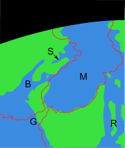
Strait
A strait or straits is a narrow, typically navigable channel of water that connects two larger, navigable bodies of water. It most commonly refers to a channel of water that lies between two land masses, but it may also refer to a navigable channel through a body of water that is otherwise not...
of water connecting the Mediterranean Sea
Mediterranean Sea
The Mediterranean Sea is a sea connected to the Atlantic Ocean surrounded by the Mediterranean region and almost completely enclosed by land: on the north by Anatolia and Europe, on the south by North Africa, and on the east by the Levant...
with the Atlantic Ocean
Atlantic Ocean
The Atlantic Ocean is the second-largest of the world's oceanic divisions. With a total area of about , it covers approximately 20% of the Earth's surface and about 26% of its water surface area...
that once separated the Iberian plate
Iberian plate
The microcontinent Iberia encompassed not only the Iberian Peninsula but also Corsica, Sardinia, the Balearic Islands, and the Briançonnais zone of the Penninic nappes of the Alps...
from the Eurasian plate
Eurasian Plate
The Eurasian Plate is a tectonic plate which includes most of the continent of Eurasia , with the notable exceptions of the Indian subcontinent, the Arabian subcontinent, and the area east of the Chersky Range in East Siberia...
through the Betic Cordillera. Its closure approximately 5.96 million years ago during the Messinian
Messinian
The Messinian is in the geologic timescale the last age or uppermost stage of the Miocene. It spans the time between 7.246 ± 0.005 Ma and 5.332 ± 0.005 Ma...
period of the Miocene
Miocene
The Miocene is a geological epoch of the Neogene Period and extends from about . The Miocene was named by Sir Charles Lyell. Its name comes from the Greek words and and means "less recent" because it has 18% fewer modern sea invertebrates than the Pliocene. The Miocene follows the Oligocene...
epoch, precipitated the Messinian Salinity Crisis
Messinian salinity crisis
The Messinian Salinity Crisis, also referred to as the Messinian Event, and in its latest stage as the Lago Mare event, was a geological event during which the Mediterranean Sea went into a cycle of partly or nearly complete desiccation throughout the latter part of the Messinian age of the Miocene...
, a period when the Mediterranean Sea evaporated partly or completely.
Geology
Betic corridor rock faciesFacies
In geology, facies are a body of rock with specified characteristics. Ideally, a facies is a distinctive rock unit that forms under certain conditions of sedimentation, reflecting a particular process or environment....
consist of heterozoan bioclastic carbonates and mixed siliciclastic
Siliciclastic
Siliciclastic rocks are clastic noncarbonate sedimentary rocks that are almost exclusively silica-bearing, either as forms of quartz or other silicate minerals. All siliciclastic rocks are formed by inorganic processes, or deposited through some mechanical process, such as stream deposits that are...
–carbonates with conglomerates
Conglomerate (geology)
A conglomerate is a rock consisting of individual clasts within a finer-grained matrix that have become cemented together. Conglomerates are sedimentary rocks consisting of rounded fragments and are thus differentiated from breccias, which consist of angular clasts...
appearing in local fan-delta deposits. Betic deposits exhibit huge trough cross-bedded structures with single troughs up to 5 m high pointing to the east in the easternmost outcrops. In central outcrops, they reach up to 15 m in height and some tens of metres in length and point both to the east and to the west. The westernmost outcrops show the largest cross-bedded structures, up to 20 m in height and some hundred of metres in length, all pointing to the west. The large-scale cross-bedding was generated by the migration of very large dunes moved by tides. The largest structures are inferred to have formed at depths of 90 m. Depth estimations indicate that the Betic corridor shallowed toward the Mediterranean and deepened toward the Atlantic. The Miocene evolution towards the formation of the Betic corridor can be divided into a series of steps. The palaeogeography evolved from a south-facing platform, marginal to a northeastern relief, to a wide-open marine passage limited by a southern platform and, finally, to a tidal-dominated strait. The closing of the Betic corridor is recorded by the presence of lagoonal, silty sediments covered by a stromatolite layer and crowned by a red soil in the westernmost outcrops.