
Beargrass Creek
Encyclopedia
Jefferson County, Kentucky
As of the census of 2000, there were 693,604 people, 287,012 households, and 183,113 families residing in the county. The population density was . There were 305,835 housing units at an average density of...
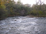
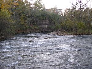
. The Beargrass Creek watershed
Drainage basin
A drainage basin is an extent or an area of land where surface water from rain and melting snow or ice converges to a single point, usually the exit of the basin, where the waters join another waterbody, such as a river, lake, reservoir, estuary, wetland, sea, or ocean...
is the largest in the county, draining over 60 square miles (155.4 km²).
As the forks wind through the area that has become Louisville's East End, they have contributed to the geography that has shaped the area. The origin of the name "Beargrass" is not clear, though local stories abound and it was written as "Bear Grass Creek" in early maps.
Lyndon Lore states, "The name Beargrass was originally Bear Grasse, because the bears came to the creek for water and also for salt from the salt licks which were located near Salt River
Salt River (Kentucky)
The Salt River is a river in Kentucky that drains . It begins near Danville, Kentucky, rising from the north slope of Persimmon Knob south of KY 300 between Alum Springs and Wilsonville, and ends at the Ohio River near West Point...
."
The earliest settlements by Europeans in the area were built in the form of stations, or forts, along the banks of the creek. The three forks drain about 70 square miles (181 km²) of land, and occasionally flood.
The three main branches are the South, Middle and Muddy Forks. They separate just east of Downtown Louisville
Downtown Louisville
Downtown Louisville is the largest central business district in the Commonwealth of Kentucky and the urban hub of the Louisville, Kentucky Metropolitan Area. Its boundaries are the Ohio River to the north, Hancock Street to the east, York and Jacob Streets to the south, and 9th Street to the west...
. The South Fork runs through Butchertown
Butchertown
Butchertown is a neighborhood just east of downtown Louisville, Kentucky, USA. The first homes in the area were laid out in the 1820s along the newly completed Louisville to Lexington turnpike, referred to in that stretch as Story Avenue.- History :...
and Germantown to west of Tyler Park, through the Poplar Level
Poplar Level
Poplar Level is a neighborhood five miles southeast of downtown Louisville, Kentucky, USA. It is part of the larger Camp Zachary Taylor area....
area (where the Beargrass Creek State Nature Preserve
Beargrass Creek State Nature Preserve
Beargrass Creek State Nature Preserve is a nature preserve in Louisville, Kentucky's Poplar Level neighborhood, in roughly the central portion of the city. It is named for Beargrass Creek, the south fork of which passes along the northern side of the preserve. The preserve is adjacent to...
is located) and eventually the Fern Creek neighborhood. Eleven Jones Cave
Eleven Jones Cave
Eleven Jones Cave is located by Beargrass Creek in Louisville, Kentucky. It is southeast of the corner of Eastern Parkway and Poplar Level Road on the west bank, between Louisville Cemetery and Calvary Cemetery, near St. X High School. It is developed in Louisville Limestone 448 feet above sea...
is located along this fork.
The south fork originally ran through downtown, but was rerouted in the 1850s. The original route was turned into a sewer. In the 1920s, the stretch near Germantown was placed into a concrete channel. The current channelized state of the creek bed and Louisville's continued problems with Combined Sewer Overflows (CSOs) often leads to poor water quality in the creek. Volunteer groups such as the Beargrass Creek Watershed Alliance regularly conduct water testing to provide up-to-date information on the health of the creek. Following heavy rain events one should avoid contact with the creek if at all possible.
The middle fork has two branches, called Weicher Creek and the Sinking Fork. Weicher Creek flows from the Hurstborne Area, and the Sinking Fork has its headweaters near Anchorage, Kentucky
Anchorage, Kentucky
As of the census of 2000, there were 2,264 people, 729 households, and 643 families residing in the city. The population density was 744.0 people per square mile . There were 750 housing units at an average density of 246.5 per square mile...
. They join in St. Matthews
St. Matthews, Kentucky
St. Matthews is the 20th largest city in Kentucky, United States and is a prominent suburb of Louisville. It is located 8 miles east of downtown Louisville in Jefferson County. It is one of the state's major shopping areas, being home to second and fifth largest malls in Kentucky St. Matthews is...
and flow through Cherokee Park
Cherokee Park
Cherokee Park is a municipal park located in Louisville, Kentucky, United States. It was designed, like 18 of Louisville's 123 public parks, by Frederick Law Olmsted, the father of landscape architecture...
until it meets the South Fork near the Bourbon Stockyards. The Muddy Fork rises at a stone springhouse in Windy Hills
Windy Hills, Kentucky
Windy Hills is a city in eastern Jefferson County, Kentucky, United States. The population was 2,480 at the 2000 census.-Geography:Windy Hills is located at ....
and runs parallel to the Ohio River
Ohio River
The Ohio River is the largest tributary, by volume, of the Mississippi River. At the confluence, the Ohio is even bigger than the Mississippi and, thus, is hydrologically the main stream of the whole river system, including the Allegheny River further upstream...
and was rerouted during the construction of Interstate 71
Interstate 71
Interstate 71 is an Interstate Highway in the Great Lakes/Midwestern and Southeastern region of the United States. Its southern terminus is at an interchange with Interstate 64 and Interstate 65 in Louisville, Kentucky. Its northern terminus is at an interchange with Interstate 90 in Cleveland,...
.
Although used just for drainage and as a scenic feature by the 20th century, in pioneer days it was navigable and used for that purpose.