
Bay St. Louis, Mississippi
Encyclopedia
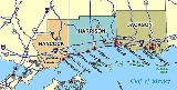
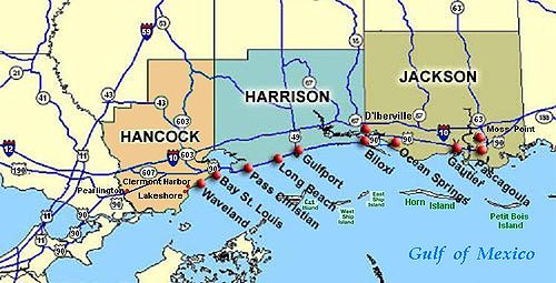
Bay Saint Louis is a city located in Hancock County, Mississippi
. It is part of the Gulfport
–Biloxi
, Mississippi Metropolitan Statistical Area
. As of the 2000 census, the city had a total population of 8,209. It is the county seat
of Hancock County
. Like several other upper Gulf Coast cities, Bay Saint Louis was devastated by Hurricane Katrina
in August 2005 (see details below).
According to the United States Census Bureau
, the city has a total area of 16.9 square miles (43.8 km²), of which, 6.1 square miles (15.8 km²) of it is land and 10.7 square miles (27.7 km²) of it is water. The total area is 63.70% water.
of 2000, there were 8,209 people, 3,271 households, and 2,064 families residing in the city. The population density
was 1,342.1 people per square mile (517.9/km²). There were 3,817 housing units at an average density of 624.1 per square mile (240.8/km²). The racial makeup of the city was 80.23% White, 16.59% African American, 0.40% Native American, 1.11% Asian, 0.05% Pacific Islander, 0.19% from other races, and 1.43% from two or more races. 1.68% of the population was Hispanic or Latino of any race.
There were 3,271 households out of which 29.6% had children under the age of 18 living with them, 44.0% were married couples
living together, 14.7% had a female householder with no husband present, and 36.9% were non-families. 31.5% of all households were made up of individuals and 12.6% have someone living alone who was 65 years of age or older. The average household size was 2.41 and the average family size is 3.05.
In the city the population was 24.5% under the age of 18, 7.6% from 18 to 24, 26.8% from 25 to 44, 24.5% from 45 to 64, and 16.6% who are 65 years of age or older. The median age is 39 years. For every 100 females there were 92.0 males. For every 100 females age 18 and over, there were 88.0 males. The median income for a household in the city was $34,106, and the median income for a family was $41,957. Males had a median income of $32,261 versus $21,308 for females. The per capita income
for the city was $18,483. 13.2% of the population and 10.0% of families were below the poverty line. Out of the total population, 17.2% of those under the age of 18 and 11.5% of those 65 and older were living below the poverty line.
It is the home of St. Stanislaus College prep, a residency and day school for boys grades 7–12, and Our Lady academy, a day school for girls grades 7–12. These two share some classrooms as well as a Catholic curriculum.
made landfall at the tip of Louisiana before continuing to Bay St. Louis.
made its final landfall near Bay St. Louis, at the mouth of the Pearl River
, with a 28 feet (8.5 m) storm surge. Hurricane Katrina came ashore during the high tide of 9:15AM, +2.3 feet more, causing a storm tide over 30 feet (9.1 m) deep. USGS Topographical maps show a common 25 feet (7.6 m) elevation contour line running throughout a ridge along old HWY 90 (Old Spanish Trail) in the western edge of the city. It was primarily this area which did not see the surge inundation of Hurricane Katrina.
The town was notable for being the highest point on the entire Gulf of Mexico
coastline (approx. 12 feet), its pristine beaches, and esteemed restaurants such as Trapani's.
The final death toll from Hurricane Katrina is not yet known.
Hurricane Katrina damaged over 40 Mississippi libraries, with severe roof and water damage to the Bay St. Louis Public Library. The library reopened to the public on October 12, 2005, and is awaiting repairs. The Bay St. Louis Bridge on US Highway 90, was also damaged, with many bridge sections downdropped at the west edges. The destroyed bridge was replaced by a new St. Louis Bay Bridge, which was awarded America's Transportation Award. http://www.americastransportationaward.org/Default.aspx?ContentID=45 The new bridge features a pedestrian bridge with an art walk featuring the works of local artists. http://www.hancockchamber.org/Events/Bridgefest2009/bridgefestartists.asp
Currently, the underground utility infrastructure in Bay St. Louis is receiving a federally funded total overhaul and replacement.
Hancock County, Mississippi
-Demographics:As of the census of 2000, there were 42,967 people, 16,897 households, and 11,827 families residing in the county. The population density was 90 people per square mile . There were 21,072 housing units at an average density of 44 per square mile...
. It is part of the Gulfport
Gulfport, Mississippi
Gulfport is the second largest city in Mississippi after the state capital Jackson. It is the larger of the two principal cities of the Gulfport-Biloxi, Mississippi Metropolitan Statistical Area, which is included in the Gulfport-Biloxi-Pascagoula, Mississippi Combined Statistical Area. As of the...
–Biloxi
Biloxi, Mississippi
Biloxi is a city in Harrison County, Mississippi, in the United States. The 2010 census recorded the population as 44,054. Along with Gulfport, Biloxi is a county seat of Harrison County....
, Mississippi Metropolitan Statistical Area
Gulfport-Biloxi metropolitan area
The Gulfport-Biloxi Metropolitan Statistical Area is a metropolitan area in the Mississippi Gulf Coast region that covers three counties - Hancock, Harrison, and Stone. As of the 2000 census, the MSA had a population of 246,190. The area was significantly impacted by Hurricane Katrina in 2005. A...
. As of the 2000 census, the city had a total population of 8,209. It is the county seat
County seat
A county seat is an administrative center, or seat of government, for a county or civil parish. The term is primarily used in the United States....
of Hancock County
Hancock County, Mississippi
-Demographics:As of the census of 2000, there were 42,967 people, 16,897 households, and 11,827 families residing in the county. The population density was 90 people per square mile . There were 21,072 housing units at an average density of 44 per square mile...
. Like several other upper Gulf Coast cities, Bay Saint Louis was devastated by Hurricane Katrina
Hurricane Katrina
Hurricane Katrina of the 2005 Atlantic hurricane season was a powerful Atlantic hurricane. It is the costliest natural disaster, as well as one of the five deadliest hurricanes, in the history of the United States. Among recorded Atlantic hurricanes, it was the sixth strongest overall...
in August 2005 (see details below).
Geography
Bay St. Louis is located at 30°18'53" North, 89°20'39" West (30.314696, −89.344096). It is situated on the Bay of Saint Louis, which empties into the Mississippi Sound.According to the United States Census Bureau
United States Census Bureau
The United States Census Bureau is the government agency that is responsible for the United States Census. It also gathers other national demographic and economic data...
, the city has a total area of 16.9 square miles (43.8 km²), of which, 6.1 square miles (15.8 km²) of it is land and 10.7 square miles (27.7 km²) of it is water. The total area is 63.70% water.
Demographics
As of the censusCensus
A census is the procedure of systematically acquiring and recording information about the members of a given population. It is a regularly occurring and official count of a particular population. The term is used mostly in connection with national population and housing censuses; other common...
of 2000, there were 8,209 people, 3,271 households, and 2,064 families residing in the city. The population density
Population density
Population density is a measurement of population per unit area or unit volume. It is frequently applied to living organisms, and particularly to humans...
was 1,342.1 people per square mile (517.9/km²). There were 3,817 housing units at an average density of 624.1 per square mile (240.8/km²). The racial makeup of the city was 80.23% White, 16.59% African American, 0.40% Native American, 1.11% Asian, 0.05% Pacific Islander, 0.19% from other races, and 1.43% from two or more races. 1.68% of the population was Hispanic or Latino of any race.
There were 3,271 households out of which 29.6% had children under the age of 18 living with them, 44.0% were married couples
Marriage
Marriage is a social union or legal contract between people that creates kinship. It is an institution in which interpersonal relationships, usually intimate and sexual, are acknowledged in a variety of ways, depending on the culture or subculture in which it is found...
living together, 14.7% had a female householder with no husband present, and 36.9% were non-families. 31.5% of all households were made up of individuals and 12.6% have someone living alone who was 65 years of age or older. The average household size was 2.41 and the average family size is 3.05.
In the city the population was 24.5% under the age of 18, 7.6% from 18 to 24, 26.8% from 25 to 44, 24.5% from 45 to 64, and 16.6% who are 65 years of age or older. The median age is 39 years. For every 100 females there were 92.0 males. For every 100 females age 18 and over, there were 88.0 males. The median income for a household in the city was $34,106, and the median income for a family was $41,957. Males had a median income of $32,261 versus $21,308 for females. The per capita income
Per capita income
Per capita income or income per person is a measure of mean income within an economic aggregate, such as a country or city. It is calculated by taking a measure of all sources of income in the aggregate and dividing it by the total population...
for the city was $18,483. 13.2% of the population and 10.0% of families were below the poverty line. Out of the total population, 17.2% of those under the age of 18 and 11.5% of those 65 and older were living below the poverty line.
Education
The City of Bay St. Louis is served by the Bay St. Louis-Waveland School DistrictBay St. Louis-Waveland School District
The Bay St. Louis-Waveland School District is a public school district based in Bay St. Louis, Mississippi .In addition to Bay St. Louis, the district serves the city of Waveland and part of Shoreline Park.-Schools:...
It is the home of St. Stanislaus College prep, a residency and day school for boys grades 7–12, and Our Lady academy, a day school for girls grades 7–12. These two share some classrooms as well as a Catholic curriculum.
Hurricane Camille
On August 17, 1969, Hurricane CamilleHurricane Camille
Hurricane Camille was the third and strongest tropical cyclone and second hurricane during the 1969 Atlantic hurricane season. The second of three catastrophic Category 5 hurricanes to make landfall in the United States during the 20th century , which it did near the mouth of the Mississippi River...
made landfall at the tip of Louisiana before continuing to Bay St. Louis.
Hurricane Katrina
On August 29, 2005 at 10:00 a.m. CDT, Hurricane KatrinaHurricane Katrina
Hurricane Katrina of the 2005 Atlantic hurricane season was a powerful Atlantic hurricane. It is the costliest natural disaster, as well as one of the five deadliest hurricanes, in the history of the United States. Among recorded Atlantic hurricanes, it was the sixth strongest overall...
made its final landfall near Bay St. Louis, at the mouth of the Pearl River
Pearl River (Mississippi-Louisiana)
The Pearl River is a river in the U.S. states of Mississippi and Louisiana. It forms in Neshoba County, Mississippi from the confluence of Nanih Waiya and Tallahaga creeks. It is long. The Yockanookany and Strong rivers are tributaries. Northeast of Jackson, the Ross Barnett Reservoir is formed by...
, with a 28 feet (8.5 m) storm surge. Hurricane Katrina came ashore during the high tide of 9:15AM, +2.3 feet more, causing a storm tide over 30 feet (9.1 m) deep. USGS Topographical maps show a common 25 feet (7.6 m) elevation contour line running throughout a ridge along old HWY 90 (Old Spanish Trail) in the western edge of the city. It was primarily this area which did not see the surge inundation of Hurricane Katrina.
The town was notable for being the highest point on the entire Gulf of Mexico
Gulf of Mexico
The Gulf of Mexico is a partially landlocked ocean basin largely surrounded by the North American continent and the island of Cuba. It is bounded on the northeast, north and northwest by the Gulf Coast of the United States, on the southwest and south by Mexico, and on the southeast by Cuba. In...
coastline (approx. 12 feet), its pristine beaches, and esteemed restaurants such as Trapani's.
The final death toll from Hurricane Katrina is not yet known.
Hurricane Katrina damaged over 40 Mississippi libraries, with severe roof and water damage to the Bay St. Louis Public Library. The library reopened to the public on October 12, 2005, and is awaiting repairs. The Bay St. Louis Bridge on US Highway 90, was also damaged, with many bridge sections downdropped at the west edges. The destroyed bridge was replaced by a new St. Louis Bay Bridge, which was awarded America's Transportation Award. http://www.americastransportationaward.org/Default.aspx?ContentID=45 The new bridge features a pedestrian bridge with an art walk featuring the works of local artists. http://www.hancockchamber.org/Events/Bridgefest2009/bridgefestartists.asp
Currently, the underground utility infrastructure in Bay St. Louis is receiving a federally funded total overhaul and replacement.
External links
- Bay St. Louis’ Working Web - The City’s information Source
- Sea Coast Echo, the local newspaper
- Coastal 90 Bay St Louis, the local online paper
- Mississippi's West Coast, Official Tourism Site
- St. Louis Bay Bridge, America's Transportation Awards
- Directory for Families in Bay St. Louis of Things-to-Do