

Barrier Highway
Encyclopedia
The Barrier Highway is a highway
in New South Wales
and South Australia
signposted as in South Australia and
  in New South Wales, Australia
.
 The Barrier Highway starts at Nyngan
where it joins the Mitchell Highway
. It heads west past Hermidale and Boppy Mountain to Cobar
, a mining town. It then continues to Wilcannia
where it crosses the Darling River
. Further west it passes through Broken Hill
and enters South Australia
, turning southwest towards Adelaide
. It joins Main North Road
at Giles Corner
between Riverton
and Tarlee
. Route A32 continues on Main North Road to Gawler
where it joins Route A20 (the Sturt Highway
).
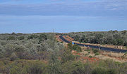
The area traversed by the Barrier Highway is remote and very sparsely settled.
Highway
A highway is any public road. In American English, the term is common and almost always designates major roads. In British English, the term designates any road open to the public. Any interconnected set of highways can be variously referred to as a "highway system", a "highway network", or a...
in New South Wales
New South Wales
New South Wales is a state of :Australia, located in the east of the country. It is bordered by Queensland, Victoria and South Australia to the north, south and west respectively. To the east, the state is bordered by the Tasman Sea, which forms part of the Pacific Ocean. New South Wales...
and South Australia
South Australia
South Australia is a state of Australia in the southern central part of the country. It covers some of the most arid parts of the continent; with a total land area of , it is the fourth largest of Australia's six states and two territories.South Australia shares borders with all of the mainland...
signposted as
in New South Wales, AustraliaAustralia
Australia , officially the Commonwealth of Australia, is a country in the Southern Hemisphere comprising the mainland of the Australian continent, the island of Tasmania, and numerous smaller islands in the Indian and Pacific Oceans. It is the world's sixth-largest country by total area...
.
Nyngan, New South Wales
Nyngan [pr: ning-g'n] is a town in the central west of New South Wales, Australia. It is located in the Bogan Shire Local Government Area. At the 2006 census, Nyngan had a population of 1,975 people. Nyngan is situated on the Bogan River between Narromine and Bourke, on the junction of the...
where it joins the Mitchell Highway
Mitchell Highway
The Mitchell Highway is a major rural highway in Australia, travelling through central and northern New South Wales and south central Queensland. The highway starts from its northern end in Queensland with the Landsborough Highway near Augathella and continues south to Charleville and Cunnamulla...
. It heads west past Hermidale and Boppy Mountain to Cobar
Cobar, New South Wales
-Notable people:*Nik Kosef, former rugby league player for the Manly-Warringah Sea Eagles, 1996 premiership player, NSW & Australia representative*Ernie Toshack, cricketer, member of Bradman's Invincibles* Jemma Heather, state representative 4 times....
, a mining town. It then continues to Wilcannia
Wilcannia, New South Wales
Wilcannia is a small town located within the Central Darling Shire in north western New South Wales, Australia. This was the third largest inland port in the country during the great river boat era of the mid-19th century. At the 2006 census, Wilcannia had a population of 596.- Geography...
where it crosses the Darling River
Darling River
The Darling River is the third longest river in Australia, measuring from its source in northern New South Wales to its confluence with the Murray River at Wentworth, New South Wales. Including its longest contiguous tributaries it is long, making it the longest river system in Australia.The...
. Further west it passes through Broken Hill
Broken Hill, New South Wales
-Geology:Broken Hill's massive orebody, which formed about 1,800 million years ago, has proved to be among the world's largest silver-lead-zinc mineral deposits. The orebody is shaped like a boomerang plunging into the earth at its ends and outcropping in the centre. The protruding tip of the...
and enters South Australia
South Australia
South Australia is a state of Australia in the southern central part of the country. It covers some of the most arid parts of the continent; with a total land area of , it is the fourth largest of Australia's six states and two territories.South Australia shares borders with all of the mainland...
, turning southwest towards Adelaide
Adelaide
Adelaide is the capital city of South Australia and the fifth-largest city in Australia. Adelaide has an estimated population of more than 1.2 million...
. It joins Main North Road
Main North Road
Main North Road is the major north-south arterial route north of the city of Adelaide, South Australia.From the Adelaide city centre, it passes through the Adelaide Parklands and the suburbs of Thorngate, Medindie, Medindie Gardens, Nailsworth, Prospect, Sefton Park, Blair Athol and Enfield before...
at Giles Corner
Giles Corner, South Australia
Giles Corner is the name of the intersection of Main North Road and the Barrier Highway, halfway between the towns of Tarlee and Rhynie. The Barrier Highway branches off from Main North Road at this location, heading north towards Riverton, Burra and eventually Broken Hill...
between Riverton
Riverton, South Australia
Riverton is a small town of distinctive character and interest to travellers in the Mid North of South Australia, in the Gilbert Valley. It is situated on the Gilbert River, from which the town derives its name...
and Tarlee
Tarlee, South Australia
Tarlee is a town in South Australia. The origin of the name is uncertain, but it is thought to be a corruption of the name Tralee in Ireland. The town is in the lower Mid North region where Main North Road crosses the Gilbert River. It is approximately 8 km south of Giles Corner, where the...
. Route A32 continues on Main North Road to Gawler
Gawler, South Australia
Gawler is the first country town in the state of South Australia, and is named after the second Governor of the colony of South Australia, George Gawler. It is located north of the centre of the state capital, Adelaide, and is close to the major wine producing district of the Barossa Valley...
where it joins Route A20 (the Sturt Highway
Sturt Highway
The Sturt Highway is an Australian highway in New South Wales, Victoria, and South Australia. It is part of the Auslink National network and is part of the main highway route between Sydney and Adelaide.-Route:...
).
The area traversed by the Barrier Highway is remote and very sparsely settled.
Major intersections and towns
| Barrier Highway |
|||
| Westbound | Distance to Adelaide (km) |
Distance to Broken Hill (km) |
Eastbound |
.svg.png) Main North Road Main North Road Main North Road is the major north-south arterial route north of the city of Adelaide, South Australia.From the Adelaide city centre, it passes through the Adelaide Parklands and the suburbs of Thorngate, Medindie, Medindie Gardens, Nailsworth, Prospect, Sefton Park, Blair Athol and Enfield before... to TarleeTarlee, South Australia Tarlee is a town in South Australia. The origin of the name is uncertain, but it is thought to be a corruption of the name Tralee in Ireland. The town is in the lower Mid North region where Main North Road crosses the Gilbert River. It is approximately 8 km south of Giles Corner, where the... , Gawler Gawler, South Australia Gawler is the first country town in the state of South Australia, and is named after the second Governor of the colony of South Australia, George Gawler. It is located north of the centre of the state capital, Adelaide, and is close to the major wine producing district of the Barossa Valley... and Adelaide Adelaide Adelaide is the capital city of South Australia and the fifth-largest city in Australia. Adelaide has an estimated population of more than 1.2 million...  Main North Road Main North Road Main North Road is the major north-south arterial route north of the city of Adelaide, South Australia.From the Adelaide city centre, it passes through the Adelaide Parklands and the suburbs of Thorngate, Medindie, Medindie Gardens, Nailsworth, Prospect, Sefton Park, Blair Athol and Enfield before...  to Clare to ClareClare, South Australia The town of Clare is located in South Australia in the Mid North region, 136 km north of Adelaide. It gives its name to the Clare Valley wine and tourist region.-History:One of the first settlers in the area was John Horrocks, in 1839... , Jamestown Jamestown, South Australia Jamestown is a town in the Mid North region of South Australia north of Adelaide. It is on the banks of the Belalie Creek and on the railway line between Gladstone and Peterborough, and ultimately on the main line linking Adelaide and Perth to Sydney... and Port Augusta Port Augusta, South Australia -Electricity generation:Electricity is generated at the Playford B and Northern power stations from brown coal mined at Leigh Creek, 250 km to the north... |
|||
| End Barrier Highway |
85 | 424 | Start Barrier Highway |
| Riverton Riverton, South Australia Riverton is a small town of distinctive character and interest to travellers in the Mid North of South Australia, in the Gilbert Valley. It is situated on the Gilbert River, from which the town derives its name... |
93 | 416 | Riverton Riverton, South Australia Riverton is a small town of distinctive character and interest to travellers in the Mid North of South Australia, in the Gilbert Valley. It is situated on the Gilbert River, from which the town derives its name... |
| continues as |
102 | 407 | Saddleworth Saddleworth, South Australia Saddleworth is a small town in the Mid North region of South Australia. The town is situated on the Gilbert River and along with neighbouring towns of Riverton, Rhynie and Tarlee the local area is known as the Gilbert Valley. The town in bisected by the Barrier Highway... |
| Marrabel Marrabel, South Australia Marrabel is a locality in South Australia. The locality is in the Clare and Gilbert Valleys Council local government area, north west of the state capital, Adelaide. At the 2006 census, Marrabel had a population of 209.... , Eudunda Eudunda, South Australia Eudunda is a rural town in South Australia, roughly 103 kilometres northeast of Adelaide, established in 1870 after settlers began moving into the area in the 1860s... Marrabel Road |
Marrabel Marrabel, South Australia Marrabel is a locality in South Australia. The locality is in the Clare and Gilbert Valleys Council local government area, north west of the state capital, Adelaide. At the 2006 census, Marrabel had a population of 209.... , Eudunda Eudunda, South Australia Eudunda is a rural town in South Australia, roughly 103 kilometres northeast of Adelaide, established in 1870 after settlers began moving into the area in the 1860s... Marrabel Road |
||
| duplexes with |
|||
| Saddleworth Saddleworth, South Australia Saddleworth is a small town in the Mid North region of South Australia. The town is situated on the Gilbert River and along with neighbouring towns of Riverton, Rhynie and Tarlee the local area is known as the Gilbert Valley. The town in bisected by the Barrier Highway... |
103 | 406 | Auburn Auburn, South Australia Auburn is the name of a small town in the southern edge of the Clare Valley, in the Mid North of South Australia.-History:Often considered the Gateway to the Clare Valley, Auburn was originally settled by William Tateham, who lived in a dugout along the Wakefield River and was first named... , Port Wakefield Port Wakefield, South Australia Port Wakefield was the first government town to be established north of the capital, Adelaide, in South Australia.Port Wakefield is situated approximately 98.7 kilometres from Adelaide and lies on the Port Wakefield Road section of the A1 National Highway... Auburn Road |
| duplexes with |
|||
| Auburn Auburn, South Australia Auburn is the name of a small town in the southern edge of the Clare Valley, in the Mid North of South Australia.-History:Often considered the Gateway to the Clare Valley, Auburn was originally settled by William Tateham, who lived in a dugout along the Wakefield River and was first named... , Port Wakefield Port Wakefield, South Australia Port Wakefield was the first government town to be established north of the capital, Adelaide, in South Australia.Port Wakefield is situated approximately 98.7 kilometres from Adelaide and lies on the Port Wakefield Road section of the A1 National Highway... Auburn Road |
continues as |
||
| Manoora Manoora, South Australia Manoora is a settlement in South Australia. At the 2006 census, Manoora had a population of 277.-References:... |
112 | 397 | Manoora Manoora, South Australia Manoora is a settlement in South Australia. At the 2006 census, Manoora had a population of 277.-References:... |
BURRA RAIL LINE .svg.png) |
113 | 396 | BURRA RAIL LINE |
| Farrell Flat Farrell Flat, South Australia Farrell Flat is a town in South Australia. The town is located east of Clare and south-west of Burra, in the Regional Council of Goyder. At the 2006 census, Farrell Flat and the surrounding area had a population of 294.... , Clare Clare, South Australia The town of Clare is located in South Australia in the Mid North region, 136 km north of Adelaide. It gives its name to the Clare Valley wine and tourist region.-History:One of the first settlers in the area was John Horrocks, in 1839... Farrell Flat Road |
142 | 367 | Farrell Flat Farrell Flat, South Australia Farrell Flat is a town in South Australia. The town is located east of Clare and south-west of Burra, in the Regional Council of Goyder. At the 2006 census, Farrell Flat and the surrounding area had a population of 294.... Farrell Flat Road |
| Burra Burra, South Australia Burra is a pastoral centre and historic tourist town in the mid-north of South Australia. It lies east of the Clare Valley in the Bald Hills range, part of the northern Mount Lofty Ranges, and on Burra Creek. The town began as a single company mining township that, by 1851, was a set of townships ... |
155 | 354 | Burra Burra, South Australia Burra is a pastoral centre and historic tourist town in the mid-north of South Australia. It lies east of the Clare Valley in the Bald Hills range, part of the northern Mount Lofty Ranges, and on Burra Creek. The town began as a single company mining township that, by 1851, was a set of townships ... |
| continues as |
157 | 352 | Morgan Morgan, South Australia Morgan is a town in South Australia on the right bank of the Murray River, just downstream of where it turns from flowing roughly westwards to roughly southwards. It is about north east of Adelaide, and about upstream of the Murray Mouth. At the 2006 census, Morgan had a population of 426.The... , Waikerie Waikerie, South Australia Waikerie is a rural town in the Riverland region of South Australia on the south bank of the Murray River. At the 2006 census, Waikerie had a population of 1,744. The Sturt Highway passes to the south of the town at the top of the cliffs... Spalding Burramble-Morgan Road  |
| Morgan Morgan, South Australia Morgan is a town in South Australia on the right bank of the Murray River, just downstream of where it turns from flowing roughly westwards to roughly southwards. It is about north east of Adelaide, and about upstream of the Murray Mouth. At the 2006 census, Morgan had a population of 426.The... , Waikerie Waikerie, South Australia Waikerie is a rural town in the Riverland region of South Australia on the south bank of the Murray River. At the 2006 census, Waikerie had a population of 1,744. The Sturt Highway passes to the south of the town at the top of the cliffs... Spalding Burramble-Morgan Road |
duplexes with |
||
| duplexes with |
163 | 346 | Spalding Spalding, South Australia Spalding is a town located north of the Clare Valley in South Australia, Australia at . At the 2006 census, Spalding had a population of 212.It is mainly a farming community and also is home to a slate quarry.... , Crystal Brook Crystal Brook, South Australia Crystal Brook is a town in South Australia, named after the spring-fed creek next to which it was founded. It is north of Adelaide and in 2006 had a population of 1,185.Crystal Brook is situated on Goyder's Line near the border of two climate systems... Ford Road |
| Spalding Spalding, South Australia Spalding is a town located north of the Clare Valley in South Australia, Australia at . At the 2006 census, Spalding had a population of 212.It is mainly a farming community and also is home to a slate quarry.... , Crystal Brook Crystal Brook, South Australia Crystal Brook is a town in South Australia, named after the spring-fed creek next to which it was founded. It is north of Adelaide and in 2006 had a population of 1,185.Crystal Brook is situated on Goyder's Line near the border of two climate systems... Ford Road |
continues as |
||
| Jamestown Jamestown, South Australia Jamestown is a town in the Mid North region of South Australia north of Adelaide. It is on the banks of the Belalie Creek and on the railway line between Gladstone and Peterborough, and ultimately on the main line linking Adelaide and Perth to Sydney... Tommy Gap Road  |
187 | 322 | Hallett Hallett, South Australia Hallett is a small town with a large history. Situated on the Barrier Highway north of Burra and south-east of Jamestown, Hallett lies close to Goyder's Line, plotted in the nineteenth century by George Goyder, separating the land suitable for cropping from the land suitable for grazing... |
| Hallett Hallett, South Australia Hallett is a small town with a large history. Situated on the Barrier Highway north of Burra and south-east of Jamestown, Hallett lies close to Goyder's Line, plotted in the nineteenth century by George Goyder, separating the land suitable for cropping from the land suitable for grazing... |
Jamestown Jamestown, South Australia Jamestown is a town in the Mid North region of South Australia north of Adelaide. It is on the banks of the Belalie Creek and on the railway line between Gladstone and Peterborough, and ultimately on the main line linking Adelaide and Perth to Sydney... Tommy Gap Road |
||
| Jamestown Jamestown, South Australia Jamestown is a town in the Mid North region of South Australia north of Adelaide. It is on the banks of the Belalie Creek and on the railway line between Gladstone and Peterborough, and ultimately on the main line linking Adelaide and Perth to Sydney... , Gladstone Gladstone, South Australia Gladstone is a small rural town in the Mid North of South Australia in the approach to the lower Flinders Ranges. At the 2006 census, Gladstone had a population of 629.... Jamestown-Whyte Yarcowie Road |
209 | 300 | Whyte Yarcowie Whyte Yarcowie, South Australia Whyte Yarcowie is a settlement in South Australia. At the 2006 census, Whyte Yarcowie had a population of 119.... |
| Whyte Yarcowie Whyte Yarcowie, South Australia Whyte Yarcowie is a settlement in South Australia. At the 2006 census, Whyte Yarcowie had a population of 119.... |
Jamestown Jamestown, South Australia Jamestown is a town in the Mid North region of South Australia north of Adelaide. It is on the banks of the Belalie Creek and on the railway line between Gladstone and Peterborough, and ultimately on the main line linking Adelaide and Perth to Sydney... , Gladstone Gladstone, South Australia Gladstone is a small rural town in the Mid North of South Australia in the approach to the lower Flinders Ranges. At the 2006 census, Gladstone had a population of 629.... Jamestown-Whyte Yarcowie Road |
||
| Terowie Terowie, South Australia Terowie is a small town in the mid-north of South Australia located north of Adelaide. It is located in the Regional Council of Goyder. Terowie retains a number of authentic and well preserved 1880s buildings, and has been declared a "historic town". It also remains a town of interest to those... |
218 | 291 | Terowie Terowie, South Australia Terowie is a small town in the mid-north of South Australia located north of Adelaide. It is located in the Regional Council of Goyder. Terowie retains a number of authentic and well preserved 1880s buildings, and has been declared a "historic town". It also remains a town of interest to those... |
| Peterborough Peterborough, South Australia Peterborough is a town in the mid north of South Australia, in wheat country, just off the Barrier Highway. At the 2006 census, Peterborough had a population of 1,689.... Terowie Road |
221 | 288 | Peterborough Peterborough, South Australia Peterborough is a town in the mid north of South Australia, in wheat country, just off the Barrier Highway. At the 2006 census, Peterborough had a population of 1,689.... Terowie Road |
| Peterborough Peterborough, South Australia Peterborough is a town in the mid north of South Australia, in wheat country, just off the Barrier Highway. At the 2006 census, Peterborough had a population of 1,689.... , Orroroo Orroroo, South Australia Orroroo is a town in the Flinders Ranges region of South Australia. At the 2006 census, Orroroo had a population of 543. The Wilmington-Ucolta Road passes through here, intersecting there with the southern stretch of the Birdsville and Oodnadatta Tracks. The narrow gauge rail line was extended to... , Port Augusta Port Augusta, South Australia -Electricity generation:Electricity is generated at the Playford B and Northern power stations from brown coal mined at Leigh Creek, 250 km to the north... Wilmington-Ucolta Road  |
241 | 268 | Peterborough Peterborough, South Australia Peterborough is a town in the mid north of South Australia, in wheat country, just off the Barrier Highway. At the 2006 census, Peterborough had a population of 1,689.... , Orroroo Orroroo, South Australia Orroroo is a town in the Flinders Ranges region of South Australia. At the 2006 census, Orroroo had a population of 543. The Wilmington-Ucolta Road passes through here, intersecting there with the southern stretch of the Birdsville and Oodnadatta Tracks. The narrow gauge rail line was extended to... Wilmington-Ucolta Road |
| CRYSTAL BROOK-BROKEN HILL RAIL LINE Crystal Brook-Broken Hill railway The Crystal Brook - Broken Hill railway is a standard gauge railway line in the mid north of South Australia and the far west of New South Wales. It is part of the East-West rail corridor in Australia.- Infrastructure :... |
243 | 266 | CRYSTAL BROOK-BROKEN HILL RAIL LINE Crystal Brook-Broken Hill railway The Crystal Brook - Broken Hill railway is a standard gauge railway line in the mid north of South Australia and the far west of New South Wales. It is part of the East-West rail corridor in Australia.- Infrastructure :... |
| Waukaringa Yunta-Waukaringa Road |
313 | 196 | Yunta Yunta, South Australia Yunta is a village on the Barrier Highway in South Australia that services both the local area and travellers passing through. It lies south west of Broken Hill and north east of Peterborough.... |
| Yunta Yunta, South Australia Yunta is a village on the Barrier Highway in South Australia that services both the local area and travellers passing through. It lies south west of Broken Hill and north east of Peterborough.... |
Waukaringa Yunta-Waukaringa Road |
||
| Manna Hill Manna Hill, South Australia Mannahill is a settlement on the Barrier Highway and Indian Pacific railway line in South Australia. Mannahill is in the Northeast Pastoral district and is one of the easternmost settlements in South Australia... |
356 | 153 | Manna Hill Manna Hill, South Australia Mannahill is a settlement on the Barrier Highway and Indian Pacific railway line in South Australia. Mannahill is in the Northeast Pastoral district and is one of the easternmost settlements in South Australia... |
| Olary Olary, South Australia Olary is a settlement on the Barrier Highway in South Australia. It is situated near Olary Creek and is one of the easternmost settlements in South Australia.... |
394 | 115 | Olary Olary, South Australia Olary is a settlement on the Barrier Highway in South Australia. It is situated near Olary Creek and is one of the easternmost settlements in South Australia.... |
| CRYSTAL BROOK-BROKEN HILL RAIL LINE Crystal Brook-Broken Hill railway The Crystal Brook - Broken Hill railway is a standard gauge railway line in the mid north of South Australia and the far west of New South Wales. It is part of the East-West rail corridor in Australia.- Infrastructure :... |
427 | 82 | CRYSTAL BROOK-BROKEN HILL RAIL LINE Crystal Brook-Broken Hill railway The Crystal Brook - Broken Hill railway is a standard gauge railway line in the mid north of South Australia and the far west of New South Wales. It is part of the East-West rail corridor in Australia.- Infrastructure :... |
| CRYSTAL BROOK-BROKEN HILL RAIL LINE Crystal Brook-Broken Hill railway The Crystal Brook - Broken Hill railway is a standard gauge railway line in the mid north of South Australia and the far west of New South Wales. It is part of the East-West rail corridor in Australia.- Infrastructure :... |
460.5 | 48.5 | CRYSTAL BROOK-BROKEN HILL RAIL LINE Crystal Brook-Broken Hill railway The Crystal Brook - Broken Hill railway is a standard gauge railway line in the mid north of South Australia and the far west of New South Wales. It is part of the East-West rail corridor in Australia.- Infrastructure :... |
| Cockburn Cockburn, South Australia Cockburn is a town on the border of South Australia and New South Wales near Broken Hill. The town population consists of roughly 25 people with a greater regional community of 180 as of 2005.-Town history:... |
462.5 | 46.5 | Cockburn Cockburn, South Australia Cockburn is a town on the border of South Australia and New South Wales near Broken Hill. The town population consists of roughly 25 people with a greater regional community of 180 as of 2005.-Town history:... |
| Start |
463 | 46 | End |
| SOUTH AUSTRALIA STATE BORDER NEW SOUTH WALES |
|||
| End |
463 | 46 | Start |
| Silverton Silverton, New South Wales Silverton is a small village at the far west of New South Wales, Australia, 25 kilometres north-west of Broken Hill. At the 2006 census, Silverton had a population of 89 people.... Brookfield Avenue .svg.png) |
509 | 0 | Broken Hill Broken Hill, New South Wales -Geology:Broken Hill's massive orebody, which formed about 1,800 million years ago, has proved to be among the world's largest silver-lead-zinc mineral deposits. The orebody is shaped like a boomerang plunging into the earth at its ends and outcropping in the centre. The protruding tip of the... |
| Silverton Silverton, New South Wales Silverton is a small village at the far west of New South Wales, Australia, 25 kilometres north-west of Broken Hill. At the 2006 census, Silverton had a population of 89 people.... Brookfield Avenue |
|||
| Westbound | Distance to Adelaide (km) |
Distance to Sydney (km) |
Eastbound |
| continues as |
511 | 1160 | Milparinka Milparinka, New South Wales Milparinka is a small settlement in north-west New South Wales, Australia about north of Broken Hill on the Silver City Highway. At the time of the 2006 census, Milparinka had a population of 55 people.... , Tibooburra Tibooburra, New South Wales Tibooburra has an arid, desert climate with temperatures soaring above 40°Celsius in summer, often reaching as high as 47°C . Temperatures are milder in winter, averaging around 20°C in the daytime. These extreme temperatures make Tibooburra the hottest town in New South Wales, as reported on... Silver City Highway Silver City Highway The Silver City Highway is a highway in the state of New South Wales, Australia. It runs from south to north close to the western border of New South Wales with South Australia...  |
| Milparinka Milparinka, New South Wales Milparinka is a small settlement in north-west New South Wales, Australia about north of Broken Hill on the Silver City Highway. At the time of the 2006 census, Milparinka had a population of 55 people.... , Tibooburra Tibooburra, New South Wales Tibooburra has an arid, desert climate with temperatures soaring above 40°Celsius in summer, often reaching as high as 47°C . Temperatures are milder in winter, averaging around 20°C in the daytime. These extreme temperatures make Tibooburra the hottest town in New South Wales, as reported on... Silver City Highway Silver City Highway The Silver City Highway is a highway in the state of New South Wales, Australia. It runs from south to north close to the western border of New South Wales with South Australia... |
duplexes with |
||
| duplexes with |
512.5 | 1158.5 | Wentworth Wentworth, New South Wales Wentworth is a small border town in the far south west of the state of New South Wales, Australia. It lies at the confluence of Australia's two most important rivers, the Darling and the Murray, the latter forming the border with the state of Victoria to the south. The border with the state of... , Mildura Mildura, Victoria Mildura is a regional city in northwestern Victoria, Australia and seat of the Rural City of Mildura local government area. It is located in the Sunraysia region, and is on the banks of the Murray River. The current population is estimated at just over 30,000.Mildura is a major agricultural centre... , Melbourne Melbourne Melbourne is the capital and most populous city in the state of Victoria, and the second most populous city in Australia. The Melbourne City Centre is the hub of the greater metropolitan area and the Census statistical division—of which "Melbourne" is the common name. As of June 2009, the greater... Silver City Highway Silver City Highway The Silver City Highway is a highway in the state of New South Wales, Australia. It runs from south to north close to the western border of New South Wales with South Australia... |
| Wentworth Wentworth, New South Wales Wentworth is a small border town in the far south west of the state of New South Wales, Australia. It lies at the confluence of Australia's two most important rivers, the Darling and the Murray, the latter forming the border with the state of Victoria to the south. The border with the state of... , Mildura Mildura, Victoria Mildura is a regional city in northwestern Victoria, Australia and seat of the Rural City of Mildura local government area. It is located in the Sunraysia region, and is on the banks of the Murray River. The current population is estimated at just over 30,000.Mildura is a major agricultural centre... , Melbourne Melbourne Melbourne is the capital and most populous city in the state of Victoria, and the second most populous city in Australia. The Melbourne City Centre is the hub of the greater metropolitan area and the Census statistical division—of which "Melbourne" is the common name. As of June 2009, the greater... Silver City Highway Silver City Highway The Silver City Highway is a highway in the state of New South Wales, Australia. It runs from south to north close to the western border of New South Wales with South Australia... |
continues as |
||
| Westbound | Distance to Broken Hill (km) |
Distance to Sydney (km) |
Eastbound |
| Menindee Menindee, New South Wales Menindee is a small town in the far west of New South Wales, Australia, in Central Darling Shire, on the banks of the Darling River, with a sign-posted population of 980.-History:... Menindee Road |
0 | 1158 | Menindee Menindee, New South Wales Menindee is a small town in the far west of New South Wales, Australia, in Central Darling Shire, on the banks of the Darling River, with a sign-posted population of 980.-History:... Menindee Road |
| Broken Hill Broken Hill, New South Wales -Geology:Broken Hill's massive orebody, which formed about 1,800 million years ago, has proved to be among the world's largest silver-lead-zinc mineral deposits. The orebody is shaped like a boomerang plunging into the earth at its ends and outcropping in the centre. The protruding tip of the... |
|||
| White Cliffs White Cliffs, New South Wales White Cliffs is a small town in outback New South Wales in Australia, in Central Darling Shire. White Cliffs is around 255 km northeast of Broken Hill, 93 km north of Wilcannia. At the 2006 census, White Cliffs had a population of 119.... Opal Miners Way |
194.5 | 963.5 | White Cliffs White Cliffs, New South Wales White Cliffs is a small town in outback New South Wales in Australia, in Central Darling Shire. White Cliffs is around 255 km northeast of Broken Hill, 93 km north of Wilcannia. At the 2006 census, White Cliffs had a population of 119.... Opal Miners Way |
| Wannaring Wanaaring, New South Wales - References :* http://wiserivers.nationalparks.nsw.gov.au/Multimedia/vBlob.jsp?lvl1=3&lvl2=1&lvl3=4&lvl4=9&lvl5=5... Wilcannia-Wannaring Road |
195.3 | 962.7 | Wilcannia Wilcannia, New South Wales Wilcannia is a small town located within the Central Darling Shire in north western New South Wales, Australia. This was the third largest inland port in the country during the great river boat era of the mid-19th century. At the 2006 census, Wilcannia had a population of 596.- Geography... |
| Wannaring Wanaaring, New South Wales - References :* http://wiserivers.nationalparks.nsw.gov.au/Multimedia/vBlob.jsp?lvl1=3&lvl2=1&lvl3=4&lvl4=9&lvl5=5... Wilcannia-Wannaring Road |
|||
| Menindee Menindee, New South Wales Menindee is a small town in the far west of New South Wales, Australia, in Central Darling Shire, on the banks of the Darling River, with a sign-posted population of 980.-History:... Menindee-Wilcannia Road |
195.4 | 962.6 | Menindee Menindee, New South Wales Menindee is a small town in the far west of New South Wales, Australia, in Central Darling Shire, on the banks of the Darling River, with a sign-posted population of 980.-History:... Menindee-Wilcannia Road |
| Wilcannia Wilcannia, New South Wales Wilcannia is a small town located within the Central Darling Shire in north western New South Wales, Australia. This was the third largest inland port in the country during the great river boat era of the mid-19th century. At the 2006 census, Wilcannia had a population of 596.- Geography... |
|||
| DARLING RIVER Darling River The Darling River is the third longest river in Australia, measuring from its source in northern New South Wales to its confluence with the Murray River at Wentworth, New South Wales. Including its longest contiguous tributaries it is long, making it the longest river system in Australia.The... |
195.5 | 962.5 | DARLING RIVER Darling River The Darling River is the third longest river in Australia, measuring from its source in northern New South Wales to its confluence with the Murray River at Wentworth, New South Wales. Including its longest contiguous tributaries it is long, making it the longest river system in Australia.The... |
| Louth Louth, New South Wales Louth is a village on the eastern side of the Darling River in New South Wales, Australia. The village is in Bourke Shire, 99 kilometres south west of Bourke and 132 kilometres north west of Cobar. The town is made famous by the Louth Races which are held in August each year, attracting crowds of... , Bourke Bourke, New South Wales -Transportation:Bourke can be reached by the Mitchell Highway, with additional sealed roads from town to the north , east and south . The town is also served by Bourke Airport and has Countrylink bus service to other regional centres, like Dubbo... Wilcannia-Bourke Road |
202 | 956 | Louth Louth, New South Wales Louth is a village on the eastern side of the Darling River in New South Wales, Australia. The village is in Bourke Shire, 99 kilometres south west of Bourke and 132 kilometres north west of Cobar. The town is made famous by the Louth Races which are held in August each year, attracting crowds of... , Bourke Bourke, New South Wales -Transportation:Bourke can be reached by the Mitchell Highway, with additional sealed roads from town to the north , east and south . The town is also served by Bourke Airport and has Countrylink bus service to other regional centres, like Dubbo... Wilcannia-Bourke Road |
| Ivanhoe Ivanhoe, New South Wales Ivanhoe is a small township on the Cobb Highway between the Lachlan and Darling rivers in New South Wales, Australia. It is located within the Central Darling Shire local government area. Ivanhoe functions as a service centre for the surrounding area. The township is... , Hay Hay, New South Wales Hay is a town in the western Riverina region of south western New South Wales , Australia. It is the administrative centre of Hay Shire Local Government Area and the centre of a prosperous and productive agricultural district on the wide Hay Plains.... Cobb Highway Cobb Highway The Cobb Highway is a State highway in western New South Wales, Australia. From north to south the Cobb Highway begins at its junction with the Barrier Highway near Wilcannia and runs south through the townships of Ivanhoe, Booligal, Hay and Deniliquin. It ends at Moama where the...  |
215 | 943 | Ivanhoe Ivanhoe, New South Wales Ivanhoe is a small township on the Cobb Highway between the Lachlan and Darling rivers in New South Wales, Australia. It is located within the Central Darling Shire local government area. Ivanhoe functions as a service centre for the surrounding area. The township is... , Hay Hay, New South Wales Hay is a town in the western Riverina region of south western New South Wales , Australia. It is the administrative centre of Hay Shire Local Government Area and the centre of a prosperous and productive agricultural district on the wide Hay Plains.... , Melbourne Melbourne Melbourne is the capital and most populous city in the state of Victoria, and the second most populous city in Australia. The Melbourne City Centre is the hub of the greater metropolitan area and the Census statistical division—of which "Melbourne" is the common name. As of June 2009, the greater... Cobb Highway Cobb Highway The Cobb Highway is a State highway in western New South Wales, Australia. From north to south the Cobb Highway begins at its junction with the Barrier Highway near Wilcannia and runs south through the townships of Ivanhoe, Booligal, Hay and Deniliquin. It ends at Moama where the... |
| Ivanhoe Ivanhoe, New South Wales Ivanhoe is a small township on the Cobb Highway between the Lachlan and Darling rivers in New South Wales, Australia. It is located within the Central Darling Shire local government area. Ivanhoe functions as a service centre for the surrounding area. The township is... Cobar-Belarabon Road |
446 | 712 | Ivanhoe Ivanhoe, New South Wales Ivanhoe is a small township on the Cobb Highway between the Lachlan and Darling rivers in New South Wales, Australia. It is located within the Central Darling Shire local government area. Ivanhoe functions as a service centre for the surrounding area. The township is... Cobar-Belarabon Road |
| Cobar Cobar, New South Wales -Notable people:*Nik Kosef, former rugby league player for the Manly-Warringah Sea Eagles, 1996 premiership player, NSW & Australia representative*Ernie Toshack, cricketer, member of Bradman's Invincibles* Jemma Heather, state representative 4 times.... |
456 | 702 | Cobar Cobar, New South Wales -Notable people:*Nik Kosef, former rugby league player for the Manly-Warringah Sea Eagles, 1996 premiership player, NSW & Australia representative*Ernie Toshack, cricketer, member of Bradman's Invincibles* Jemma Heather, state representative 4 times.... |
| continues as |
456.5 | 701.5 | Bourke Bourke, New South Wales -Transportation:Bourke can be reached by the Mitchell Highway, with additional sealed roads from town to the north , east and south . The town is also served by Bourke Airport and has Countrylink bus service to other regional centres, like Dubbo... , Charleville Charleville, Queensland Charleville is a town in south western Queensland, Australia, 758 kilometres by road west of Brisbane . It is the largest town and administrative centre of the Murweh Shire, which covers an area of 43,905 square kilometres... Kidman Way Kidman Way The Kidman Way is an important highway in New South Wales , Australia, which is designated as State Highway 87. It is named after Sir Sidney Kidman, Australian cattle king and philanthropist who owned a large number of cattle stations along the path, many still owned by his descendants. It is an...  |
| Bourke Bourke, New South Wales -Transportation:Bourke can be reached by the Mitchell Highway, with additional sealed roads from town to the north , east and south . The town is also served by Bourke Airport and has Countrylink bus service to other regional centres, like Dubbo... , Charleville Charleville, Queensland Charleville is a town in south western Queensland, Australia, 758 kilometres by road west of Brisbane . It is the largest town and administrative centre of the Murweh Shire, which covers an area of 43,905 square kilometres... Kidman Way Kidman Way The Kidman Way is an important highway in New South Wales , Australia, which is designated as State Highway 87. It is named after Sir Sidney Kidman, Australian cattle king and philanthropist who owned a large number of cattle stations along the path, many still owned by his descendants. It is an... |
duplexes with |
||
| duplexes with |
457 | 701 | Hillston Hillston, New South Wales Hillston is a township in western New South Wales, Australia, in Carrathool Shire, built on the banks of the Lachlan River. It was founded in 1863 and at the 2006 census had a population of 1,054.-History:... , Condobolin Condobolin, New South Wales Condobolin is a town in the west of the Central West region of New South Wales, Australia, on the Lachlan River. At the 2006 census, Condobolin had a population of 2,847.- History :... , Griffith Griffith, New South Wales Griffith is a city in south-western New South Wales, Australia. It is also the seat of the City of Griffith local government area. Like the Australian capital, Canberra and the nearby town of Leeton, Griffith was designed by Walter Burley Griffin. Griffith was named after Sir Arthur Griffith the... Kidman Way Kidman Way The Kidman Way is an important highway in New South Wales , Australia, which is designated as State Highway 87. It is named after Sir Sidney Kidman, Australian cattle king and philanthropist who owned a large number of cattle stations along the path, many still owned by his descendants. It is an... |
| Hillston Hillston, New South Wales Hillston is a township in western New South Wales, Australia, in Carrathool Shire, built on the banks of the Lachlan River. It was founded in 1863 and at the 2006 census had a population of 1,054.-History:... , Condobolin Condobolin, New South Wales Condobolin is a town in the west of the Central West region of New South Wales, Australia, on the Lachlan River. At the 2006 census, Condobolin had a population of 2,847.- History :... , Griffith Griffith, New South Wales Griffith is a city in south-western New South Wales, Australia. It is also the seat of the City of Griffith local government area. Like the Australian capital, Canberra and the nearby town of Leeton, Griffith was designed by Walter Burley Griffin. Griffith was named after Sir Arthur Griffith the... Kidman Way Kidman Way The Kidman Way is an important highway in New South Wales , Australia, which is designated as State Highway 87. It is named after Sir Sidney Kidman, Australian cattle king and philanthropist who owned a large number of cattle stations along the path, many still owned by his descendants. It is an... |
continues as |
||
| Canbelego, Nymagee Gilgunnia-Canbelego Road |
500 | 658 | Canbelego, Nymagee Gilgunnia-Canbelego Road |
| NYNGAN-COBAR RAIL LINE Cobar railway line, New South Wales The Cobar railway line is a railway line in New South Wales, Australia. It branches west towards Cobar from the Main West Line at Nyngan. The Main West once continued northwest to Bourke but is now closed beyond Nyngan... |
524 | 634 | NYNGAN-COBAR RAIL LINE Cobar railway line, New South Wales The Cobar railway line is a railway line in New South Wales, Australia. It branches west towards Cobar from the Main West Line at Nyngan. The Main West once continued northwest to Bourke but is now closed beyond Nyngan... |
| Nymagee Hermidale-Nymagee Road |
542 | 616 | Hermidale |
| Hermidale | Nymagee Hermidale-Nymagee Road |
||
| Nymagee Gilgai Road |
566 | 598 | Miandetta |
| Miandetta | Nymagee Gilgai Road |
||
| NYNGAN-COBAR RAIL LINE Cobar railway line, New South Wales The Cobar railway line is a railway line in New South Wales, Australia. It branches west towards Cobar from the Main West Line at Nyngan. The Main West once continued northwest to Bourke but is now closed beyond Nyngan... |
583 | 575 | NYNGAN-COBAR RAIL LINE Cobar railway line, New South Wales The Cobar railway line is a railway line in New South Wales, Australia. It branches west towards Cobar from the Main West Line at Nyngan. The Main West once continued northwest to Bourke but is now closed beyond Nyngan... |
| Start Barrier Highway |
586 | 572 | Nyngan Nyngan, New South Wales Nyngan [pr: ning-g'n] is a town in the central west of New South Wales, Australia. It is located in the Bogan Shire Local Government Area. At the 2006 census, Nyngan had a population of 1,975 people. Nyngan is situated on the Bogan River between Narromine and Bourke, on the junction of the... |
| End Barrier Highway |
|||
| Mitchell Highway Mitchell Highway The Mitchell Highway is a major rural highway in Australia, travelling through central and northern New South Wales and south central Queensland. The highway starts from its northern end in Queensland with the Landsborough Highway near Augathella and continues south to Charleville and Cunnamulla...  to Bourke to BourkeBourke, New South Wales -Transportation:Bourke can be reached by the Mitchell Highway, with additional sealed roads from town to the north , east and south . The town is also served by Bourke Airport and has Countrylink bus service to other regional centres, like Dubbo... , Charleville Charleville, Queensland Charleville is a town in south western Queensland, Australia, 758 kilometres by road west of Brisbane . It is the largest town and administrative centre of the Murweh Shire, which covers an area of 43,905 square kilometres... and Augathella Augathella, Queensland Augathella is a town in western Queensland, Australia, and is part of the Murweh Shire. Augathella lies on the Matilda Highway, is north of the town of Charleville, and west of Brisbane . The town lies on the banks of the Warrego River... Mitchell Highway Mitchell Highway The Mitchell Highway is a major rural highway in Australia, travelling through central and northern New South Wales and south central Queensland. The highway starts from its northern end in Queensland with the Landsborough Highway near Augathella and continues south to Charleville and Cunnamulla... to Dubbo, BathurstBathurst, New South Wales -CBD and suburbs:Bathurst's CBD is located on William, George, Howick, Russell, and Durham Streets. The CBD is approximately 25 hectares and surrounds two city blocks. Within this block layout is banking, government services, shopping centres, retail shops, a park* and monuments... and Sydney Sydney Sydney is the most populous city in Australia and the state capital of New South Wales. Sydney is located on Australia's south-east coast of the Tasman Sea. As of June 2010, the greater metropolitan area had an approximate population of 4.6 million people... |
|||
See also
- Highways in AustraliaHighways in AustraliaThis is a list of highways in Australia, listed alphabetically along with each highway's route number and location. Note that some highways service more than one state or territory.-Route numbering systems:...
- List of highways in New South Wales
- List of highways in South Australia