
Barlow Road
Encyclopedia
The Barlow Road is a historic road in what is now the U.S. state
of Oregon
. It was built in 1846 by Sam Barlow
and Philip Foster
, with authorization of the Provisional Legislature of Oregon
, and served as the last overland segment of the Oregon Trail
. Its construction allowed covered wagon
s to cross the Cascade Range
and reach the Willamette Valley
, which had previously been nearly impossible. Even so, it was by far the most harrowing 100 miles (160.9 km) of the nearly 2000 miles (3,218.7 km) Oregon Trail.
Before the opening of the Barlow Road, pioneers traveling by land from the east followed the Oregon Trail to Wascopam Mission (now The Dalles) and floated down the Columbia River
to Fort Vancouver
, then a perilous and expensive journey. It was also possible to drive livestock over Lolo Pass
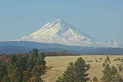
on the north side of Mount Hood
, but that trail was too rugged for vehicles and unsuitable for wagons.
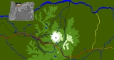
The Barlow Road begins at The Dalles
and heads south to Tygh Valley
(some consider Tygh Valley to be the beginning), then turns west and roughly parallels the White River
on the north and then west, crosses the south shoulder of Mount Hood at Barlow Pass
, follows Camp Creek and the Sandy River
for some way, and finally leads to Oregon City
. The road was rendered largely irrelevant in the early 1900s by the construction of the Mount Hood Highway
. It still exists as a dirt road in some places, while many other parts have been paved over by new modern streets and highways.
On October 1, 1845, Barlow and three men scouted ahead of their company and entered Mount Hood's foothills from the east near Tygh Creek, about 35 miles (56.3 km) from the mouth of the Deschutes River. They came within perhaps 12 miles (19.3 km) of Mount Hood. They thought they had glimpsed the Willamette Valley, and learned from the Indians of a trail leading to Oregon City, but returned to Tygh Creek about five days after their departure. There Joel Palmer
was waiting for him with a 23 wagon party. Palmer had followed Barlow for a better route, and had just returned from exploring the same area. The combined company organized road clearing through dense laurel forest, mostly by burning.
 The clearing party made it to the top of a ridge, now known as Barlow Pass, where they were effectively lost. Barlow, Palmer, and a man named Lock hiked the south face of Mount Hood west of Palmer Glacier
to scout a westward route off the mountain. Palmer, in better physical condition than his companions, climbed high on the glacier (likely Zigzag Glacier
), and took detailed notes on the surrounding ridges and rivers. They returned to the group, arranged for guards for their wagons at a place they named Fort Deposit. Several families in wagons ill-suited for travel through the wilderness remained at Fort Deposit, while the remainder returned to The Dalles. Barlow's group followed the Sandy River west on foot. Palmer noted an intersection with a trail coming from The Dalles by way of Lolo Pass, around the north side of Mount Hood, which had previously been the only overland trail traversed by pioneers. Near the present-day city of Sandy
, they turned southwest to reach Eagle Creek
and Philip Foster's farm near present-day Clackamas
.
That autumn, Barlow considered the route over the mountains and petitioned the Provisional Legislature of Oregon for permission to build a road on December 9, 1845, claiming that his estimated cost of $4000 was lower than that of others familiar with the route. Permission was granted with a vote of 8-2 on December 17, 1845, approved by Speaker pro-tem Henry A. G. Lee
, and signed into law by Governor George Abernethy
.
The road's toll was authorized for two years effective January 1, 1846 and specified toll rates at five dollars (about a week's wages) for each wagon and ten cents for each head of horse, mule, ass, or horned cattle. The grant named the route "Mount Hood Road"—but it was immediately known as the "Barlow Road."
The road was built with the financial backing of Philip Foster and a crew of forty men. Five toll gates were eventually built along the route. Barlow's estimate of $4000 had underestimated the number of trees to be cut down and forgotten the numerous challenging bridges that would have to be built over rivers such as the Sandy, Zigzag
, White, and Salmon
. The White River continues to challenge its bridges to this day.
In its first season of operation, Barlow recorded the passage of 152 wagons, 1300 sheep, 1559 mules, horses, and cattle. Despite ongoing maintenance, the general condition of the road was considered to vary from "rough to barely passable."
 The direction of travel was effectively one-way until 1861, when a better road was blasted through Laurel Hill. Despite the expense and difficulties of passage, the road was very popular, with more than a thousand immigrants and 145 wagons recorded in the first year of operation. Approximately three-quarters of the pioneers entering the Willamette Valley traveled the Barlow Road, with most of the remainder choosing the Columbia River route.
Barlow's concession expired in 1848, and he and Foster terminated their largely unprofitable partnership on November 29, 1848. Others continued to operate the toll road, but weather and mountain conditions made this a financial struggle. By 1863, the toll had decreased to $2.50 per wagon and team.
In 1849, a military wagon train destined for Oregon forts passed over the road.
It carried 250 tons of munitions in more than 400 wagons pulled by 1700 mules.
From the beginning of Barlow Road to the camp the soldiers made at what has been known since as Government Camp
, they abandoned 45 wagons after dozens of mules died of starvation.
purchased that company in 1912, and made improvements to the road. Wemme's attorney, George W. Joseph
, became the owner upon Wemme's death in 1914, in a probate dispute so contentious that it shaped the 1930 race for Governor of Oregon
. Joseph and his wife donated the road to the people of Oregon in 1919.
The 1923 Oregon Legislative Assembly
designated the path from Idaho to the Pacific Ocean as the "Old Oregon Trail" route and approved signage with a prairie schooner and oxen for modern travelers to navigate.
In 1978, the entire Oregon Trail, including the Barlow Road, was named a National Historic Trail
by the U.S. Congress
.
In 1992, the Barlow Road was placed on the National Register of Historic Places
as a Historic District
.
In 2005, part of it was incorporated into the Mount Hood Scenic Byway.
The Oregon Trail, Barlow Road Segment is a small segment of an alternate route, near Wemme, that was separately listed on the National Register in 1974. Also Rock Corral on the Barlow Road, a campsite on the Barlow Road near Brightwood, was also separately NRHP-listed in 1974.
 On the western side of the Cascades, U.S. Route 26
follows more or less the same route from Sandy to Government Camp; south of Government Camp, US 26 follows a valley just west of the Barlow Road's route along Barlow Creek. The route is concurrent with a few miles of the southern end of Oregon Route 35, and much of the Mount Hood Highway.
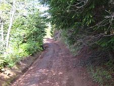
The Barlow Road is intact as a dirt road in a roughly north–south stretch along Barlow Creek; other portions are pristine ruts up to six feet deep. The easternmost part of the original Barlow Road in Wasco County
traverses an unpopulated area within Mount Hood National Forest and follows small Forest Service
roads and "Jeep trails", then Rock Creek Dam Road, and finally Wamic Market Road, north of the White River, from the Cascades to Tygh Valley. The areas east of Mount Hood National Forest have always been sparsely populated. Good rut viewing is possible at Pioneer Woman's Grave near Bennett Pass and in several other places. Much of the Clackamas County side is buried under US 26. Overall, about twenty percent of the road is still visible today.
A roadside marker and trail at Laurel Hill (just west of Government Camp) provides history and access to the portion where a sixty percent grade was present in the early Barlow Road. Wagons were lowered down the hill winched by ropes wrapped around trees.
U.S. state
A U.S. state is any one of the 50 federated states of the United States of America that share sovereignty with the federal government. Because of this shared sovereignty, an American is a citizen both of the federal entity and of his or her state of domicile. Four states use the official title of...
of Oregon
Oregon
Oregon is a state in the Pacific Northwest region of the United States. It is located on the Pacific coast, with Washington to the north, California to the south, Nevada on the southeast and Idaho to the east. The Columbia and Snake rivers delineate much of Oregon's northern and eastern...
. It was built in 1846 by Sam Barlow
Sam Barlow
Samuel Kimbrough Barlow was a pioneer in the area that became the U.S. state of Oregon, and was key in establishing the Barlow Road, the most widely chosen final segment to the Oregon Trail.-Biography:...
and Philip Foster
Philip Foster
Philip Foster was one of the first settlers in Oregon, United States. The farmstead he established in Eagle Creek in 1847 became the first outpost of civilization after 2,000 miles of travel for pioneers heading west along the Oregon Trail. Approximately 10,000 emigrants are believed to have...
, with authorization of the Provisional Legislature of Oregon
Provisional Legislature of Oregon
The Provisional Legislature of Oregon was the single-chamber legislative body of the Provisional Government of Oregon. It served the Oregon Country of the Pacific Northwest of North America from 1843 until early 1849 at a time when no country had sovereignty over the region...
, and served as the last overland segment of the Oregon Trail
Oregon Trail
The Oregon Trail is a historic east-west wagon route that connected the Missouri River to valleys in Oregon and locations in between.After 1840 steam-powered riverboats and steamboats traversing up and down the Ohio, Mississippi and Missouri rivers sped settlement and development in the flat...
. Its construction allowed covered wagon
Covered wagon
The covered wagon, also known as a Prairie schooner, is an icon of the American Old West.Although covered wagons were commonly used for shorter moves within the United States, in the mid-nineteenth century thousands of Americans took them across the Great Plains to Oregon and California...
s to cross the Cascade Range
Cascade Range
The Cascade Range is a major mountain range of western North America, extending from southern British Columbia through Washington and Oregon to Northern California. It includes both non-volcanic mountains, such as the North Cascades, and the notable volcanoes known as the High Cascades...
and reach the Willamette Valley
Willamette Valley
The Willamette Valley is the most populated region in the state of Oregon of the United States. Located in the state's northwest, the region is surrounded by tall mountain ranges to the east, west and south and the valley's floor is broad, flat and fertile because of Ice Age conditions...
, which had previously been nearly impossible. Even so, it was by far the most harrowing 100 miles (160.9 km) of the nearly 2000 miles (3,218.7 km) Oregon Trail.
Before the opening of the Barlow Road, pioneers traveling by land from the east followed the Oregon Trail to Wascopam Mission (now The Dalles) and floated down the Columbia River
Columbia River
The Columbia River is the largest river in the Pacific Northwest region of North America. The river rises in the Rocky Mountains of British Columbia, Canada, flows northwest and then south into the U.S. state of Washington, then turns west to form most of the border between Washington and the state...
to Fort Vancouver
Fort Vancouver
Fort Vancouver was a 19th century fur trading outpost along the Columbia River that served as the headquarters of the Hudson's Bay Company in the company's Columbia District...
, then a perilous and expensive journey. It was also possible to drive livestock over Lolo Pass
Lolo Pass (Oregon)
Lolo Pass is a mountain pass northwest of Mount Hood and northeast of Zigzag, Oregon, on the Clackamas–Hood River county line. It divides the Sandy River watershed on the southwest from the Hood River watershed on the northeast....
on the north side of Mount Hood
Mount Hood
Mount Hood, called Wy'east by the Multnomah tribe, is a stratovolcano in the Cascade Volcanic Arc of northern Oregon. It was formed by a subduction zone and rests in the Pacific Northwest region of the United States...
, but that trail was too rugged for vehicles and unsuitable for wagons.
The Barlow Road begins at The Dalles
The Dalles, Oregon
The Dalles is the largest city and county seat of Wasco County, Oregon, United States. The name of the city comes from the French word dalle The Dalles is the largest city and county seat of Wasco County, Oregon, United States. The name of the city comes from the French word dalle The Dalles is...
and heads south to Tygh Valley
Tygh Valley, Oregon
* Annual Average High Temperatures: 86 °F 41 °F * Annual Average Low Temperatures 50 °F 26 °F * Highest Recorded Temperature: 110 °F * Lowest Recorded Temperature: -28 °F...
(some consider Tygh Valley to be the beginning), then turns west and roughly parallels the White River
White River (Oregon)
The White River is a tributary of the Deschutes River, approximately 50 mi long, in north central Oregon in the United States. It drains a scenic mountainous area of the Columbia Plateau on the east side of the Cascade Range southeast of Mount Hood. In the 1840s, a section of the Oregon...
on the north and then west, crosses the south shoulder of Mount Hood at Barlow Pass
Barlow Pass (Oregon)
Barlow Pass is a mountain pass in the Cascades in Oregon, on the Oregon Trail, and a major milestone of the Barlow Road. It is the crest of the Cascade Mountains: the dividing line between watersheds of the Deschutes River and those that flow into the Sandy River.It is located on the southern...
, follows Camp Creek and the Sandy River
Sandy River (Oregon)
The Sandy River is a tributary of the Columbia River in northwestern Oregon in the United States. Measured by a United States Geological Survey gauge downstream of the Sandy's confluence with the Bull Run River, from the mouth, the river's average discharge is . The maximum daily recorded flow...
for some way, and finally leads to Oregon City
Oregon City, Oregon
Oregon City was the first city in the United States west of the Rocky Mountains to be incorporated. It is the county seat of Clackamas County, Oregon...
. The road was rendered largely irrelevant in the early 1900s by the construction of the Mount Hood Highway
Mount Hood Highway
The Mount Hood Highway No. 26 is the Oregon Department of Transportation's designation for a 93.84-mile highway from Portland east around the south side of Mount Hood and north via Bennett Pass to Hood River. It is marked as U.S...
. It still exists as a dirt road in some places, while many other parts have been paved over by new modern streets and highways.
Planning and construction
When Sam Barlow arrived at The Dalles late September 1845, as many as sixty families were waiting for river transport. The expected wait was more than ten days, and the transportation "exorbitantly" priced. Local inquiries turned up little information about traveling over the mountains except that water, timber, and grazing were plentiful. Barlow and H. M. Knighton set out to determine the feasibility of a route, seeking a more expedient and less expensive way to the Willamette Valley. Knighton decided it was impractical after 20 or 25 miles (30–40 km) and returned. Barlow forged on with a train of seven wagons, intending to return for river transport if the mountain passage proved impractical.On October 1, 1845, Barlow and three men scouted ahead of their company and entered Mount Hood's foothills from the east near Tygh Creek, about 35 miles (56.3 km) from the mouth of the Deschutes River. They came within perhaps 12 miles (19.3 km) of Mount Hood. They thought they had glimpsed the Willamette Valley, and learned from the Indians of a trail leading to Oregon City, but returned to Tygh Creek about five days after their departure. There Joel Palmer
Joel Palmer
General Joel Palmer was an American pioneer of the Oregon Territory in the Pacific Northwest region of North America. He was born in Canada, and spent his early years in New York and Pennsylvania before serving as a member of the Indiana House of Representatives.Palmer traveled to the Oregon...
was waiting for him with a 23 wagon party. Palmer had followed Barlow for a better route, and had just returned from exploring the same area. The combined company organized road clearing through dense laurel forest, mostly by burning.
Palmer Glacier
The Palmer Glacier is a glacier located on the upper slopes of Mount Hood in the U.S. state of Oregon. It is on the south side of the mountain ranging in elevation from about 6,200 to 9,300 ft , and was named for Joel Palmer, an Oregon pioneer...
to scout a westward route off the mountain. Palmer, in better physical condition than his companions, climbed high on the glacier (likely Zigzag Glacier
Zigzag Glacier
The Zigzag Glacier is an alpine glacier located on the upper southwest slopes of Mount Hood in the U.S. state of Oregon.It ranges in elevation from 7,200 to 10,200 ft with fingers in canyons extending to about 6,400 ft , and lies almost entirely within Mount Hood Wilderness. The upper...
), and took detailed notes on the surrounding ridges and rivers. They returned to the group, arranged for guards for their wagons at a place they named Fort Deposit. Several families in wagons ill-suited for travel through the wilderness remained at Fort Deposit, while the remainder returned to The Dalles. Barlow's group followed the Sandy River west on foot. Palmer noted an intersection with a trail coming from The Dalles by way of Lolo Pass, around the north side of Mount Hood, which had previously been the only overland trail traversed by pioneers. Near the present-day city of Sandy
Sandy, Oregon
Sandy is a city located in Clackamas County, Oregon, United States, and named after the nearby Sandy River. As of the 2000 census, the city had a total population of 5,385, however the 2006 estimate shows 7,070 people....
, they turned southwest to reach Eagle Creek
Eagle Creek, Oregon
Eagle Creek is an unincorporated community in Clackamas County, Oregon, United States. It is located seven miles southwest of Sandy, seven miles north of Estacada, and five miles southeast of Carver, at the junction of Oregon Routes 224 and 211, on the Clackamas River.-Background and history:The...
and Philip Foster's farm near present-day Clackamas
Clackamas, Oregon
Clackamas was a census-designated place in Clackamas County, Oregon, United States. The population was 5,177 at the 2000 census. It is a suburb of Portland, Oregon.It is the location of Camp Withycombe, a military base...
.
That autumn, Barlow considered the route over the mountains and petitioned the Provisional Legislature of Oregon for permission to build a road on December 9, 1845, claiming that his estimated cost of $4000 was lower than that of others familiar with the route. Permission was granted with a vote of 8-2 on December 17, 1845, approved by Speaker pro-tem Henry A. G. Lee
Henry A. G. Lee
Henry A. G. Lee was a soldier and politician in Oregon Country in the 1840s. A member of Virginia’s Lee family, he was part of the Fremont Expedition and commanded troops during the Cayuse War in what became the Oregon Territory...
, and signed into law by Governor George Abernethy
George Abernethy
George Abernethy was an American pioneer, notable entrepreneur, and first governor of Oregon under the provisional government in what would become the state of Oregon in the United States...
.
The road's toll was authorized for two years effective January 1, 1846 and specified toll rates at five dollars (about a week's wages) for each wagon and ten cents for each head of horse, mule, ass, or horned cattle. The grant named the route "Mount Hood Road"—but it was immediately known as the "Barlow Road."
The road was built with the financial backing of Philip Foster and a crew of forty men. Five toll gates were eventually built along the route. Barlow's estimate of $4000 had underestimated the number of trees to be cut down and forgotten the numerous challenging bridges that would have to be built over rivers such as the Sandy, Zigzag
Zigzag River
The Zigzag River is a tributary, about long, of the Sandy River in the U.S. state of Oregon. The Zigzag and one of its major tributaries, the Little Zigzag River, drain the Zigzag Glacier on Mount Hood, a high volcanic peak in the Cascade Range. Their waters flow westward to meet the Sandy River...
, White, and Salmon
Salmon River (Clackamas County, Oregon)
The Salmon River is a 33.9 mile river in Oregon's Cascade Range and drains a portion of southwestern Mount Hood.The entire length of the river is protected National Wild and Scenic River, the only such river in the contiguous 48 states....
. The White River continues to challenge its bridges to this day.
In its first season of operation, Barlow recorded the passage of 152 wagons, 1300 sheep, 1559 mules, horses, and cattle. Despite ongoing maintenance, the general condition of the road was considered to vary from "rough to barely passable."
Early use
Barlow's concession expired in 1848, and he and Foster terminated their largely unprofitable partnership on November 29, 1848. Others continued to operate the toll road, but weather and mountain conditions made this a financial struggle. By 1863, the toll had decreased to $2.50 per wagon and team.
In 1849, a military wagon train destined for Oregon forts passed over the road.
It carried 250 tons of munitions in more than 400 wagons pulled by 1700 mules.
From the beginning of Barlow Road to the camp the soldiers made at what has been known since as Government Camp
Government Camp, Oregon
Government Camp is an unincorporated community located in Clackamas County, Oregon, United States, south of Mount Hood and north of Tom, Dick and Harry Mountain. It is a gateway to several ski resorts, the most popular being Timberline Lodge and Mount Hood Skibowl. Also, Government Camp has its...
, they abandoned 45 wagons after dozens of mules died of starvation.
Later use and historic designations
Various owners operated the road until 1882. Ownership then passed to the Mount Hood & Barlow Road Company. E. Henry WemmeE. Henry Wemme
E. Henry Wemme was a wealthy businessman in Portland, in the U.S. state of Oregon. He was an active business investor during the pioneering era of automobiles and aviation....
purchased that company in 1912, and made improvements to the road. Wemme's attorney, George W. Joseph
George W. Joseph
George W. P. Joseph was an attorney and Republican politician in the U.S. state of Oregon. A native of California, his family relocated to Oregon when he was young. There he would practice law and serve in the Oregon State Senate....
, became the owner upon Wemme's death in 1914, in a probate dispute so contentious that it shaped the 1930 race for Governor of Oregon
Governor of Oregon
The Governor of Oregon is the top executive of the government of the U.S. state of Oregon. The title of governor was also applied to the office of Oregon's chief executive during the provisional and U.S. territorial governments....
. Joseph and his wife donated the road to the people of Oregon in 1919.
The 1923 Oregon Legislative Assembly
Oregon Legislative Assembly
The Oregon Legislative Assembly is the state legislature for the U.S. state of Oregon. The Legislative Assembly is bicameral, consisting of an upper and lower house: the Senate, whose 30 members are elected to serve four-year terms; and the House of Representatives, with 60 members elected to...
designated the path from Idaho to the Pacific Ocean as the "Old Oregon Trail" route and approved signage with a prairie schooner and oxen for modern travelers to navigate.
In 1978, the entire Oregon Trail, including the Barlow Road, was named a National Historic Trail
National Historic Trail
National Historic Trail is a designation for a protected area in the United States containing historic trails and surrounding areas. They are part of the National Trails System....
by the U.S. Congress
United States House of Representatives
The United States House of Representatives is one of the two Houses of the United States Congress, the bicameral legislature which also includes the Senate.The composition and powers of the House are established in Article One of the Constitution...
.
In 1992, the Barlow Road was placed on the National Register of Historic Places
National Register of Historic Places
The National Register of Historic Places is the United States government's official list of districts, sites, buildings, structures, and objects deemed worthy of preservation...
as a Historic District
Historic district
A historic district or heritage district is a section of a city which contains older buildings considered valuable for historical or architectural reasons. In some countries, historic districts receive legal protection from development....
.
In 2005, part of it was incorporated into the Mount Hood Scenic Byway.
The Oregon Trail, Barlow Road Segment is a small segment of an alternate route, near Wemme, that was separately listed on the National Register in 1974. Also Rock Corral on the Barlow Road, a campsite on the Barlow Road near Brightwood, was also separately NRHP-listed in 1974.
Today
U.S. Route 26 in Oregon
In the U.S. state of Oregon, U.S. Route 26 is a major cross-state state highway, connecting U.S. Route 101 on the Oregon Coast near Seaside with the Idaho state line east of Nyssa. Local highway names include the Sunset Highway No. 47, Mount Hood Highway No. 26, and John Day Highway No...
follows more or less the same route from Sandy to Government Camp; south of Government Camp, US 26 follows a valley just west of the Barlow Road's route along Barlow Creek. The route is concurrent with a few miles of the southern end of Oregon Route 35, and much of the Mount Hood Highway.
The Barlow Road is intact as a dirt road in a roughly north–south stretch along Barlow Creek; other portions are pristine ruts up to six feet deep. The easternmost part of the original Barlow Road in Wasco County
Wasco County, Oregon
Wasco County is a county located in the U.S. state of Oregon. The county is named for a local tribe of Native Americans, the Wasco, a Chinook tribe who lived on the south side of the Columbia River. In 2010, its population was 25,213...
traverses an unpopulated area within Mount Hood National Forest and follows small Forest Service
United States Forest Service
The United States Forest Service is an agency of the United States Department of Agriculture that administers the nation's 155 national forests and 20 national grasslands, which encompass...
roads and "Jeep trails", then Rock Creek Dam Road, and finally Wamic Market Road, north of the White River, from the Cascades to Tygh Valley. The areas east of Mount Hood National Forest have always been sparsely populated. Good rut viewing is possible at Pioneer Woman's Grave near Bennett Pass and in several other places. Much of the Clackamas County side is buried under US 26. Overall, about twenty percent of the road is still visible today.
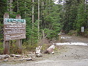
A roadside marker and trail at Laurel Hill (just west of Government Camp) provides history and access to the portion where a sixty percent grade was present in the early Barlow Road. Wagons were lowered down the hill winched by ropes wrapped around trees.
See also
- Applegate TrailApplegate TrailThe Applegate Trail was a wilderness trail through today's U.S. states of Idaho, Nevada, California, and Oregon, and was originally intended as a less dangerous route to the Oregon Territory.-Background:...
built by Jesse ApplegateJesse ApplegateJesse Applegate was an American pioneer who led a large group of settlers along the Oregon Trail to the Oregon Country. He took part in the early government of Oregon, and helped establish the Applegate Trail as an alternative route to the Oregon Trail.-Early life:Jesse Applegate was born in Henry... - Lolo PassLolo Pass (Oregon)Lolo Pass is a mountain pass northwest of Mount Hood and northeast of Zigzag, Oregon, on the Clackamas–Hood River county line. It divides the Sandy River watershed on the southwest from the Hood River watershed on the northeast....
- Meek Cutoff
- Mount Hood Corridor
- Santiam Wagon RoadSantiam Wagon RoadThe Santiam Wagon Road was a freight route in the U.S. state of Oregon between the Willamette Valley and Central Oregon regions from 1865 to the 1930s. It is considered one of the most important historical routes in the state...
- William Barlow HouseWilliam Barlow HouseWilliam Barlow House is a historic building in Clackamas County, Oregon, United States.Barlow House was home to William Barlow, namesake of the city of Barlow and son of Samuel K. Barlow, who built the Barlow Road. The house is located south of Barlow, between Canby and Aurora on 99E...
External links
- Barlow, Mary S. (1902): History of the Barlow Road, Oregon Historical Quarterly.
- Bailey, Walter (1912): The Barlow Road, Oregon Historical Quarterly.
- Barlow, William (1912): Reminiscences of seventy years, Oregon Historical Quarterly.
- Map of Barlow Road from
- Oregon Trail map from USGenNet for Clackamas County genealogy research