
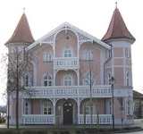
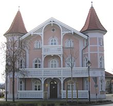
Aßling
Encyclopedia
- Aßling is also the German name for Jesenice, Slovenia.
Upper Bavaria
Upper Bavaria is one of the seven administrative regions of Bavaria, Germany.- Geography :Upper Bavaria is located in the southern portion of Bavaria, and is centered around the city of Munich. It is subdivided into four regions : Ingolstadt, Munich, Bayerisches Oberland , and Südostoberbayern...
n district of Ebersberg
Ebersberg (district)
Ebersberg is a district in Bavaria, Germany. It is bounded by the districts of Erding, Mühldorf, Rosenheim and Munich.-History:...
. It is, along with the communities of Emmering and Frauenneuharting
Frauenneuharting
Frauenneuharting is a community in the district of Ebersberg in Upper Bavaria and a member of the administrative community of Aßling.-Constituent communities:*Aichat*Alme*Anger*Baumberg*Biebing*Buch*Eichbichl*Eschenloh*Gersdorf*Graben*Großaschau...
a member of the administrative community (Verwaltungsgemeinschaft) of the same name.
Geography
Aßling lies within the Munich communter area, about 40 km from that city. It has its own railway station on the Munich–Salzburg lineMunich–Salzburg railway
The Munich–Salzburg railway is a 153 kilometre-long double-track main line of the German railways. It connects Munich with the line to Vienna at Salzburg. At Rosenheim station, it connects with the line to Kufstein. which continues to Innsbruck and the Brenner line to Italy...
. Grafing bei München lies only 7 km away, Ebersberg
Ebersberg
Ebersberg is the district seat of the similarly named Landkreis in the Regierungsbezirk of Oberbayern in southern Germany. The Ebersberger Forst is one of Germany’s largest continuous area of woodlands....
is 11 km away, Wasserburg am Inn
Wasserburg am Inn
Wasserburg am Inn is a town in the district Rosenheim in Upper Bavaria, Germany. The historic centre is a peninsula, formed by the meandering Inn River...
23 km and Rosenheim
Rosenheim
Rosenheim is a town in Bavaria at the confluence of the rivers Inn and Mangfall. It is seat of administration of the district of Rosenheim, but is not a part of it.-Geography:...
20 km. However, there is no connection to any main highway in the Aßling area.
Aßling also holds two rural areas (Gemarkungen), Aßling and Loitersdorf.
History
Aßling had its first documentary mention, as Azzalinga, on 18 September 778. The place belonged to the Rentamt of Munich and the Court of Swabia of the Electorate of Bavaria. Aßling was the seat of a Hauptmannschaft (an historical form of administration). The community in its current form came into being in 1818 with the constituent communities of Adelpolt, Ametsbichl, Aßling, Ast, Bichl, Haar, Holzen, Längholz, Langkofen, Martermühle, Niclasreuth, Obstädt, Osterwald, Pörsdorf, Pürzelberg, Rammel, Sixtenreit, Sonnenreit, Steinkirchen, Stelzenreit, Tegernau, Thaldorf and Wollwies.In 1978, as part of administrative reform, the formerly separate community of Loitersdorf was amalgamated with Aßling along with its constituent communities of Dorfen, Hochreit, Lorenzenberg, Loitersdorf, Obereichhofen, Untereichhofen, Pfadendorf, Hainza, Pausmühle, Setzermühle and Siglmühle.
Population development
The community’s land area was home to 3112 inhabitants in 1970, 3319 in 1987 and 4031 in 2000.Politics
The community’s mayor (Bürgermeister) is Werner Lampl (CSU).The community’s tax revenue in 1999, converted into euros, was €1,964,000, of which €324,000 was from business taxes.
Coat of arms
Aßling’s arms might heraldically be described thus: In azure a six-spoked wheel argent ringed with three flowers argent with middles Or. The official German blazon (In Blau ein sechsspeichiges silbernes Rad, beiderseits und unten begleitet von je einer silbernen Blume mit goldenem Butzen) says that the flowers are on each side and underneath, but the usual interpretation is to have the flowers surrounding the wheel in the form of a triangle pointing down.Economy and infrastructure
In 1998, the fields of agriculture and forestry employed 11 workers on the social insurance contribution rolls. In industry it was 182 and in trade and transport 122. In other fields of work there were 159. Also, 1240 people on the aforesaid rolls worked from their homes. Nobody worked in processing businesses. There were nine businesses in contracting. Furthermore, in 1999, there were 97 agricultural businesses with a total productive land area of 1 720 ha, of which 480 ha was cropland and the other 1 240 ha was meadowland.Education
In 1999, the following institutions could be found in Aßling:- Kindergarten: 167 Kindergarten places with 140 children
- Elementary school: 1 with 27 teachers and 485 pupils