
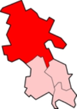
Aylesbury Vale
Encyclopedia
The Aylesbury Vale is a large area of flat land mostly in Buckinghamshire
, England
. Its boundary is marked by Milton Keynes
to the north, Leighton Buzzard
and the Chiltern Hills
to the east and south, Thame
to the south and Bicester
and Brackley
to the west.
The vale is named after Aylesbury
, the county town of Buckinghamshire. Two other towns lie within the vale and they are Winslow
and Buckingham
.
The bed of the vale is largely made up of clay
that was formed at the end of the ice age
. Also at this time the vast underground reserves of water that make the water table
higher than average in the Vale of Aylesbury were created.
In the 2001 UK
census
the population of Aylesbury Vale was 165,748, representing an increase since 1991 of 18,600 people. About half of those live in the county town
Aylesbury.
of northern Buckinghamshire, administered by Aylesbury Vale District Council. This district was formed on 1 April 1974 by the merger of the boroughs of Aylesbury
and Buckingham
, Aylesbury Rural District
, Buckingham Rural District
, Wing Rural District
and part of Winslow Rural District
. The district offices are based in Aylesbury. The district council's logo includes the historical figure of John Hampden
There are 111 civil parishes: 84 with a parish council, including three town councils (Aylesbury
, Buckingham
and Winslow
), and a further 27 operating with a Parish meeting, see list of civil parishes in Aylesbury Vale.
Elections to the district council
take place every 4 years, with 59 councillor
s being elected from 36 wards
. Since winning a majority at the 2003 election the Conservative party
has held control of the council. After the latest election in 2011
the council is composed of the following councillors:-
does enter the district for five miles between junctions 8A and 9. Major roads include the A41
, A413
and A418
- which all meet at Aylesbury. The A421
passes through the north of the district providing connections to Milton Keynes
, Bedford
and the M1 to the east, and the M40 and Oxford
and Birmingham
to the west.
For its size, the district contains relatively few railway stations; most of its stations are in the very south of the district along the London to Aylesbury Line
- the major station being Aylesbury
. At Aylesbury there are connecting services to Princes Risborough
station. In addition, the West Coast
and Chiltern
main lines both pass through the district, each having a station within the district.
Buckinghamshire
Buckinghamshire is a ceremonial and non-metropolitan home county in South East England. The county town is Aylesbury, the largest town in the ceremonial county is Milton Keynes and largest town in the non-metropolitan county is High Wycombe....
, England
England
England is a country that is part of the United Kingdom. It shares land borders with Scotland to the north and Wales to the west; the Irish Sea is to the north west, the Celtic Sea to the south west, with the North Sea to the east and the English Channel to the south separating it from continental...
. Its boundary is marked by Milton Keynes
Milton Keynes
Milton Keynes , sometimes abbreviated MK, is a large town in Buckinghamshire, in the south east of England, about north-west of London. It is the administrative centre of the Borough of Milton Keynes...
to the north, Leighton Buzzard
Leighton Buzzard
-Lower schools:*Beaudesert Lower School - Apennine Way*Clipstone Brook Lower School - Brooklands Drive*Greenleas Lower School - Derwent Road*Dovery Down Lower School - Heath Road*Heathwood Lower School - Heath Road*Leedon Lower School - Highfield Road...
and the Chiltern Hills
Chiltern Hills
The Chiltern Hills form a chalk escarpment in South East England. They are known locally as "the Chilterns". A large portion of the hills was designated officially as an Area of Outstanding Natural Beauty in 1965.-Location:...
to the east and south, Thame
Thame
Thame is a town and civil parish in Oxfordshire, about southwest of the Buckinghamshire town of Aylesbury. It derives its toponym from the River Thame which flows past the north side of the town....
to the south and Bicester
Bicester
Bicester is a town and civil parish in the Cherwell district of northeastern Oxfordshire in England.This historic market centre is one of the fastest growing towns in Oxfordshire Development has been favoured by its proximity to junction 9 of the M40 motorway linking it to London, Birmingham and...
and Brackley
Brackley
Brackley is a town in south Northamptonshire, England. It is about from Oxford and miles form Northampton. Historically a market town based on the wool and lace trade, it was built on the intersecting trade routes between London, Birmingham and the English Midlands and between Cambridge and Oxford...
to the west.
The vale is named after Aylesbury
Aylesbury
Aylesbury is the county town of Buckinghamshire in South East England. However the town also falls into a geographical region known as the South Midlands an area that ecompasses the north of the South East, and the southern extremities of the East Midlands...
, the county town of Buckinghamshire. Two other towns lie within the vale and they are Winslow
Winslow, Buckinghamshire
Winslow is a small market town and also a civil parish designated as a town council within Aylesbury Vale district in north Buckinghamshire. It has a population of about 4500....
and Buckingham
Buckingham
Buckingham is a town situated in north Buckinghamshire, England, close to the borders of Northamptonshire and Oxfordshire. The town has a population of 11,572 ,...
.
The bed of the vale is largely made up of clay
Clay
Clay is a general term including many combinations of one or more clay minerals with traces of metal oxides and organic matter. Geologic clay deposits are mostly composed of phyllosilicate minerals containing variable amounts of water trapped in the mineral structure.- Formation :Clay minerals...
that was formed at the end of the ice age
Ice age
An ice age or, more precisely, glacial age, is a generic geological period of long-term reduction in the temperature of the Earth's surface and atmosphere, resulting in the presence or expansion of continental ice sheets, polar ice sheets and alpine glaciers...
. Also at this time the vast underground reserves of water that make the water table
Water table
The water table is the level at which the submarine pressure is far from atmospheric pressure. It may be conveniently visualized as the 'surface' of the subsurface materials that are saturated with groundwater in a given vicinity. However, saturated conditions may extend above the water table as...
higher than average in the Vale of Aylesbury were created.
In the 2001 UK
United Kingdom
The United Kingdom of Great Britain and Northern IrelandIn the United Kingdom and Dependencies, other languages have been officially recognised as legitimate autochthonous languages under the European Charter for Regional or Minority Languages...
census
Census
A census is the procedure of systematically acquiring and recording information about the members of a given population. It is a regularly occurring and official count of a particular population. The term is used mostly in connection with national population and housing censuses; other common...
the population of Aylesbury Vale was 165,748, representing an increase since 1991 of 18,600 people. About half of those live in the county town
County town
A county town is a county's administrative centre in the United Kingdom or Ireland. County towns are usually the location of administrative or judicial functions, or established over time as the de facto main town of a county. The concept of a county town eventually became detached from its...
Aylesbury.
Governance
Today the area is a local government districtNon-metropolitan district
Non-metropolitan districts, or colloquially shire districts, are a type of local government district in England. As created, they are sub-divisions of non-metropolitan counties in a so-called "two-tier" arrangement...
of northern Buckinghamshire, administered by Aylesbury Vale District Council. This district was formed on 1 April 1974 by the merger of the boroughs of Aylesbury
Aylesbury
Aylesbury is the county town of Buckinghamshire in South East England. However the town also falls into a geographical region known as the South Midlands an area that ecompasses the north of the South East, and the southern extremities of the East Midlands...
and Buckingham
Buckingham
Buckingham is a town situated in north Buckinghamshire, England, close to the borders of Northamptonshire and Oxfordshire. The town has a population of 11,572 ,...
, Aylesbury Rural District
Aylesbury Rural District
Aylesbury was a rural district in the administrative county of Buckinghamshire, England from 1894 to 1974. It was named after but did not include Aylesbury, which was a separate municipal borough...
, Buckingham Rural District
Buckingham Rural District
Buckingham was a rural district in the administrative county of Buckinghamshire, England from 1894 to 1974. The rural district took over the responsibilities of the disbanded Buckingham Rural Sanitary District and also incorporated parishes from Brackley RSD which was mainly based in...
, Wing Rural District
Wing Rural District
Wing Rural District was a rural district in the administrative county of Buckinghamshire, England from 1894 to 1974.It was created under the Local Government Act 1894 from the parts of both the Leighton Buzzard and the Berkhampstead Rural Sanitary Districts that were in Buckinghamshire...
and part of Winslow Rural District
Winslow Rural District
Winslow was a rural district in the administrative county of Buckinghamshire, England from 1894 to 1974. The rural district took over the responsibilities of the disbanded Winslow Rural Sanitary District...
. The district offices are based in Aylesbury. The district council's logo includes the historical figure of John Hampden
John Hampden
John Hampden was an English politician, the eldest son of William Hampden, of Hampden House, Great Hampden in Buckinghamshire, John Hampden (ca. 15951643) was an English politician, the eldest son of William Hampden, of Hampden House, Great Hampden in Buckinghamshire, John Hampden (ca. 15951643)...
There are 111 civil parishes: 84 with a parish council, including three town councils (Aylesbury
Aylesbury
Aylesbury is the county town of Buckinghamshire in South East England. However the town also falls into a geographical region known as the South Midlands an area that ecompasses the north of the South East, and the southern extremities of the East Midlands...
, Buckingham
Buckingham
Buckingham is a town situated in north Buckinghamshire, England, close to the borders of Northamptonshire and Oxfordshire. The town has a population of 11,572 ,...
and Winslow
Winslow
-Places:United Kingdom*Winslow, BuckinghamshireUnited States*Winslow, Arizona*Winslow, Arkansas*Winslow, California*Winslow, Illinois*Winslow, Indiana*Winslow, Maine*Winslow, Nebraska*Winslow, Washington*Winslow West, Arizona...
), and a further 27 operating with a Parish meeting, see list of civil parishes in Aylesbury Vale.
Elections to the district council
Aylesbury Vale local elections
Aylesbury Vale District Council in Buckinghamshire, England is elected every four years. Since the last boundary changes in 2003, 59 councillors have been elected from 36 wards.-Political control:...
take place every 4 years, with 59 councillor
Councillor
A councillor or councilor is a member of a local government council, such as a city council.Often in the United States, the title is councilman or councilwoman.-United Kingdom:...
s being elected from 36 wards
Wards of the United Kingdom
A ward in the United Kingdom is an electoral district at sub-national level represented by one or more councillors. It is the primary unit of British administrative and electoral geography .-England:...
. Since winning a majority at the 2003 election the Conservative party
Conservative Party (UK)
The Conservative Party, formally the Conservative and Unionist Party, is a centre-right political party in the United Kingdom that adheres to the philosophies of conservatism and British unionism. It is the largest political party in the UK, and is currently the largest single party in the House...
has held control of the council. After the latest election in 2011
Aylesbury Vale Council election, 2011
The 2011 Aylesbury Vale Council election took place on 5 May 2011 to elect members of Aylesbury Vale District Council in Buckinghamshire, England. The whole council was up for election and the Conservative party stayed in overall control of the council....
the council is composed of the following councillors:-
| Year | Con Conservative Party (UK) The Conservative Party, formally the Conservative and Unionist Party, is a centre-right political party in the United Kingdom that adheres to the philosophies of conservatism and British unionism. It is the largest political party in the UK, and is currently the largest single party in the House... | LD | UKIP United Kingdom Independence Party The United Kingdom Independence Party is a eurosceptic and right-wing populist political party in the United Kingdom. Whilst its primary goal is the UK's withdrawal from the European Union, the party has expanded beyond its single-issue image to develop a more comprehensive party platform.UKIP... | Lab Labour Party (UK) The Labour Party is a centre-left democratic socialist party in the United Kingdom. It surpassed the Liberal Party in general elections during the early 1920s, forming minority governments under Ramsay MacDonald in 1924 and 1929-1931. The party was in a wartime coalition from 1940 to 1945, after... | Ind Independent (politician) In politics, an independent or non-party politician is an individual not affiliated to any political party. Independents may hold a centrist viewpoint between those of major political parties, a viewpoint more extreme than any major party, or they may have a viewpoint based on issues that they do... |
|---|---|---|---|---|---|
| 2011 | 37 | 17 | 2 | 2 | 1 |
Transport
The district contains no motorway junctions, although the M40M40 motorway
The M40 motorway is a motorway in the British transport network that forms a major part of the connection between London and Birmingham. Part of this road forms a section of the unsigned European route E05...
does enter the district for five miles between junctions 8A and 9. Major roads include the A41
A41 road
The A41 is a formerly-major trunk road in England that links London and Birkenhead, although it has now largely been superseded by motorways. It passes through or near various towns and cities including Watford, Hemel Hempstead, Aylesbury, Solihull, Birmingham, West Bromwich, Wolverhampton,...
, A413
A413 road
The A413 is a major road in England that links Gerrards Cross to Towcester. It passes through various towns and villages including Buckingham, Aylesbury, Wendover, Winslow, Great Missenden and Amersham....
and A418
A418 road
The A418 road is a main trunk road in Buckinghamshire and Oxfordshire, England. It begins at a roundabout with the A4146 just north of Ascott, near Leighton Buzzard. It then runs south as a single carriageway through Wing to Aylesbury. This stretch is proposed for a dual carriageway bypass. After...
- which all meet at Aylesbury. The A421
A421 road
The A421 is an important road for east/west journeys across England. Together with the A428, the A43 and A34, it forms the route from Cambridge through Milton Keynes to Oxford...
passes through the north of the district providing connections to Milton Keynes
Milton Keynes
Milton Keynes , sometimes abbreviated MK, is a large town in Buckinghamshire, in the south east of England, about north-west of London. It is the administrative centre of the Borough of Milton Keynes...
, Bedford
Bedford
Bedford is the county town of Bedfordshire, in the East of England. It is a large town and the administrative centre for the wider Borough of Bedford. According to the former Bedfordshire County Council's estimates, the town had a population of 79,190 in mid 2005, with 19,720 in the adjacent town...
and the M1 to the east, and the M40 and Oxford
Oxford
The city of Oxford is the county town of Oxfordshire, England. The city, made prominent by its medieval university, has a population of just under 165,000, with 153,900 living within the district boundary. It lies about 50 miles north-west of London. The rivers Cherwell and Thames run through...
and Birmingham
Birmingham
Birmingham is a city and metropolitan borough in the West Midlands of England. It is the most populous British city outside the capital London, with a population of 1,036,900 , and lies at the heart of the West Midlands conurbation, the second most populous urban area in the United Kingdom with a...
to the west.
For its size, the district contains relatively few railway stations; most of its stations are in the very south of the district along the London to Aylesbury Line
London to Aylesbury Line
The London to Aylesbury Line is the main railway line between London and Aylesbury, going via the Chiltern Hills; it is operated by Chiltern Railways. The line includes the only route where National Rail trains use track that is utilized by London Underground services...
- the major station being Aylesbury
Aylesbury railway station
Aylesbury railway station is a railway station in Aylesbury, Buckinghamshire, England and is a major stop on the London to Aylesbury Line from Marylebone station via Amersham. It is 37.75 miles from Aylesbury Station to Marylebone Station...
. At Aylesbury there are connecting services to Princes Risborough
Princes Risborough railway station
Princes Risborough station is a railway station on the Chiltern Main Line that serves the town of Princes Risborough in Buckinghamshire, England...
station. In addition, the West Coast
West Coast Main Line
The West Coast Main Line is the busiest mixed-traffic railway route in Britain, being the country's most important rail backbone in terms of population served. Fast, long-distance inter-city passenger services are provided between London, the West Midlands, the North West, North Wales and the...
and Chiltern
Chiltern Main Line
The Chiltern Main Line is an inter-urban, regional and commuter railway, part of the British railway system. It links London and Birmingham on a 112-mile route via the towns of High Wycombe, Banbury, and Leamington Spa...
main lines both pass through the district, each having a station within the district.