
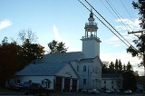
Ashfield, Massachusetts
Encyclopedia
Ashfield is a town
in Franklin County
, Massachusetts
, United States. The population was 1,737 at the 2010 census. It is part of the Springfield, Massachusetts
Metropolitan Statistical Area
.
, and who had inherited the land as payment for his services.
The first permanent settlement was in 1745, by Richard Ellis, an Irish immigrant from the town of Easton
. The town was renamed upon reincorporation, although there is debate over its namesake; it is either for the ash tree
s in the area, or because Governor Bernard had friends in Ashfield
, England. The town had a small peppermint
industry in the nineteenth century, but for the most part the town has had a mostly agrarian economy, with some tourism around Ashfield Pond.
Ashfield is the birthplace of prominent director Cecil B. DeMille
(whose parents were vacationing in the town at the time), Alvan Clark
, nineteenth century astronomer and telescope maker
, and William S. Clark
, member of the Massachusetts Senate
and third president of Massachusetts Agricultural College
(now UMass-Amherst).
, the town has a total area of 40.4 square miles (104.6 km²), of which, 40.3 square miles (104.4 km²) of it is land and 0.1 square mile (0.258998811 km²) of it (0.30%) is water. Ashfield is located in the southwest corner of Franklin County, along the Hampshire County
line. Ashfield is bordered by Buckland
to the north, Conway
to the east, Goshen
to the south, Cummington
to the southwest, Plainfield
to the west, and Hawley
to the northwest. Ashfield is fifteen miles west-southwest of Greenfield
, thirty-five miles north-northwest of Springfield
, and 105 miles west-northwest of Boston.
Ashfield lies in the eastern foothills of The Berkshires
, with several high hills, including Ridge Hill, in the northern portion of town. The town is fed by several rivers and brooks, including the South River, the "western" Swift River (the "eastern" river flows out of the Quabbin Reservoir
in central Massachusetts) and several prominent brooks, most of which feed into either the Deerfield River
or the Connecticut River
. Near the center of town, Ashfield Lake feeds into the South River, and is a recreational site. In the southwest portion of town, a small portion of the Poland Brook Wildlife Management Area crosses into town, as does a portion of the Daughters of the American Revolution
State Forest.
The town is at the junction of the north-south Route 112 and the east-west Route 116
, which are combined for 1.4 miles south of Ashfield Lake. The town is located approximately twelve miles west of Interstate 91
, the nearest interstate to the town. The nearest bus service is in Greenfield, with the nearest small air service being Turners Falls
just east of there. The nearest Amtrak
service is in either Pittsfield, Amherst, or Springfield, and the nearest national air service is at Bradley International Airport
in Windsor Locks
, Connecticut
.
of 2000, there were 1,800 people, 741 households, and 500 families residing in the town. By population, Ashfield ranked thirteenth of the twenty-six towns in Franklin County, and 296th out of the 351 cities and towns in Massachusetts. The population density
was 44.7 people per square mile (17.2/km²), which ranked seventeenth in the county and 314th in the Commonwealth. There were 821 housing units at an average density of 20.4 per square mile (7.9/km²). The racial makeup of the town was 97.33% White, 0.61% African American, 0.11% Native American, 0.33% Asian, 0.06% from other races
, and 1.56% from two or more races. Hispanic or Latino of any race were 0.44% of the population.
There were 741 households out of which 31.8% had children under the age of 18 living with them, 55.6% were married couples
living together, 9.2% had a female householder with no husband present, and 32.4% were non-families. 24.0% of all households were made up of individuals and 8.2% had someone living alone who was 65 years of age or older. The average household size was 2.43 and the average family size was 2.90.
In the town the population was spread out with 23.8% under the age of 18, 4.9% from 18 to 24, 26.5% from 25 to 44, 33.2% from 45 to 64, and 11.6% who were 65 years of age or older. The median age was 42 years. For every 100 females there were 96.3 males. For every 100 females age 18 and over, there were 88.7 males.
The median income for a household in the town was $52,875, and the median income for a family was $56,739. Males had a median income of $38,818 versus $31,146 for females. The per capita income
for the town was $26,483. About 5.2% of families and 7.6% of the population were below the poverty line, including 14.4% of those under age 18 and 5.1% of those age 65 or over.
form of government, and is led by a board of selectmen
and an administrative assistant. All of the town's services are located in the town center, including the town hall, police and fire departments, as well as the Belding Memorial Library and the town's post office. The nearest hospital, Franklin Medical Center, is located in Greenfield, as are most of the nearest state offices.
On the state level, Ashfield is represented in the Massachusetts House of Representatives
as part of the Second Berkshire district, represented by Paul Mark, which covers central Berkshire County, as well as portions of Hampshire and Franklin Counties. In the Massachusetts Senate
, the town is part of the Berkshire, Hampshire and Franklin district, represented by Ben Downing, which includes all of Berkshire County as well as western portions of Franklin and Hampshire Counties. The town is patrolled by the Second Barracks of Troop "B" of the Massachusetts State Police
, headquartered in Shelburne Falls.
On the national level, Ashfield is represented in the United States House of Representatives
as part of Massachusetts's 1st congressional district
, and has been represented by John Olver
of Amherst
since June 1991. Massachusetts is currently represented in the United States Senate
by John Kerry
, and Scott Brown
.
in neighboring Buckland
. There are several private, religious and charter schools located in the Greenfield area, with the most prominent being Deerfield Academy
in Deerfield
, Northfield Mount Hermon School in Gill
, and the Academy at Charlemont
in Charlemont
.
The nearest community college, Greenfield Community College
, is located in Greenfield. The nearest state college is Massachusetts College of Liberal Arts
in North Adams, and the nearest state university is the University of Massachusetts Amherst
. The nearest private colleges, including members of the Five Colleges
and Seven Sisters
, are located southeast in the Northampton area.
New England town
The New England town is the basic unit of local government in each of the six New England states. Without a direct counterpart in most other U.S. states, New England towns are conceptually similar to civil townships in other states, but are incorporated, possessing powers like cities in other...
in Franklin County
Franklin County, Massachusetts
-Demographics:As of the census of 2000, there were 71,535 people, 29,466 households, and 18,416 families residing in the county. The population density was 102 people per square mile . There were 31,939 housing units at an average density of 46 per square mile...
, Massachusetts
Massachusetts
The Commonwealth of Massachusetts is a state in the New England region of the northeastern United States of America. It is bordered by Rhode Island and Connecticut to the south, New York to the west, and Vermont and New Hampshire to the north; at its east lies the Atlantic Ocean. As of the 2010...
, United States. The population was 1,737 at the 2010 census. It is part of the Springfield, Massachusetts
Springfield, Massachusetts
Springfield is the most populous city in Western New England, and the seat of Hampden County, Massachusetts, United States. Springfield sits on the eastern bank of the Connecticut River near its confluence with three rivers; the western Westfield River, the eastern Chicopee River, and the eastern...
Metropolitan Statistical Area
Springfield, Massachusetts metropolitan area
The Springfield Metropolitan Area is a region that is socio-economically and culturally tied to the City of Springfield, Massachusetts. The U.S. Office of Management and Budget defines the Springfield metropolitan statistical area as consisting of three counties in Western Massachusetts. As of...
.
History
Ashfield was first settled in 1743 and was officially incorporated in 1765. The town was originally called "Huntstown" for Captain Ephraim Hunt, who died in King William's WarKing William's War
The first of the French and Indian Wars, King William's War was the name used in the English colonies in America to refer to the North American theater of the Nine Years' War...
, and who had inherited the land as payment for his services.
The first permanent settlement was in 1745, by Richard Ellis, an Irish immigrant from the town of Easton
Easton, Massachusetts
Easton is a town in Bristol County, Massachusetts, United States. The population was 23,112 at the 2010 census.Easton is governed by an elected committee of selectmen and a town administrator.- History :...
. The town was renamed upon reincorporation, although there is debate over its namesake; it is either for the ash tree
Ash tree
Fraxinus is a genus flowering plants in the olive and lilac family, Oleaceae. It contains 45-65 species of usually medium to large trees, mostly deciduous though a few subtropical species are evergreen. The tree's common English name, ash, goes back to the Old English æsc, while the generic name...
s in the area, or because Governor Bernard had friends in Ashfield
Ashfield
Ashfield is a local government district in western Nottinghamshire, England. According to the 2001 UK census, it has a population of 111,387. The district is mostly urban, with a tradition of coal mining. There are three towns in the district; the largest being Sutton-in-Ashfield...
, England. The town had a small peppermint
Peppermint
Peppermint is a hybrid mint, a cross between the watermint and spearmint . The plant, indigenous to Europe, is now widespread in cultivation throughout all regions of the world...
industry in the nineteenth century, but for the most part the town has had a mostly agrarian economy, with some tourism around Ashfield Pond.
Ashfield is the birthplace of prominent director Cecil B. DeMille
Cecil B. DeMille
Cecil Blount DeMille was an American film director and Academy Award-winning film producer in both silent and sound films. He was renowned for the flamboyance and showmanship of his movies...
(whose parents were vacationing in the town at the time), Alvan Clark
Alvan Clark
Alvan Clark , born in Ashfield, Massachusetts, the descendant of a Cape Cod whaling family of English ancestry, was an American astronomer and telescope maker. He was a portrait painter and engraver , and at the age of 40 became involved in telescope making...
, nineteenth century astronomer and telescope maker
Alvan Clark & Sons
Alvan Clark & Sons was an American maker of optics that became famous for crafting lenses for some of the largest refracting telescopes of the 19th and early 20th centuries...
, and William S. Clark
William S. Clark
William Smith Clark was a professor of chemistry, botany and zoology, a colonel during the American Civil War, and a leader in agricultural education. Raised and schooled in Easthampton, Massachusetts, Clark spent most of his adult life in Amherst, Massachusetts...
, member of the Massachusetts Senate
Massachusetts Senate
The Massachusetts Senate is the upper house of the Massachusetts General Court, the bicameral state legislature of the Commonwealth of Massachusetts. The Senate comprises 40 elected members from 40 single-member senatorial districts in the state...
and third president of Massachusetts Agricultural College
University of Massachusetts Amherst
The University of Massachusetts Amherst is a public research and land-grant university in Amherst, Massachusetts, United States and the flagship of the University of Massachusetts system...
(now UMass-Amherst).
Geography
According to the United States Census BureauUnited States Census Bureau
The United States Census Bureau is the government agency that is responsible for the United States Census. It also gathers other national demographic and economic data...
, the town has a total area of 40.4 square miles (104.6 km²), of which, 40.3 square miles (104.4 km²) of it is land and 0.1 square mile (0.258998811 km²) of it (0.30%) is water. Ashfield is located in the southwest corner of Franklin County, along the Hampshire County
Hampshire County, Massachusetts
-Demographics:As of the census of 2000, there were 152,251 people, 55,991 households, and 33,818 families residing in the county. The population density was 288 people per square mile . There were 58,644 housing units at an average density of 111 per square mile...
line. Ashfield is bordered by Buckland
Buckland, Massachusetts
Buckland is a town in Franklin County, Massachusetts, United States. The population was 1,991 at the 2000 census. The town shares the village of Shelburne Falls with neighboring Shelburne...
to the north, Conway
Conway, Massachusetts
Conway is a town in Franklin County, Massachusetts, United States. The population was 1,809 at the 2000 census. It is part of the Springfield, Massachusetts Metropolitan Statistical Area.- History :...
to the east, Goshen
Goshen, Massachusetts
Goshen is a town in Hampshire County, Massachusetts, United States. The population was 1,054 at the 2010 census. It is part of the Springfield, Massachusetts Metropolitan Statistical Area. The town has a rural atmosphere, with only one general store, a post office, Elementary school, and town hall...
to the south, Cummington
Cummington, Massachusetts
Cummington is a town in Hampshire County, Massachusetts, United States. The population was 978 at the 2000 census. It is part of the Springfield, Massachusetts Metropolitan Statistical Area.- History :...
to the southwest, Plainfield
Plainfield, Massachusetts
Plainfield is a town on the northwestern edge of Hampshire County, Massachusetts, United States, about 25 miles east of Pittsfield and 30 miles northwest of Northampton. The population was 589 at the 2000 census...
to the west, and Hawley
Hawley, Massachusetts
Hawley is a town in Franklin County, Massachusetts, United States. The population was 337 at the 2010 census. It is part of the Springfield, Massachusetts Metropolitan Statistical Area.- History :...
to the northwest. Ashfield is fifteen miles west-southwest of Greenfield
Greenfield, Massachusetts
Greenfield is a city in Franklin County, Massachusetts, United States. The population was 17,456 at the 2010 census. It is the county seat of Franklin County. Greenfield is home to Greenfield Community College, the Pioneer Valley Symphony Orchestra, and the Franklin County Fair...
, thirty-five miles north-northwest of Springfield
Springfield, Massachusetts
Springfield is the most populous city in Western New England, and the seat of Hampden County, Massachusetts, United States. Springfield sits on the eastern bank of the Connecticut River near its confluence with three rivers; the western Westfield River, the eastern Chicopee River, and the eastern...
, and 105 miles west-northwest of Boston.
Ashfield lies in the eastern foothills of The Berkshires
The Berkshires
The Berkshires , is a highland geologic region located in the western parts of Massachusetts and Connecticut.Also referred to as the Berkshire Hills, Berkshire Mountains, and Berkshire Plateau, the region enjoys a vibrant tourism industry based on music, arts, and recreation.-Definition:The term...
, with several high hills, including Ridge Hill, in the northern portion of town. The town is fed by several rivers and brooks, including the South River, the "western" Swift River (the "eastern" river flows out of the Quabbin Reservoir
Quabbin Reservoir
The Quabbin Reservoir is the largest inland body of water in the Commonwealth of Massachusetts and was built between 1930 and 1939. Today along with the Wachusett Reservoir, it is the primary water supply for Boston, some to the east, as well as 40 other communities in Greater Boston...
in central Massachusetts) and several prominent brooks, most of which feed into either the Deerfield River
Deerfield River
Deerfield River is a river that runs for from southern Vermont through northwestern Massachusetts to the Connecticut River. The Deerfield was historically influential in the settlement of western Franklin County, Massachusetts, and its namesake town...
or the Connecticut River
Connecticut River
The Connecticut River is the largest and longest river in New England, and also an American Heritage River. It flows roughly south, starting from the Fourth Connecticut Lake in New Hampshire. After flowing through the remaining Connecticut Lakes and Lake Francis, it defines the border between the...
. Near the center of town, Ashfield Lake feeds into the South River, and is a recreational site. In the southwest portion of town, a small portion of the Poland Brook Wildlife Management Area crosses into town, as does a portion of the Daughters of the American Revolution
Daughters of the American Revolution
The Daughters of the American Revolution is a lineage-based membership organization for women who are descended from a person involved in United States' independence....
State Forest.
The town is at the junction of the north-south Route 112 and the east-west Route 116
Massachusetts Route 116
Route 116 is a south–north state highway in Massachusetts. The route runs from Springfield through mill towns, college towns and rural towns, crossing the Connecticut River three times before finally ending in Adams.-Route description:...
, which are combined for 1.4 miles south of Ashfield Lake. The town is located approximately twelve miles west of Interstate 91
Interstate 91
Interstate 91 is an Interstate Highway in the New England region of the United States. It provides the primary north–south thoroughfare in the western part of New England...
, the nearest interstate to the town. The nearest bus service is in Greenfield, with the nearest small air service being Turners Falls
Montague, Massachusetts
Montague is a town in Franklin County, Massachusetts, United States. The population was 8,489 at the 2000 census. It is part of the Springfield, Massachusetts metropolitan statistical area....
just east of there. The nearest Amtrak
Amtrak
The National Railroad Passenger Corporation, doing business as Amtrak , is a government-owned corporation that was organized on May 1, 1971, to provide intercity passenger train service in the United States. "Amtrak" is a portmanteau of the words "America" and "track". It is headquartered at Union...
service is in either Pittsfield, Amherst, or Springfield, and the nearest national air service is at Bradley International Airport
Bradley International Airport
Bradley International Airport is a joint civil-military public airport located in Windsor Locks on the border with East Granby and Suffield, in Hartford County, Connecticut, United States. It is owned by the State of Connecticut....
in Windsor Locks
Windsor Locks, Connecticut
Windsor Locks is a town located in Hartford County, Connecticut, United States. As of the 2000 census, its population was 12,043. It is the site of Bradley International Airport, which serves the Greater Hartford-Springfield region. It is also the site of the New England Air Museum...
, Connecticut
Connecticut
Connecticut is a state in the New England region of the northeastern United States. It is bordered by Rhode Island to the east, Massachusetts to the north, and the state of New York to the west and the south .Connecticut is named for the Connecticut River, the major U.S. river that approximately...
.
Demographics
As of the censusCensus
A census is the procedure of systematically acquiring and recording information about the members of a given population. It is a regularly occurring and official count of a particular population. The term is used mostly in connection with national population and housing censuses; other common...
of 2000, there were 1,800 people, 741 households, and 500 families residing in the town. By population, Ashfield ranked thirteenth of the twenty-six towns in Franklin County, and 296th out of the 351 cities and towns in Massachusetts. The population density
Population density
Population density is a measurement of population per unit area or unit volume. It is frequently applied to living organisms, and particularly to humans...
was 44.7 people per square mile (17.2/km²), which ranked seventeenth in the county and 314th in the Commonwealth. There were 821 housing units at an average density of 20.4 per square mile (7.9/km²). The racial makeup of the town was 97.33% White, 0.61% African American, 0.11% Native American, 0.33% Asian, 0.06% from other races
Race (United States Census)
Race and ethnicity in the United States Census, as defined by the Federal Office of Management and Budget and the United States Census Bureau, are self-identification data items in which residents choose the race or races with which they most closely identify, and indicate whether or not they are...
, and 1.56% from two or more races. Hispanic or Latino of any race were 0.44% of the population.
There were 741 households out of which 31.8% had children under the age of 18 living with them, 55.6% were married couples
Marriage
Marriage is a social union or legal contract between people that creates kinship. It is an institution in which interpersonal relationships, usually intimate and sexual, are acknowledged in a variety of ways, depending on the culture or subculture in which it is found...
living together, 9.2% had a female householder with no husband present, and 32.4% were non-families. 24.0% of all households were made up of individuals and 8.2% had someone living alone who was 65 years of age or older. The average household size was 2.43 and the average family size was 2.90.
In the town the population was spread out with 23.8% under the age of 18, 4.9% from 18 to 24, 26.5% from 25 to 44, 33.2% from 45 to 64, and 11.6% who were 65 years of age or older. The median age was 42 years. For every 100 females there were 96.3 males. For every 100 females age 18 and over, there were 88.7 males.
The median income for a household in the town was $52,875, and the median income for a family was $56,739. Males had a median income of $38,818 versus $31,146 for females. The per capita income
Per capita income
Per capita income or income per person is a measure of mean income within an economic aggregate, such as a country or city. It is calculated by taking a measure of all sources of income in the aggregate and dividing it by the total population...
for the town was $26,483. About 5.2% of families and 7.6% of the population were below the poverty line, including 14.4% of those under age 18 and 5.1% of those age 65 or over.
Government
Ashfield employs the open town meetingOpen town meeting
An open town meeting is a form of town meeting in which all registered voters of a town may vote . This form of government is typical of smaller municipalities in the New England region of the United States....
form of government, and is led by a board of selectmen
Board of selectmen
The board of selectmen is commonly the executive arm of the government of New England towns in the United States. The board typically consists of three or five members, with or without staggered terms.-History:...
and an administrative assistant. All of the town's services are located in the town center, including the town hall, police and fire departments, as well as the Belding Memorial Library and the town's post office. The nearest hospital, Franklin Medical Center, is located in Greenfield, as are most of the nearest state offices.
On the state level, Ashfield is represented in the Massachusetts House of Representatives
Massachusetts House of Representatives
The Massachusetts House of Representatives is the lower house of the Massachusetts General Court, the state legislature of the Commonwealth of Massachusetts. It is composed of 160 members elected from single-member electoral districts across the Commonwealth. Representatives serve two-year terms...
as part of the Second Berkshire district, represented by Paul Mark, which covers central Berkshire County, as well as portions of Hampshire and Franklin Counties. In the Massachusetts Senate
Massachusetts Senate
The Massachusetts Senate is the upper house of the Massachusetts General Court, the bicameral state legislature of the Commonwealth of Massachusetts. The Senate comprises 40 elected members from 40 single-member senatorial districts in the state...
, the town is part of the Berkshire, Hampshire and Franklin district, represented by Ben Downing, which includes all of Berkshire County as well as western portions of Franklin and Hampshire Counties. The town is patrolled by the Second Barracks of Troop "B" of the Massachusetts State Police
Massachusetts State Police
The Massachusetts State Police is an agency of the Commonwealth of Massachusetts' Executive Office of Public Safety and Security responsible for criminal law enforcement and traffic vehicle regulation across the state...
, headquartered in Shelburne Falls.
On the national level, Ashfield is represented in the United States House of Representatives
United States House of Representatives
The United States House of Representatives is one of the two Houses of the United States Congress, the bicameral legislature which also includes the Senate.The composition and powers of the House are established in Article One of the Constitution...
as part of Massachusetts's 1st congressional district
Massachusetts's 1st congressional district
Massachusetts's 1st congressional district is in western and central Massachusetts. The largest Massachusetts district in area, it covers about one-third of the state and is more rural than the rest. It has the state's highest point, Mount Greylock...
, and has been represented by John Olver
John Olver
John Walter Olver is the U.S. Representative for , serving since 1991. He is a member of the Democratic Party. Early in his career, he was a chemistry professor and served in both chambers of the Massachusetts General Court....
of Amherst
Amherst, Massachusetts
Amherst is a town in Hampshire County, Massachusetts, United States in the Connecticut River valley. As of the 2010 census, the population was 37,819, making it the largest community in Hampshire County . The town is home to Amherst College, Hampshire College, and the University of Massachusetts...
since June 1991. Massachusetts is currently represented in the United States Senate
United States Senate
The United States Senate is the upper house of the bicameral legislature of the United States, and together with the United States House of Representatives comprises the United States Congress. The composition and powers of the Senate are established in Article One of the U.S. Constitution. Each...
by John Kerry
John Kerry
John Forbes Kerry is the senior United States Senator from Massachusetts, the 10th most senior U.S. Senator and chairman of the Senate Foreign Relations Committee. He was the presidential nominee of the Democratic Party in the 2004 presidential election, but lost to former President George W...
, and Scott Brown
Scott Brown
Scott Brown is a United States senator.Scott Brown may also refer to:-Sportsmen:*Scott Brown , American college football coach of Kentucky State...
.
Education
Ashfield is a member of the Mohawk Trail Regional School District, which covers six towns on the elementary level and most of western Franklin County on the upper levels of education. Sanderson Academy serves the town's students from kindergarten through sixth grade, and also serves neighboring Plainfield. All district students from grades 7-12 attend Mohawk Trail Regional High SchoolMohawk Trail Regional High School
Mohawk Trail Regional High School is located on Route 112 in Buckland, Massachusetts, United States. The public school currently serves nine towns, grades 7-12.- History :...
in neighboring Buckland
Buckland, Massachusetts
Buckland is a town in Franklin County, Massachusetts, United States. The population was 1,991 at the 2000 census. The town shares the village of Shelburne Falls with neighboring Shelburne...
. There are several private, religious and charter schools located in the Greenfield area, with the most prominent being Deerfield Academy
Deerfield Academy
Deerfield Academy is an independent, coeducational boarding school in Deerfield, Massachusetts, United States. It is a four-year college-preparatory school with approximately 600 students and about 100 faculty, all of whom live on or near campus....
in Deerfield
Deerfield, Massachusetts
Deerfield is a town in Franklin County, Massachusetts, United States. The population was 4,750 as of the 2000 census. Deerfield is part of the Springfield, Massachusetts Metropolitan Statistical Area in Western Massachusetts, lying only north of the city of Springfield.Deerfield includes the...
, Northfield Mount Hermon School in Gill
Gill, Massachusetts
Gill is a town in Franklin County, Massachusetts, USA. The population was 1,363 at the 2000 census. It is part of the Springfield, Massachusetts Metropolitan Statistical Area...
, and the Academy at Charlemont
Academy at Charlemont
The Academy at Charlemont is a small, private, college-preparatory day school, located on the Deerfield River in Charlemont, Massachusetts, that serves grade 7 through postgraduate. It has approximately 110 students. The school was founded by Eric Grinnell, Dianne Grinnell, David W. McKay, Patricia...
in Charlemont
Charlemont, Massachusetts
Charlemont is a town in Franklin County, Massachusetts, United States. The population was 1,358 at the 2000 census. It is part of the Springfield, Massachusetts Metropolitan Statistical Area.- History :...
.
The nearest community college, Greenfield Community College
Greenfield Community College
Greenfield Community College is a two-year Community College in Greenfield, Massachusetts. It was founded in 1962, currently has an annual enrollment of 3,000, is regionally known for its art program, its small-town atmosphere, and its setting amid picturesque old farmland at the foot of...
, is located in Greenfield. The nearest state college is Massachusetts College of Liberal Arts
Massachusetts College of Liberal Arts
The Massachusetts College of Liberal Arts is a public, residential, liberal arts college that offers both undergraduate and graduate programs. Located in North Adams, Massachusetts, it is part of the state university system of Massachusetts. It is a member of the Council of Public Liberal Arts...
in North Adams, and the nearest state university is the University of Massachusetts Amherst
University of Massachusetts Amherst
The University of Massachusetts Amherst is a public research and land-grant university in Amherst, Massachusetts, United States and the flagship of the University of Massachusetts system...
. The nearest private colleges, including members of the Five Colleges
Five Colleges (Massachusetts)
The Five Colleges comprises four liberal arts colleges and one university in the Connecticut River Pioneer Valley of Western Massachusetts, totaling approximately 28,000 students. The schools belong to a consortium called Five Colleges, Incorporated, established in 1965...
and Seven Sisters
Seven Sisters (colleges)
The Seven Sisters are seven liberal arts colleges in the Northeastern United States that are historically women's colleges. They are Barnard College, Bryn Mawr College, Mount Holyoke College, Radcliffe College, Smith College, Vassar College, and Wellesley College. All were founded between 1837 and...
, are located southeast in the Northampton area.