
Arroyo Seco, Querétaro
Encyclopedia
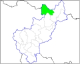
Arroyo Seco is a town and municipality
located in the far north of the Mexican
state of Querétaro. Its territory is part of the Sierra Gorda Biosphere Reserve of Querétaro
. The municipality is centered on the small town of Arroyo Seco, which was established as a military outpost then given town status in 1833 under the name of Villa de Guadalupe before changing to its current name. The town gained municipal status in 1931. The area is very rural with most people living in communities of under 100 people, with significant Pame
communities. It has a traditional economy based on agriculture, livestock and forestry but it is also one of the poorest in Mexico, with high rates of emigration, especially sending migrant workers to the United States. It is estimated that one in four households in the municipality receives money from family members in this country. The municipality is also home to one of five Franciscan mission complexes
built under the tenure of Junípero Serra
, located in the community of Concá.
. The town originated as a military outpost called the Presido de Arroyo Seco. It became the seat of the municipality of the same name in 1931.
The houses are painted in various colors and its streets are quiet. The town is home to all municipal services and has the most developed infrastructure and social services in the area. This includes the Casa de Cultura cultural center, an auditorium and a library. The Mariano Escobedo plaza has an “oriental” style kiosk
surrounded by large trees. On one side the main parish church called the Nuestra Señora de Guadalupe dominates. This church was begun in 1904 and was supposed to be much larger than it is, but construction was suspended due to the Mexican Revolution
. It has an austere facade and the interior has black pews. The most important yearly event in the municipal seat is the feast of the Virgin of Guadalupe on 12 December.
Handcrafts such as saddles, leather goods and wooden barrels for water storage can be found in the town.
, the farthest from the state capital 238 km away. The municipality borders the municipalities of Jalpan de Serra
and Pinal de Amoles
with the San Luis Potosí
to the north and west and the state of Guanajuato
to the south and west. The municipality consists of forty five communities divided into the municipal seat, five delegations and forty sub delegations. It has a government consisting of a municipal president and nine officials called “regidors.” In 2009, the municipality sponsored the first Guadalupana Race, with prizes for competitors in five different categories. The event attracts runners from various parts of the Sierra Gorda
and neighboring states.
As of 2005, there were just over three thousand housing units in the municipality. Most are privately owned and built with materials found in the region such as adobe, bamboo
, wood and tiles for roofs. Floors are either of cement or packed earth. Only 72% of the population has running water, most of which is in individual storage systems operated by gravity. Thirty communities have electrical service. There is both landline and cellular phone service and post offices in several locations.
There are thirty nine preschool programs and forty four primary schools. There are seven middle schools, four of which are distance education and three are technical. In Concá, there is a distance learning vocational high school, which belongs to the Sistema Colegio de Bachilleres del Estado de Querétaro. A new similar facility has been recently built in Purísima de Arista. Over 75% of the municipality’s population only completes primary school, with just over 18% finishing middle school. In 2010, the Instituto Tecnológico de Querétaro
(ITQ) opened a small unit in the municipality to provide higher education classes both face-to-face and via distance education. Classes include those in computer and industrial systems as well as certain types of high school level classes. The classes are giving at the Casa de Cultura in rooms which have been adapted for the purpose.
The main highway in the municipality is Federal Highway 69. A state highway connecting Jalpan with San Luis Potosí was built through here in 2000. In 2004, a highway to Guanajuato was added. These are supplemented by a number of rural roads connecting the various communities. Many of these roads have public bus service, including service to neighboring states.
Aside from the municipal seat there are a number of other important communities. Purísima de Arista is the second largest community in the municipality, which also has all utilities along with schools, health center and sporting facilities. Its economy is based on agriculture growing corn, beans, chili peppers, tomatoes, chickpeas and squash. It is located 36 km from the municipal seat. The town has a parish church was built in 1909. The Virgin of the Immaculate Conception is honored in Purísima de Arista on 8 December. Río de Carrizal is a small community located at an altitude of 600 masl, so it has a warm, subtropical climate. To arrive, one must cross as 205 meter bridge which is seven meters above the ground over the Santa María River
. The community is wedged between two large mountains and consists of houses, small shops, gardens and a few fields. San Juan Buenaventura is located 48 km from the municipal seat and at an altitude of 1600 masl. The town is divided into the communities of El Bosque, San José de las Flores, El Quirino, La Mohonera and Laguna de la Cruz. Most of its economy is based on livestock.
The Concá delegation has the largest number of communities and is located 15 km from the municipal seat in the most agriculturally productive area of the municipality. Its agriculture along with tourism from the mission church has made it one of the most important communities in the region. The town of Concá is noted for its commemoration of Day of the Dead
. The community of El Refugio was known as El Sótano until the early 20th century. Its origins date back to the beginning of the 18th century. Today, it is one of the main livestock (mostly smaller animals like goats and domestic fowl) in the municipality, which has been growing. It has one of the municipality’s parish churches called Nuestra Señora del Refugio. It also has its own schools from pre school to middle school via distance education.
people, which extends over northern Querétaro and southern San Luis Potosí. In Querétaro, they are found in Jalpan de Serra and Arroyo Seco, especially San José de las Flores, El Rincón and El Rincón. Among themselves, they organize into groups called “desisorias” which are tightly knit communities which interact with other similar units for public services such as education and health. As of 2005, the census counted only sixty six people who spoke an indigenous language, Pame and Otomi
. However, only a third of all Pames speak the language with over half being monolingual in Spanish. Disease in the colonial period and displacement, sometimes forced expulsion of Pame peoples nearly extinguished the ethnicity in Arroyo Seco, but since the early 20th century, there has been some migration of Pame back into the area. Pames generally live in homes made of palm, adobe
and wood which can measure from 300 to 1000m2, rectangular with pitched roofs. The inside is generally a single room which includes a kitchen and places to sleep. Most Pame raise small livestock such as pigs and domestic fowl for sale or self consumption. Land is held by communities in common with certain authorities to regulate its use in places such as San José de las Flores, and El Rincón. Common handcrafts include items made from palm fronds such as mats and pottery, including comal
s and other cooking utensils. They also fashion wood into furniture and masks for sale or their own use. A number of these communities have received official recognition from the municipality as “Pueblos Indígenas” (Indigenous Villages). This allows the communities to petition for funds from the Comisión Nacional para el Desarrollo de los Pueblos Indígenas (CDI). The communities are Tierras Prietas, El Sabinito, Crucero del Sabinito, Las Trancas, La Cantera, El Riachuelo, San José de las Flores and San Juan Buenaventura.
The overwhelming majority of the population is Catholic, with four parish churches and the Concá mission church. The last church is directly administered by the Diocese of Querétaro
. However, overall, the tendency of the population is negative. The population declined from 12,667 in 2000 to 12,493 in 2005. Arroyo Seco is the least populated in the Sierra Gorda region. Most of its communities have a population of between one and ninety nine inhabitants. The main for the decline is the emigration of much of its population due to poverty.
region, which is centered on northern Querétaro
state. This region is a branch of the Sierra Madre Oriental
, consisting of mountain chains that parallel the Gulf of Mexico
. This land was sea bed 100 million years ago, which formed ancient sedimentary rock, mostly limestone, which easily erodes. This makes the area part of the Huasteca Karst Arroyo Seco is completely within the Sierra Gorda Biosphere Reserve of Querétaro, which was established in 1997.
Most of the territory is mountainous, with gradients of over 25%. Altitudes in the territory range from 560 to 1340 masl with an average of 980masl. The mountain formations are subdivided into two parts. The first is a corridor along the border with Jalpan which is over forty km long and five km wide. This area has some very low valleys of only 700 masl. The second area is more rugged with canyons of up to 600 meters deep and peaks which reach over 2000 masl. There are a number of flat areas and valleys which are mostly along the Ayutla and Concá rivers. The principle elevations are Santo Domingo, Cantera, Cofradía, Soledad and Pitorreal.
The terrain is composed of sedimentary rock, mostly layers of limestone
, which present on the surface with medium or fine grain and sometimes as clay. It, like most of the Sierra Gorda, is on former sea bed from 150 million years ago. Recently, Arroyo Seco and other municipalities of the Sierra Gorda have reported numerous small earthquakes. According to seismologists, these are caused by the movement of water through sedimentary rock. Erosion causes gaps and then the gaps settle onto themselves, causing the small quakes. One thing scientists are checking for is to see if any areas stand over underground cavities which may give way.
The area’s location over the Huasteca Karst and the erosion of limestone has given rise to numerous pit caves. The largest of these in the Sierra Gorda is located in Arroyo Seco, called the Sótano de Barro, located in the Santa María de los Cocos community. The Sótano del Barro is one of the largest cavities of the world by volume, measuring 15 million cubic metres, surpassed only the Sima Mayor de Sarisariñama in Venezuela
. In comparison the Sótano de Las Golondrinas has a volume of only five million meters cubed. Its widest diameter measures 420 meters and its average width is 200 meters. It has a total depth of 455 meters with a direct drop of 410 meters. Its perimeter is surrounded by dense vegetation, which is a sanctuary for green macaws
. It requires a walk or mule ride of about two hours through dense forest to reach. The walls of the pit cave
are mostly vertical and partially covered by vegetation. At the bottom of the cave there is a small forest on a floor which was sea bed 100 million years ago, which measures 220 meters long and 100 meters wide. Despite its depth, the bottom of the pit cave receives an abundance of sunlight allowing for the growth of trees and other vegetation, making it an isolated mini forest. The bottom also has a number of small caves, with the largest fifty meters long. This pit cave has been classified as the deepest in the world although this has recently been challenged by those who wish to include those pit caves which are not continuous such as the Stary Swistak in Austria
, which has a total depth of 480 meters.
Principle river systems include the Santa María, the Ayutla and the Jalpan with their tributaries such as the Concá River in the south of the municipality. The Santa María enters the municipality from San Luis Potosí and flows along a 400 meter deep canyon until it merges with the Ayutla River. This river flows northeast, forming another canyon then merges with the Jalpan River. There are about 100 accessible sources of water in the municipality with most located in the communities of Salitrillo, Concá and Ayutla. The municipality is home to the junction of two of the major rivers of the Sierra Gorda, the Santa María and the Ayutla River at a location called Las Adjuntas. The Santa María River here flows warm to hot in the summer and the Ayutla River remains cold. Although the two rivers have different water colors and temperatures, both are regulated by the surrounding environment. The Santa María River has a number of beaches which are open to camping. There is also sports fishing of native catfish. The northern border of the municipality is partially formed by the Verde River. The Concá Waterfall is located just south of the town of the same name. This waterfall is fed by a fresh water spring and falls into the Santa María River. Despite the name (which means dry stream or dry arroyo
), most of the arroyos in the area have water in them most of the year. The municipality has ten easily accessible sources of surface water. However, the over extraction of water has led to dropping water tables and many of the area’s fresh water springs are flowing at slower rates or have dried up.
The municipality divides into two climate regions. The north is semi arid with an average temperature of 22C and an annual rainfall of between five and 10.5mm per falling mostly in the summer. The other is semi hot with average temperatures varying from 18 to 22C with rains in the summer. In the winter, the area is vulnerable to cold spells, brought in by cold fronts that arrive from the north and west. The cold spells do not usually reach freezing as the municipality does not have the high peaks that neighbors such as Pinal de Amoles
does, but snow mixed with rain fell in 2006 and in 2010, freezing temperatures did reach communities such as La Florida and San Juan Buenaventura. Very cold temperatures can prompt emergency services such as the provision of blankets by the municipality’s civil protection service or evacuation to shelters. Communities which are most vulnerable to severe cold include La Sanguijuela, La Escondida de Guadalupe, La Cantera, Río del Carrizal and El Durazno. The area has had problems with droughts over the past decade, especially in 2009, which have been draining reserves and aquifers. The lack of water has caused the deaths of livestock and forced more people to emigrate from the municipality. Many communities now must rely on water trucked in from outside.
Vegetation on the limestone
and other sedimentary soils ranges from lowland rainforest to grasslands to scrub brush in more arid areas. In forested areas, the trees include oaks, pines, white cedar, strawberry tree
s and oyamels. In the drier areas, there are also mesquite
trees with some other desert plants including cactus. In the lowest elevations there are tropical hardwoods such as red cedar
, Montezuma cypress and a tree called the “parota.” Wildlife mostly consists of birds and mammals such as doves, quails, chachalaca
s, eagles, roadrunner
s, and some waterfowl. Mammals include squirrels, rabbits, armadillo
s, white-tailed deer
, foxes, coyote
s, wild boar, pumas, raccoon
s, skunk
s, and opossums. There are some reptiles such as rattlesnake
s and coral snake
s.
, especially Huapango arribeño. It is most often played in “topadas” a type of musical duel between two musicians competing on improvisation of lyrics and melodies. Many of the songs are about history, arte and current events. In 2006, Guadalupe Reyes Reyes from El Refugio won the Premio Nacional de Ciencias y Artes in the Popular Arts category. He won the award for his contributions to Huapango arribeño. Reyes formed the band, Los Reyes de El Refugio and their work mostly focuses on rural life in the Sierra Gorda. He was born 1931, but had to work at farming early, learning to read and write mostly on his own. He was taught guitar and found he had musical ability, becoming a cantor at the local church when he was 14.
Typical dishes include jerky, cecina
, “Serrano” style enchiladas and pit cooked barbacoa
. Sweets include “chancaquillas” which is made with piloncillo and squash seeds. Beverages include aguamiel
and pulque
along with atole
with sunflower seeds.
The various communities have festivals in honor of local patron saints, but the most important festival in the municipality is that honoring the Archangel Michael on 29 September. It is celebrated with street fairs and crafts exhibitions.
which were built under the direction of Junípero Serra
in the mid to latter 18th century. The missions were the last in a long line of evangelization efforts in the Sierra Gorda, which were resisted by the indigenous peoples, especially the Chichimeca Jonaz
for about two centuries. This resistance was militarily broken at the Battle of Media Luna in 1748. To consolidate Spanish dominance, the Franciscans under Serra had these churches with elaborate Baroque facades built in the heart of the Sierra Gorda. In addition to Concá, churches were built in Jalpan
, Tancoyol, Landa
and Tilaco. The facades are notable not only for their profuse decoration, but also for the appearance of a number of indigenous elements.
The Concá mission is the smallest of the five, but between 1754 and 1758 by José Antonio de Murguía and Joaquin Fernández Osorio. It is dedicated to the Archangel Michael, with the theme of the facade being “The Victory of the Faith.” It is considered to have the most indigenous elements, with many of its elements showing the more brusque work characteristic of indigenous decoration. More obvious is an image of the Holy Trinity at the crest, which is accompanied by a rabbit and a two-headed eagle, which are Pame symbols. Also prominent are the coat of arms of the Franciscan order, grapevines, two headed eagles, with the Virgin of Guadalupe and Our Lady of the Pillar, the patronesses of Mexico and Spain respectively.
After the missions were turned over to secular clergy, many indigenous abandoned them, a process that would continue with the Mexican War of Independence
and Mexican Revolution
, when the churches all suffered deterioration and sacking. Restoration of the churches began starting in 1979 until the 2000s. The five where inscribed together as a World Heritage Site
in 2003.
Arroyo Seco is part of the heart of the Sierra Gorda. This region has been occupied for about 6000 years. In the Pre Classic and Classic periods
, the Sierra Gorda had a number of small cities as the climate at that time was wetter than it is now. Most of the larger cities were south of the current municipalities due to mining activities and major trade routes, but there were cities and trade routes through here as well, connecting the area mostly with Huasteca
areas to the east and other areas to the north. As the climate of the Sierra Gorda dried out in the early Post Classic period
, cities were abandoned for simpler hunter gatherer communities and there were migrations of Chichimecas, mostly Pame
s and Chichimeca Jonaz
from the north. Arroyo Seco would become Pame territory. In the late pre Hispanic period, the Sierra Gorda had incursions from both the P’urhépecha and Aztecs from as early as 1400, attracted by the area’s mineral deposits, but neither had true dominance as the Chichimecas fiercely opposed them. In the 15th century, the area was marginally dominated by the Oxitipa dominion, which was conquered by Moctezuma Ilhuicama and the Pames. This officially converted the area into an Aztec
tributary state, but the Aztecs never truly had control.
The Spanish made incursions into the Sierra Gorda early in the colonial period, but the Chichimeca
, especially the Jonaz
just to the south, put up fierce resistance to their intrusions. This would keep the Spanish from fully dominating the area for two hundred years.
In 1532, Nuño Beltrán de Guzmán
entered the Sierra Gorda and conquered it but did not hold it. From that time until the 18th century, there had been a number of missions established by the Franciscans and the Augustinians
, but these missions were either destroyed by the Chichimecas or the population would flee from them and move into more inaccessible mountains and canyons. The first Spanish population in the Arroyo Seco area was in San Nicolás Concá, established as an encomienda
under Pedro Guzmán between 1533 and 1538. This territory extended over much of the Sierra Gorda and into what is now San Luis Potosí. In 1587, Concá and Jalpan had missions established in them by the Augustinians from Xilitla. In 1601, friar Lucas de los Ángeles from the Xichú
monastery preached in the area with limited success. In 1609, viceroy
Luis de Velasco
ordered that the Franciscans leave missionary work to the Augustinians, including the Arroyo Seco area. However, Franciscans from Michoacán
stayed and worked with the Augustinians. Those who lasted longest in the area were those who learned the Pame
language and learned to live with Pame customs.
The Spanish would break Chichimeca resistance in the Sierra Gorda in the 1740s, with the expeditions of José de Escandón
, culminating in the Battle of Media Luna. To solidify these military gains, Franciscans founded new missions in this and other areas of northern Querétaro, the heart of the Sierra Gorda. These missions were taken over by Junípero Serra
starting in 1750, who decided to have elaborate mission complexes built in five locations, one of which is in the municipality at Concá. In addition to evangelization, the missions worked to group the semi nomadic Pames into permanent communities centered on churches.
There was one battle here during the Mexican Revolution
when forces under General Saturnino Cedillo and Coronel Marcial Cevallos took over the Concá Hacienda in 1918. The town of Arroyo Seco itself was also attacked by General Cedillo, who killed many non-combatants, sacked and burned the town. In retaliation, forces loyal to Venustiano Carranza
recruited soldiers from Arroyo Seco and defeated Cedillo at the Laguna de Concá.
The town gained municipal status in 1933. At first the new municipality was governed by a committee headed by Antonio Rubio Chávez but the first municipal president, C. Angel Torres Montes, was elected in 1935.
In 1994, the municipality decided to build a garbage dump near the archeological zone of San Rafael without informing the Instituto Nacional de Antropología e Historia (INAH). Since 2006, it has been known that the dump sits on the southern part of the site proper and that the digging of the dump site is estimated to have destroyed between eight and ten pyramids. More vestiges of the site lie 300 meters below the dump. The municipality promised for years to move the facility and from 2006, state and federal authorities have promised to replaced it with a new one farther away. However, as of 2009, the dump is still operating taking on as much as forty tons of trash per week, as the new facility was not yet finished. In 2007, a smaller, above ground dump appeared in the same area, within sight of visible ruins. During this time, acids and other substances produced by the pit have probably caused damage to the limestone of the site, eating away at structures made of the substance. The site belongs to the Río Verde Culture and its estimated to extend over 10km2. Its importance has been compared to that of Tamtoc in San Luis Potosí
.
In 1998, forests in the municipality were among those in five states destroyed by wildfires. In total, 180 hectares were burned. The fires were due to freezing conditions in the prior winter which dried out grasslands.
In the latter 2000s, the municipality has been struggling with water shortages due to drought conditions. The lack of water has caused the deaths of livestock and forced more people to emigrate from the municipality. Many communities now must rely on water trucked in from outside. As of 2007, sixteen out of forty six communities in the municipality have significant problems with water shortages. The government states that this is because a number of wells are drying up and there is insufficient distribution. In the second largest community of Purísima de Arista, about half of the residents experience water shortages. In 2009, the municipality had number of cases of cattle dying due to bites from “vampire” bats which were transmitting a type of paralytic rabies
. The bats were coming from caves located in neighboring Guanajuato.
From the latter 2000s to the present, Arroyo Seco and the rest of the Sierra Gorda in Querétaro have been experiencing numerous small earthquakes, with most registering from 2.5 to 3.5 on the Richter scale, generally imperceptible to humans. Seismologists say that while the number has been unusual, such activity is not and is due to the settling of the sedimentary rock which is below most of the Sierra Gorda region. However, Arroyo Seco and other municipalities have seismographs installed to monitor the situation.
The municipality’s recent history also includes the mass migration out by many of its working aged people due to lack of economic opportunity. Most have gone to the United States with as much as forty percent of the municipality’s population living in the country alone. The money that these workers send back home have significantly changed the local economy, as it is larger than the locally generated economy and larger than annual municipal budget. The migration has caused municipality schools, especially primary schools to lose students as they leave for the United States with their parents.
In 2006, the municipality elected its first non-PRI
municipal president since the Mexican Revolution
, a former migrant worker by the name of Mariano Palacios Trejo, from the PRD
.
Construction of a military base was begun in early 2011 at a three hectare site. The base is one of three being built to work against drug trafficking and other crimes along the Querétaro/San Luis Potosí border. This base is part of the 17th Military Zone to patrol the Querétaro-San Luis Potosí border. The military is there to countering drug trafficking in the area as the region does not have the resources for local police forces.
Because of this emigration, only 23.36% of the total population is economically active, mostly employed in traditional economic activities, such as agriculture, livestock, forestry and general commerce. About twenty percent of the total population works at home for no pay. Women make up only 22% of the paid workforce. Most of those who are not economically active are students and housewives.
Most of the territory is used for pasture and forestry, with total about ninety percent. The rest is used for agriculture, most of which is done only during the rainy season. Just over 43% of the economically active are working agriculture, livestock, forestry and fishing. Thirty of the municipality’s communities engage in agriculture to some degree with most of the production for self consumption. The soil is fertile although it is sometimes hard with some drainage problems. These problems are greatest where the topsoil is less than ten centimeters. One problem with agriculture here is that the soil erodes easily. Fruit trees include mango
, oranges, limes, bananas, guava
s, avocado
s and papaya
. Other crops such as sugar cane, corn, beans, green chili pepper
s, cascabel chili peppers, tomatoes, watermelon, squash, chickpeas, sorghum
, barley
and pitahaya. Most livestock is raised in the communities of El Refugio, San Juan Buenaventura, La Florida, San José de la Flores, Río de Carrizal, Ayutla, Salitrillo and Tepame. Most livestock is cattle with some sheep and goats.
The forests of the municipality make up about sixteen percent of the state’s forest resources and cover 54% of the municipality. Over eighty percent of the forest is made up solely of broad-leafed trees with most of the rest a mix of broad-leafed and conifers. Logging is limited because of the tropical hardwoods here and conservation efforts related to the Sierra Gorda Biosphere Reserve, but it still makes up over 15% of the state’s total. About 19% of the forested lands are used for grazing. Fish farming is a growing segment of the economy, especially in communities near rivers such as Río del Carrizal, Concá, Vegas Cuatas and Ayutla.
About 25% are working in mining, construction, utilities and manufacturing.
Commerce, transportation and services employ about eighteen percent. There are about 140 people dedicated to commerce, most of which is small grocery stores. Supermarkets and other similar stores are located in neighboring San Luis Potosí in Río Verde and San Ciro
. Tourism is a small percentage of the economy, mostly based on the mission church at Concá and some resort hotels opened in recent years. During the colonial period, there were several haciendas in the municipality. One of these was San Nicolás de Concá, which still has abundant vegetation, a large fresh water spring and hiking trails. The main house has been converted into a hotel, conserving part of the original structure made of adobe, with rustic stairs, wooden roof beams and gardens. The San Nicolas Conca hotel is owned by an American by the name of Sharpton. The hacienda was originally dedicated to sugar cane and dates from the 18th century. It has fifty rooms and a 1000 year old kapok
tree which grows at a fresh water spring, called the Árbol Milenario or Millenium Tree. Its trunk has the second largest diameter in Mexico after the Tule tree in Oaxaca
, requiring twenty two children linking hands to surround it. From its roots flows one of the fresh water springs of the community.
The El Abanico water park has two swimming pools, a wading pool, restaurant and gardens and areas for camping. It is located next to the Concá Hacienda.
The Hotel Ayutla water park has two swimming pools, three wading pools, sports fields, picnic areas, restaurant, gardens and areas to camp.
Eight to ten structures are considered destroyed and more may have suffered irreversible damage by acids eating way the limestone blocks. As of 2006, the limits of the sites have still not been defined. The vestiges of the site lie about three hundred meters below the dump. The site belongs to the Río Verde Culture and its estimated to extend over 10km2. Its importance has been compared to that of Tamtoc in San Luis Potosí.
Municipalities of Mexico
Municipalities are the second-level administrative division in Mexico . There are 2,438 municipalities in Mexico, making the average municipality population 45,616...
located in the far north of the Mexican
Mexico
The United Mexican States , commonly known as Mexico , is a federal constitutional republic in North America. It is bordered on the north by the United States; on the south and west by the Pacific Ocean; on the southeast by Guatemala, Belize, and the Caribbean Sea; and on the east by the Gulf of...
state of Querétaro. Its territory is part of the Sierra Gorda Biosphere Reserve of Querétaro
Sierra Gorda
The Sierra Gorda is an ecological region centered on the northern third of the state of Querétaro and extending into the neighboring states of Guanajuato, Hidalgo and San Luis Potosí...
. The municipality is centered on the small town of Arroyo Seco, which was established as a military outpost then given town status in 1833 under the name of Villa de Guadalupe before changing to its current name. The town gained municipal status in 1931. The area is very rural with most people living in communities of under 100 people, with significant Pame
Pame
The Pame are an indigenous people of central Mexico living in the state of San Luis Potosí. They call themselves Xi'úi. They speak the Pame language, which belongs to the Oto-Pamean group of the Oto-Manguean language family....
communities. It has a traditional economy based on agriculture, livestock and forestry but it is also one of the poorest in Mexico, with high rates of emigration, especially sending migrant workers to the United States. It is estimated that one in four households in the municipality receives money from family members in this country. The municipality is also home to one of five Franciscan mission complexes
Franciscan Missions in the Sierra Gorda
The Franciscan Missions of the Sierra Gorda in the Mexican state of Querétaro were declared a World Heritage Site by the UNESCO in 2003. They are credited to Junípero Serra of the Franciscan Order, who also founded important missions in Alta California....
built under the tenure of Junípero Serra
Junípero Serra
Blessed Junípero Serra, O.F.M., , known as Fra Juníper Serra in Catalan, his mother tongue was a Majorcan Franciscan friar who founded the mission chain in Alta California of the Las Californias Province in New Spain—present day California, United States. Fr...
, located in the community of Concá.
The town
Arroyo Seco is a small town of about three hundred homes centered on a plaza named after Mariano EscobedoMariano Escobedo
Mariano Escobedo was a Mexican Army general and former Governor of Nuevo León.He was born on January 16, 1826 in Galeana, Nuevo León. He fought during the Mexican American War in the army with the rank of lieutenant...
. The town originated as a military outpost called the Presido de Arroyo Seco. It became the seat of the municipality of the same name in 1931.
The houses are painted in various colors and its streets are quiet. The town is home to all municipal services and has the most developed infrastructure and social services in the area. This includes the Casa de Cultura cultural center, an auditorium and a library. The Mariano Escobedo plaza has an “oriental” style kiosk
Kiosk
Kiosk is a small, separated garden pavilion open on some or all sides. Kiosks were common in Persia, India, Pakistan, and in the Ottoman Empire from the 13th century onward...
surrounded by large trees. On one side the main parish church called the Nuestra Señora de Guadalupe dominates. This church was begun in 1904 and was supposed to be much larger than it is, but construction was suspended due to the Mexican Revolution
Mexican Revolution
The Mexican Revolution was a major armed struggle that started in 1910, with an uprising led by Francisco I. Madero against longtime autocrat Porfirio Díaz. The Revolution was characterized by several socialist, liberal, anarchist, populist, and agrarianist movements. Over time the Revolution...
. It has an austere facade and the interior has black pews. The most important yearly event in the municipal seat is the feast of the Virgin of Guadalupe on 12 December.
Handcrafts such as saddles, leather goods and wooden barrels for water storage can be found in the town.
The municipality
As municipal seat, the town of Arroyo Seco is the local government for forty five communities, which together make up an area of 731.1665km2. The municipality is located in the north of QuerétaroQuerétaro
Querétaro officially Estado Libre y Soberano de Querétaro de Arteaga is one of the 31 states which, with the Federal District, comprise the 32 Federal Entities of Mexico. It is divided into 18 municipalities and its capital city is Santiago de Querétaro....
, the farthest from the state capital 238 km away. The municipality borders the municipalities of Jalpan de Serra
Jalpan de Serra
Jalpan de Serra is a town and municipality located in the north of the state of Querétaro, Mexico. It is located in the heart of an important ecological zone called the Sierra Gorda. It is also the site two of five Franciscan missions, including the first one, to have been built in the mid 18th...
and Pinal de Amoles
Pinal de Amoles
Pinal de Amoles is a town and municipality located in the north of the state of Querétaro in central Mexico. It is part of the Sierra Gorda region which stretches over northern Querétaro into Guanajuato, Hidalgo and San Luis Potosí, with 88% of the municipality’s land part of the Sierra Gorda...
with the San Luis Potosí
San Luis Potosí
San Luis Potosí officially Estado Libre y Soberano de San Luis Potosí is one of the 31 states which, with the Federal District, comprise the 32 Federal Entities of Mexico. It is divided in 58 municipalities and its capital city is San Luis Potosí....
to the north and west and the state of Guanajuato
Guanajuato
Guanajuato officially Estado Libre y Soberano de Guanajuato is one of the 31 states which, with the Federal District, comprise the 32 Federal Entities of Mexico. It is divided in 46 municipalities and its capital city is Guanajuato....
to the south and west. The municipality consists of forty five communities divided into the municipal seat, five delegations and forty sub delegations. It has a government consisting of a municipal president and nine officials called “regidors.” In 2009, the municipality sponsored the first Guadalupana Race, with prizes for competitors in five different categories. The event attracts runners from various parts of the Sierra Gorda
Sierra Gorda
The Sierra Gorda is an ecological region centered on the northern third of the state of Querétaro and extending into the neighboring states of Guanajuato, Hidalgo and San Luis Potosí...
and neighboring states.
As of 2005, there were just over three thousand housing units in the municipality. Most are privately owned and built with materials found in the region such as adobe, bamboo
Bamboo
Bamboo is a group of perennial evergreens in the true grass family Poaceae, subfamily Bambusoideae, tribe Bambuseae. Giant bamboos are the largest members of the grass family....
, wood and tiles for roofs. Floors are either of cement or packed earth. Only 72% of the population has running water, most of which is in individual storage systems operated by gravity. Thirty communities have electrical service. There is both landline and cellular phone service and post offices in several locations.
There are thirty nine preschool programs and forty four primary schools. There are seven middle schools, four of which are distance education and three are technical. In Concá, there is a distance learning vocational high school, which belongs to the Sistema Colegio de Bachilleres del Estado de Querétaro. A new similar facility has been recently built in Purísima de Arista. Over 75% of the municipality’s population only completes primary school, with just over 18% finishing middle school. In 2010, the Instituto Tecnológico de Querétaro
Instituto Tecnológico de Querétaro
The Technological Institute of Querétaro is part of Mexico's National Institutes of Technology system, which is an organized educational complex, high academic self-sufficiency and continuity in their actions, together by a strong sense of national community and with strong traditions in the fields...
(ITQ) opened a small unit in the municipality to provide higher education classes both face-to-face and via distance education. Classes include those in computer and industrial systems as well as certain types of high school level classes. The classes are giving at the Casa de Cultura in rooms which have been adapted for the purpose.
The main highway in the municipality is Federal Highway 69. A state highway connecting Jalpan with San Luis Potosí was built through here in 2000. In 2004, a highway to Guanajuato was added. These are supplemented by a number of rural roads connecting the various communities. Many of these roads have public bus service, including service to neighboring states.
Aside from the municipal seat there are a number of other important communities. Purísima de Arista is the second largest community in the municipality, which also has all utilities along with schools, health center and sporting facilities. Its economy is based on agriculture growing corn, beans, chili peppers, tomatoes, chickpeas and squash. It is located 36 km from the municipal seat. The town has a parish church was built in 1909. The Virgin of the Immaculate Conception is honored in Purísima de Arista on 8 December. Río de Carrizal is a small community located at an altitude of 600 masl, so it has a warm, subtropical climate. To arrive, one must cross as 205 meter bridge which is seven meters above the ground over the Santa María River
Santa Maria River
Santa Maria River on the Central Coast of California, is formed at the confluence of the Sisquoc River and Cuyama River, just east of the city of Santa Maria, and flows to its delta at the Pacific Ocean....
. The community is wedged between two large mountains and consists of houses, small shops, gardens and a few fields. San Juan Buenaventura is located 48 km from the municipal seat and at an altitude of 1600 masl. The town is divided into the communities of El Bosque, San José de las Flores, El Quirino, La Mohonera and Laguna de la Cruz. Most of its economy is based on livestock.
The Concá delegation has the largest number of communities and is located 15 km from the municipal seat in the most agriculturally productive area of the municipality. Its agriculture along with tourism from the mission church has made it one of the most important communities in the region. The town of Concá is noted for its commemoration of Day of the Dead
Day of the Dead
Day of the Dead is a Mexican holiday celebrated throughout Mexico and around the world in many cultures. The holiday focuses on gatherings of family and friends to pray for and remember friends and family members who have died. It is particularly celebrated in Mexico, where it attains the quality...
. The community of El Refugio was known as El Sótano until the early 20th century. Its origins date back to the beginning of the 18th century. Today, it is one of the main livestock (mostly smaller animals like goats and domestic fowl) in the municipality, which has been growing. It has one of the municipality’s parish churches called Nuestra Señora del Refugio. It also has its own schools from pre school to middle school via distance education.
Demographics
The municipality is part of the traditional territory of the PamePame
The Pame are an indigenous people of central Mexico living in the state of San Luis Potosí. They call themselves Xi'úi. They speak the Pame language, which belongs to the Oto-Pamean group of the Oto-Manguean language family....
people, which extends over northern Querétaro and southern San Luis Potosí. In Querétaro, they are found in Jalpan de Serra and Arroyo Seco, especially San José de las Flores, El Rincón and El Rincón. Among themselves, they organize into groups called “desisorias” which are tightly knit communities which interact with other similar units for public services such as education and health. As of 2005, the census counted only sixty six people who spoke an indigenous language, Pame and Otomi
Otomi language
Otomi is an Oto-Manguean language and one of the indigenous languages of Mexico, spoken by approximately 240,000 indigenous Otomi people in the central altiplano region of Mexico. The language is spoken in many different dialects, some of which are not mutually intelligible, therefore it is in...
. However, only a third of all Pames speak the language with over half being monolingual in Spanish. Disease in the colonial period and displacement, sometimes forced expulsion of Pame peoples nearly extinguished the ethnicity in Arroyo Seco, but since the early 20th century, there has been some migration of Pame back into the area. Pames generally live in homes made of palm, adobe
Adobe
Adobe is a natural building material made from sand, clay, water, and some kind of fibrous or organic material , which the builders shape into bricks using frames and dry in the sun. Adobe buildings are similar to cob and mudbrick buildings. Adobe structures are extremely durable, and account for...
and wood which can measure from 300 to 1000m2, rectangular with pitched roofs. The inside is generally a single room which includes a kitchen and places to sleep. Most Pame raise small livestock such as pigs and domestic fowl for sale or self consumption. Land is held by communities in common with certain authorities to regulate its use in places such as San José de las Flores, and El Rincón. Common handcrafts include items made from palm fronds such as mats and pottery, including comal
Comal
Comal can refer to:*COMAL, a computer programming language*Comal , frequently used to cook tortillasComal is the name of several places:*Comal County, Texas*Comal River, Texas*Comal Springs...
s and other cooking utensils. They also fashion wood into furniture and masks for sale or their own use. A number of these communities have received official recognition from the municipality as “Pueblos Indígenas” (Indigenous Villages). This allows the communities to petition for funds from the Comisión Nacional para el Desarrollo de los Pueblos Indígenas (CDI). The communities are Tierras Prietas, El Sabinito, Crucero del Sabinito, Las Trancas, La Cantera, El Riachuelo, San José de las Flores and San Juan Buenaventura.
The overwhelming majority of the population is Catholic, with four parish churches and the Concá mission church. The last church is directly administered by the Diocese of Querétaro
Diocese of Querétaro
The Diocese of Querétaro is the Catholic Church's diocese of the Mexican state of Querétaro. Erected on January 26, 1863, it covers an area of 15,326 km². , and contains a population of 1,730,034 - 95% of which are Catholic. It belongs to the Archdiocese of San Luis Potosí. The current bishop...
. However, overall, the tendency of the population is negative. The population declined from 12,667 in 2000 to 12,493 in 2005. Arroyo Seco is the least populated in the Sierra Gorda region. Most of its communities have a population of between one and ninety nine inhabitants. The main for the decline is the emigration of much of its population due to poverty.
Environment
The municipality is part of the Sierra GordaSierra Gorda
The Sierra Gorda is an ecological region centered on the northern third of the state of Querétaro and extending into the neighboring states of Guanajuato, Hidalgo and San Luis Potosí...
region, which is centered on northern Querétaro
Querétaro
Querétaro officially Estado Libre y Soberano de Querétaro de Arteaga is one of the 31 states which, with the Federal District, comprise the 32 Federal Entities of Mexico. It is divided into 18 municipalities and its capital city is Santiago de Querétaro....
state. This region is a branch of the Sierra Madre Oriental
Sierra Madre Oriental
The Sierra Madre Oriental is a mountain range in northeastern Mexico.-Setting:Spanning the Sierra Madre Oriental runs from Coahuila south through Nuevo León, southwest Tamaulipas, San Luis Potosí, Querétaro, and Hidalgo to northern Puebla, where it joins with the east-west running Eje Volcánico...
, consisting of mountain chains that parallel the Gulf of Mexico
Gulf of Mexico
The Gulf of Mexico is a partially landlocked ocean basin largely surrounded by the North American continent and the island of Cuba. It is bounded on the northeast, north and northwest by the Gulf Coast of the United States, on the southwest and south by Mexico, and on the southeast by Cuba. In...
. This land was sea bed 100 million years ago, which formed ancient sedimentary rock, mostly limestone, which easily erodes. This makes the area part of the Huasteca Karst Arroyo Seco is completely within the Sierra Gorda Biosphere Reserve of Querétaro, which was established in 1997.
Most of the territory is mountainous, with gradients of over 25%. Altitudes in the territory range from 560 to 1340 masl with an average of 980masl. The mountain formations are subdivided into two parts. The first is a corridor along the border with Jalpan which is over forty km long and five km wide. This area has some very low valleys of only 700 masl. The second area is more rugged with canyons of up to 600 meters deep and peaks which reach over 2000 masl. There are a number of flat areas and valleys which are mostly along the Ayutla and Concá rivers. The principle elevations are Santo Domingo, Cantera, Cofradía, Soledad and Pitorreal.
The terrain is composed of sedimentary rock, mostly layers of limestone
Limestone
Limestone is a sedimentary rock composed largely of the minerals calcite and aragonite, which are different crystal forms of calcium carbonate . Many limestones are composed from skeletal fragments of marine organisms such as coral or foraminifera....
, which present on the surface with medium or fine grain and sometimes as clay. It, like most of the Sierra Gorda, is on former sea bed from 150 million years ago. Recently, Arroyo Seco and other municipalities of the Sierra Gorda have reported numerous small earthquakes. According to seismologists, these are caused by the movement of water through sedimentary rock. Erosion causes gaps and then the gaps settle onto themselves, causing the small quakes. One thing scientists are checking for is to see if any areas stand over underground cavities which may give way.
The area’s location over the Huasteca Karst and the erosion of limestone has given rise to numerous pit caves. The largest of these in the Sierra Gorda is located in Arroyo Seco, called the Sótano de Barro, located in the Santa María de los Cocos community. The Sótano del Barro is one of the largest cavities of the world by volume, measuring 15 million cubic metres, surpassed only the Sima Mayor de Sarisariñama in Venezuela
Venezuela
Venezuela , officially called the Bolivarian Republic of Venezuela , is a tropical country on the northern coast of South America. It borders Colombia to the west, Guyana to the east, and Brazil to the south...
. In comparison the Sótano de Las Golondrinas has a volume of only five million meters cubed. Its widest diameter measures 420 meters and its average width is 200 meters. It has a total depth of 455 meters with a direct drop of 410 meters. Its perimeter is surrounded by dense vegetation, which is a sanctuary for green macaws
Great Green Macaw
The Great Green Macaw, Ara ambiguus, also known as Buffon's Macaw or the Great Military Macaw, is a Central and South American parrot found in Nicaragua, Honduras, Costa Rica, Panama, Colombia and Ecuador. Two allopatric subspecies are recognized, the nominate subspecies is found in Central America...
. It requires a walk or mule ride of about two hours through dense forest to reach. The walls of the pit cave
Pit Cave
A pit cave, or vertical cave — or often simply called a pit or pot — is a type of natural cave which contains one or more significant vertical shafts rather than being predominantly a conventional horizontal cave passage. Pit caves typically form in limestone as a result of long-term erosion by...
are mostly vertical and partially covered by vegetation. At the bottom of the cave there is a small forest on a floor which was sea bed 100 million years ago, which measures 220 meters long and 100 meters wide. Despite its depth, the bottom of the pit cave receives an abundance of sunlight allowing for the growth of trees and other vegetation, making it an isolated mini forest. The bottom also has a number of small caves, with the largest fifty meters long. This pit cave has been classified as the deepest in the world although this has recently been challenged by those who wish to include those pit caves which are not continuous such as the Stary Swistak in Austria
Austria
Austria , officially the Republic of Austria , is a landlocked country of roughly 8.4 million people in Central Europe. It is bordered by the Czech Republic and Germany to the north, Slovakia and Hungary to the east, Slovenia and Italy to the south, and Switzerland and Liechtenstein to the...
, which has a total depth of 480 meters.
Principle river systems include the Santa María, the Ayutla and the Jalpan with their tributaries such as the Concá River in the south of the municipality. The Santa María enters the municipality from San Luis Potosí and flows along a 400 meter deep canyon until it merges with the Ayutla River. This river flows northeast, forming another canyon then merges with the Jalpan River. There are about 100 accessible sources of water in the municipality with most located in the communities of Salitrillo, Concá and Ayutla. The municipality is home to the junction of two of the major rivers of the Sierra Gorda, the Santa María and the Ayutla River at a location called Las Adjuntas. The Santa María River here flows warm to hot in the summer and the Ayutla River remains cold. Although the two rivers have different water colors and temperatures, both are regulated by the surrounding environment. The Santa María River has a number of beaches which are open to camping. There is also sports fishing of native catfish. The northern border of the municipality is partially formed by the Verde River. The Concá Waterfall is located just south of the town of the same name. This waterfall is fed by a fresh water spring and falls into the Santa María River. Despite the name (which means dry stream or dry arroyo
Arroyo (creek)
An arroyo , a Spanish word translated as brook, and also called a wash is usually a dry creek or stream bed—gulch that temporarily or seasonally fills and flows after sufficient rain. Wadi is a similar term in Africa. In Spain, a rambla has a similar meaning to arroyo.-Types and processes:Arroyos...
), most of the arroyos in the area have water in them most of the year. The municipality has ten easily accessible sources of surface water. However, the over extraction of water has led to dropping water tables and many of the area’s fresh water springs are flowing at slower rates or have dried up.
The municipality divides into two climate regions. The north is semi arid with an average temperature of 22C and an annual rainfall of between five and 10.5mm per falling mostly in the summer. The other is semi hot with average temperatures varying from 18 to 22C with rains in the summer. In the winter, the area is vulnerable to cold spells, brought in by cold fronts that arrive from the north and west. The cold spells do not usually reach freezing as the municipality does not have the high peaks that neighbors such as Pinal de Amoles
Pinal de Amoles
Pinal de Amoles is a town and municipality located in the north of the state of Querétaro in central Mexico. It is part of the Sierra Gorda region which stretches over northern Querétaro into Guanajuato, Hidalgo and San Luis Potosí, with 88% of the municipality’s land part of the Sierra Gorda...
does, but snow mixed with rain fell in 2006 and in 2010, freezing temperatures did reach communities such as La Florida and San Juan Buenaventura. Very cold temperatures can prompt emergency services such as the provision of blankets by the municipality’s civil protection service or evacuation to shelters. Communities which are most vulnerable to severe cold include La Sanguijuela, La Escondida de Guadalupe, La Cantera, Río del Carrizal and El Durazno. The area has had problems with droughts over the past decade, especially in 2009, which have been draining reserves and aquifers. The lack of water has caused the deaths of livestock and forced more people to emigrate from the municipality. Many communities now must rely on water trucked in from outside.
Vegetation on the limestone
Limestone
Limestone is a sedimentary rock composed largely of the minerals calcite and aragonite, which are different crystal forms of calcium carbonate . Many limestones are composed from skeletal fragments of marine organisms such as coral or foraminifera....
and other sedimentary soils ranges from lowland rainforest to grasslands to scrub brush in more arid areas. In forested areas, the trees include oaks, pines, white cedar, strawberry tree
Strawberry Tree
Arbutus unedo, commonly called Strawberry Tree, Apple of Cain, or Cane Apple, is an evergreen shrub or small tree in the family Ericaceae, native to the Mediterranean region and western Europe north to western France and Ireland...
s and oyamels. In the drier areas, there are also mesquite
Mesquite
Mesquite is a leguminous plant of the Prosopis genus found in northern Mexico through the Sonoran Desert and Chihuahuan Deserts, and up into the Southwestern United States as far north as southern Kansas, west to the Colorado Desert in California,and east to the eastern fifth of Texas, where...
trees with some other desert plants including cactus. In the lowest elevations there are tropical hardwoods such as red cedar
Red Cedar
- Trees :* Toona ciliata, an Australian / Asian rainforest tree* Juniperus virginiana, a North American juniper* Thuja plicata, a North American tree in the cypress family- Places :Canada* Red Cedar Lake , a lake in the Temagami region...
, Montezuma cypress and a tree called the “parota.” Wildlife mostly consists of birds and mammals such as doves, quails, chachalaca
Chachalaca
Chachalacas are mainly brown birds from the genus Ortalis. These cracids are found in wooded habitats in far southern United States , Mexico, and Central and South America. They are social, can be very noisy and often remain fairly common even near humans, as their relatively small size makes them...
s, eagles, roadrunner
Roadrunner
Roadrunners are birds of the genus Geococcyx.Roadrunner or Road Runner may also refer to:* Wile E. Coyote and Road Runner, an animated character based on the bird** The Road Runner Show, compiled cartoons including the character...
s, and some waterfowl. Mammals include squirrels, rabbits, armadillo
Armadillo
Armadillos are New World placental mammals, known for having a leathery armor shell. Dasypodidae is the only surviving family in the order Cingulata, part of the superorder Xenarthra along with the anteaters and sloths. The word armadillo is Spanish for "little armored one"...
s, white-tailed deer
White-tailed Deer
The white-tailed deer , also known as the Virginia deer or simply as the whitetail, is a medium-sized deer native to the United States , Canada, Mexico, Central America, and South America as far south as Peru...
, foxes, coyote
Coyote
The coyote , also known as the American jackal or the prairie wolf, is a species of canine found throughout North and Central America, ranging from Panama in the south, north through Mexico, the United States and Canada...
s, wild boar, pumas, raccoon
Raccoon
Procyon is a genus of nocturnal mammals, comprising three species commonly known as raccoons, in the family Procyonidae. The most familiar species, the common raccoon , is often known simply as "the" raccoon, as the two other raccoon species in the genus are native only to the tropics and are...
s, skunk
Skunk
Skunks are mammals best known for their ability to secrete a liquid with a strong, foul odor. General appearance varies from species to species, from black-and-white to brown or cream colored. Skunks belong to the family Mephitidae and to the order Carnivora...
s, and opossums. There are some reptiles such as rattlesnake
Rattlesnake
Rattlesnakes are a group of venomous snakes of the genera Crotalus and Sistrurus of the subfamily Crotalinae . There are 32 known species of rattlesnake, with between 65-70 subspecies, all native to the Americas, ranging from southern Alberta and southern British Columbia in Canada to Central...
s and coral snake
Coral snake
The coral snakes are a large group of elapid snakes that can be subdivided into two distinct groups, Old World coral snakes and New World coral snakes...
s.
Culture
The most popular traditional music is HuapangoHuapango
Huapango is a corruption of the Nahuatl word huapanco that textually means on top of the wood platform according to the dictionary of the Real Academia Española . Today huapango refers to a musical style that originated in and is played throughout the La Huasteca region in Mexico...
, especially Huapango arribeño. It is most often played in “topadas” a type of musical duel between two musicians competing on improvisation of lyrics and melodies. Many of the songs are about history, arte and current events. In 2006, Guadalupe Reyes Reyes from El Refugio won the Premio Nacional de Ciencias y Artes in the Popular Arts category. He won the award for his contributions to Huapango arribeño. Reyes formed the band, Los Reyes de El Refugio and their work mostly focuses on rural life in the Sierra Gorda. He was born 1931, but had to work at farming early, learning to read and write mostly on his own. He was taught guitar and found he had musical ability, becoming a cantor at the local church when he was 14.
Typical dishes include jerky, cecina
Cecina
Cecina may refer to:*Cecina, Tuscany, a town in the Italian Province of Livorno*Cecina , a river in Italy*Cecina , a Spanish and Mexican culinary specialty made of beef*Farinata, a Tuscan culinary specialty made of chickpea flour...
, “Serrano” style enchiladas and pit cooked barbacoa
Barbacoa
Barbacoa is a form of cooking meat that originated in the Caribbean with the Taíno people, from which the term "barbecue" derives. In contemporary Mexico it generally refers to meats or a whole sheep slow-cooked over an open fire, or more traditionally, in a hole dug in the ground covered with...
. Sweets include “chancaquillas” which is made with piloncillo and squash seeds. Beverages include aguamiel
Aguamiel
Aguamiel is the sap of the Mexican maguey plant which is believed to have therapeutic qualities. The sap is found in abundance among the agave plants which grow among the ruins of the Teotihuacan civilization. Also called honeywater it has been used in Mexico as a medicine. In its fermented state...
and pulque
Pulque
Pulque, or octli, is a milk-colored, somewhat viscous alcoholic beverage made from the fermented sap of the maguey plant, and is a traditional native beverage of Mexico. The drink’s history extends far back into the Mesoamerican period, when it was considered sacred, and its use was limited to...
along with atole
Atole
Atole is a traditional masa-based Mexican and Central American hot drink. Chocolate atole is known as champurrado or atole...
with sunflower seeds.
The various communities have festivals in honor of local patron saints, but the most important festival in the municipality is that honoring the Archangel Michael on 29 September. It is celebrated with street fairs and crafts exhibitions.
The mission church of Concá
The mission complex at Concá is one of five Franciscan missionsFranciscan Missions in the Sierra Gorda
The Franciscan Missions of the Sierra Gorda in the Mexican state of Querétaro were declared a World Heritage Site by the UNESCO in 2003. They are credited to Junípero Serra of the Franciscan Order, who also founded important missions in Alta California....
which were built under the direction of Junípero Serra
Junípero Serra
Blessed Junípero Serra, O.F.M., , known as Fra Juníper Serra in Catalan, his mother tongue was a Majorcan Franciscan friar who founded the mission chain in Alta California of the Las Californias Province in New Spain—present day California, United States. Fr...
in the mid to latter 18th century. The missions were the last in a long line of evangelization efforts in the Sierra Gorda, which were resisted by the indigenous peoples, especially the Chichimeca Jonaz
Chichimeca Jonaz
The Chichimeca Jonaz are a group of indigenous people living in Guanajuato and San Luis Potosí. In Guanajuato State the Chichimeca Jonaz people live in a community of San Luis de la Paz municipality. The settlement is 2,070 m above sea level...
for about two centuries. This resistance was militarily broken at the Battle of Media Luna in 1748. To consolidate Spanish dominance, the Franciscans under Serra had these churches with elaborate Baroque facades built in the heart of the Sierra Gorda. In addition to Concá, churches were built in Jalpan
Jalpan de Serra
Jalpan de Serra is a town and municipality located in the north of the state of Querétaro, Mexico. It is located in the heart of an important ecological zone called the Sierra Gorda. It is also the site two of five Franciscan missions, including the first one, to have been built in the mid 18th...
, Tancoyol, Landa
Landa de Matamoros
Landa de Matamoros is a town and municipality located in the northwest of the state of Querétaro in central Mexico. It is part of the Sierra Gorda region, which consists of rugged mountains, canyons and wide diversity of flora and fauna, with the municipality's flora representing about 25% of all...
and Tilaco. The facades are notable not only for their profuse decoration, but also for the appearance of a number of indigenous elements.
The Concá mission is the smallest of the five, but between 1754 and 1758 by José Antonio de Murguía and Joaquin Fernández Osorio. It is dedicated to the Archangel Michael, with the theme of the facade being “The Victory of the Faith.” It is considered to have the most indigenous elements, with many of its elements showing the more brusque work characteristic of indigenous decoration. More obvious is an image of the Holy Trinity at the crest, which is accompanied by a rabbit and a two-headed eagle, which are Pame symbols. Also prominent are the coat of arms of the Franciscan order, grapevines, two headed eagles, with the Virgin of Guadalupe and Our Lady of the Pillar, the patronesses of Mexico and Spain respectively.
After the missions were turned over to secular clergy, many indigenous abandoned them, a process that would continue with the Mexican War of Independence
Mexican War of Independence
The Mexican War of Independence was an armed conflict between the people of Mexico and the Spanish colonial authorities which started on 16 September 1810. The movement, which became known as the Mexican War of Independence, was led by Mexican-born Spaniards, Mestizos and Amerindians who sought...
and Mexican Revolution
Mexican Revolution
The Mexican Revolution was a major armed struggle that started in 1910, with an uprising led by Francisco I. Madero against longtime autocrat Porfirio Díaz. The Revolution was characterized by several socialist, liberal, anarchist, populist, and agrarianist movements. Over time the Revolution...
, when the churches all suffered deterioration and sacking. Restoration of the churches began starting in 1979 until the 2000s. The five where inscribed together as a World Heritage Site
World Heritage Site
A UNESCO World Heritage Site is a place that is listed by the UNESCO as of special cultural or physical significance...
in 2003.
History
The town was originally known as the Presidio de Arroyo Seco, a military outpost. In 1833, missionary Francisco Cano Santander gave it the ecclesiastical name of Villa de Guadalupe which was the town’s formal name until 1840, which it was changed to the current one. Its coat of arms has three parts. The first represents the Cross of the Holy Trinity with hands representing the indigenous peoples and the evangelizers. The second is the rabbit which appears on the facade of the mission church of Concá. This rabbit is the only one to appear on the five mission churches. The third is an arroyo from which the name comes.Arroyo Seco is part of the heart of the Sierra Gorda. This region has been occupied for about 6000 years. In the Pre Classic and Classic periods
Mesoamerican chronology
Mesoamerican chronology divides the history of pre-Columbian Mesoamerica into several periods: the Paleo-Indian , the Archaic , the Preclassic , the Classic , and the Postclassic...
, the Sierra Gorda had a number of small cities as the climate at that time was wetter than it is now. Most of the larger cities were south of the current municipalities due to mining activities and major trade routes, but there were cities and trade routes through here as well, connecting the area mostly with Huasteca
La Huasteca
La Huasteca is the first climbing area in Monterrey, Mexico, only 15 minutes from the city. With nearly 200 bolted routes with grades from 5.8 to 5.13C, it is the favorite place for weekend climbers. It is also known for the slippery type of limestone from which it is comprised, and which makes...
areas to the east and other areas to the north. As the climate of the Sierra Gorda dried out in the early Post Classic period
Mesoamerican chronology
Mesoamerican chronology divides the history of pre-Columbian Mesoamerica into several periods: the Paleo-Indian , the Archaic , the Preclassic , the Classic , and the Postclassic...
, cities were abandoned for simpler hunter gatherer communities and there were migrations of Chichimecas, mostly Pame
Pame
The Pame are an indigenous people of central Mexico living in the state of San Luis Potosí. They call themselves Xi'úi. They speak the Pame language, which belongs to the Oto-Pamean group of the Oto-Manguean language family....
s and Chichimeca Jonaz
Chichimeca Jonaz
The Chichimeca Jonaz are a group of indigenous people living in Guanajuato and San Luis Potosí. In Guanajuato State the Chichimeca Jonaz people live in a community of San Luis de la Paz municipality. The settlement is 2,070 m above sea level...
from the north. Arroyo Seco would become Pame territory. In the late pre Hispanic period, the Sierra Gorda had incursions from both the P’urhépecha and Aztecs from as early as 1400, attracted by the area’s mineral deposits, but neither had true dominance as the Chichimecas fiercely opposed them. In the 15th century, the area was marginally dominated by the Oxitipa dominion, which was conquered by Moctezuma Ilhuicama and the Pames. This officially converted the area into an Aztec
Aztec
The Aztec people were certain ethnic groups of central Mexico, particularly those groups who spoke the Nahuatl language and who dominated large parts of Mesoamerica in the 14th, 15th and 16th centuries, a period referred to as the late post-classic period in Mesoamerican chronology.Aztec is the...
tributary state, but the Aztecs never truly had control.
The Spanish made incursions into the Sierra Gorda early in the colonial period, but the Chichimeca
Chichimeca
Chichimeca was the name that the Nahua peoples of Mexico generically applied to a wide range of semi-nomadic peoples who inhabited the north of modern-day Mexico and southwestern United States, and carried the same sense as the European term "barbarian"...
, especially the Jonaz
Chichimeca Jonaz
The Chichimeca Jonaz are a group of indigenous people living in Guanajuato and San Luis Potosí. In Guanajuato State the Chichimeca Jonaz people live in a community of San Luis de la Paz municipality. The settlement is 2,070 m above sea level...
just to the south, put up fierce resistance to their intrusions. This would keep the Spanish from fully dominating the area for two hundred years.
In 1532, Nuño Beltrán de Guzmán
Nuño Beltrán de Guzmán
Nuño Beltrán de Guzmán or sometimes Nuño de Guzmán was a Spanish conquistador and colonial administrator in New Spain. He was Governor of the province of Pánuco from 1525–1533, and of Nueva Galicia from 1529–1534, President of the first Audiencia from 1528-30. He founded several cities in...
entered the Sierra Gorda and conquered it but did not hold it. From that time until the 18th century, there had been a number of missions established by the Franciscans and the Augustinians
Augustinians
The term Augustinians, named after Saint Augustine of Hippo , applies to two separate and unrelated types of Catholic religious orders:...
, but these missions were either destroyed by the Chichimecas or the population would flee from them and move into more inaccessible mountains and canyons. The first Spanish population in the Arroyo Seco area was in San Nicolás Concá, established as an encomienda
Encomienda
The encomienda was a system that was employed mainly by the Spanish crown during the colonization of the Americas to regulate Native American labor....
under Pedro Guzmán between 1533 and 1538. This territory extended over much of the Sierra Gorda and into what is now San Luis Potosí. In 1587, Concá and Jalpan had missions established in them by the Augustinians from Xilitla. In 1601, friar Lucas de los Ángeles from the Xichú
Xichú
Xichú is a Mexican city located in the Northeast region of the state of Guanajuato. The municipality is entirely within the Sierra Gorda range and has an area of 912.20 square kilometres...
monastery preached in the area with limited success. In 1609, viceroy
Viceroy
A viceroy is a royal official who runs a country, colony, or province in the name of and as representative of the monarch. The term derives from the Latin prefix vice-, meaning "in the place of" and the French word roi, meaning king. A viceroy's province or larger territory is called a viceroyalty...
Luis de Velasco
Luis de Velasco
Luís de Velasco was the second viceroy of New Spain during the Spanish colonization of the Americas in the mid-sixteenth century....
ordered that the Franciscans leave missionary work to the Augustinians, including the Arroyo Seco area. However, Franciscans from Michoacán
Michoacán
Michoacán officially Estado Libre y Soberano de Michoacán de Ocampo is one of the 31 states which, with the Federal District, comprise the 32 Federal Entities of Mexico. It is divided in 113 municipalities and its capital city is Morelia...
stayed and worked with the Augustinians. Those who lasted longest in the area were those who learned the Pame
Pame
The Pame are an indigenous people of central Mexico living in the state of San Luis Potosí. They call themselves Xi'úi. They speak the Pame language, which belongs to the Oto-Pamean group of the Oto-Manguean language family....
language and learned to live with Pame customs.
The Spanish would break Chichimeca resistance in the Sierra Gorda in the 1740s, with the expeditions of José de Escandón
José de Escandón
José de Escandón y Helguera, 1st Count of Sierra Gorda was a Spanish Indian-fighter in New Spain and the founder and first governor of the colony of Nuevo Santander, which extended from the Pánuco River in the modern-day Mexican state of Veracruz to the Guadalupe River in...
, culminating in the Battle of Media Luna. To solidify these military gains, Franciscans founded new missions in this and other areas of northern Querétaro, the heart of the Sierra Gorda. These missions were taken over by Junípero Serra
Junípero Serra
Blessed Junípero Serra, O.F.M., , known as Fra Juníper Serra in Catalan, his mother tongue was a Majorcan Franciscan friar who founded the mission chain in Alta California of the Las Californias Province in New Spain—present day California, United States. Fr...
starting in 1750, who decided to have elaborate mission complexes built in five locations, one of which is in the municipality at Concá. In addition to evangelization, the missions worked to group the semi nomadic Pames into permanent communities centered on churches.
There was one battle here during the Mexican Revolution
Mexican Revolution
The Mexican Revolution was a major armed struggle that started in 1910, with an uprising led by Francisco I. Madero against longtime autocrat Porfirio Díaz. The Revolution was characterized by several socialist, liberal, anarchist, populist, and agrarianist movements. Over time the Revolution...
when forces under General Saturnino Cedillo and Coronel Marcial Cevallos took over the Concá Hacienda in 1918. The town of Arroyo Seco itself was also attacked by General Cedillo, who killed many non-combatants, sacked and burned the town. In retaliation, forces loyal to Venustiano Carranza
Venustiano Carranza
Venustiano Carranza de la Garza, was one of the leaders of the Mexican Revolution. He ultimately became President of Mexico following the overthrow of the dictatorial Huerta regime in the summer of 1914 and during his administration the current constitution of Mexico was drafted...
recruited soldiers from Arroyo Seco and defeated Cedillo at the Laguna de Concá.
The town gained municipal status in 1933. At first the new municipality was governed by a committee headed by Antonio Rubio Chávez but the first municipal president, C. Angel Torres Montes, was elected in 1935.
In 1994, the municipality decided to build a garbage dump near the archeological zone of San Rafael without informing the Instituto Nacional de Antropología e Historia (INAH). Since 2006, it has been known that the dump sits on the southern part of the site proper and that the digging of the dump site is estimated to have destroyed between eight and ten pyramids. More vestiges of the site lie 300 meters below the dump. The municipality promised for years to move the facility and from 2006, state and federal authorities have promised to replaced it with a new one farther away. However, as of 2009, the dump is still operating taking on as much as forty tons of trash per week, as the new facility was not yet finished. In 2007, a smaller, above ground dump appeared in the same area, within sight of visible ruins. During this time, acids and other substances produced by the pit have probably caused damage to the limestone of the site, eating away at structures made of the substance. The site belongs to the Río Verde Culture and its estimated to extend over 10km2. Its importance has been compared to that of Tamtoc in San Luis Potosí
Tamuín
Tamuín is a municipio in the Mexican state of San Luis Potosí. Tamuín is internationally renowned for three archaeological sites representative of the precolonial Huastec culture.-Toponymy:...
.
In 1998, forests in the municipality were among those in five states destroyed by wildfires. In total, 180 hectares were burned. The fires were due to freezing conditions in the prior winter which dried out grasslands.
In the latter 2000s, the municipality has been struggling with water shortages due to drought conditions. The lack of water has caused the deaths of livestock and forced more people to emigrate from the municipality. Many communities now must rely on water trucked in from outside. As of 2007, sixteen out of forty six communities in the municipality have significant problems with water shortages. The government states that this is because a number of wells are drying up and there is insufficient distribution. In the second largest community of Purísima de Arista, about half of the residents experience water shortages. In 2009, the municipality had number of cases of cattle dying due to bites from “vampire” bats which were transmitting a type of paralytic rabies
Rabies
Rabies is a viral disease that causes acute encephalitis in warm-blooded animals. It is zoonotic , most commonly by a bite from an infected animal. For a human, rabies is almost invariably fatal if post-exposure prophylaxis is not administered prior to the onset of severe symptoms...
. The bats were coming from caves located in neighboring Guanajuato.
From the latter 2000s to the present, Arroyo Seco and the rest of the Sierra Gorda in Querétaro have been experiencing numerous small earthquakes, with most registering from 2.5 to 3.5 on the Richter scale, generally imperceptible to humans. Seismologists say that while the number has been unusual, such activity is not and is due to the settling of the sedimentary rock which is below most of the Sierra Gorda region. However, Arroyo Seco and other municipalities have seismographs installed to monitor the situation.
The municipality’s recent history also includes the mass migration out by many of its working aged people due to lack of economic opportunity. Most have gone to the United States with as much as forty percent of the municipality’s population living in the country alone. The money that these workers send back home have significantly changed the local economy, as it is larger than the locally generated economy and larger than annual municipal budget. The migration has caused municipality schools, especially primary schools to lose students as they leave for the United States with their parents.
In 2006, the municipality elected its first non-PRI
Institutional Revolutionary Party
The Institutional Revolutionary Party is a Mexican political party that held power in the country—under a succession of names—for more than 70 years. The PRI is a member of the Socialist International, as is the rival Party of the Democratic Revolution , making Mexico one of the few...
municipal president since the Mexican Revolution
Mexican Revolution
The Mexican Revolution was a major armed struggle that started in 1910, with an uprising led by Francisco I. Madero against longtime autocrat Porfirio Díaz. The Revolution was characterized by several socialist, liberal, anarchist, populist, and agrarianist movements. Over time the Revolution...
, a former migrant worker by the name of Mariano Palacios Trejo, from the PRD
Party of the Democratic Revolution
The Party of the Democratic Revolution is a democratic socialist party in Mexico and one of 2 Mexican affiliates of the Socialist International...
.
Construction of a military base was begun in early 2011 at a three hectare site. The base is one of three being built to work against drug trafficking and other crimes along the Querétaro/San Luis Potosí border. This base is part of the 17th Military Zone to patrol the Querétaro-San Luis Potosí border. The military is there to countering drug trafficking in the area as the region does not have the resources for local police forces.
Economy and tourism
The municipality is one of the most economically marginalized in the state, with the Secretaría de Desarrollo Social (SEDESOL) cataloging it as one of the 200 most socioeconomically marginalized in the country. This is the main reason why Arroyo Seco and other municipalities in the Sierra Gorda of Querétaro have high rates of emigration. It is not known exactly how many have left or how many come back at the end of the year to visit family, but Arroyo Seco estimates that about forty percent of its population is living somewhere in the United States. The amount sent back in remittances is also not known, but it has been estimated at between 50,000 to 100,000 USD per day or about 18 million USD per year to the Sierra Gorda alone, based on money exchanges made the in the main city of Jalpan de Serra. This amount supersedes the annual municipal budget of Arroyo Seco and other area municipalities and generally superseded money generated by municipal economies. In Arroyo Seco, one in four homes is supported by dollars send home by family in the United States. These migrants not only provide remittances directly to their families, they have also formed clubs with the purpose of promoting infrastructure projects in their home communities. The Club de Migrantes de la Sierra Gorda is an association of twenty seven of these clubs from various municipalities, with three from Arroyo Seco. Most of the projects are related paving, water distribution and sewerage/drainage. These dollars are often matched through a program sponsored by the Mexican federal government. Many businesses in the municipality and the rest of the Sierra Gorda take the dollar as currency, especially at the end of the year when many come to the area to visit family. Arroyo Seco has one of the highest rates of emigration in Querétaro. Arroyo Seco is one of the sponsors of the Día del Paisano to honor returning migrant workers in Jalpan de Serra. This events includes parades and raffles.Because of this emigration, only 23.36% of the total population is economically active, mostly employed in traditional economic activities, such as agriculture, livestock, forestry and general commerce. About twenty percent of the total population works at home for no pay. Women make up only 22% of the paid workforce. Most of those who are not economically active are students and housewives.
Most of the territory is used for pasture and forestry, with total about ninety percent. The rest is used for agriculture, most of which is done only during the rainy season. Just over 43% of the economically active are working agriculture, livestock, forestry and fishing. Thirty of the municipality’s communities engage in agriculture to some degree with most of the production for self consumption. The soil is fertile although it is sometimes hard with some drainage problems. These problems are greatest where the topsoil is less than ten centimeters. One problem with agriculture here is that the soil erodes easily. Fruit trees include mango
Mango
The mango is a fleshy stone fruit belonging to the genus Mangifera, consisting of numerous tropical fruiting trees in the flowering plant family Anacardiaceae. The mango is native to India from where it spread all over the world. It is also the most cultivated fruit of the tropical world. While...
, oranges, limes, bananas, guava
Guava
Guavas are plants in the myrtle family genus Psidium , which contains about 100 species of tropical shrubs and small trees. They are native to Mexico, Central America, and northern South America...
s, avocado
Avocado
The avocado is a tree native to Central Mexico, classified in the flowering plant family Lauraceae along with cinnamon, camphor and bay laurel...
s and papaya
Papaya
The papaya , papaw, or pawpaw is the fruit of the plant Carica papaya, the sole species in the genus Carica of the plant family Caricaceae...
. Other crops such as sugar cane, corn, beans, green chili pepper
Chili pepper
Chili pepper is the fruit of plants from the genus Capsicum, members of the nightshade family, Solanaceae. The term in British English and in Australia, New Zealand, India, Malaysia and other Asian countries is just chilli without pepper.Chili peppers originated in the Americas...
s, cascabel chili peppers, tomatoes, watermelon, squash, chickpeas, sorghum
Sorghum
Sorghum is a genus of numerous species of grasses, one of which is raised for grain and many of which are used as fodder plants either cultivated or as part of pasture. The plants are cultivated in warmer climates worldwide. Species are native to tropical and subtropical regions of all continents...
, barley
Barley
Barley is a major cereal grain, a member of the grass family. It serves as a major animal fodder, as a base malt for beer and certain distilled beverages, and as a component of various health foods...
and pitahaya. Most livestock is raised in the communities of El Refugio, San Juan Buenaventura, La Florida, San José de la Flores, Río de Carrizal, Ayutla, Salitrillo and Tepame. Most livestock is cattle with some sheep and goats.
The forests of the municipality make up about sixteen percent of the state’s forest resources and cover 54% of the municipality. Over eighty percent of the forest is made up solely of broad-leafed trees with most of the rest a mix of broad-leafed and conifers. Logging is limited because of the tropical hardwoods here and conservation efforts related to the Sierra Gorda Biosphere Reserve, but it still makes up over 15% of the state’s total. About 19% of the forested lands are used for grazing. Fish farming is a growing segment of the economy, especially in communities near rivers such as Río del Carrizal, Concá, Vegas Cuatas and Ayutla.
About 25% are working in mining, construction, utilities and manufacturing.
Commerce, transportation and services employ about eighteen percent. There are about 140 people dedicated to commerce, most of which is small grocery stores. Supermarkets and other similar stores are located in neighboring San Luis Potosí in Río Verde and San Ciro
San Ciro de Acosta
San Ciro de Acosta is a town and municipality in San Luis Potosí in central Mexico.-References:...
. Tourism is a small percentage of the economy, mostly based on the mission church at Concá and some resort hotels opened in recent years. During the colonial period, there were several haciendas in the municipality. One of these was San Nicolás de Concá, which still has abundant vegetation, a large fresh water spring and hiking trails. The main house has been converted into a hotel, conserving part of the original structure made of adobe, with rustic stairs, wooden roof beams and gardens. The San Nicolas Conca hotel is owned by an American by the name of Sharpton. The hacienda was originally dedicated to sugar cane and dates from the 18th century. It has fifty rooms and a 1000 year old kapok
Kapok
Ceiba pentandra is a tropical tree of the order Malvales and the family Malvaceae , native to Mexico, Central America and the Caribbean, northern South America, and to tropical west Africa...
tree which grows at a fresh water spring, called the Árbol Milenario or Millenium Tree. Its trunk has the second largest diameter in Mexico after the Tule tree in Oaxaca
Árbol del Tule
El Árbol del Tule is a tree located in the church grounds in the town center of Santa María del Tule in the Mexican state of Oaxaca, approximately 9 km east of the city of Oaxaca on the road to Mitla. It is a Montezuma Cypress , or Ahuehuete...
, requiring twenty two children linking hands to surround it. From its roots flows one of the fresh water springs of the community.
The El Abanico water park has two swimming pools, a wading pool, restaurant and gardens and areas for camping. It is located next to the Concá Hacienda.
The Hotel Ayutla water park has two swimming pools, three wading pools, sports fields, picnic areas, restaurant, gardens and areas to camp.
Archeology
The San Rafael site was first documented in 1939 by the Instituto Panamericano de Geografía e Historia. Some work was done on the site by archeologists such as Dominique Michelet for about a decade. This work determined that the site was occupied from 200 to 900 CE as a Mesoamerican city with temples, plazas, patios and residences located around four Mesoamerican ball courts. The city was an regional seat of government with strong Huasteca influence. It had a total of 250 buildings even larger than the better known sites of Las Ranas and Toluquilla .Eight to ten structures are considered destroyed and more may have suffered irreversible damage by acids eating way the limestone blocks. As of 2006, the limits of the sites have still not been defined. The vestiges of the site lie about three hundred meters below the dump. The site belongs to the Río Verde Culture and its estimated to extend over 10km2. Its importance has been compared to that of Tamtoc in San Luis Potosí.