
April 2007 Nor'easter
Encyclopedia
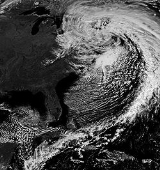
The April or Spring Nor’easter of 2007 was a nor'easter
that affected mainly the eastern parts of North America
during its four day course April 14 to April 17, 2007. The combined effects of high winds, heavy rainfall, and high tides led to flooding, storm damages, power outages, and evacuations, and disrupted traffic and commerce. In the north, heavy wet snow caused the loss of power for several thousands of homes in Ontario
and Quebec
. The storm caused at least 18 fatalities.
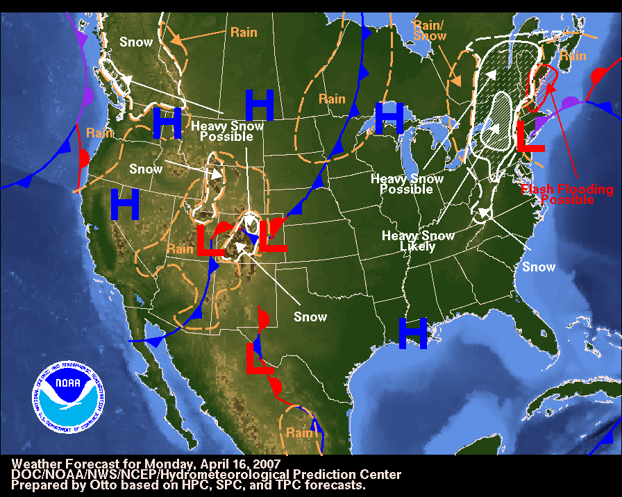
, on April 13. It brought high wind and fire danger to California
, Nevada
, New Mexico
and Arizona
. The storm then moved out into the southern Plains States, bringing heavy snow to Colorado, Oklahoma, and Texas. Heavy rain and severe thunderstorms, with hail, wind, and tornadoes, affected parts of Texas
, Louisiana
, Mississippi
, Alabama
, Georgia
, Florida
, and the Carolinas. The storm then moved across the Mid-Atlantic States, and into the Atlantic Ocean
, following the East Coast. The storm then rapidly intensified into a major nor'easter
, with the warm waters of the Gulf Stream
. The storm stalled just offshore from New York City
and continued to strengthen. The lowest barometric pressure recorded was 968 millibars (28.58 in Hg), equivalent to that of a moderate category 2 hurricane
.
 The National Weather Service
reported 7.57 inches (192 mm) of rain in Central Park
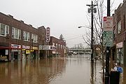
by midnight of April 15, the second heaviest rainfall in 24 hours on record, and indicated that this storm caused the worst flooding since Hurricane Floyd
in 1999.
Major airports in the New York area resumed flights on April 16, after having had to cancel over 500 flights before. Local rail and transit lines reported delays and cancellations affecting the MTA
, NJ Transit, LIRR
, and Metro-North Railroad
. Power failures affected several thousand people.
On April 16, 2007, the storm caused sustained winds of nearly 100 mph (87 knots) on, and near New Hampshire's Mount Washington
, with gusts topping out at 156 mph (136 knots).
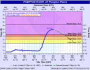
 While areas closer to the shore received heavy rainfall, higher regions inland received unseasonal snow. Several towns suffered from flooding including Mamaroneck
in New York, and Bound Brook
and Manville
in New Jersey, while coastal towns had to deal with damage from high tides. Most major highways in Westchester County, New York
were closed on April 15 and April 16 due to extreme flooding. In Quebec, several regions including the Laurentides and Charlevoix
regions received in excess of 6 inches (15 cm) of snow with areas exceeding well above 1 foot (30 cm) of snow. In the city of Ottawa
, 17 cm (5 in) of heavy wet snow fell in just a few hours causing power lines and trees to fall down causing scattered blackouts in several parts of the city. Similar damage was reported in the higher elevations north of Montreal and Ottawa.
In total, more than 175,000 homes in Canada suffered a power outage, including 160,000 Hydro-Québec
customers mainly in areas from Gatineau
towards Quebec City
including Montreal
, Lanaudière
and the Laurentians with an additional 15,000 Hydro One
and Hydro Ottawa customers. In the US over a quarter million homes lost power with New York and Pennsylvania being the hardest hit states due to the strong winds.
Governor Eliot Spitzer
of New York
activated 3,200 members of the National Guard
on alert. Richard Codey
, acting governor of New Jersey
, declared a state of emergency
.
 The storm was blamed for several fatalities, including one person in a tornado
in South Carolina, two people in storm-related traffic accidents in New York and Connecticut, two people in West Virginia, three people in New Jersey, and prior to its arrival in the East, five deaths in Kansas and Texas. In Quebec, an accident between a van and a tractor trailer killed five occupants of the van in a highway north of Montreal. Numerous other accidents were reported by OPP
and the Sûreté du Québec
during the storm.
The Boston Marathon
took place in what many considered to be the worst weather in its 110 year history. Race officials held serious talks about whether or not to cancel the race. The men's race had the slowest winning time in thirty years (1977). In the women's race, "[t]he rainy and windy conditions led to the slowest winning time since 1985".
High winds during the storm prevented emergency medical services
from using helicopters for evacuation
of the injured at the Virginia Tech massacre
.
The Internal Revenue Service
delayed by two days the deadline for tax filing for victims of the nor'easter.
While filing for federal disaster relief, acting governor Codey of New Jersey indicated that the storm caused $180 million in property damage in New Jersey, making it the second-worst rain storm in its history, after Hurricane Floyd
.
Nor'easter
A nor'easter is a type of macro-scale storm along the East Coast of the United States and Atlantic Canada, so named because the storm travels to the northeast from the south and the winds come from the northeast, especially in the coastal areas of the Northeastern United States and Atlantic Canada...
that affected mainly the eastern parts of North America
North America
North America is a continent wholly within the Northern Hemisphere and almost wholly within the Western Hemisphere. It is also considered a northern subcontinent of the Americas...
during its four day course April 14 to April 17, 2007. The combined effects of high winds, heavy rainfall, and high tides led to flooding, storm damages, power outages, and evacuations, and disrupted traffic and commerce. In the north, heavy wet snow caused the loss of power for several thousands of homes in Ontario
Ontario
Ontario is a province of Canada, located in east-central Canada. It is Canada's most populous province and second largest in total area. It is home to the nation's most populous city, Toronto, and the nation's capital, Ottawa....
and Quebec
Quebec
Quebec or is a province in east-central Canada. It is the only Canadian province with a predominantly French-speaking population and the only one whose sole official language is French at the provincial level....
. The storm caused at least 18 fatalities.
Meteorological synopsis
The storm that would become the April 2007 Nor'easter started in the southwestern United States as an upper-level disturbance in the jetstreamJetStream
JetStream and Mobile JetStream are two former brand names used by Telecom New Zealand to market its retail and resale ADSL-based fixed line and CDMA2000-based 3G wireless Internet access offerings respectively...
, on April 13. It brought high wind and fire danger to California
California
California is a state located on the West Coast of the United States. It is by far the most populous U.S. state, and the third-largest by land area...
, Nevada
Nevada
Nevada is a state in the western, mountain west, and southwestern regions of the United States. With an area of and a population of about 2.7 million, it is the 7th-largest and 35th-most populous state. Over two-thirds of Nevada's people live in the Las Vegas metropolitan area, which contains its...
, New Mexico
New Mexico
New Mexico is a state located in the southwest and western regions of the United States. New Mexico is also usually considered one of the Mountain States. With a population density of 16 per square mile, New Mexico is the sixth-most sparsely inhabited U.S...
and Arizona
Arizona
Arizona ; is a state located in the southwestern region of the United States. It is also part of the western United States and the mountain west. The capital and largest city is Phoenix...
. The storm then moved out into the southern Plains States, bringing heavy snow to Colorado, Oklahoma, and Texas. Heavy rain and severe thunderstorms, with hail, wind, and tornadoes, affected parts of Texas
Texas
Texas is the second largest U.S. state by both area and population, and the largest state by area in the contiguous United States.The name, based on the Caddo word "Tejas" meaning "friends" or "allies", was applied by the Spanish to the Caddo themselves and to the region of their settlement in...
, Louisiana
Louisiana
Louisiana is a state located in the southern region of the United States of America. Its capital is Baton Rouge and largest city is New Orleans. Louisiana is the only state in the U.S. with political subdivisions termed parishes, which are local governments equivalent to counties...
, Mississippi
Mississippi
Mississippi is a U.S. state located in the Southern United States. Jackson is the state capital and largest city. The name of the state derives from the Mississippi River, which flows along its western boundary, whose name comes from the Ojibwe word misi-ziibi...
, Alabama
Alabama
Alabama is a state located in the southeastern region of the United States. It is bordered by Tennessee to the north, Georgia to the east, Florida and the Gulf of Mexico to the south, and Mississippi to the west. Alabama ranks 30th in total land area and ranks second in the size of its inland...
, Georgia
Georgia (U.S. state)
Georgia is a state located in the southeastern United States. It was established in 1732, the last of the original Thirteen Colonies. The state is named after King George II of Great Britain. Georgia was the fourth state to ratify the United States Constitution, on January 2, 1788...
, Florida
Florida
Florida is a state in the southeastern United States, located on the nation's Atlantic and Gulf coasts. It is bordered to the west by the Gulf of Mexico, to the north by Alabama and Georgia and to the east by the Atlantic Ocean. With a population of 18,801,310 as measured by the 2010 census, it...
, and the Carolinas. The storm then moved across the Mid-Atlantic States, and into the Atlantic Ocean
Atlantic Ocean
The Atlantic Ocean is the second-largest of the world's oceanic divisions. With a total area of about , it covers approximately 20% of the Earth's surface and about 26% of its water surface area...
, following the East Coast. The storm then rapidly intensified into a major nor'easter
Nor'easter
A nor'easter is a type of macro-scale storm along the East Coast of the United States and Atlantic Canada, so named because the storm travels to the northeast from the south and the winds come from the northeast, especially in the coastal areas of the Northeastern United States and Atlantic Canada...
, with the warm waters of the Gulf Stream
Gulf Stream
The Gulf Stream, together with its northern extension towards Europe, the North Atlantic Drift, is a powerful, warm, and swift Atlantic ocean current that originates at the tip of Florida, and follows the eastern coastlines of the United States and Newfoundland before crossing the Atlantic Ocean...
. The storm stalled just offshore from New York City
New York City
New York is the most populous city in the United States and the center of the New York Metropolitan Area, one of the most populous metropolitan areas in the world. New York exerts a significant impact upon global commerce, finance, media, art, fashion, research, technology, education, and...
and continued to strengthen. The lowest barometric pressure recorded was 968 millibars (28.58 in Hg), equivalent to that of a moderate category 2 hurricane
Saffir-Simpson Hurricane Scale
The Saffir–Simpson Hurricane Scale , or the Saffir–Simpson Hurricane Wind Scale , classifies hurricanes — Western Hemisphere tropical cyclones that exceed the intensities of tropical depressions and tropical storms — into five categories distinguished by the intensities of their sustained winds...
.
Impact
National Weather Service
The National Weather Service , once known as the Weather Bureau, is one of the six scientific agencies that make up the National Oceanic and Atmospheric Administration of the United States government...
reported 7.57 inches (192 mm) of rain in Central Park
Central Park
Central Park is a public park in the center of Manhattan in New York City, United States. The park initially opened in 1857, on of city-owned land. In 1858, Frederick Law Olmsted and Calvert Vaux won a design competition to improve and expand the park with a plan they entitled the Greensward Plan...
by midnight of April 15, the second heaviest rainfall in 24 hours on record, and indicated that this storm caused the worst flooding since Hurricane Floyd
Hurricane Floyd
Hurricane Floyd was the sixth named storm, fourth hurricane, and third major hurricane in the 1999 Atlantic hurricane season. Floyd triggered the third largest evacuation in US history when 2.6 million coastal residents of five states were ordered from their homes as it approached...
in 1999.
Major airports in the New York area resumed flights on April 16, after having had to cancel over 500 flights before. Local rail and transit lines reported delays and cancellations affecting the MTA
Metropolitan Transportation Authority (New York)
The Metropolitan Transportation Authority of the State of New York is a public benefit corporation responsible for public transportation in the U.S...
, NJ Transit, LIRR
Lirr
Lirr or LIRR may refer to:*Long Island Rail Road, a commuter railroad in Long Island, New York, USA*Lapeer Industrial Railroad, in Lapeer, Michigan*Leeds Inner Ring Road, a motorway and A-road circling Leeds, West Yorkshire, England...
, and Metro-North Railroad
Metro-North Railroad
The Metro-North Commuter Railroad , trading as MTA Metro-North Railroad, or, more commonly, Metro-North, is a suburban commuter rail service that is run and managed by the Metropolitan Transportation Authority , an authority of New York State. It is the busiest commuter railroad in the United...
. Power failures affected several thousand people.
On April 16, 2007, the storm caused sustained winds of nearly 100 mph (87 knots) on, and near New Hampshire's Mount Washington
Mount Washington (New Hampshire)
Mount Washington is the highest peak in the Northeastern United States at , famous for dangerously erratic weather. For 76 years, a weather observatory on the summit held the record for the highest wind gust directly measured at the Earth's surface, , on the afternoon of April 12, 1934...
, with gusts topping out at 156 mph (136 knots).
Mamaroneck (village), New York
Mamaroneck is a village in Westchester County, New York, United States. The population was 18,929 at the 2010 census. It is located partially within the town of Mamaroneck and partially within the town of Rye. The portion in Rye is unofficially called "Rye Neck"...
in New York, and Bound Brook
Bound Brook, New Jersey
Bound Brook is a borough in Somerset County, New Jersey, United States. At the United States 2010 Census, the population was 10,402.Bound Brook was originally incorporated as a town by an Act of the New Jersey Legislature on March 24, 1869, within portions of Bridgewater Township...
and Manville
Manville, New Jersey
Manville is a Borough in Somerset County, New Jersey, United States. As of the 2010 United States Census, the borough population was 10,344. Manville was named after the Johns-Manville Corporation, which maintained a large manufacturing facility in the borough for decades.Historically, many of...
in New Jersey, while coastal towns had to deal with damage from high tides. Most major highways in Westchester County, New York
New York
New York is a state in the Northeastern region of the United States. It is the nation's third most populous state. New York is bordered by New Jersey and Pennsylvania to the south, and by Connecticut, Massachusetts and Vermont to the east...
were closed on April 15 and April 16 due to extreme flooding. In Quebec, several regions including the Laurentides and Charlevoix
Charlevoix
The Charlevoix region, located in Quebec, includes parts of the north shore of the Saint Lawrence River and the Laurentian Mountains region of the Canadian Shield...
regions received in excess of 6 inches (15 cm) of snow with areas exceeding well above 1 foot (30 cm) of snow. In the city of Ottawa
Ottawa
Ottawa is the capital of Canada, the second largest city in the Province of Ontario, and the fourth largest city in the country. The city is located on the south bank of the Ottawa River in the eastern portion of Southern Ontario...
, 17 cm (5 in) of heavy wet snow fell in just a few hours causing power lines and trees to fall down causing scattered blackouts in several parts of the city. Similar damage was reported in the higher elevations north of Montreal and Ottawa.
In total, more than 175,000 homes in Canada suffered a power outage, including 160,000 Hydro-Québec
Hydro-Québec
Hydro-Québec is a government-owned public utility established in 1944 by the Government of Quebec. Based in Montreal, the company is in charge of the generation, transmission and distribution of electricity across Quebec....
customers mainly in areas from Gatineau
Gatineau
Gatineau is a city in western Quebec, Canada. It is the fourth largest city in the province. It is located on the northern banks of the Ottawa River, immediately across from Ottawa, Ontario, and together they form Canada's National Capital Region. Ottawa and Gatineau comprise a single Census...
towards Quebec City
Quebec City
Quebec , also Québec, Quebec City or Québec City is the capital of the Canadian province of Quebec and is located within the Capitale-Nationale region. It is the second most populous city in Quebec after Montreal, which is about to the southwest...
including Montreal
Montreal
Montreal is a city in Canada. It is the largest city in the province of Quebec, the second-largest city in Canada and the seventh largest in North America...
, Lanaudière
Lanaudière
Lanaudière is one of the seventeen administrative regions of Quebec, Canada, situated immediately to the northeast of Montreal. It has a total population of 429,053 inhabitants.-Geography:...
and the Laurentians with an additional 15,000 Hydro One
Hydro One
Hydro One Incorporated delivers electricity across the Canadian province of Ontario. It is a Corporation established under the Business Corporations Act with a single shareholder, the Government of Ontario....
and Hydro Ottawa customers. In the US over a quarter million homes lost power with New York and Pennsylvania being the hardest hit states due to the strong winds.
Governor Eliot Spitzer
Eliot Spitzer
Eliot Laurence Spitzer is an American lawyer, former Democratic Party politician, and political commentator. He was the co-host of In the Arena, a talk-show and punditry forum broadcast on CNN until CNN cancelled his show in July of 2011...
of New York
New York
New York is a state in the Northeastern region of the United States. It is the nation's third most populous state. New York is bordered by New Jersey and Pennsylvania to the south, and by Connecticut, Massachusetts and Vermont to the east...
activated 3,200 members of the National Guard
United States National Guard
The National Guard of the United States is a reserve military force composed of state National Guard militia members or units under federally recognized active or inactive armed force service for the United States. Militia members are citizen soldiers, meaning they work part time for the National...
on alert. Richard Codey
Richard Codey
Richard James Codey is an American Democratic Party politician who served as the 53rd Governor of New Jersey from November 2004 to January 2006. He has served in the New Jersey Senate since 1981 and served as the President of the Senate from 2002 to January 2010. He represents the 27th Legislative...
, acting governor of New Jersey
New Jersey
New Jersey is a state in the Northeastern and Middle Atlantic regions of the United States. , its population was 8,791,894. It is bordered on the north and east by the state of New York, on the southeast and south by the Atlantic Ocean, on the west by Pennsylvania and on the southwest by Delaware...
, declared a state of emergency
State of emergency
A state of emergency is a governmental declaration that may suspend some normal functions of the executive, legislative and judicial powers, alert citizens to change their normal behaviours, or order government agencies to implement emergency preparedness plans. It can also be used as a rationale...
.
Tornado
A tornado is a violent, dangerous, rotating column of air that is in contact with both the surface of the earth and a cumulonimbus cloud or, in rare cases, the base of a cumulus cloud. They are often referred to as a twister or a cyclone, although the word cyclone is used in meteorology in a wider...
in South Carolina, two people in storm-related traffic accidents in New York and Connecticut, two people in West Virginia, three people in New Jersey, and prior to its arrival in the East, five deaths in Kansas and Texas. In Quebec, an accident between a van and a tractor trailer killed five occupants of the van in a highway north of Montreal. Numerous other accidents were reported by OPP
Ontario Provincial Police
The Ontario Provincial Police is the Provincial Police service for the province of Ontario, Canada.-Overview:The OPP is the the largest deployed police force in Ontario, and the second largest in Canada. The service is responsible for providing policing services throughout the province in areas...
and the Sûreté du Québec
Sûreté du Québec
Sûreté du Québec or SQ is the provincial police force for the Canadian province of Québec...
during the storm.
The Boston Marathon
Boston Marathon
The Boston Marathon is an annual marathon hosted by the U.S. city of Boston, Massachusetts, on Patriots' Day, the third Monday of April. Begun in 1897 and inspired by the success of the first modern-day marathon competition in the 1896 Summer Olympics, the Boston Marathon is the world's oldest...
took place in what many considered to be the worst weather in its 110 year history. Race officials held serious talks about whether or not to cancel the race. The men's race had the slowest winning time in thirty years (1977). In the women's race, "[t]he rainy and windy conditions led to the slowest winning time since 1985".
High winds during the storm prevented emergency medical services
Emergency medical services
Emergency medical services are a type of emergency service dedicated to providing out-of-hospital acute medical care and/or transport to definitive care, to patients with illnesses and injuries which the patient, or the medical practitioner, believes constitutes a medical emergency...
from using helicopters for evacuation
MEDEVAC
Medical evacuation, often termed Medevac or Medivac, is the timely and efficient movement and en route care provided by medical personnel to the wounded being evacuated from the battlefield or to injured patients being evacuated from the scene of an accident to receiving medical facilities using...
of the injured at the Virginia Tech massacre
Virginia Tech massacre
The Virginia Tech massacre was a school shooting that took place on April 16, 2007, on the campus of Virginia Polytechnic Institute and State University in Blacksburg, Virginia, United States. In two separate attacks, approximately two hours apart, the perpetrator, Seung-Hui Cho, killed 32 people...
.
The Internal Revenue Service
Internal Revenue Service
The Internal Revenue Service is the revenue service of the United States federal government. The agency is a bureau of the Department of the Treasury, and is under the immediate direction of the Commissioner of Internal Revenue...
delayed by two days the deadline for tax filing for victims of the nor'easter.
While filing for federal disaster relief, acting governor Codey of New Jersey indicated that the storm caused $180 million in property damage in New Jersey, making it the second-worst rain storm in its history, after Hurricane Floyd
Hurricane Floyd
Hurricane Floyd was the sixth named storm, fourth hurricane, and third major hurricane in the 1999 Atlantic hurricane season. Floyd triggered the third largest evacuation in US history when 2.6 million coastal residents of five states were ordered from their homes as it approached...
.
Tornado table
April 13 event
| F# Fujita scale The Fujita scale , or Fujita-Pearson scale, is a scale for rating tornado intensity, based primarily on the damage tornadoes inflict on human-built structures and vegetation... |
Location | County | Time (UTC) | Path length | Damage | |
|---|---|---|---|---|---|---|
| Texas Texas Texas is the second largest U.S. state by both area and population, and the largest state by area in the contiguous United States.The name, based on the Caddo word "Tejas" meaning "friends" or "allies", was applied by the Spanish to the Caddo themselves and to the region of their settlement in... |
||||||
| EF0 | NE of Rule Rule, Texas Rule is a town in Haskell County, Texas, United States. The population was 698 at the 2000 census.-Geography:Rule is located at .According to the United States Census Bureau, the town has a total area of , all of it land.... |
Haskell Haskell County, Texas As of the census of 2000, 6,093 people, 2,569 households, and 1,775 families resided in the county. The population density was 7 people per square mile . There were 3,555 housing units at an average density of 4 per square mile... |
1845 | 1 miles (1.6 km) |
Weak tornado producing no damage | |
| EF0 | S of Seymour Seymour, Texas Seymour is a city in and the county seat of Baylor County, Texas, United States. The population was 2,740 as of the 2010 Census.-Geography:Seymour is located at .... |
Baylor Baylor County, Texas As of the census of 2000, there were 4,093 people, 1,791 households, and 1,156 families residing in the county. The population density was 5 people per square mile . There were 2,820 housing units at an average density of 3 per square mile... |
1938 | 6 miles (9.6 km) |
Large tornado (1/2 mile wide) over rural areas producing no structural damage. | |
| EF0 | S of Benbrook Benbrook, Texas Benbrook is a city located in the southwestern corner of Tarrant County, Texas, in Texas's 12th congressional district, and a suburb of Fort Worth... |
Tarrant Tarrant County, Texas Tarrant County is a county located in the U.S. state of Texas. As of the 2010 U.S. Census, it had a population of 1,809,034. Its county seat is Fort Worth. Tarrant County is the sixteenth most populous county in the United States and the third most populous in Texas. The county is named in honor... |
2255 | 2 miles (3.2 km) |
Damage to trees, fences and signs as well as the facade of a business | |
| EF1 | NE of Fort Worth Fort Worth, Texas Fort Worth is the 16th-largest city in the United States of America and the fifth-largest city in the state of Texas. Located in North Central Texas, just southeast of the Texas Panhandle, the city is a cultural gateway into the American West and covers nearly in Tarrant, Parker, Denton, and... |
Tarrant Tarrant County, Texas Tarrant County is a county located in the U.S. state of Texas. As of the 2010 U.S. Census, it had a population of 1,809,034. Its county seat is Fort Worth. Tarrant County is the sixteenth most populous county in the United States and the third most populous in Texas. The county is named in honor... |
2309 | 6 miles (9.6 km) |
1 death - Several commercial buildings, homes, a grocery store and two churches were damaged with some recreational vehicles and trailers being destroyed. | |
| EF0 | NE of Dallas Dallas, Texas Dallas is the third-largest city in Texas and the ninth-largest in the United States. The Dallas-Fort Worth Metroplex is the largest metropolitan area in the South and fourth-largest metropolitan area in the United States... |
Dallas Dallas County, Texas As of the census of 2000, there were 2,218,899 people, 807,621 households, and 533,837 families residing in the county. The population density was 2,523 people per square mile . There were 854,119 housing units at an average density of 971/sq mi... |
0000 | 1 miles (1.6 km) |
Damage to roof of apartments, trees and fences | |
| EF0 | S of Royse City Royse City, Texas Royse City is a city in Rockwall County in the U.S. state of Texas. It also extends into Collin and Hunt Counties.The population was 2,957 at the 2000 census... |
Rockwall Rockwall County, Texas As of the census of 2000, there were 43,080 people, 14,530 households, and 11,972 families residing in the county. The population density was 334 people per square mile . There were 15,351 housing units at an average density of 119 per square mile... |
0045 | 2 miles (3.2 km) |
Two barns were destroyed and fences were downed | |
| EF0 | SW of Greenville Greenville, Texas Greenville is the county seat, and the largest city, of Hunt County, Texas, in the United States. As of the 2010 census, the city population was 25,557.... |
Hunt Hunt County, Texas As of the census of 2000, there were 76,596 people, 28,742 households, and 20,521 families residing in the county. The population density was 91 people per square mile . There were 32,490 housing units at an average density of 39 per square mile... |
0053 | unknown | Damage limited to trees | |
| Source: NCDC Storm Data | ||||||
April 14 event
| F# Fujita scale The Fujita scale , or Fujita-Pearson scale, is a scale for rating tornado intensity, based primarily on the damage tornadoes inflict on human-built structures and vegetation... |
Location | County | Time (UTC) | Path length | Damage | |
|---|---|---|---|---|---|---|
| Mississippi Mississippi Mississippi is a U.S. state located in the Southern United States. Jackson is the state capital and largest city. The name of the state derives from the Mississippi River, which flows along its western boundary, whose name comes from the Ojibwe word misi-ziibi... |
||||||
| EF0 | N of Pinebur | Marion Marion County, Mississippi -Demographics:As of the census of 2000, there were 25,595 people, 9,336 households, and 6,880 families residing in the county. The population density was 47 people per square mile . There were 10,395 housing units at an average density of 19 per square mile... |
1510 | unknown | Damage limited to trees | |
| EF0 | SE of Oak Bowery | Jones Jones County, Mississippi -History:Jones County, formed out parts of Covington and Wayne counties, was established on January 24, 1826 and was named for John Paul Jones. There are other counties named Jones, but it appears that this is the only one named for John Paul Jones... |
1535 | unknown | Brief tornado touchdown with no damage | |
| EF1 | SE of Petal Petal, Mississippi Petal is a city in Forrest County, Mississippi, United States, along the Leaf River. It is part of the Hattiesburg, Mississippi Metropolitan Statistical Area. The population is 10,617 per the US Census estimates performed in July 2007.... |
Forrest Forrest County, Mississippi The median income for a household in the county was $27,420, and the median income for a family was $35,791. Males had a median income of $28,742 versus $20,500 for females. The per capita income for the county was $15,160... |
1641 | 1 miles (1.6 km) |
One home had significant damage with the carport being destroyed and other damage to sidings, roof and windows. Trees were snapped or uprooted and a power pole also snapped | |
| Alabama Alabama Alabama is a state located in the southeastern region of the United States. It is bordered by Tennessee to the north, Georgia to the east, Florida and the Gulf of Mexico to the south, and Mississippi to the west. Alabama ranks 30th in total land area and ranks second in the size of its inland... |
||||||
| EF1 | Vredenburgh Vredenburgh, Alabama Vredenburgh is a town in Monroe County, Alabama, United States. At the 2000 census the population was 327.-Geography:Vredenburgh is located at .According to the U.S... area |
Monroe Monroe County, Alabama Monroe County is a county of the U.S. state of Alabama. Its name is in honor of James Monroe, fifth President of the United States. As of 2010, the population was 23,068. Its county seat is Monroeville. It is a dry county, in which the sale of alcoholic beverages is restricted or... |
1833 | 1 miles (1.6 km) |
Two churches were damage and a old home was pushed from its blocks. A microburst Microburst A microburst is a very localized column of sinking air, producing damaging divergent and straight-line winds at the surface that are similar to, but distinguishable from, tornadoes, which generally have convergent damage. There are two types of microbursts: wet microbursts and dry microbursts... in the area preceded the tornado. |
|
| EF0 | NW of Saville | Crenshaw Crenshaw County, Alabama Crenshaw County is a county of the U.S. state of Alabama. Its name is in honor of a judge, Anderson Crenshaw. As of 2010 the population was 13,906. Its county seat is Luverne.-Geography:... |
2100 | 1 miles (1.6 km) |
Damage to a poultry farm, three farm buildings and three other buildings | |
| EF1 | NW of Castleberry Castleberry, Alabama Castleberry is a town in Conecuh County, Alabama, United States. At the 2000 census the population was 590. Castleberry is known as the "Strawberry Capital of Alabama" and is home to the annual Castleberry Strawberry Festival.-Geography:... |
Conecuh Conecuh County, Alabama -2010:Whereas according to the 2010 U.S. Census Bureau:*51.3% White*46.5% Black*0.3% Native American*0.1% Asian*0.0% Native Hawaiian or Pacific Islander*1.0% Two or more races*1.2% Hispanic or Latino -2000:... |
2212 | unknown | One residence was damage and trees were blown down | |
| EF1 | Tanyard area | Bullock Bullock County, Alabama Bullock County, Alabama is a county of the U.S. state of Alabama. Its name is in honor of Colonel Edward C. Bullock of Barbour County. Living descendants of Colonel Bullock include prominent American cinema film actress, Sandra Bullock. As of 2010 the population was 10,914. In 1867, Union Springs... |
2311 | 3 miles (4.8 km) |
One barn was destroyed and several homes had minor roof damage. Trees were snapped or uprooted. | |
| EF1 | N of Ozark Ozark, Alabama Ozark is a city in and the county seat of Dale County, Alabama, United States. In 1990 the city population was 12,922. As of the 2000 census, the population of the city was 15,119.... |
Dale Dale County, Alabama Dale County is a county of the U.S. state of Alabama. Its name is in honor of General Samuel Dale. As of the 2010 census the population was 50,251... |
0005 | 6 miles (9.6 km) |
A carport, two sheds, a barn and a greenhouse were destroyed. Some homes sustained some damage. A residential gable collapsed and numerous were snapped or blown down. | |
| Georgia | ||||||
| EF0 | N of Morgan Morgan, Georgia Morgan is a city in Calhoun County, Georgia, United States. The population was 1,464 at the 2000 census. The city is the county seat of Calhoun County.-Geography:Morgan is located at .... |
Calhoun Calhoun County, Georgia Calhoun County is a county located in the U.S. state of Georgia. It was created on February 20, 1854. As of 2000, the population was 6,320. The 2007 Census Estimate shows a population of 6,098... |
0145 | 1 miles (1.6 km) |
One structure was damaged and trees were knocked down | |
| EF1 | NW of Leesburg Leesburg, Georgia Leesburg is a city in Lee County, Georgia, United States. The population was 2,965 at the 2009 census estimate. The city is the county seat of Lee County.Leesburg is part of the Albany, Georgia Metropolitan Statistical Area.-Geography:... |
Lee Lee County, Georgia Lee County is a county located in the U.S. state of Georgia. As of 2000, the population was 24,757. The 2007 Census Estimate shows a population of 33,050... |
0230 | 2 miles (3.2 km) |
Fifteen structures were damaged including a mobile home and a frame home being destroyed. Trees and power lines were downed. | |
| EF1 | Eastman Eastman, Georgia Eastman is a city in Dodge County, Georgia, United States. The population was 13,541 at the 2000 census. The city is the county seat of Dodge County... area |
Dodge Dodge County, Georgia Dodge County is a county located in the U.S. state of Georgia. As of 2000, the population was 19,171. The 2007 Census Estimate shows a population of 20,042. The county seat is Eastman. Dodge County lies in the Historic South region of Georgia, an area that has architectural wonders and shows the... |
0523 | 4 miles (6.4 km) |
A greenhouse, an announcers booth at a football field and two mobile homes were destroyed. One home was destroyed by a fallen tree injuring both occupants. Trees and power lines were downed some on homes. | |
| EF2 | S of Dublin Dublin, Georgia Dublin is a city in Laurens County, Georgia, United States. As of the 2010 census, the city had a population of 16,201. The city is the county seat of Laurens County.-History:The original settlement was named after the city Dublin, Ireland.... |
Laurens Laurens County, Georgia Laurens County is a county located in the U.S. state of Georgia. It was created on December 10, 1807. As of 2000, the population was 44,874. The 2007 Census Estimate shows a population of 47,520... |
0545 | 6 miles (9.6 km) |
Two mobile homes and greenhouse were destroyed while several mobile homes and homes were damaged. 3 people were injured. | |
| EF0 | NE of Cedar Grove | Laurens Laurens County, Georgia Laurens County is a county located in the U.S. state of Georgia. It was created on December 10, 1807. As of 2000, the population was 44,874. The 2007 Census Estimate shows a population of 47,520... |
0550 | 6 miles (9.6 km) |
Outbuildings and trees were damaged | |
| EF1 | SE of Orland to NW of Norristown Junction | Treutlen Treutlen County, Georgia Treutlen County is a county located in the U.S. state of Georgia. As of 2000, the population was 6,854. The 2007 Census Estimate shows a population of 6,938. The county seat is Soperton... , Emanuel Emanuel County, Georgia Emanuel County is a county located in the U.S. state of Georgia. As of 2000, the population was 21,837. The 2007 Census Estimate shows a population of 22,469. The county seat is Swainsboro.-History:... , Johnson Johnson County, Georgia Johnson County is a county located in the U.S. state of Georgia. As of 2000, the population was 8,560. The 2007 Census Estimate shows a population of 9,533... |
0604 | 14 miles (22.4 km) |
One mobile home was rolled over and a utility building lost portions of its roof. About a dozen homes in Adrian were damaged. Two homes at a campground were also damaged due to fallen trees. In Orianna homes were damaged some heavily and two outbuildings were destroyed. A mobile home was also destroyed in Emanuel County near the end of the path. | |
| EF1 | SE of Dublin Dublin, Georgia Dublin is a city in Laurens County, Georgia, United States. As of the 2010 census, the city had a population of 16,201. The city is the county seat of Laurens County.-History:The original settlement was named after the city Dublin, Ireland.... to SW of Kite Kite, Georgia Kite is a town in Johnson County, Georgia, USA, along the Little Ohoopee River. The town was named after Shaderick Kight, who donated the land to build the town. He requested the simpler spelling of the name for more efficient mail delivery and processing. The population was 241 at the 2000 census... |
Laurens Laurens County, Georgia Laurens County is a county located in the U.S. state of Georgia. It was created on December 10, 1807. As of 2000, the population was 44,874. The 2007 Census Estimate shows a population of 47,520... , Johnson Johnson County, Georgia Johnson County is a county located in the U.S. state of Georgia. As of 2000, the population was 8,560. The 2007 Census Estimate shows a population of 9,533... |
0605 | 19 miles (30.4 km) |
Outbuildings were destroyed. Several homes had minor to moderate damage while a church and family life center were also damaged. | |
| EF2 | E of Twin City Twin City, Georgia Twin City is a city in Emanuel County, Georgia, United States. As of the 2000 census, the city had a total population of 1,752.-History:Twin City gets its name from the combining of two adjacent cities: Graymont and Summit.-Geography:... |
Emanuel Emanuel County, Georgia Emanuel County is a county located in the U.S. state of Georgia. As of 2000, the population was 21,837. The 2007 Census Estimate shows a population of 22,469. The county seat is Swainsboro.-History:... |
0656 | 5 miles (8 km) |
Outbuildings were destroyed while a mobile home and two homes were heavily damaged. | |
| EF1 | S of Warwick Warwick, Georgia Warwick is a city in Worth County, Georgia, United States. The population was 430 at the 2000 census. It is part of the Albany, Georgia Metropolitan Statistical Area.-Geography:Warwick is located at .... to NE of Arabi Arabi, Georgia Arabi is a town in Crisp County, Georgia, United States. The population was 456 at the 2000 census.-Geography:Arabi is located at .... |
Worth Worth County, Georgia Worth County is a county located in the southwestern part of the U.S. state of Georgia. As of 2000, the population was 21,967. The 2007 Census Estimate shows a population of 21,285... , Crisp Crisp County, Georgia Crisp County is a county located in the U.S. state of Georgia. It was created on August 17, 1905 and named for Charles Frederick Crisp. As of 2000, the population was 21,996. The 2007 Census Estimate shows a population of 22,125... |
0723 | 15 miles (24 km) |
A home and several silos were damaged while trees and power lines were downed. A mobile home was also pushed off its foundation while a car was thrown into a guard rail on Interstate 75 Interstate 75 Interstate 75 is a major north–south Interstate Highway in the Great Lakes and Southeastern regions of the United States. It travels from State Road 826 and State Road 924 in Hialeah, Florida to Sault Ste. Marie, Michigan, at the Ontario, Canada, border... |
|
| Source: NCDC Storm Data | ||||||
April 15 event
| F# Fujita scale The Fujita scale , or Fujita-Pearson scale, is a scale for rating tornado intensity, based primarily on the damage tornadoes inflict on human-built structures and vegetation... |
Location | County | Time (UTC) | Path length | Damage | |
|---|---|---|---|---|---|---|
| Georgia | ||||||
| EF2 | SE of Eastman Eastman, Georgia Eastman is a city in Dodge County, Georgia, United States. The population was 13,541 at the 2000 census. The city is the county seat of Dodge County... |
Dodge Dodge County, Georgia Dodge County is a county located in the U.S. state of Georgia. As of 2000, the population was 19,171. The 2007 Census Estimate shows a population of 20,042. The county seat is Eastman. Dodge County lies in the Historic South region of Georgia, an area that has architectural wonders and shows the... |
0825 | 4 miles (6.4 km) |
Two mobile homes, a barn and a garage were destroyed while several homes sustained minor to heavy damage. | |
| Florida Florida Florida is a state in the southeastern United States, located on the nation's Atlantic and Gulf coasts. It is bordered to the west by the Gulf of Mexico, to the north by Alabama and Georgia and to the east by the Atlantic Ocean. With a population of 18,801,310 as measured by the 2010 census, it... |
||||||
| EF2 | NW of Baxter | Baker Baker County, Florida Baker County is a county located in the U.S. state of Florida. As of 2000, the population was 22,259. The U.S. Census Bureau 2008 estimate for the county is 26,164 . Its county seat is Macclenny, Florida. While primarily rural, the county is included in the Jacksonville Metropolitan Area.-... |
1115 | 2 miles (3.2 km) |
One home had property damage with widespread tree damage and an outbuilding destroyed | |
| EF1 | NW of Summer Haven | St. Johns St. Johns County, Florida St. Johns County is a county located in northeastern Florida. As of the 2010 census, the population was 190,039. The county seat is St. Augustine. Due to the inclusion of Ponte Vedra Beach, it is one of the highest-income counties in the United States.... |
1410 | unknown | Boat house roofs were blown off, trees were snapped and some structures had window damage. Signs were also damaged | |
| EF0 | Dundee Dundee, Florida Dundee is a town in Polk County, Florida, United States. The population was 2,912 at the 2000 census. As of 2004, the population recorded by the U.S. Census Bureau is 3,008... area |
Polk Polk County, Florida Polk County is located in central Florida between the Tampa Bay and Greater Orlando metropolitan areas. The county was established by the state government in 1861 on the eve of the American Civil War and named after former United States president James K. Polk. The county seat is Bartow and its... |
1600 | 2 miles (3.2 km) |
Several manufactured homes were damaged to various degrees some were left inhabitable. | |
| South Carolina South Carolina South Carolina is a state in the Deep South of the United States that borders Georgia to the south, North Carolina to the north, and the Atlantic Ocean to the east. Originally part of the Province of Carolina, the Province of South Carolina was one of the 13 colonies that declared independence... |
||||||
| EF0 | E of Springton | Bamberg Bamberg County, South Carolina -Demographics:As of the census of 2000, there were 16,658 people, 6,123 households, and 4,255 families residing in the county. The population density was 42 people per square mile . There were 7,130 housing units at an average density of 18 per square mile... |
1147 | 8 miles (12.8 km) |
Damage to trees and power lines | |
| EF0 | E of Ehrhardt Ehrhardt, South Carolina Ehrhardt is a town in Bamberg County, South Carolina, United States. As of the 2000 census, the town population was 614.-Geography:Ehrhardt is located at .... |
Bamberg Bamberg County, South Carolina -Demographics:As of the census of 2000, there were 16,658 people, 6,123 households, and 4,255 families residing in the county. The population density was 42 people per square mile . There were 7,130 housing units at an average density of 18 per square mile... |
1211 | 4 miles (6.4 km) |
Damage limited to trees. | |
| EF3 | NW of Pinewood Pinewood, South Carolina Pinewood is a town located on South Carolina Highway 261 at the southern entrance to the High Hills of Santee in Sumter County, South Carolina, United States. The population was 459 at the 2000 census... to NW of Mayesville Mayesville, South Carolina Mayesville is a town in Sumter County, South Carolina, United States. The population was 1,001 at the 2000 census. It is included in the Sumter, South Carolina Metropolitan Statistical Area.-Geography:Mayesville is located at .... |
Sumter | 1220 | 19 miles (30.4 km) |
1 death - Seven mobile homes were destroyed, nine frame homes were severely damaged while 62 mobile and frame homes were damaged at varying degrees. 5 other people were injured. | |
| EF1 | E of St. Charles | Lee | 1250 | 4 miles (6.4 km) |
Minor damage to a mobile home and church while trees and power lines were downed | |
| EF0 | Bowman Bowman, South Carolina Bowman is a town in Orangeburg County, South Carolina, United States. The population was 1,198 at the 2000 census.-Geography:Bowman is located at .According to the United States Census Bureau, the town has a total area of , all of it land.-History:... area |
Orangeburg | 1337 | 6 miles (9.6 km) |
Damage to trees and power lines | |
| EF1 | S of Islandton | Colleton | 1338 | 1 miles (1.6 km) |
A large barn was destroyed while a home was damaged. A horse trailer and a grain wagon were carried some distance while a bass boat was flipped over. Farm equipment was also damaged while trees were downed including one that damaged a mobile home. | |
| EF1 | SE of Islandton | Colleton | 1341 | 1 miles (1.6 km) |
A outbuilding was destroyed while two empty grain silos were carried some distance. A dog was severely injured. | |
| EF1 | SW of Ruffin | Colleton | 1344 | 8 miles (12.8 km) |
3 mobile homes were overturned and seven others were shifted from their foundations. Another mobile home, a vehicle and an outbuilding were damaged while a storage shed was destroyed and trees were snapped or uprooted. 9 people had minor damage | |
| Source: NCDC Storm Data | ||||||