

Antioch, Pisidia
Encyclopedia
Roman Empire
The Roman Empire was the post-Republican period of the ancient Roman civilization, characterised by an autocratic form of government and large territorial holdings in Europe and around the Mediterranean....
, Latin: Antiochia Caesareia or Antiochia Caesaria – is a city in the Turkish Lakes Region, which is at the crossroads of the Mediterranean, Aegean
Aegean Sea
The Aegean Sea[p] is an elongated embayment of the Mediterranean Sea located between the southern Balkan and Anatolian peninsulas, i.e., between the mainlands of Greece and Turkey. In the north, it is connected to the Marmara Sea and Black Sea by the Dardanelles and Bosporus...
and Central Anatolia
Anatolia
Anatolia is a geographic and historical term denoting the westernmost protrusion of Asia, comprising the majority of the Republic of Turkey...
n regions, and formerly on the border of Pisidia
Pisidia
Pisidia was a region of ancient Asia Minor located north of Lycia, and bordering Caria, Lydia, Phrygia and Pamphylia. It corresponds roughly to the modern-day province of Antalya in Turkey...
and Phrygia
Phrygia
In antiquity, Phrygia was a kingdom in the west central part of Anatolia, in what is now modern-day Turkey. The Phrygians initially lived in the southern Balkans; according to Herodotus, under the name of Bryges , changing it to Phruges after their final migration to Anatolia, via the...
, hence also known as Antiochia in Phrygia. The site lies approximately 1 km northeast of Yalvaç
Yalvaç
Yalvaç is a town and district of Isparta Province in the Mediterranean region of Turkey. The population is 20,259 as of 2010.-Twin towns - Sister cities:Yalvaç is twinned with: Bethlehem, Palestinian Authority -External links:*...
, the modern town of Isparta Province
Isparta Province
Isparta Province is a province in southwestern Turkey. Its adjacent provinces are Afyon to the northwest, Burdur to the southwest, Antalya to the south, and Konya to the east. It has an area of 8,993 km² and a population of 448,298 up from 434,771...
. The city is on a hill with its highest point of 1236 m in the north.
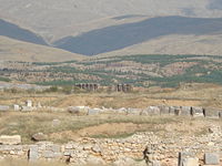
Geography
The city is surrounded by, on the east the deep ravine of the Anthius River which flows into Lake EğirdirLake Egirdir
Eğirdir is the name of a lake and of the town situated on the shore of that lake in Turkey. The lake lies in the Turkish Lakes Region and is 186 kilometers north of Antalya...
, with the Sultan Mountains
Sultan Mountains
The Sultan Mountains , also known as Sultan Dagh range or Sultan Dag, is a short mountain range on the western edge of the Anatolian Plateau, Turkey with highest elevation of .The town of Sultandağı is their namesake....
to the northeast, Mount Karakuş to the north, Kızıldağ (Red Mountain
Red Mountain
-Canada:* Red Mountain , a mountain near Rossland, British Columbia** Red Mountain Resort, a ski resort on Red Mountain in Rossland, also known as Red Resort* Mount Price, a volcano in British Columbia, Canada formerly known as Red Mountain...
) to the southeast, Kirişli Mountain and the northern shore of Lake Eğirdir to the southwest.
Although very close to Mediterranean on the map, the warm climate of the south cannot pass the height of the Taurus Mountains
Taurus Mountains
Taurus Mountains are a mountain complex in southern Turkey, dividing the Mediterranean coastal region of southern Turkey from the central Anatolian Plateau. The system extends along a curve from Lake Eğirdir in the west to the upper reaches of the Euphrates and Tigris rivers in the east...
. Owing to the climate, there is no timberland but crop plants grow in areas provided with water from the Sultan Mountains, whose annual average rainfall is c. 1000 mm on the peaks and 500 mm on the slopes. This water feeds the plateau and Antioch. The other Pisidia
Pisidia
Pisidia was a region of ancient Asia Minor located north of Lycia, and bordering Caria, Lydia, Phrygia and Pamphylia. It corresponds roughly to the modern-day province of Antalya in Turkey...
n cities Neapolis
Neapolis, Pisidia
Neapolis is an ancient town in Pisidia, a few miles south of Antioch. Pliny mentions it as a town of the Roman province of Galatia, which embraced a portion of Pisidia. Franz identifies its site with Tutinek, where some ancient remains still exist.-References:*Smith, William ; Dictionary of Greek...
, Tyriacum, Laodiceia Katakekaumene
Laodicea Combusta
Laodicea or Laodicea Combusta – ), also transliterated as Laodiceia or Laodikeia; also Laodikeia Katakekaumenê and Λαοδίκεια Κεκαυμένη; later Claudiolaodicea – was a Hellenistic city in central Anatolia, in the region of Pisidia; its site is currently occupied by Ladik, Konya Province,...
and Philomelium founded on the slopes, benefited from this fertility.
The acropolis
Acropolis
Acropolis means "high city" in Greek, literally city on the extremity and is usually translated into English as Citadel . For purposes of defense, early people naturally chose elevated ground to build a new settlement, frequently a hill with precipitous sides...
has an area of 460,000 square metres (115 acres) and is surrounded by fortified defence walls. The Territorium of the settlement can be seen from the Temple of Men in the sanctuary of Men Askaenos on a hill to the southeast. The Territorium of the city is estimated to have been approximately 1,400 km² in ancient times. According to the 1950 census, there were 40 villages with 50,000 people living in the area. The population during the Roman
Ancient Rome
Ancient Rome was a thriving civilization that grew on the Italian Peninsula as early as the 8th century BC. Located along the Mediterranean Sea and centered on the city of Rome, it expanded to one of the largest empires in the ancient world....
period must have been a little more than this.
The constantly irrigated fertile soil of the land is very suitable for growing fruits and for husbandry. For the veterans (retired Roman legionaries
Legionary
The Roman legionary was a professional soldier of the Roman army after the Marian reforms of 107 BC. Legionaries had to be Roman citizens under the age of 45. They enlisted in a legion for twenty-five years of service, a change from the early practice of enlisting only for a campaign...
) who came from poorer parts of Italy
Italy
Italy , officially the Italian Republic languages]] under the European Charter for Regional or Minority Languages. In each of these, Italy's official name is as follows:;;;;;;;;), is a unitary parliamentary republic in South-Central Europe. To the north it borders France, Switzerland, Austria and...
during the Roman period, agriculture must have been the driving force for integration of the colonies into the area.
The modern town of Yalvaç is the second biggest in Isparta province with an area of 14,000 km² The population in the centre is 35,000, the total is c. 100,000. The town is 230 km from Antalya
Antalya
Antalya is a city on the Mediterranean coast of southwestern Turkey. With a population 1,001,318 as of 2010. It is the eighth most populous city in Turkey and country's biggest international sea resort.- History :...
, 180 km from Konya
Konya
Konya is a city in the Central Anatolia Region of Turkey. The metropolitan area in the entire Konya Province had a population of 1,036,027 as of 2010, making the city seventh most populous in Turkey.-Etymology:...
, 105 km from Isparta and 50 km from Akşehir
Aksehir
Akşehir is a town and district of Konya Province in the Central Anatolia region of Turkey. According to 2000 census, population of the district is 114,918 of which 63,000 live in the town of Akşehir...
, via the main road.
Prehistory
It has been a tradition to claim that the city dates back to the 3rd century BC and that it was founded by the Seleucid DynastySeleucid dynasty
The Seleucid dynasty or the Seleucidae was a Greek Macedonian royal family, founded by Seleucus I Nicator , which ruled the Seleucid Kingdom centered in the Near East and regions of the Asian part of the earlier Achaemenid Persian Empire during the Hellenistic period.-History:Seleucus was an...
, one of the Hellenistic kingdoms. But the history of the city cannot be separated from the history of the Lakes Region and of Pisidia
Pisidia
Pisidia was a region of ancient Asia Minor located north of Lycia, and bordering Caria, Lydia, Phrygia and Pamphylia. It corresponds roughly to the modern-day province of Antalya in Turkey...
. Research done in the area has shown habitation since the Paleolithic
Paleolithic
The Paleolithic Age, Era or Period, is a prehistoric period of human history distinguished by the development of the most primitive stone tools discovered , and covers roughly 99% of human technological prehistory...
age.
During the excavations and surveys made by D.M. Robinson and the University of Michigan around Yalvaç in 1924 it was shown that finds from surrounding mounds date back to the 3rd millennium BC
3rd millennium BC
The 3rd millennium BC spans the Early to Middle Bronze Age.It represents a period of time in which imperialism, or the desire to conquer, grew to prominence, in the city states of the Middle East, but also throughout Eurasia, with Indo-European expansion to Anatolia, Europe and Central Asia. The...
.
In Antioch itself, no finds have emerged from the Proto-Hittite, Hittite
Hittites
The Hittites were a Bronze Age people of Anatolia.They established a kingdom centered at Hattusa in north-central Anatolia c. the 18th century BC. The Hittite empire reached its height c...
, Phrygia
Phrygia
In antiquity, Phrygia was a kingdom in the west central part of Anatolia, in what is now modern-day Turkey. The Phrygians initially lived in the southern Balkans; according to Herodotus, under the name of Bryges , changing it to Phruges after their final migration to Anatolia, via the...
n or Lydia
Lydia
Lydia was an Iron Age kingdom of western Asia Minor located generally east of ancient Ionia in the modern Turkish provinces of Manisa and inland İzmir. Its population spoke an Anatolian language known as Lydian....
n civilisations, but we learn from Hittite
Hittite language
Hittite is the extinct language once spoken by the Hittites, a people who created an empire centred on Hattusa in north-central Anatolia...
records that the region was named "Arzawa
Arzawa
Arzawa in the second half of the second millennium BC was the name of a region and a political entity in Western Anatolia, the core area of which was centered on the Hermos and Maeander river valleys, corresponding with the Late Bronze Age kingdoms of the...
" and that independent communities lived in the region. These people did not come under the yoke of the Hittites, but fought beside them against the Egyptians
History of Ancient Egypt
The History of Ancient Egypt spans the period from the early predynastic settlements of the northern Nile Valley to the Roman conquest in 30 BC...
in the Battle of Kadesh
Kadesh
This article is about Kadesh in the lands of the Amurru, bordering on Damascus Syria up to Hammath; see also Kadesh or Kedesh Kadesh was an ancient city of the Levant, located on or near the headwaters or ford of the Orontes River...
.
Over the ages, people were able to live independently in the Pisidian region because of its strategical position. Even the Persians, who conquered Anatolia
Anatolia
Anatolia is a geographic and historical term denoting the westernmost protrusion of Asia, comprising the majority of the Republic of Turkey...
in the 6th century BC, and attempted to rule the area by dividing it into satrap
Satrap
Satrap was the name given to the governors of the provinces of the ancient Median and Achaemenid Empires and in several of their successors, such as the Sassanid Empire and the Hellenistic empires....
ies, were unable to cope with constant uprisings and turmoil.
The approach of some researchers who would like to connect the cult of Men Askaenos with the cult of the Phrygia
Phrygia
In antiquity, Phrygia was a kingdom in the west central part of Anatolia, in what is now modern-day Turkey. The Phrygians initially lived in the southern Balkans; according to Herodotus, under the name of Bryges , changing it to Phruges after their final migration to Anatolia, via the...
n Mother Goddess Cybele
Cybele
Cybele , was a Phrygian form of the Earth Mother or Great Mother. As with Greek Gaia , her Minoan equivalent Rhea and some aspects of Demeter, Cybele embodies the fertile Earth...
is also controversial. The worship of Cybele
Cybele
Cybele , was a Phrygian form of the Earth Mother or Great Mother. As with Greek Gaia , her Minoan equivalent Rhea and some aspects of Demeter, Cybele embodies the fertile Earth...
, traces of which can be seen in Antioch, is not a result of Phrygia
Phrygia
In antiquity, Phrygia was a kingdom in the west central part of Anatolia, in what is now modern-day Turkey. The Phrygians initially lived in the southern Balkans; according to Herodotus, under the name of Bryges , changing it to Phruges after their final migration to Anatolia, via the...
n influence: the idea of a Mother Goddess
Mother goddess
Mother goddess is a term used to refer to a goddess who represents motherhood, fertility, creation or embodies the bounty of the Earth. When equated with the Earth or the natural world such goddesses are sometimes referred to as Mother Earth or as the Earth Mother.Many different goddesses have...
dates back to the Neolithic
Neolithic
The Neolithic Age, Era, or Period, or New Stone Age, was a period in the development of human technology, beginning about 9500 BC in some parts of the Middle East, and later in other parts of the world. It is traditionally considered as the last part of the Stone Age...
age as is shown by idols and figurines exhibited in Yalvaç Museum.
Hellenistic age
After the death of Alexander the Great, Seleucus I NicatorSeleucus I Nicator
Seleucus I was a Macedonian officer of Alexander the Great and one of the Diadochi. In the Wars of the Diadochi that took place after Alexander's death, Seleucus established the Seleucid dynasty and the Seleucid Empire...
, founder of the Seleucid Dynasty, took control of Pisidia. Captured places were Hellenised
Hellenization
Hellenization is a term used to describe the spread of ancient Greek culture, and, to a lesser extent, language. It is mainly used to describe the spread of Hellenistic civilization during the Hellenistic period following the campaigns of Alexander the Great of Macedon...
and, in order to protect the population, fortified cities were founded at strategically important places, usually on an acropolis
Acropolis
Acropolis means "high city" in Greek, literally city on the extremity and is usually translated into English as Citadel . For purposes of defense, early people naturally chose elevated ground to build a new settlement, frequently a hill with precipitous sides...
. Seleucus I Nicator
Seleucus I Nicator
Seleucus I was a Macedonian officer of Alexander the Great and one of the Diadochi. In the Wars of the Diadochi that took place after Alexander's death, Seleucus established the Seleucid dynasty and the Seleucid Empire...
had nearly 60 cities founded, and gave to 16 of them the name of his father Antiochos. Colonists were brought from Magnesia on the Maeander
Magnesia on the Maeander
Magnesia or Magnesia on the Maeander was an ancient Greek city in Anatolia, considerable in size, at an important location commercially and strategically in the triangle of Priene, Ephesus and Tralles. The city was named Magnesia, after the Magnetes from Thessaly who settled the area along with...
to found Pisidian Antioch (the Land of Antiochus).
Meanwhile, fights for the sharing of Anatolia
Anatolia
Anatolia is a geographic and historical term denoting the westernmost protrusion of Asia, comprising the majority of the Republic of Turkey...
continued and were complicated by the Galatia
Galatia
Ancient Galatia was an area in the highlands of central Anatolia in modern Turkey. Galatia was named for the immigrant Gauls from Thrace , who settled here and became its ruling caste in the 3rd century BC, following the Gallic invasion of the Balkans in 279 BC. It has been called the "Gallia" of...
ns coming in from Europe. The self-interested Hellenistic
Hellenistic civilization
Hellenistic civilization represents the zenith of Greek influence in the ancient world from 323 BCE to about 146 BCE...
dynasties could not expel the Galatia
Galatia
Ancient Galatia was an area in the highlands of central Anatolia in modern Turkey. Galatia was named for the immigrant Gauls from Thrace , who settled here and became its ruling caste in the 3rd century BC, following the Gallic invasion of the Balkans in 279 BC. It has been called the "Gallia" of...
ns from the interior, but Antiochus I Seleucos
Antiochus I Soter
Antiochus I Soter , was a king of the Hellenistic Seleucid Empire. He reigned from 281 BC - 261 BC....
fought against them in 270 BC in the Taurus Mountains
Taurus Mountains
Taurus Mountains are a mountain complex in southern Turkey, dividing the Mediterranean coastal region of southern Turkey from the central Anatolian Plateau. The system extends along a curve from Lake Eğirdir in the west to the upper reaches of the Euphrates and Tigris rivers in the east...
and defeated them by the help of elephants, which the Galatia
Galatia
Ancient Galatia was an area in the highlands of central Anatolia in modern Turkey. Galatia was named for the immigrant Gauls from Thrace , who settled here and became its ruling caste in the 3rd century BC, following the Gallic invasion of the Balkans in 279 BC. It has been called the "Gallia" of...
ns had never seen before. The historian Lucian
Lucian
Lucian of Samosata was a rhetorician and satirist who wrote in the Greek language. He is noted for his witty and scoffing nature.His ethnicity is disputed and is attributed as Assyrian according to Frye and Parpola, and Syrian according to Joseph....
reported the comment of Antiochos
Antiochus I Soter
Antiochus I Soter , was a king of the Hellenistic Seleucid Empire. He reigned from 281 BC - 261 BC....
: "It's a great shame that we owe our liberation to 16 elephants". Anyway, Antiochos celebrated his victory when he returned to Syria and was given the title of "Soter" (Saviour).
The most reasonable approach is that Antioch was founded by Antiochus I Soter
Antiochus I Soter
Antiochus I Soter , was a king of the Hellenistic Seleucid Empire. He reigned from 281 BC - 261 BC....
as a military base to control the Galatian attacks because it was on the border of the regions of Pisidia and Phrygia
Phrygia
In antiquity, Phrygia was a kingdom in the west central part of Anatolia, in what is now modern-day Turkey. The Phrygians initially lived in the southern Balkans; according to Herodotus, under the name of Bryges , changing it to Phruges after their final migration to Anatolia, via the...
. The foundation of Antioch indicates a date of the last quarter of the 3rd century BC, but archeological finds at the Sanctuary of Men Askaenos
Men (god)
Men was a god worshipped in the western interior parts of Anatolia.The roots of the Men cult may go back to Mesopotamia in the fourth millennium BC. Ancient writers describe Men as a local god of the Phrygians....
in the northeast date back to the 4th century. This indicates that there had been earlier classical cultures in the area.
Roman period
While the Hellenistic Kingdoms (the inheritors of Alexander the Great) were fighting each other and the Galatians, RomeAncient Rome
Ancient Rome was a thriving civilization that grew on the Italian Peninsula as early as the 8th century BC. Located along the Mediterranean Sea and centered on the city of Rome, it expanded to one of the largest empires in the ancient world....
became the most powerful state in Europe and started to follow a policy of expansion to the east. They invaded Macedon
Macedon
Macedonia or Macedon was an ancient kingdom, centered in the northeastern part of the Greek peninsula, bordered by Epirus to the west, Paeonia to the north, the region of Thrace to the east and Thessaly to the south....
, Thrace
Thrace
Thrace is a historical and geographic area in southeast Europe. As a geographical concept, Thrace designates a region bounded by the Balkan Mountains on the north, Rhodope Mountains and the Aegean Sea on the south, and by the Black Sea and the Sea of Marmara on the east...
, and the Dardanelles
Dardanelles
The Dardanelles , formerly known as the Hellespont, is a narrow strait in northwestern Turkey connecting the Aegean Sea to the Sea of Marmara. It is one of the Turkish Straits, along with its counterpart the Bosphorus. It is located at approximately...
, and reaching Phrygia
Phrygia
In antiquity, Phrygia was a kingdom in the west central part of Anatolia, in what is now modern-day Turkey. The Phrygians initially lived in the southern Balkans; according to Herodotus, under the name of Bryges , changing it to Phruges after their final migration to Anatolia, via the...
via Magnesia
Battle of Magnesia
The Battle of Magnesia was fought in 190 BC near Magnesia ad Sipylum, on the plains of Lydia , between the Romans, led by the consul Lucius Cornelius Scipio and his brother, the famed general Scipio Africanus, with their ally Eumenes II of Pergamum against the army of Antiochus III the Great of the...
and Pisidia. They cowed the Galatians and according to the treaty
Treaty of Apamea
The Treaty of Apamea of 188 BC, was peace treaty between the Roman Republic and Antiochus III , ruler of the Seleucid Empire. It took place after the Romans' victories in the battle of Thermopylae , in the Battle of Magnesia , and after Roman and Rhodian naval victories over the Seleucid navy.In...
signed in Apamea
Apamea (Phrygia)
Apamea or Apameia – previously, Kibotos , hê Kibôtos or Cibotus – was an ancient city in Phrygia, Anatolia, founded by Antiochus I Soter , near, but on lower ground than, Celaenae .-Geography:It overlooks the Ghab valley and the site is now partly occupied by the city of...
in 188 BC, they gave the land of Pisidia which they had got from Antiochos III, to their ally the Pergamon
Pergamon
Pergamon , or Pergamum, was an ancient Greek city in modern-day Turkey, in Mysia, today located from the Aegean Sea on a promontory on the north side of the river Caicus , that became the capital of the Kingdom of Pergamon during the Hellenistic period, under the Attalid dynasty, 281–133 BC...
Kingdom which dominated the region. Attalos III, the last king of Pergamon
Pergamon
Pergamon , or Pergamum, was an ancient Greek city in modern-day Turkey, in Mysia, today located from the Aegean Sea on a promontory on the north side of the river Caicus , that became the capital of the Kingdom of Pergamon during the Hellenistic period, under the Attalid dynasty, 281–133 BC...
, bequeathed his kingdom to Rome on his death in 133 BC Aristonikos who claimed Pergamon was defeated in 129, then Rome affected Anatolia with its well-developed, creative culture for centuries.
Although Anatolia
Anatolia
Anatolia is a geographic and historical term denoting the westernmost protrusion of Asia, comprising the majority of the Republic of Turkey...
was dominated by the Roman Empire
Roman Empire
The Roman Empire was the post-Republican period of the ancient Roman civilization, characterised by an autocratic form of government and large territorial holdings in Europe and around the Mediterranean....
as the province of Asia, Pisidia was given to the Kingdom of Cappadocia
Cappadocia
Cappadocia is a historical region in Central Anatolia, largely in Nevşehir Province.In the time of Herodotus, the Cappadocians were reported as occupying the whole region from Mount Taurus to the vicinity of the Euxine...
, which was an ally of Rome. During the following years, the authority gap which could not be filled by these kingdoms remote from central government, led to the rise of powerful pirate kingdoms, especially in Cilicia
Cilicia
In antiquity, Cilicia was the south coastal region of Asia Minor, south of the central Anatolian plateau. It existed as a political entity from Hittite times into the Byzantine empire...
and Pisidia. The Romans were disturbed by these kingdoms and fought against them. Cilicia
Cilicia
In antiquity, Cilicia was the south coastal region of Asia Minor, south of the central Anatolian plateau. It existed as a political entity from Hittite times into the Byzantine empire...
, Pampylia, Phrygia
Phrygia
In antiquity, Phrygia was a kingdom in the west central part of Anatolia, in what is now modern-day Turkey. The Phrygians initially lived in the southern Balkans; according to Herodotus, under the name of Bryges , changing it to Phruges after their final migration to Anatolia, via the...
and Pisida were freed from pirates and Roman rule was restored in 102 BC.
The geographical and strategical position of the region made it difficult to control the area and maintain constant peace. The Homonadesians, settled in the Taurus Mountains
Taurus Mountains
Taurus Mountains are a mountain complex in southern Turkey, dividing the Mediterranean coastal region of southern Turkey from the central Anatolian Plateau. The system extends along a curve from Lake Eğirdir in the west to the upper reaches of the Euphrates and Tigris rivers in the east...
between Attalaia and Iconion, caused problems for Rome. Marcus Antonius
Mark Antony
Marcus Antonius , known in English as Mark Antony, was a Roman politician and general. As a military commander and administrator, he was an important supporter and loyal friend of his mother's cousin Julius Caesar...
who had to control the roads connecting Pisidia to Pamphylia, charged his allied king Amyntas
Amyntas
-External links:*...
, King of Pisidia, to fight against Homonadesians, but Amyntas
Amyntas
-External links:*...
was killed during the struggle.
Then Rome started to colonize using military legions
Roman legion
A Roman legion normally indicates the basic ancient Roman army unit recruited specifically from Roman citizens. The organization of legions varied greatly over time but they were typically composed of perhaps 5,000 soldiers, divided into maniples and later into "cohorts"...
as a solution to the failure of the locally appointed governors. The Province of Galatia
Galatia
Ancient Galatia was an area in the highlands of central Anatolia in modern Turkey. Galatia was named for the immigrant Gauls from Thrace , who settled here and became its ruling caste in the 3rd century BC, following the Gallic invasion of the Balkans in 279 BC. It has been called the "Gallia" of...
was established in 25 BC
25 BC
Year 25 BC was either a common year starting on Wednesday, Thursday or Friday or a leap year starting on Wednesday or Thursday of the Julian calendar and a leap year starting on Tuesday of the Proleptic Julian calendar...
and Antioch became a part of it. To support the struggle against the Homonadesians logistically, the construction of a road called the Via Sebaste, the centre of which was Antioch, was started by the governor of the Province of Galatia
Galatia
Ancient Galatia was an area in the highlands of central Anatolia in modern Turkey. Galatia was named for the immigrant Gauls from Thrace , who settled here and became its ruling caste in the 3rd century BC, following the Gallic invasion of the Balkans in 279 BC. It has been called the "Gallia" of...
, Cornutus Arrutius Aquila. The Via Sebaste was separated into two and directed to the southwest and southeast to surround the Homonadesians. Secondary connecting roads were built between these two roads. Rome thanks to the Via Sebaste and P.Sulpicius Quirinius
Quirinius
Publius Sulpicius Quirinius was a Roman aristocrat. After the banishment of the ethnarch Herod Archelaus from the tetrarchy of Judea in AD 6, Quirinius was appointed legate governor of Syria, to which the province of Iudaea had been added for the purpose of a census.-Life:Born in the neighborhood...
wiped the Homonadesians out from history in 3 BC.
During the reign of Augustus
Augustus
Augustus ;23 September 63 BC – 19 August AD 14) is considered the first emperor of the Roman Empire, which he ruled alone from 27 BC until his death in 14 AD.The dates of his rule are contemporary dates; Augustus lived under two calendars, the Roman Republican until 45 BC, and the Julian...
, eight colonies were established in Pisidia, but only Antioch was honoured with the title of Caesarea and given the right of the Ius Italicum
Ius Italicum
Ius Italicum was an honour conferred on particular cities of the Roman Empire by the emperors. It did not describe any status of citizenship, but granted to communities outside Italy the legal fiction that it was on Italian soil...
, maybe because of its strategic position. The city became an important Roman colony which rose to the position of a capital city with the name of "Colonia
Colonia (Roman)
A Roman colonia was originally a Roman outpost established in conquered territory to secure it. Eventually, however, the term came to denote the highest status of Roman city.-History:...
Caesarea".
Hellenisation
Hellenization
Hellenization is a term used to describe the spread of ancient Greek culture, and, to a lesser extent, language. It is mainly used to describe the spread of Hellenistic civilization during the Hellenistic period following the campaigns of Alexander the Great of Macedon...
became Latinisation during the Roman period and it was applied in Antioch best. The city was divided into seven quarters called "vici
Vicus
Vicus may refer to:*Vicus , plural vici, a neighborhood or local administrative unit of ancient Rome**Vicus Tuscus in Rome**Vicus Jugarius, leading into the Roman Forum** Gensis in Moesia Superior...
" all of which were founded on seven hills like in Rome. The formal language was Latin
Latin
Latin is an Italic language originally spoken in Latium and Ancient Rome. It, along with most European languages, is a descendant of the ancient Proto-Indo-European language. Although it is considered a dead language, a number of scholars and members of the Christian clergy speak it fluently, and...
till the end of the 3rd century AD. The fertility of the land and the peace brought by Augustus
Augustus
Augustus ;23 September 63 BC – 19 August AD 14) is considered the first emperor of the Roman Empire, which he ruled alone from 27 BC until his death in 14 AD.The dates of his rule are contemporary dates; Augustus lived under two calendars, the Roman Republican until 45 BC, and the Julian...
(Pax Romana
Pax Romana
Pax Romana was the long period of relative peace and minimal expansion by military force experienced by the Roman Empire in the 1st and 2nd centuries AD. Since it was established by Caesar Augustus it is sometimes called Pax Augusta...
: Roman Peace) made it easier for the veterans as colonists in the area to have good relations and integration with the natives.
One of the three surviving copies of the Res Gestae Divi Augusti
Res Gestae Divi Augusti
Res Gestae Divi Augusti, is the funerary inscription of the first Roman emperor, Augustus, giving a first-person record of his life and accomplishments. The Res Gestae is especially significant because it gives an insight into the image Augustus portrayed to the Roman people...
, the famous inscription recording the noble deeds of the Emperor Augustus was found in front of the Augusteum in Antioch. The original was carved on bronze tablets and exhibited in front of the Mausoleum of Augustus
Mausoleum of Augustus
The Mausoleum of Augustus is a large tomb built by the Roman Emperor Augustus in 28 BC on the Campus Martius in Rome, Italy. The Mausoleum, now located on the Piazza Augusto Imperatore, is no longer open to tourists, and the ravages of time and carelessness have stripped the ruins bare...
in Rome, but unfortunately has not survived. The Antioch copy on stone was written in Latin which is a sign of the importance of the city as a military and cultural base of Rome in Asia. (One of the copies, in Greek
Greek language
Greek is an independent branch of the Indo-European family of languages. Native to the southern Balkans, it has the longest documented history of any Indo-European language, spanning 34 centuries of written records. Its writing system has been the Greek alphabet for the majority of its history;...
and Latin
Latin
Latin is an Italic language originally spoken in Latium and Ancient Rome. It, along with most European languages, is a descendant of the ancient Proto-Indo-European language. Although it is considered a dead language, a number of scholars and members of the Christian clergy speak it fluently, and...
, is in Ankara
Ankara
Ankara is the capital of Turkey and the country's second largest city after Istanbul. The city has a mean elevation of , and as of 2010 the metropolitan area in the entire Ankara Province had a population of 4.4 million....
, the other, in Greek, in Apollonia -Uluborlu).
Early Christian-Byzantine period
Antioch was a capital city for many different cultures because of the economic, military and religious activities of the region. This is the reason why Paul of TarsusPaul of Tarsus
Paul the Apostle , also known as Saul of Tarsus, is described in the Christian New Testament as one of the most influential early Christian missionaries, with the writings ascribed to him by the church forming a considerable portion of the New Testament...
gave his first sermon to the Gentile
Gentile
The term Gentile refers to non-Israelite peoples or nations in English translations of the Bible....
s (Acts
Acts of the Apostles
The Acts of the Apostles , usually referred to simply as Acts, is the fifth book of the New Testament; Acts outlines the history of the Apostolic Age...
13:13–52), and visited the city once on each of his missionary journeys, helping to make Antioch a center of early Christianity in Anatolia.
The Emperor Constantine's liberalization of Christianity
Christianity
Christianity is a monotheistic religion based on the life and teachings of Jesus as presented in canonical gospels and other New Testament writings...
in 311 and the passing of new laws supporting it, caused people to adopt themselves to the new religion. Antioch played an important role as a metropolitan city at meetings of the church councils. It became the capital city of the Christian Pisidian Province, founded in the 4th century and welcomed the mayor of state and archbishop
Archbishop
An archbishop is a bishop of higher rank, but not of higher sacramental order above that of the three orders of deacon, priest , and bishop...
.
In the 6th century two reasons that had helped Antioch to become a colony and gain importance — the fight for sharing Anatolia and the civil wars — had both ceased. It was still an important centre of Christianity, but like many other colonies it remained off the main trade route, and it started to lose its importance.
The Eastern Roman Empire directed its economic, political and military power to the southeast because the warriors of a new religion from the Arab Peninsula were invading the furthest borders of the Empire. The Arab raids from the sea and land weakened the empire, the capital city Constantinople
Constantinople
Constantinople was the capital of the Roman, Eastern Roman, Byzantine, Latin, and Ottoman Empires. Throughout most of the Middle Ages, Constantinople was Europe's largest and wealthiest city.-Names:...
was surrounded by Arabs several times. Anatolian cities were damaged by these raids, especially after the time of the crusaders
Crusader states
The Crusader states were a number of mostly 12th- and 13th-century feudal states created by Western European crusaders in Asia Minor, Greece and the Holy Land , and during the Northern Crusades in the eastern Baltic area...
, and they started to be deserted. In the 8th century the raids increased. The fiercest of all against Antioch was conducted by Abbas
Abbas
Abbas, medieval Latin for "abbot", is an element in a number of place names in England and may refer to:- Places :* Abbas Combe, Somerset* Bradford Abbas, Dorset* Cerne Abbas, Dorset* Compton Abbas, Dorset* Itchen Abbas, Hampshire* Melbury Abbas, Dorset...
, the Caliph's
Caliph
The Caliph is the head of state in a Caliphate, and the title for the ruler of the Islamic Ummah, an Islamic community ruled by the Shari'ah. It is a transcribed version of the Arabic word which means "successor" or "representative"...
son, in 718 during the reign of Caliph Velid. Antioch never recovered and hundreds years of glamour vanished.
In Antioch, which was visited by crusaders as well, a new people appeared in the 11th century: the Seljuk Turks, who captured the area and founded the Anatolian Seljuk Empire (Sultanate) in Central Anatolia. Until the 12th century Antioch was a base where soldiers stopped for a rest, constantly changing hands. On 11 September 1176, the armies of the Eastern Roman Empire and the Seljuk Sultanate
Sultanate of Rûm
The Sultanate of Rum , also known as the Anatolian Seljuk State , was a Turkic state centered in in Anatolia, with capitals first at İznik and then at Konya. Since the court of the sultanate was highly mobile, cities like Kayseri and Sivas also functioned at times as capitals...
met at Myriokephalon (thousand heads), whose exact location is not know; but it is widely accepted that it is somewhere near Yalvaç. The Great Sultan Kılıçarslan won the battle against Manuel Commenos. After the battle the treaty signed in Antioch between Kılıçarslan and Manuel led to the introduction of the Turkish culture which survives to the present day.
The Turks preferred to settle down in the valley instead of on the acropolis because they now controlled the whole of Central Anatolia
Anatolia
Anatolia is a geographic and historical term denoting the westernmost protrusion of Asia, comprising the majority of the Republic of Turkey...
. They did not need defence walls and the valley was very suitable for agriculture. The names of most captured cities were not changed by the Turks, but since the name of Antioch had already been forgotten and there were no Christians in the region anymore, the city was named "Yalvac" which means "Prophet
Prophet
In religion, a prophet, from the Greek word προφήτης profitis meaning "foreteller", is an individual who is claimed to have been contacted by the supernatural or the divine, and serves as an intermediary with humanity, delivering this newfound knowledge from the supernatural entity to other people...
", which reminds us of Saint Paul
Paul of Tarsus
Paul the Apostle , also known as Saul of Tarsus, is described in the Christian New Testament as one of the most influential early Christian missionaries, with the writings ascribed to him by the church forming a considerable portion of the New Testament...
.
Archaeology
Francis Vyvyan Jago ArundellFrancis Vyvyan Jago Arundell
-Biography:Arundell was born at Launceston, Cornwall in July 1780, being the only son of Thomas Jago, a solicitor in that town, who married Catherine, a daughter of Mr. Bolt, a surgeon at Launceston. Francis was educated at Liskeard Grammar School and at Exeter College, Oxford, where he took the...
, British
United Kingdom
The United Kingdom of Great Britain and Northern IrelandIn the United Kingdom and Dependencies, other languages have been officially recognised as legitimate autochthonous languages under the European Charter for Regional or Minority Languages...
chaplain at İzmir
Izmir
Izmir is a large metropolis in the western extremity of Anatolia. The metropolitan area in the entire Izmir Province had a population of 3.35 million as of 2010, making the city third most populous in Turkey...
between 1822–1834, was the first person to define and study the city. In 1828 he published the record of his first journey to inner Anatolia
Anatolia
Anatolia is a geographic and historical term denoting the westernmost protrusion of Asia, comprising the majority of the Republic of Turkey...
made in 1826 as A visit to the seven Churches of Asia. His notes after his second journey in 1833 were published under the title Discoveries in Asia Minor: including a description of the ruins of several ancient cities and especially Antioch of Pisidia in London in 1834.
W. J. Hamilton came to the region passing over the Sultan Mountains
Sultan Mountains
The Sultan Mountains , also known as Sultan Dagh range or Sultan Dag, is a short mountain range on the western edge of the Anatolian Plateau, Turkey with highest elevation of .The town of Sultandağı is their namesake....
and observed the aqueduct
Aqueduct
An aqueduct is a water supply or navigable channel constructed to convey water. In modern engineering, the term is used for any system of pipes, ditches, canals, tunnels, and other structures used for this purpose....
s, bath, and great basilica
Basilica
The Latin word basilica , was originally used to describe a Roman public building, usually located in the forum of a Roman town. Public basilicas began to appear in Hellenistic cities in the 2nd century BC.The term was also applied to buildings used for religious purposes...
. His notes were published as "Researches in Asia Minor, Pontus, Armenia" in 1842. He was followed at different periods by many famous explorers of the 19th century such as Tchihatcheff, Laborde, Ritter, Richter, but none of them have the power of Arundell's detailed study, until Ramsay.
William Mitchell Ramsay
William Mitchell Ramsay
Sir William Mitchell Ramsay was a Scottish archaeologist and New Testament scholar. By his death in 1939 he had become the foremost authority of his day on the history of Asia Minor and a leading scholar in the study of the New Testament...
, who devoted 50 years of his life to the historical geography of Asia Minor
Asia Minor
Asia Minor is a geographical location at the westernmost protrusion of Asia, also called Anatolia, and corresponds to the western two thirds of the Asian part of Turkey...
, made his first journey to Anatolia
Anatolia
Anatolia is a geographic and historical term denoting the westernmost protrusion of Asia, comprising the majority of the Republic of Turkey...
in 1880. Together with J. R. S. Sterrett he embarked on two journeys studying inscriptions which provided detailed historical information. On both journeys they visited Antioch. In the same period Weber concentrated his studies on aqueducts: the water system was examined and the monumental fountain was identified. The outcomes of Ramsay's studies up to 1905 were published in 1907 as The Cities of St. Paul. Their influence on his Life and Thought.
In 1911 Ramsay and his wife, W. M. Calder and M. M. Hardie made camp in Antioch and studies were started systematically. Calder and Hardie explored the Sanctuary of Men Askaenos which is on Karakuyu Hill 5 km to the southeast of Antioch. The following year, excavations were made under the direction of Ramsay and were supported by Princeton University
Princeton University
Princeton University is a private research university located in Princeton, New Jersey, United States. The school is one of the eight universities of the Ivy League, and is one of the nine Colonial Colleges founded before the American Revolution....
. During these excavations up to 1914, some important buildings were excavated in and around the city. In 1914 one of the breathtaking finds of archaeology, the "Res Gestae Divi Augusti
Res Gestae Divi Augusti
Res Gestae Divi Augusti, is the funerary inscription of the first Roman emperor, Augustus, giving a first-person record of his life and accomplishments. The Res Gestae is especially significant because it gives an insight into the image Augustus portrayed to the Roman people...
", appeared as fragments in front of the Imperial Sanctuary. After a compulsory break during World War I
World War I
World War I , which was predominantly called the World War or the Great War from its occurrence until 1939, and the First World War or World War I thereafter, was a major war centred in Europe that began on 28 July 1914 and lasted until 11 November 1918...
, Ramsay returned in 1923.
In 1924 a major expedition was mounted by F W Kelsey of the University of Michigan
University of Michigan
The University of Michigan is a public research university located in Ann Arbor, Michigan in the United States. It is the state's oldest university and the flagship campus of the University of Michigan...
which included Ramsay.
The excavations were under the direction of D.M. Robinson and, employing at times over 200 men from Yalvaç, the Great Basilica, Tiberia Platea, Propylon and monumental western gate were exposed. Then after only one year of excavation the work of the Michigan group ceased, the result of the bitter quarrel between Ramsay and Robinson.
The only person who might have had the authority to resolve matters was Kelsey, and he died in 1927. Ramsay visited again between 1925 and 1927 but without any major results. No further studies were made until the 1960s. During this long interval many of the architectural blocks from these major buildings were used by the natives for the construction of modern Yalvaç and by the early 1960s, when Yalvaç Museum was about to be built, Antioch had become buried again.
In 1962 a detailed survey was made by M.H. Ballance and A. Frazer. K. Tuchelt came to the city in 1976 and caused some new arguments about the Imperial Sanctuary. Stephen Mitchell and Marc Waelkens conducted a survey and documentation of Antioch between 1982–3. Using their discoveries and drawing from earlier studies, especially those of the University of Michigan in 1924, they subsequently brought together all the available information about the city, supported with new finds, in a book entitled "Pisidian Antioch" (1998).
Today's Antioch is studied by Dr. Mehmet Taşlıalan, Director of Yalvaç Museum (1979–2002), and Tekin Bayram, Mayor of Yalvaç. Mr. Taşlıalan obtained his Ph.D. thesis on the Imperial Sanctuary and described the building known as the Great Basilica as the Church of St.Paul.
Acropolis and fortifications
The city, like other Hellenistic colonies, was founded on a hill for ease of defence. The steep valley of the River Anthius in the east provides a perfect defence. On the other slopes the acropolis goes up smoothly in terraces and reaches a height of 60 meters above the plain. It is not known whether the bastions of semi-circular plan which can be seen in the West continue in other parts of the defence walls.The city is surrounded by re-used blocks made of mainly grey local limestone. The massive blocked wall structure of the earlier phases are different the from the mortared Byzantine-Early Christian walls. No clear evidence of defence towers has yet been found. Curved semi-circular walls in the south and north would have made it easier to defend the fortifications. The defence system, when the masonry of the walls is considered, is very similar to the neighbouring colonies Cremna, Sagalassos
Sagalassos
Sagalassos is an archaeological site in southwestern Turkey, about 100 km north of Antalya , and 30 km from Burdur and Isparta...
and even Aphrodisias
Aphrodisias
Aphrodisias was a small city in Caria, on the southwest coast of Asia Minor. Its site is located near the modern village of Geyre, Turkey, about 230 km from İzmir....
in Caria
Caria
Caria was a region of western Anatolia extending along the coast from mid-Ionia south to Lycia and east to Phrygia. The Ionian and Dorian Greeks colonized the west of it and joined the Carian population in forming Greek-dominated states there...
. Most of the walls and defence system are from the 4th century AD. Other buried entrances and fortifications datable back to the Hellenistic period will no doubt come to light as excavations continue.
The acropolis was a defended space to which natives retreated during wartime or invasion: houses and farms however, were outside the walls. Especially in the west and east, on the slopes going down to the plain the remains of houses have been found. The location of the necropolis is not known, but pieces of sarcophagi, Phrygian door-tombstones and funeral inscriptions in the walls of the houses in the modern Kızılca Quarter are indications that the necropolis should be looked for there.
City plan
Most of the city has not been excavated and questions like, for example, the relationship between the TheatreTheatre
Theatre is a collaborative form of fine art that uses live performers to present the experience of a real or imagined event before a live audience in a specific place. The performers may communicate this experience to the audience through combinations of gesture, speech, song, music or dance...
and the Cardo Maximus cannot yet be fully explained. There is much which is still buried under the hills in the potential excavation area of 800 by 1000 meters. Electromagnetic
Electromagnetism
Electromagnetism is one of the four fundamental interactions in nature. The other three are the strong interaction, the weak interaction and gravitation...
studies in recent years have shown that the Hippodamic plan with streets at right-angles was applied successfully like at Priene and Miletos. The city was divided by the streets into quarters (vicus, plural vici). The names of the following vici are known from inscriptions: Venerius, Velabrus, Aediculus, Patricius, Cermalus, Salutaris and Tuscus, but their extent has yet to be established.
One of the two principal streets is the Decumanus Maximus which starts from the Western City Gate and it is 90+320 m long. The other is the Cardo Maximus which is 400 m. long and it starts from the Nympheum and crosses the Decumanus c. 70 m south of the Tiberia Platea. On both sides of the streets are ruins dating back to the 1st–2nd centuries AD. The name Platea is used for large areas of street-squares surrounded by shops and porticos. In the eastern Roman provinces, the platea became colonaded streets. The discovery of monumental buildings and especially of several nympheums on both sides of these two colonaded main streets prove that this was something which occurred in Antioch also.
Tour of Antioch
Arriving at Antioch from the west, visitors can see the fortifications and structures of various periods. Architectural fragments of the City Gate by the main street are awaiting re-erection. The road through the gate passes the ruins of the Waterfall and turns to the right at the beginning of the Decumanus Maximus, which has been excavated recently.In this street, one can see the damaged drainage system and wear from the wheels of vehicles, and after passing the Theatre, one turns left into the second important street, the Cardo Maximus.
The Cardo leads the visitor to the Tiberia Platea and Central Church with buildings from later periods on either side. The remains of the 12 steps up to the monumental Propylon take one to the most impressive architectural structure which has survived from the earlier periods of Antioch: the Imperial Sanctuary-Augusteum.
Going back to the Tiberia Platea and following the Cardo to the right will take one to the source of life of the city: the Nympheum. The aqueducts which can be seen behind the Nympheum brought fresh water from springs in the Sultan Mountains 11 km from the city over the centuries.
The Bath which is some distance from the water source, is to the west of the Nympheum and is in good condition. On the way to the Great Basilica, which can be seen from any high point of the city, one can see the small valley created by the horseshoe shaped Stadion. The tour ends back at the Western Gate.
City gate
Facing the valley in the west, the Western Gate is most probably the main entrance to the city as a number of ancient roads meet here. It is supported by the city walls on both sides. Like 40% of the monumental gates in Anatolia it is a three-vaulted victory arch. In architectural structure and in ornament, the gate was influenced by the pre-existing Propylon (the entrance to the Imperial Sanctuary).It was excavated in 1924 by the University of Michigan
University of Michigan
The University of Michigan is a public research university located in Ann Arbor, Michigan in the United States. It is the state's oldest university and the flagship campus of the University of Michigan...
team. The gate had inscriptions on both sides. These were mounted on architraves and were formed from individually cast bronze letters which had mounting lug
Lug (knob)
A Lug is a typically flattened protuberance, a knob, or extrusion on the side of a vessel: pottery, jug, glass, vase, etc. They are sometimes found on prehistoric ceramics/stone-vessels such as pots from Ancient Egypt, Hembury ware, claw beakers, and boar spears.A lug may also only be shaped as a...
s on their reverses. These lugs were fixed with lead into holes cut in the stone.
These letters are now missing, but in 1924 one stone was found which still had letters in position. It read: C.IVL.ASP. Robinson jumped to the conclusion that this referred to Caius Julius Asper who was proconsul of the Province of Asia in AD 212 and for many years this was taken as the date of construction of the gate.
Over the last ten years Dr Maurice Byrne has been working on the gate and the archives of the 1924 expedition. He has found that Robinson's own records show that lying on the ground next to the stone with the letters was another which had broken off it. This stone continued the name and showed that it was not that of the proconsul, but of a member of a distinguished Antioch family, the Pansiniani, who are known of over a number of generations.
Many of the stones from the inscriptions on both sides of the gate are missing (in 1924 one of these was found in the local graveyard acting as a tombstone). Dr Byrne's present reading of the inscriptions (or rather of the holes into which they were mounted) is:
Inner side:
C. IVL. ASP[ER] PANSINI[AN]VS II VIR V TRIB[UNUS MILITUM]
LEG I PRAEF AL[AE] D[E] S[UA] P[ECUNIA] F[ECIT] ET ORNAVIT
"Caius Julius Asper Pansinianus, mayor for the fifth time (or for five years), military tribune of the first legion, prefect of the foreign cavalry composed of soldiers from ... (here a stone is missing) constructed and ornamented (this gate) from his own money."
Outer side:
IMP. CAESARI [DIVI NERVAE NEP.] DIVI [TRAIANI FIL. TRAIANO H]ADRIANO AU[G. PONT.] MAX. TRIB. POT. XIII. COS III P.P. ET SABINAE AU[G...] COL[ONIA].
"For the Emperor Caesar Traianus Hadrianus Augustus, grandson of the deified Nerva, son of the deified Traianus, Pontifex Maximus, Tribunus for the 13th time, Consul for the 3rd time, Pater Patriae (Father of the land) and for Sabina Augusta....the colony."
This outer inscription makes it possible to date the gate to the year AD 129 AD when Hadrian visited Asia Minor. The gates at Antalya and Phaselis were also built during this period. It is a possibility that further work was done on the gate at a later date which was recorded by the internal inscription.
Monumental gates in Roman cities, especially in colonies were built as victory arches to symbolize the military power of Roman authority. The main gate in Antioch decorated with nikes, weapons, armour, bucrania and garlands is a perfect example of this tradition.
The waterfall
On the main axis of the street through the gate, about 7 m into the city, the remains of a semi-circular ended pool can be seen. This stands at the bottom of a waterfall which consisted of a series of tanks 2 meters wide and 0.80 m high. These rose up the hill to the Decumanus Maximus and water flowed down the hill from tank to tank. This must have been a most welcome sight to thirsty travellers on a hot summer's day. A similar waterfall is known at Perge. The water system feeding the waterfall is not yet clear and awaits investigation at the start of the Decumanus Maximus.The theatre
Beyond the City Gate the Decumanus Maximus begins. Fifty meters up this street there is the entrance to the theatre. Unfortunately little more than the semi-circular seating survives. It is rather difficult to get an idea of a typical Graeco-Roman building from its present condition. The blocks of the cavea (auditorium), diazoma (dividing corridor of the auditorium), kerkidai (climbing steps), entrances and the orchestra have been carried away for later period constructions in Antioch and in Yalvaç. Arundell observed that many blocks had been removed when he identified the theatre in 1833.During the recent clearing by Dr.Taşlıalan it is understood that the width of the scene building at the back of the theatre is c.100 meters. So we can compare the building to the theatre of Aspendos in Pamphylia with its capacity of 12,000 people. It is rather bigger and larger than the other important Pisidian city theatres at Sagalassos
Sagalassos
Sagalassos is an archaeological site in southwestern Turkey, about 100 km north of Antalya , and 30 km from Burdur and Isparta...
, Termessos
Termessos
Termessos or Thermessos was a Pisidian city built at an altitude of more than 1000 meters at the south-west side of the mountain Solymos in the Taurus Mountains . It lies 30 kilometres to the north-west of Antalya...
and Selge
Selge, Pisidia
Selge was an important city in Pisidia, on the southern slope of Mount Taurus, modern Antalya Province, Turkey, at the part where the river Eurymedon River forces its way through the mountains towards the south....
.
The theatre was enlarged in the period AD 311-13. This involved building above the Decumanus Maximus which was taken through a tunnel 5 m wide and 55 m long. An inscription which was at the entrance to the tunnel dates this enlargement. The original architecture can be dated back to the founding of the colony or may go back to the Hellenistic age. Further excavation is needed.
Central church
At the end of the Decumanus Maximus a left turn takes one into the Cardo Maximus, leading after 75 meters to the Central Church.The church is on the axis of the Platea, Propylon, and Augusteum and was so named by researchers because of its topographical position. One apse which was then visible had been identified as part of a church by Arundell, but none of the further researchers were interested in the building until 1924, when it was excavated and the architect Woodbridge drew a rough plan. It was thought that the church had a small Latin-cross plan, but continuing excavations in 1927 by Ramsay and in the present by Taşlıalan have shown that the central church has a larger and a more orthodox plan.
Ramsay carried out unrecorded excavations in 1927 and found an iron seal with the names of three martyrs from the period of Diocletian: Neon, Nikon and Heliodorus. Taşlıalan adds the name of St. Bassus of Antioch to this finding and the church is known as St.Bassus Church today.
Ramsay went deeper to earlier phases of the church and found another apse in the south of the church. He thought that this earlier apse had been built on the synagogue in which St.Paul preached to the first Christians of Antioch. The details of the plan and connections between the two apses and the construction phases are not clear because of unsystemathic digging. So the 4th century date given by Ramsay can be taken forward about a century because new results from Mitchell's survey and Taşlıalan's excavations.
Tiberia Platea
Opposite the central church, at the end of an 11 m wide and 85 m long street can be seen the stairs of the Propylon. This large street was decorated with colonnades and statues on both sides. There is still an argument whether the name "Tiberia Platea" (Tiberius square) should be given to the whole street complex or only to the 30 m wide square in front of the Propylon. The architectural plan of the shops behind the porticos on both sides of the large street-square and the connection between square and street are evidence that the whole complex up to the Propylon can be named as the Tiberia Platea.The 1924 finds: inscriptions, altars, drinking cups, eating or preserving pottery, several kitchen tools and hundreds of coins show that the shops were like little restaurants and bars. Because of the central situation of the Platea and its close proximity to the Imperial Sanctuary we can say that this place was at the heart of urban life in its time.
The name of the Platea is known from the famous inscription recording the edict governing the hoarding of grain made by L. Antistius Rusticus, Governor of Galatia
Galatia
Ancient Galatia was an area in the highlands of central Anatolia in modern Turkey. Galatia was named for the immigrant Gauls from Thrace , who settled here and became its ruling caste in the 3rd century BC, following the Gallic invasion of the Balkans in 279 BC. It has been called the "Gallia" of...
-Cappadocia
Cappadocia
Cappadocia is a historical region in Central Anatolia, largely in Nevşehir Province.In the time of Herodotus, the Cappadocians were reported as occupying the whole region from Mount Taurus to the vicinity of the Euxine...
. The inscription is in Afyon Museum today. Robinson and Ramsay published it in the same year in different articles, each claiming the right of publication. This was the opening round in a series of increasingly rancorous publications by these two scholars. As a consequence of this quarrel the Americans did not return after 1924 and the well-shaped paving blocks of this ownerless area were pulled up and used for road building or for modern buildings in Yalvaç as late as the 1970s.
A short wander amongst the older houses of Yalvaç will reveal many ornamental pieces from the Augusteum
Augusteum
An Augusteum was originally a site of the imperial cult of ancient Rome, named after the imperial title of Augustus. It was known as a Sebasteion in the Greek East of the Roman Empire...
, Tiberia Platea, Propylon and other important buildings of Antioch. It is certain that many pieces lie beneath the foundations of mud-brick walls which are now covered by the risen level of the streets.
Over two hundred further pieces of the Monumentum Ancyranum
Monumentum Ancyranum
The name Monumentum Ancyranum refers to the Temple of Augustus and Rome in Ancyra , or to the inscription Res Gestae Divi Augusti, a text recounting the deeds of the first Roman emperor Augustus, the most intact copy of which is preserved on the walls of this temple.The temple was built between 25...
(Res Gestae Divi Augusti
Res Gestae Divi Augusti
Res Gestae Divi Augusti, is the funerary inscription of the first Roman emperor, Augustus, giving a first-person record of his life and accomplishments. The Res Gestae is especially significant because it gives an insight into the image Augustus portrayed to the Roman people...
) whose first fragments were found in 1914, were also found during the 1924 excavations of the Platea. The restored remains of nearly 60 pieces are on display in Yalvaç Museum.
In 1924, 20 meters from the Propylon and at the south corner of the Platea architectural blocks from an eight columned circular building were unearthed. This little tholos (rotunda) was built on a square base of side 5.20 m. It is appears that the Ionic and Composite columns were standing directly on the stylobate without column bases. The building was covered with a conical stone roof decorated in imitation of tiling and looking like fish scales. From the remains of an inscription reading …I ANTONINI AUG. on a cornice block which can still be seen at the site, we learn that the tholos belongs to the period of Marcus Aurelius Antoninus (Caracalla) who became Augustus in 198 and died in 217.
As a characteristic of the period we see concentrated drillwork and light contrast in the stonemasonship of the building. There are several similar examples of a tholos in other metropolitan cities of antiquitiy, for example at Pergamon
Pergamon
Pergamon , or Pergamum, was an ancient Greek city in modern-day Turkey, in Mysia, today located from the Aegean Sea on a promontory on the north side of the river Caicus , that became the capital of the Kingdom of Pergamon during the Hellenistic period, under the Attalid dynasty, 281–133 BC...
and Ephesus
Ephesus
Ephesus was an ancient Greek city, and later a major Roman city, on the west coast of Asia Minor, near present-day Selçuk, Izmir Province, Turkey. It was one of the twelve cities of the Ionian League during the Classical Greek era...
. Meanwhile, the small inscription on the cornice shows us the importance of epigraphy for dating archaeological remains.
During the Michigan
Michigan
Michigan is a U.S. state located in the Great Lakes Region of the United States of America. The name Michigan is the French form of the Ojibwa word mishigamaa, meaning "large water" or "large lake"....
excavations in 1924 an interesting square block of side 1.7 m was found set into the pavement on the main axis of the Propylon, Platea and Augusteum.
It bore an inscription on a domed circular panel. This was originally formed from bronze letters recessed into the stone. Although the bronze letters were missing it was possible to read the whole inscription. Because it was too heavy to carry away or because there were many well-shaped blocks nearby the block was not removed although it has been damaged. It can be seen at the site today. The inscription, which dates to the first building phase of the Platea in 25–50 AD, records the gift of our citizen Baebius Asiaticus who paid for the paving of the street:
T.BAEBIUS T.F.SER[GIA]
ASIATICUS
AED[ILIS]
III[MIL] PEDUM D[E] S[UA] P[ECUNIA]
STRAVIT
"Titus Baebius Asiaticus, son of Titus, of the tribe Sergia, Aedile (Mayor)
paved 3000 feet from his own money."
It is clear, as Mitchell has pointed out, exactly where these 3000 feet paved by Baebius were. This is because 3000 Roman feet, each of 0.296 m, fit the total lengths of the Decumanus and Cardo
Cardo
The cardo was a north-south oriented street in Roman cities, military camps, and coloniae. The cardo, an integral component of city planning, was lined with shops and vendors, and served as a hub of economic life. The main cardo was called cardo maximus.Most Roman cities also had a Decumanus...
(810 m) plus that of the Platea (70 m) = 880 m or 2973 Roman feet.
Another interesting find in the Platea is a fountain block. The remains of a water system made out of earthenware tubes can be seen in the Platea today. This system distributed water which came from the nympheum to the shops from a fountain under the second column of the Propylon to the north.
Propylon
The 12 steps at the end of the Tiberia Platea are all that remain of the Propylon, a monumental passage gateway leading up to the Imperial Sanctuary. Woodbridge, the architect of the 1924 excavations proposed a reconstruction of the Propylon which is still accepted today.It was triple-arch
Arch
An arch is a structure that spans a space and supports a load. Arches appeared as early as the 2nd millennium BC in Mesopotamian brick architecture and their systematic use started with the Ancient Romans who were the first to apply the technique to a wide range of structures.-Technical aspects:The...
ed and highly ornamented with its massive entablature
Entablature
An entablature refers to the superstructure of moldings and bands which lie horizontally above columns, resting on their capitals. Entablatures are major elements of classical architecture, and are commonly divided into the architrave , the frieze ,...
carried by four columns in front and four at the rear. The building was an exemplar not only for the later Western City Gate but also for many other victory arches in Anatolia. The Propylon was built to honour Augustus who, as Octavian, had won the sea-battle of Actium
Actium
Actium was the ancient name of a promontory of western Greece in northwestern Acarnania, at the mouth of the Sinus Ambracius opposite Nicopolis, built by Augustus on the north side of the strait....
against Marcus Antonius
Mark Antony
Marcus Antonius , known in English as Mark Antony, was a Roman politician and general. As a military commander and administrator, he was an important supporter and loyal friend of his mother's cousin Julius Caesar...
in 35 BC
35 BC
Year 35 BC was either a common year starting on Thursday or Friday or a leap year starting on Wednesday, Thursday or Friday of the Julian calendar and a common year starting on Thursday of the Proleptic Julian calendar...
and thus became the single power of the Roman world. The aim of the decoration of the building is to commemorate the naval and other victories of Augustus.
The Sanctuary beyond the gate provides the function for the building. The discovery of many fragments of the Res Gestae Divi Augusti
Res Gestae Divi Augusti
Res Gestae Divi Augusti, is the funerary inscription of the first Roman emperor, Augustus, giving a first-person record of his life and accomplishments. The Res Gestae is especially significant because it gives an insight into the image Augustus portrayed to the Roman people...
in front of the Propylon is further confirmation. Although there is not agreement on the exact position where the stone panels bearing the inscription were mounted on the Propylon, it is clear that the letters of the inscription (the remains of which are in Yalvaç Museum) were intended to be read at eye level.
The most recent work on the bronze
Bronze
Bronze is a metal alloy consisting primarily of copper, usually with tin as the main additive. It is hard and brittle, and it was particularly significant in antiquity, so much so that the Bronze Age was named after the metal...
letter inscriptions which were mounted on the architrave
Architrave
An architrave is the lintel or beam that rests on the capitals of the columns. It is an architectural element in Classical architecture.-Classical architecture:...
s of both sides of the central entrance has been done by Dr. Maurice Byrne. He located in the 1924 photographic archive evidence of three stones which have been lost subsequently. These show that the same inscription was mounted on both sides of the building, but that the vertical alignment of the letters in the two lines of the inscription differed by the width of one letter between the two sides. The inscription reads:
IMP. CAES[ARI. DI]VI. [F. A]VGVSTO. PONTI[F]ICI.
M[AXIM]O COS. X[III.TRIB]UN[ICIAE.]POTESTATIS.
XXII.[IM]P.XIIII. P.[P.]
"For the emperor Caesar Augustus, son of a god, pontifex maximus, consul for the 13th time, with tribunician power for the 22nd time, imperator for the 14th time, father of the country."
The inscription is a dedication to Augustus who became Pater Patriae on 5 February, 2 BC. A similar briefer inscription exists on an Imperial Temple at Pola:
ROMAE ET AVGVSTO CAESARI DIVI F. PATRI PATRIAE.
The width of the central entrance is 4.5 metres and of the side entrances 3.5 m. Both upper sides of the central arch were decorated with two face-to-face Pisidian captives, one of them naked, whose hands are tied at the back. The side entrances are decorated with Eros and Nike
Nike (mythology)
In Greek mythology, Nike was a goddess who personified victory, also known as the Winged Goddess of Victory. The Roman equivalent was Victoria. Depending upon the time of various myths, she was described as the daughter of Pallas and Styx and the sister of Kratos , Bia , and Zelus...
face-to-face and carrying garlands. There was a frieze
Frieze
thumb|267px|Frieze of the [[Tower of the Winds]], AthensIn architecture the frieze is the wide central section part of an entablature and may be plain in the Ionic or Doric order, or decorated with bas-reliefs. Even when neither columns nor pilasters are expressed, on an astylar wall it lies upon...
on the architrave ornamented with symbols of victory, several weapons, armour and tritons.
Without Woodbridge's reconstruction it is impossible to recreate the shape of the Propylon from what can be seen today. The structure has been totally destroyed and blocks may have been used in later defences, or in buildings in Yalvaç.
Augusteum/Sebasteion (sanctuary of the imperial cult)
The most effective, most monumental complex at Antioch is reached after climbing the twelve steps of the Propylon. The temple that was constructed at the highest point of the city by cutting away the rock has on first sight a stunning effect on the visitor with its ornamental and architectural richness.The Augusteum
Augusteum
An Augusteum was originally a site of the imperial cult of ancient Rome, named after the imperial title of Augustus. It was known as a Sebasteion in the Greek East of the Roman Empire...
was one of the first places to be dug by Ramsay's team in 1913. Callander, a member of the team, wrote with emotion on their work at the Augusteum. Current thinking is that construction of the temple started when Augustus was alive and that it was dedicated to him after his death. The complex seen now is contemporary with the Propylon and Platea but there are some traces on the rock that the area could have been used for another cult in earlier times.
When a large section of the mound was cut away to form the semicircle and smooth the area, a huge block, 14x28 m and 2.5 m high, was left in the centre as a podium for the temple. The interior of this podium was carved out to form a cult room (Naos).
There were twelve steps up to the temple, like at the Propylon, and the order was a four columned prostylos. The 8.72 m high fluted drum-columns, which stood on Anatolian type bases, carried with their Corinthian capitals
Corinthian order
The Corinthian order is one of the three principal classical orders of ancient Greek and Roman architecture. The other two are the Doric and Ionic. When classical architecture was revived during the Renaissance, two more orders were added to the canon, the Tuscan order and the Composite order...
a three-fascia architrave. On the architrave there was a frieze of garlands and bucrania
Bucranium
Bucranium, plural bucrania , is the word for the skull of an ox. It is also an architectural term used to describe a common form of carved decoration in Classical architecture, used to fill the metopes between the triglyphs of the frieze of Doric temples...
. The entablature was surmounted with a tympanon which had an epiphania window (at which god showed himself to the people) in the middle, surrounded with lotus
Nelumbo
Nelumbo is a genus of aquatic plants with large, showy flowers resembling water lilies, commonly known as lotus. The generic name is derived from the Sinhalese word Nelum. There are only two known living species in the genus. The sacred lotus is native to Asia, and is the better known of the two...
and palmet leaves.
The ornamental richness of the building is completed with a floral frieze on the walls of the cella
Cella
A cella or naos , is the inner chamber of a temple in classical architecture, or a shop facing the street in domestic Roman architecture...
. Important parts of the friezes are well-preserved and can be seen at the site and in Yalvaç Museum but unfortunately the same cannot be said about the columns and other architectural blocks.
In the surrounding sanctuary, which measures c. 100x85 m, the perimeter of the semi-circular area was covered with a portico
Portico
A portico is a porch leading to the entrance of a building, or extended as a colonnade, with a roof structure over a walkway, supported by columns or enclosed by walls...
. At each end of this portico, on the south and north sides there were stoa
Stoa
Stoa in Ancient Greek architecture; covered walkways or porticos, commonly for public usage. Early stoae were open at the entrance with columns, usually of the Doric order, lining the side of the building; they created a safe, enveloping, protective atmosphere.Later examples were built as two...
s. The stoas and portico are connected to each other organically and in the area carved from the rock, the broken surfaces were renovated with local limestones. The stoas at the sides were one floored with Doric columns. The semi-circular portico had two floors, the lower with Doric columns
Doric order
The Doric order was one of the three orders or organizational systems of ancient Greek or classical architecture; the other two canonical orders were the Ionic and the Corinthian.-History:...
without bases and the upper with fine Ionic columns
Ionic order
The Ionic order forms one of the three orders or organizational systems of classical architecture, the other two canonic orders being the Doric and the Corinthian...
. In reconstruction tests it is believed that about 150 columns were used in the monumental construction.
The excavators reported that the rock was covered with a hard stucco-like mortar. The regular rectangular holes were for beams carrying the second floor of the portico and the occasional rectangular holes of different size were possibly for the scaffolding
Scaffolding
Scaffolding is a temporary structure used to support people and material in the construction or repair of buildings and other large structures. It is usually a modular system of metal pipes or tubes, although it can be from other materials...
put up during the construction and then filled with mortar.
Nympheum and water supply system
After returning to the Cardo Maximus from the Augusteum and continuing to the north of the city, the Nympheum waits at the beginning of Cardo. The building is a large U-shape and was built to collect water brought by the aqueduct and distribute it throughout the city.The Nympheum complex included a reservoir 27x3 m to collect incoming water, an ornamented facade building 9 m high and a pool 27 by 7 m and 1.5 m deep. Just behind the complex, the remains of the aqueduct which brought water to the city from the "Suçıkan" source in Sultan Mountains c. 11 km away, can be seen. The modern town of Yalvaç uses the same water from the same source today.
The excavations in the nympheum only reveal the foundations and it is difficult to interpret the ornaments of the facade from only a few fine marble remains, but no doubt these were similar to those in other Roman cities. No inscription has been found associated with the building.
In Imperial Rome, aqueducts appeared with the development of urbanism and a well-preserved example of such a structure can be seen at Antioch. Especially as a result of the Pax Romana
Pax Romana
Pax Romana was the long period of relative peace and minimal expansion by military force experienced by the Roman Empire in the 1st and 2nd centuries AD. Since it was established by Caesar Augustus it is sometimes called Pax Augusta...
(Roman Peace), the problem of supplying the needs of fast growing populations was solved by these structures. The aqueduct arches were constructed robustly to bear the weight of the water and they are still standing despite many earthquakes.
In Antioch the water, which comes from an altitude of 1465 m in the mountains, is conveyed the 11 km to the city sometimes in channels, sometimes in tunnels and sometimes on arches of one or two stories, according to the terrain, in stone and earthenware tubes to the nympheum which is at 1178 m.
This gives an average slope of 2.6% along the 287 m difference of altitude between the source and nympheum. The water pressure along such a slope is high and the pressure of flow was lowered by phases and when the water arrived at the syphon aqueducts at the end of the system, the flow was controlled with a slope of only 0.02%. As a result of this feat of experimental engineering 3000 cubic meters of water was distributed to the city daily without any problems for centuries. The height of nympheum should therefore be at least 9 m to give water to the higher points of city like the Platea, and Owens has suggested that part of the supply was a sealed pressurised tube.
Around 200 meters of the aqueduct can be seen on the hills and the ruined parts can be followed along a line right up to the nympheum.
The height of the arches which are still standing varies between 5 and 7 m and the massive blocked pylons are on average 4 m high and have a floor area of 4 m² (4.78 sq yd). The blocks are bossaged with a deep anathrosys and this gives an effect of solidity to the whole structure. The lines beneath the arch feet hide the heaviness of the structure and give a lightness of appearance. There are no ornaments on the keystones showing us that the building was primarily functional. The distance between two pylons varies between 3.8 and 4.7 m.
The key-stones are sometimes single, sometimes double, and the masonship of the round arches is different but the aqueduct appears as a unity. The cause of this strength or solidity depends on the perfectionism of the arch architecture.
The entablature is completely ruined, but many of the stone tubes for the water supply (Specus Canalis) with c. 25 cm holes can be seen in the area.
The nympheum and water supply system is dated to the first half of 1st century when Antioch became Colonia Caesarea.
The Bath
The bath lies at the northwest corner of the city and the building did not receive much interest from researchers over the last 150 years. Most of them identified the building as an arched, colossal complex but none of them had anything to say about the function of the building. Seven section of the building have been unearthed by the excavations directed by Taşlıalan in recent years, but an important part of the complex, which is 70x55 m, is still buried and the plan is not yet clear. There is still some uncertainty whether the building is in fact a bath or not.For example, because of sun and wind factors, the entrances to bath-houses in Anatolia were made on the south or east sides, but here the situation is different, the entrances are on the west and north-west sides. Also there are not clear traces of a water supply and heating system and in this situation the building rather looks like the lower part of a huge building that bore a massive structure above on its strong arches. Also because of the slope of the area on which it is constructed, the arches provide a solution so that the complex looks like the foundations for a building on a slope. For instance at Pergamon the same remedy was used for the Trajaneum.
But until further excavations prove the contrary the building can be accepted as a bath house which it resembles.
Treating it as a bath, the building is a reasonable distance from the nympheum. The exterior of the walls of the building on the north side are similar to the semi-circular fortifications of the western city walls. So it is possible that the massive external walls of the structure were also used for fortification in an as yet unrecognized plan and the small entrance in the north wall was used for the supply of wood needed for heating. The stonemasonship of the building is the strongest work visible at Antioch and it looks as if it will keep the building standing for many thousand years yet to come.
In the rooms cleared during the excavations it is understood that some places were filled deliberately. The style of the blocked and mortar-filled walls show the techniques of different centuries and show that the building was used over an extended period and possibly for different purposes also.
The court which is 38 by 29 m, identified as a palaestra, at the east side of the complex is connected to the building in an organic way. The court is surrounded with a colonaded-portico but the plan is not yet clear.
In one room, the remains of a floor heating system (Hypocaust) is visible as baked-clay tubes and rectangular brick-columns, but this would not reach the central heating oven of the building which should be at east or south side, if the building is a bath. It will be possible to understand the functions and phases of the building by continuing the excavations and in this situation the building may be comparable with the bath-house of Sagalassos in Pisidia which is 80x55 m. The beginning of the building phases can be dated to the first half of the 1st century AD. like the aqueduct and nympheum.
Stadium
Outside the late period defence walls and opposite the Great Basilica, a small valley can be discerned. It has been recognized as a stadium only recently. The building blocks have all gone but traces of a U-shaped stadium c.190x30 m for athletic games and competitions can be seen.The great basilica
One of the most important building complexes of Antioch is the Great Basilica in the northwest of the city, close to the outer walls. Arundell first identified the building as a basilica and the plan published by him became a guide for subsequent researchers. The BasilicaBasilica
The Latin word basilica , was originally used to describe a Roman public building, usually located in the forum of a Roman town. Public basilicas began to appear in Hellenistic cities in the 2nd century BC.The term was also applied to buildings used for religious purposes...
was excavated first in 1924 by the Michigan team and it was then buried again for 80 years until the outside of the building was cleared by Taşlıalan who has most recently made a sondage in the apse.
The building lies in the east-west direction and is 70 by 27 m The narthex which is 27 by 13 m bears against the defence walls. The format reflects all the specifications of a basilica with an apse, a large nave in the middle and two narrow ones at the sides. The outer wall of the apse is of hectagonal plan.
The basilica shows changes to its plan over time. Possibly at the end of the 4th century the apse and naves were filled up to the level of the floor visible today and the filled area was pressed and covered with mosaics. Three new entrances were added to the building on the north side in this phase and the courtyard on the north side also dated to this period. The central axis of the basilica is different from the central axis of the mosaic floor, showing changes of structure. The mosaic which was unearthed by Robinson's team is covered with c. 30 cm of earth today, and 1924 photographs show that it was of geometrical floral motives in rectangular frames.
In the central nave at the beginning of the apse where there should be an altar a mosaic inscription was found giving the name of Bishop Optimus who represented Antioch at the Council of Constantinople in 381. This date is at the beginning of the building of basilical churches in Asia Minor. It also consolidates the dating of the Great Basilica. So, the Great Basilica of Antioch is known as one of the two earliest examples of Early Christian churches in Anatolia. The other example is in another Antioch on the Orontes (Hatay
Hatay Province
Hatay Province is a province in southern Turkey, on the Mediterranean coast. It is bordered by Syria to the south and east and the Turkish provinces of Adana and Osmaniye to the north. The province is part of Çukurova, a geographical, economical and cultural region that covers the provinces of...
) dedicated to St. Babylas in Daphne.
The apse is 10.8 m in diameter and the central nave is separated by two rows of 13 columns standing on hectagonal bases. Beneath the filling, there are earlier construction phases of the naves. The recent sondage shows traces of an arched foundation on both sides. Possibly the second floor was carried on this. These vaults were subsequently filled and the columns of the Optimus phase erected on this filled surface. Three gates were added to the north wall of which the central one is 4 m wide and two were added to the south wall. The northern entrances open onto the central ceremonial court which is surrounded with an L–shaped portico. All the material of this court is reused from earlier buildings. In the north of the court a baptistery
Baptistery
In Christian architecture the baptistry or baptistery is the separate centrally-planned structure surrounding the baptismal font. The baptistry may be incorporated within the body of a church or cathedral and be provided with an altar as a chapel...
pool was added to the basilical complex and the foundations of a mosaic paved building beside the pool may possibly be a bishops residence.
There is no church comparable to the basilica in Pisidia and it is earlier than the churches of Sagalassos, Thekla, Anabarzus and Korykos. Evidence from the late 4th century like the enlarged theatre, a new agora, enlarged fortifications show that the city had one of its most brilliant eras at the beginning of the 5th century.
Dr.Taşlıalan identified the Great Basilica as the "Church of St.Paul" by means of an altar which was found in Yalvaç market place and he claims that the wall foundations at the south side of the basilica belong to the synagogue where St.Paul first preached to the Gentiles.
The altar is dated to the 6th century and the rough inscription is easily readable as "AGIOS PAULOS". W.M. Calder is the first who mentions this altar, found in the Yalvaç Baths, in his reports of 1911 and he said it could be belong to an unknown Church of St.Paul. Podromos, the Greek guide of Calder, was the first man who translated the inscription on the altar.
It is not clear if the basilica was used for another purpose in its earlier levels. Conservation and lifting of the mosaics will give opportunities to go deeper into the naves of Optimus and this will shed further light on this important Antioch building.
The sanctuary of Men Askaenos
A sanctuarySanctuary
A sanctuary is any place of safety. They may be categorized into human and non-human .- Religious sanctuary :A religious sanctuary can be a sacred place , or a consecrated area of a church or temple around its tabernacle or altar.- Sanctuary as a sacred place :#Sanctuary as a sacred place:#:In...
exists on the neighbouring hill east of Antioch, which is about 1600 m high, that 6 km away from Antioch(3.5 km as the crow flies) dedicated to one of the mystic gods of Anatolia: Men Askaenos. The hill is known as Gemen Korusu (grove of Gemen
Gemen
Gemen was an immediate, sovereign lordship of the Holy Roman Empire, in the Lower Rhine region. Since Gemen had a vote in the Imperial Diet it was also an Imperial Estate. It was centered on Gemen, a small town and castle in the present municipality of Borken, western North Rhine-Westphalia.Gemen...
) or Karakuyu (blackwell, because of a dried spring beside a Byzantine church). Even today the hill is rendered attractive by means of the sacred trees of the Father God(Patrios Theos)of Antioch, pine trees. The sanctuary was founded on a high hill to see the Beyşehir Lake in southeast, Eğirdir Lake in southwest and the territory of Antioch 400 meters below.
At the beginning of the 20th century, the discoverer of Antioch wondered about the sanctuary that Strabo
Strabo
Strabo, also written Strabon was a Greek historian, geographer and philosopher.-Life:Strabo was born to an affluent family from Amaseia in Pontus , a city which he said was situated the approximate equivalent of 75 km from the Black Sea...
mentions in his Geography, and Ramsay's team found a sacred prosessional road with votive steles on either side leading up to the sanctuary. And the researchers met there with a temple
Temple
A temple is a structure reserved for religious or spiritual activities, such as prayer and sacrifice, or analogous rites. A templum constituted a sacred precinct as defined by a priest, or augur. It has the same root as the word "template," a plan in preparation of the building that was marked out...
in a temenos
Temenos
Temenos is a piece of land cut off and assigned as an official domain, especially to kings and chiefs, or a piece of land marked off from common uses and dedicated to a god, a sanctuary, holy grove or holy precinct: The Pythian race-course is called a temenos, the sacred valley of the Nile is the ...
, another smaller one, a stadion, andron
Andron
Andron , or Andronitis, is part of a Greek house that is reserved for men, as distinguished from the gynaeceum , the women's quarters. Symposium, social events with food and wine, were held in the andron. For this purpose the andron held several couches and tables in addition to artwork and any...
, ceremonial hall, Byzantine church
Byzantine architecture
Byzantine architecture is the architecture of the Byzantine Empire. The empire gradually emerged as a distinct artistic and cultural entity from what is today referred to as the Roman Empire after AD 330, when the Roman Emperor Constantine moved the capital of the Roman Empire east from Rome to...
and house-shaped unidentified buildings. Inscriptions indicate that a strong cult
Cult
The word cult in current popular usage usually refers to a group whose beliefs or practices are considered abnormal or bizarre. The word originally denoted a system of ritual practices...
of a local belief reigned in sanctuary in a long period between 4th century BC and 4th century AD.
Ramsay and Hardie identified the Temple of Men
Men (god)
Men was a god worshipped in the western interior parts of Anatolia.The roots of the Men cult may go back to Mesopotamia in the fourth millennium BC. Ancient writers describe Men as a local god of the Phrygians....
as a "Great Altar" maybe from its similarity to Pergamon Altar. The next year they recognized the building and identified as "an unusual shaped small temple".
On temenos walls especially on the south –southwest side that looks to Antioch they discovered many inscriptions on votive stels dedicated to Men begging help,health,protection; telling sins,dreams,wishing forgiving and giving thanks, shortly shared lives with the Patrios Theos.
The temple is a peripteral Ionic order
Ionic order
The Ionic order forms one of the three orders or organizational systems of classical architecture, the other two canonic orders being the Doric and the Corinthian...
ed temple with 11x6 columns. The measures are 31x17.4 in podium base and 25x12.5 on the podium
Podium
A podium is a platform that is used to raise something to a short distance above its surroundings. It derives from the Greek πόδι In architecture a building can rest on a large podium. Podia can also be used to raise people, for instance the conductor of an orchestra stands on a podium as do many...
. There are 10 steps in southwest-northwest sides and 6 steps in southeast-northeast sides of the podium.
The site and other buildings are in a bad condition. Although it has been surveyed, the site is not been excavated yet. With the growth of Christianity, sites of local polytheistic religions of Anatolia and imported cults like emperors were systematically damaged in the 4th century. This is why even plan specifications of the buildings cannot be clearly seen in the present day.
Yalvaç museum
Continuing research in the area makes Yalvaç a centre for interest in the Pisidian Region. Even from the early years of the last century research and excavations led to the need for a museum. Some early finds went to the Museum at Konya. The artifacts that were found in the American excavations were at first kept in the High School, but as the natives started to bring many different objects there, it became necessary to built a museum in Yalvaç. In 1947 even the excavations stopped for this coming inflating objects a storage room built.For some time objects were displayed in Yalvaç Public Library but the need continues and the present building was started in 1963 and finished in 1966.
The museum consisting of a Prehistoric hall, a classical hall, an etnographic hall, with the garden in the centre, and is open every day, except Monday, between 08.30 and 17.30.
The Pre-History Hall
Just at the left side of the entrance, fossilFossil
Fossils are the preserved remains or traces of animals , plants, and other organisms from the remote past...
finds are on display, which were found at Tokmacık (a small town 17 km from Yalvaç). They are the remains of several mammal
Mammal
Mammals are members of a class of air-breathing vertebrate animals characterised by the possession of endothermy, hair, three middle ear bones, and mammary glands functional in mothers with young...
s belonging to the Late Miocene Era, 7 million to 8 million years old.
In continuous windows, early Bronze Age
Bronze Age
The Bronze Age is a period characterized by the use of copper and its alloy bronze as the chief hard materials in the manufacture of some implements and weapons. Chronologically, it stands between the Stone Age and Iron Age...
finds by villagers and surveyors who explored around the 17 prehistoric-settled mounds of the Yalvaç region are on display. These objects, baked clay
Clay
Clay is a general term including many combinations of one or more clay minerals with traces of metal oxides and organic matter. Geologic clay deposits are mostly composed of phyllosilicate minerals containing variable amounts of water trapped in the mineral structure.- Formation :Clay minerals...
cups and jars, several stone objects, axes, weights, seals, and figurines reflect the characteristic style of the Lake District
Lake District
The Lake District, also commonly known as The Lakes or Lakeland, is a mountainous region in North West England. A popular holiday destination, it is famous not only for its lakes and its mountains but also for its associations with the early 19th century poetry and writings of William Wordsworth...
.
The Classical Hall
This hall is in the central part of the museum and mostly contains finds from the excavations at Antioch. On display are statues, statue fragments, portraits and reliefRelief
Relief is a sculptural technique. The term relief is from the Latin verb levo, to raise. To create a sculpture in relief is thus to give the impression that the sculpted material has been raised above the background plane...
s, all reflecting the culture of a Roman
Ancient Rome
Ancient Rome was a thriving civilization that grew on the Italian Peninsula as early as the 8th century BC. Located along the Mediterranean Sea and centered on the city of Rome, it expanded to one of the largest empires in the ancient world....
colony that melded in Anatolian pot.
Objects of daily use, such as jars, jewellery, perfume bottles, terracotta and bronze
Bronze
Bronze is a metal alloy consisting primarily of copper, usually with tin as the main additive. It is hard and brittle, and it was particularly significant in antiquity, so much so that the Bronze Age was named after the metal...
figurines together with marble
Marble
Marble is a metamorphic rock composed of recrystallized carbonate minerals, most commonly calcite or dolomite.Geologists use the term "marble" to refer to metamorphosed limestone; however stonemasons use the term more broadly to encompass unmetamorphosed limestone.Marble is commonly used for...
statuettes, votive steles from the Men Sanctuary, and early examples of Christian
Christian
A Christian is a person who adheres to Christianity, an Abrahamic, monotheistic religion based on the life and teachings of Jesus of Nazareth as recorded in the Canonical gospels and the letters of the New Testament...
crosses are on display forming a rich, concentrated collection.
Ethnographic Hall
Some beautiful examples of TurkishTurkey
Turkey , known officially as the Republic of Turkey , is a Eurasian country located in Western Asia and in East Thrace in Southeastern Europe...
culture, which had settled in Yalvaç from the 12th century, are exhibited in this gallery. Particularly impressive are the carved wooden chimneys, ceilings, doors and wardrobes. In other cabinets, objects of daily use, such as dresses, jewellery, weapons, and medals are on display.
The Garden
This contains some representative examples of architectureArchitecture
Architecture is both the process and product of planning, designing and construction. Architectural works, in the material form of buildings, are often perceived as cultural and political symbols and as works of art...
from the site of Antioch together with many stones found in Yalvaç and its surroundings.
The development of the museum is continued by research. There is now a need for a larger museum for the display of objects in storage. The coins, manuscripts, weapons, reliefs and statue fragments are still waiting to be exhibited in new galleries.