

Animated mapping
Encyclopedia
Animated mapping is the application of animation
, either computer or video, to add a temporal component to a map
displaying change in some dimension. Most commonly the change is shown over time
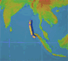
, generally at a greatly changed scale (either much faster than real time or much slower). An example would be the animation produced after the 2004 Tsunami showing how the waves spread across the Indian Ocean.
With the development of computers in the 1960s and 1970s, animation programs were developed allowing the growth of animation in mapping. Waldo Tobler created one of the first animations, using a 3-D computer generated map to portray population growth over a specified time in Detroit (Tobler 1970). Hal Moellering created another animated map in 1976 representing a spatiotemporal pattern in traffic accidents (Slocum et al. 2005).
Further development in animated map was stalled until the 1990s due to a lack of animation in academics, financial restrictions on research, and lack of distribution means (Campbell and Egbert 1990). In the 1990s, however, the invention of faster, more efficient computers, compact discs and the Internet solved such problems.
extended these visual variables in 1995 to include display date (time at which change is initiated), frequency (number of times identifiable forms are displayed) and synchronization (correspondence of 2 or more time series) (Slocum et al. 2005).
The use of the Internet has allowed animated maps to become interactive. The user can witness representations of changes over time, while manipulating the direction of view, the pace or the parameters of the map displayed (MacEachren 1998).
----
Animation on Maps can be mainly divided into two types:
Temporal Animation: Temporal shows the ongoing gradual changes over time. Temporal maps can also be termed as animated timeline maps and can be a useful reference to examine the changes ongoing on each step and analyze the progression occurring gradually as time passes.
There are many purposes which temporal animation might serve to depict:
1) Displaying changes in geographic pattern over time.
2) Analyzing hurricane paths and meteorological events by mapping previous data.
3) See the ongoing changes in ozone level.
4) Studying the progression of flood, stream flow etc.
Importance of Legend in Temporal Maps:
As in the case of static maps, it would be useful if temporal maps could also be provided with proper legend. Legends for temporal maps should not only tell the time but also let user travel over the time. Various manipulations such as traveling to a certain point in time, selecting focus level etc. should be allowed to enhance user friendliness.
Using legend in temporal map will answer important questions related to the entity’s existence (if?), the entity’s location (when?), time intervals (how long?), temporal texture (how often), speed at which change takes place (how fast?), and the order of change (what order?) (MacEachren, 1995).
Depending upon their construction, animated legends may distract the viewer from the animated map. Care must be taken to integrate the legend in an unobtrusive fashion.
Non-Temporal Animation: Non-Temporal Animation shows changes against some other variables other than time. The variable might be place, position, generalization level etc. Non –temporal animation also serves when there is a need to show both the data set and the transformation that has been applied on it for its display.
Non- temporal animation can be of many types according to the purpose they serve:
1) Fly thorough animation:
This type of animation gives the viewer the feeling of flying through the landscape.
2) Cartographic zoom animation:
This type of animation shows maps at different focus level and viewer can change the scale of the map as desired.
3) Classification animation:
Different methods of data classification are depicted in this animation.
4) Generalization animation:
This type of animation uses single classification method with multiple classes of data.
Time is an important aspect in both animations. Real time is depicted in temporal animation and presentation time (time to show the animation) is associated with non-temporal animation.
----
On the basis of animating software used, there are mainly different types of animated maps:
1) GIF animated mapping: Mapping prepared by combining GIF images.
2) Animated movies mapping: ESRI ArcGIS 9.3 can be used to create this type of mapping.
3) Google Earth animated timeline mapping: Distributed by Google.
4) Flash animated Mapping: Made by using animation software like Flash.
5) VisualEyes map: Flash driven browser that allow users to code on their own animations.
6) OpenLayers map: Similar to Google API but developed by the open source community.
----
Animation
Animation is the rapid display of a sequence of images of 2-D or 3-D artwork or model positions in order to create an illusion of movement. The effect is an optical illusion of motion due to the phenomenon of persistence of vision, and can be created and demonstrated in several ways...
, either computer or video, to add a temporal component to a map
Map
A map is a visual representation of an area—a symbolic depiction highlighting relationships between elements of that space such as objects, regions, and themes....
displaying change in some dimension. Most commonly the change is shown over time
Time
Time is a part of the measuring system used to sequence events, to compare the durations of events and the intervals between them, and to quantify rates of change such as the motions of objects....
, generally at a greatly changed scale (either much faster than real time or much slower). An example would be the animation produced after the 2004 Tsunami showing how the waves spread across the Indian Ocean.
History
The concept of animated maps began in the 1930s, but did not become more developed by cartographers until the 1950s (Slocum et al. 2005). In 1959, Norman Thrower published Animated Cartography, discussing the use of animated maps in adding a new dimension that was difficult to express in static maps: time. These early maps were created by drawing "snap-shots" of static maps, putting a series of maps together to form a scene and creating animation through photography tricks (Thrower 1959). Such early maps rarely had an associated scale, legends or oriented themselves to lines of longitude or latitude (Campbell and Egbert 1990).With the development of computers in the 1960s and 1970s, animation programs were developed allowing the growth of animation in mapping. Waldo Tobler created one of the first animations, using a 3-D computer generated map to portray population growth over a specified time in Detroit (Tobler 1970). Hal Moellering created another animated map in 1976 representing a spatiotemporal pattern in traffic accidents (Slocum et al. 2005).
Further development in animated map was stalled until the 1990s due to a lack of animation in academics, financial restrictions on research, and lack of distribution means (Campbell and Egbert 1990). In the 1990s, however, the invention of faster, more efficient computers, compact discs and the Internet solved such problems.
Visual variables
With the growth of animated mapping came the development of guidelines for creating animated maps. Visual variables such as spacing, lightness and shape used for static maps apply. However, in 1991, David DiBiase and colleagues developed visual variables unique to animated maps: duration, rate of change and order. Duration is the unit of time a frame or scene is displayed, affecting the smoothness of the animation. The shorter a frame is displayed, the smoother the animation will appear (Slocum et al. 2005). Smoothness of animation is also a function of the rate of change (Slocum et al. 2005). Order refers to the time sequence in which animation is played out, usually presented in chronological sequence (Slocum et al. 2005). Alan MacEachrenAlan MacEachren
Alan M. MacEachren is an American geographer, Professor of Geography and Director, GeoVISTA Center, Department of Geography, The Pennsylvania State University. He is known for his cross-disciplinary work in the fields of human-centered geographic visualization, scientific and information...
extended these visual variables in 1995 to include display date (time at which change is initiated), frequency (number of times identifiable forms are displayed) and synchronization (correspondence of 2 or more time series) (Slocum et al. 2005).
Types of animated maps
Animated maps can emphasize the existence of an occurrence at a location, emphasize an attribute of an occurrence or representing change in the position or attributes of an occurrence (DiBiase 1992). For instance, a flashing symbol may be used to draw the map-reader’s attention to a particular occurrence at one location or multiple location across the map. Maps on the weather channel use animation to emphasize current and predicted paths of hurricanes.The use of the Internet has allowed animated maps to become interactive. The user can witness representations of changes over time, while manipulating the direction of view, the pace or the parameters of the map displayed (MacEachren 1998).
----
Animation on Maps can be mainly divided into two types:
Temporal Animation: Temporal shows the ongoing gradual changes over time. Temporal maps can also be termed as animated timeline maps and can be a useful reference to examine the changes ongoing on each step and analyze the progression occurring gradually as time passes.
There are many purposes which temporal animation might serve to depict:
1) Displaying changes in geographic pattern over time.
2) Analyzing hurricane paths and meteorological events by mapping previous data.
3) See the ongoing changes in ozone level.
4) Studying the progression of flood, stream flow etc.
Importance of Legend in Temporal Maps:
As in the case of static maps, it would be useful if temporal maps could also be provided with proper legend. Legends for temporal maps should not only tell the time but also let user travel over the time. Various manipulations such as traveling to a certain point in time, selecting focus level etc. should be allowed to enhance user friendliness.
Using legend in temporal map will answer important questions related to the entity’s existence (if?), the entity’s location (when?), time intervals (how long?), temporal texture (how often), speed at which change takes place (how fast?), and the order of change (what order?) (MacEachren, 1995).
Depending upon their construction, animated legends may distract the viewer from the animated map. Care must be taken to integrate the legend in an unobtrusive fashion.
Non-Temporal Animation: Non-Temporal Animation shows changes against some other variables other than time. The variable might be place, position, generalization level etc. Non –temporal animation also serves when there is a need to show both the data set and the transformation that has been applied on it for its display.
Non- temporal animation can be of many types according to the purpose they serve:
1) Fly thorough animation:
This type of animation gives the viewer the feeling of flying through the landscape.
2) Cartographic zoom animation:
This type of animation shows maps at different focus level and viewer can change the scale of the map as desired.
3) Classification animation:
Different methods of data classification are depicted in this animation.
4) Generalization animation:
This type of animation uses single classification method with multiple classes of data.
Time is an important aspect in both animations. Real time is depicted in temporal animation and presentation time (time to show the animation) is associated with non-temporal animation.
----
On the basis of animating software used, there are mainly different types of animated maps:
1) GIF animated mapping: Mapping prepared by combining GIF images.
2) Animated movies mapping: ESRI ArcGIS 9.3 can be used to create this type of mapping.
3) Google Earth animated timeline mapping: Distributed by Google.
4) Flash animated Mapping: Made by using animation software like Flash.
5) VisualEyes map: Flash driven browser that allow users to code on their own animations.
6) OpenLayers map: Similar to Google API but developed by the open source community.
----
See also
- CartographyCartographyCartography is the study and practice of making maps. Combining science, aesthetics, and technique, cartography builds on the premise that reality can be modeled in ways that communicate spatial information effectively.The fundamental problems of traditional cartography are to:*Set the map's...
- GeovisualizationGeovisualizationGeovisualization, short for Geographic Visualization, refers to a set of tools and techniques supporting geospatial data analysis through the use of interactive visualization....
- Geographic Information SystemGeographic Information SystemA geographic information system, geographical information science, or geospatial information studies is a system designed to capture, store, manipulate, analyze, manage, and present all types of geographically referenced data...
(GIS) - GeocodeGeocodeGEOCODE is a standardized all-natural number representation format specification for geospatial coordinate measurements that provide details of the exact location of geospatial point at, below, or above the surface of the earth at a specified moment of time.Geocode is patented under US Patents...
- List of cartographers
- Map projectionMap projectionA map projection is any method of representing the surface of a sphere or other three-dimensional body on a plane. Map projections are necessary for creating maps. All map projections distort the surface in some fashion...
- Pictorial mapsPictorial mapsPictorial maps are a category of maps that are also loosely called illustrated maps, panoramic maps, perspective maps, bird’s-eye view maps and Geopictorial maps amongst others. In contrast to the regular road map, Atlas or topographic cartography, pictorial maps depict a given territory with a...
- TimeMapTimeMapTimeMap TMJava is an Open Source web mapping application, which was one of the first such applications to introduce generic time filtering and map animation on the web...