
Algoma, Unorganized, North Part, Ontario
Encyclopedia
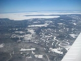
Algoma Unorganized North Part is an unorganized area in northeastern Ontario
, Canada, comprising all areas in Algoma District, north of the Sault Ste. Marie
to Elliot Lake corridor, which are not part of an incorporated municipality or a First Nation. It covers 44016.97 km² (16,995 sq mi) of land, and had a population of 5,717 in 2006.
at the southern boundary of Lake Superior Provincial Park
.
and Chapleau
and Algoma Central Railway
s near Hobon Lake, 209 kilometres (129.9 mi) north of Sault Ste. Marie
and 65 kilometres (40.4 mi) from Chapleau
. Franz once had a booming economy in forestry
, transportation and mining
. The community's original name was Hobon. In 1914, the post office's name was changed to Franz, and the railway station was renamed from Hobon to Franz Station after former Algoma Steel
executive William Charles Franz. The station closed in 1991 and the building was moved to Dubreuilville where it serves as a library and tourist office.
. It's located on the shores of Frater Lake.
.
When the Cline
mine opened, Goudreau sprang to life with some 200 residents coming to the area to work. Not all of the residents worked in the mine, some of them were pospectors in search of the gold, silver, copper and iron pyrite. During the First World War, the mine was leased to the Nichols Chemicals company for the production of sulphuric acid. After the war ended, the market fell and the mine ceased operations. Other mines soon set up operations in the area. They went by the names of The Emily, Algold, Algoma Summit and The Edward. Each mine had a town site for their employees.
The town continued to grow, with the building of a two-storey railway station, workers homes and a movie theatre. A post office was built in 1915 and closed in 1966.
The Second World War ultimately led to Goudreau's demise as the demand for gold came second to iron and steel for the war. The mines eventually closed down as costs increased. Located along, Highway 519
, Goudreau is now a virtual ghost town
, still used for logging operations and summer homes.
and rail siding
located at the very south end of Wabatongushi Lake
, along the Canadian Pacific Railway
between Missanabie
and Franz. A taxi
ran between Lochalsh, Goudreau, and the Cline Mine. When the mine closed in 1946, both towns became ghost towns. There are still active mining operations in the area as well as a few ghost mines.
just south of Lake Superior Provincial Park
.
and the Algoma Central Railway
s, approximately halfway between Dubreuilville and Hearst
. The community is also accessible by a forest roads extending from Highway 583.
. It's centered at the intersection of the east-west and north-south portions of Highway 638.
Non-native settlers began farming in the area around the time the mines of Bruce Mines closed in 1875. In November, 1889, William Moor, a farmer prospecting after the fall harvest, found ore containing gold atop a ridge overlooking what was then Lake Ickta (now Havilah Lake). After some ownership dispute, American investors organized the Ophir
Gold Mining Company (named after the biblical Ophir
) to purchase the land in 1892. A small mining town was built, and gold mining operations commenced in 1893, producing 2489 tons of ore worth $8459. Operations ceased due to a financial panic
in the United States and a fatal mining accident. The name of the mine and lake were changed to Havilah
, another biblical reference, as mining resumed from 1910 to 1911, but the operation and its buildings were subsequently abandoned
located approximately 8.6 kilometres (5.3 mi) north-west of Searchmont.
Ontario
Ontario is a province of Canada, located in east-central Canada. It is Canada's most populous province and second largest in total area. It is home to the nation's most populous city, Toronto, and the nation's capital, Ottawa....
, Canada, comprising all areas in Algoma District, north of the Sault Ste. Marie
Sault Ste. Marie, Ontario
Sault Ste. Marie is a city on the St. Marys River in Algoma District, Ontario, Canada. It is the third largest city in Northern Ontario, after Sudbury and Thunder Bay, with a population of 74,948. The community was founded as a French religious mission: Sault either means "jump" or "rapids" in...
to Elliot Lake corridor, which are not part of an incorporated municipality or a First Nation. It covers 44016.97 km² (16,995 sq mi) of land, and had a population of 5,717 in 2006.
Local services boards
- AweresAweres, OntarioAweres is a local services board in the Canadian province of Ontario. Located in the Algoma District, it encompasses and provides services to most of the geographic township of Aweres, including the communities of Island Lake and Heyden....
- Batchawana BayBatchawana Bay, OntarioBatchawana Bay is a community with a local services board in the Canadian province of Ontario, consisting of parts of the unincorporated townships of Ryan, Herrick, Tilley and Fisher in the Algoma District. It is located north of Sault Ste...
- Goulais and DistrictGoulais and District, OntarioGoulais and District is a local services board in the Canadian province of Ontario. Located in the Algoma District north of Sault Ste. Marie, it encompasses and provides services to the unincorporated townships of Dennis, Fenwick, Havilland, Kars, Ley, Pennefather, Tupper and Vankoughnet, including...
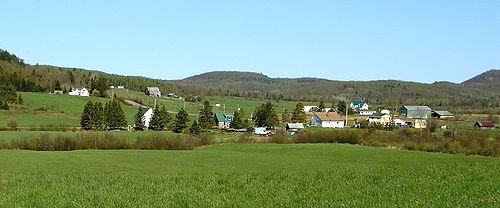
- Hawk JunctionHawk Junction, OntarioHawk Junction is a community with a local services board in the Canadian province of Ontario, located just north of Highway 101, about east of Wawa....
- MissanabieMissanabie, OntarioMissanabie is a community in the Canadian province of Ontario, located in the Algoma District at the northern terminus of Highway 651, just outside the boundaries of the Chapleau Crown Game Preserve....
- Peace TreePeace Tree, OntarioPeace Tree is a local services board in the Canadian province of Ontario, located in the Algoma District.The area administers the portion of the geographic township of Aweres located northwest of Heyden along the Trans-Canada Highway, including the suburban subdivision centred on Peace Tree Drive....
- SearchmontSearchmont, OntarioSearchmont is a community with a local services board in the Canadian province of Ontario. The services board covers the unincorporated townships of Deroche, Gaudette, Hodgins and Shields in the Algoma District northeast of Sault Ste. Marie...
- Wharncliffe and KynochWharncliffe and Kynoch, OntarioWharncliffe and Kynoch is a local services board in the Canadian province of Ontario, consisting of the unincorporated communities of Wharncliffe and Kynoch in the Algoma District....
Agawa Bay
Agawa Bay (47°20′N 84°40′W) is located along Highway 17Highway 17 (Ontario)
King's Highway 17, more commonly known as Highway 17, is a provincially maintained highway and the primary route of the Trans-Canada Highway through the Canadian province of Ontario. It begins at the Manitoba border west of Kenora and ends south of Arnprior at the western terminus of Highway 417, ...
at the southern boundary of Lake Superior Provincial Park
Lake Superior Provincial Park
Lake Superior Provincial Park is one of the largest provincial parks in Ontario, covering about along the northeastern shores of Lake Superior between Wawa and Sault Ste. Marie in Algoma District, Northeastern Ontario, Canada...
.
Amyot
Amyot (48°29′N 84°57′W) is located on the Canadian Pacific rail line, on the shores of Negwazu Lake, around 10 km east of Highway 17.Fire River
Fire River is an uninhabited railway siding located west of the Missinaibi River, between the Dishnish and Argolis stations. It can only be accessed by train as there are no roads leading to it. It's located about halfway between HearstHearst, Ontario
Hearst is a town in the Canadian province of Ontario. It is located in Northern Ontario, approximately west of Kapuskasing, approximately north of Toronto and east of Thunder Bay on Highway 11...
and Chapleau
Chapleau, Ontario
Chapleau is a township in Sudbury District, Ontario, Canada. It is home to one of the world's largest wildlife preserves. Chapleau has a population of 2,354 according to the Canada 2006 Census....
Franz
Franz (48°28′N 84°25′W) is located at the junction of the Canadian PacificCanadian Pacific Railway
The Canadian Pacific Railway , formerly also known as CP Rail between 1968 and 1996, is a historic Canadian Class I railway founded in 1881 and now operated by Canadian Pacific Railway Limited, which began operations as legal owner in a corporate restructuring in 2001...
and Algoma Central Railway
Algoma Central Railway
The Algoma Central Railway is a railway in Northern Ontario that operates between Sault Ste. Marie and Hearst, with a branch line to Michipicoten. The area served by the railway is sparsely populated, with few roads...
s near Hobon Lake, 209 kilometres (129.9 mi) north of Sault Ste. Marie
Sault Ste. Marie, Ontario
Sault Ste. Marie is a city on the St. Marys River in Algoma District, Ontario, Canada. It is the third largest city in Northern Ontario, after Sudbury and Thunder Bay, with a population of 74,948. The community was founded as a French religious mission: Sault either means "jump" or "rapids" in...
and 65 kilometres (40.4 mi) from Chapleau
Chapleau, Ontario
Chapleau is a township in Sudbury District, Ontario, Canada. It is home to one of the world's largest wildlife preserves. Chapleau has a population of 2,354 according to the Canada 2006 Census....
. Franz once had a booming economy in forestry
Forestry
Forestry is the interdisciplinary profession embracing the science, art, and craft of creating, managing, using, and conserving forests and associated resources in a sustainable manner to meet desired goals, needs, and values for human benefit. Forestry is practiced in plantations and natural stands...
, transportation and mining
Mining
Mining is the extraction of valuable minerals or other geological materials from the earth, from an ore body, vein or seam. The term also includes the removal of soil. Materials recovered by mining include base metals, precious metals, iron, uranium, coal, diamonds, limestone, oil shale, rock...
. The community's original name was Hobon. In 1914, the post office's name was changed to Franz, and the railway station was renamed from Hobon to Franz Station after former Algoma Steel
Algoma Steel
See also Algoma Essar Steel Algoma is an integrated primary steel producer located on the St. Marys River in Sault Ste. Marie, Ontario, Canada. Its products are sold in Canada and the United States as well as overseas. Algoma Steel was founded in 1902 by Francis Clergue, an American entrepreneur...
executive William Charles Franz. The station closed in 1991 and the building was moved to Dubreuilville where it serves as a library and tourist office.
Frater
Frater, Ontario is an uninhabited railway siding located 91 kilometres north of Sault Ste. Marie and is 3.5 kilometres from the Trans-Canada Highway and 4.3 from the shore of Lake SuperiorLake Superior
Lake Superior is the largest of the five traditionally-demarcated Great Lakes of North America. It is bounded to the north by the Canadian province of Ontario and the U.S. state of Minnesota, and to the south by the U.S. states of Wisconsin and Michigan. It is the largest freshwater lake in the...
. It's located on the shores of Frater Lake.
Goudreau
Goudreau (48.250°N 84.533°W) was built as a stopping point along the Algoma Central RailwayAlgoma Central Railway
The Algoma Central Railway is a railway in Northern Ontario that operates between Sault Ste. Marie and Hearst, with a branch line to Michipicoten. The area served by the railway is sparsely populated, with few roads...
.
When the Cline
Cline
Cline, as spelled, is an Irish surname with historical roots in County Roscommon.People bearing the name include:* Catherine Ann Cline , American historian and author* Edward Cline , American screenwriter and director...
mine opened, Goudreau sprang to life with some 200 residents coming to the area to work. Not all of the residents worked in the mine, some of them were pospectors in search of the gold, silver, copper and iron pyrite. During the First World War, the mine was leased to the Nichols Chemicals company for the production of sulphuric acid. After the war ended, the market fell and the mine ceased operations. Other mines soon set up operations in the area. They went by the names of The Emily, Algold, Algoma Summit and The Edward. Each mine had a town site for their employees.
The town continued to grow, with the building of a two-storey railway station, workers homes and a movie theatre. A post office was built in 1915 and closed in 1966.
The Second World War ultimately led to Goudreau's demise as the demand for gold came second to iron and steel for the war. The mines eventually closed down as costs increased. Located along, Highway 519
Highway 519 (Ontario)
Secondary Highway 519, commonly referred to as Highway 519, is a provincially maintained highway in the Canadian province of Ontario. The highway is in length, connecting Highway 17 near Obatanga Provincial Park with Dubreuilville station. A private logging road continues east from there.Highway...
, Goudreau is now a virtual ghost town
Ghost town
A ghost town is an abandoned town or city. A town often becomes a ghost town because the economic activity that supported it has failed, or due to natural or human-caused disasters such as floods, government actions, uncontrolled lawlessness, war, or nuclear disasters...
, still used for logging operations and summer homes.
Leeburn
Leeburn (46°28′00"N 83°48′52"W) is located along Highway 638. The town has a nice background view of the northern Ontario mountains. At one time there was a gold mine at Bass Lake, a few kilometres north of Leeburn. The quality of the ore found was not sufficient to make the mine profitable.Lochalsh
Lochalsh (48°21′00"N 84°16′00"W) is a ghost townGhost town
A ghost town is an abandoned town or city. A town often becomes a ghost town because the economic activity that supported it has failed, or due to natural or human-caused disasters such as floods, government actions, uncontrolled lawlessness, war, or nuclear disasters...
and rail siding
Rail siding
A siding, in rail terminology, is a low-speed track section distinct from a running line or through route such as a main line or branch line or spur. It may connect to through track or to other sidings at either end...
located at the very south end of Wabatongushi Lake
Wabatongushi Lake
Wabatongushi Lake is a lake in Northern Ontario, Canada, fully within the Chapleau Crown Game Preserve. It is a long lake with many deep bays and a narrow middle section, making it seem like 2 separate lakes. Its outflow, the Lochalsh River, is a tributary of the Michipicoten River via Dog Lake...
, along the Canadian Pacific Railway
Canadian Pacific Railway
The Canadian Pacific Railway , formerly also known as CP Rail between 1968 and 1996, is a historic Canadian Class I railway founded in 1881 and now operated by Canadian Pacific Railway Limited, which began operations as legal owner in a corporate restructuring in 2001...
between Missanabie
Missanabie, Ontario
Missanabie is a community in the Canadian province of Ontario, located in the Algoma District at the northern terminus of Highway 651, just outside the boundaries of the Chapleau Crown Game Preserve....
and Franz. A taxi
Taxicab
A taxicab, also taxi or cab, is a type of vehicle for hire with a driver, used by a single passenger or small group of passengers, often for a non-shared ride. A taxicab conveys passengers between locations of their choice...
ran between Lochalsh, Goudreau, and the Cline Mine. When the mine closed in 1946, both towns became ghost towns. There are still active mining operations in the area as well as a few ghost mines.
Montreal River
Montreal River or Montreal River Harbour (47°14′25"N 84°38′45"W) is a very small community located at the mouth of the Montreal RiverMontreal River (Algoma–Sudbury, Ontario)
The Montreal River is a river in Algoma and Sudbury Districts, Ontario, Canada. It is a tributary of Lake Superior.-Course:The river begins at Montreal Lake at the community of Island Lake in northwest Sudbury District...
just south of Lake Superior Provincial Park
Lake Superior Provincial Park
Lake Superior Provincial Park is one of the largest provincial parks in Ontario, covering about along the northeastern shores of Lake Superior between Wawa and Sault Ste. Marie in Algoma District, Northeastern Ontario, Canada...
.
Oba
Oba (49.067°N 84.100°W) is located at the junction of the Canadian NationalCanadian National Railway
The Canadian National Railway Company is a Canadian Class I railway headquartered in Montreal, Quebec. CN's slogan is "North America's Railroad"....
and the Algoma Central Railway
Algoma Central Railway
The Algoma Central Railway is a railway in Northern Ontario that operates between Sault Ste. Marie and Hearst, with a branch line to Michipicoten. The area served by the railway is sparsely populated, with few roads...
s, approximately halfway between Dubreuilville and Hearst
Hearst, Ontario
Hearst is a town in the Canadian province of Ontario. It is located in Northern Ontario, approximately west of Kapuskasing, approximately north of Toronto and east of Thunder Bay on Highway 11...
. The community is also accessible by a forest roads extending from Highway 583.
Ophir
Ophir (46°27′48"N 83°43′44"W) is a sparsely populated farming community located 25 km north of Bruce MinesBruce Mines, Ontario
Bruce Mines is a town in the Canadian province of Ontario, located on the north shore of Lake Huron in the Algoma District along Highway 17. The town of Bruce Mines has a population of 584 residents. The current mayor of Bruce Mines is Gordon Post.- History :...
. It's centered at the intersection of the east-west and north-south portions of Highway 638.
Non-native settlers began farming in the area around the time the mines of Bruce Mines closed in 1875. In November, 1889, William Moor, a farmer prospecting after the fall harvest, found ore containing gold atop a ridge overlooking what was then Lake Ickta (now Havilah Lake). After some ownership dispute, American investors organized the Ophir
Gold Mining Company (named after the biblical Ophir
Ophir
Ophir is a port or region mentioned in the Bible, famous for its wealth. King Solomon is supposed to have received a cargo of gold, silver, sandalwood, precious stones, ivory, apes and peacocks from Ophir, every three years.- Citations :...
) to purchase the land in 1892. A small mining town was built, and gold mining operations commenced in 1893, producing 2489 tons of ore worth $8459. Operations ceased due to a financial panic
Panic of 1893
The Panic of 1893 was a serious economic depression in the United States that began in 1893. Similar to the Panic of 1873, this panic was marked by the collapse of railroad overbuilding and shaky railroad financing which set off a series of bank failures...
in the United States and a fatal mining accident. The name of the mine and lake were changed to Havilah
Havilah
Havilah is in several books of the Bible referring to both land and people.The story of the Garden of Eden in Genesis 2:11: "And a river went out of Eden to water the garden; and from thence it was parted, and became into four heads...
, another biblical reference, as mining resumed from 1910 to 1911, but the operation and its buildings were subsequently abandoned
Poplar Dale
North of Ophir, this region was settled in the late 19th century for primarily agricultural reasons. The community comprises all peoples living along the Poplar Dale Rd. and its tributaries, north of the Thessalon River. The community's major exports are beef and timber.Ranger Lake
The community of Ranger Lake (46°52′25"N 83°34′50"W) is located along Highway 556 at the south end of the lake with the same name. It is mostly a collection of summer cottages and resorts. There is an old fire tower.Wabos
Wabos (46°49′00"N 84°06′55"W) is a railway siding along the Algoma Central RailwayAlgoma Central Railway
The Algoma Central Railway is a railway in Northern Ontario that operates between Sault Ste. Marie and Hearst, with a branch line to Michipicoten. The area served by the railway is sparsely populated, with few roads...
located approximately 8.6 kilometres (5.3 mi) north-west of Searchmont.
Statistics
-
-
- N/A = Data not available
-