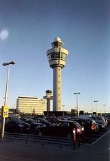
All Topics  
Air traffic control

 
Air Traffic Control

   Email Print
   Bookmark   Link


Air traffic control


Air traffic control (ATC) is a service provided by ground-based controllers
Air traffic controller

Air traffic controllers are people who operate the air traffic control system to expedite and maintain a safe and orderly flow of Aircraft and help prevent mid-air collisions....
 who direct aircraft
Aircraft

An aircraft is a vehicle which is able to flight by being supported by the air, or in general, the atmosphere, of a planet. Examples include balloons, airplanes and helicopters....
 on the ground and in the air. The primary purpose of ATC systems worldwide is to separate aircraft to prevent collisions, to organize and expedite the flow of traffic, and to provide information and other support for pilots when able. In some countries, ATC may also play a security or defense role (as in the United States), or be run entirely by the military (as in Brazil).

Preventing collisions is referred to as separation
Separation (air traffic control)

In air traffic control, separation is the name for the concept of keeping an aircraft in a minimum distance from another aircraft to reduce the risk of those aircraft colliding, as well as prevent accidents due to wake turbulence....
, which is a term used to prevent aircraft from coming too close to each other by use of lateral, vertical and longitudinal separation minima; many aircraft now have collision avoidance systems
Aircraft collision avoidance systems

Modern aircraft can use several types of collision avoidance systems to prevent unintentional contact with other aircraft, obstacles, or the ground:...
 installed to act as a backup to ATC observation and instructions.


Discussion
Ask a question about 'Air traffic control'
Start a new discussion about 'Air traffic control'
Answer questions from other users
Full Discussion Forum


Recent Posts


Encyclopedia


Air traffic control (ATC) is a service provided by ground-based controllers
Air traffic controller

Air traffic controllers are people who operate the air traffic control system to expedite and maintain a safe and orderly flow of Aircraft and help prevent mid-air collisions....
 who direct aircraft
Aircraft

An aircraft is a vehicle which is able to flight by being supported by the air, or in general, the atmosphere, of a planet. Examples include balloons, airplanes and helicopters....
 on the ground and in the air. The primary purpose of ATC systems worldwide is to separate aircraft to prevent collisions, to organize and expedite the flow of traffic, and to provide information and other support for pilots when able. In some countries, ATC may also play a security or defense role (as in the United States), or be run entirely by the military (as in Brazil).

Preventing collisions is referred to as separation
Separation (air traffic control)

In air traffic control, separation is the name for the concept of keeping an aircraft in a minimum distance from another aircraft to reduce the risk of those aircraft colliding, as well as prevent accidents due to wake turbulence....
, which is a term used to prevent aircraft from coming too close to each other by use of lateral, vertical and longitudinal separation minima; many aircraft now have collision avoidance systems
Aircraft collision avoidance systems

Modern aircraft can use several types of collision avoidance systems to prevent unintentional contact with other aircraft, obstacles, or the ground:...
 installed to act as a backup to ATC observation and instructions. In addition to its primary function, the ATC can provide additional services such as providing information to pilots, weather and navigation information and NOTAM
NOTAM

NOTAM or NoTAM is the quasi-acronym for a "Notice To Airmen". NOTAMs are created and transmitted by government agencies under guidelines specified by Annex 15: Aeronautical Information Services of the Convention on International Civil Aviation....
s (Notices to Airmen).

In many countries, ATC services are provided throughout the majority of airspace, and its services are available to all users (private, military, and commercial). When controllers are responsible for separating some or all aircraft, such airspace is called "controlled airspace
Controlled airspace

Controlled airspace is an aviation term used to describe airspace in which traffic levels are such that it has been determined that air traffic control must provide some form of separation between aircraft....
" in contrast to "uncontrolled airspace
Uncontrolled airspace

Uncontrolled airspace is an aviation term to describe airspace where an Air Traffic Control service is not deemed necessary or cannot be provided for practical reasons....
" where aircraft may fly without the use of the air traffic control system. Depending on the type of flight and the class of airspace, ATC may issue
instructions that pilots
Aviator

An aviator is a person who flies aircraft for pleasure or as a profession.The feminine word aviatrix is sometimes used and is the correct term to refer to all women pilots....
 are required to follow, or merely
flight information (in some countries known as advisories) to assist pilots operating in the airspace. In all cases, however, the pilot in command has final responsibility for the safety of the flight, and may deviate from ATC instructions in an emergency.

Although native language for the region is normally used, English language
English language

English is a West Germanic language that originated in Anglo-Saxon England and has lingua franca status in many parts of the world as a result of the military, economic, scientific, political and cultural influence of the British Empire in the 18th, 19th and early 20th centuries and that of the United States from the mid 20th century onwa...
 must be used if requested, as required by the international aviation organization ICAO.

History

The first attempts to provide a semblance of air traffic control were based on simple "rules of the road" (European sponsored International Convention for Air Navigation, 1919).

It is considered that the first introduction of Air traffic control was at London's Croydon Airport
Croydon Airport

Croydon Airport was an airport in South London which straddled the boundary between what are now the London boroughs of London Borough of Croydon and London Borough of Sutton....
 in 1921. Archie League
Archie League

Archie William League is generally considered the first air traffic controller.League had been a licensed pilot, and licensed engine and aircraft mechanic....
, who controlled aircraft using colored flags at what is today Lambert-St. Louis International Airport
Lambert-St. Louis International Airport

Lambert-St. Louis International Airport is the primary airport for St. Louis, Missouri, Missouri, United States and the surrounding area.The airport lies outside the city limits and is owned and operated by the City of St....
, is often considered the first air traffic controller
Air traffic controller

Air traffic controllers are people who operate the air traffic control system to expedite and maintain a safe and orderly flow of Aircraft and help prevent mid-air collisions....
.

The first air traffic regulations were established in the United States by the passage of the Air Commerce Act (1926).

Around 1930, radio equipped control towers were established by some local authorities, and in 1933 instrument flying began.

By 1935 several airlines jointly established the first Airway Traffic Control centers to safeguard their aircraft against midair collisions. In 1936 this preliminary effort was transferred to the Federal Government, and the first-generation Air Traffic Control (ATC) System was born.

In 1935, in the US, airlines using the Chicago, Cleveland, and Newark airports agreed to coordinate the handling of airline traffic between those cities. In December, the first Airway Traffic Control Center opened at Newark, New Jersey. The first-generation Air Traffic Control (ATC) System was born. Additional centers at Chicago and Cleveland followed in 1936.

Airport control

The primary method of controlling the immediate airport environment is visual observation from the control tower. The tower is a tall, windowed structure located on the airport grounds. Aerodrome or Tower controllers are responsible for the separation and efficient movement of aircraft and vehicles operating on the taxiways and runways of the airport itself, and aircraft in the air near the airport, generally 2 to 5 nautical miles (3.7 to 9.2 km) depending on the airport procedures.

Radar
Radar

Radar is a system that uses electromagnetic radiation waves to identify the range, altitude, direction, or speed of both moving and fixed objects such as aircraft, ships, motor vehicles, weather formations, and terrain....
 displays are also available to controllers at some airports. Controllers may use a radar system called Secondary Surveillance Radar
Secondary surveillance radar

Secondary surveillance radar is a radar system used in air traffic control , which not only detects and measures the position of aircraft but also requests additional information from the aircraft itself such as its identity and altitude....
 for airborne traffic approaching and departing. These displays include a map of the area, the position of various aircraft, and data tags that include aircraft identification, speed, heading, and other information described in local procedures.

The areas of responsibility for tower controllers fall into three general operational disciplines; Ground Control, Local or Air Control, and Flight Data or Clearance Delivery -- other categories, such as Apron
Airport ramp

The airport ramp or apron is part of an airport. It is usually the area where aircraft are parked, unloaded or loaded, refueled or boarded....
 Control or Ground Movement Planner, may exist at extremely busy airports. While each tower's procedures will vary and while there may be multiple teams in larger towers that control multiple runways, the following provides a general concept of the delegation of responsibilities within the tower environment.

Ground Control


Ground Control (sometimes known as Ground Movement Control abbreviated to GMC or Surface Movement Control abbreviated to SMC) is responsible for the airport "maneuvering" areas, or areas not released to the airlines or other users. This generally includes all taxiways, inactive runways, holding areas, and some transitional aprons or intersections where aircraft arrive having vacated the runway and departure gates. Exact areas and control responsibilities are clearly defined in local documents and agreements at each airport. Any aircraft, vehicle, or person walking or working in these areas is required to have clearance from the ground controller. This is normally done via VHF radio, but there may be special cases where other processes are used. Most aircraft and airside vehicles have radios. Aircraft or vehicles without radios will communicate with the tower via aviation light signals
Aviation light signals

In the case of a NORDO or aircraft not equipped with a radio, air traffic control may use a signal lamp to direct the aircraft. The signal lamp has a focused bright beam and is capable of emitting three different colors: red, white and green....
 or will be led by vehicles with radios. People working on the airport surface normally have a communications link through which they can reach or be reached by ground control, commonly either by handheld radio or even cell phone
Mobile phone

A mobile phone is a long-range, electronic device used for mobile voice or data communication over a network of specialized base stations known as cell sites....
. Ground control is vital to the smooth operation of the airport because this position might constrain the order in which the aircraft will be sequenced to depart, which can affect the safety and efficiency of the airport's operation.

Some busier airports have Surface Movement Radar (SMR), such as, ASDE-3, AMASS or ASDE-X
ASDE-X

Airport Surface Detection Equipment, Model X, or ASDE-X, is a runway-safety tool that enables air traffic controllers to detect potential runway conflicts by providing detailed coverage of movement on runways and taxiways....
, designed to display aircraft and vehicles on the ground. These are used by the ground controller as an additional tool to control ground traffic, particularly at night or in poor visibility. There are a wide range of capabilities on these systems as they are being modernized. Older systems will display a map of the airport and the target. Newer systems include the capability to display higher quality mapping, radar target, data blocks, and safety alerts, and to interface with other systems such as digital flight strips
Digital flight strips

OverviewElectronic replacements for flight progress strips are based on thepaper strip metaphor and try to mimic existing operational procedures...
.

Local or Air Control

Local or Air Control (most often referred to as the generic "Tower" control, although Tower control can also refer to a combination of the local, ground and clearance delivery positions) is responsible for the active runway surfaces. The Air Traffic Control Tower clears aircraft for take off or landing and ensures the runway is clear for these aircraft. If the tower controller detects any unsafe condition, a landing aircraft may be told to "go-around
Go-around

A go-around is an aborted landing of an aircraft which is on Final approach ....
" and be re-sequenced into the landing pattern by the approach or terminal area controller.

Within the tower, a highly disciplined communications process between tower and ground control is an absolute necessity. Ground control must request and gain approval from tower control to cross any active runway with any aircraft or vehicle. Likewise, tower control must ensure ground control is aware of any operations that impact the taxiways and must work with the approach radar controllers to ensure "holes" or "gaps" in the arrival traffic are created (where necessary) to allow taxiing traffic to cross runways and to allow departing aircraft to take off. Crew Resource Management
Crew Resource Management

Crew Resource Management training originated from a NASA workshop in 1979 that focused on improving air safety. The NASA research presented at this meeting found that the primary cause of the majority of aviation accidents was human error, and that the main problems were failures of interpersonal communication, leadership, and decision ma...
 (CRM) procedures are often used to ensure this communication process is efficient and clear, although this is not as prevalent as CRM for pilots
Aviator

An aviator is a person who flies aircraft for pleasure or as a profession.The feminine word aviatrix is sometimes used and is the correct term to refer to all women pilots....
.

Flight Data or Clearance delivery

Clearance delivery is the position that issues route clearances to aircraft before they commence taxiing. These contain details of the route that the aircraft is expected to fly after departure. This position will, if necessary, coordinate with the en-route center and national command center or flow control to obtain releases for aircraft. Often however such releases are given automatically or are controlled by local agreements allowing "free-flow" departures. When weather or extremely high demand for a certain airport or airspace becomes a factor, there may be ground "stops" (or "slot delays") or re-routes may be necessary to ensure the system does not get overloaded. The primary responsibility of the clearance delivery position is to ensure that the aircraft have the proper route and slot time. This information is also coordinated with the en-route center and the ground controller in order to ensure the aircraft reaches the runway in time to meet the slot time provided by the command center. At some airports the clearance delivery controller also plans aircraft pushbacks and engine starts and is known as Ground Movement Planner (GMP): this position is particularly important at heavily congested airports to prevent taxiway and apron gridlock.

Approach and terminal control

Potomac Consolidated Tracon
Many airports have a radar control facility that is associated with the airport. In most countries, this is referred to as
Approach or Terminal Control; in the U.S., it is often still referred to as a TRACON
Terminal Control Center

A Terminal Radar Approach Control is an Air traffic control facility usually located within the vicinity of a large airport. Typically, the TRACON controls aircraft within a 30-50 nautical mile radius of the airport between the surface and 10,000 to ....
 (Terminal Radar Approach CONtrol) facility. While every airport varies, terminal controllers usually handle traffic in a 30 to 50 nautical mile (56 to 93 km) radius from the airport. Where there are many busy airports in close proximity, one single terminal control may service all the airports. The actual airspace boundaries and altitudes assigned to a terminal control are based on factors such as traffic flows, neighboring airports and terrain, and vary widely from airport to airport: a large and complex example is the London Terminal Control Centre
London Terminal Control Centre

The London Terminal Control Centre was an air traffic control Terminal Control Center based in West Drayton, in the London Borough of Hillingdon, England, approximately 2.5 miles north of London Heathrow airport....
 which controls traffic for five main London airports up to and out to .

Terminal controllers are responsible for providing all ATC services within their airspace. Traffic flow is broadly divided into departures, arrivals, and overflights. As aircraft move in and out of the terminal airspace, they are handed off to the next appropriate control facility (a control tower, an en-route control facility, or a bordering terminal or approach control). Terminal control is responsible for ensuring that aircraft are at an appropriate altitude when they are handed off, and that aircraft arrive at a suitable rate for landing.

Not all airports have a radar approach or terminal control available. In this case, the en-route center or a neighboring terminal or approach control may co-ordinate directly with the tower on the airport and vector inbound aircraft to a position from where they can land visually. At some of these airports, the tower may provide a non-radar procedural approach
Procedural control

Procedural control is a method of providing air traffic control services without the use of radar. It is used in regions of the world, specifically sparsely-populated land areas and oceans, where provision of contiguous radar cover is either prohibitively expensive or is simply not feasible....
 service to arriving aircraft handed over from a radar unit before they are visual to land. Some units also have a dedicated approach unit which can provide the procedural approach
Procedural control

Procedural control is a method of providing air traffic control services without the use of radar. It is used in regions of the world, specifically sparsely-populated land areas and oceans, where provision of contiguous radar cover is either prohibitively expensive or is simply not feasible....
 service either all the time or for any periods of radar outage for any reason.

En-route, center, or area control

Airtraffic 8
ATC provides services to aircraft in flight between airports as well. Pilots fly under one of two sets of rules for separation: Visual Flight Rules
Visual flight rules

Visual flight rules are a set of aviation regulations with which a aviator may operate an aircraft, in a specific airspace, with meteorological conditions better than Basic VFR Weather Minimums....
 (VFR) or Instrument Flight Rules
Instrument flight rules

Instrument flight rules are a set of regulations and procedures for flying aircraft whereby navigation and obstacle clearance is maintained with reference to aircraft instruments only, while separation from other aircraft is provided by Air Traffic Control....
 (IFR). Air traffic controllers have different responsibilities to aircraft operating under the different sets of rules. While IFR flights are under positive control, in the US VFR pilots can request flight following, which provides traffic advisory services on a time permitting basis and may also provide assistance in avoiding areas of weather and flight restrictions.

En-route air traffic controllers issue clearances and instructions for airborne aircraft, and pilots are required to comply with these instructions. En-route controllers also provide air traffic control services to many smaller airports around the country, including clearance off of the ground and clearance for approach to an airport. Controllers adhere to a set of separation standards that define the minimum distance allowed between aircraft. These distances vary depending on the equipment and procedures used in providing ATC services.

General characteristics

En-route air traffic controllers work in facilities called Area Control Centers, each of which is commonly referred to as a "Center". The United States uses the equivalent term Air Route Traffic Control Center (ARTCC). Each center is responsible for many thousands of square miles of airspace (known as a Flight Information Region
Flight Information Region

A Flight Information Region is an aviation term used to describe airspace with specific dimensions, in which a Flight Information Service and an alerting service are provided....
) and for the airports within that airspace. Centers control IFR aircraft from the time they depart from an airport or terminal area's airspace to the time they arrive at another airport or terminal area's airspace. Centers may also "pick up" VFR aircraft that are already airborne and integrate them into the IFR system. These aircraft must, however, remain VFR until the Center provides a clearance.

Center controllers are responsible for climbing the aircraft to their requested altitude while, at the same time, ensuring that the aircraft is properly separated from all other aircraft in the immediate area. Additionally, the aircraft must be placed in a flow consistent with the aircraft's route of flight. This effort is complicated by crossing traffic, severe weather, special missions that require large airspace allocations, and traffic density. When the aircraft approaches its destination, the center is responsible for meeting altitude restrictions by specific points, as well as providing many destination airports with a traffic flow, which prohibits all of the arrivals being "bunched together". These "flow restrictions" often begin in the middle of the route, as controllers will position aircraft landing in the same destination so that when the aircraft are close to their destination they are sequenced.

As an aircraft reaches the boundary of a Center's control area it is "handed off" or "handed over" to the next Area Control Center. In some cases this "hand-off" process involves a transfer of identification and details between controllers so that air traffic control services can be provided in a seamless manner; in other cases local agreements may allow "silent handovers" such that the receiving center does not require any co-ordination if traffic is presented in an agreed manner. After the hand-off, the aircraft is given a frequency change and begins talking to the next controller. This process continues until the aircraft is handed off to a terminal controller ("approach").

Radar coverage

Since centers control a large airspace area, they will typically use long range radar that has the capability, at higher altitudes, to see aircraft within 200 nautical miles (370 km) of the radar antenna. They may also use TRACON radar data to control when it provides a better "picture" of the traffic or when it can fill in a portion of the area not covered by the long range radar.

In the U.S. system, at higher altitudes, over 90% of the U.S. airspace is covered by radar and often by multiple radar systems; however, coverage may be inconsistent at lower altitudes used by unpressurized aircraft due to high terrain or distance from radar facilities. A center may require numerous radar systems to cover the airspace assigned to them, and may also rely on pilot position reports from aircraft flying below the floor of radar coverage. This results in a large amount of data being available to the controller. To address this, automation systems have been designed that consolidate the radar data for the controller. This consolidation includes eliminating duplicate radar returns, ensuring the best radar for each geographical area is providing the data, and displaying the data in an effective format.

Centers also exercise control over traffic travelling over the world's ocean areas. These areas are also FIR
Flight Information Region

A Flight Information Region is an aviation term used to describe airspace with specific dimensions, in which a Flight Information Service and an alerting service are provided....
s. Because there are no radar systems available for oceanic control, oceanic controllers provide ATC services using procedural control
Procedural control

Procedural control is a method of providing air traffic control services without the use of radar. It is used in regions of the world, specifically sparsely-populated land areas and oceans, where provision of contiguous radar cover is either prohibitively expensive or is simply not feasible....
. These procedures use aircraft position reports, time, altitude, distance, and speed to ensure separation. Controllers record information on flight progress strip
Flight progress strip

A flight progress strip is a small strip of paper used to track a flight in air traffic control . It may seem as an artifact of days gone by, however it is still used in modern ATC as a quick way to annotate a flight, to keep a legal record of the instructions that were issued, to allow others to see instantly what is happening and to pass...
s and in specially developed oceanic computer systems as aircraft report positions. This process requires that aircraft be separated by greater distances, which reduces the overall capacity for any given route.

Some Air Navigation Service Providers (e.g Airservices Australia, The Federal Aviation Administration, NAVCANADA, etc.) have implemented Automatic Dependent Surveillance - Broadcast (ADS-B) as part of their surveillance capability. This new technology reverses the radar concept. Instead of radar "finding" a target by interrogating the transponder, the ADS-equipped aircraft sends a position report as determined by the navigation equipment on board the aircraft. Normally, ADS operates in the "contract" mode where the aircraft reports a position, automatically or initiated by the pilot, based on a predetermined time interval. It is also possible for controllers to request more frequent reports to more quickly establish aircraft position for specific reasons. However, since the cost for each report is charged by the ADS service providers to the company operating the aircraft, more frequent reports are not commonly requested except in emergency situations. ADS is significant because it can be used where it is not possible to locate the infrastructure for a radar system (e.g. over water). Computerized radar displays are now being designed to accept ADS inputs as part of the display. This technology is currently used in portions of the North Atlantic and the Pacific by a variety of States who share responsibility for the control of this airspace.

Flight traffic mapping

]The mapping of flights in real-time is based on the air traffic control system. In 1991, data on the location of aircraft was made available by the Federal Aviation Administration to the airline industry. The National Business Aviation Association (NBAA), the General Aviation Manufacturers Association, the Aircraft Owners & Pilots Association, the Helicopter Association International, and the National Air Transportation Association petitioned the FAA to make ASDI information available on a "need-to-know" basis. Subsequently, NBAA advocated the broad-scale dissemination of air traffic data. The Aircraft Situational Display to Industry (ASDI) system now conveys up-to-date flight information to the airline industry and the public. Some companies that distribute ASDI information are FlightExplorer, FlightView
FlightView

FlightView is company that develops flight tracking tools for the general public and commercial and private aviation. FlightView Dispatch, the first product introduced in 1994, was the only commercial radar-based set of applications available in real-time flight tracking....
, and FlyteComm. Each company maintains a website that provides free updated information to the public on flight status. Stand-alone programs are also available for displaying the geographic location of airborne IFR (Instrument Flight Rules) air traffic anywhere in the FAA air traffic system. Positions are reported for both commercial and general aviation traffic. The programs can overlay air traffic with a wide selection of maps such as, geo-political boundaries, air traffic control center boundaries, high altitude jet routes, satellite cloud and radar imagery.

Problems


Traffic

For more information see Air traffic flow management
Air traffic flow management

Air Traffic Flow Management is the regulation of air traffic in order to avoid exceeding airport or air traffic control capacity in handling traffic, and to ensure that available capacity is used efficiently....
.


The day-to-day problems faced by the air traffic control system are primarily related to the volume of air traffic demand placed on the system, and weather
Weather

Weather is a set of all the Phenomenon occurring in a given atmosphere at a given time. Weather phenomena lie in the hydrosphere and troposphere....
. Several factors dictate the amount of traffic that can land at an airport in a given amount of time. Each landing aircraft must touch down, slow, and exit the runway
Runway

A runway is a strip of land on an airport, on which aircraft can Takeoff and landing. Runways may be a man-made surface or a natural surface ....
 before the next crosses the beginning of the runway. This process requires at least one and up to four minutes for each aircraft. Allowing for departures between arrivals, each runway can thus handle about 30 arrivals per hour. A large airport with two arrival runways can handle about 60 arrivals per hour in good weather. Problems begin when airline
Airline

File:Fedex-md11-N525FE-051109-21-16.jpgFile:Ryanair.b737-800.aftertakeoff.arp.jpgAn airline provides civil aviation for passengers or freight, generally with a recognized operating certificate or license....
s schedule more arrivals into an airport than can be physically handled, or when delays elsewhere cause groups of aircraft that would otherwise be separated in time to arrive simultaneously. Aircraft must then be delayed in the air by holding
Holding (aviation)

In aviation, holding is a maneuver designed to delay an aircraft already in flight while keeping it within a specified airspace....
 over specified locations until they may be safely sequenced to the runway. Up until the 1990s, holding, which has significant environmental and cost implications, was a routine occurrence at many airports. Advances in computers now allow the sequencing of planes hours in advance. Thus, planes may be delayed before they even take off (by being given a "slot"), or may reduce power in flight and proceed more slowly thus significantly reducing the amount of holding.

Weather

Beyond runway capacity issues, weather is a major factor in traffic capacity. Rain
Rain

Rain is liquid precipitation . On Earth, it is the condensation of atmospheric water vapor into droplet heavy enough to fall, often making it to the surface....
 or ice
Ice

Ice is a solid phases of matter, usually crystalline solid, of a non-metallic substance that is liquid or gas at room temperature, such as ammonia ice or methane ice....
 and snow
Snow

Snow is a type of precipitation in the form of crystalline water ice, consisting of a multitude of snowflakes that fall from clouds. The process of this precipitation is called snowfall....
 on the runway cause landing aircraft to take longer to slow and exit, thus reducing the safe arrival rate and requiring more space between landing aircraft. Fog
Fog

Fog is a cloud bank that is in contact with the ground. A cloud may be considered partly fog; for example, the part of a cloud that is suspended in the air above the ground is not considered fog, whereas the part of the cloud that comes in contact with higher ground is considered fog....
 also requires a decrease in the landing rate. These, in turn, increase airborne delay for holding aircraft. If more aircraft are scheduled than can be safely and efficiently held in the air, a ground delay program may be established, delaying aircraft on the ground before departure due to conditions at the arrival airport.

In Area Control Centers, a major weather problem is thunderstorms, which present a variety of hazards to aircraft. Aircraft will deviate around storms, reducing the capacity of the en-route system by requiring more space per aircraft, or causing congestion as many aircraft try to move through a single hole in a line of thunderstorms. Occasionally weather considerations cause delays to aircraft prior to their departure as routes are closed by thunderstorms.

Much money has been spent on creating software to streamline this process. However, at some ACCs, air traffic controllers still record data for each flight on strips of paper and personally coordinate their paths. In newer sites, these flight progress strip
Flight progress strip

A flight progress strip is a small strip of paper used to track a flight in air traffic control . It may seem as an artifact of days gone by, however it is still used in modern ATC as a quick way to annotate a flight, to keep a legal record of the instructions that were issued, to allow others to see instantly what is happening and to pass...
s have been replaced by electronic data presented on computer screens. As new equipment is brought in, more and more sites are upgrading away from paper flight strips.

Call signs

A prerequisite to safe air traffic separation is the assignment and use of distinctive call signs. These are permanently allocated by ICAO (pronounced "eh-key-oh") on request usually to scheduled flights and some air forces for military flights
Military aviation

Military aviation is the use of aircraft and other flying machines for the purposes of conducting or enabling warfare, including national airlift capacity to provide logistical supply to forces stationed in a theater or along a front....
. They are written callsigns with 3-letter combination like KLM, AAL, SWA , BAW , DLH followed by the flight number, like AAL872, BAW018. As such they appear on flight plans and ATC radar labels. There are also the
audio or Radio-telephony callsigns used on the radio contact between pilots and Air Traffic Control not always identical with the written ones. For example BAW stands for British Airways but on the radio you will only hear the word Speedbird instead. By default, the callsign for any other flight is the registration number
Aircraft registration

An aircraft registration is a unique alphanumeric string that identifies an aircraft, in similar fashion to a Vehicle registration plate on an automobile....
 (tail number) of the aircraft, such as "N12345" or "C-GABC". The term
tail number is because a registration number is usually painted somewhere on the tail of a plane, yet this is not a rule. Registration numbers may appear on the engines, anywhere on the fuselage
Fuselage

The fuselage is an aircraft's main body section that holds crew and passengers or cargo. In single-engine aircraft it will usually contain an engine, although in some amphibious aircraft the single engine is mounted on a hardpoint attached to the fuselage which in turn is used as a floating Hull ....
, and often on the wings. The short
Radio-telephony callsigns for these tail numbers is the first letter followed by the last two, like C-BC spoken as Charlie-Bravo-Charlie for C-GABC or the last 3 letters only like ABC spoken Alpha-Bravo-Charlie for C-GABC or the last 3 numbers like 345 spoken as tree-fower-fife for N12345. In the United States the abbreviation of callsigns is required to be a prefix (such as aircraft type, aircraft manufacturer, or first letter of registration) followed by the last three characters of the callsign. This abbreviation is only allowed after communications has been established in each sector.

The flight number part is decided by the aircraft operator. In this arrangement, an identical call sign might well be used for the same scheduled journey each day it is operated, even if the departure time varies a little across different days of the week. The call sign of the return flight often differs only by the final digit from the outbound flight. Generally, airline flight numbers are even if eastbound, and odd if westbound. In order to reduce the possibility of two callsigns on one frequency at any time sounding too similar, a number of airlines, particularly in Europe, have started using alphanumeric
Alphanumeric

Alphanumeric is a portmanteau of alphabetic and numeric and is used to describe the collection of Latin alphabet and Arabic numerals used by much of western society....
 callsigns that are not based on flight numbers. For example DLH23LG, spoken as lufthansa
Lufthansa

Deutsche Lufthansa Aktiengesellschaft is one of the List of largest airlines in Europe airlines in Europe in terms of overall passengers carried, and the flag carrier of Germany....
-two-tree-lima-golf. Additionally it is the right of the air traffic controller to change the 'audio' callsign for the period the flight is in his sector if there is a risk of confusion, usually choosing the tail number instead.

Before around 1980 IATA and ICAO were using the same 2-letter callsigns. Due to the larger number of new airlines after deregulation ICAO established the 3-letter callsigns as mentioned above. The IATA callsigns are currently used in aerodromes on the announcement tables but never used any longer in Air Traffic Control. For example, AA is the IATA callsign for American Airlines
American Airlines

American Airlines, Inc. is a major carrier of the United States. It is the world's largest airlines in passenger miles transported and passenger fleet size; second largest, behind FedEx Express, in aircraft operated; and second behind Air France-KLM in operating revenues....
 — ATC equivalent AAL. Other examples include LY/ELY for El Al
El Al

El Al is the national airline of Israel. It operates regular international passenger and cargo flights between its Airline hub at Ben Gurion International Airport and destinations in Africa, Asia, Europe, and North America, as well as domestic connections to Eilat....
, DL/DAL for Delta Air Lines
Delta Air Lines

Delta Air Lines, incorporation is a United States airline based and headquartered in Atlanta, Georgia . Delta operates an expansive domestic and international network, spanning North America, South America, Europe, Asia, Africa, the Middle East and the Caribbean....
, LH/DLH for Lufthansa etc.

Technology

Many technologies are used in air traffic control systems. Primary and secondary radar
Radar

Radar is a system that uses electromagnetic radiation waves to identify the range, altitude, direction, or speed of both moving and fixed objects such as aircraft, ships, motor vehicles, weather formations, and terrain....
 are used to enhance a controller's "situational awareness" within his assigned airspace — all types of aircraft send back primary echoes of varying sizes to controllers' screens as radar energy is bounced off their skins, and transponder
Transponder

In telecommunication, the term transponder has the following meanings:* An automatic information appliance that receiver , amplifier, and Transmission a Signalling on a different frequency ....
-equipped aircraft reply to secondary radar interrogations by giving an ID (Mode A), an altitude (Mode C) and/or a unique callsign (Mode S). Certain types of weather may also register on the radar screen.

These inputs, added to data from other radars, are correlated to build the air situation. Some basic processing occurs on the radar tracks, such as calculating ground speed and magnetic headings.

Usually, a Flight Data Processing System manages all the flight plan
Flight plan

Flight plans are documents filed by aviator or a Flight Dispatcher with the local Civil Aviation Authority prior to departure. They generally include basic information such as departure and arrival points, estimated time en route, alternate airports in case of bad weather, type of flight , pilot's name and number of people on board....
 related data, incorporating - in a low or high degree - the information of the track once the correlation between them (flight plan and track) is established. All this information is distributed to modern operational display system
Operational display system

Operational Display Systems refers to systems used for tracking the status of multiple objects in avionics. Operational Displays Systems are usually being developed by large countries' civil aviation authorities , with inputs from technology companies and air traffic controllers associations....
s, making it available to controllers.

The FAA
Federal Aviation Administration

The Federal Aviation Administration is an agency of the United States Department of Transportation with authority to regulate and oversee all aspects of civil aviation in the U.S....
 has spent over USD$3 billion on software, but a fully-automated system is still over the horizon. In 2002 the UK brought a new area control centre into service at Swanwick
Swanwick, Hampshire

Swanwick is a village in Hampshire, England, west of the River Hamble and just north of the M27 motorway.The village is located within the borough of Fareham and is the site of the London Area Control Centre and the London Terminal Control Centre part of National Air Traffic Services Air Traffic Control Centre and the last remaining examp...
, in Hampshire
Hampshire

Hampshire , sometimes historically Southamptonshire, Hamptonshire, , or the County of Southampton, is a Counties of England on the south coast of England....
, relieving a busy suburban centre at West Drayton
West Drayton

West Drayton is an area of West London in the London Borough of Hillingdon....
 in Middlesex
Middlesex

Middlesex , from the Old English Middelseaxe , is one of the 39 Historic counties of England of England and the List of counties of England by area in 1831....
, north of London Heathrow Airport
London Heathrow Airport

London Heathrow Airport or Heathrow , located in the London Borough of Hillingdon, is the largest and Busiest airports in the United Kingdom by total passenger traffic airport in the United Kingdom....
. Software from Lockheed-Martin predominates at Swanwick. The Swanwick facility, however, was initially been troubled by software and communications problems causing delays and occasional shutdowns.

Some tools are available in different domains to help the controller further:
  • Flight Data Processing Systems: this is the system (usually one per Center) that processes all the information related to the Flight (the Flight Plan), typically in the time horizon from Gate to gate (airport departure/arrival gates). It uses such processed information to invoke other Flight Plan related tools (such as e.g. MTCD), and distributes such processed information to all the stakeholders (Air Traffic Controllers, collateral Centers, Airports, etc).
  • STCA
    Short Term Conflict Alert

    Short Term Conflict Alert is an automated warning system for air traffic controllers.STCA is designed to alert controllers to possible losses of Separation that may occur according to the computer predicted flight path of an aircraft....
     (Short Term CA) that checks possible conflicting trajectories in a time horizon of about 2 or 3 minutes (or even less in approach context - 35 seconds in the French Roissy & Orly approach centres ) and alerts the controller prior the loss of separation. The algorithms used may also provide in some systems a possible vectoring solution, that is, the manner in which to turn, descend, or climb the aircraft in order to avoid infringing the minimum safety distance or altitude clearance.
  • Minimum Safe Altitude Warning (MSAW): a tool that alerts the controller if an aircraft appears to be flying too low to the ground or will impact terrain based on its current altitude and heading.
  • System Coordination (SYSCO) to enable controller to negotiate the release of flights from one sector to another.
  • Area Penetration Warning (APW) to inform a controller that a flight will penetrate a restricted area.
  • Arrival and Departure Manager to help sequence the takeoff and landing of aircraft.
    • The Departure Manager (DMAN)
      DMAN

      DMAN, also known as Departure Manager is a planning tool developed to improve the departure flows at airports and increase the predictability....
      : A system aid for the ATC at airports, that calculates a planned departure flow with the goal to maintain an optimal throughput at the runway, reduce queuing at holding point and distribute the information to various stakeholders at the airport (i.e. the airline, ground handling and Air Traffic Control (ATC)).
    • The Arrival Manager (AMAN)
      Aman

      Aman is the name of a location in J. R. R. Tolkien's legendarium, also known as the Undying Lands or Blessed Realm.It was a continent that lay to the west of Middle-earth across the great ocean Belegaer, although it lay in another dimension during the time of The Lord of the Rings....
      : A system aid for the ATC at airports, that calculates a planned Arrival flow with the goal to maintain an optimal throughput at the runway, reduce arrival queuing and distribute the information to various stakeholders.
    • passive Final Approach Spacing Tool (pFAST), a CTAS tool, provides runway assignment and sequence number advisories to terminal controllers to improve the arrival rate at congested airports. pFAST was deployed and operational at five US TRACONs before being cancelled. NASA research included an Active FAST capability that also provided vector and speed advisories to implement the runway and sequence advisories.
  • Converging Runway Display Aid (CRDA) enables Approach controllers to run two final approaches that intersect and make sure that go arounds are minimized
  • Center TRACON Automation System (CTAS) is a suite of human centered decision support tools developed by NASA Ames Research Center. Several of the CTAS tools have been field tested and transitioned to the FAA for operational evaluation and use. Some of the CTAS tools are: Traffic Management Advisor (TMA), passive Final Approach Spacing Tool (pFAST), Collaborative Arrival Planning (CAP), Direct-To (D2), En Route Descent Advisor (EDA) and Multi Center TMA.
  • Traffic Management Advisor (TMA), a CTAS tool, is an en route decision support tool that automates time based metering solutions to provide an upper limit of aircraft to a TRACON from the Center over a set period of time. Schedules are determined that will not exceed the specified arrival rate and controllers use the scheduled times to provide the appropriate delay to arrivals while in the en route domain. This results in an overall reduction in en route delays and also moves the delays to more efficient airspace (higher altitudes) than occur if holding near the TRACON boundary is required to not overload the TRACON controllers. TMA is operational at most en route air route traffic control centers (ARTCCs) and continues to be enhanced to address more complex traffic situations (e.g. Adjacent Center Metering (ACM) and En Route Departure Capability (EDC))
  • MTCD & URET
    • In the US, User Request Evaluation Tool (URET) takes paper strips out of the equation for En Route controllers at ARTCCs by providing a display that shows all aircraft that are either in or currently routed into the sector.
    • In Europe, several MTCD tools are available: iFACTS (NATS
      National Air Traffic Services

      NATS, , is the United Kingdom's main Air Navigation Service Provider. A full member of the Civil Air Navigation Services Organisation, NATS is also a shareholder in European Satellite Services Provider , a company set up to operate the European Geostationary Navigation Overlay Service ....
      ), ERATO (DSNA ), VAFORIT (DFS
      Deutsche Flugsicherung

      The Deutsche Flugsicherung is the company in charge of air traffic control for Germany. Since 1994, DFS has been responsible for handling both civil and military air traffic in peacetime, removing a prior separation of traffic between controllers....
      ), New FDPS (MASUAC). The SESAR
      Single European Sky ATM Research

      SESAR or Single European Sky Air Traffic Management Research is the name given to the project which is set to completely overhaul the EU airspace....
       Programme should soon launch new MTCD concepts.
URET and MTCD provide conflict advisories up to 30 minutes in advance and have a suite of assistance tools that assist in evaluating resolution options and pilot requests.
  • Mode S
    Transponder (aviation)

    A transponder is an electronic device that produces a response when it receives a radio-frequency interrogation. In aviation, aircraft have transponders to assist in identifying them on radar and on other aircraft's Airborne Collision Avoidance Systems....
    : provides a data downlink of flight parameters via Secondary Surveillance Radars allowing radar processing systems and therefore controllers to see various data on a flight, including airframe unique id (24-bits encoded), indicated airspeed and flight director selected level, amongst others.
  • CPDLC: Controller Pilot Data Link Communications
    Controller Pilot Data Link Communications

    Controller Pilot Data Link Communications , also referred to as Controller Pilot Data Link , is a method by which air traffic controllers can communicate with pilots over a datalink system....
     — allows digital messages to be sent between controllers and pilots, avoiding the need to use radiotelephony. It is especially useful in areas where difficult-to-use HF
    High frequency

    High frequency radio frequency are between 3 and 30 Megahertz. Also known as the decameter band or decameter wave as the wavelengths range from one to ten decameters ....
     radiotelephony was previously used for communication with aircraft, e.g. oceans. This is currently in use in various parts of the world including the Atlantic and Pacific oceans.
  • ADS-B: Automatic Dependent Surveillance Broadcast — provides a data downlink of various flight parameters to air traffic control systems via the Transponder (1090 MHz) and reception of those data by other aircraft in the vicinity. The most important is the aircraft's latitude, longitude and level: such data can be utilized to create a radar-like display of aircraft for controllers and thus allows a form of pseudo-radar control to be done in areas where the installation of radar is either prohibitive on the grounds of low traffic levels, or technically not feasible (e.g. oceans). This is currently in use in Australia and parts of the Pacific Ocean and Alaska.
  • The Electronic Flight Strip system (e-strip): A system of electronic flight strips replacing the old paper strips is been used by several Service Providers, such as NAV CANADA, MASUAC, DFS, being produced by several industries, such as Indra Sistemas, Thales Group
    Thales Group

    The Thales Group is a French electronics company delivering information technology and services for the Aerospace, defence , and Security markets....
    , Frequentis, Avibit, SAAB etc. E-strips allows controllers to manage electronic flight data online without Paper Strips, reducing the need for manual functions.


Major accidents

A list of recent accidents can be found in this list.

On July 1, 2002 a Tupolev Tu-154
Tupolev Tu-154

The Tupolev Tu-154 is a Soviet medium-range trijet airliner similar to the Boeing 727. It was the mainstay of Soviet airlines for several decades and carried about half, or approximately 137 million, of the passengers flown by Aeroflot and its subsidiaries during that time....
 and Boeing 757
Boeing 757

The Boeing 757 is a Narrow-body aircraft commercial passenger fixed-wing aircraft manufactured by Boeing Commercial Airplanes. It was launched by Eastern Air Lines and British Airways to replace the Boeing 727 and entered service in 1983....
 collided above Überlingen
Überlingen

?berlingen is a city in the Bodensee district in Baden-W?rttemberg in southwestern Germany. It is located on the northwest shore of Lake Constance and has a population of just over 21,000....
 near the boundary between German
Germany

Germany , officially the Federal Republic of Germany , is a country in Central Europe. It is bordered to the north by the North Sea, Denmark, and the Baltic Sea; to the east by Poland and the Czech Republic; to the south by Austria and Switzerland; and to the west by France, Luxembourg, Belgium, and the Netherlands....
 and Swiss
Switzerland

Switzerland is a landlocked Swiss Alps country of roughly 7.7 million people in Western Europe with an area of 41,285 km?. Switzerland is a federal republic consisting of 26 states called Cantons of Switzerland....
-controlled airspace
Airspace

Airspace means the portion of the atmosphere controlled by a particular country on top of its territory and territorial waters or, more generally, any specific three-dimensional portion of the atmosphere....
 when a Skyguide
Skyguide

Skyguide is the Air Navigation Service Provider that controls Swiss airspace.It is a private law Swiss public limited company, responsible on behalf of the Confederation for safety in the whole of Swiss airspace and parts of the neighbouring countries of Germany, Austria, France and Italy....
-employed controller (Peter Nielsen
Peter Nielsen

Peter Nielsen may refer to:*Peter Nielsen , Danish footballer*Peter Meinert Nielsen , Danish road bicycle racer*Peter Nielsen, air traffic controller for Bashkirian Airlines Flight 2937, murdered by Vitaly Kaloyev...
), unaware that the flight was receiving instruction from the on-board automatic Traffic Collision Avoidance System
Traffic Collision Avoidance System

The Traffic alert and Collision Avoidance System is an aircraft collision avoidance systems designed to reduce the incidence of mid-air collisions between aircraft....
 software to climb, instructed the southbound Tupolev to descend. See
2002 Überlingen Mid-Air Collision for more on this accident.

The deadliest mid-air crash, the 1996 Charkhi Dadri mid-air collision over India
India

India, officially the Republic of India , is a country in South Asia. It is the List of countries and outlying territories by total area country by geographical area, the List of countries by population country, and the most populous liberal democracy in the world....
, partly resulted from the fact that the New Delhi
New Delhi

New Delhi is the capital city of India. With a total area of 42.7 km2, New Delhi is situated within the metropolis of Delhi and serves as the seat of the Government of India and the Government of the National Capital Territory of Delhi ....
-area airspace was shared by departures and arrivals, when in most cases departures and arrivals would use separate airspaces.

The deadliest collision between airliners took place on the ground, on March 27, 1977, in what is known as the Tenerife disaster
Tenerife disaster

In 1977 two Boeing 747 airliners collided on the runway of Los Rodeos Airport on the Spanish island of Tenerife, resulting in the deaths of 583 people, making it the worst accident in aviation history....
.

Air navigation service providers (ANSPs) and traffic service providers (ATSPs)

The regulatory function remains the responsibility of the State and can be exercised by Government and/or independent Safety, Airspace and Economic Regulators depending on the national institutional arrangements. Often you will see a division between the Civil Aviation Authority
Civil Aviation Authority

This is a list of national and supra-national civil aviation authorities.See also* National Transportation Safety Board External links...
 (CAA) (the Regulator
Regulator

Regulator may refer to:*Regulator , a device which has the function of maintaining a designated characteristic*Battery regulator, a device in a battery pack which bleeds off excess charge current to let all cells reach full charge without overcharging some cells...
) and the ANSP (the Air Navigation Service Provider
Air Navigation Service Provider

An Air Navigation Service Provider is the organisation that separates aircraft on the ground or in flight in a dedicated block of airspace on behalf of a state or a number of states....
).

An Air Navigation Service Provider — The air navigation service provider is the authority directly responsible for providing both visual and non-visual aids to navigation within a specific airspace in compliance with, but not limited to, International Civil Aviation Organization (ICAO) Annexes 2, 6, 10 and 11; ICAO Documents 4444 and 9426; and, other international, multi-national, and national policy, agreements or regulations.

An Air Traffic Service Provider is the relevant authority designated by the State responsible for providing air traffic services in the airspace concerned — where airspace is classified as Type A through G airspace. Air traffic service is a generic term meaning variously, flight information service, alerting service, air traffic advisory service, air traffic control service (area control service, approach control service or aerodrome control service).

Both ANSPs and ATSPs can be public, private or corporatized organisations and examples of the different legal models exist throughout the world today. The world's ANSPs are united in and represented by the Civil Air Navigation Services Organisation
Civil Air Navigation Services Organisation

Civil Air Navigation Services Organisation is an organization representing Air Navigation Service Provider throughout the world. It was established in January 1998....
 () based at Amsterdam Airport Schiphol in the Netherlands.

In the United States
United States

The United States of America is a Federal government constitutional republic comprising U.S. state and a federal district. The country is situated mostly in central North America, where its Contiguous United States and Washington, D.C., the Capital districts and territories, lie between the Pacific Ocean and Atlantic Oceans, Borders of the U...
, the Federal Aviation Administration
Federal Aviation Administration

The Federal Aviation Administration is an agency of the United States Department of Transportation with authority to regulate and oversee all aspects of civil aviation in the U.S....
 (FAA) provides this service to all aircraft in the National Airspace System
National Airspace System

The National Airspace System of the United States is one of the most complex aviation systems in the world ? consisting of thousands of people, procedures, facilities, and pieces of equipment ? that enables safe and expeditious air travel in the United States and over large portions of the world's oceans....
 (NAS). With the exception of facilities operated by the Department of Defense
United States Department of Defense

The United States Department of Defense is the federal department charged with coordinating and supervising all agencies and functions of the government relating directly to national security and the Military of the United States....
 (DoD), the FAA is responsible for all aspects of U.S. Air Traffic Control including hiring and training controllers, although there are contract towers located in many parts of the country. A contract tower is an Airport Traffic Control Tower (ATCT) that performs the same function as an FAA-run ATCT but is staffed by employees of a private company (Martin State Airport
Martin State Airport

Martin State Airport is a joint civil-military public airport located near the town of Essex, Maryland on Maryland State Highway 150 , near the intersection of Maryland State Highway 700 , 9 miles east of the city of Baltimore, Maryland, in Baltimore County, Maryland, Maryland, United States....
 in Maryland
Maryland

Maryland is a U.S. state located in the Mid Atlantic States of the United States, bordering Virginia, West Virginia and the Washington, D.C. to the south and west, Pennsylvania to the north, and Delaware to the east....
 is an example). DoD facilities are generally staffed by military personnel and operate separately but concurrently with FAA facilities, under similar rules and procedures. In Canada
Canada

Canada is a country occupying most of northern North America, extending from the Atlantic Ocean in the east to the Pacific Ocean in the west and northward into the Arctic Ocean....
, Air Traffic Control is provided by NAV CANADA
NAV CANADA

NAV CANADA is a privately run, not-for-profit organization that operates Canada's civil air navigation service and employs approximately 2,000 air traffic control , 800 flight service specialists and 700 technologist....
, a private, non-share capital corporation that operates Canada's civil air navigation service.

  • -
  • -
  • - Airservices Australia
    Airservices Australia

    File:Airservices Australia Routes Man and Mat Depot.jpgAirservices Australia is an Australian Government agency, responsible for providing safe and environmentally sound air traffic control management and related airside services to the aviation industry within the Australian Flight Information Region ....
     (State Owned Corporation) and the Royal Australian Air Force
    Royal Australian Air Force

    The Royal Australian Air Force is the Air Force branch of the Australian Defence Force. The RAAF began in March 1912 as the Australian Flying Corps and became a fully independent Air Force in March 1921....
    .
  • -
  • - (Military Authority) and the
  • -
  • - NAV CANADA
    NAV CANADA

    NAV CANADA is a privately run, not-for-profit organization that operates Canada's civil air navigation service and employs approximately 2,000 air traffic control , 800 flight service specialists and 700 technologist....
     - formerly provided by Transport Canada
    Transport Canada

    Transport Canada is the Ministry within the government of Canada which is responsible for developing regulations, policies and Public services of transportation in Canada....
  • Central America
    Central America

    Central America is a central geography region of the Americas. It is the southernmost, isthmus portion of the North American continent, which connects with South America on the southeast....
     -
    • -
    • -
  • -
  • -
  • -
  • -
  • - (Danish ATC)
  • -
  • -
  • - Eurocontrol - (European Organisation for the Safety of Air Navigation)
  • - Finavia
    Finavia

    Finavia , the former Finnish Civil Aviation Administration, is the managing body of 25 airports located in Finland. Finavia maintains the airport network as well as the navigation system....
  • - : (Government body)
  • -
  • - Deutsche Flugsicherung
    Deutsche Flugsicherung

    The Deutsche Flugsicherung is the company in charge of air traffic control for Germany. Since 1994, DFS has been responsible for handling both civil and military air traffic in peacetime, removing a prior separation of traffic between controllers....
     (German ATC)
  • - Hellenic Civil Aviation Authority (Hellenic ATC)
  • -
  • - (HungaroControl Hungarian Air Navigation Services Pte. Ltd. Co.)
  • -
  • -
  • - IAA (Irish Aviation Authority
    Irish Aviation Authority

    The Irish Aviation Authority is a state owned company in the Republic of Ireland responsible for the regulation of air travel. It is also responsible for providing Air Traffic Control services to Ireland's three main airports, namely Dublin Airport, Shannon Airport and Cork Airport....
    )
  • - Airports Authority of India
    Airports Authority of India

    The Airports Authority of India is an organization working under the Ministry of Civil Aviation that manages all the airports in India. The AAI manages and operates 126 airports including 11 international airports, 89 domestic airports and 26 civil enclaves....
     (AAI) (under Ministry of Civil Aviation, Government Of India
    Government of India

    The Government of India , officially referred to as the Union Government, and also as Central Government, was established by the Constitution of India, and is the governing authority of a federal union of States and territories of India, collectively called the Republic of India....
    )
  • - ENAV (Italian ATC)
  • -
  • -
  • -
  • -
  • -
  • -
  • -
  • - Airways New Zealand
    Airways New Zealand

    Airways New Zealand is the sole Air Traffic Service provider in New Zealand.The company was created 1987 as a State-Owned Enterprise having formerly being a division of the Ministry of Transport, a government department....
     (State Owned Enterprise)
  • - Avinor
    Avinor

    Avinor AS is a state owned aksjeselskap in Norway that operates most of the civil airports in the country. The Norwegian state through the Norwegian Ministry of Transport and Communications controls 100% of the share capital....
     (State-owned private company)
  • - Civil Aviation Authority (under Government of Pakistan
    Government of Pakistan

    The Government of Pakistan is a federal parliamentary system, with an Indirect election President of Pakistan as the Head of State and Commander in Chief of the Military of Pakistan, and an indirectly-elected Prime Minister of Pakistan as the Head of Government....
    )
  • - Civil Aviation Training Center
  • - Air Transportation Office (ATO) (under the Philippine Government)
  • - PANSA - Polish Air Navigation Services Agency
  • - NAV -
  • - Romanian Air Traffic Services Administration -
  • - CAAS (Civil Aviation Authority of Singapore
    Civil Aviation Authority of Singapore

    The Civil Aviation Authority of Singapore , contrasted by the popularised logo and initials of CAAS, is Singapore's Civil Aviation Authority and a Statutory boards of the Singapore Government under the Ministry of Transport ....
    )
  • - Nacionalna sluzba letenja
  • -
  • -
  • - Air Traffic and Navigation Services ,
  • - AENA
    Aena

    Aena is the Spanish state owned company that owns and manages all Spanish airports. Aena is also responsible for Air Traffic Control throughout Spain....
     (Spanish ATC and Airports)
  • - (Swedish ATC)
  • - Skyguide
    Skyguide

    Skyguide is the Air Navigation Service Provider that controls Swiss airspace.It is a private law Swiss public limited company, responsible on behalf of the Confederation for safety in the whole of Swiss airspace and parts of the neighbouring countries of Germany, Austria, France and Italy....
  • - Civil Aeronautical Administration
  • -
  • -
  • -
  • - National Air Traffic Services
    National Air Traffic Services

    NATS, , is the United Kingdom's main Air Navigation Service Provider. A full member of the Civil Air Navigation Services Organisation, NATS is also a shareholder in European Satellite Services Provider , a company set up to operate the European Geostationary Navigation Overlay Service ....
     (49% State Owned Public-Private Partnership)
  • - Federal Aviation Administration
    Federal Aviation Administration

    The Federal Aviation Administration is an agency of the United States Department of Transportation with authority to regulate and oversee all aspects of civil aviation in the U.S....
     (Government Body)
  • - Ukrainian State Air Traffic Service Enterprise (UkSATSE)
  • - INAC (Instituto Nacional de Aviación Civil)


Proposed changes


In the United States, some alterations to traffic control procedures are being examined.
  • The Next Generation Air Transportation System
    Next Generation Air Transportation System

    The Next Generation Air Transportation System, or NextGen, is umbrella term for the ongoing evolution of the United States National Airspace System from a ground-based system of air traffic control to a satellite-based system of air traffic management....
     examines how to overhaul the United States national airspace system.
  • Free flight
    Free flight (air traffic control)

    Free flight is a developing air traffic control method that uses no centralized control . Instead, parts of airspace are reserved dynamically and automatically in a distributed way using computer communication to ensure the required separation between aircraft....
     is a developing air traffic control method that uses no centralized control (e.g. air traffic controllers). Instead, parts of airspace are reserved dynamically and automatically in a distributed way using computer communication to ensure the required separation between aircraft.


In Europe, the SESAR (Single European Sky ATM Research
Single European Sky ATM Research

SESAR or Single European Sky Air Traffic Management Research is the name given to the project which is set to completely overhaul the EU airspace....
) Programme plans to develop new methods, new technologies, new procedures, new systems to accommodate future (2020 and beyond) Air Traffic Needs.

Many countries have also privatized or corporatized their air navigation service providers.

USA Specifities


FAA Control Tower Operator
Control Tower Operator

A Control Tower Operator is a tower-rated controller, meaning the individual is rated and tested on Ground Control, Tower Flight Data, and Local Control within the tower....
s (CTO
CTO

CTO may refer to:* Chinese Trademark Office* Central Telegraph Office, London UK* Cancelled-to-order, a postage stamp that was cancelled by the postal administration before being sold to stamp collectors...
)/Air Traffic Controller
Air traffic controller

Air traffic controllers are people who operate the air traffic control system to expedite and maintain a safe and orderly flow of Aircraft and help prevent mid-air collisions....
s use FAA Order 7110.65S
FAA Order 7110.65S

FAA Order 7110.65S is a manual that prescribes air traffic control procedures and phraseology for use by personnel providing air traffic control services....
 as the authority for all procedures regarding air traffic. For more information regarding Air Traffic Control
Air traffic control

Air traffic control is a service provided by ground-based Air traffic controller who direct aircraft on the ground and in the air. The primary purpose of ATC systems worldwide is to separate aircraft to prevent collisions, to organize and expedite the flow of traffic, and to provide information and other support for pilots when able....
 rules and regulations, refer the Federal Aviation Administration
Federal Aviation Administration

The Federal Aviation Administration is an agency of the United States Department of Transportation with authority to regulate and oversee all aspects of civil aviation in the U.S....
's (FAA) website at:

See also

  • Air safety
    Air safety

    Air safety is a term encompassing the theory, investigation and categorization of Aviation accidents and incidents, and the prevention of such failures through regulation, education and training....
  • Air traffic controller
    Air traffic controller

    Air traffic controllers are people who operate the air traffic control system to expedite and maintain a safe and orderly flow of Aircraft and help prevent mid-air collisions....
  • Airspace
    Airspace

    Airspace means the portion of the atmosphere controlled by a particular country on top of its territory and territorial waters or, more generally, any specific three-dimensional portion of the atmosphere....
  • Area Control Center
    Area Control Center

    In air traffic control, an Area Control Center , also known as a Center, is a facility responsible for controlling instrument flight rules aircraft en route in a particular volume of airspace at high altitudes between airport approaches and departures....
     (ACC)
  • Australian Air Traffic Control
    Australian air traffic control

    Air traffic control in Australia is provided by two different agencies, one civilian and one military. The civilian provider is Airservices Australia, which controls civilian airfields and airspace....
  • Automatic dependent surveillance-broadcast
    Automatic dependent surveillance-broadcast

    Automatic dependent surveillance-broadcast is a cooperative surveillance technique for air traffic control and related applications.An ADS-B-equipped aircraft determines its own position using a global navigation satellite system and periodically broadcasts this position and other relevant information to potential ground stations and other...
     (ADS-B)
  • Aviation light signals
    Aviation light signals

    In the case of a NORDO or aircraft not equipped with a radio, air traffic control may use a signal lamp to direct the aircraft. The signal lamp has a focused bright beam and is capable of emitting three different colors: red, white and green....
  • European Operational Concept Validation Methodology (E-OCVM)
  • Flight level
    Flight level

    A Flight Level is a standard nominal altitude of an aircraft, in hundreds of feet. This altitude is calculated from a world-wide fixed pressure datum of 1013.25 Pascal , the average sea-level pressure, and therefore is not necessarily the same as the aircraft's true altitude either above mean sea level or above ground level....
     (FL)
  • Flight planning
    Flight planning

    Flight planning is the process of producing a flight plan to describe a proposed aircraft flight. It involves two Life-critical system aspects: fuel calculation, to ensure that the aircraft can safely reach the destination, and compliance with air traffic control requirements, to minimise the risk of mid-air collision....
  • Flight progress strip
    Flight progress strip

    A flight progress strip is a small strip of paper used to track a flight in air traffic control . It may seem as an artifact of days gone by, however it is still used in modern ATC as a quick way to annotate a flight, to keep a legal record of the instructions that were issued, to allow others to see instantly what is happening and to pass...
  • Flight traffic mapping
    Flight traffic mapping

    Flight Traffic Mapping uses animation to depict flight traffic. The mapping of flights in real-time is based on a sophisticated air traffic control system that was developed for North America....
  • Global Air Traffic Management
    Global Air Traffic Management

    Global Air Traffic Management is a concept for satellite-based communication, navigation, surveillance and Air traffic control. The Federal Aviation Administration and the International Civil Aviation Organization, a special agency of the United Nations, established GATM standards in order to keep air travel safe and effective in increasingl...
  • IFATCA (International Federation of ATC Associations)
  • Professional Air Traffic Controllers Organization
    Professional Air Traffic Controllers Organization

    The Professional Air Traffic Controllers Organization or PATCO was a trade union that once represented air traffic controllers in the United States in matters relating to wages, hours, and other terms and conditions of employment....
  • Tenerife disaster
    Tenerife disaster

    In 1977 two Boeing 747 airliners collided on the runway of Los Rodeos Airport on the Spanish island of Tenerife, resulting in the deaths of 583 people, making it the worst accident in aviation history....
    , (TFN
    Los Rodeos Airport

    Tenerife North Airport is located by road from Santa Cruz de Tenerife in the island of Tenerife, Spain. It is one of two international airports on the island, and was formerly known as Los Rodeos Airport....
    )
  • Terminal Control Center
    Terminal Control Center

    A Terminal Radar Approach Control is an Air traffic control facility usually located within the vicinity of a large airport. Typically, the TRACON controls aircraft within a 30-50 nautical mile radius of the airport between the surface and 10,000 to ....
  • Tower en route control
    Tower en route control

    In United States aviation, tower en route control is a collection of published low-altitude, short-distance instrument flight rules routes through large metropolitan areas that require no level of air traffic control higher than approach-control facilities....
     (TEC)
  • Zagreb mid-air collision


External links


History


Internet services

  • 24/7 Live Aviation Radio