

ACE High
Encyclopedia
Communications system
In telecommunication, a communications system is a collection of individual communications networks, transmission systems, relay stations, tributary stations, and data terminal equipment usually capable of interconnection and interoperation to form an integrated whole...
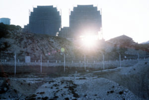
which dates back to 1956. The system was decommissioned in the late 1980s, and its frequencies reallocated for commercial radiotelephone service. The system was designed to be an L-band troposcatter radio system, which was meant to provide long-range communication service in the form of telephone
Telephone
The telephone , colloquially referred to as a phone, is a telecommunications device that transmits and receives sounds, usually the human voice. Telephones are a point-to-point communication system whose most basic function is to allow two people separated by large distances to talk to each other...
and telegraph to NATO. These two services combined produced over two hundred channels, and equipment was in place to multiplex them to contain up to 12 different calls each. There were 82 stations, located in nine different NATO countries.
The transmitters broadcast at 832.56 to 959.28 MHz, and some were able to produce a transmitting power of about 10 kilowatts.
ACE High sites
The ACE High network included the following major sites and terminals, but also consisted of LOS (line of sight) microwave links to Operations centres and headquarters not listed here.Norway
- (NC- Senja) > NSEZ - Senja 69°19'44.06"N 17°29'49,52"O
- (nca - Höggumpen) > NHGZ - Höggumpen 69°04'41.27"N 18°00'16.53"O 502üNN
- (ND- Bodö) > NKLZ - Bodoe 67°10'23.34"N 15°01'24.42"O 801üNN
- (nda - Bodoe Tail - Kletkov)
- (NE - Mosjöen) > NMOZ - Mosjoen 65°52'41.93"N 13°18'11.54"O 627üNN
- (NF - Trondheim) > NSBZ - Trondheim 63° 18′ 41,1″ N, 10° 56′ 17,75″ O
- (nfa - Trondheim Tail - Graakallen) 63°25'15.27"N 10°15'06.65"O 543üNN
- (NG - Oslo AAA) > NSOZ - Oslo 60°03'34.24"N 11°16'09.06"O 246üNN
- (Oslo YYY - Svartas) > NVAZ - Svartas
- (nga - Oslo Tail 01 - Kolsaas)
- (ngb - Oslo Tail 02 - Maakeroy)
- (NH - Kristiansand - Stormyrheia) > NSMZ - Kristiansand 58°27'19.14"N 08°27'43.45"O 326üNN
- (NJ - Sola - Lysanuf) > NLYZ - Sola 59°31'40.46"N 05°54'12.25"O 792üNN
United Kingdom
- (EAA - Foroes - Sandfelli 2)
- USVZ
- UCOZ
- (EA - Shetlands - Mossy Hill) > UMSZ - Mossy Hill > 59°57'17.15"N 01°18'11.60"O 227üNN
- (eab - Shetlands Tail Relay - Collofirth Hill)
- (eac - Shetlands Tail - Saxa Vord) 60°49'37.20"N 00°50'22.59"O 276üNN
- (EB - Aberdeen - Mormond Hill) > UMOZ - Mormond Hill 57°36'11.19"N 02°01'51.86"O 227üNN
- (eba - Aberdeen Tail - Long Haven Hill) > USVZ - Long Haven Hill
- (EC - Boulmer - Brizlee Wood) > UBOZ - Brizlee Wood
- (ED - Binbrook - Stenigot) > UBIZ - Stenigot 53°19'36.08"N 00°06'57.44"O 153üNN
- (EE - London - Coldblow Lane) > UMAZ - Coldblow Lane 51°17'44.95"N 00°36'51.52"O 194üNN
- (eeb - London Tail Relay - Woldinghom)
- (eea - London tail - Hillingolon)
- RAF UxbridgeRAF UxbridgeRAF Uxbridge was a Royal Air Force station in Uxbridge within the London Borough of Hillingdon. Its grounds covered originally belonging to the Hillingdon House estate, which was purchased by the British Government in 1915, three years before the founding of the RAF...
– local terminus
France
- (FAN - Paris - Mont Florentin) FFLZ - Paris North 49°20'27.59"N 02°03'06.79"O 222üNN
- FTAZ - Taverny 49°02'02.88"N 02°13'45.85"O 178üNN
- (fac - Paris Tail (2)- Sant Germain) 48°54'44.67"N 02°01'25.44"O 71üNN
- (fae - Paris Tail (2) - Extension (SHAPE) 48°50'34'19"N 02°06'14.30"O 178üNN
- (fa - Relais Paris - Emeville) FEMZ - Emeville 49°18'01.83"N 03°00'41.00"O 247üNN
- (faa - Paris Tail (1) - Laffaux) 49°27'15.05"N 03°24'57.39"O 143üNN
- (fad - Relay Paris - Rozoy Bellevalle) FRBZ - Rozoy Bellevalle 48°55'56.05"N 03°28'24.62"O 219üNN
- (FAS - Paris - Mont Aout) FAOZ - Paris South 48°46'14.78"N 03°53'25.33"O 216üNN
- (FA - Trier - Rohrbach) FROZ - Rohrbach 49°03'18.47"N 07°14'40.74"O 376üNN
- (fay - Trier Tail - Kindsbach) ABHZ - Kindsbach 49°23'48.11"N 07°35'38.32"O 458üNN
- (FC - Lyon - Pierre sur Haute) FLYZ - Lyon 45°39'11.52"N 03°48'33.07"O 1632üNN
- (FD - Nice - Signal de la Chens) FNIZ - Nice 43°44'53.67"N 06°39'44.85"O 1703üNN
Netherlands
- HBRZ - Brunssum 50°56'19.11"N 05°58'35.60"= 95üNN
- HMAZ - Maastricht 50°50'25.05"N 05°39'33.78"O 82üNN
Belgium
- BADZ - Adinkerke
- BCAZ - Casteau (SHAPE) Supreme Headquarters Allied Powers Europe - Central command of NATO military forces 50°30'05.56"N 03°58'15.69"O 87üNN
- BCHZ - Chievres
- BFRZ - Baraque de Fraiture 50°15'07.94"N 05°43'56.13"O 654üNN
Italy
- IDGZ - Dosso dei Galli 45°51'13.66"N 10°22'32.28"O 2174üNN
- IVTZ - Verona Tail ( im West Star Bunker ) 45°33'17.89"N 10°45'46.83"O 334üNN
- (IA - Livorno - Monte Giogo) IMXZ - Livorno 44°19'17.38"N 10°07'30.94"O 1496üNN
- (IAZ - Cavriana - Monte Bosco Sucro) IMBZ - Cavriana 45°21'00.79"N 10°37'01.46"O 189üNN
- (iaa - Verona Torre 4) 45°27'11.35"N 11°00'30.55"O 164üNN
- (IAY - Lame - Cavanella) ICEZ - Lame Concordia 45°44'55.99"N 12°52'08.75"O 7üNN
- (iax - Aviano) IAVZ - Aviano 46°01'23.02"N 12°35'34.19"O 99üNN
- (IB - Rome - Tolfa) ITLZ - Rome 42°09'01.76"N 11°54'32.73"O 621üNN
- (iba - Rome Tail - Monte Cavo) IMCZ - Monte Cavo 41°45'04.86"N 12°42'31.03"O 930üNN
- (IC - Neaples - Ischia - Punta Fetto) IICZ - Neaples 40°35'50.88"N 13°54'08.54"O 639üNN
- (ica - Neaples Tail - Monte Pecorara) IPEZ - Monte Petrino 41°13'24.29"N 13°57'57.75"O 335üNN
- (icy - Monte Vergine) IMNZ - Monte Nardello 40°56'20.67"N 14°43'07.21"O 1489üNN
- (icz - Monte Vulture) IVUZ - Monte Vulture 40°57'03.12"N 15°38'10.75"O 1301üNN
- (icv - Monte Lacontenente)
- (icf - Pietra Ficcata) IPFZ - Pietra Ficcata 40°34'04.90"N 16°19'21.31"O 586üNN
- (icw - Martina Franca) IAMZ - Martina Franca
- (ID - Catanzaro - Monte Mancuso) IMMZ - Catanzaro 39°01'09.13"N 16°13'32.02"O 1319üNN
- (IDA - Monte Lauro - Cozzo tre Grotte) ICCZ - Monte Lauro 37°06'52.13"N 14°51'18.96"O 944üNN
- (idb - Malta - Gharghur) IDBZ - Malta - Gharghur
Greece
- (GA - Kefallina) > GKFZ - Kefallonia 38°10'11.18"N 20°37'08'53"O 1001üNN
- (GB - Athens - Pendelikon) > GPKZ - Athens 38°04'50.46"N 23°52'58.14"O 1038üNN
- (GBZ - Crete - Ziros) > GZIZ - Ziros 35°03'53.52"N 26°09'14.24"O 786üNN
- (GBY - Larissa - Phillon) > GPIZ - Phillon 39°25'22.75N 23°03'11.54"O 1513üNN
- (GBW - Vitsi) > GVIZ - Vitzi 40°38'43.34"N 21°23'11.07"O 2009üNN
- (GBV - Ismaros) > GISZ - Ismaros 40°53'34.67"N 25°32'56.06"O 612üNN
Turkey
- (TA - Izmir - Bespinar Tepes) > TBPZ - Izmir - Bespinar Tepes
- (taa - Izmir Tail) > TKYZ - Izmir Tail
- (TB - Eskisehir)
- (tba - Eskirsehir Tail)
- (TC - Ankara) > TEDZ - Ankara - Elan Dagi 39°48'20.59"N 32°59'32.27"O 1856üNN
- (TCK - Merzifon)
- (TCW - Persembe)
- (TCV - Pazar)
- (TD - Siwas - Pinarbasi) > TPIZ - Pinarbasi
- (TG - Adana) > TDDZ - Davudi Dağı
- (tga - Adana Tail)
- (TE - Dyarbakir - Karaka Dagi)
- (tea - Dyarbakir Tail)
- TKUZ,
- TKJZ,
- TDIZ,
- Bloatli, Turkey
Cyprus
- (TCZ - Cap Greco) > JCGZ -Cavo Greko 36°58'00.85"N 34°04'11.41"O 62üNN
Germany
- ABHZ - Kindsbach 49°23'51.24"N 07°35'41.17"E 458üNN
- (AA - Emden - Aurich) AEMZ - Aurich 53°30'32.04"N 07°26'34.83"E 10üNN
- (AB - Moenchengladbach - Roetgen) ALAZ -Lammersdorf 50°39'57.59"N 06°17'14.58"E 593üNN
- (abb - Moenchengladbach Tail (1) - Hehn) AHEZ - Hehn 51°10'51.44"N 06°23'37.77"E 81üNN
- (aba - Moenchengladbach Tail (2) - Millen) 50°45'57.87"N 05°33'47.26"E 151üNN
- (abc - Uedem) AUEZ - Uedem 51°39'39.08"N 06°16'58.97"E 47üNN
- AFEZ - Feldberg 47°52'23.09"N 08°00'59.73"E 1458üNN
Denmark
- (DA - Karup - Torphoe) DLUZ - Karup 56°13'49.03"N 09°09'48.63"O 68üNN
- (daa - Karup Tail - Lundbakke) DTOZ - Kollemorten 55°52'28.98"N 09°21'00.95"O 135üNN
See also
- Radio propagationRadio propagationRadio propagation is the behavior of radio waves when they are transmitted, or propagated from one point on the Earth to another, or into various parts of the atmosphere...
- Tropospheric scatterTropospheric scatterTropospheric scatter is a method of transmitting and receiving microwave radio signals over considerable distances – often up to 300 km...
- MicrowaveMicrowaveMicrowaves, a subset of radio waves, have wavelengths ranging from as long as one meter to as short as one millimeter, or equivalently, with frequencies between 300 MHz and 300 GHz. This broad definition includes both UHF and EHF , and various sources use different boundaries...
- White Alice Communications SystemWhite Alice Communications SystemThe White Alice Communications System was a United States Air Force telecommunication link system constructed in Alaska during the cold war. It featured tropospheric scatter links and line-of-sight microwave radio links...
- Cold war era Alaskan tropospheric communications link - List of White Alice Communications System sites
- List of DEW Line Sites
- Distant Early Warning LineDistant Early Warning LineThe Distant Early Warning Line, also known as the DEW Line or Early Warning Line, was a system of radar stations in the far northern Arctic region of Canada, with additional stations along the North Coast and Aleutian Islands of Alaska, in addition to the Faroe Islands, Greenland, and Iceland...