

A61 road
Encyclopedia
The A61 is a major trunk road
in England
. It runs from Derby
to Thirsk
in North Yorkshire
. From Derby, it heads north via Alfreton
, Clay Cross
, Chesterfield
, Sheffield
, Barnsley
, Wakefield
, Leeds
, Harrogate
and Ripon
. The road is closely paralleled by the M1 motorway
as far as Leeds.
 Heading south, the road begins as single carriageway which bypasses Ripon and onto Harrogate town centre. At Harrogate, the road divides into two major one way streets which enclose the town centre and run along The Stray, (a 200 acre (0.809372 km²) stretch of grassland in Harrogate). The A61 continues through Harewood
before approaching the north's metropolis
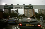
, where a sudden urban fringe approaches. As the road enters Leeds, the road becomes a main dual carriageway (or Trunk Road) and artery for north Leeds. For a distance it stays the same before the arrival of the superbusway near Potternewton
. Here, the A61 rises slightly, and a panoramic view of Leeds skyline is revealed. The descent into Leeds is quick and the road soon turns into a multi-lane road, as it approaches Sheepscar
Interchange. Fast Flowing traffic is directed onto the A61, although some traffic is directed off the A61 to avoid Leeds City Centre as it routes around the back of Quarry House. The A61 meets it shortly after, as it shares the city centre loop for a short distance. After crossing the river, the road splits again before taking traffic out to the motorways. The road then continues out of Leeds
towards Wakefield
and Barnsley
. South of Barnsley it crosses the M1
at Junction 36 then heads towards Sheffield
. Between the M1 at Junction 36 and the Westwood roundabout intersection with the A616
, the road is designated as a trunk road
under the responsibility of the Highways Agency
.
The A61 travels into Sheffield through Grenoside
and Hillsborough
, passing next to the Sheffield Wednesday football stadium
. At this point it forms a major artery into the City Centre
from the north, before becoming the Sheffield Inner Ring Road
(which as of 2007 is labelled as A61 all the way around). It meets the A57
twice; at Park Square
and Brookhill roundabout. The A61 takes a southerly course past Sheffield United football stadium
through Heeley
as Chesterfield Road
and climbs up to Norton and Greenhill roundabout. Between Sheffield and Chesterfield is a dual carriageway
, avoids Dronfield
as the eponymous by-pass. The road used to go through Chesterfield town centre, passing by the famous crooked spire, but was heavily congested. This was alleviated by the construction of the Chesterfield bypass in the 1980s on the alignment of the former Great Central Railway
. The road reverts to single carriageway south of Chesterfield, passing through Clay Cross
and Alfreton
.
South of Alfreton, the A61 merges with the dual carriageway A38
, but the old A61 continues as the B6179 through Swanwick
and Denby
, meeting the A38
again just north of the City. The A61 road continues towards the city centre along Sir Frank Whittle Road until it finally ends at the junction with the A52
near to the headquarters of Derbyshire County Cricket Club
.
Trunk road
A trunk road, trunk highway, or strategic road is a major road—usually connecting two or more cities, ports, airports, and other things.—which is the recommended route for long-distance and freight traffic...
in England
England
England is a country that is part of the United Kingdom. It shares land borders with Scotland to the north and Wales to the west; the Irish Sea is to the north west, the Celtic Sea to the south west, with the North Sea to the east and the English Channel to the south separating it from continental...
. It runs from Derby
Derby
Derby , is a city and unitary authority in the East Midlands region of England. It lies upon the banks of the River Derwent and is located in the south of the ceremonial county of Derbyshire. In the 2001 census, the population of the city was 233,700, whilst that of the Derby Urban Area was 229,407...
to Thirsk
Thirsk
Thirsk is a small market town and civil parish in the Hambleton district of North Yorkshire, England. The local travel links are located a mile from the town centre to Thirsk railway station and to Durham Tees Valley Airport...
in North Yorkshire
North Yorkshire
North Yorkshire is a non-metropolitan or shire county located in the Yorkshire and the Humber region of England, and a ceremonial county primarily in that region but partly in North East England. Created in 1974 by the Local Government Act 1972 it covers an area of , making it the largest...
. From Derby, it heads north via Alfreton
Alfreton
Alfreton is a town and civil parish in Amber Valley, Derbyshire, England, adjoining the Bolsover and North East Derbyshire districts. It was formerly a Norman Manor and later an Urban District. The population of the Alfreton Ward was 7,928 at the 2001 Census...
, Clay Cross
Clay Cross
Clay Cross is a former mining town and civil parish in the North East Derbyshire district of Derbyshire, England, about six miles south of Chesterfield. It is directly on the A61, the former Roman road Ryknield Street...
, Chesterfield
Chesterfield
Chesterfield is a market town and a borough of Derbyshire, England. It lies north of Derby, on a confluence of the rivers Rother and Hipper. Its population is 70,260 , making it Derbyshire's largest town...
, Sheffield
Sheffield
Sheffield is a city and metropolitan borough of South Yorkshire, England. Its name derives from the River Sheaf, which runs through the city. Historically a part of the West Riding of Yorkshire, and with some of its southern suburbs annexed from Derbyshire, the city has grown from its largely...
, Barnsley
Barnsley
Barnsley is a town in South Yorkshire, England. It lies on the River Dearne, north of the city of Sheffield, south of Leeds and west of Doncaster. Barnsley is surrounded by several smaller settlements which together form the Metropolitan Borough of Barnsley, of which Barnsley is the largest and...
, Wakefield
Wakefield
Wakefield is the main settlement and administrative centre of the City of Wakefield, a metropolitan district of West Yorkshire, England. Located by the River Calder on the eastern edge of the Pennines, the urban area is and had a population of 76,886 in 2001....
, Leeds
Leeds
Leeds is a city and metropolitan borough in West Yorkshire, England. In 2001 Leeds' main urban subdivision had a population of 443,247, while the entire city has a population of 798,800 , making it the 30th-most populous city in the European Union.Leeds is the cultural, financial and commercial...
, Harrogate
Harrogate
Harrogate is a spa town in North Yorkshire, England. The town is a tourist destination and its visitor attractions include its spa waters, RHS Harlow Carr gardens, and Betty's Tea Rooms. From the town one can explore the nearby Yorkshire Dales national park. Harrogate originated in the 17th...
and Ripon
Ripon
Ripon is a cathedral city, market town and successor parish in the Borough of Harrogate, North Yorkshire, England, located at the confluence of two streams of the River Ure in the form of the Laver and Skell. The city is noted for its main feature the Ripon Cathedral which is architecturally...
. The road is closely paralleled by the M1 motorway
M1 motorway
The M1 is a north–south motorway in England primarily connecting London to Leeds, where it joins the A1 near Aberford. While the M1 is considered to be the first inter-urban motorway to be completed in the United Kingdom, the first road to be built to motorway standard in the country was the...
as far as Leeds.
Route
Harewood
Harewood is a village and civil parish in the City of Leeds metropolitan borough, West Yorkshire, England. The A61 runs through the village, from Leeds city centre in the south to Harrogate in the north...
before approaching the north's metropolis
Metropolis
A metropolis is a very large city or urban area which is a significant economic, political and cultural center for a country or region, and an important hub for regional or international connections and communications...
, where a sudden urban fringe approaches. As the road enters Leeds, the road becomes a main dual carriageway (or Trunk Road) and artery for north Leeds. For a distance it stays the same before the arrival of the superbusway near Potternewton
Potternewton
Potternewton is a suburb and parish of north-east Leeds, West Yorkshire, England, situated between Chapeltown and Chapel Allerton, mainly in the LS7 postcode. It is between Scott Hall Road on the West and Roundhay Road on the East, with Harehills Lane on the North...
. Here, the A61 rises slightly, and a panoramic view of Leeds skyline is revealed. The descent into Leeds is quick and the road soon turns into a multi-lane road, as it approaches Sheepscar
Sheepscar
Sheepscar is an inner city district of Leeds in West Yorkshire England, lying to the north east of Leeds city centre. It is overlooked by the tower blocks of Little London and Lovell Park to the west, and gives way to Meanwood in the north-west, Chapeltown in the north-east and Burmantofts in the...
Interchange. Fast Flowing traffic is directed onto the A61, although some traffic is directed off the A61 to avoid Leeds City Centre as it routes around the back of Quarry House. The A61 meets it shortly after, as it shares the city centre loop for a short distance. After crossing the river, the road splits again before taking traffic out to the motorways. The road then continues out of Leeds
Leeds
Leeds is a city and metropolitan borough in West Yorkshire, England. In 2001 Leeds' main urban subdivision had a population of 443,247, while the entire city has a population of 798,800 , making it the 30th-most populous city in the European Union.Leeds is the cultural, financial and commercial...
towards Wakefield
Wakefield
Wakefield is the main settlement and administrative centre of the City of Wakefield, a metropolitan district of West Yorkshire, England. Located by the River Calder on the eastern edge of the Pennines, the urban area is and had a population of 76,886 in 2001....
and Barnsley
Barnsley
Barnsley is a town in South Yorkshire, England. It lies on the River Dearne, north of the city of Sheffield, south of Leeds and west of Doncaster. Barnsley is surrounded by several smaller settlements which together form the Metropolitan Borough of Barnsley, of which Barnsley is the largest and...
. South of Barnsley it crosses the M1
M1 motorway
The M1 is a north–south motorway in England primarily connecting London to Leeds, where it joins the A1 near Aberford. While the M1 is considered to be the first inter-urban motorway to be completed in the United Kingdom, the first road to be built to motorway standard in the country was the...
at Junction 36 then heads towards Sheffield
Sheffield
Sheffield is a city and metropolitan borough of South Yorkshire, England. Its name derives from the River Sheaf, which runs through the city. Historically a part of the West Riding of Yorkshire, and with some of its southern suburbs annexed from Derbyshire, the city has grown from its largely...
. Between the M1 at Junction 36 and the Westwood roundabout intersection with the A616
A616 road
The A616 is a road which links Newark-on-Trent, Nottinghamshire, to the M1 motorway at Junction 30, then reappears at Junction 35A and goes on to Huddersfield, West Yorkshire....
, the road is designated as a trunk road
Trunk road
A trunk road, trunk highway, or strategic road is a major road—usually connecting two or more cities, ports, airports, and other things.—which is the recommended route for long-distance and freight traffic...
under the responsibility of the Highways Agency
Highways Agency
The Highways Agency is an executive agency, part of the Department for Transport in England. It has responsibility for managing the core road network in England...
.
The A61 travels into Sheffield through Grenoside
Grenoside
Grenoside is a suburb of Sheffield, South Yorkshire, England.-History:The name Grenoside is derived from the language of the Anglo-Saxons. The name Grenoside, which was first recorded in the thirteenth century as Gravenhou, is made up of the different elements. Gren from the Old English graefan...
and Hillsborough
Hillsborough, South Yorkshire
Hillsborough is an electoral ward which includes the districts of Malin Bridge, Owlerton, Wadsley and Wisewood. It is one of the 28 electoral wards in City of Sheffield, England. It is located in the northwestern part of the city and covers an area of 4.6 km2...
, passing next to the Sheffield Wednesday football stadium
Sheffield Wednesday F.C.
Sheffield Wednesday Football Club are a football club based in Sheffield, South Yorkshire, England, who are currently competing in the Football League One in the 2011-12 season, in England. Sheffield Wednesday are one of the oldest professional clubs in the world and the fourth oldest in the...
. At this point it forms a major artery into the City Centre
Sheffield City Centre
Sheffield City Centre—often just referred to as town—is a district of the City of Sheffield, and part of the Sheffield Central ward. It includes the area that is within a radius of roughly of Sheffield Cathedral, and is encircled by the Inner Ring Road—a circular route started in the late 1960s...
from the north, before becoming the Sheffield Inner Ring Road
Sheffield Inner Ring Road
Sheffield Inner Ring Road is a dual-carriageway circling central Sheffield, South Yorkshire, England. Built from the 1960s onwards the Ring Road connects to the Sheffield Parkway, which itself connects with the M1 motorway...
(which as of 2007 is labelled as A61 all the way around). It meets the A57
A57 road
The A57 is a major road in England. It runs east from Liverpool to Lincoln, via Warrington, Cadishead, Irlam, Patricroft, Eccles, Salford and Manchester, then through the Pennines over the Snake Pass , around the Ladybower Reservoir, through Sheffield and past Worksop...
twice; at Park Square
Park Square, Sheffield
Park Square is a major roundabout in Sheffield, England. The Sheffield Parkway, a major road from M1 Junction 33, terminates here. It is located next to Ponds Forge, a swimming pool and a venue for the games...
and Brookhill roundabout. The A61 takes a southerly course past Sheffield United football stadium
Sheffield United F.C.
Sheffield United Football Club is a professional English football club based in the city of Sheffield, South Yorkshire.They were the first sporting team to use the name 'United' and are nicknamed 'The Blades', thanks to Sheffield's worldwide reputation for steel production...
through Heeley
Heeley
Heeley is a former cluster of villages now a suburb in the south of the City of Sheffield, England. The village has existed at least since 1343, its name deriving from Heah Leah, High Lea then Hely, meaning a high, woodland clearing...
as Chesterfield Road
Chesterfield Road (Sheffield)
Chesterfield Road is a shopping street in Sheffield, England. It leads south from the suburb of Meersbrook to Woodseats, before becoming Meadowhead at the Abbey Lane junction, next to the Abbey pub. The road starts at Toll Bar bridge on the Meers Brook, the former boundary between Yorkshire and...
and climbs up to Norton and Greenhill roundabout. Between Sheffield and Chesterfield is a dual carriageway
Dual carriageway
A dual carriageway is a class of highway with two carriageways for traffic travelling in opposite directions separated by a central reservation...
, avoids Dronfield
Dronfield
Dronfield is a town in North East Derbyshire in the North Midlands region of England. It comprises the three communities of Dronfield, Dronfield Woodhouse and Coal Aston. It is sited in the valley of the small River Drone, and lies between the town of Chesterfield and the city of Sheffield. The...
as the eponymous by-pass. The road used to go through Chesterfield town centre, passing by the famous crooked spire, but was heavily congested. This was alleviated by the construction of the Chesterfield bypass in the 1980s on the alignment of the former Great Central Railway
Great Central Railway
The Great Central Railway was a railway company in England which came into being when the Manchester, Sheffield and Lincolnshire Railway changed its name in 1897 in anticipation of the opening in 1899 of its London Extension . On 1 January 1923, it was grouped into the London and North Eastern...
. The road reverts to single carriageway south of Chesterfield, passing through Clay Cross
Clay Cross
Clay Cross is a former mining town and civil parish in the North East Derbyshire district of Derbyshire, England, about six miles south of Chesterfield. It is directly on the A61, the former Roman road Ryknield Street...
and Alfreton
Alfreton
Alfreton is a town and civil parish in Amber Valley, Derbyshire, England, adjoining the Bolsover and North East Derbyshire districts. It was formerly a Norman Manor and later an Urban District. The population of the Alfreton Ward was 7,928 at the 2001 Census...
.
South of Alfreton, the A61 merges with the dual carriageway A38
A38 road
The A38, part of which is also known as the Devon Expressway, is a major A-class trunk road in England.The road runs from Bodmin in Cornwall to Mansfield in Nottinghamshire. It is long, making it one of the longest A-roads in England. It was formerly known as the Leeds — Exeter Trunk Road,...
, but the old A61 continues as the B6179 through Swanwick
Swanwick
Swanwick may refer to:* The village of Swanwick, Derbyshire, England.* The village of Swanwick, Hampshire, England.* Helena Swanwick , British feminist and pacifist....
and Denby
Denby
Denby is a village in the English county of Derbyshire that is notable as the birthplace of John Flamsteed, England's first Royal Astronomer, and the location of the Denby Pottery Company....
, meeting the A38
A38 road
The A38, part of which is also known as the Devon Expressway, is a major A-class trunk road in England.The road runs from Bodmin in Cornwall to Mansfield in Nottinghamshire. It is long, making it one of the longest A-roads in England. It was formerly known as the Leeds — Exeter Trunk Road,...
again just north of the City. The A61 road continues towards the city centre along Sir Frank Whittle Road until it finally ends at the junction with the A52
A52 road
The A52 is a major road in the East Midlands, England. It runs east from the junction with the A53 at Newcastle-under-Lyme near Stoke-on-Trent via Ashbourne, Derby, Stapleford, Nottingham, West Bridgford, Bingham, Grantham, Boston and Skegness before terminating on the east Lincolnshire coast at...
near to the headquarters of Derbyshire County Cricket Club
Derbyshire County Cricket Club
Derbyshire County Cricket Club is one of the 18 major county clubs which make up the England and Wales domestic cricket structure, representing the historic county of Derbyshire...
.