
A491 road
Encyclopedia
The A491 is an A road in Zone 4 of the Great Britain numbering scheme
.
origin, joining the burh
s of Worcester
and Stafford
. The crossing of the River Stour
was probably the swine-ford that gave rise to the placenames Kingswinford and Oldswinford, and later to the name Stourbridge.
The road from Wordsley Green to the Market House in Stourbidge and so to Bromsgrove was turnpiked in 1753. The same act also dealt with several other roads from that Market House, as well as the road from Birmingham through Halesowen
and Hagley to Blakedown
Pool, but that was managed by separate trustees from 1773. Its continuation north of Wordsley Green, through Wolverhampton, and Stafford to Stone, much of it now part of A449 road
was turnpiked by the Wolverhampton
Turnpike Act of 1760.
In the original 1922 road numberings, A491 was the number assigned to the Shrewsbury - Welshpool - Mallwydd - Cemmaes Road route, now part of the A458 and A470. The route between Wall Heath and Bromsgrove was assigned the A449 number.
, Clent
, Romsley
and Holy Cross
. Following a roundabout in Hagley
the A491 is concurrent with the A456
for a short period before heading north towards Stourbridge
. At Pedmore
the A4036 leaves at a roundabout towards Dudley
. The A491 then continues to join the Stourbridge ring road.
, Wordsley
and Kingswinford
, passing numerous traffic light controlled junctions, before terminating on the A449
at a roundabout just north of Wall Heath
.
A roads in Zone 4 of the Great Britain numbering scheme
List of A roads in zone 4 in Great Britain starting north of the A4 and south/west of the A5 .-Single- and double-digit roads:-Triple-digit roads:-Four-digit roads :-Four-digit roads :...
.
History
The road north of Oldswinford forms part of an ancient road, probably of Anglo-SaxonAnglo-Saxon
Anglo-Saxon may refer to:* Anglo-Saxons, a group that invaded Britain** Old English, their language** Anglo-Saxon England, their history, one of various ships* White Anglo-Saxon Protestant, an ethnicity* Anglo-Saxon economy, modern macroeconomic term...
origin, joining the burh
Burh
A Burh is an Old English name for a fortified town or other defended site, sometimes centred upon a hill fort though always intended as a place of permanent settlement, its origin was in military defence; "it represented only a stage, though a vitally important one, in the evolution of the...
s of Worcester
Worcester
The City of Worcester, commonly known as Worcester, , is a city and county town of Worcestershire in the West Midlands of England. Worcester is situated some southwest of Birmingham and north of Gloucester, and has an approximate population of 94,000 people. The River Severn runs through the...
and Stafford
Stafford
Stafford is the county town of Staffordshire, in the West Midlands region of England. It lies approximately north of Wolverhampton and south of Stoke-on-Trent, adjacent to the M6 motorway Junction 13 to Junction 14...
. The crossing of the River Stour
River Stour, Worcestershire
The Stour is a river flowing through the counties of Worcestershire, the West Midlands and Staffordshire in the West Midlands region of England. The Stour is a major tributary of the River Severn, and it is about in length...
was probably the swine-ford that gave rise to the placenames Kingswinford and Oldswinford, and later to the name Stourbridge.
The road from Wordsley Green to the Market House in Stourbidge and so to Bromsgrove was turnpiked in 1753. The same act also dealt with several other roads from that Market House, as well as the road from Birmingham through Halesowen
Halesowen
Halesowen is a town in the Metropolitan Borough of Dudley, in the West Midlands, England.The population, as measured by the United Kingdom Census 2001, was 55,273...
and Hagley to Blakedown
Blakedown
Blakedown is a village in the Wyre Forest District in the north of the county of Worcestershire, England. Due to its road and rail links it serves mainly as a dormitory village for Kidderminster, and the cities of Birmingham and Worcester...
Pool, but that was managed by separate trustees from 1773. Its continuation north of Wordsley Green, through Wolverhampton, and Stafford to Stone, much of it now part of A449 road
A449 road
The A449 is a major road in the United Kingdom. It runs north from junction 24 of the M4 motorway at Newport in South Wales to Stafford in Staffordshire....
was turnpiked by the Wolverhampton
Wolverhampton
Wolverhampton is a city and metropolitan borough in the West Midlands, England. For Eurostat purposes Walsall and Wolverhampton is a NUTS 3 region and is one of five boroughs or unitary districts that comprise the "West Midlands" NUTS 2 region...
Turnpike Act of 1760.
In the original 1922 road numberings, A491 was the number assigned to the Shrewsbury - Welshpool - Mallwydd - Cemmaes Road route, now part of the A458 and A470. The route between Wall Heath and Bromsgrove was assigned the A449 number.
Lydiate Ash - Stourbridge
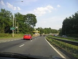
Starting at junction 4 of the M5, the road heads West on a single carriageway alignment, meeting the B4091 at a roundabout, then becoming a dual carriageway. There are local accesses for the villages of BelbroughtonBelbroughton
Belbroughton is a village and civil parish in the Bromsgrove District of Worcestershire, England. According to the 2001 census it had a population of 2,380. It is about six miles north of Bromsgrove, six miles east of Kidderminster and four miles south of Stourbridge, in Worcestershire...
, Clent
Clent
Clent is a village and civil parish in the Bromsgrove District of Worcestershire, England, southwest of Birmingham and close to the edge of the West Midlands conurbation. At the 2001 census it had a population of 2,600...
, Romsley
Romsley, Worcestershire
Romsley is a village and civil parish in the Bromsgrove District of Worcestershire, England, on the east side of the Clent Hills about 4 miles south of Halesowen. As of 2001 it has a population of 1,601....
and Holy Cross
Holy Cross, Worcestershire
Holy Cross is a hamlet in Worcestershire, England. It is one of the five hamlets that make up the parish of Clent. The village is mostly housing apart from a pub....
. Following a roundabout in Hagley
Hagley
Hagley is a village and civil parish on the northern boundary of Worcestershire, England, near to the towns of Kidderminster and Stourbridge. The parish had a population of 4,283 in 2001, but the whole village had a population of perhaps 5,600, including the part in Clent parish...
the A491 is concurrent with the A456
A456 road
The A456 is a main road in England running between Birmingham and Woofferton, Shropshire, south of Ludlow.-History:Much of the road is almost certainly medieval in origin...
for a short period before heading north towards Stourbridge
Stourbridge
Stourbridge is a town within the Metropolitan Borough of Dudley, in the West Midlands of England. Historically part of Worcestershire, Stourbridge was a centre of glass making, and today includes the suburbs of Amblecote, Lye, Norton, Oldswinford, Pedmore, Wollaston, Wollescote and Wordsley The...
. At Pedmore
Pedmore
Pedmore is a residential suburb of Stourbridge in the West Midlands of England. It was originally a village in the Worcestershire countryside until extensive housebuilding during the interwar years saw it gradually merged into Stourbridge.- Amenities :...
the A4036 leaves at a roundabout towards Dudley
Dudley
Dudley is a large town in the West Midlands county of England. At the 2001 census , the Dudley Urban Sub Area had a population of 194,919, making it the 26th largest settlement in England, the second largest town in the United Kingdom behind Reading, and the largest settlement in the UK without...
. The A491 then continues to join the Stourbridge ring road.
Stourbridge - Wall Heath
The A491 resumes again on the northern side of the Stourbridge ring road. This final section is entirely single carriageway in an urban environment. The road passes through AmblecoteAmblecote
Amblecote is an urban village in the Metropolitan Borough of Dudley in the West Midlands, England. It lies immediately north of the historic town of Stourbridge, extending about one and a half miles from it. As such, it is on the southwestern edge of the West Midlands urban area...
, Wordsley
Wordsley
Wordsley with Buckpool is a village south of Kingswinford although is the most northern suburb of Stourbridge in the West Midlands, England. Wordsley still retains its rural character because it abuts open countryside...
and Kingswinford
Kingswinford
Kingswinford is a suburban area in the West Midlands.Historically within Staffordshire, the area is mentioned in the Domesday Book its name relates to a ford for the King's swine - Latin Swinford Regis. The current significance is probably in tourism, education and housing...
, passing numerous traffic light controlled junctions, before terminating on the A449
A449 road
The A449 is a major road in the United Kingdom. It runs north from junction 24 of the M4 motorway at Newport in South Wales to Stafford in Staffordshire....
at a roundabout just north of Wall Heath
Wall Heath
-Geography:Wall Heath is a small village on the western fringe of the Black Country and the West Midlands conurbation in the United Kingdom. It is located on the A449 road, approximately seven miles south of Wolverhampton and 9 miles North of Kidderminster....
.
Bypasses and Realignments
- Holy Cross (Now bypassed by a dual carriageway to the North)
- Stourbridge Town Centre (Traffic now uses the ring road)