
A470 road
Encyclopedia
The A470 is a major long-distance connective spine road in Wales
, running from Cardiff
on the south coast to Llandudno
on the north coast. It covers approximately 186 miles (299 km), over a zig-zagging route through the entirety of the country's mountainous central region, including the Brecon Beacons
and much of Snowdonia National Park.
Though the southernmost 26 miles (42 km) from Cardiff Bay to Merthyr Tydfil are mainly direct and good quality dual carriageway
, and it remains a primary trunk route throughout its length, the great majority of the route from here north to the Llandudno seafront is single carriageway
of variable quality (and even in brief instances single track
) in order to accommodate the natural and built landscape. It takes in several town centres, right-angle (or tighter) divergent junctions and sharp curves.
, outside the Wales Millennium Centre
. It runs up Lloyd George Avenue
(this was previously Collingdon Road, and the A470 previously ran along the parallel Bute Street
), and continues along St. Mary Street in central Cardiff
. The road then becomes North Road, and after a tidal flow
system running to Maindy
and then goes over the flyover at the Gabalfa
interchange of the A48
and the A469
. It becomes an urban dual-carriageway along Manor Way and Northern Avenue, where the number changes to (470)B because there is housing along it, with a 40 mi/h speed limit and with many traffic-signalled crossings. It passes without interruption under the M4
at the giant Coryton roundabout. For the next 15 miles (24.1 km) it is a modern high-speed dual carriageway by-passing Tongwynlais
and Castell Coch
, Taff's Well
, to Pontypridd
. Heading north to Abercynon
, the road now follows the route of the Taff Vale Railway
s Llancaiach Branch
to Quakers Yard roundabout, where it is joined by the A4059 from Abercynon
, Aberdare
and Hirwaun
; the A472
from Ystrad Mynach
and Pontypool
finally the A4054 from Quakers Yard
, and Merthyr Tydfil
.
 From Quakers Yard roundabout (locally known as 'Fiddlers Elbow'), 5.5 miles (8.9 km) of dual carriageway takes the road to the Pentrebach roundabout where the A4060 links, and then to the Merthyr Tydfil roundabout where the road meets the A465
and the dual carriageway ends. A twisting section alongside the Taf Fawr reservoirs of Llwyn-on
, Cantref
and Beacons
takes the road to its highest point at Storey Arms on the pass over the Brecon Beacons
before a long descent down to the town of Brecon
. This marks the northernmost point of the "traditional" A470.
The remainder of the route north of Brecon consists of older routes now renamed 'A470'. This artificiality is apparent as a driver following the entire route north to south must diverge from the main line of respective stretches of road no fewer than five times. A short three lane stretch heads north east before a sharp left turn is required to stay on the road. From this point on the road becomes narrow and twisting and overtaking is problematic except at a few straight sections. Another sharp left turn at a stop sign in Llyswen
takes the road alongside the River Wye
into Builth Wells
.
 The road continues to follow the Wye to the busy crossroads where it meets the A44
in the centre of Rhayader
. On reaching Llangurig
, a right turn outside the village takes the road past Llanidloes
and through Llandinam
, the birthplace of David Davies
and now the headquarters of Girl Guides Wales
. Another anomalous left turn at a railway crossing sets the path for Caersws
, Carno
and Llanbrynmair
. Just beyond the village of Talerddig
the road descends and crosses under the Shrewsbury-Aberystwyth railway line
. The long descent towards Commins Coch
is a relatively new stretch of road that replaced a record breaking set of road-works that had traffic light controlled single lane working for over 10 years because of unstable ground conditions. The river bridge at Commins Coch
is so narrow and set at such an angle that only one vehicle at a time can pass. At Cemmaes Road
the road joins the A487
at a roundabout. A right turn at the roundabout takes the road on to Mallwyd
where the A458
joins at yet another roundabout.
 The country becomes more forested and the road climbs up through Dinas Mawddwy
and then steeply up the eastern foot-hills of Cadair Idris
before dropping down through tortuous bends to the Dolgellau
by-pass. More sharp twists and turns in the forestry and through the village of Ganllwyd
brings the road up onto the high plateau of the Cambrian dome where the road follows the ancient track of Sarn Helen
Roman road passing the redundant nuclear power station at Trawsfynydd
. A right turn beyond the power station takes the road on to Ffestiniog
and Blaenau Ffestiniog
before heading over the Crimea Pass
to Dolwyddelan
. A sharp left turn interrupts the A470 as it becomes the A5 for a short distance towards Betws-y-Coed
before turning right again back onto the A470 just before Waterloo Bridge
. Passing down the valley of the River Conwy
the road passes through Llanrwst
, Tal y Cafn and Glan Conwy
, at which point there is a dual roundabout that intersects with the A55 North Wales Expressway before descending to the north coast at Llandudno
.
 According to the Bartholomew “Motorists’ Road Atlas
Britain” (1971-72 edition) the original roads that now make up the A470 were as follows:-
From Cardiff
to Brecon
was the original A470. It originally ran into Brecon town centre and joined the A40 road
. The old A470 between the by-pass and the town, along Newgate Street, is now the B4601. A4062 was the number for the section from the junction of the A40 and the B4601 – the Brecon (eastern) bypass to B4602 section. The B4601 was originally the A40 which ran through the town of Brecon. Similarly, the B4602 was originally the westernmost part of the A438.
 The A438 was the original number for the road from the junction with B4602 to the sharp left turn where A470 turns north in the vicinity of Llanfilo. The A438 continues on from there to Hereford
and Tewkesbury
. From north of Llanfilo to Llyswen
was the A4073. A479 originally linked the A40 west of Crickhowell
to the A44 road
at Rhayader
. The A479 now runs only from Crickhowell to Llyswen. The stretch from Rhayader to Llangurig
was the A44. Officially, (according to the British Ordnance Survey Landranger Map sheet 136 Newtown & Llanidloes) this section is the A470 only, but some local signage shows A44/A470.
The next section, from Llangurig to Moat Lane (east of Caersws
) was once the A492. The A492 originally ran from Llangurig to Newtown. The section Moat Lane to Newtown has since been renumbered A489. From Moat Lane to Glantwymyn the A470 replaced the A489. The A489 ran all the way from Machynlleth
to the A49 road
north of Craven Arms
in south Shropshire
. Now the A489 designation applies to two roads separated by 17 miles (27.4 km) of the A470. Glantwymyn to Mallwyd was the A4084.
Originally starting at the Cross Foxes near Dolgellau
the A458 now runs only from Mallwyd to Shrewsbury
. It now starts at Mallwyd with the Mallwyd to Cross Foxes section being the A470. Cross Foxes to near Gellilydan (in the Meirionydd part of Gwynedd
south of Ffestiniog
) brings us to a complicated series of route renumbering. This stretch was originally the A487 which ran through Dolgellau town centre. The modern A470 bypasses the town using the line of the old Ruabon – Morfa Mawddach railway
. The A487 number applies to two sections of the Fishguard
– Bangor
trunk road
with the A470 between Dolgellau and Gellilydan.
Gellilydan via Llan Ffestiniog to Blaenau Ffestiniog
(Congl-y-Wal) was originally A4108. The A4108 used to stop where the A496 came up the hill from Maentwrog. The A496 has now been rerouted to pass Tanygrisiau following (in part) the old B4414 which was upgraded and now avoids Tanygrisiau.
One of the simplest sections is from Blaenau Ffestiniog (Congl-y-Wal) to Llandudno
. Originally as the A496 it ran from west of Dolgellau via Barmouth
, Maentwrog
, Blaenau Ffestiniog, Betws-y-Coed
, and Llanrwst
to Llandudno. The section of road from Glan Conwy corner to Llandudno is a new well aligned direct route to Llandudno. The old A496 has been renumbered A547 between Glan Conwy and Llandudno Junction and A546 between Llandudno Junction and Llandudno. The A496 now numbers only the Dolgellau – Blaenau Ffestiniog coast road.
Wales
Wales is a country that is part of the United Kingdom and the island of Great Britain, bordered by England to its east and the Atlantic Ocean and Irish Sea to its west. It has a population of three million, and a total area of 20,779 km²...
, running from Cardiff
Cardiff
Cardiff is the capital, largest city and most populous county of Wales and the 10th largest city in the United Kingdom. The city is Wales' chief commercial centre, the base for most national cultural and sporting institutions, the Welsh national media, and the seat of the National Assembly for...
on the south coast to Llandudno
Llandudno
Llandudno is a seaside resort and town in Conwy County Borough, Wales. In the 2001 UK census it had a population of 20,090 including that of Penrhyn Bay and Penrhynside, which are within the Llandudno Community...
on the north coast. It covers approximately 186 miles (299 km), over a zig-zagging route through the entirety of the country's mountainous central region, including the Brecon Beacons
Brecon Beacons
The Brecon Beacons is a mountain range in South Wales. In a narrow sense, the name refers to the range of popular peaks south of Brecon, including South Wales' highest mountain, Pen y Fan, and which together form the central section of the Brecon Beacons National Park...
and much of Snowdonia National Park.
Though the southernmost 26 miles (42 km) from Cardiff Bay to Merthyr Tydfil are mainly direct and good quality dual carriageway
Dual carriageway
A dual carriageway is a class of highway with two carriageways for traffic travelling in opposite directions separated by a central reservation...
, and it remains a primary trunk route throughout its length, the great majority of the route from here north to the Llandudno seafront is single carriageway
Single carriageway
A single carriageway is a road with 1, 2 or more lanes arranged within a single carriageway with no central reservation to separate opposing flows of traffic. Two-lane road or two-lane highway are single carriageway with one lane for each direction...
of variable quality (and even in brief instances single track
Single track road
A single-track road or one-lane road is a road that permits two-way travel but is not wide enough in most places to allow vehicles to pass one another . This kind of road is common in rural areas across the United Kingdom and elsewhere...
) in order to accommodate the natural and built landscape. It takes in several town centres, right-angle (or tighter) divergent junctions and sharp curves.
Route in detail
The southernmost point of the route is at The Flourish, Cardiff BayCardiff Bay
Cardiff Bay is the area created by the Cardiff Barrage in South Cardiff, the capital of Wales. The regeneration of Cardiff Bay is now widely regarded as one of the most successful regeneration projects in the United Kingdom. The Bay is supplied by two rivers to form a freshwater lake round the...
, outside the Wales Millennium Centre
Wales Millennium Centre
Wales Millennium Centre is an arts centre located in the Cardiff Bay area of Cardiff, Wales. The site covers a total area of . Phase 1 of the building was opened during the weekend of the 26–28 November 2004 and phase 2 opened on 22 January 2009 with an inaugural concert...
. It runs up Lloyd George Avenue
Lloyd George Avenue
Lloyd George Avenue is an avenue in Cardiff, Wales. Roughly one mile long, the road links the Inner Harbour of Cardiff Bay to Cardiff city centre and forms part of the A470 road. It runs parallel to Bute Street and the Butetown Branch Line...
(this was previously Collingdon Road, and the A470 previously ran along the parallel Bute Street
Bute Street (Cardiff)
Bute Street is a street in Cardiff, Wales. It links Cardiff Bay and Butetown with Cardiff city centre. It now has no road number...
), and continues along St. Mary Street in central Cardiff
Cardiff city centre
Cardiff city centre is the central business district of Cardiff, Wales. The area is tightly bounded by the River Taff to the west, the Civic centre to the north and railway lines and two railway stations - Central and Queen Street - to the south and east respectively...
. The road then becomes North Road, and after a tidal flow
Reversible lane
A reversible lane , called a counterflow lane or contraflow lane in transport engineering nomenclature, is a lane in which traffic may travel in either direction, depending on certain conditions...
system running to Maindy
Maindy
Maindy is a district of the city of Cardiff, Wales. It lies between the districts of Cathays and Penylan. It falls within the Cathays ward.A notable facility in the area is the Maindy Centre consisting of a cycle track and swimming pool. The cycle track was used in the 1958 British Empire and...
and then goes over the flyover at the Gabalfa
Gabalfa
Gabalfa is a district in the north of the city of Cardiff, capital of Wales. It is characterised by an enormous fly over road which is part of the large Gabalfa Interchange, and crosses the A48 road in a north-south direction. The area is also the site of the All Nations Centre.The name is derived...
interchange of the A48
A48 road
The A48 is a major trunk road in Great Britain. It runs from the A40 at Highnam west of Gloucester to the A40 at Carmarthen. Before the construction of the M4 motorway and the first Severn Bridge in the mid 1960s it was the principal route into South Wales. For most of its journey through Wales,...
and the A469
A469 road
The A469 is a road in south Wales. It links Cardiff and Caerphilly with Rhymney and the Heads of the Valleys Road .-References:* Cardiff & Newport A-Z Street Atlas 2007 Edition...
. It becomes an urban dual-carriageway along Manor Way and Northern Avenue, where the number changes to (470)B because there is housing along it, with a 40 mi/h speed limit and with many traffic-signalled crossings. It passes without interruption under the M4
M4 motorway
The M4 motorway links London with South Wales. It is part of the unsigned European route E30. Other major places directly accessible from M4 junctions are Reading, Swindon, Bristol, Newport, Cardiff and Swansea...
at the giant Coryton roundabout. For the next 15 miles (24.1 km) it is a modern high-speed dual carriageway by-passing Tongwynlais
Tongwynlais
Tongwynlais is a village in the north of Cardiff, capital of Wales, in the Taff Valley.- Overview :Tongwynlais lies in the River Taff Valley. Its population is 1946 people....
and Castell Coch
Castell Coch
Castell Coch is a 19th-century Gothic Revival castle built on the remains of a genuine 13th-century fortification. It is situated on a steep hillside high above the village of Tongwynlais, to the north of Cardiff in Wales, and is a Grade I listed building as of 28 January 1963.Designed by William...
, Taff's Well
Taff's Well
Taff's Well or Taffs Well is a village located just north of the city of Cardiff and from its city centre. Located in the county borough of Rhondda Cynon Taf, Taff's Well serves as a commuter town.-Name:...
, to Pontypridd
Pontypridd
Pontypridd is both a community and a principal town of Rhondda Cynon Taf, Wales and is situated 12 miles/19 km north of the Welsh capital city of Cardiff...
. Heading north to Abercynon
Abercynon
Abercynon is a small village in the Cynon Valley in Mid Glamorgan, Wales. The unitary authority is now known as Rhondda Cynon Taff. It is composed of the village of Abercynon itself,Carnetown,Glancynon,Park View and Pontcynon. However, in recent years the sign to show motorists they are entering...
, the road now follows the route of the Taff Vale Railway
Taff Vale Railway
The Taff Vale Railway is a railway in Glamorgan, South Wales, and is one of the oldest in Wales. It operated as an independent company from 1836 until 1922, when it became a constituent company of the Great Western Railway...
s Llancaiach Branch
Llancaiach Branch
The Llancaiach Branch was a railway branch line in South Wales. Financed and operated by the Taff Vale Railway, on amalgamation became part of the Great Western Railway in 1923...
to Quakers Yard roundabout, where it is joined by the A4059 from Abercynon
Abercynon
Abercynon is a small village in the Cynon Valley in Mid Glamorgan, Wales. The unitary authority is now known as Rhondda Cynon Taff. It is composed of the village of Abercynon itself,Carnetown,Glancynon,Park View and Pontcynon. However, in recent years the sign to show motorists they are entering...
, Aberdare
Aberdare
Aberdare is an industrial town in Rhondda Cynon Taf, Wales, situated at the confluence of the Rivers Dare and Cynon. The population at the census was 31,705...
and Hirwaun
Hirwaun
Hirwaun is the name of a village at the northwest end of the Cynon Valley in the County Borough of Rhondda Cynon Taf, South Wales. The village of Hirwaun is from the town of Aberdare, and comes under Aberdare for postal reasons...
; the A472
A472 road
The A472 is a cross valley link road in South Wales that runs west to east across the old South Wales coalfield from Treharris through Nelson, Ystrad Mynach, Maesycwmmer, Pontllanfraith, Newbridge, Crumlin, Hafodyrynys, Pontypool and thence into the Usk valley, through Little Mill and Usk to a...
from Ystrad Mynach
Ystrad Mynach
Ystrad Mynach is a town in the County Borough of Caerphilly, previously within the ancient traditional county of Glamorgan, Wales, and is 5 miles north of Caerphilly town. It has a population of around 13,500 and stands in the Rhymney Valley . Before the Industrial Revolution and the coming of coal...
and Pontypool
Pontypool
Pontypool is a town of approximately 36,000 people in the county borough of Torfaen, within the historic boundaries of Monmouthshire in South Wales....
finally the A4054 from Quakers Yard
Quakers Yard
Quakers Yard is a village in the Merthyr Tydfil County Borough, situated where the Taff Bargoed Valley joins the Taff Valley. Quakers Yard is part of the community of Treharris.-History:...
, and Merthyr Tydfil
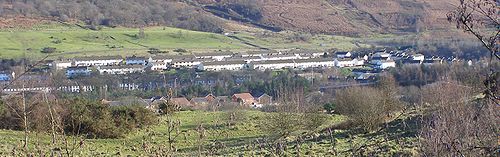
Merthyr Tydfil
Merthyr Tydfil is a town in Wales, with a population of about 30,000. Although once the largest town in Wales, it is now ranked as the 15th largest urban area in Wales. It also gives its name to a county borough, which has a population of around 55,000. It is located in the historic county of...
.
A465 road
The A465 is a major road in south Wales. It is more commonly known as the Heads of the Valleys Road because it joins together the north ends of the South Wales Valleys...
and the dual carriageway ends. A twisting section alongside the Taf Fawr reservoirs of Llwyn-on
Llwyn-On Reservoir
Llwyn-on Reservoir is the largest and southernmost of the three reservoirs in the Taff Fawr valley in South Wales. It is owned by Welsh Water. It is located in the Brecon Beacons National Park. The eastern half is in the Merthyr Tydfil unitary authority area and the western half is in the Rhondda...
, Cantref
Cantref Reservoir
Cantref Reservoir is the middle of the three reservoirs in the Taff Fawr valley in South Wales. It is owned by Welsh Water. It is located in the Brecon Beacons National Park, mostly in the Powys unitary authority area and within the historic county boundaries of Breconshire...
and Beacons
Beacons Reservoir
Beacons Reservoir is the northernmost of the three reservoirs in the Taff Fawr valley in South Wales. It is owned by Welsh Water. As its name suggests, it is located in the Brecon Beacons National Park in the Powys unitary authority area and within the historic county boundaries of...
takes the road to its highest point at Storey Arms on the pass over the Brecon Beacons
Brecon Beacons
The Brecon Beacons is a mountain range in South Wales. In a narrow sense, the name refers to the range of popular peaks south of Brecon, including South Wales' highest mountain, Pen y Fan, and which together form the central section of the Brecon Beacons National Park...
before a long descent down to the town of Brecon
Brecon
Brecon is a long-established market town and community in southern Powys, Mid Wales, with a population of 7,901. It was the county town of the historic county of Brecknockshire; although its role as such was eclipsed with the formation of Powys, it remains an important local centre...
. This marks the northernmost point of the "traditional" A470.
The remainder of the route north of Brecon consists of older routes now renamed 'A470'. This artificiality is apparent as a driver following the entire route north to south must diverge from the main line of respective stretches of road no fewer than five times. A short three lane stretch heads north east before a sharp left turn is required to stay on the road. From this point on the road becomes narrow and twisting and overtaking is problematic except at a few straight sections. Another sharp left turn at a stop sign in Llyswen
Llyswen
Llyswen is a small village in Powys, Wales on the west bank of the River Wye. It was formerly within the county of Brecknockshire and now forms part of the Community of Bronllys...
takes the road alongside the River Wye
River Wye
The River Wye is the fifth-longest river in the UK and for parts of its length forms part of the border between England and Wales. It is important for nature conservation and recreation.-Description:...
into Builth Wells
Builth Wells
Builth Wells is a town in the county of Powys, within the historic boundaries of Brecknockshire, mid Wales, lying at the confluence of the River Wye and the River Irfon, in the Welsh of the Wye Valley. It has a population of 2,352....
.
A44 road
The A44 is a major road in the United Kingdom that runs from Oxford in southern England to Aberystwyth in west Wales.-History:The original route of the A44 was Chipping Norton to Aberystwyth. No changes were made to the route of the A44 in the early years...
in the centre of Rhayader
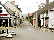
Rhayader
Rhayader is a market town and community in Powys, Mid Wales. It has a population of 2,075, and is the first town on the banks of the River Wye, from its source on the Plynlimon range of the Cambrian Mountains....
. On reaching Llangurig
Llangurig
Llangurig is a village in Powys, within the historic county boundaries of Montgomeryshire, mid Wales, lying on the River Wye. The population is 670.Llangurig is reputed to be the highest village in Wales at an altitude of 1000 feet...
, a right turn outside the village takes the road past Llanidloes
Llanidloes
Llanidloes is a town along the A470 road and B4518 road in Powys, within the historic county boundaries of Montgomeryshire , Mid Wales.It is the first town on the River Severn...
and through Llandinam
Llandinam
Llandinam is village in Powys, central Wales, between Newtown and Llanidloes, located on the A470.Llandinam was the family home of David Davies who was responsible for much of the development of the South Wales Valleys and the export of coal in the 19th century...
, the birthplace of David Davies
David Davies (industrialist)
David Davies was a Welsh industrialist and Liberal politician who sat in the House of Commons between 1874 and 1886. Davies was often known as David Davies Llandinam , in order to differentiate him from others of the same name.Davies was the son of David Davies and his wife Elizabeth...
and now the headquarters of Girl Guides Wales
Girlguiding UK
Girlguiding UK is the national Guiding organisation of the United Kingdom. Guiding began in the UK in 1910 after Robert Baden-Powell asked his sister Agnes to start a group especially for girls that would be run along similar lines to Scouting for Boys. The Guide Association was a founder member of...
. Another anomalous left turn at a railway crossing sets the path for Caersws
Caersws
Caersws is a village and community sitting on the River Severn, at miles west of Newtown, Powys, and halfway between Aberystwyth and Shrewsbury.- History & Amenities :...
, Carno
Carno
Carno is a village in Powys, Mid Wales. It is located on the main A470 road between Llanbrynmair & Caersws.The local railway station, on the Cambrian Line, closed as part of the Beeching closures in the 1965. An ongoing campaign started in August 2009 for its reopening, with the Welsh Assembly...
and Llanbrynmair
Llanbrynmair
Llanbrynmair is a village and community in Powys, Mid Wales on the A470 road between Caersws and Machynlleth. Llanbrynmair, in area, is the second largest in Powys. In 2005, it had a population of 958.-Description:...
. Just beyond the village of Talerddig
Talerddig
Talerddig is a village in Powys, Mid Wales located on the main A470 road between Llanbrynmair and Carno. It is part of Llanbrynmair community and Anglican parish....
the road descends and crosses under the Shrewsbury-Aberystwyth railway line
Cambrian Line
The Cambrian Line is a railway from Shrewsbury to Welshpool, Aberystwyth and Pwllheli. The railway runs first through the central part of Wales and then along the coast of Cardigan Bay....
. The long descent towards Commins Coch
Commins Coch
Commins Coch is a small village on the A470 in the county of Powys in Wales.Commins Coch is notable for the narrow bridge set at right angles that crosses the Mid Wales Railway line...
is a relatively new stretch of road that replaced a record breaking set of road-works that had traffic light controlled single lane working for over 10 years because of unstable ground conditions. The river bridge at Commins Coch
Commins Coch
Commins Coch is a small village on the A470 in the county of Powys in Wales.Commins Coch is notable for the narrow bridge set at right angles that crosses the Mid Wales Railway line...
is so narrow and set at such an angle that only one vehicle at a time can pass. At Cemmaes Road
Cemmaes Road
Cemmaes Road is a village in Powys, Mid Wales, in English, the village was named after the now-closed Cemmaes Road railway station. The Welsh name for the village, and for the community, is Glantwymyn , as it lies on the River Twymyn. According to the United Kingdom Census 2001, the population of...
the road joins the A487
A487 road
The A487 is a trunk road in Wales, running up the western side of the country from Haverfordwest in the south to Bangor in the north.It starts at Merlin's Bridge near Haverfordwest, from where it travels north west to St David's, then switches back north east through Fishguard, Cardigan, Aberaeron,...
at a roundabout. A right turn at the roundabout takes the road on to Mallwyd
Mallwyd
Mallwyd is a small village at the most southern end of the county of Gwynedd in North Wales in the valley of the River Dyfi. It lies on the A470 approximately half-way between Dolgellau and Machynlleth, and forms the junction of the A458 towards Welshpool. The nearest village is Dinas Mawddwy, two...
where the A458
A458 road
The A458 is a route on the UK highway network that runs from Mallwyd, near Machynlleth, in Wales, to Halesowen, near Stourbridge, in England. On the way it passes through Welshpool, Shrewsbury, Much Wenlock, Bridgnorth and Stourbridge.-Welshpool to Shrewsbury:...
joins at yet another roundabout.
Dinas Mawddwy
Dinas Mawddwy is a village in Gwynedd, north Wales, just to the side of the A470 so that most visitors pass the village by. Its population is roughly 600. The village marks the junction of the unclassified road to Llanuwchllyn which climbs up through the mountains to cross Bwlch y Groes at its...
and then steeply up the eastern foot-hills of Cadair Idris
Cadair Idris
Cadair Idris or Cader Idris is a mountain in Gwynedd, Wales that lies at the southern end of the Snowdonia National Park. The peak, which is one of the most popular in Wales for walkers and hikers, is composed largely of Ordovician igneous rocks, with classic glacial erosion features such as...
before dropping down through tortuous bends to the Dolgellau
Dolgellau
Dolgellau is a market town in Gwynedd, north-west Wales, lying on the River Wnion, a tributary of the River Mawddach. It was the county town of the former county of Merionethshire .-History and economy:...
by-pass. More sharp twists and turns in the forestry and through the village of Ganllwyd
Ganllwyd
Ganllwyd is small village in southern Gwynedd, Wales through which the A470 passes. It lies in the Snowdonia National Park to the north of Dolgellau....
brings the road up onto the high plateau of the Cambrian dome where the road follows the ancient track of Sarn Helen
Sarn Helen
right|thumb|250px|A section of Sarn Helen near Betws-y-coed.Sarn Helen was a Roman road in Wales, running from Aberconwy in the north to Carmarthen in the south.It was some 160 miles in length...
Roman road passing the redundant nuclear power station at Trawsfynydd
Trawsfynydd
Trawsfynydd is a village in Gwynedd, North Wales, adjacent to the A470 north of Dolgellau near Blaenau Ffestiniog....
. A right turn beyond the power station takes the road on to Ffestiniog
Ffestiniog
Ffestiniog is a community in Gwynedd in Wales, containing several villages, in particular the settlements of Llan Ffestiniog and Blaenau Ffestiniog. It has a population of 4,830....
and Blaenau Ffestiniog
Blaenau Ffestiniog
Blaenau Ffestiniog is a town in Gwynedd, north-west Wales. It has a population of 5,000, including Llan Ffestiniog, which makes it the third largest town in Gwynedd, behind Caernarfon & Porthmadog. Although the population reached 12,000 at the peak of the slate industry, the population fell due to...
before heading over the Crimea Pass
Crimea Pass
The Crimea Pass is a mountain pass in north Wales, on the A470 road between Blaenau Ffestiniog and Dolwyddelan.At its highest point, it is above sea level, and is sometimes closed in winter because of snow...
to Dolwyddelan
Dolwyddelan
Dolwyddelan, Welsh language : 'the meadow of Gwyddelan', is a village and community in Conwy county borough, north Wales, on the main A470 road between Blaenau Ffestiniog and Betws-y-Coed...
. A sharp left turn interrupts the A470 as it becomes the A5 for a short distance towards Betws-y-Coed
Betws-y-Coed
Betws-y-Coed is a village and community in the Conwy valley in Conwy County Borough, Wales. It has a population of 534. The name Betws or Bettws is generally thought to be derived from the Anglo-Saxon Old English 'bed-hus' - i.e. a bead-house - a house of prayer, or oratory...
before turning right again back onto the A470 just before Waterloo Bridge
Waterloo Bridge, Betws-y-Coed
Waterloo Bridge is an early cast iron bridge, spanning the River Conwy at Betws-y-Coed, in Conwy county borough, north-west Wales.The bridge is located about half a mile south-east of the village. It was built by the civil engineer Thomas Telford...
. Passing down the valley of the River Conwy
River Conwy
The River Conwy is a river in north Wales. From its source to its discharge in Conwy Bay it is a little over long. "Conwy" is sometimes Anglicized as "Conway."...
the road passes through Llanrwst
Llanrwst
Llanrwst is a small town and community on the A470 road and the River Conwy in Conwy County Borough, Wales. It takes its name from the 5th century to 6th century Saint Grwst, and the original parish church in Cae Llan was replaced by the 12th-century church....
, Tal y Cafn and Glan Conwy
Glan Conwy
Llansanffraid Glan Conwy, usually shortened to Glan Conwy, is a village in Conwy County Borough, North Wales. The name translates from the Welsh as Church of St Ffraid on the bank of the River Conwy. The village was founded in the 5th century and in the past had a marine based economy, but it is...
, at which point there is a dual roundabout that intersects with the A55 North Wales Expressway before descending to the north coast at Llandudno
Llandudno
Llandudno is a seaside resort and town in Conwy County Borough, Wales. In the 2001 UK census it had a population of 20,090 including that of Penrhyn Bay and Penrhynside, which are within the Llandudno Community...
.
History of numbering of the A470
Road atlas
A road atlas is a map or set of maps that primarily display roads and transport links rather than geographical information.- Types :Road atlases come in many shapes, sizes and scales...
Britain” (1971-72 edition) the original roads that now make up the A470 were as follows:-
From Cardiff
Cardiff
Cardiff is the capital, largest city and most populous county of Wales and the 10th largest city in the United Kingdom. The city is Wales' chief commercial centre, the base for most national cultural and sporting institutions, the Welsh national media, and the seat of the National Assembly for...
to Brecon
Brecon
Brecon is a long-established market town and community in southern Powys, Mid Wales, with a population of 7,901. It was the county town of the historic county of Brecknockshire; although its role as such was eclipsed with the formation of Powys, it remains an important local centre...
was the original A470. It originally ran into Brecon town centre and joined the A40 road
A40 road
The A40 is a major trunk road connecting London to Fishguard, Wales and officially called The London to Fishguard Trunk Road in all legal documents and Acts...
. The old A470 between the by-pass and the town, along Newgate Street, is now the B4601. A4062 was the number for the section from the junction of the A40 and the B4601 – the Brecon (eastern) bypass to B4602 section. The B4601 was originally the A40 which ran through the town of Brecon. Similarly, the B4602 was originally the westernmost part of the A438.
Hereford
Hereford is a cathedral city, civil parish and county town of Herefordshire, England. It lies on the River Wye, approximately east of the border with Wales, southwest of Worcester, and northwest of Gloucester...
and Tewkesbury
Tewkesbury
Tewkesbury is a town in Gloucestershire, England. It stands at the confluence of the River Severn and the River Avon, and also minor tributaries the Swilgate and Carrant Brook...
. From north of Llanfilo to Llyswen
Llyswen
Llyswen is a small village in Powys, Wales on the west bank of the River Wye. It was formerly within the county of Brecknockshire and now forms part of the Community of Bronllys...
was the A4073. A479 originally linked the A40 west of Crickhowell
Crickhowell
Crickhowell is a small town in Powys, Mid Wales.-Location:The name Crickhowell is taken from that of the nearby Iron Age hill fort of Crug Hywel above the town, the Welsh language name being anglicised by map-makers and local English-speaking people...
to the A44 road
A44 road
The A44 is a major road in the United Kingdom that runs from Oxford in southern England to Aberystwyth in west Wales.-History:The original route of the A44 was Chipping Norton to Aberystwyth. No changes were made to the route of the A44 in the early years...
at Rhayader
Rhayader
Rhayader is a market town and community in Powys, Mid Wales. It has a population of 2,075, and is the first town on the banks of the River Wye, from its source on the Plynlimon range of the Cambrian Mountains....
. The A479 now runs only from Crickhowell to Llyswen. The stretch from Rhayader to Llangurig
Llangurig
Llangurig is a village in Powys, within the historic county boundaries of Montgomeryshire, mid Wales, lying on the River Wye. The population is 670.Llangurig is reputed to be the highest village in Wales at an altitude of 1000 feet...
was the A44. Officially, (according to the British Ordnance Survey Landranger Map sheet 136 Newtown & Llanidloes) this section is the A470 only, but some local signage shows A44/A470.
The next section, from Llangurig to Moat Lane (east of Caersws
Caersws
Caersws is a village and community sitting on the River Severn, at miles west of Newtown, Powys, and halfway between Aberystwyth and Shrewsbury.- History & Amenities :...
) was once the A492. The A492 originally ran from Llangurig to Newtown. The section Moat Lane to Newtown has since been renumbered A489. From Moat Lane to Glantwymyn the A470 replaced the A489. The A489 ran all the way from Machynlleth
Machynlleth
Machynlleth is a market town in Powys, Wales. It is in the Dyfi Valley at the intersection of the A487 and the A489 roads.Machynlleth was the seat of Owain Glyndŵr's Welsh Parliament in 1404, and as such claims to be the "ancient capital of Wales". However, it has never held any official...
to the A49 road
A49 road
The A49 is a major road in western England, which traverses the Welsh Marches region. It runs north from Ross-on-Wye in Herefordshire via Hereford, Leominster, Ludlow, Shrewsbury and Whitchurch, then continues through central Cheshire to Warrington and Wigan before terminating at its junction with...
north of Craven Arms
Craven Arms
Craven Arms is a small town and civil parish in Shropshire, England, located on the A49 road and the Welsh Marches railway line, which connect it north and south to the larger towns of Shrewsbury and Ludlow respectively. The Heart of Wales railway line joins the Welsh Marches line at Craven Arms...
in south Shropshire
Shropshire
Shropshire is a county in the West Midlands region of England. For Eurostat purposes, the county is a NUTS 3 region and is one of four counties or unitary districts that comprise the "Shropshire and Staffordshire" NUTS 2 region. It borders Wales to the west...
. Now the A489 designation applies to two roads separated by 17 miles (27.4 km) of the A470. Glantwymyn to Mallwyd was the A4084.
Originally starting at the Cross Foxes near Dolgellau
Dolgellau
Dolgellau is a market town in Gwynedd, north-west Wales, lying on the River Wnion, a tributary of the River Mawddach. It was the county town of the former county of Merionethshire .-History and economy:...
the A458 now runs only from Mallwyd to Shrewsbury
Shrewsbury
Shrewsbury is the county town of Shropshire, in the West Midlands region of England. Lying on the River Severn, it is a civil parish home to some 70,000 inhabitants, and is the primary settlement and headquarters of Shropshire Council...
. It now starts at Mallwyd with the Mallwyd to Cross Foxes section being the A470. Cross Foxes to near Gellilydan (in the Meirionydd part of Gwynedd
Gwynedd
Gwynedd is a county in north-west Wales, named after the old Kingdom of Gwynedd. Although the second biggest in terms of geographical area, it is also one of the most sparsely populated...
south of Ffestiniog
Ffestiniog
Ffestiniog is a community in Gwynedd in Wales, containing several villages, in particular the settlements of Llan Ffestiniog and Blaenau Ffestiniog. It has a population of 4,830....
) brings us to a complicated series of route renumbering. This stretch was originally the A487 which ran through Dolgellau town centre. The modern A470 bypasses the town using the line of the old Ruabon – Morfa Mawddach railway
Ruabon Barmouth Line
The Ruabon to Barmouth Line was a standard gauge branch line of the Great Western Railway across the north of Wales which connected Ruabon, in the east, with Barmouth on the west coast.-Connections:...
. The A487 number applies to two sections of the Fishguard
Fishguard
Fishguard is a coastal town in Pembrokeshire, south-west Wales, with a population of 3,300 . The community of Fishguard and Goodwick had a population of 5043 at the 2001 census....
– Bangor
Bangor, Gwynedd
Bangor is a city in Gwynedd, north west Wales, and one of the smallest cities in Britain. It is a university city with a population of 13,725 at the 2001 census, not including around 10,000 students at Bangor University. Including nearby Menai Bridge on Anglesey, which does not however form part of...
trunk road
Trunk road
A trunk road, trunk highway, or strategic road is a major road—usually connecting two or more cities, ports, airports, and other things.—which is the recommended route for long-distance and freight traffic...
with the A470 between Dolgellau and Gellilydan.
Gellilydan via Llan Ffestiniog to Blaenau Ffestiniog
Blaenau Ffestiniog
Blaenau Ffestiniog is a town in Gwynedd, north-west Wales. It has a population of 5,000, including Llan Ffestiniog, which makes it the third largest town in Gwynedd, behind Caernarfon & Porthmadog. Although the population reached 12,000 at the peak of the slate industry, the population fell due to...
(Congl-y-Wal) was originally A4108. The A4108 used to stop where the A496 came up the hill from Maentwrog. The A496 has now been rerouted to pass Tanygrisiau following (in part) the old B4414 which was upgraded and now avoids Tanygrisiau.
One of the simplest sections is from Blaenau Ffestiniog (Congl-y-Wal) to Llandudno
Llandudno
Llandudno is a seaside resort and town in Conwy County Borough, Wales. In the 2001 UK census it had a population of 20,090 including that of Penrhyn Bay and Penrhynside, which are within the Llandudno Community...
. Originally as the A496 it ran from west of Dolgellau via Barmouth
Barmouth
Barmouth ; Y Bermo ) is a town in the county of Gwynedd, north-western Wales, lying on the estuary of the River Mawddach and Cardigan Bay.The town is served by Barmouth railway station.- History :...
, Maentwrog
Maentwrog
Maentwrog is a village and community in the Welsh county of Gwynedd, lying in the Vale of Ffestiniog, within the Snowdonia National Park. The River Dwyryd runs alongside the village...
, Blaenau Ffestiniog, Betws-y-Coed
Betws-y-Coed
Betws-y-Coed is a village and community in the Conwy valley in Conwy County Borough, Wales. It has a population of 534. The name Betws or Bettws is generally thought to be derived from the Anglo-Saxon Old English 'bed-hus' - i.e. a bead-house - a house of prayer, or oratory...
, and Llanrwst
Llanrwst
Llanrwst is a small town and community on the A470 road and the River Conwy in Conwy County Borough, Wales. It takes its name from the 5th century to 6th century Saint Grwst, and the original parish church in Cae Llan was replaced by the 12th-century church....
to Llandudno. The section of road from Glan Conwy corner to Llandudno is a new well aligned direct route to Llandudno. The old A496 has been renumbered A547 between Glan Conwy and Llandudno Junction and A546 between Llandudno Junction and Llandudno. The A496 now numbers only the Dolgellau – Blaenau Ffestiniog coast road.
A470 - Other uses of the name
- the name of a Welsh languageWelsh languageWelsh is a member of the Brythonic branch of the Celtic languages spoken natively in Wales, by some along the Welsh border in England, and in Y Wladfa...
drama programme. This programme can be found on the Welsh language channel S4CS4CS4C , currently branded as S4/C, is a Welsh television channel broadcast from the capital, Cardiff. The first television channel to be aimed specifically at a Welsh-speaking audience, it is the fifth oldest British television channel .The channel - initially broadcast on...
. - the name of a Welsh languageWelsh languageWelsh is a member of the Brythonic branch of the Celtic languages spoken natively in Wales, by some along the Welsh border in England, and in Y Wladfa...
On-Line Welsh Football Fanzine. - was the name of a video and photo exhibition in 2001.
- the name of a bi-monthly magazine, subtitled What’s On In Literary Wales, containing commentary and up-to-date news of events.
- the title of a Welsh languageWelsh languageWelsh is a member of the Brythonic branch of the Celtic languages spoken natively in Wales, by some along the Welsh border in England, and in Y Wladfa...
pop song. - the name of a metal band from Wales
- the welsh psych group Soft Hearted Scientists had a song called the A470 song, the theme being about wanting to get out of the city and into the nature of the Welsh countryside.