
A3 road
Encyclopedia
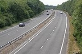
The A3, known as the Portsmouth Road for much of its length, is a dual carriageway, or expressway, which follows the historic route between London
and Portsmouth
passing close to Kingston upon Thames
, Guildford
, Haslemere
and Petersfield
. For much of its 67 miles (107.8 km) length, it is classified as a trunk road
and, apart from a section within the London conurbation
is a dual carriageway
. At its southerly end, the original road has been replaced by the A3(M), but the designation A3 is still used to identify the old road.
The historic Portsmouth Road once had great strategic significance as the major link between the capital city and one of its major sea ports. Many of the towns and villages that it passed through gained income and prestige as a result — such as Kingston upon Thames
, Esher
, Guildford
, Godalming
, Haslemere
and Petersfield
. The modern A3 follows the general route of the Portsmouth Road, but bypass
es many of the towns and villages along the way, leaving the various stretches of the old Portsmouth Road for local traffic — for instance, the A307
which passes through Kingston-upon-Thames and Esher
, is also known as the Portsmouth Road. For some of its length, the road follows a similar line to the Portsmouth Direct Line
railway, although one of the major exceptions is that the A3 does not go through or closely bypass Havant
.
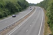
However, a programme of road improvements starting in the 1920s transformed the road so that is now predominantly a two or three lane dual carriageway
, bypassing the town centres, with a section of motorway, the A3(M), just before the road reaches the A27
at Havant. The construction of the Kingston and Guildford bypasses in the 1920s and 1930s made use of temporary narrow gauge railways to move the construction materials. The Esher bypass, between Hook
and the M25
, is three lanes with a good hard shoulder, and thus almost motorway standard; from the M25 to Guildford also has three lanes.
The Kingston By-pass had been proposed in 1912 but with the advent of World War I plans were shelved. By the early 1920s, traffic in Kingston town centre had increased by over 160% in 10 years and the decision was taken to revive the plans. Work finally started in 1924 on what was to become one of the first arterial roads in Britain. It was opened by the Prime Minister, the Rt Hon Stanley Baldwin
MP, on 28 October 1927. It ran for 8.5 miles (13.7 km) from the Robin Hood Gate of Richmond Park
to the outskirts of Esher
. The opening ceremony concluded with refreshments for 800 guests in marquees near what is now the Merton
fly-over. The Merton flyover takes the Merton Spur 1 miles (1.6 km), finishing close to Wimbledon Chase railway station
.
The construction of the Kingston By-pass immediately attracted developers wishing to build houses where access was already provided. The 1935 Ribbon Development Act came too late to prevent this building, which is especially notable where the A3 winds through Tolworth
and New Malden
.
The road was once the haunt of highwaymen. For example, the legendary Jerry Abershawe
terrorised the area around Kingston and led a gang based at the Bald Faced Stag Inn on the Portsmouth Road. Another particularly dangerous location was in the vicinity of the Devil's Punch Bowl
, Hindhead
, about 8 miles (12.9 km) south-west of Guildford
.
is a 1830 metres (1.1 mi) twin bore tunnel, which cost £371 million to construct, and is the longest non-estuarial road tunnel in the UK. Transport Secretary
Philip Hammond
conducted the opening ceremony on 27 July 2011, though the northbound tunnel opened to traffic two days later than the southbound one, on 29 July.
It was constructed near Hindhead to replace the busy single carriageway A3 road, through the Devil's Punch Bowl Site of Special Scientific Interest
. This was a busy commuting route used by some 28,400 vehicles per day, where long queues built up, particularly during the morning peak hours and school holidays. It was the last single carriageway section of the A3, outside of London and Portsmouth, to be replaced by dual carriageway.
The short stretch of road from the Grayshott exit leading towards Hindhead remains in use, but has been renumbered from A3 to A333
.
now open - the entire route is dual-carriageway between London and Portsmouth, at Liss
there remains an at-grade roundabout; the only such junction on the route. Widely considered a traffic blackspot, and an accident hotspot (due to its unusual egg-shape and camber angle
causing lorries to tip over), there have been wide calls for its removal, particularly with the projected increase in traffic with the completion of the tunnel. Eventually, in November 2010, the Highways Agency
announced it would discuss three options for the roundabout's future:
In December 2010 however, the Highways Agency announced no changes would be made before 2015.
and the Surrey Research Park
regularly creates congestion on the main A3 during peak times when the traffic queue reaches onto the main carriageway. This is due to be resolved with new improvements to the traffic system directly adjacent to the A3 with work funded jointly between the University of Surrey
and Surrey County Council
at its junction with Gracechurch Street
in the City of London
, crosses London Bridge
, and goes south-west along Borough High Street
and Newington Causeway
to the Elephant and Castle
roundabout. It continues along Newington Butts
, Kennington Park Road
, Clapham Road and Clapham High Street
. The road then passes the north side of Clapham Common
and carries on through Wandsworth
to Putney Heath and then between Richmond Park
and Wimbledon Common. It bypasses Kingston upon Thames
, where the road is referred to as the Kingston By-pass.
Today there is a traffic black spot during peak hours going northbound before the Hook underpass. The road reduces from three lanes to two in the underpass. The speed limit at this point reduces from 70 miles per hour (112.7 km/h) to 50 miles per hour (80.5 km/h), with the first of many GATSO speed enforcement cameras situated before the road bears to the right and under the bridge . The traffic from the A309 also joins just before the underpass. This section is often busy from about 7:50am to 8:30am and from 5:15pm to 5:50pm.
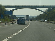
The road then intersects with the M25
and runs through Guildford
as a dual carriageway standard before bypassing Godalming
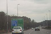
. It continues through the new tunnel at Hindhead
, passes Liphook
and Petersfield
, then climbs over the South Downs
and down towards Horndean
.
, roughly parallel with the M275
, into the centre of the city where, after passing the Catholic cathedral
, it meets with the A2030
. It then continues through Old Portsmouth
passing the Anglican cathedral
and the old 15th century harbour where it comes to an end at Portsmouth Point
.
_m27_interchange,_farlington.jpg) This section of the road was opened in 1979 and acts as a bypass of the A3 road in this part of Hampshire.
This section of the road was opened in 1979 and acts as a bypass of the A3 road in this part of Hampshire.
Information above gathered from Advanced Direction Signs May 2011
with the town of Petersfield on the Portsmouth-bound side of the A3 Petersfield bypass.
Another links the village of Greatham
with West Liss
. The path is on the London-bound side, linking to a bridge over the A3 to West Liss. This means cyclists and pedestrians are not required to cross the dual carriageway on foot at the Ham Barn roundabout. There is another path on the Portsmouth-bound A3 between Longmoor Rd (near Greatham) and Liphook
via Griggs Green.
There is also a cycle path between Greatham and Liphook, and nearer Portsmouth there is a cycle path between Clanfield
and the Queen Elizabeth Country Park
, a large forest near Petersfield next to the A3. There is, however, no cycle path between Petersfield and the Queen Elizabeth Country Park.
Between Thursley
and Milford
(near Guildford
), cycle crossings of the slip roads have been constructed on both sides of the carriageway for the few cyclists travelling on this dual carriageway.
London
London is the capital city of :England and the :United Kingdom, the largest metropolitan area in the United Kingdom, and the largest urban zone in the European Union by most measures. Located on the River Thames, London has been a major settlement for two millennia, its history going back to its...
and Portsmouth
Portsmouth
Portsmouth is the second largest city in the ceremonial county of Hampshire on the south coast of England. Portsmouth is notable for being the United Kingdom's only island city; it is located mainly on Portsea Island...
passing close to Kingston upon Thames
Kingston upon Thames
Kingston upon Thames is the principal settlement of the Royal Borough of Kingston upon Thames in southwest London. It was the ancient market town where Saxon kings were crowned and is now a suburb situated south west of Charing Cross. It is one of the major metropolitan centres identified in the...
, Guildford
Guildford
Guildford is the county town of Surrey. England, as well as the seat for the borough of Guildford and the administrative headquarters of the South East England region...
, Haslemere
Haslemere
Haslemere is a town in Surrey, England, close to the border with both Hampshire and West Sussex. The major road between London and Portsmouth, the A3, lies to the west, and a branch of the River Wey to the south. Haslemere is approximately south-west of Guildford.Haslemere is surrounded by hills,...
and Petersfield
Petersfield
Petersfield can refer to any of the following places:*Petersfield, Hampshire, a market town in England*Petersfield, Jamaica, a small town in the parish of Westmoreland*Petersfield, Manitoba, in Canada*Petersfield, an area of Cambridge, England...
. For much of its 67 miles (107.8 km) length, it is classified as a trunk road
Trunk road
A trunk road, trunk highway, or strategic road is a major road—usually connecting two or more cities, ports, airports, and other things.—which is the recommended route for long-distance and freight traffic...
and, apart from a section within the London conurbation
Conurbation
A conurbation is a region comprising a number of cities, large towns, and other urban areas that, through population growth and physical expansion, have merged to form one continuous urban and industrially developed area...
is a dual carriageway
Dual carriageway
A dual carriageway is a class of highway with two carriageways for traffic travelling in opposite directions separated by a central reservation...
. At its southerly end, the original road has been replaced by the A3(M), but the designation A3 is still used to identify the old road.
History
Also known as the London Portsmouth Trunk Road.The historic Portsmouth Road once had great strategic significance as the major link between the capital city and one of its major sea ports. Many of the towns and villages that it passed through gained income and prestige as a result — such as Kingston upon Thames
Kingston upon Thames
Kingston upon Thames is the principal settlement of the Royal Borough of Kingston upon Thames in southwest London. It was the ancient market town where Saxon kings were crowned and is now a suburb situated south west of Charing Cross. It is one of the major metropolitan centres identified in the...
, Esher
Esher
Esher is a town in the Surrey borough of Elmbridge in South East England near the River Mole. It is a very prosperous part of the Greater London Urban Area, largely suburban in character, and is situated 14.1 miles south west of Charing Cross....
, Guildford
Guildford
Guildford is the county town of Surrey. England, as well as the seat for the borough of Guildford and the administrative headquarters of the South East England region...
, Godalming
Godalming
Godalming is a town and civil parish in the Waverley district of the county of Surrey, England, south of Guildford. It is built on the banks of the River Wey and is a prosperous part of the London commuter belt. Godalming shares a three-way twinning arrangement with the towns of Joigny in France...
, Haslemere
Haslemere
Haslemere is a town in Surrey, England, close to the border with both Hampshire and West Sussex. The major road between London and Portsmouth, the A3, lies to the west, and a branch of the River Wey to the south. Haslemere is approximately south-west of Guildford.Haslemere is surrounded by hills,...
and Petersfield
Petersfield, Hampshire
Petersfield is a market town and civil parish in the East Hampshire district of Hampshire, England. It is north of Portsmouth, on the A3 road. The town has its own railway station on the Portsmouth Direct Line, the mainline rail link connecting Portsmouth and London. The town is situated on the...
. The modern A3 follows the general route of the Portsmouth Road, but bypass
Bypass (road)
A bypass is a road or highway that avoids or "bypasses" a built-up area, town, or village, to let through traffic flow without interference from local traffic, to reduce congestion in the built-up area, and to improve road safety....
es many of the towns and villages along the way, leaving the various stretches of the old Portsmouth Road for local traffic — for instance, the A307
A307 road
The A307 road is a link road running through SW London and NW Surrey, which is primary at the start but for the most part is now more local in character...
which passes through Kingston-upon-Thames and Esher
Esher
Esher is a town in the Surrey borough of Elmbridge in South East England near the River Mole. It is a very prosperous part of the Greater London Urban Area, largely suburban in character, and is situated 14.1 miles south west of Charing Cross....
, is also known as the Portsmouth Road. For some of its length, the road follows a similar line to the Portsmouth Direct Line
Portsmouth Direct Line
The Portsmouth Direct Line is the route of a railway service operated by South West Trains which runs between London Waterloo and Portsmouth Harbour, England...
railway, although one of the major exceptions is that the A3 does not go through or closely bypass Havant
Havant
Havant is a town in south east Hampshire on the South coast of England, between Portsmouth and Chichester. It gives its name to the borough comprising the town and the surrounding area. The town has rapidly grown since the end of the Second World War.It has good railway connections to London,...
.
However, a programme of road improvements starting in the 1920s transformed the road so that is now predominantly a two or three lane dual carriageway
Dual carriageway
A dual carriageway is a class of highway with two carriageways for traffic travelling in opposite directions separated by a central reservation...
, bypassing the town centres, with a section of motorway, the A3(M), just before the road reaches the A27
A27 road
The A27 is a major road in England. It runs from its junction with the A36 at Whiteparish in the county of Wiltshire. It closely parallels the south coast, where it passes through West Sussex and terminates at Pevensey in East Sussex.Between Portsmouth and Lewes, it is one of the busiest trunk...
at Havant. The construction of the Kingston and Guildford bypasses in the 1920s and 1930s made use of temporary narrow gauge railways to move the construction materials. The Esher bypass, between Hook
Hook, London
Hook is a place in south west London, England. It forms part of the Royal Borough of Kingston upon Thames and is located 13.5 miles south west of Charing Cross....
and the M25
M25 motorway
The M25 motorway, or London Orbital, is a orbital motorway that almost encircles Greater London, England, in the United Kingdom. The motorway was first mooted early in the 20th century. A few sections, based on the now abandoned London Ringways plan, were constructed in the early 1970s and it ...
, is three lanes with a good hard shoulder, and thus almost motorway standard; from the M25 to Guildford also has three lanes.
The Kingston By-pass had been proposed in 1912 but with the advent of World War I plans were shelved. By the early 1920s, traffic in Kingston town centre had increased by over 160% in 10 years and the decision was taken to revive the plans. Work finally started in 1924 on what was to become one of the first arterial roads in Britain. It was opened by the Prime Minister, the Rt Hon Stanley Baldwin
Stanley Baldwin
Stanley Baldwin, 1st Earl Baldwin of Bewdley, KG, PC was a British Conservative politician, who dominated the government in his country between the two world wars...
MP, on 28 October 1927. It ran for 8.5 miles (13.7 km) from the Robin Hood Gate of Richmond Park
Richmond Park
Richmond Park is a 2,360 acre park within London. It is the largest of the Royal Parks in London and Britain's second largest urban walled park after Sutton Park, Birmingham. It is close to Richmond, Ham, Kingston upon Thames, Wimbledon, Roehampton and East Sheen...
to the outskirts of Esher
Esher
Esher is a town in the Surrey borough of Elmbridge in South East England near the River Mole. It is a very prosperous part of the Greater London Urban Area, largely suburban in character, and is situated 14.1 miles south west of Charing Cross....
. The opening ceremony concluded with refreshments for 800 guests in marquees near what is now the Merton
London Borough of Merton
The London Borough of Merton is a borough in southwest London, England.The borough was formed under the London Government Act in 1965 by the merger of the Municipal Borough of Mitcham, the Municipal Borough of Wimbledon and the Merton and Morden Urban District, all formerly within Surrey...
fly-over. The Merton flyover takes the Merton Spur 1 miles (1.6 km), finishing close to Wimbledon Chase railway station
Wimbledon Chase railway station
Wimbledon Chase railway station is in the London Borough of Merton in South London. The station is served by First Capital Connect trains, and is on the Thameslink loop...
.
The construction of the Kingston By-pass immediately attracted developers wishing to build houses where access was already provided. The 1935 Ribbon Development Act came too late to prevent this building, which is especially notable where the A3 winds through Tolworth
Tolworth
Tolworth is a mostly residential area of outer South London in the Royal Borough of Kingston upon Thames, located south west of Charing Cross. Neighbouring places include: New Malden, Kingston, Surbiton, Berrylands, Chessington, Ewell and Worcester Park....
and New Malden
New Malden
New Malden is a town and shopping centre in the south-western London suburbs, mostly within the Royal Borough of Kingston upon Thames and partly in the London Borough of Merton, and is situated from Charing Cross...
.
The road was once the haunt of highwaymen. For example, the legendary Jerry Abershawe
Jerry Abershawe
Louis Jeremiah Abershawe , better known as Jerry Abershawe, was a notorious highwayman who terrorised travellers along the road between London and Portsmouth in the late eighteenth century.-Biography:...
terrorised the area around Kingston and led a gang based at the Bald Faced Stag Inn on the Portsmouth Road. Another particularly dangerous location was in the vicinity of the Devil's Punch Bowl
Devil's Punch Bowl
The Devil's Punch Bowl is a large natural amphitheatre and beauty spot near Hindhead, Surrey, in England, and is the source of many stories about the area. The London to Portsmouth road used to climb round its side, but this is now closed due to the Hindhead Tunnel opening on the 27th July 2011...
, Hindhead
Hindhead
Hindhead is a village in Surrey, England, about 11 miles south-west of Guildford. Neighbouring settlements include Haslemere, Grayshott and Beacon Hill. Hindhead is the highest village in Surrey...
, about 8 miles (12.9 km) south-west of Guildford
Guildford
Guildford is the county town of Surrey. England, as well as the seat for the borough of Guildford and the administrative headquarters of the South East England region...
.
Hindhead tunnel
The Hindhead TunnelHindhead Tunnel
The Hindhead Tunnel is a road tunnel that opened on 29 July 2011 as part of the new Hindhead bypass for the A3 road in Surrey. It forms part of the 4 mile dual-carriageway being built to replace the last remaining stretch of single-carriageway on the London to Portsmouth road...
is a 1830 metres (1.1 mi) twin bore tunnel, which cost £371 million to construct, and is the longest non-estuarial road tunnel in the UK. Transport Secretary
Secretary of State for Transport
The Secretary of State for Transport is the member of the cabinet responsible for the British Department for Transport. The role has had a high turnover as new appointments are blamed for the failures of decades of their predecessors...
Philip Hammond
Philip Hammond
Philip Hammond MP is a British Conservative Party politician. He is the current Defence Secretary in the Coalition government led by David Cameron, having succeeded Liam Fox on 14 October 2011...
conducted the opening ceremony on 27 July 2011, though the northbound tunnel opened to traffic two days later than the southbound one, on 29 July.
It was constructed near Hindhead to replace the busy single carriageway A3 road, through the Devil's Punch Bowl Site of Special Scientific Interest
Site of Special Scientific Interest
A Site of Special Scientific Interest is a conservation designation denoting a protected area in the United Kingdom. SSSIs are the basic building block of site-based nature conservation legislation and most other legal nature/geological conservation designations in Great Britain are based upon...
. This was a busy commuting route used by some 28,400 vehicles per day, where long queues built up, particularly during the morning peak hours and school holidays. It was the last single carriageway section of the A3, outside of London and Portsmouth, to be replaced by dual carriageway.
The short stretch of road from the Grayshott exit leading towards Hindhead remains in use, but has been renumbered from A3 to A333
A333 road
The A333 is a road in Surrey, south-east England. It runs between the Hazel Grove interchange and the Hindhead crossroads . It was formerly a small section of the A3 and was re-numbered in 2011 as part of the Hindhead Tunnel project....
.
Ham Barn roundabout
Although - with the Hindhead TunnelHindhead Tunnel
The Hindhead Tunnel is a road tunnel that opened on 29 July 2011 as part of the new Hindhead bypass for the A3 road in Surrey. It forms part of the 4 mile dual-carriageway being built to replace the last remaining stretch of single-carriageway on the London to Portsmouth road...
now open - the entire route is dual-carriageway between London and Portsmouth, at Liss
Liss
Liss is a village and civil parish in the East Hampshire district of Hampshire, England. It is 3.3 miles northeast of Petersfield, on the A3 road, on the Hampshire/West Sussex border....
there remains an at-grade roundabout; the only such junction on the route. Widely considered a traffic blackspot, and an accident hotspot (due to its unusual egg-shape and camber angle
Camber angle
thumb|100px|From the front of the car, a right wheel with a negative camber angleCamber angle is the angle made by the wheels of a vehicle; specifically, it is the angle between the vertical axis of the wheels used for steering and the vertical axis of the vehicle when viewed from the front or...
causing lorries to tip over), there have been wide calls for its removal, particularly with the projected increase in traffic with the completion of the tunnel. Eventually, in November 2010, the Highways Agency
Highways Agency
The Highways Agency is an executive agency, part of the Department for Transport in England. It has responsibility for managing the core road network in England...
announced it would discuss three options for the roundabout's future:
- full-time signalling,
- removing the roundabout entirely (and thereby removing the A3/B3006 connection completely),
- keeping the existing system.
In December 2010 however, the Highways Agency announced no changes would be made before 2015.
Cathedral Exit, Guildford
The slip road exiting the A3 leading to the Royal Surrey County HospitalRoyal Surrey County Hospital
The Royal Surrey County Hospital is a 527-bedded District General Hospital, located on the fringe of Guildford, serving a population of 320,000 for general services and 1,200,000 for cancer services...
and the Surrey Research Park
Surrey Research Park
The Surrey Research Park is located in Guildford, Surrey, UK close to the A3 road and the Royal Surrey County Hospital. The park is owned and run by the University of Surrey....
regularly creates congestion on the main A3 during peak times when the traffic queue reaches onto the main carriageway. This is due to be resolved with new improvements to the traffic system directly adjacent to the A3 with work funded jointly between the University of Surrey
University of Surrey
The University of Surrey is a university located within the county town of Guildford, Surrey in the South East of England. It received its charter on 9 September 1966, and was previously situated near Battersea Park in south-west London. The institution was known as Battersea College of Technology...
and Surrey County Council
Surrey County Council
Surrey County Council is the county council that governs the non-metropolitan county of Surrey in England. The council is composed of 80 elected councillors.The council is controlled by the Conservative party.The leader of the council is David Hodge....
London
The A3 starts at King William StreetKing William Street (London)
King William Street is the name of a street in the City of London, England. It runs from a junction at the Bank of England, meeting Poultry, Lombard Street and Threadneedle Street, south-east, where it meets a junction with Gracechurch and Cannon Street. It continues south after this junction, and...
at its junction with Gracechurch Street
Gracechurch Street
Gracechurch Street is a street in the City of London which forms part of the A10. It is home to a number of shops, restaurants, offices and Leadenhall Market....
in the City of London
City of London
The City of London is a small area within Greater London, England. It is the historic core of London around which the modern conurbation grew and has held city status since time immemorial. The City’s boundaries have remained almost unchanged since the Middle Ages, and it is now only a tiny part of...
, crosses London Bridge
London Bridge
London Bridge is a bridge over the River Thames, connecting the City of London and Southwark, in central London. Situated between Cannon Street Railway Bridge and Tower Bridge, it forms the western end of the Pool of London...
, and goes south-west along Borough High Street
Borough High Street
Borough High Street is a main street in Southwark, London running south-west from London Bridge, forming part of the A3 road, which runs from London to Portsmouth.- Overview :...
and Newington Causeway
Newington Causeway
Newington Causeway is a road in Southwark, London, England, between the Elephant and Castle and Borough High Street. The Elephant and Castle tube station is at the southern end....
to the Elephant and Castle
Elephant and Castle
The Elephant and Castle is a major road intersection in south London, England, located in the London Borough of Southwark. It is also used as a name for the surrounding area....
roundabout. It continues along Newington Butts
Newington Butts
Newington Butts is a former village, now an area of the London Borough of Southwark, that gives its name to a segment of the A3 road running south-west from the Elephant and Castle junction...
, Kennington Park Road
Kennington Park Road
Kennington Park Road is a main road in south-east London, England, and is part of the A3 trunk road. It runs from Newington Butts at its Y-junction with Kennington Lane, south-west to the Oval, where the A3 continues as Clapham Road, towards Stockwell...
, Clapham Road and Clapham High Street
Clapham High Street
Clapham High Street is the main through road and shopping area in Clapham, South London, England, in the London Borough of Lambeth.-History:Clapham High Street is of historical importance because it not only houses two of London's deep level air raid shelters, it was also damaged by bombs during...
. The road then passes the north side of Clapham Common
Clapham Common
Clapham Common is an 89 hectare triangular area of grassland situated in south London, England. It was historically common land for the parishes of Battersea and Clapham, but was converted to parkland under the terms of the Metropolitan Commons Act 1878.43 hectares of the common are within the...
and carries on through Wandsworth
Wandsworth
Wandsworth is a district of south London, England, in the London Borough of Wandsworth. It is situated southwest of Charing Cross. The area is identified in the London Plan as one of 35 major centres in Greater London.-Toponymy:...
to Putney Heath and then between Richmond Park
Richmond Park
Richmond Park is a 2,360 acre park within London. It is the largest of the Royal Parks in London and Britain's second largest urban walled park after Sutton Park, Birmingham. It is close to Richmond, Ham, Kingston upon Thames, Wimbledon, Roehampton and East Sheen...
and Wimbledon Common. It bypasses Kingston upon Thames
Kingston upon Thames
Kingston upon Thames is the principal settlement of the Royal Borough of Kingston upon Thames in southwest London. It was the ancient market town where Saxon kings were crowned and is now a suburb situated south west of Charing Cross. It is one of the major metropolitan centres identified in the...
, where the road is referred to as the Kingston By-pass.
Today there is a traffic black spot during peak hours going northbound before the Hook underpass. The road reduces from three lanes to two in the underpass. The speed limit at this point reduces from 70 miles per hour (112.7 km/h) to 50 miles per hour (80.5 km/h), with the first of many GATSO speed enforcement cameras situated before the road bears to the right and under the bridge . The traffic from the A309 also joins just before the underpass. This section is often busy from about 7:50am to 8:30am and from 5:15pm to 5:50pm.
Surrey and Hampshire
The Kingston By-pass becomes the Esher By-pass at the A3's junction with the A309.The road then intersects with the M25
M25 motorway
The M25 motorway, or London Orbital, is a orbital motorway that almost encircles Greater London, England, in the United Kingdom. The motorway was first mooted early in the 20th century. A few sections, based on the now abandoned London Ringways plan, were constructed in the early 1970s and it ...
and runs through Guildford
Guildford
Guildford is the county town of Surrey. England, as well as the seat for the borough of Guildford and the administrative headquarters of the South East England region...
as a dual carriageway standard before bypassing Godalming
Godalming
Godalming is a town and civil parish in the Waverley district of the county of Surrey, England, south of Guildford. It is built on the banks of the River Wey and is a prosperous part of the London commuter belt. Godalming shares a three-way twinning arrangement with the towns of Joigny in France...
. It continues through the new tunnel at Hindhead
Hindhead
Hindhead is a village in Surrey, England, about 11 miles south-west of Guildford. Neighbouring settlements include Haslemere, Grayshott and Beacon Hill. Hindhead is the highest village in Surrey...
, passes Liphook
Liphook
Liphook is a large village in the East Hampshire district of Hampshire, England. It is 4.1 miles west of Haslemere, on the A3 road, and lies on the Hampshire/West Sussex border.Liphook has its own railway station, on the Portsmouth Direct Line....
and Petersfield
Petersfield
Petersfield can refer to any of the following places:*Petersfield, Hampshire, a market town in England*Petersfield, Jamaica, a small town in the parish of Westmoreland*Petersfield, Manitoba, in Canada*Petersfield, an area of Cambridge, England...
, then climbs over the South Downs
South Downs
The South Downs is a range of chalk hills that extends for about across the south-eastern coastal counties of England from the Itchen Valley of Hampshire in the west to Beachy Head, near Eastbourne, East Sussex, in the east. It is bounded on its northern side by a steep escarpment, from whose...
and down towards Horndean
Horndean
Horndean is a village and civil parish in the East Hampshire district of Hampshire, England. It is 8 miles north of Portsmouth.The nearest railway station is 2.2 miles southeast of the village at Rowlands Castle....
.
Portsmouth
From just north of Horndean southwards the A3 separates from the A3(M) (below) and continues as London Road as far as Hilsea, south of which it is Northern Parade (London Road continues as the A2047). It runs along the west side of Portsea IslandPortsea Island
Portsea Island is a small, flat and low lying island just off the south coast of England. The island is totally within, and contains a large proportion of, the city of Portsmouth. It has the third-largest population of any island in the British Isles, after the mainlands of Great Britain and...
, roughly parallel with the M275
M275 motorway
The M275 is a long, dual three-lane motorway in the county of Hampshire, southern England. It is the principal route for entering and leaving Portsmouth. It continues as the A3 into Portsmouth, and meets the M27 at its northern terminus...
, into the centre of the city where, after passing the Catholic cathedral
Cathedral of St John the Evangelist, Portsmouth
The Cathedral Church of St John the Evangelist is a Roman Catholic cathedral in Portsmouth, England. It is the mother church of the Portsmouth Diocese and seat of the Bishop of Portsmouth, currently the Right Reverend Crispian Hollis...
, it meets with the A2030
A2030 road
The A2030 is a road in Hampshire. The road starts off at junction 5 of the A3, near the village of Bedhampton. The road then runs west along the base of Portsdown Hill, following the old route of the A27 into Portsmouth until it reaches the Drayton area...
. It then continues through Old Portsmouth
Old Portsmouth
Old Portsmouth is a district of the city of Portsmouth. It is the area covered by the original town of Portsmouth as planned by Jean de Gisors. It is situated in the south west corner of Portsea Island....
passing the Anglican cathedral
Portsmouth Cathedral
The Cathedral Church of St Thomas of Canterbury, Portsmouth, commonly known as Portsmouth Cathedral, is the Church of England cathedral of the City of Portsmouth, England and is located in the heart of Old Portsmouth...
and the old 15th century harbour where it comes to an end at Portsmouth Point
Portsmouth Point
Portsmouth Point, or "Spice Island", is part of Old Portsmouth in Portsmouth, Hampshire, on the southern coast of England. The name Spice Island comes from the areas involvement in the trade of Caribbean spices...
.
A3(M)
Junctions
| A3(M) Motorway | ||
| Northbound exits | Junction | Southbound exits |
| Road continues as the A3 to Petersfield Petersfield Petersfield can refer to any of the following places:*Petersfield, Hampshire, a market town in England*Petersfield, Jamaica, a small town in the parish of Westmoreland*Petersfield, Manitoba, in Canada*Petersfield, an area of Cambridge, England... and London London London is the capital city of :England and the :United Kingdom, the largest metropolitan area in the United Kingdom, and the largest urban zone in the European Union by most measures. Located on the River Thames, London has been a major settlement for two millennia, its history going back to its... |
A3 Terminus (J1) |
Horndean Horndean Horndean is a village and civil parish in the East Hampshire district of Hampshire, England. It is 8 miles north of Portsmouth.The nearest railway station is 2.2 miles southeast of the village at Rowlands Castle.... , Clanfield Clanfield, Hampshire Clanfield is a village and civil parish in the East Hampshire district of Hampshire, England. It is 2.4 miles north of Horndean, just west of the A3 road.... A3 Portsmouth Portsmouth Portsmouth is the second largest city in the ceremonial county of Hampshire on the south coast of England. Portsmouth is notable for being the United Kingdom's only island city; it is located mainly on Portsea Island... , Hayling Island Hayling Island -Leisure activities:Although largely residential, Hayling is also a holiday, windsurfing and sailing centre, the site where windsurfing was invented.... A3(M) |
| No exit | Start of motorway | |
| Horndean Horndean Horndean is a village and civil parish in the East Hampshire district of Hampshire, England. It is 8 miles north of Portsmouth.The nearest railway station is 2.2 miles southeast of the village at Rowlands Castle.... , Cowplain Cowplain Cowplain is a village on the northern outskirts of Waterlooville. With a population of 8775, it takes up 7.3% of Havant borough's population. The origins of the settlement grew along the old London to Portsmouth road... B2149 |
J2 | Emsworth Emsworth Emsworth is a large village the south coast of England, situated on the Hampshire side of the border between Hampshire and West Sussex. The village lies at the north end of an arm of Chichester Harbour, a large but shallow inlet of the English Channel.... , Cowplain, Rowland's Castle Rowland's Castle Rowland's Castle is a village and civil parish in the East Hampshire district of Hampshire, England. It is 2.9 miles north of Havant, on the Hampshire/West Sussex border.... B2149 |
| Waterlooville Waterlooville Waterlooville is a town in Hampshire, England approximately 8 miles north of Portsmouth.The town has a population itself of about 10,000 and is surrounded by Purbrook, Blendworth, Cowplain, Lovedean, Clanfield, Catherington, Crookhorn, Denmead, Hambledon, Horndean and Widley. It forms part of... B2150 |
J3 | Waterlooville B2150 |
| Purbrook Purbrook Purbrook is a village and local government sub-division located in Hampshire, England. Purbrook is on the outskirts of Waterlooville just North of the Portsmouth city Boundary... , Leigh Park Leigh Park Leigh Park is a large suburb of Havant, in Hampshire, England. It has four electoral wards: Battins, Bondfields, Barncroft and Warren Park .... |
J4 | No exit |
| Start of motorway | J5 Terminus A27 |
Bedhampton Bedhampton Bedhampton is a former village, and now suburb, located in the Borough of Havant, Hampshire, England. It is located at the northern end of Langstone Harbour and at the foot of the eastern end of Portsdown Hill.... , Farlington, Drayton |
| Petersfield Petersfield Petersfield can refer to any of the following places:*Petersfield, Hampshire, a market town in England*Petersfield, Jamaica, a small town in the parish of Westmoreland*Petersfield, Manitoba, in Canada*Petersfield, an area of Cambridge, England... , London London London is the capital city of :England and the :United Kingdom, the largest metropolitan area in the United Kingdom, and the largest urban zone in the European Union by most measures. Located on the River Thames, London has been a major settlement for two millennia, its history going back to its... , Waterlooville Waterlooville Waterlooville is a town in Hampshire, England approximately 8 miles north of Portsmouth.The town has a population itself of about 10,000 and is surrounded by Purbrook, Blendworth, Cowplain, Lovedean, Clanfield, Catherington, Crookhorn, Denmead, Hambledon, Horndean and Widley. It forms part of... , Leigh Park Leigh Park Leigh Park is a large suburb of Havant, in Hampshire, England. It has four electoral wards: Battins, Bondfields, Barncroft and Warren Park .... (A3(M)) Bedhampton Bedhampton Bedhampton is a former village, and now suburb, located in the Borough of Havant, Hampshire, England. It is located at the northern end of Langstone Harbour and at the foot of the eastern end of Portsdown Hill.... B2177 |
Brighton Brighton Brighton is the major part of the city of Brighton and Hove in East Sussex, England on the south coast of Great Britain... , Chichester Chichester Chichester is a cathedral city in West Sussex, within the historic County of Sussex, South-East England. It has a long history as a settlement; its Roman past and its subsequent importance in Anglo-Saxon times are only its beginnings... , Havant Havant Havant is a town in south east Hampshire on the South coast of England, between Portsmouth and Chichester. It gives its name to the borough comprising the town and the surrounding area. The town has rapidly grown since the end of the Second World War.It has good railway connections to London,... , Hayling Island Hayling Island -Leisure activities:Although largely residential, Hayling is also a holiday, windsurfing and sailing centre, the site where windsurfing was invented.... A27(E) Portsmouth Portsmouth Portsmouth is the second largest city in the ceremonial county of Hampshire on the south coast of England. Portsmouth is notable for being the United Kingdom's only island city; it is located mainly on Portsea Island... , Southampton Southampton Southampton is the largest city in the county of Hampshire on the south coast of England, and is situated south-west of London and north-west of Portsmouth. Southampton is a major port and the closest city to the New Forest... (M27 M27 motorway The M27 is a motorway in Hampshire, England. It is long and runs west-east from Cadnam to Portsmouth. It was opened in stages between 1975 and 1983. It is however unfinished as an extension to the east was planned... ) A27(W) A27 road The A27 is a major road in England. It runs from its junction with the A36 at Whiteparish in the county of Wiltshire. It closely parallels the south coast, where it passes through West Sussex and terminates at Pevensey in East Sussex.Between Portsmouth and Lewes, it is one of the busiest trunk... |
|
Information above gathered from Advanced Direction Signs May 2011
Cycle paths
There are several shared pedestrian and cycle paths on the A3, although many are infrequently used. One cycle path links the village of LissLiss
Liss is a village and civil parish in the East Hampshire district of Hampshire, England. It is 3.3 miles northeast of Petersfield, on the A3 road, on the Hampshire/West Sussex border....
with the town of Petersfield on the Portsmouth-bound side of the A3 Petersfield bypass.
Another links the village of Greatham
Greatham, Hampshire
Greatham is a village and civil parish in the East Hampshire district of Hampshire, England. It is 1.9 miles north of Liss, just off the A3 road.The nearest railway station is 1.9 miles south of the village, at Liss....
with West Liss
West Liss
West Liss is the oldest part of the modern village of Liss, in Hampshire, England. It has two pubs, called The Spread Eagle and The Blue Bell....
. The path is on the London-bound side, linking to a bridge over the A3 to West Liss. This means cyclists and pedestrians are not required to cross the dual carriageway on foot at the Ham Barn roundabout. There is another path on the Portsmouth-bound A3 between Longmoor Rd (near Greatham) and Liphook
Liphook
Liphook is a large village in the East Hampshire district of Hampshire, England. It is 4.1 miles west of Haslemere, on the A3 road, and lies on the Hampshire/West Sussex border.Liphook has its own railway station, on the Portsmouth Direct Line....
via Griggs Green.
There is also a cycle path between Greatham and Liphook, and nearer Portsmouth there is a cycle path between Clanfield
Clanfield, Hampshire
Clanfield is a village and civil parish in the East Hampshire district of Hampshire, England. It is 2.4 miles north of Horndean, just west of the A3 road....
and the Queen Elizabeth Country Park
Queen Elizabeth Country Park
Queen Elizabeth Country Park is a large country park situated on the South Downs in southern England. It is located on the A3 road three miles south of Petersfield, Hampshire....
, a large forest near Petersfield next to the A3. There is, however, no cycle path between Petersfield and the Queen Elizabeth Country Park.
Between Thursley
Thursley
Thursley is a small village in Surrey. It lies just west of the A3 running between Milford and Hindhead. Neighbouring villages include Rushmoor, Bowlhead Green and Brook. Thursley is in south-west Surrey, in south-east England...
and Milford
Milford, Surrey
Milford is a large village, situated south west of Godalming in Surrey, England. Nearby villages include Witley, Elstead and Eashing, and the hamlets of Enton and Hydestile. It is situated in the Borough of Waverley.-Transportation:...
(near Guildford
Guildford
Guildford is the county town of Surrey. England, as well as the seat for the borough of Guildford and the administrative headquarters of the South East England region...
), cycle crossings of the slip roads have been constructed on both sides of the carriageway for the few cyclists travelling on this dual carriageway.
See also
- Great Britain road numbering schemeGreat Britain road numbering schemeThe Great Britain road numbering scheme is a numbering scheme used to classify and identify all roads in Great Britain. Each road is given a single letter, which represents the road's category, and a subsequent number, with a length of between 1 and 4 digits. Originally introduced to arrange...
- List of motorways in the United Kingdom
- British industrial narrow gauge railways