
1993 Pacific hurricane season
Encyclopedia
The 1993 Pacific hurricane season was a very active season that officially started May 15, 1993 in the eastern Pacific, and June 1, 1993 in the central Pacific, and lasted until November 30, 1993. These dates conventionally delimit the period of each year when most tropical cyclones form in the northeastern Pacific Ocean
.
that originated in the Atlantic Ocean
, roughly 960 mi (1,545 km) southwest of Baja California Sur
. Located within a weak steering flow, Adrian gradually strengthened as it drifted to the west and later northwest. By June 15, an eye
developed over the storm's center of circulation
, indicating that it attained hurricane status. The following day, Adrian reached its peak intensity of 85 mph (140 km/h). However, increased wind shear
quickly weakened the storm shortly thereafter. Turning clockwise towards the southeast, winds dropped below gale-force by June 17 and the storm became nearly stationary. Devoid of convective activity
, the remnants of Adrian were last noted on June 19 over open waters.
on June 14. Moving little, a broad area of low pressure formed within the mass, but the area remained disorganized, although a tropical wave
moved through on June 16. However, another tropical wave moved through on June 18, and the area of cloudiness gradually became more concentrated, and post-storm analysis indicated that a tropical depression formed on June 18 near Huatulco as banding increased. A report of tropical storm
-force winds from a ship was issued, and the depression was quickly upgraded to Tropical Storm Beatriz. Beatriz moved northwest due to influence from the outflow from developing Tropical Storm Arlene in the Gulf of Mexico
, briefly reaching its peak intensity of 65 mph (105 km/h) on June 19 shortly prior to landfall near Puerto Escondido, Oaxaca. Beatriz quickly weakened after landfall, dissipating over the mountainous southwest Mexican
terrain, although the remnant cloudiness associated from the storm's circulation spread over portions of the western Gulf of Mexico
on June 20.
Beatriz caused extensive damage in southwest Mexico
, especially from heavy rains and flooding, with highest rainfall totals of between five and ten inches occurring in Oaxaca
, with even higher totals of 11.97 in (304 mm) and 15.46 in (393 mm) from Las Pilas
and Salina Cruz
. Six deaths were reported in the Mexican states of Morelos
and Veracruz
from flooding and downed trees attributed to Beatriz. Total losses from the storm amounted to $1.7 billion (1993 USD; $ USD).
. Tropical Depression Three remained disorganized, and did not intensify as it paralleled the coast of Mexico for several days, although it was always predicted to become a tropical storm. Reaching along the east coast of Baja California
, Tropical Depression Three dissipated in the Gulf of California
, after bring large amounts of rain and flooding to southern Mexico.
on July 2. Following the development of banding features
, the disturbance organized into a tropical depression two days later, while situated 315 mi (506.9 km) southeast of Acapulco
, Mexico
. Quickly intensifying, the depression was soon named Calvin as it attained gale-force winds. After initially tracking westward, Calvin turned north and attained hurricane status before reinstating a westward component. Situated just off the coast of Mexico, Calvin attained its peak intensity with winds of 110 mph (175 km/h) on July 7 before moving ashore. Substantially disrupted by the interaction with land, the hurricane rapidly weakened before emerging back over water as a minimal system. Now a tropical depression, Calvin made its final landfall in Baja California Sur
before dissipating over cold waters in the region.
In Mexico, Calvin produced torrential rains, peaking at 16.34 in (415 mm), that triggered widespread flooding and mudslides. At least 34 people died as a result of the storm and damage reached $32 million (1993 USD; $ USD). Following the storm, the Government of Mexico declared a state of emergency
for ten of the affected states. Additionally, 1,600 people were left homeless.
. Dora had no effects on land.
hurricane that formed quickly in the eastern Pacific off Mexico on July 15, but it soon weakened to a tropical storm over open waters by the July 22, and it made landfall on the Big Island of Hawaii as a tropical depression on July 25, dissipating shortly thereafter after crossing the island. , it is the most recent tropical cyclone to make landfall in Hawaii, although there have been a few near-misses since then. Effects were minimal.
and becoming a typhoon in the western Pacific, but never affected land.
that moved off the west African coast on July 28 and crossed into the eastern Pacific
. The developing storm reached tropical storm
status on August 9 while 635 mi (1,022 km) south of the southern tip of Baja
, and Fernanda strengthened into a hurricane the next day. Fernanda developed a large and well-defined eye, reaching its peak of 145 mph (235 km/h) on August 12 over the open eastern Pacific. Fernanda eventually crossed into the central Pacific on August 14, and passed as close as 300 mi (483 km) northeast of the Big Island of Hawaii
as a Category 2
hurricane on August 16. Fernanda later began to curve slowly to the northwest on August 16 under the influence of an upper-level trough after approaching the Hawaiian Islands
, becoming extratropical on August 19 after weakening due to shear and cooler waters, with the remnant circulation merging with the cold upper-level trough.
Although it did not make landfall in the Hawaiian Islands
, Fernanda's close approach prompted a hurricane warning
for the Big Island
and a hurricane watch elsewhere in the islands. Heavy surf and wave action affected the islands, with waves as high as between 15 (5 m) and 20 ft (six m) reported on Kauai
, causing damage to shoreline roads on all of the islands, allowing water intrusion into some homes, and washing one home several feet off its foundation. Many beach parks were also inundated, though evacuations prevented any deaths. In total, Fernanda caused $5 million (1993 USD, $ USD) in damage to the Hawaiian Islands
, and moisture induced by the interaction of Fernanda and the cold-core trough also affected the islands, producing showers and thunderstorms on all of the islands and localized flooding on Kauai
.
. Forming on August 15, it initially moved west-northwestward, before turning to the west. Greg reached an intense peak as a 135 mph (215 km/h) Category 4 south of Baja California over open waters. Though it traveled a rather long distance, lasting until August 28, Greg had no effects on any land.
that crossed Central America
on August 14. By August 17, just three days after entering the Eastern Pacific, the wave was sufficiently organized to be declared Tropical Depression Nine-E. Tracking westward, the depression gradually developed, attaining hurricane status two days later. By this time, a ridge
situated over the Gulf of Mexico
caused Hilary to turn northwestward, parallel to the Mexican coastline. Following the development of a 18 mi (29 km) wide eye on August 21, the storm further intensified into a Category 3 hurricane, attaining peak winds of 120 mph (195 km/h). By August 23, the hurricane nearly stalled as it underwent a Fujiwhara interaction with the newly developed Tropical Storm Irwin. Executing a small counter-clockwise loop, Hilary degraded to tropical storm intensity and took a northerly track for the remainder of its existence. The storm made two landfalls
in Mexico, one in Baja California Sur
on August 25 and again near Hermosillo
, Sonora
the following day. The remnants of Hilary were last noted over the northern Gulf of California
on August 27.
Heavy rains, peaking at 11.35 in (288.3 mm), accompanied the storm, though no damage or loss of life took place. The outer bands of the storm also brought localized downpours to parts of California
, resulting in flash floods.
on August 20. The tropical wave likely spawned Tropical Storm Cindy
in the Atlantic a few days prior. Early on August 21, the system was upgraded to Tropical Depression Ten after satellite imagery indicated further organization. Six hours later, the depression intensified and was upgraded to Tropical Storm Irwin. After becoming a tropical storm, Irwin rapidly intensified, and peaked just below hurricane status early on August 22. However, Irwin began to rapidly weakened and was only a tropical depression twelve hours later. By 1800 UTC on August 22, Irwin was absorbed by Hurricane Hilary.
Irwin came close to western Mexico, but did not make landfall. However, the storm dropped torrential rainfall. Rainfall was reported near 7 in (177.8 mm) in Jala
, Nayarit
, Mexico. In addition, high winds were also reported, especially in the Manzanillo
area. A wind gust was reported at 66 mph (101 km/h) while Irwin was passing about 46 mi (74 km) south of that location. At the Manzanillo harbor, a wind gust of nearly 100 mph (155 km/h) was recorded.
became better defined, the area of disturbed weather was upgraded to a tropical depression on August 29 near the Mexican coast about 300 mi (483 km) south of Acapulco
. Jova moved steadily to the west-northwest, paralleling the coast while strengthening into a tropical storm later on August 29 and a hurricane on August 31 while on steady movement of 13 to 17 mph (21 to 27 km/h). An eye developed shortly thereafter on August 31, and Jova reached its peak of 135 mph (220 km/h) based on Dvorak
estimates while located approximately 155 mi (249 km) southwest of Manzanillo
.
Jova began gradually weakening thereafter, with an intermittently appearing eye
on September 2 and September 3 before a final weakening trend began as Jova turned to the west. With a gradual loss of deep convection, Jova eventually weakened to a swirl of stratocumulus clouds and dissipated on September 5 about 805 mi (1,296 km) west of the southernmost tip of the Baja peninsula
. Jova's outermost rainband
s affected coastal Mexico, resulting in some rainfall but no deaths as the storm paralleled the coastline and moved out to sea.
, Sinaloa
. A tropical wave organized into a depression on September 8. It became a tropical depression early on the next day. Convection became well developed, and Lidia peaked as a Category 4 on September 11. Two trough
s and re-curved Lidia towards Mexico
. For unknown reasons, Lidia weakened considerably before making landfall in Sinaloa
as a Category 2. Lidia dissipated near Austin
on September 14 and was later absorbed by a cold front. Seven people were killed, and over 100,000 people were forced to evacuate their homes. A total of 160 homes were damage and 10,000 people were left homeless because of the storm.
, moderate rains fell in the region, amounting to more than 3 in (76.2 mm) in some areas. Over the following several days, the depression gradually dissipated and was last noted on September 26 over open waters.
. This is the same list used for the 1987 season
.
One name was used in the Central Pacific basin during the 1993 season – Keoni.
Pacific Ocean
The Pacific Ocean is the largest of the Earth's oceanic divisions. It extends from the Arctic in the north to the Southern Ocean in the south, bounded by Asia and Australia in the west, and the Americas in the east.At 165.2 million square kilometres in area, this largest division of the World...
.
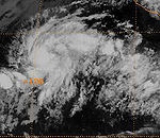
Hurricane Adrian
The first named storm of the season developed on June 11 from a broad and persisting area of disturbed weather, partially related to a tropical waveTropical wave
Tropical waves, easterly waves, or tropical easterly waves, also known as African easterly waves in the Atlantic region, are a type of atmospheric trough, an elongated area of relatively low air pressure, oriented north to south, which move from east to west across the tropics causing areas of...
that originated in the Atlantic Ocean
Atlantic Ocean
The Atlantic Ocean is the second-largest of the world's oceanic divisions. With a total area of about , it covers approximately 20% of the Earth's surface and about 26% of its water surface area...
, roughly 960 mi (1,545 km) southwest of Baja California Sur
Baja California Sur
Baja California Sur , is one of the 31 states which, with the Federal District, comprise the 32 Federal Entities of Mexico. Before becoming a state on October 8, 1974, the area was known as the South Territory of Baja California. It has an area of , or 3.57% of the land mass of Mexico and comprises...
. Located within a weak steering flow, Adrian gradually strengthened as it drifted to the west and later northwest. By June 15, an eye
Eye (cyclone)
The eye is a region of mostly calm weather found at the center of strong tropical cyclones. The eye of a storm is a roughly circular area and typically 30–65 km in diameter. It is surrounded by the eyewall, a ring of towering thunderstorms where the second most severe weather of a cyclone...
developed over the storm's center of circulation
Low pressure area
A low-pressure area, or "low", is a region where the atmospheric pressure at sea level is below that of surrounding locations. Low-pressure systems form under areas of wind divergence which occur in upper levels of the troposphere. The formation process of a low-pressure area is known as...
, indicating that it attained hurricane status. The following day, Adrian reached its peak intensity of 85 mph (140 km/h). However, increased wind shear
Wind shear
Wind shear, sometimes referred to as windshear or wind gradient, is a difference in wind speed and direction over a relatively short distance in the atmosphere...
quickly weakened the storm shortly thereafter. Turning clockwise towards the southeast, winds dropped below gale-force by June 17 and the storm became nearly stationary. Devoid of convective activity
Atmospheric convection
Atmospheric convection is the result of a parcel-environment instability, or temperature difference, layer in the atmosphere. Different lapse rates within dry and moist air lead to instability. Mixing of air during the day which expands the height of the planetary boundary layer leads to...
, the remnants of Adrian were last noted on June 19 over open waters.
Tropical Storm Beatriz
The second named storm of the season originated from a slow-moving area of increasing cloudiness over the Gulf of TehuantepecGulf of Tehuantepec
Gulf of Tehuantepec is a large body of water on the Pacific coast of the Isthmus of Tehuantepec, southeastern Mexico, at . Most of the hurricanes that form in the Eastern Pacific organize in or near this body of water...
on June 14. Moving little, a broad area of low pressure formed within the mass, but the area remained disorganized, although a tropical wave
Tropical wave
Tropical waves, easterly waves, or tropical easterly waves, also known as African easterly waves in the Atlantic region, are a type of atmospheric trough, an elongated area of relatively low air pressure, oriented north to south, which move from east to west across the tropics causing areas of...
moved through on June 16. However, another tropical wave moved through on June 18, and the area of cloudiness gradually became more concentrated, and post-storm analysis indicated that a tropical depression formed on June 18 near Huatulco as banding increased. A report of tropical storm
Tropical cyclone
A tropical cyclone is a storm system characterized by a large low-pressure center and numerous thunderstorms that produce strong winds and heavy rain. Tropical cyclones strengthen when water evaporated from the ocean is released as the saturated air rises, resulting in condensation of water vapor...
-force winds from a ship was issued, and the depression was quickly upgraded to Tropical Storm Beatriz. Beatriz moved northwest due to influence from the outflow from developing Tropical Storm Arlene in the Gulf of Mexico
Gulf of Mexico
The Gulf of Mexico is a partially landlocked ocean basin largely surrounded by the North American continent and the island of Cuba. It is bounded on the northeast, north and northwest by the Gulf Coast of the United States, on the southwest and south by Mexico, and on the southeast by Cuba. In...
, briefly reaching its peak intensity of 65 mph (105 km/h) on June 19 shortly prior to landfall near Puerto Escondido, Oaxaca. Beatriz quickly weakened after landfall, dissipating over the mountainous southwest Mexican
Mexico
The United Mexican States , commonly known as Mexico , is a federal constitutional republic in North America. It is bordered on the north by the United States; on the south and west by the Pacific Ocean; on the southeast by Guatemala, Belize, and the Caribbean Sea; and on the east by the Gulf of...
terrain, although the remnant cloudiness associated from the storm's circulation spread over portions of the western Gulf of Mexico
Gulf of Mexico
The Gulf of Mexico is a partially landlocked ocean basin largely surrounded by the North American continent and the island of Cuba. It is bounded on the northeast, north and northwest by the Gulf Coast of the United States, on the southwest and south by Mexico, and on the southeast by Cuba. In...
on June 20.
Beatriz caused extensive damage in southwest Mexico
Mexico
The United Mexican States , commonly known as Mexico , is a federal constitutional republic in North America. It is bordered on the north by the United States; on the south and west by the Pacific Ocean; on the southeast by Guatemala, Belize, and the Caribbean Sea; and on the east by the Gulf of...
, especially from heavy rains and flooding, with highest rainfall totals of between five and ten inches occurring in Oaxaca
Oaxaca
Oaxaca , , officially Estado Libre y Soberano de Oaxaca is one of the 31 states which, along with the Federal District, comprise the 32 federative entities of Mexico. It is divided into 571 municipalities; of which 418 are governed by the system of customs and traditions...
, with even higher totals of 11.97 in (304 mm) and 15.46 in (393 mm) from Las Pilas
Las Pilas
Las Pilas is a complex volcano located in the western part of Nicaragua. Part of a 30-km-long volcanic massif, Las Pilas has a series of well preserved flank vents surrounding a central cone. Las Pilas last erupted in the 1950s and before that possibly in the 16th century....
and Salina Cruz
Salina Cruz
Salina Cruz is a major seaport on the Pacific coast of the Mexican state of Oaxaca. It is the state's third-largest city and is municipal seat of the municipality of the same name.It is part of the Tehuantepec District in the west of the Istmo Region....
. Six deaths were reported in the Mexican states of Morelos
Morelos
Morelos officially Estado Libre y Soberano de Morelos is one of the 31 states which, with the Federal District, comprise the 32 Federal Entities of Mexico. It is divided in 33 municipalities and its capital city is Cuernavaca....
and Veracruz
Veracruz, Veracruz
Veracruz, officially known as Heroica Veracruz, is a major port city and municipality on the Gulf of Mexico in the Mexican state of Veracruz. The city is located in the central part of the state. It is located along Federal Highway 140 from the state capital Xalapa, and is the state's most...
from flooding and downed trees attributed to Beatriz. Total losses from the storm amounted to $1.7 billion (1993 USD; $ USD).
Tropical Depression Three-E
The third tropical depression of the season developed on June 27 from an area of disturbed weather situated near the Gulf of TehuantepecGulf of Tehuantepec
Gulf of Tehuantepec is a large body of water on the Pacific coast of the Isthmus of Tehuantepec, southeastern Mexico, at . Most of the hurricanes that form in the Eastern Pacific organize in or near this body of water...
. Tropical Depression Three remained disorganized, and did not intensify as it paralleled the coast of Mexico for several days, although it was always predicted to become a tropical storm. Reaching along the east coast of Baja California
Baja California
Baja California officially Estado Libre y Soberano de Baja California is one of the 31 states which, with the Federal District, comprise the 32 Federal Entities of Mexico. It is both the northernmost and westernmost state of Mexico. Before becoming a state in 1953, the area was known as the North...
, Tropical Depression Three dissipated in the Gulf of California
Gulf of California
The Gulf of California is a body of water that separates the Baja California Peninsula from the Mexican mainland...
, after bring large amounts of rain and flooding to southern Mexico.
Hurricane Calvin
The deadliest storm of the season, Hurricane Calvin, was first identified as an area of disturbed weather near the Gulf of TehuantepecGulf of Tehuantepec
Gulf of Tehuantepec is a large body of water on the Pacific coast of the Isthmus of Tehuantepec, southeastern Mexico, at . Most of the hurricanes that form in the Eastern Pacific organize in or near this body of water...
on July 2. Following the development of banding features
Rainband
A rainband is a cloud and precipitation structure associated with an area of rainfall which is significantly elongated. Rainbands can be stratiform or convective, and are generated by differences in temperature. When noted on weather radar imagery, this precipitation elongation is referred to as...
, the disturbance organized into a tropical depression two days later, while situated 315 mi (506.9 km) southeast of Acapulco
Acapulco
Acapulco is a city, municipality and major sea port in the state of Guerrero on the Pacific coast of Mexico, southwest from Mexico City. Acapulco is located on a deep, semi-circular bay and has been a port since the early colonial period of Mexico’s history...
, Mexico
Mexico
The United Mexican States , commonly known as Mexico , is a federal constitutional republic in North America. It is bordered on the north by the United States; on the south and west by the Pacific Ocean; on the southeast by Guatemala, Belize, and the Caribbean Sea; and on the east by the Gulf of...
. Quickly intensifying, the depression was soon named Calvin as it attained gale-force winds. After initially tracking westward, Calvin turned north and attained hurricane status before reinstating a westward component. Situated just off the coast of Mexico, Calvin attained its peak intensity with winds of 110 mph (175 km/h) on July 7 before moving ashore. Substantially disrupted by the interaction with land, the hurricane rapidly weakened before emerging back over water as a minimal system. Now a tropical depression, Calvin made its final landfall in Baja California Sur
Baja California Sur
Baja California Sur , is one of the 31 states which, with the Federal District, comprise the 32 Federal Entities of Mexico. Before becoming a state on October 8, 1974, the area was known as the South Territory of Baja California. It has an area of , or 3.57% of the land mass of Mexico and comprises...
before dissipating over cold waters in the region.
In Mexico, Calvin produced torrential rains, peaking at 16.34 in (415 mm), that triggered widespread flooding and mudslides. At least 34 people died as a result of the storm and damage reached $32 million (1993 USD; $ USD). Following the storm, the Government of Mexico declared a state of emergency
State of emergency
A state of emergency is a governmental declaration that may suspend some normal functions of the executive, legislative and judicial powers, alert citizens to change their normal behaviours, or order government agencies to implement emergency preparedness plans. It can also be used as a rationale...
for ten of the affected states. Additionally, 1,600 people were left homeless.
Hurricane Dora
Dora lasted over the open east Pacific from July 14 to July 20, peaking over open waters as a 135 mph (215 km/h) Category 4 with a minimum pressure of 945 mbarBar (unit)
The bar is a unit of pressure equal to 100 kilopascals, and roughly equal to the atmospheric pressure on Earth at sea level. Other units derived from the bar are the megabar , kilobar , decibar , centibar , and millibar...
. Dora had no effects on land.
Hurricane Eugene
Eugene was an intense major Category 3Saffir-Simpson Hurricane Scale
The Saffir–Simpson Hurricane Scale , or the Saffir–Simpson Hurricane Wind Scale , classifies hurricanes — Western Hemisphere tropical cyclones that exceed the intensities of tropical depressions and tropical storms — into five categories distinguished by the intensities of their sustained winds...
hurricane that formed quickly in the eastern Pacific off Mexico on July 15, but it soon weakened to a tropical storm over open waters by the July 22, and it made landfall on the Big Island of Hawaii as a tropical depression on July 25, dissipating shortly thereafter after crossing the island. , it is the most recent tropical cyclone to make landfall in Hawaii, although there have been a few near-misses since then. Effects were minimal.
Hurricane Keoni
Keoni formed southeast of the Big Island of Hawaii on August 9, and was later classified as a named system south of the island chain. Keoni peaked as an intense 135 mph (215 km/h) Category 4 hurricane over open waters and lasted until August 19, crossing the International Date LineInternational Date Line
The International Date Line is a generally north-south imaginary line on the surface of the Earth, passing through the middle of the Pacific Ocean, that designates the place where each calendar day begins...
and becoming a typhoon in the western Pacific, but never affected land.
Hurricane Fernanda
Fernanda formed from a tropical waveTropical wave
Tropical waves, easterly waves, or tropical easterly waves, also known as African easterly waves in the Atlantic region, are a type of atmospheric trough, an elongated area of relatively low air pressure, oriented north to south, which move from east to west across the tropics causing areas of...
that moved off the west African coast on July 28 and crossed into the eastern Pacific
Pacific Ocean
The Pacific Ocean is the largest of the Earth's oceanic divisions. It extends from the Arctic in the north to the Southern Ocean in the south, bounded by Asia and Australia in the west, and the Americas in the east.At 165.2 million square kilometres in area, this largest division of the World...
. The developing storm reached tropical storm
Tropical cyclone
A tropical cyclone is a storm system characterized by a large low-pressure center and numerous thunderstorms that produce strong winds and heavy rain. Tropical cyclones strengthen when water evaporated from the ocean is released as the saturated air rises, resulting in condensation of water vapor...
status on August 9 while 635 mi (1,022 km) south of the southern tip of Baja
Baja California
Baja California officially Estado Libre y Soberano de Baja California is one of the 31 states which, with the Federal District, comprise the 32 Federal Entities of Mexico. It is both the northernmost and westernmost state of Mexico. Before becoming a state in 1953, the area was known as the North...
, and Fernanda strengthened into a hurricane the next day. Fernanda developed a large and well-defined eye, reaching its peak of 145 mph (235 km/h) on August 12 over the open eastern Pacific. Fernanda eventually crossed into the central Pacific on August 14, and passed as close as 300 mi (483 km) northeast of the Big Island of Hawaii
Hawaii (island)
The Island of Hawaii, also called the Big Island or Hawaii Island , is a volcanic island in the North Pacific Ocean...
as a Category 2
Saffir-Simpson Hurricane Scale
The Saffir–Simpson Hurricane Scale , or the Saffir–Simpson Hurricane Wind Scale , classifies hurricanes — Western Hemisphere tropical cyclones that exceed the intensities of tropical depressions and tropical storms — into five categories distinguished by the intensities of their sustained winds...
hurricane on August 16. Fernanda later began to curve slowly to the northwest on August 16 under the influence of an upper-level trough after approaching the Hawaiian Islands
Hawaiian Islands
The Hawaiian Islands are an archipelago of eight major islands, several atolls, numerous smaller islets, and undersea seamounts in the North Pacific Ocean, extending some 1,500 miles from the island of Hawaii in the south to northernmost Kure Atoll...
, becoming extratropical on August 19 after weakening due to shear and cooler waters, with the remnant circulation merging with the cold upper-level trough.
Although it did not make landfall in the Hawaiian Islands
Hawaiian Islands
The Hawaiian Islands are an archipelago of eight major islands, several atolls, numerous smaller islets, and undersea seamounts in the North Pacific Ocean, extending some 1,500 miles from the island of Hawaii in the south to northernmost Kure Atoll...
, Fernanda's close approach prompted a hurricane warning
Tropical cyclone warnings and watches
Warnings and watches are two levels of alert issued by national weather forecasting bodies to coastal areas threatened by the imminent approach of a tropical cyclone of tropical storm or hurricane intensity. They are notices to the local population and civil authorities to make appropriate...
for the Big Island
Hawaii (island)
The Island of Hawaii, also called the Big Island or Hawaii Island , is a volcanic island in the North Pacific Ocean...
and a hurricane watch elsewhere in the islands. Heavy surf and wave action affected the islands, with waves as high as between 15 (5 m) and 20 ft (six m) reported on Kauai
Kauai
Kauai or Kauai, known as Tauai in the ancient Kaua'i dialect, is geologically the oldest of the main Hawaiian Islands. With an area of , it is the fourth largest of the main islands in the Hawaiian archipelago, and the 21st largest island in the United States. Known also as the "Garden Isle",...
, causing damage to shoreline roads on all of the islands, allowing water intrusion into some homes, and washing one home several feet off its foundation. Many beach parks were also inundated, though evacuations prevented any deaths. In total, Fernanda caused $5 million (1993 USD, $ USD) in damage to the Hawaiian Islands
Hawaiian Islands
The Hawaiian Islands are an archipelago of eight major islands, several atolls, numerous smaller islets, and undersea seamounts in the North Pacific Ocean, extending some 1,500 miles from the island of Hawaii in the south to northernmost Kure Atoll...
, and moisture induced by the interaction of Fernanda and the cold-core trough also affected the islands, producing showers and thunderstorms on all of the islands and localized flooding on Kauai
Kauai
Kauai or Kauai, known as Tauai in the ancient Kaua'i dialect, is geologically the oldest of the main Hawaiian Islands. With an area of , it is the fourth largest of the main islands in the Hawaiian archipelago, and the 21st largest island in the United States. Known also as the "Garden Isle",...
.
Hurricane Greg
Greg was a continuation of Atlantic Tropical Storm BretTropical Storm Bret (1993)
Tropical Storm Bret was the second named storm of the 1993 Atlantic hurricane season. The third tropical cyclone of the season, Bret formed on August 4 from a westward moving, African tropical wave. Bret would later peak as a 60 mph tropical storm as it neared Trinidad...
. Forming on August 15, it initially moved west-northwestward, before turning to the west. Greg reached an intense peak as a 135 mph (215 km/h) Category 4 south of Baja California over open waters. Though it traveled a rather long distance, lasting until August 28, Greg had no effects on any land.
Hurricane Hilary
The third in a series of intense August hurricanes, Hilary originated from a tropical waveTropical wave
Tropical waves, easterly waves, or tropical easterly waves, also known as African easterly waves in the Atlantic region, are a type of atmospheric trough, an elongated area of relatively low air pressure, oriented north to south, which move from east to west across the tropics causing areas of...
that crossed Central America
Central America
Central America is the central geographic region of the Americas. It is the southernmost, isthmian portion of the North American continent, which connects with South America on the southeast. When considered part of the unified continental model, it is considered a subcontinent...
on August 14. By August 17, just three days after entering the Eastern Pacific, the wave was sufficiently organized to be declared Tropical Depression Nine-E. Tracking westward, the depression gradually developed, attaining hurricane status two days later. By this time, a ridge
Ridge (meteorology)
A ridge is an elongated region of relatively high atmospheric pressure, the opposite of a trough....
situated over the Gulf of Mexico
Gulf of Mexico
The Gulf of Mexico is a partially landlocked ocean basin largely surrounded by the North American continent and the island of Cuba. It is bounded on the northeast, north and northwest by the Gulf Coast of the United States, on the southwest and south by Mexico, and on the southeast by Cuba. In...
caused Hilary to turn northwestward, parallel to the Mexican coastline. Following the development of a 18 mi (29 km) wide eye on August 21, the storm further intensified into a Category 3 hurricane, attaining peak winds of 120 mph (195 km/h). By August 23, the hurricane nearly stalled as it underwent a Fujiwhara interaction with the newly developed Tropical Storm Irwin. Executing a small counter-clockwise loop, Hilary degraded to tropical storm intensity and took a northerly track for the remainder of its existence. The storm made two landfalls
Landfall (meteorology)
Landfall is the event of a tropical cyclone or a waterspout coming onto land after being over water. When a waterspout makes landfall it is reclassified as a tornado, which can then cause damage inland...
in Mexico, one in Baja California Sur
Baja California Sur
Baja California Sur , is one of the 31 states which, with the Federal District, comprise the 32 Federal Entities of Mexico. Before becoming a state on October 8, 1974, the area was known as the South Territory of Baja California. It has an area of , or 3.57% of the land mass of Mexico and comprises...
on August 25 and again near Hermosillo
Hermosillo
Hermosillo is a city and municipality located centrally in the northwestern Mexican state of Sonora. It is the capital and main economic center for the state and region. It contains almost all of the state's manufacturing and has thirty percent of its population...
, Sonora
Sonora
Sonora officially Estado Libre y Soberano de Sonora is one of the 31 states which, with the Federal District, comprise the 32 Federal Entities of Mexico. It is divided into 72 municipalities; the capital city is Hermosillo....
the following day. The remnants of Hilary were last noted over the northern Gulf of California
Gulf of California
The Gulf of California is a body of water that separates the Baja California Peninsula from the Mexican mainland...
on August 27.
Heavy rains, peaking at 11.35 in (288.3 mm), accompanied the storm, though no damage or loss of life took place. The outer bands of the storm also brought localized downpours to parts of California
California
California is a state located on the West Coast of the United States. It is by far the most populous U.S. state, and the third-largest by land area...
, resulting in flash floods.
Tropical Storm Irwin
A tropical wave emerged into the Gulf of TehuantepecGulf of Tehuantepec
Gulf of Tehuantepec is a large body of water on the Pacific coast of the Isthmus of Tehuantepec, southeastern Mexico, at . Most of the hurricanes that form in the Eastern Pacific organize in or near this body of water...
on August 20. The tropical wave likely spawned Tropical Storm Cindy
Tropical Storm Cindy (1993)
Tropical Storm Cindy of the 1993 Atlantic hurricane season was a weak tropical storm that formed near Martinique. The fourth tropical depression of the season, Tropical Depression Four had developed from a westward moving tropical wave, which emerged from the northwest coast of Africa on August 8...
in the Atlantic a few days prior. Early on August 21, the system was upgraded to Tropical Depression Ten after satellite imagery indicated further organization. Six hours later, the depression intensified and was upgraded to Tropical Storm Irwin. After becoming a tropical storm, Irwin rapidly intensified, and peaked just below hurricane status early on August 22. However, Irwin began to rapidly weakened and was only a tropical depression twelve hours later. By 1800 UTC on August 22, Irwin was absorbed by Hurricane Hilary.
Irwin came close to western Mexico, but did not make landfall. However, the storm dropped torrential rainfall. Rainfall was reported near 7 in (177.8 mm) in Jala
Jala, Nayarit
Jala is both a municipality and a town in the Mexican state of Nayarit. The population of the municipality was 16,071 in 2005, in a total area of 364.60 square kilometers...
, Nayarit
Nayarit
Nayarit officially Estado Libre y Soberano de Nayarit is one of the 31 states which, with the Federal District, comprise the 32 Federal Entities of Mexico. It is divided in 20 municipalities and its capital city is Tepic.It is located in Western Mexico...
, Mexico. In addition, high winds were also reported, especially in the Manzanillo
Manzanillo, Colima
The name Manzanillo refers to the city as well as its surrounding municipality in the Mexican state of Colima. The city, located on the Pacific Ocean, contains Mexico's busiest port. Manzanillo was the third port created by the Spanish in the Pacific during the New Spain period...
area. A wind gust was reported at 66 mph (101 km/h) while Irwin was passing about 46 mi (74 km) south of that location. At the Manzanillo harbor, a wind gust of nearly 100 mph (155 km/h) was recorded.
Hurricane Jova
Jova originated from a persisting area of disturbed weather, associated with a tropical wave that exited the African coastline on August 14, that crossed the Atlantic and Caribbean into the Gulf of Tehuantepec on August 26. Signs of a weak circulation appeared, and as the circulationAtmospheric circulation
Atmospheric circulation is the large-scale movement of air, and the means by which thermal energy is distributed on the surface of the Earth....
became better defined, the area of disturbed weather was upgraded to a tropical depression on August 29 near the Mexican coast about 300 mi (483 km) south of Acapulco
Acapulco
Acapulco is a city, municipality and major sea port in the state of Guerrero on the Pacific coast of Mexico, southwest from Mexico City. Acapulco is located on a deep, semi-circular bay and has been a port since the early colonial period of Mexico’s history...
. Jova moved steadily to the west-northwest, paralleling the coast while strengthening into a tropical storm later on August 29 and a hurricane on August 31 while on steady movement of 13 to 17 mph (21 to 27 km/h). An eye developed shortly thereafter on August 31, and Jova reached its peak of 135 mph (220 km/h) based on Dvorak
Dvorak technique
The Dvorak technique is a widely used system to subjectively estimate tropical cyclone intensity based solely on visible and infrared satellite images. Several agencies issue Dvorak intensity numbers for cyclones of sufficient intensity...
estimates while located approximately 155 mi (249 km) southwest of Manzanillo
Manzanillo, Colima
The name Manzanillo refers to the city as well as its surrounding municipality in the Mexican state of Colima. The city, located on the Pacific Ocean, contains Mexico's busiest port. Manzanillo was the third port created by the Spanish in the Pacific during the New Spain period...
.
Jova began gradually weakening thereafter, with an intermittently appearing eye
Eye (cyclone)
The eye is a region of mostly calm weather found at the center of strong tropical cyclones. The eye of a storm is a roughly circular area and typically 30–65 km in diameter. It is surrounded by the eyewall, a ring of towering thunderstorms where the second most severe weather of a cyclone...
on September 2 and September 3 before a final weakening trend began as Jova turned to the west. With a gradual loss of deep convection, Jova eventually weakened to a swirl of stratocumulus clouds and dissipated on September 5 about 805 mi (1,296 km) west of the southernmost tip of the Baja peninsula
Baja California
Baja California officially Estado Libre y Soberano de Baja California is one of the 31 states which, with the Federal District, comprise the 32 Federal Entities of Mexico. It is both the northernmost and westernmost state of Mexico. Before becoming a state in 1953, the area was known as the North...
. Jova's outermost rainband
Rainband
A rainband is a cloud and precipitation structure associated with an area of rainfall which is significantly elongated. Rainbands can be stratiform or convective, and are generated by differences in temperature. When noted on weather radar imagery, this precipitation elongation is referred to as...
s affected coastal Mexico, resulting in some rainfall but no deaths as the storm paralleled the coastline and moved out to sea.
Hurricane Kenneth
Kenneth was a long-lasting and intense 150 mph (240 km/h) Category 4 hurricane that stayed south and southwest of Baja California and never affected land. It lasted from September 5 to September 17.Hurricane Lidia
Lidia was the strongest storm of the season. It made landfall close to MazatlánMazatlán
Mazatlán is a city in the Mexican state of Sinaloa; the surrounding municipio for which the city serves as the municipal seat is Mazatlán Municipality. It is located at on the Pacific coast, across from the southernmost tip of the Baja California peninsula.Mazatlán is a Nahuatl word meaning...
, Sinaloa
Sinaloa
Sinaloa officially Estado Libre y Soberano de Sinaloa is one of the 31 states which, with the Federal District, comprise the 32 Federal Entities of Mexico. It is divided in 18 municipalities and its capital city is Culiacán Rosales....
. A tropical wave organized into a depression on September 8. It became a tropical depression early on the next day. Convection became well developed, and Lidia peaked as a Category 4 on September 11. Two trough
Trough (meteorology)
A trough is an elongated region of relatively low atmospheric pressure, often associated with fronts.Unlike fronts, there is not a universal symbol for a trough on a weather chart. The weather charts in some countries or regions mark troughs by a line. In the United States, a trough may be marked...
s and re-curved Lidia towards Mexico
Mexico
The United Mexican States , commonly known as Mexico , is a federal constitutional republic in North America. It is bordered on the north by the United States; on the south and west by the Pacific Ocean; on the southeast by Guatemala, Belize, and the Caribbean Sea; and on the east by the Gulf of...
. For unknown reasons, Lidia weakened considerably before making landfall in Sinaloa
Sinaloa
Sinaloa officially Estado Libre y Soberano de Sinaloa is one of the 31 states which, with the Federal District, comprise the 32 Federal Entities of Mexico. It is divided in 18 municipalities and its capital city is Culiacán Rosales....
as a Category 2. Lidia dissipated near Austin
Austin, Texas
Austin is the capital city of the U.S. state of :Texas and the seat of Travis County. Located in Central Texas on the eastern edge of the American Southwest, it is the fourth-largest city in Texas and the 14th most populous city in the United States. It was the third-fastest-growing large city in...
on September 14 and was later absorbed by a cold front. Seven people were killed, and over 100,000 people were forced to evacuate their homes. A total of 160 homes were damage and 10,000 people were left homeless because of the storm.
Tropical Depression Fourteen-E
On September 21, Hurricane Gert entered the Eastern Pacific Ocean after traversing Mexico. Due to its large size and fast movement, the system was able to maintain its low-level circulation during the crossing, retaining tropical cyclone status, one of only a handful of storms to do so. While over land, the system produced heavy rainfall over much of northern Mexico, with several areas recording over 10 in (254 mm) of precipitation. Once over water, the depression quickly redeveloped as deep convection consolidated around its center. On September 23, the system nearly attained tropical storm intensity, peaking with winds of 35 mph (55 km/h); however, satellite estimates indicate it may have stronger. Passing close to the Baja California PeninsulaBaja California Peninsula
The Baja California peninsula , is a peninsula in northwestern Mexico. Its land mass separates the Pacific Ocean from the Gulf of California. The Peninsula extends from Mexicali, Baja California in the north to Cabo San Lucas, Baja California Sur in the south.The total area of the Baja California...
, moderate rains fell in the region, amounting to more than 3 in (76.2 mm) in some areas. Over the following several days, the depression gradually dissipated and was last noted on September 26 over open waters.
Tropical Storm Max
An area of convection, possibly associated with a tropical wave, existed in the Pacific Ocean in September. By 0000 UTC on September 30, the area of convection organized into Tropical Depression Fifteen-E. The depression continued to intensify, and became Tropical Storm Max twelve hours later. However, strong wind shear began removing convection from the center, and Max quickly weakened back to a tropical depression. Wind shear later decreased after a large upper-level anticyclone moved over Max. As a result, convection began reorganizing, and Max re-strengthened into a tropical storm late on October 1. Max strengthened slightly after re-intensifying into a tropical storm, and peaked with maximum sustained winds of 45 mph (75 km/h). After peak intensity, Max began executing a small cyclonic loop. By October 3, Max once again weakened back to a tropical depression. Twelve hours later, Max was absorbed into Tropical Storm Norma.Tropical Storm Norma
Norma was a tropical storm for only 36 hours and affected no land areas.Tropical Depression Seventeen-E
This was a short-lived tropical depression that did not affect any land areas.Storm names
The following names were used for named storms that formed in the eastern Pacific in 1993. Names that were not assigned are marked in gray. No names were retired, so it was used again in the 1999 season1999 Pacific hurricane season
The 1999 Pacific hurricane season officially started on May 15, 1999 in the eastern Pacific, and on June 1, 1999 in the central Pacific, and lasted until November 30, 1999. These dates conventionally delimit the period of each year when most tropical cyclones form in the northeastern Pacific...
. This is the same list used for the 1987 season
1987 Pacific hurricane season
The 1987 Pacific hurricane season was the last year in which the Eastern Pacific Hurricane Center was the primary warning center for tropical cyclones in the eastern Pacific Ocean. The season officially started May 15, 1987 in the eastern Pacific, and June 1, 1987 in the central Pacific, and lasted...
.
|
|
One name was used in the Central Pacific basin during the 1993 season – Keoni.
See also
- List of Pacific hurricanes
- List of Pacific hurricane seasons
- 1993 Atlantic hurricane season1993 Atlantic hurricane seasonThe 1993 Atlantic hurricane season was a period in the annual formation of tropical cyclones. It officially began on June 1, 1993, and lasted until November 30, 1993. These dates conventionally delimit the period of each year when most tropical cyclones form in the Atlantic basin...
- 1993 Pacific typhoon season1993 Pacific typhoon seasonOn July 29, PAGASA initiated advisories on a poorly organised tropical depression. The depression moved slowly towards the north-west before it dissipated during the next day.-Typhoon Robyn :...
- 1993 North Indian Ocean cyclone season1993 North Indian Ocean cyclone seasonThe 1993 North Indian Ocean cyclone season was the period in which tropical cyclones formed within the north Indian ocean. The season has no official bounds but cyclones tend to form within this basin between April and December. There are two main seas in the North Indian Ocean — the Bay of...
- Southern Hemisphere tropical cyclone seasons: 1992–93, 1993–94
External links
- [ftp://ftp.nhc.noaa.gov/pub/storm_archives/pacific/prelimep/ep1993/ NHC 1993 Pacific hurricane season archive]
- Central Pacific Hurricane Center archive