
1989 Pacific hurricane season
Encyclopedia
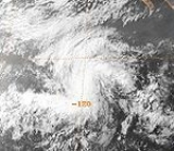
Tropical Storm Adolph
The first storm of the season developed out of a weak area of low pressureLow pressure area
A low-pressure area, or "low", is a region where the atmospheric pressure at sea level is below that of surrounding locations. Low-pressure systems form under areas of wind divergence which occur in upper levels of the troposphere. The formation process of a low-pressure area is known as...
situated about 570 mi (925 km) south-southwest of Acapulco
Acapulco
Acapulco is a city, municipality and major sea port in the state of Guerrero on the Pacific coast of Mexico, southwest from Mexico City. Acapulco is located on a deep, semi-circular bay and has been a port since the early colonial period of Mexico’s history...
, Mexico
Mexico
The United Mexican States , commonly known as Mexico , is a federal constitutional republic in North America. It is bordered on the north by the United States; on the south and west by the Pacific Ocean; on the southeast by Guatemala, Belize, and the Caribbean Sea; and on the east by the Gulf of...
. Tracking towards the west, the circluation briefly dissipated on May 30, before redeveloping the following day into Tropical Depression One-E. A ridge of high pressure
High pressure area
A high-pressure area is a region where the atmospheric pressure at the surface of the planet is greater than its surrounding environment. Winds within high-pressure areas flow outward due to the higher density air near their center and friction with land...
north of the system steered it towards the west-northwest. By 0600 UTC on June 1, the National Hurricane Center
National Hurricane Center
The National Hurricane Center , located at Florida International University in Miami, Florida, is the division of the National Weather Service responsible for tracking and predicting weather systems within the tropics between the Prime Meridian and the 140th meridian west poleward to the 30th...
(NHC) upgraded the depression to a tropical storm and gave it the name Adolph. Adolph continued to strengthen until early on June 2, at which time it reached its peak intensity with winds of 65 mph (100 km/h) and a minimum pressure of 994 mbar (hPa). Shortly after peaking, cool, dry air became entrained in the circulation, preventing further intensification. Early on June 3, Adolph weakened slightly due to unfavorable conditions. Later that day, Adolph briefly re-intensified. On June 4, strong wind shear
Wind shear
Wind shear, sometimes referred to as windshear or wind gradient, is a difference in wind speed and direction over a relatively short distance in the atmosphere...
displaced convection associated with the storm to the west of the center of circulation; this resulted in Adolph weakening to a tropical depression by 1800 UTC that day, and Adolph persisted until June 5 at which time it dissipated.
Hurricane Barbara
On June 10, an area of disturbed weather was located several hundred miles southwest of Acapulco, Mexico, and the system slowed to a westward drift. After gradually becoming better organized, the NHC estimated that the wave spawned Tropical Depression Two-E around 1800 UTC on June 15. Initially, the depression towards the northwest before a ridge of high pressureRidge (meteorology)
A ridge is an elongated region of relatively high atmospheric pressure, the opposite of a trough....
situated over Mexico caused the storm to turn towards the west-northwest. Based on improving satellite presentation, the NHC upgraded the depression to Tropical storm Barbara. With favorable conditions, Barbara continued to intensify, attaining hurricane-status roughly 24 hours after being named. Six hours later, the storm reached its peak intensity with winds of 80 mph (130 km/h) Satellite images early on June 18 showed that cool, dry air was becoming entrained into the northern inflow of the storm and Barbara was nearing cooler waters. These factors led to the storm weakening below hurricane intensity by 0000 UTC on June 19. Wind shear
Wind shear
Wind shear, sometimes referred to as windshear or wind gradient, is a difference in wind speed and direction over a relatively short distance in the atmosphere...
at this time also began to increase, displacing all convection associated with the storm to the northeast of the center. By June 20, the former hurricane was further downgraded to a tropical depression. The NHC issued their final advisory on the system early on June 21; however, the remnants of the storm persisted until June 27.
Hurricane Cosme
On June 18 a tropical disturbance formed several hundred miles off the coast of Mexico. Ships in the vicinity of the storm, in addition to satellite images, indicated that the disturbance had developed into Tropical Depression Three-E around 1800 UTC. Remaining nearly stationary, the depression gradually strengthened into a tropical storm by June 20, receiving the name Cosme at that time. Early on June 21, Cosme began to track towards the north and intensify. Around 1200 UTC, Cosme strengthened into a Category 1 hurricane on the Saffir-Simpson Hurricane ScaleSaffir-Simpson Hurricane Scale
The Saffir–Simpson Hurricane Scale , or the Saffir–Simpson Hurricane Wind Scale , classifies hurricanes — Western Hemisphere tropical cyclones that exceed the intensities of tropical depressions and tropical storms — into five categories distinguished by the intensities of their sustained winds...
. Several hours later, Cosme reached its peak intensity. Late on June 21, the center of the hurricane made landfall
Landfall (meteorology)
Landfall is the event of a tropical cyclone or a waterspout coming onto land after being over water. When a waterspout makes landfall it is reclassified as a tornado, which can then cause damage inland...
on the Mexican coast, just east of Acapulco with winds of 80 mph (130 km/h). The low associated with the former hurricane was last identified near Brownsville, Texas
Brownsville, Texas
Brownsville is a city in the southernmost tip of the state of Texas, in the United States. It is located on the northern bank of the Rio Grande, directly north and across the border from Matamoros, Tamaulipas, Mexico. Brownsville is the 16th largest city in the state of Texas with a population of...
.
Cosme brought heavy rains, which killed at least 30 people due to drowning. Many adobe
Adobe
Adobe is a natural building material made from sand, clay, water, and some kind of fibrous or organic material , which the builders shape into bricks using frames and dry in the sun. Adobe buildings are similar to cob and mudbrick buildings. Adobe structures are extremely durable, and account for...
homes were destroyed, but a specific cost of damage is not known. The highest rainfall recorded in relation to Cosme was 16.1 in (408.9 mm) in Yautepec San Bartolo, Mexico.
Tropical Depression Four-E
The fourth tropical cyclone of the season formed as a well-organized depression on July 9. Deep convection associated with the system indicated that intensification into a tropical storm was possible. The system track generally westward in response to high pressure system to the north. On July 10, the depression quickly became disorganized, with only a small area of convection around the center remaining by midday. Although the depression was nearly at tropical storm intensity, the NHC held off on upgrading it due to its proximity to Tropical Depression Five-E. However, the system failed to intensify. By July 11, the depression entered the Central Pacific hurricane center's area of responsibility. Tracking generally northwest, the system slowly weakened before dissipating on July 13 to the south-southeast of Hawaii.Tropical Depression Five-E
On July 10, a tropical depression formed far from land. Upon formation, there was uncertainty of the location of center. Shortly thereafter, the system became sheared and further intensification was no longer anticipated. On July 11, the low-level center became displaced form the deep convection.the next day, the center was relocated, and moved to the west. While the NHC noted the possibility of intensification, the depression was forecasted to dissipate in 36 hours. It failed to intensify, and moved into the Central Pacific
Pacific Ocean
The Pacific Ocean is the largest of the Earth's oceanic divisions. It extends from the Arctic in the north to the Southern Ocean in the south, bounded by Asia and Australia in the west, and the Americas in the east.At 165.2 million square kilometres in area, this largest division of the World...
on July 14. The fast-moving tropical depression dissipated two days later. The remnants of the depression passed far to the south of Hawaii
Hawaii
Hawaii is the newest of the 50 U.S. states , and is the only U.S. state made up entirely of islands. It is the northernmost island group in Polynesia, occupying most of an archipelago in the central Pacific Ocean, southwest of the continental United States, southeast of Japan, and northeast of...
, thus there was no damage.
Hurricane Dalilia
On July 9, a defined low pressure system formed south of Baja California and increased convective activity led to the NHC classifying it Tropical Depression Six-E on July 11. About 24 hours later, the depression intensified into Tropical Storm Dalilia. By July 13, Dalilia had intensified into a minimal hurricane as it tracked generally toward the northwest. Two days later, the storm took a nearly due west track, which it maintained until July 19. Although the storm tracked near cool waters, a well-developed outflow allowed it to maintain hurricane-intensity. Shortly before crossing into the Central Pacific basin, the storm reached its peak intensity with winds of 90 mph (150 km/h) and a central pressure of 977 mbar (hPa; 28.85 inHg). After crossing 140°W140th meridian west
The meridian 140° west of Greenwich is a line of longitude that extends from the North Pole across the Arctic Ocean, North America, the Pacific Ocean, the Southern Ocean, and Antarctica to the South Pole....
, Dalilia weakened to a minimal hurricane. The storm maintained this intensity until July 19, at which time the system slowed and turned northwest. The following day, the weakening tropical storm brushed the Hawaiian Islands to the south, eventually curving away from the island chain on July 21. Later that day, Dalilia further weakened to a tropical depression, with the Central Pacific Hurricane Center issuing their final advisory at that time. The remnants of the former hurricane continued to track northwest. On July 24, the system interacted with the remnants of Tropical Storm Erick and may have briefly re-attained tropical storm intensity; however, by July 28, the storm was rapidly tracking north through the Aleutian Islands. The remnants of Dalilia dissipated shortly thereafter.
While tracking near the Hawaiian islands, Dalilia produced waves up to 20 ft (6.1 m) along south-facing coastlines. Along the coasts of Ka'u and South Kona, winds gusted up to 45 mph (75 km/h); the winds caused minor damage, mainly downed power lines. Along the southeast slopes of Mauna Loa
Mauna Loa
Mauna Loa is one of five volcanoes that form the Island of Hawaii in the U.S. state of Hawaii in the Pacific Ocean, and the largest on Earth in terms of volume and area covered. It is an active shield volcano, with a volume estimated at approximately , although its peak is about lower than that...
, heavy rains caused minor flooding which forced transit officials to shut down several roads. The heaviest rainfall was recorded on the north side of Kauai
Kauai
Kauai or Kauai, known as Tauai in the ancient Kaua'i dialect, is geologically the oldest of the main Hawaiian Islands. With an area of , it is the fourth largest of the main islands in the Hawaiian archipelago, and the 21st largest island in the United States. Known also as the "Garden Isle",...
, with localized areas receiving rainfall in excess of 10 in (254 mm). The remnants of the storm continued to produce unseasonable rains in the northwestern Hawaiian islands through July 28.
Tropical Depression Seven-E
On July 16, an area of disturbed weather located 900 mi (1,448.4 km) organized into a tropical depression. Upon formation, the NHC did not anticipate significant intensification due to it close distance to both cooler waters and Hurricane Dalilia. The next day, however, the center became difficult to locate and the system was no longer forecast to intensity. By the night, only minimal deep convection remained. The depression soon moved into cold water and as such the system was expected to dissipate within 24 hours. It dissipated the next day. The remnants of this system contributed to a surge in the monsoon trough that led to the formation of Tropical Storm Erick. This system never impacted land, and thus no damage or deaths were reported.Tropical Storm Erick
On July 16, there was a surge in convection in the monsoon trough. The most concentrated area soon separated for the trough and by July 19, satellite imagerySatellite imagery
Satellite imagery consists of photographs of Earth or other planets made by means of artificial satellites.- History :The first images from space were taken on sub-orbital flights. The U.S-launched V-2 flight on October 24, 1946 took one image every 1.5 seconds...
indicated an area of deep convection that was located nearly 1237 mi (1,990.8 km) away from Mexico. Early that day, the system was upgraded to a tropical depression. Upon becoming a tropical cyclone
Tropical cyclone
A tropical cyclone is a storm system characterized by a large low-pressure center and numerous thunderstorms that produce strong winds and heavy rain. Tropical cyclones strengthen when water evaporated from the ocean is released as the saturated air rises, resulting in condensation of water vapor...
, only slight intensification was anticipated. The system intensified to a tropical storm 24 hours after forming. Erick soon moved into cooler waters. This quickly weakened the cyclone and was downgraded to a tropical depression on July 20. It dissipated the next day, without ever impacting any land masses.
Tropical Storm Flossie
Flossie originated form a tropical wave that entered the Pacific OceanPacific Ocean
The Pacific Ocean is the largest of the Earth's oceanic divisions. It extends from the Arctic in the north to the Southern Ocean in the south, bounded by Asia and Australia in the west, and the Americas in the east.At 165.2 million square kilometres in area, this largest division of the World...
on July 20. The system began to show sings of organization two days later. Continuing to organize, the system was upgraded Tropical Depression Nine-E on July 23. Despite being located over warm waters, only gradual intensification was anticipated. It strengthened into Tropical Storm Flossie the next day. Shortly thereafter the upgraded, convection began to diminish. The cyclone then drifted northwest. The upper-level environment rapidly changed, and the cyclones convection became disorganized. The convection separated from the center of circulation. The cluster of convection developed a new center of circulation on July 24. The original center drifted away from Flossie for 12 hours before dissipating. The new center, which was still a tropical storm, drifted northwest. Flossie then encountered an unfavorable environment, and weakened into a depression on July 25. Flossie continued drifting to the northwest until dissipating July 28, while just off the coast of the Baja California Peninsula
Baja California Peninsula
The Baja California peninsula , is a peninsula in northwestern Mexico. Its land mass separates the Pacific Ocean from the Gulf of California. The Peninsula extends from Mexicali, Baja California in the north to Cabo San Lucas, Baja California Sur in the south.The total area of the Baja California...
. Despite its close distance to Mexico
Mexico
The United Mexican States , commonly known as Mexico , is a federal constitutional republic in North America. It is bordered on the north by the United States; on the south and west by the Pacific Ocean; on the southeast by Guatemala, Belize, and the Caribbean Sea; and on the east by the Gulf of...
, no damage or deaths was reported.
Hurricane Gil
Gild formed from an area of disturbed weather located near the MexicoMexico
The United Mexican States , commonly known as Mexico , is a federal constitutional republic in North America. It is bordered on the north by the United States; on the south and west by the Pacific Ocean; on the southeast by Guatemala, Belize, and the Caribbean Sea; and on the east by the Gulf of...
–Guatemala
Guatemala
Guatemala is a country in Central America bordered by Mexico to the north and west, the Pacific Ocean to the southwest, Belize to the northeast, the Caribbean to the east, and Honduras and El Salvador to the southeast...
border developed a circulation in the Gulf of Tehuantepec
Gulf of Tehuantepec
Gulf of Tehuantepec is a large body of water on the Pacific coast of the Isthmus of Tehuantepec, southeastern Mexico, at . Most of the hurricanes that form in the Eastern Pacific organize in or near this body of water...
and then dissipated. On July 30, the disturbance redeveloped a circulation and then convection. It paralleled the coast of Mexico and headed in a northwesterly direction. The low continued to organize, and was upgraded into a tropical depression. Initially, there was some uncertain in the storms future path, and there was a possibility of the system recurving towards the coast. It strengthened into a tropical storm on July 31. The system continued to become better organized, with further intensification foretasted because the low was located over very warm waters; and was upgraded into a hurricane that same day. Shortly thereafter, the cyclone developed an eye
Eye (cyclone)
The eye is a region of mostly calm weather found at the center of strong tropical cyclones. The eye of a storm is a roughly circular area and typically 30–65 km in diameter. It is surrounded by the eyewall, a ring of towering thunderstorms where the second most severe weather of a cyclone...
. Gil was a hurricane for only about 30 hours, and it began to encounter dry air. By the August 1, Gill had lost hurricane intensity. It was downgraded to a tropical depression the next day. The cyclone dissipated on August 5.
The outer bands
Rainband
A rainband is a cloud and precipitation structure associated with an area of rainfall which is significantly elongated. Rainbands can be stratiform or convective, and are generated by differences in temperature. When noted on weather radar imagery, this precipitation elongation is referred to as...
of Gil produced significant amounts of rainfall over coastal areas of eastern Mexico, with satellites estimating areas of rainfall in excess of 5 in (127 mm). The heavy rains may have triggered deadly flooding and landslides; however, no reports from Mexican officials have been received to confirm this. However, officials reported 4.8 in (121.9 mm) of rain in a 12 hour period.
Hurricane Ismael
A tropical wave crossed Central AmericaCentral America
Central America is the central geographic region of the Americas. It is the southernmost, isthmian portion of the North American continent, which connects with South America on the southeast. When considered part of the unified continental model, it is considered a subcontinent...
on July 11, and then became an area of low pressure. While located of the coast of Mexico it became better organized on August 14. This was enough to warrant an upgrade to Tropical Depression Eleven-E. This system slowly became better organized, but northerly wind shear
Wind shear
Wind shear, sometimes referred to as windshear or wind gradient, is a difference in wind speed and direction over a relatively short distance in the atmosphere...
prevent rapid intensification. Initially, this system was slow to intensify. After strengthening into Tropical Storm Ismael, it closely paralleled the coast of Mexico, Ismael turned to the west. It would maintain that generally westerly direction for the rest of its long path across the Pacific Ocean. The system steadily intensified, and by August 16, Ismael had developed a fair outflow. It reached hurricane strength later that day. Continuing to intensify, the hurricane reached Category 2 intensity. However, the system was not expect to intensify further due to cool sea surface temperatures. However, Ismael managed reached Category 3 status. It then reached a peak intensity of 120 mph (195 km/h) and a peak pressure of 955 millibars
Bar (unit)
The bar is a unit of pressure equal to 100 kilopascals, and roughly equal to the atmospheric pressure on Earth at sea level. Other units derived from the bar are the megabar , kilobar , decibar , centibar , and millibar...
. Shortly after its peak, Ismael underwent fluctuations in strength. On August 21, Ismael passed over cooler waters. In addition, the storm encountered strong wind shear
Wind shear
Wind shear, sometimes referred to as windshear or wind gradient, is a difference in wind speed and direction over a relatively short distance in the atmosphere...
. The hostile environment continued to take its toll on Ismael, and it weakened to a tropical storm on August 23. Ismael dissipated not long after weakening to a depression on August 25. The remains of Ismael, which was only a swirl of clouds, dissipated near Hawaii
Hawaii
Hawaii is the newest of the 50 U.S. states , and is the only U.S. state made up entirely of islands. It is the northernmost island group in Polynesia, occupying most of an archipelago in the central Pacific Ocean, southwest of the continental United States, southeast of Japan, and northeast of...
.
Between August 15 and 17, the outer bands
Rainband
A rainband is a cloud and precipitation structure associated with an area of rainfall which is significantly elongated. Rainbands can be stratiform or convective, and are generated by differences in temperature. When noted on weather radar imagery, this precipitation elongation is referred to as...
of Ismael produced heavy rains along coastal areas of Mexico between Acapulco
Acapulco
Acapulco is a city, municipality and major sea port in the state of Guerrero on the Pacific coast of Mexico, southwest from Mexico City. Acapulco is located on a deep, semi-circular bay and has been a port since the early colonial period of Mexico’s history...
and Manzanillo, Colima
Manzanillo, Colima
The name Manzanillo refers to the city as well as its surrounding municipality in the Mexican state of Colima. The city, located on the Pacific Ocean, contains Mexico's busiest port. Manzanillo was the third port created by the Spanish in the Pacific during the New Spain period...
. At least three people were killed by flooding triggered by the storm; however, no structural damage was reported. Despite the rainfall, there were no reports of flooding. The remnants of the hurricane passed near, but did not pose a threat Hawaii.
Tropical Storm Henriette
On August 12, a tropical waveTropical wave
Tropical waves, easterly waves, or tropical easterly waves, also known as African easterly waves in the Atlantic region, are a type of atmospheric trough, an elongated area of relatively low air pressure, oriented north to south, which move from east to west across the tropics causing areas of...
formed in the Pacific Ocean
Pacific Ocean
The Pacific Ocean is the largest of the Earth's oceanic divisions. It extends from the Arctic in the north to the Southern Ocean in the south, bounded by Asia and Australia in the west, and the Americas in the east.At 165.2 million square kilometres in area, this largest division of the World...
. it steadily organized into the twelfth tropical depression of the season early on August 14. It slowly strengthened and was named Henriette after strengthening into a tropical storm. After peaking with winds of 50 mph (85 km/h) and a peak pressure of 1000 mbar (29.5 inHg) on August 15, wind shear immediately began to weaken the tropical cyclone
Tropical cyclone
A tropical cyclone is a storm system characterized by a large low-pressure center and numerous thunderstorms that produce strong winds and heavy rain. Tropical cyclones strengthen when water evaporated from the ocean is released as the saturated air rises, resulting in condensation of water vapor...
. On August 16, after becoming devoid of any convection, it was downgraded into tropical depression status on August 16. Henriette degenerated into a remnant low on August 17. The low persisted for a few more days until completely dissipating.
Tropical Storm Juliette
A surge in convection in the monsoon trough caused by nearby Hurricane Ismael interacted with a tropical wave to form the thirteenth tropical depression of the season on August 21. Due to the small distance of 621 miles (999.4 km) between the cyclones, the depression followed Ismael. Despite strong wind shear caused by Ismael, the depression strengthened into Tropical Storm Juliette on August 22 as a strong burst of convection occurred. After Ismael dissipated, steering currents collapsed, and Juliette moved over cool waters in the open ocean for several days. In addition, strong wind shearWind shear
Wind shear, sometimes referred to as windshear or wind gradient, is a difference in wind speed and direction over a relatively short distance in the atmosphere...
took toll on the system. The low had completely dissipated during the evening of August 25. Juliette never impacted land.
Hurricane Kiko
On August 25, the seasons fourteenth tropical depression formed off the coast of SonoraSonora
Sonora officially Estado Libre y Soberano de Sonora is one of the 31 states which, with the Federal District, comprise the 32 Federal Entities of Mexico. It is divided into 72 municipalities; the capital city is Hermosillo....
, Mexico from a Mesoscale Convective System
Mesoscale Convective System
A mesoscale convective system is a complex of thunderstorms that becomes organized on a scale larger than the individual thunderstorms but smaller than extratropical cyclones, and normally persists for several hours or more...
. A small cyclone, the system rapidly intensified over the warm waters of the Gulf of California
Gulf of California
The Gulf of California is a body of water that separates the Baja California Peninsula from the Mexican mainland...
, becoming Tropical Storm Kiko hours after forming and a hurricane 12 hours later. The fast rate of strengthening continued until August 27, at which time Kiko peaked in intensity as a strong Category 3 hurricane with winds of 120 mph (195 km/h) and a minimum pressure of 955 mbar (hPa; 28.2 inHg). Slight weakening occurred before the storm made landfall near Punta Arena, Mexico, becoming one of the strongest storms to make landfall in Mexico since reliable records began in 1949. The hurricane quickly weakened as it moved over the Baja Peninsula, being downgraded to a tropical depression before emerging into the Pacific Ocean on August 28. The following day, the remnants of Kiko were absorbed by the nearby Hurricane Lorena.
Although Kiko was a major hurricane upon landfall, little damage resulted from the storm. However, 20 homes were destroyed and numerous highways were flooded by torrential rains.
Hurricane Lorena
In the AtlanticAtlantic Ocean
The Atlantic Ocean is the second-largest of the world's oceanic divisions. With a total area of about , it covers approximately 20% of the Earth's surface and about 26% of its water surface area...
, a tropical wave
Tropical wave
Tropical waves, easterly waves, or tropical easterly waves, also known as African easterly waves in the Atlantic region, are a type of atmospheric trough, an elongated area of relatively low air pressure, oriented north to south, which move from east to west across the tropics causing areas of...
spawned Tropical Depression Six. Twenty four hours later, wind shear
Wind shear
Wind shear, sometimes referred to as windshear or wind gradient, is a difference in wind speed and direction over a relatively short distance in the atmosphere...
degenerated the depression back into a wave. The wave continued westward, and in the southern Caribbean Sea
Caribbean Sea
The Caribbean Sea is a sea of the Atlantic Ocean located in the tropics of the Western hemisphere. It is bounded by Mexico and Central America to the west and southwest, to the north by the Greater Antilles, and to the east by the Lesser Antilles....
, split in two on August 21. The southern part crossed Central America
Central America
Central America is the central geographic region of the Americas. It is the southernmost, isthmian portion of the North American continent, which connects with South America on the southeast. When considered part of the unified continental model, it is considered a subcontinent...
and emerged into the Pacific Ocean. Banding and convection steadily organized, and Tropical Depression Fifteen-E formed on August 27. It strengthened into Tropical Storm Lorena the next day. At this time, three systems were active and in close proximity. Lorena and a weakening Kiko started a Fujiwhara interaction. Lorena eventually became the dominate system, and absorbed the remnants of Kiko on August 29. Moving slowly out to sea, Lorena reached minimal hurricane strength on the September 1 as the convection became more concentrated. Lorena was a hurricane for less than a day. It weakened quickly weakening to a depression on September 3. The cyclone was devoid of convection by September 7, and was thus declared a remnant low. The system never affected land.
Tropical Storm Manuel
An area of thunderstorms organized into a tropical depression on August 28. The next day, convection increased near the center, and was respectively upgraded into a tropical storm. Manuel gradually strengthened, reaching a peak of 45 mph (75 km/h). Manuel approached to within 578 mi (930.2 km) of Lorena. Due to its proximity to the storm, Manuel lost its center circulation on August 31. The storms only impact on land was light rainfall near Manzanillo, ColimaManzanillo, Colima
The name Manzanillo refers to the city as well as its surrounding municipality in the Mexican state of Colima. The city, located on the Pacific Ocean, contains Mexico's busiest port. Manzanillo was the third port created by the Spanish in the Pacific during the New Spain period...
. No reports of death or damage were reported.
Tropical Storm Narda
On September 2, a tropical wave began showing sings of organization, and on September 3, it organized into a tropical depression. Upon becoming a tropical cyclone, Narda was located over warm sea surface temperatures. Moving rapidly, to the west-northwest, Narda strengthened into a tropical storm. Strong wind shearWind shear
Wind shear, sometimes referred to as windshear or wind gradient, is a difference in wind speed and direction over a relatively short distance in the atmosphere...
prevented significant intensification beyond minimal tropical storm strength, with winds peaking at 50 mph (75 km/h). Initially, Narda managed to produce brief burst of convection. By September 7, however, Narda was devoid of convection, and was respectively downgraded to a tropical depression. It never impacted land.
Hurricane Octave
At low latitude in the Atlantic, Tropical Depression Nine formed from a tropical wave on August 28. The depression degenerated the next day due to strong wind shearWind shear
Wind shear, sometimes referred to as windshear or wind gradient, is a difference in wind speed and direction over a relatively short distance in the atmosphere...
. The wave continued drifting westward, and entered the Pacific Ocean on the September 2. It slowly developed, and organized into Tropical Depression Eighteen-E on September 8. The cyclone turned northwestward, and strengthened into Tropical Storm Octave on September 10. After strengthening into a hurricane the next day, Octave started deepening. After peaking as a Category 4 on September 13 with 135 mi/h winds, Octave moved into a region of cooler waters and strong shear. Octave weakened to a storm at midday on September 14 and a depression 32 hours later. The depression hooked to the east, and dissipated on September 18 near Guadalupe Island
Guadalupe Island
Guadalupe Island, or Isla Guadalupe is a volcanic island located 241 kilometers off the west coast of Mexico's Baja California peninsula and some 400 kilometers southwest of the city of Ensenada in Baja California state, in the Pacific Ocean...
. The remnants eventually turned to the north before dissipating.
While Octave had no significant effects on land as a hurricane, its remnants did move into California
California
California is a state located on the West Coast of the United States. It is by far the most populous U.S. state, and the third-largest by land area...
. In the Sacramento Valley
Sacramento Valley
The Sacramento Valley is the portion of the California Central Valley that lies to the north of the San Joaquin-Sacramento Delta in the U.S. state of California. It encompasses all or parts of ten counties.-Geography:...
, the town of Redding
Redding, California
Redding is a city in far-Northern California. It is the county seat of Shasta County, California, USA. With a population of 89,861, according to the 2010 Census...
recorded 2.21 in (56.1 mm) of rain in a 12 hour span.
Tropical Storm Priscilla
Tropical Depression Nineteen-E organized from an area of low pressure on September 21. Upon being upgraded, the depression was anticipated to slowly strengthen, becoming a strong tropical storm in three days. Moving northwestward, it was named Priscilla the next day. Continuing to intensify, it reached its peak intensity of 65 mph (100 km/h). Due to its close proximity to the cooler waters, Priscilla began weakening almost immediately thereafter. The cyclone weakened into a tropical depression on September 24 and dissipated the next day .Although Priscilla did not directly impact land as a tropical cyclone, the remnant moisture enhanced a non-tropical low off the California coastline, resulting in heavy rainfall along the Pacific coast of the United States. In southern California, the system also resulted in hot and humid weather, with some areas reaching up to 108 °F (42.2 °C).
Tropical Depression Twenty-E
On September 24, Tropical Depression Twenty-E formed southwest of GuatemalaGuatemala
Guatemala is a country in Central America bordered by Mexico to the north and west, the Pacific Ocean to the southwest, Belize to the northeast, the Caribbean to the east, and Honduras and El Salvador to the southeast...
. Although convection increased, significant development was not anticipated due to its promoxity to land. It was also forecasted to make landfall in 36 hours. A small cyclone, its close distance to Hurricane Raymond
Hurricane Raymond (1989)
Hurricane Raymond was the strongest tropical cyclone of the 1989 Pacific hurricane season, peaking as a strong Category 4 hurricane on the Saffir-Simpson Hurricane Scale. Forming out of a tropical wave on September 25, the tropical depression slowly tracked northwest before becoming nearly...
hindered development. Moving very little, the winds soon diminished. The depression dissipated on September 27.
When the depression was anticipated to make landfall in Mexico. As such, the NHC noted the possibility of heavy rains especially over the higher elevations. However, no impact was reported from the tropical cyclone.
Hurricane Raymond
Tropical Depression Twenty One-E formed from part of the same tropical waveTropical wave
Tropical waves, easterly waves, or tropical easterly waves, also known as African easterly waves in the Atlantic region, are a type of atmospheric trough, an elongated area of relatively low air pressure, oriented north to south, which move from east to west across the tropics causing areas of...
that had earlier spawned Hurricane Hugo
Hurricane Hugo
Hurricane Hugo was a classical, destructive and rare Cape Verde-type hurricane which struck the Caribbean islands of Guadeloupe, Montserrat, St. Croix, Puerto Rico and the USA mainland in South Carolina as a Category 4 hurricane during September of the 1989 Atlantic hurricane season...
. Moving slowly to the west-northwest, it accelerated to the northwest in response to a trough
Trough (meteorology)
A trough is an elongated region of relatively low atmospheric pressure, often associated with fronts.Unlike fronts, there is not a universal symbol for a trough on a weather chart. The weather charts in some countries or regions mark troughs by a line. In the United States, a trough may be marked...
and strengthened into the seventeenth named storm of the season on September 26. Raymond turned to the west again and entered a favourable environment. Raymond eventually peaked as a Category 4 hurricane and the strongest storm of the season on October 1. A trough over Mexico destroyed the ridge
Ridge (meteorology)
A ridge is an elongated region of relatively high atmospheric pressure, the opposite of a trough....
that was steering Raymond and recurved the cyclone to the northeast. The hurricane accelerated into a less favorable environment, and slowly weakened as its forward speed increased to 23 mph (37 km/h). Raymond made landfall as a tropical storm on October 4. Northern Mexico's mountains disrupted Raymond's circulation, and dissipated over New Mexico on October 5 after passing over that state and Arizona
Arizona
Arizona ; is a state located in the southwestern region of the United States. It is also part of the western United States and the mountain west. The capital and largest city is Phoenix...
as a depression.
Since Raymond had significantly weakened prior to its first landfall, only minor impacts were recorded in Mexico. The highest rainfall was recorded in Nogales
Nogales, Sonora
Heroica Nogales , more commonly known as Nogales, is a city and its surrounding municipality on the northern border of the Mexican State of Sonora. The municipality covers an area of 1,675 km², and borders to the north the city of Nogales, Arizona, United States, across the U.S.-Mexico border...
at 4.72 in (119.9 mm). In the city, the swollen Santa Cruz River destroyed a heavily traveled bridge, known as the Calle Obregon, and destroyed a store which was situated on the banks of the river. Mexican officials estimated damages at $250,000 (1989 USD, $ USD). The remnants of the storm tracked into the Southwest United States and further into the Central United States
Central United States
The Central United States is sometimes conceived as between the Eastern United States and Western United States as part of a three-region model, roughly coincident with the Midwestern United States plus the western and central portions of the Southern United States; the term is also sometimes used...
before dissipating. Rainfall in excess of 3 in (76.2 mm) fell in parts of southern Arizona
Arizona
Arizona ; is a state located in the southwestern region of the United States. It is also part of the western United States and the mountain west. The capital and largest city is Phoenix...
; the highest total was recorded in Independence, Kansas
Independence, Kansas
Independence is a city in and the county seat of Montgomery County, Kansas, United States. As of the 2010 census, the city population was 9,483.-Geography:...
at 3.91 in (99.3 mm). One person was killed in a mobile home which was destroyed by high winds. Flash flooding triggered by Raymond caused an estimated $1.5 million (1989 USD, $ USD) in damages in Arizona.
Tropical Depression Twenty Two-E
On October 3, a tropical depression formed 475 mi (764.4 km) south of Mexico from an area of disturbed weather that had become better organized. Upon becoming a tropical cyclone, the cyclone was located in a favorable environment. As such, it was forecasted to reach a peak intensity of 70 mph (112.7 km/h). Later that day, convection increased, but the NHC did not upgrade the system into a tropical storm. However, increased wind shear quickly caused the system to become exposed. After drifting westbound, it did not become a tropical storm and dissipated on October 4. However, it regenerated on October 7 as deep convection had developed near the center for about 12 hours. Upon regenerating, it was forecasted to intensify into a strong tropical storm as it was expected to turn to the north. Shortly thereafter, the system became less organized; it dissipated again the next day. The depression never threatened land.Tropical Depression Twenty Three-E
On October 15, a tropical depression formed south of MexicoMexico
The United Mexican States , commonly known as Mexico , is a federal constitutional republic in North America. It is bordered on the north by the United States; on the south and west by the Pacific Ocean; on the southeast by Guatemala, Belize, and the Caribbean Sea; and on the east by the Gulf of...
. Although it was small cyclone, the system was located in an area of warm water and decreasing wind shear. As such, it was foretasted to intensify into a tropical storm. The next day, the depression lost deep convection. and the center became poorly defined. It dissipated on October 16, without becoming a tropical storm or affecting land.
Tropical Depression Twenty Four-E
On October 18, the NHC began issuing advisories on Tropical Depression Twenty Four-E. Although the depression was located within an area of high wind shearWind shear
Wind shear, sometimes referred to as windshear or wind gradient, is a difference in wind speed and direction over a relatively short distance in the atmosphere...
, convection
Atmospheric convection
Atmospheric convection is the result of a parcel-environment instability, or temperature difference, layer in the atmosphere. Different lapse rates within dry and moist air lead to instability. Mixing of air during the day which expands the height of the planetary boundary layer leads to...
had managed to partially develop around the center of circulation. A ship nearby the system reported sustained winds of 40 mph (65 km/h); however, the winds were not considered to be representative of the actual intensity of the depression. Further intensification was not expected as the depression tracked in a northward direction Shortly after the first advisory was issued, convection rapidly dissipated, leaving an exposed low pressure area, devoid of shower and thunderstorm activity. The system was forecast to dissipate within 36 hours due to high shear. Late on October 18, the forward motion of the depression abruptly changed towards the west. The final advisory on Tropical Depression Twenty Four-E was issued during the afternoon of October 19 as the system remained devoid of convection; redevelopment of the system was not anticipated due to unfavorable conditions.
Storm names
The following names were used for named storms that formed in the eastern Pacific in 1989. Since no names were retired, no new names were replaced for the 1995 season1995 Pacific hurricane season
The 1995 Pacific hurricane season was the least active Pacific hurricane season since 1979. Of the eleven tropical cyclones that formed during the season, four affected land, with the most notable storm of the season being Hurricane Ismael, which killed at least 116 people in Mexico...
. However, the name Dalilia was later changed to Dalila through a misspelling of the name. The changed spelling has remained in use since 1995. Names that were not assigned are marked in gray.
|
Hurricane Kiko (1989) Hurricane Kiko was one of the strongest tropical cyclones to ever make landfall on the eastern coast of the Baja California Peninsula. The eleventh named storm of the 1989 Pacific hurricane season, Kiko formed out of a large mesoscale convective system on August 25. Slowly tracking... Hurricane Octave (1989) Hurricane Octave was a Category 4 hurricane which existed during the above-average 1989 Pacific hurricane season. The remnants of Atlantic Tropical Depression Nine tracked westward across the Caribbean Sea, entering the Pacific Ocean on September 3. It slowly developed, and organized into a... |
Hurricane Raymond (1989) Hurricane Raymond was the strongest tropical cyclone of the 1989 Pacific hurricane season, peaking as a strong Category 4 hurricane on the Saffir-Simpson Hurricane Scale. Forming out of a tropical wave on September 25, the tropical depression slowly tracked northwest before becoming nearly... |
Central Pacific
Starting in the early 1980s, the Central Pacific Hurricane CenterCentral Pacific Hurricane Center
The Central Pacific Hurricane Center of the United States National Weather Service is the official body responsible for tracking and issuing tropical cyclone warnings, watches, advisories, discussions, and statements for the Central North Pacific Basin...
assigned names to tropical storms that formed between the 180°
180th meridian
The 180th meridian or antimeridian is the meridian which is 180° east or west of the Prime Meridian passing through the Royal Observatory, Greenwich. It is common to both east longitude and west longitude. It is used as the basis for the International Date Line because it for the most part passes...
to 140°W
140th meridian west
The meridian 140° west of Greenwich is a line of longitude that extends from the North Pole across the Arctic Ocean, North America, the Pacific Ocean, the Southern Ocean, and Antarctica to the South Pole....
. Names for the basin are taken off a single list due to the low frequency of storms in the area. Had a tropical storm formed in the Central Pacific during 1989, it would have received the name Aka. The first six names on the list that could have been used are listed below.
Season impact
This is a table of the storms in 1989 and their landfall(s), if any. Deaths in parentheses are indirect; an example of such would be a traffic accident, but still storm-related. Damage and death totals include times when the storm was an extratropical storm or precursor wave.See also
- List of Pacific hurricanes
- List of Pacific hurricane seasons
- 1989 Atlantic hurricane season1989 Atlantic hurricane seasonThe 1989 Atlantic hurricane season was an active season that produced fifteen tropical cyclones, eleven named storms, seven hurricanes, and two major hurricanes. The season was officially designated from June 1, 1989, to November 30, 1989, dates which conventionally...
- 1989 Pacific typhoon season1989 Pacific typhoon seasonThe 1989 Pacific typhoon season has no official bounds; it ran year-round in 1989, but most tropical cyclones tend to form in the northwestern Pacific Ocean between May and November. These dates conventionally delimit the period of each year when most tropical cyclones form in the northwestern...
- 1989 North Indian Ocean cyclone season
- Southern Hemisphere tropical cyclone seasons: 1988–89, 1989–90
External links
- [ftp://ftp.nhc.noaa.gov/pub/storm_archives/pacific/prelimep/ep1989/ NHC 1989 Pacific hurricane season archive]
- Central Pacific Hurricane Center archive