
1978 Tabas earthquake
Encyclopedia
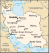
The 1978 Tabas earthquake was a huge earthquake measuring 7.8 on the Richter scale
which struck on September 16, 1978 in central Iran. The death toll was approximately 15,000 and the worst damage was to the town Tabas
, which was at the epicentre of the quake and completely flattened. 40 villages within a 30 miles (48.3 km) radius were damaged. All the town's doctors were reported to have died, leaving civilians to treat others. All water and electricity was cut from Tabas, along with phone lines. The nearest accessible place to gain water was the town of Ferdows
, a three hour drive away.
The earthquake lasted around three minutes, making it extremely dangerous. Compared to the normal earthquake duration of 10 – 20 seconds, the power of this earthquake is shown. It struck at 19:38 local time. In the aftermath of the quake, bodies were burned where found to prevent the spread of disease.
Richter magnitude scale
The expression Richter magnitude scale refers to a number of ways to assign a single number to quantify the energy contained in an earthquake....
which struck on September 16, 1978 in central Iran. The death toll was approximately 15,000 and the worst damage was to the town Tabas
Tabas
Tabas is a city in and capital of Tabas County, Yazd Province, Iran. At the 2006 census, its population was 30,681, in 7,962 families.Tabas is located in central Iran, 950 kilometers southeast of Tehran, in Yazd Province. Formerly it was part of the Khorasan province. It is a desert city with...
, which was at the epicentre of the quake and completely flattened. 40 villages within a 30 miles (48.3 km) radius were damaged. All the town's doctors were reported to have died, leaving civilians to treat others. All water and electricity was cut from Tabas, along with phone lines. The nearest accessible place to gain water was the town of Ferdows
Ferdows
Ferdows , also Romanized as Ferdos, Ferdous, and Firdaus; named Toon or Tūn until 1929) is a city in and the capital of Ferdows County, located in the northwest of South Khorasan Province in Iran. It is about south of Mashhad and 200 km northwest of Birjand...
, a three hour drive away.
The earthquake lasted around three minutes, making it extremely dangerous. Compared to the normal earthquake duration of 10 – 20 seconds, the power of this earthquake is shown. It struck at 19:38 local time. In the aftermath of the quake, bodies were burned where found to prevent the spread of disease.
External links
- Photograph showing damage from Tabas quake photo by N. Orsini