
1976 Pacific hurricane season
Encyclopedia
The 1976 Pacific hurricane season was a very deadly and costly one. Hurricanes Kathleen, Liza, and Madeline were the most notable storms this year. Hurricane Kathleen
caused death and destruction in California and Arizona due to flooding. Hurricane Liza
was the deadliest storm of the season when it killed over 600 people in Mexico. Hurricane Madeline is notable for being the most intense Pacific hurricane at landfall.
. In practice, the season lasted from the formation of the first storm on June 2 to the dissipation of the last on October 30.
This season had a slightly below average number of tropical storms, with fourteen. The number of hurricanes was average, with eight. The season had an above-average number of major hurricanes, with five reaching Category 3 or higher on the Saffir-Simpson Hurricane Scale
. Four of tropical depressions dissipated before they could reach tropical storm strength. There were five landfalls, including three by consecutive storms.
In the Central Pacific, one tropical cyclone, a hurricane formed. Two storms entered the region from the east. These totals are close to average.
on June 30 and dissipated shortly after that. Impact was minimal.
's area of responsibility. Diana's remnants lost their identity shortly after that. Diana did not threaten land.
, and finally dissipated on August 2.
downgraded Gwen to a depression, as it became nearly stationary on August 11.
Hurricane Hyacinth then approached within 500 miles. Interaction between the systems pulled the cyclone to the north. It re-intensified to a tropical storm on August 12. It then slowly weakened as Hyacinth fell apart and was absorbed by Gwen. The combined tropical depression headed west and entered the central Pacific. It was tracked to a point north of Kauai
, where it dissipated on August 17. The only effect Gwen had on any land was to disrupt the trade winds enough to cause rainfall on Kauai.
, Iva never threatened land.
and Arizona
.
on October 2.
There was only minor damage reported to the northern and eastern shores of Oahu
, Maui
, and Hawaii
due to heavy surf. A ship called the Hawaiian Princess was caught by gale
s caused by Kate but escaped.
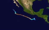
Five days later, on October 3, the disturbance reformed into a depression and a tropical storm the next day. It reached hurricane strength on October 6 and started recurving to the north. Moving over warm water, Madeline rapidly intensified to a category 4 storm with a peak central pressure of 940 mbar and winds of 145 miles per hour, the highest of the season. Madeline made landfall near Zihuatanejo
on October 8 and quickly weakened over Mexico.
. No names were retired from this list. However, as modern naming began in 1978, this is the last time this list was used. Names that were not assigned are marked in gray.
The central Pacific used names and numbers from the western Pacific typhoon name list. Kate was the only name required.
Hurricane Kathleen (1976)
Hurricane Kathleen was a hurricane of the 1976 Pacific hurricane season that caused destructive impacts in California. Kathleen caused widespread flooding and damage in northern Mexico and parts of the southwestern United States. It also took an unusual path. On September 7, a tropical depression...
caused death and destruction in California and Arizona due to flooding. Hurricane Liza
Hurricane Liza (1976)
Hurricane Liza was one of the deadliest East Pacific tropical cyclones on record. The seventeenth tropical cyclone, thirteenth named storm, and the eight hurricane of the 1976 Pacific hurricane season, Liza developed from an area of disturbed weather to the southwest of Mexico on September 25...
was the deadliest storm of the season when it killed over 600 people in Mexico. Hurricane Madeline is notable for being the most intense Pacific hurricane at landfall.
Season summary
The season officially started May 15, 1976 in the eastern Pacific, and June 1, 1976 in the central Pacific, and lasted until November 30, 1976. These dates conventionally delimit the period of each year when most tropical cyclones form in the northeastern Pacific OceanPacific Ocean
The Pacific Ocean is the largest of the Earth's oceanic divisions. It extends from the Arctic in the north to the Southern Ocean in the south, bounded by Asia and Australia in the west, and the Americas in the east.At 165.2 million square kilometres in area, this largest division of the World...
. In practice, the season lasted from the formation of the first storm on June 2 to the dissipation of the last on October 30.
This season had a slightly below average number of tropical storms, with fourteen. The number of hurricanes was average, with eight. The season had an above-average number of major hurricanes, with five reaching Category 3 or higher on the Saffir-Simpson Hurricane Scale
Saffir-Simpson Hurricane Scale
The Saffir–Simpson Hurricane Scale , or the Saffir–Simpson Hurricane Wind Scale , classifies hurricanes — Western Hemisphere tropical cyclones that exceed the intensities of tropical depressions and tropical storms — into five categories distinguished by the intensities of their sustained winds...
. Four of tropical depressions dissipated before they could reach tropical storm strength. There were five landfalls, including three by consecutive storms.
In the Central Pacific, one tropical cyclone, a hurricane formed. Two storms entered the region from the east. These totals are close to average.
Tropical Depression One
Tropical Depression One formed June 2 at a location far out to sea. After moving west, it dissipated the day after it formed.Hurricane Annette
On June 3, Tropical Cyclone Two formed from an area of disturbed weather. Three days later, it became a tropical storm and was given the name Annette. It intensified rapidly, reaching Category 4 strength three days later, and its pressure plunged to 925 millibars. Its west-northwest path was well away from any land. Annette dissipated on June 14, without ever affecting land.Hurricane Bonny
A tropical depression formed on June 26. It intensified into a weak hurricane the next day and headed westward. It then began to weaken. Bonny dissipated June 29, having never threatened land.Tropical Cyclone Four
Tropical Depression Four formed on June 28 from a large area of thunderstorms. Having moved north for its short life, it made landfall near Salina CruzSalina Cruz
Salina Cruz is a major seaport on the Pacific coast of the Mexican state of Oaxaca. It is the state's third-largest city and is municipal seat of the municipality of the same name.It is part of the Tehuantepec District in the west of the Istmo Region....
on June 30 and dissipated shortly after that. Impact was minimal.
Tropical Storm Celeste
After a calm of two weeks, Tropical Cyclone Five formed on July 14. The next day, it reached tropical storm strength. Celeste took a westward track and had no effect on any land area. The storm dropped to a depression on July 17 and dissipated two days later.Hurricane Diana
On July 16, the sixth depression of the season formed. It reached tropical storm strength later that day. The storm continued intensifying, briefly reaching Category 2 strength before weakening as it headed out to sea. Diana dissipated on July 23 not long after entering the Central Pacific Hurricane CenterCentral Pacific Hurricane Center
The Central Pacific Hurricane Center of the United States National Weather Service is the official body responsible for tracking and issuing tropical cyclone warnings, watches, advisories, discussions, and statements for the Central North Pacific Basin...
's area of responsibility. Diana's remnants lost their identity shortly after that. Diana did not threaten land.
Tropical Storm Estelle
Part of a large disturbance developed two centers of circulation. One center organized into Tropical Cyclone Seven on July 27. It quickly strengthened into Tropical Storm Estelle. Due to its proximity to Tropical Storm Fernanda as well as cooler waters, Estelle dissipated on July 29. Its remnants were promptly absorbed by the other system.Tropical Storm Fernanda
An active second half of July continued when, on July 28, the other part of the disturbance became Tropical Cyclone Eight. Soon, the depression was upgraded to Tropical Storm Fernanda. After absorbing the remnants of Tropical Storm Estelle, Fernanda began to weaken. It was only a depression when it entered the CPHC's area of responsibility on July 30. The depression was tracked to a point south of the Hawaiian IslandsHawaiian Islands
The Hawaiian Islands are an archipelago of eight major islands, several atolls, numerous smaller islets, and undersea seamounts in the North Pacific Ocean, extending some 1,500 miles from the island of Hawaii in the south to northernmost Kure Atoll...
, and finally dissipated on August 2.
Tropical Storm Gwen
On August 5, a tropical depression formed. Within a day, it was upgraded to tropical storm status and named Gwen. Gwen tracked westward over an area of cooler waters, decelerated. The Eastern Pacific Hurricane CenterEastern Pacific Hurricane Center
The Eastern Pacific Hurricane Center was formerly the Regional Specialized Meteorological Center responsible for forecasting Pacific hurricanes in the eastern north Pacific east of 140°W...
downgraded Gwen to a depression, as it became nearly stationary on August 11.
Hurricane Hyacinth then approached within 500 miles. Interaction between the systems pulled the cyclone to the north. It re-intensified to a tropical storm on August 12. It then slowly weakened as Hyacinth fell apart and was absorbed by Gwen. The combined tropical depression headed west and entered the central Pacific. It was tracked to a point north of Kauai
Kauai
Kauai or Kauai, known as Tauai in the ancient Kaua'i dialect, is geologically the oldest of the main Hawaiian Islands. With an area of , it is the fourth largest of the main islands in the Hawaiian archipelago, and the 21st largest island in the United States. Known also as the "Garden Isle",...
, where it dissipated on August 17. The only effect Gwen had on any land was to disrupt the trade winds enough to cause rainfall on Kauai.
Hurricane Hyacinth
Tropical Cyclone Ten formed on August 6 from an area of disturbed weather. Twelve hours later, it became a tropical storm and was named Hyacinth. Three days later it became a hurricane. Hyacinth rapidly intensified, reaching Category 3 intensity on August 10. It moved over cooler waters and began weakening. After briefly interacting with Tropical Storm Gwen, Hyacinth weakened to a depression and merged with Tropical Depression Gwen on August 14.Tropical Cyclone Eleven
Tropical Depression Eleven formed on August 8. It dissipated the next day after stalling out over the open ocean.Tropical Cyclone Twelve
Tropical Depression Twelve formed on August 16. After drifting for two days in the open ocean, it moved over cooler waters. It was reduced to a swirl of clouds on August 19.Hurricane Iva
The day after forming on the August 24, a tropical depression reached tropical storm intensity. Iva headed west-northwest and intensified to Category 4 on August 29. Iva then weakened and became extratropical on September 2. Except for Socorro IslandSocorro Island
Socorro Island is a small volcanic island in the Revillagigedo Islands, a Mexican possession lying some 600 kilometers off the country's western coast at 18°48'N, 110°59'W. The size is 16.5 by 11.5 km, with an area of 132 km².- Geology :...
, Iva never threatened land.
Tropical Storm Joanna
Tropical Cyclone Fourteen formed from an area of disturbed weather on August 28. After almost becoming a tropical storm, its circulation collapsed on August 30. Convection and thunderstorms regenerated on August 30. A circulation redeveloped the next day. The depression finally reached tropical storm strength and was named Joanna. An area of clouds degraded Joanna and caused it to dissipate on September 7, having never threatened land.Hurricane Kathleen
Kathleen was a destructive and costly storm. On September 10 and September 11, it caused millions of dollars in damage and at least four deaths due to widespread flooding in CaliforniaCalifornia
California is a state located on the West Coast of the United States. It is by far the most populous U.S. state, and the third-largest by land area...
and Arizona
Arizona
Arizona ; is a state located in the southwestern region of the United States. It is also part of the western United States and the mountain west. The capital and largest city is Phoenix...
.
Hurricane Kate
The only hurricane to form in the central Pacific arose from a disturbance that drifted in from the east. Tropical Depression Twenty-two formed on September 22. The depression became Tropical Storm Kate the next day. Kate headed almost due northwest. Early on September 24, the storm became a hurricane. This prompted a hurricane watch being issued for the Big Island on September 28. The watch continued until Kate was downgraded to a storm on September 29. It passed 200 miles northwest of the island and was destroyed by wind shearWind shear
Wind shear, sometimes referred to as windshear or wind gradient, is a difference in wind speed and direction over a relatively short distance in the atmosphere...
on October 2.
There was only minor damage reported to the northern and eastern shores of Oahu
Oahu
Oahu or Oahu , known as "The Gathering Place", is the third largest of the Hawaiian Islands and most populous of the islands in the U.S. state of Hawaii. The state capital Honolulu is located on the southeast coast...
, Maui
Maui
The island of Maui is the second-largest of the Hawaiian Islands at and is the 17th largest island in the United States. Maui is part of the state of Hawaii and is the largest of Maui County's four islands, bigger than Lānai, Kahoolawe, and Molokai. In 2010, Maui had a population of 144,444,...
, and Hawaii
Hawaii (island)
The Island of Hawaii, also called the Big Island or Hawaii Island , is a volcanic island in the North Pacific Ocean...
due to heavy surf. A ship called the Hawaiian Princess was caught by gale
Gale
A gale is a very strong wind. There are conflicting definitions of how strong a wind must be to be considered a gale. The U.S. government's National Weather Service defines a gale as 34–47 knots of sustained surface winds. Forecasters typically issue gale warnings when winds of this strength are...
s caused by Kate but escaped.
Hurricane Liza
Liza is the third deadliest Eastern Pacific storm of all time, killing 950 people from a dam burst on the Baja Peninsula. Only an unnamed Category 5 hurricane that slammed ashore in 1959, and a tropical depression that later became Hurricane Paul, killed more.Hurricane Madeline
The parade of landfalls continued with Hurricane Madeline. A tropical gale developed into a circulation on September 29 and was named Madeline. The system lost strength almost immediately thereafter. It weakened to a depression and then degenerated into a disturbance.Five days later, on October 3, the disturbance reformed into a depression and a tropical storm the next day. It reached hurricane strength on October 6 and started recurving to the north. Moving over warm water, Madeline rapidly intensified to a category 4 storm with a peak central pressure of 940 mbar and winds of 145 miles per hour, the highest of the season. Madeline made landfall near Zihuatanejo
Zihuatanejo
Zihuatanejo or Ixtapa-Zihuatanejo, is the fourth-largest city in the Mexican state of Guerrero. Politically the city belongs to the municipality of Zihuatanejo de Azueta in the western part of Guerrero, but both are commonly referred to as Zihuatanejo...
on October 8 and quickly weakened over Mexico.
Tropical Storm Naomi
After almost two weeks of inactivity, a tropical depression formed on October 25. It quickly strengthened into a tropical storm. Naomi took an unusual east-northeasterly track. Naomi made landfall on October 29, and quickly dissipated the next day. Reported damage was minimal.1976 storm names
The following names were used for named storms that formed in the eastern Pacific in 1976. It is the same list used in the 1972 season1972 Pacific hurricane season
The 1972 Pacific hurricane season was an ongoing event in tropical cyclone meteorology. There were few notable storms this year. No one was killed and storm effects were generally not serious. The most notable systems were Hurricane Celeste and Joanne. Celeste was the strongest storm of the...
. No names were retired from this list. However, as modern naming began in 1978, this is the last time this list was used. Names that were not assigned are marked in gray.
|
Hurricane Kathleen (1976) Hurricane Kathleen was a hurricane of the 1976 Pacific hurricane season that caused destructive impacts in California. Kathleen caused widespread flooding and damage in northern Mexico and parts of the southwestern United States. It also took an unusual path. On September 7, a tropical depression... Hurricane Liza (1976) Hurricane Liza was one of the deadliest East Pacific tropical cyclones on record. The seventeenth tropical cyclone, thirteenth named storm, and the eight hurricane of the 1976 Pacific hurricane season, Liza developed from an area of disturbed weather to the southwest of Mexico on September 25... |
The central Pacific used names and numbers from the western Pacific typhoon name list. Kate was the only name required.
See also
- List of Pacific hurricanes
- List of Pacific hurricane seasons
- 1976 Atlantic hurricane season1976 Atlantic hurricane seasonThe 1976 Atlantic hurricane season officially began on June 1, 1976, and lasted until November 30, 1976. These dates conventionally delimit the period of each year when most tropical cyclones form in the Atlantic basin...
- 1976 Pacific typhoon season1976 Pacific typhoon seasonThe 1976 Pacific typhoon season has no official bounds; it ran year-round in 1976, but most tropical cyclones tend to form in the northwestern Pacific Ocean between June and December...
- 1976 North Indian Ocean cyclone season
- Southern Hemisphere tropical cyclone seasons: 1975–76, 1976–77