
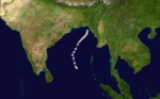
1970 North Indian Ocean cyclone season
Encyclopedia
The 1970 North Indian Ocean cyclone season had no bounds, but tropical cyclone
s in the North Indian Ocean
tend to form between April and December, with peaks in May and November. The 1970 season saw a total of seven cyclonic storms, of which three developed into severe cyclonic storms. The Bay of Bengal
was more active than the Arabian Sea
during 1970, with all of the three severe cyclonic storms in the season forming there. Unusually, none of the storms in the Arabian Sea made landfall
this year. The most significant storm of the season was the Bhola cyclone
, which formed in the Bay of Bengal and hit Bangladesh
on November 12. The storm killed over 500,000 people, making it the deadliest tropical cyclone in recorded history.
late in April moved north into the Bay of Bengal
becoming the first depression of the year on May 2. The depression intensified under the influence of a high-level anticyclone and became a cyclonic storm the next day. The storm then turned to the northeast and strengthened into a severe cyclonic storm on May 4. Soon after this, it peaked with winds of 150 km/h (90 mph) and a well-defined eye
formed. The storm made its landfall
near Cox's Bazar
in easternmost East Pakistan
(now Bangladesh
) early in the morning of May 7 and dissipated over western Burma that evening.
The cyclone brought widespread rain to the Andaman
and Nicobar Islands
before it moved clear of them on May 3. Effects in East Pakistan are unknown, but Akyab in western Burma reported winds of 55 km/h (35 mph) as the cyclone approached land.
coast. It moved towards the coast and made landfall to the south of Cox's Bazar
that night, before dissipating over southern Assam
the next day. Any effects on land are unknown.
-Goa
coastline in the Arabian Sea
on May 27 and developed into a depression the next day. The system developed further into a cyclonic storm on May 29 as it moved to the north. The storm reached its peak with 95 km/h (60 mph) soon after this as it turned to the west, but soon degenerated into a deep depression over the northern Arabian Sea on May 31. The depression continued to move west, weakening to a remnant low shortly as it made landfall on the Arabian Peninsula
on June 2. The remnant low dissipated over southern Saudi Arabia
the next day.
The cyclone itself had minimal effects on land, but the monsoon advanced into western India in late May in association with the system. As the cyclone moved to the west away from the subcontinent, the incursion of moist air from the Arabian Sea persisted over northwestern India for the first three days of June. This brought moderate rainfall to regions of Gujarat, Rajasthan
and western Madhya Pradesh
.
. The depression reversed its course overland, reemerging into the Bay of Bengal on June 8. Once over water, the depression intensified into a cyclonic storm on the morning of June 9. The cyclone's motion shifted to the northwest and it made a second landfall near Balasore
in northern Orissa
that night. The cyclone quickly weakened to a deep depression overland and tracked to the west over central India, where it degenerated into a broad area of low pressure on June 11.
Sustained winds of 65 km/h (40 mph) were recorded at Sandheads on June 9, while the cyclone was at its peak offshore. High levels of rain affected much of Orissa and West Bengal
, with over 100 mm (4 inches) falling over large areas of both states. As the storm dissipated overland, it brought severe rain to Vidarbha
and southern Madhya Pradesh
. The highest recorded rainfall was at Khandwa
were 280 mm (11 inches) fell on June 13 alone. The rains led to localised flooding in parts of Vidarbha and disrupted road transport in the region.
the previous day concentrated into a depression early on June 29. The depression intensified as it moved to the northwest, becoming a deep depression shortly before it crossed the Orissa
coast. After landfall the storm continued to move to the northwest, weakening to a depression again on July 2 over northeast Madhya Pradesh
. It degenerated into a remnant low over central Uttar Pradesh
during the evening on July 3.
The depression brought intense monsoon conditions to Orissa, Madhya Pradesh and Vidarbha
during its life. Over 210 mm (8 inches) of rain and winds of 85 km/h (50 mph) were recorded in Paradip
as the depression made landfall on June 30. Inland, the heavy rains caused some rivers in Orissa to overflow and flooded rice paddies in Cuttack District
. Further west, the Wainganga River
overflowed its banks in places. Road transport in Madhya Pradesh was disrupted and there was damage to crops in the Raipur area. Raipur recorded the highest 24-hour rains associated with the depression, with 230 mm (9 inches) falling there on July 2.
. The depression intensified as it moved to the northwest, becoming a deep depression on July 7. The system made landfall on the Orissa
coast during the morning of July 8 and rapidly degenerated into a broad area of low pressure overland. The remnant low moved north over western Bihar
and it persisted there until July 12 when it was absorbed by the monsoon trough
.
Winds of 55 km/h (30 mph) were recorded offshore at Sandheads when the system was at its peak. The depression brought isolated heavy rains to many places throughout East India
, with rains in excess of 100 mm (4 inches) falling every day from the depression's landfall until the absorption of the remnant low.
and developed into a depression on the evening of August 17 when it was 100 km (62.1 mi) southeast of Gopalpur-on-Sea
. The depression moved to the northwest and made landfall near Gopalpur-on-Sea and turned to the west overland. The depression had weakened into a remnant low by August 20, when it was over western Madhya Pradesh
.
The depression and associated weather brought widespread rain to much of south and central India, with heavy rain falling in some locations. The heavy rain in Maharashtra
disrupted road transport in many areas, especially in the east of the state. The Godavari River
inundated parts of Bhadrachalam
and many villages in regions of Andhra Pradesh
. The rains also damaged rice paddies and disrupted transport in Telangana
. Rains associated with the depression reached as far west as Bombay with 200 mm (8 inches) falling there on August 19.
on August 31 concentrated into a depression on September 2 when it was 50 km (31.1 mi) to the east of Midnapore
. It intensified as it moved to the west, becoming a deep depression the next day, about 50 km (31.1 mi) east of Ranchi
. The system continued move west across India, before weakening into a depression on September 7 near Ahmedabad
, Gujarat. The depression then turned north and entered southwest Rajasthan
. On September 8, the system turned to the southwest and emerged into the Arabian Sea
the following evening. Over water it intensified again, becoming a cyclonic storm by the evening of September 10. The cyclone developed a short-lived eye
on September 11 as it drifted slowly to the west, before degenerating into a broad area of low pressure as it neared the Oman
coast on September 14.
This system brought widespread rains to a wide swathe of India during its existence. Some heavy rains in West Bengal flooded vast areas of many districts and resulted in some fatalities, whilst in parts of neighbouring Orissa
the floodwaters damaged fields. 390 mm (15 inches) of rain fell on Bardhaman
over two days as the depression passed overhead. Several thousand people were made homeless in West Bengal. Both the Narmada
and Tapti River
s inundated parts of Madhya Pradesh
and Gujarat. The floods in Gujarat took many lives and caused severe damage to crops and other properties. Between 300 and 400 people were washed away in two villages in Bharuch district
. 260 mm (10 inches) of rain fell on Surat
on July 7 and a further 80 mm (3 inches) on Kutch District
as the cyclone moved out to sea.
on September 8 where it developed into a depression. The depression strengthened as it moved to the northwest and became a deep depression the next day, when it was 150 km (93.2 mi) southeast of Calcutta. The system crossed the West Bengal
coast later and moved to the northwest across the Chota Nagpur Plateau
. The depression stalled over Uttar Pradesh
on September 12 and remained near Lucknow
until September 14. The depression then turned to the east and weakened to a remnant low over northern Bihar
on September 18.
The depression brought widespread rain to West Bengal, Orissa
, Bihar, Uttar Pradesh and Madhya Pradesh
during its lifespan, with rains of 140 mm (5.5 inches) as far west as Lucknow. The rains in Uttar Pradesh caused severe property damage and flooding, with some 150 people losing their lives in the state. The Ganges flooded in northern Bihar, inundating parts of Munger District
, whilst the Gandaki River flooded parts of Motihari
. The rains worsened floods in south Bengal, increasing the death toll from the floods there to 80 and affecting 8 million people, with considerable damage done to crops and housing. Jaleswar
in Orissa was entirely flooded.
on September 20 and developed into a depression the next morning about 100 km (62.1 mi) south-east of Visakhapatnam
. The depression then moved overland and after crossing Vidarbha
weakened into a remnant low over Gujarat on September 23.
The depression brought widespread rain to northern South India
as it passed over the country and its remnants brought scattered rain to Gujarat over the following week. Over a period of four hours, heavy rain fell on Hyderabad and Secunderabad
, destroying many houses in the two cities. About 130 mm (5 inches) of rain fell on Bombay as the system dissipated. The heavy rains claimed about 75 lives.
and developed into a depression in the Arabian Sea off the southern Maharashtra
coast on October 11. The depression did not develop as it drifted west, and it degenerated into an area of low pressure as it was approaching the Arabian Peninsula
. The depression brought widespread rains to southern Maharashtra and Karnataka
states, with 40 mm (1.5 in) of rain recorded in Karwar
. Scattered heavy rain was also reported in the Laccadives.
and moved to the north. It gradually intensified and turned to the northeast, becoming a cyclonic storm on October 20. The storm became the second severe cyclonic storm of the season the following day, and turned onto a more northerly track towards the Ganges Delta
. The storm peaked with winds of 130 km/h (80 mph) before it made landfall
near the West Bengal
-East Pakistan
border during the morning of October 23. The storm then crossed over East Pakistan, before dissipating over southern Assam
on October 24.
This cyclone brought widespread rain to Tamil Nadu
as it formed and to the Andaman and Nicobar Islands as it moved over the Bay of Bengal. After its landfall it brought severe rains to West Bengal, Assam and East Pakistan. The highest recorded rainfall in India was at Shillong
where 220 mm (8.6 inches) fell on October 24. A gust of 105 km/h (65 mph) was recorded in Calcutta as the storm passed by to the east, where it caused the failure of the power supply.
The cyclone claimed between 200 and 300 lives in East Pakistan, with the worst of the damage occurring in Khulna District
. Over 200 villages were destroyed in the district leaving several thousand people homeless, and there was extensive damage to crops.
and became the strongest storm of the season. It then made landfall
on the coast of East Pakistan
during the night of November 12. The cyclone weakened rapidly as it moved inland and dissipated the next day over south Assam
.
This cyclone brought a devastating storm surge
of up to 10 metres (33 ft) high to the Ganges Delta
. Largely as a result of this surge somewhere between 300,000 and 500,000 people lost their lives, making this storm the deadliest tropical cyclone
ever recorded and one of the deadliest natural disaster
s of modern times. The total damage from the storm exceeded $85 million (1970 USD, $480 million 2008 USD) and much of the agricultural and fishing capacity of the region was wiped out. In total some 3.6 million people suffered direct effects from this cyclone.
The Pakistan
i government was severely criticised for its handling of the relief operations following the storm, both by local political leaders in East Pakistan and in the international media. In the December national elections, the opposition Awami League gained a landslide victory
, gaining 160 of the 162 East Pakistani seats. Continuing unrest between East Pakistanis and the central government trigged the Bangladesh Liberation War
, which concluded with the creation of the state of Bangladesh
. This is one of the first times that a natural event helped to trigger a civil war.
moved west across the southern Bay of Bengal
and concentrated into a depression on the morning of November 19, when it was about 600 km (372.8 mi) southeast of Madras. The system intensified further into a deep depression as it moved west-northwest and hit the Tamil Nadu
the following day. The depression weakened into a remnant low over Tamil Nadu.
The depression brought widespread rain to much of Tamil Nadu, with heavy rain hitting the coastal regions. Low-lying coastal regions from Pondicherry to Atirampattinam. There was damage to crops and housing in Thanjavur District
and the rains left thousands homeless in Madras. Cuddalore
experienced exceptionally heavy rains with over 440 mm (17 inches) falling there, of which 310 mm (12 inches) fell on November 20 alone.
off Kerala
late on November 21 and developed into a new depression the next day as it moved west. The depression moved further west, and gradually turned toward the southwest, intensifying as it did so. It became a cyclonic storm on November 28 to the southeast of Socotra
and reached its peak with 75 km/h (25 mph) winds soon after. The cyclone continued to move west-southwestwards and rapidly weakened into a remnant low pressure area off the Somalia
coast the next day, ending the season.
The cyclone brought widespread rain to the Laccadives from November 22 to November 24, with 60 mm (2.4 inches) recorded on Amini on November 23.
Tropical cyclone
A tropical cyclone is a storm system characterized by a large low-pressure center and numerous thunderstorms that produce strong winds and heavy rain. Tropical cyclones strengthen when water evaporated from the ocean is released as the saturated air rises, resulting in condensation of water vapor...
s in the North Indian Ocean
Indian Ocean
The Indian Ocean is the third largest of the world's oceanic divisions, covering approximately 20% of the water on the Earth's surface. It is bounded on the north by the Indian Subcontinent and Arabian Peninsula ; on the west by eastern Africa; on the east by Indochina, the Sunda Islands, and...
tend to form between April and December, with peaks in May and November. The 1970 season saw a total of seven cyclonic storms, of which three developed into severe cyclonic storms. The Bay of Bengal
Bay of Bengal
The Bay of Bengal , the largest bay in the world, forms the northeastern part of the Indian Ocean. It resembles a triangle in shape, and is bordered mostly by the Eastern Coast of India, southern coast of Bangladesh and Sri Lanka to the west and Burma and the Andaman and Nicobar Islands to the...
was more active than the Arabian Sea
Arabian Sea
The Arabian Sea is a region of the Indian Ocean bounded on the east by India, on the north by Pakistan and Iran, on the west by the Arabian Peninsula, on the south, approximately, by a line between Cape Guardafui in northeastern Somalia and Kanyakumari in India...
during 1970, with all of the three severe cyclonic storms in the season forming there. Unusually, none of the storms in the Arabian Sea made landfall
Landfall (meteorology)
Landfall is the event of a tropical cyclone or a waterspout coming onto land after being over water. When a waterspout makes landfall it is reclassified as a tornado, which can then cause damage inland...
this year. The most significant storm of the season was the Bhola cyclone
1970 Bhola cyclone
The 1970 Bhola cyclone was a devastating tropical cyclone that struck East Pakistan and India's West Bengal on November 12, 1970. It was the deadliest tropical cyclone ever recorded, and one of the deadliest natural disasters in modern times...
, which formed in the Bay of Bengal and hit Bangladesh
Bangladesh
Bangladesh , officially the People's Republic of Bangladesh is a sovereign state located in South Asia. It is bordered by India on all sides except for a small border with Burma to the far southeast and by the Bay of Bengal to the south...
on November 12. The storm killed over 500,000 people, making it the deadliest tropical cyclone in recorded history.
Very Severe Cyclonic Storm One
A low pressure area that developed over the southern Andaman SeaAndaman Sea
The Andaman Sea or Burma Sea is a body of water to the southeast of the Bay of Bengal, south of Burma, west of Thailand and east of the Andaman Islands, India; it is part of the Indian Ocean....
late in April moved north into the Bay of Bengal
Bay of Bengal
The Bay of Bengal , the largest bay in the world, forms the northeastern part of the Indian Ocean. It resembles a triangle in shape, and is bordered mostly by the Eastern Coast of India, southern coast of Bangladesh and Sri Lanka to the west and Burma and the Andaman and Nicobar Islands to the...
becoming the first depression of the year on May 2. The depression intensified under the influence of a high-level anticyclone and became a cyclonic storm the next day. The storm then turned to the northeast and strengthened into a severe cyclonic storm on May 4. Soon after this, it peaked with winds of 150 km/h (90 mph) and a well-defined eye
Eye (cyclone)
The eye is a region of mostly calm weather found at the center of strong tropical cyclones. The eye of a storm is a roughly circular area and typically 30–65 km in diameter. It is surrounded by the eyewall, a ring of towering thunderstorms where the second most severe weather of a cyclone...
formed. The storm made its landfall
Landfall (meteorology)
Landfall is the event of a tropical cyclone or a waterspout coming onto land after being over water. When a waterspout makes landfall it is reclassified as a tornado, which can then cause damage inland...
near Cox's Bazar
Cox's Bazar
Cox's Bazar is a town, a fishing port and district headquarters in Bangladesh. It is known for its wide sandy beach which is the world's longest natural sandy sea beach. It is an unbroken 125 km sandy sea beach with a gentle slope. It is located 150 km south of Chittagong. Cox’s Bazar...
in easternmost East Pakistan
East Pakistan
East Pakistan was a provincial state of Pakistan established in 14 August 1947. The provincial state existed until its declaration of independence on 26 March 1971 as the independent nation of Bangladesh. Pakistan recognized the new nation on 16 December 1971. East Pakistan was created from Bengal...
(now Bangladesh
Bangladesh
Bangladesh , officially the People's Republic of Bangladesh is a sovereign state located in South Asia. It is bordered by India on all sides except for a small border with Burma to the far southeast and by the Bay of Bengal to the south...
) early in the morning of May 7 and dissipated over western Burma that evening.
The cyclone brought widespread rain to the Andaman
Andaman Islands
The Andaman Islands are a group of Indian Ocean archipelagic islands in the Bay of Bengal between India to the west, and Burma , to the north and east...
and Nicobar Islands
Nicobar Islands
The Nicobar Islands are an archipelagic island chain in the eastern Indian Ocean...
before it moved clear of them on May 3. Effects in East Pakistan are unknown, but Akyab in western Burma reported winds of 55 km/h (35 mph) as the cyclone approached land.
Depression Two
A depression formed in the northeast of the Bay of Bengal on during the morning of May 23 near the East PakistanEast Pakistan
East Pakistan was a provincial state of Pakistan established in 14 August 1947. The provincial state existed until its declaration of independence on 26 March 1971 as the independent nation of Bangladesh. Pakistan recognized the new nation on 16 December 1971. East Pakistan was created from Bengal...
coast. It moved towards the coast and made landfall to the south of Cox's Bazar
Cox's Bazar
Cox's Bazar is a town, a fishing port and district headquarters in Bangladesh. It is known for its wide sandy beach which is the world's longest natural sandy sea beach. It is an unbroken 125 km sandy sea beach with a gentle slope. It is located 150 km south of Chittagong. Cox’s Bazar...
that night, before dissipating over southern Assam
Assam
Assam , also, rarely, Assam Valley and formerly the Assam Province , is a northeastern state of India and is one of the most culturally and geographically distinct regions of the country...
the next day. Any effects on land are unknown.
Severe Cyclonic Storm Three
A low pressure area developed off the KarnatakaKarnataka
Karnataka , the land of the Kannadigas, is a state in South West India. It was created on 1 November 1956, with the passing of the States Reorganisation Act and this day is annually celebrated as Karnataka Rajyotsava...
-Goa
Goa
Goa , a former Portuguese colony, is India's smallest state by area and the fourth smallest by population. Located in South West India in the region known as the Konkan, it is bounded by the state of Maharashtra to the north, and by Karnataka to the east and south, while the Arabian Sea forms its...
coastline in the Arabian Sea
Arabian Sea
The Arabian Sea is a region of the Indian Ocean bounded on the east by India, on the north by Pakistan and Iran, on the west by the Arabian Peninsula, on the south, approximately, by a line between Cape Guardafui in northeastern Somalia and Kanyakumari in India...
on May 27 and developed into a depression the next day. The system developed further into a cyclonic storm on May 29 as it moved to the north. The storm reached its peak with 95 km/h (60 mph) soon after this as it turned to the west, but soon degenerated into a deep depression over the northern Arabian Sea on May 31. The depression continued to move west, weakening to a remnant low shortly as it made landfall on the Arabian Peninsula
Arabian Peninsula
The Arabian Peninsula is a land mass situated north-east of Africa. Also known as Arabia or the Arabian subcontinent, it is the world's largest peninsula and covers 3,237,500 km2...
on June 2. The remnant low dissipated over southern Saudi Arabia
Saudi Arabia
The Kingdom of Saudi Arabia , commonly known in British English as Saudi Arabia and in Arabic as as-Sa‘ūdiyyah , is the largest state in Western Asia by land area, constituting the bulk of the Arabian Peninsula, and the second-largest in the Arab World...
the next day.
The cyclone itself had minimal effects on land, but the monsoon advanced into western India in late May in association with the system. As the cyclone moved to the west away from the subcontinent, the incursion of moist air from the Arabian Sea persisted over northwestern India for the first three days of June. This brought moderate rainfall to regions of Gujarat, Rajasthan
Rajasthan
Rājasthān the land of Rajasthanis, , is the largest state of the Republic of India by area. It is located in the northwest of India. It encompasses most of the area of the large, inhospitable Great Indian Desert , which has an edge paralleling the Sutlej-Indus river valley along its border with...
and western Madhya Pradesh
Madhya Pradesh
Madhya Pradesh , often called the Heart of India, is a state in central India. Its capital is Bhopal and Indore is the largest city....
.
Cyclonic Storm Four
A low pressure area developed in the northern Bay of Bengal on June 6 and developed into a depression the next day as it drifted to the north, moving over south of the Ganges DeltaGanges Delta
The Ganges Delta is a river delta in the South Asia region of Bengal, consisting of Bangladesh and the state of West Bengal, India. It is the world's largest delta, and empties into the Bay of Bengal...
. The depression reversed its course overland, reemerging into the Bay of Bengal on June 8. Once over water, the depression intensified into a cyclonic storm on the morning of June 9. The cyclone's motion shifted to the northwest and it made a second landfall near Balasore
Balasore
Balasore is a strategically located city in the state of Orissa, about north of the state capital Bhubaneswar, in eastern India. It is the administrative headquarters of Balasore district. It is best known for Chandipur beach. It is also the site of the Indian Ballistic Missile Defense...
in northern Orissa
Orissa
Orissa , officially Odisha since Nov 2011, is a state of India, located on the east coast of India, by the Bay of Bengal. It is the modern name of the ancient nation of Kalinga, which was invaded by the Maurya Emperor Ashoka in 261 BC. The modern state of Orissa was established on 1 April...
that night. The cyclone quickly weakened to a deep depression overland and tracked to the west over central India, where it degenerated into a broad area of low pressure on June 11.
Sustained winds of 65 km/h (40 mph) were recorded at Sandheads on June 9, while the cyclone was at its peak offshore. High levels of rain affected much of Orissa and West Bengal
West Bengal
West Bengal is a state in the eastern region of India and is the nation's fourth-most populous. It is also the seventh-most populous sub-national entity in the world, with over 91 million inhabitants. A major agricultural producer, West Bengal is the sixth-largest contributor to India's GDP...
, with over 100 mm (4 inches) falling over large areas of both states. As the storm dissipated overland, it brought severe rain to Vidarbha
Vidarbha
Vidarbha is the eastern region of Maharashtra state made up of Nagpur Division and Amravati Division. Its former name is Berar . It occupies 31.6% of total area and holds 21.3% of total population of Maharashtra...
and southern Madhya Pradesh
Madhya Pradesh
Madhya Pradesh , often called the Heart of India, is a state in central India. Its capital is Bhopal and Indore is the largest city....
. The highest recorded rainfall was at Khandwa
Khandwa
Khandwa is a town in the Nimaad region of Madhya Pradesh, an Administrative State in central India. It is the administrative headquarters of Khandwa District, formerly known as East Nimar District.Khandwa is an ancient town, with many places of worship, like many other towns in India...
were 280 mm (11 inches) fell on June 13 alone. The rains led to localised flooding in parts of Vidarbha and disrupted road transport in the region.
Deep Depression Five
A low pressure area that had developed over the northern Bay of BengalBay of Bengal
The Bay of Bengal , the largest bay in the world, forms the northeastern part of the Indian Ocean. It resembles a triangle in shape, and is bordered mostly by the Eastern Coast of India, southern coast of Bangladesh and Sri Lanka to the west and Burma and the Andaman and Nicobar Islands to the...
the previous day concentrated into a depression early on June 29. The depression intensified as it moved to the northwest, becoming a deep depression shortly before it crossed the Orissa
Orissa
Orissa , officially Odisha since Nov 2011, is a state of India, located on the east coast of India, by the Bay of Bengal. It is the modern name of the ancient nation of Kalinga, which was invaded by the Maurya Emperor Ashoka in 261 BC. The modern state of Orissa was established on 1 April...
coast. After landfall the storm continued to move to the northwest, weakening to a depression again on July 2 over northeast Madhya Pradesh
Madhya Pradesh
Madhya Pradesh , often called the Heart of India, is a state in central India. Its capital is Bhopal and Indore is the largest city....
. It degenerated into a remnant low over central Uttar Pradesh
Uttar Pradesh
Uttar Pradesh abbreviation U.P. , is a state located in the northern part of India. With a population of over 200 million people, it is India's most populous state, as well as the world's most populous sub-national entity...
during the evening on July 3.
The depression brought intense monsoon conditions to Orissa, Madhya Pradesh and Vidarbha
Vidarbha
Vidarbha is the eastern region of Maharashtra state made up of Nagpur Division and Amravati Division. Its former name is Berar . It occupies 31.6% of total area and holds 21.3% of total population of Maharashtra...
during its life. Over 210 mm (8 inches) of rain and winds of 85 km/h (50 mph) were recorded in Paradip
Paradip
Paradip, also spelt Paradeep, is a major seaport town and a designated notified area in Jagatsinghpur district of Orissa, India.-Geography:Paradip is located at . It has an average elevation of .-Paradip Port:...
as the depression made landfall on June 30. Inland, the heavy rains caused some rivers in Orissa to overflow and flooded rice paddies in Cuttack District
Cuttack District
Cuttack district is one of the 30 districts in Orissa state in eastern India. Its administrative headquarters is the city of Cuttack. As of 2011 it is the second most populous district of Orissa , after Ganjam.-Geography:...
. Further west, the Wainganga River
Wainganga River
The Wainganga is a river of India, which originates about 12 km from Mundara village of Seoni district in the southern slopes of the Satpura Range of Madhya Pradesh, and flows south through Madhya Pradesh and Maharashtra in a very winding course of approximatedly 360 miles...
overflowed its banks in places. Road transport in Madhya Pradesh was disrupted and there was damage to crops in the Raipur area. Raipur recorded the highest 24-hour rains associated with the depression, with 230 mm (9 inches) falling there on July 2.
Deep Depression Six
A low pressure area moved to the west off the Burmese coast on July 5 and developed into a depression the next day in the north central Bay of BengalBay of Bengal
The Bay of Bengal , the largest bay in the world, forms the northeastern part of the Indian Ocean. It resembles a triangle in shape, and is bordered mostly by the Eastern Coast of India, southern coast of Bangladesh and Sri Lanka to the west and Burma and the Andaman and Nicobar Islands to the...
. The depression intensified as it moved to the northwest, becoming a deep depression on July 7. The system made landfall on the Orissa
Orissa
Orissa , officially Odisha since Nov 2011, is a state of India, located on the east coast of India, by the Bay of Bengal. It is the modern name of the ancient nation of Kalinga, which was invaded by the Maurya Emperor Ashoka in 261 BC. The modern state of Orissa was established on 1 April...
coast during the morning of July 8 and rapidly degenerated into a broad area of low pressure overland. The remnant low moved north over western Bihar
Bihar
Bihar is a state in eastern India. It is the 12th largest state in terms of geographical size at and 3rd largest by population. Almost 58% of Biharis are below the age of 25, which is the highest proportion in India....
and it persisted there until July 12 when it was absorbed by the monsoon trough
Monsoon trough
The monsoon trough is that portion of the Intertropical Convergence Zone which extends into or through a monsoon circulation, as depicted by a line on a weather map showing the locations of minimum sea level pressure, and as such, is a convergence zone between the wind patterns of the southern and...
.
Winds of 55 km/h (30 mph) were recorded offshore at Sandheads when the system was at its peak. The depression brought isolated heavy rains to many places throughout East India
East India
East India is a region of India consisting of the states of West Bengal, Bihar, Jharkhand, and Orissa. The states of Orissa and West Bengal share some cultural and linguistic characteristics with Bangladesh and with the state of Assam. Together with Bangladesh, West Bengal formed the...
, with rains in excess of 100 mm (4 inches) falling every day from the depression's landfall until the absorption of the remnant low.
Depression Seven
A low pressure area that lay over Burma on August 15, moved to the west across the Bay of BengalBay of Bengal
The Bay of Bengal , the largest bay in the world, forms the northeastern part of the Indian Ocean. It resembles a triangle in shape, and is bordered mostly by the Eastern Coast of India, southern coast of Bangladesh and Sri Lanka to the west and Burma and the Andaman and Nicobar Islands to the...
and developed into a depression on the evening of August 17 when it was 100 km (62.1 mi) southeast of Gopalpur-on-Sea
Gopalpur-on-Sea
Gopalpur is a town and notified area in Ganjam district in the Indian state of Orissa. Gopalpur is located at . It has an average elevation of 1 metres ....
. The depression moved to the northwest and made landfall near Gopalpur-on-Sea and turned to the west overland. The depression had weakened into a remnant low by August 20, when it was over western Madhya Pradesh
Madhya Pradesh
Madhya Pradesh , often called the Heart of India, is a state in central India. Its capital is Bhopal and Indore is the largest city....
.
The depression and associated weather brought widespread rain to much of south and central India, with heavy rain falling in some locations. The heavy rain in Maharashtra
Maharashtra
Maharashtra is a state located in India. It is the second most populous after Uttar Pradesh and third largest state by area in India...
disrupted road transport in many areas, especially in the east of the state. The Godavari River
Godavari River
The Godavari is a river that runs from western to southern India and is considered to be one of the big river basins in India. With a length of 1465 km, it is the second longest river in India , that runs within the country and also the longest river in South India...
inundated parts of Bhadrachalam
Bhadrachalam
Bhadrachalam , a town known for the Sri Rama Temple constructed in the year 1674 A.D., is a Municipality in Khammam district, in the state of Andhra Pradesh, India. It is located east of state capital, Hyderabad. The Bhadrachalam Temple, where the presiding deity is Lord Rama, is an important site...
and many villages in regions of Andhra Pradesh
Andhra Pradesh
Andhra Pradesh , is one of the 28 states of India, situated on the southeastern coast of India. It is India's fourth largest state by area and fifth largest by population. Its capital and largest city by population is Hyderabad.The total GDP of Andhra Pradesh is $100 billion and is ranked third...
. The rains also damaged rice paddies and disrupted transport in Telangana
Telangana
Telangana is a region in the present state of Andhra Pradesh, India and formerly was part of Hyderabad state which was ruled by Nizam. It is bordered with the states of Maharashtra on the north and north-west, Karnataka on the west, Chattisgarh on the north-east and Orissa to the east...
. Rains associated with the depression reached as far west as Bombay with 200 mm (8 inches) falling there on August 19.
Cyclonic Storm Eight
A low pressure area that was centred over West BengalWest Bengal
West Bengal is a state in the eastern region of India and is the nation's fourth-most populous. It is also the seventh-most populous sub-national entity in the world, with over 91 million inhabitants. A major agricultural producer, West Bengal is the sixth-largest contributor to India's GDP...
on August 31 concentrated into a depression on September 2 when it was 50 km (31.1 mi) to the east of Midnapore
Midnapore
Midnapore is the district headquarters of Paschim Medinipur district of West Bengal. It is situated on the banks of the Kangsabati River . This area had taken a pioneering role in India's freedom struggle...
. It intensified as it moved to the west, becoming a deep depression the next day, about 50 km (31.1 mi) east of Ranchi
Ranchi
-Climate:Ranchi has a humid subtropical climate. However, due to its position and the forests around the city, it is known for its pleasant climate. Its climate is the primary reason why Ranchi was once the summer capital of the undivided State of Bihar...
. The system continued move west across India, before weakening into a depression on September 7 near Ahmedabad
Ahmedabad
Ahmedabad also known as Karnavati is the largest city in Gujarat, India. It is the former capital of Gujarat and is also the judicial capital of Gujarat as the Gujarat High Court has its seat in Ahmedabad...
, Gujarat. The depression then turned north and entered southwest Rajasthan
Rajasthan
Rājasthān the land of Rajasthanis, , is the largest state of the Republic of India by area. It is located in the northwest of India. It encompasses most of the area of the large, inhospitable Great Indian Desert , which has an edge paralleling the Sutlej-Indus river valley along its border with...
. On September 8, the system turned to the southwest and emerged into the Arabian Sea
Arabian Sea
The Arabian Sea is a region of the Indian Ocean bounded on the east by India, on the north by Pakistan and Iran, on the west by the Arabian Peninsula, on the south, approximately, by a line between Cape Guardafui in northeastern Somalia and Kanyakumari in India...
the following evening. Over water it intensified again, becoming a cyclonic storm by the evening of September 10. The cyclone developed a short-lived eye
Eye (cyclone)
The eye is a region of mostly calm weather found at the center of strong tropical cyclones. The eye of a storm is a roughly circular area and typically 30–65 km in diameter. It is surrounded by the eyewall, a ring of towering thunderstorms where the second most severe weather of a cyclone...
on September 11 as it drifted slowly to the west, before degenerating into a broad area of low pressure as it neared the Oman
Oman
Oman , officially called the Sultanate of Oman , is an Arab state in southwest Asia on the southeast coast of the Arabian Peninsula. It is bordered by the United Arab Emirates to the northwest, Saudi Arabia to the west, and Yemen to the southwest. The coast is formed by the Arabian Sea on the...
coast on September 14.
This system brought widespread rains to a wide swathe of India during its existence. Some heavy rains in West Bengal flooded vast areas of many districts and resulted in some fatalities, whilst in parts of neighbouring Orissa
Orissa
Orissa , officially Odisha since Nov 2011, is a state of India, located on the east coast of India, by the Bay of Bengal. It is the modern name of the ancient nation of Kalinga, which was invaded by the Maurya Emperor Ashoka in 261 BC. The modern state of Orissa was established on 1 April...
the floodwaters damaged fields. 390 mm (15 inches) of rain fell on Bardhaman
Bardhaman
'Bardhaman or Burdwan , is a city of West Bengal state in eastern India. It is the headquarters of Bardhaman District....
over two days as the depression passed overhead. Several thousand people were made homeless in West Bengal. Both the Narmada
Narmada River
The Narmada , also called Rewa is a river in central India and the fifth largest river in the Indian subcontinent. It is the third largest river that completely flows within India after Ganges and Godavari...
and Tapti River
Tapti River
The Tapi River ancient original name Tapi River , is a river in central India. It is one of the major rivers of peninsular India with a length of around 724 km...
s inundated parts of Madhya Pradesh
Madhya Pradesh
Madhya Pradesh , often called the Heart of India, is a state in central India. Its capital is Bhopal and Indore is the largest city....
and Gujarat. The floods in Gujarat took many lives and caused severe damage to crops and other properties. Between 300 and 400 people were washed away in two villages in Bharuch district
Bharuch district
Bharuch in India, is a district in the southern part of the Gujarat peninsula on the west coast of state of Gujarat with a size and population comparable to that of Greater Boston...
. 260 mm (10 inches) of rain fell on Surat
Surat
Surat , also known as Suryapur, is the commercial capital city of the Indian state of Gujarat. Surat is India's Eighth most populous city and Ninth-most populous urban agglomeration. It is also administrative capital of Surat district and one of the fastest growing cities in India. The city proper...
on July 7 and a further 80 mm (3 inches) on Kutch District
Kutch District
Kutch district is a district of Gujarat state in western India. Covering an area of 45,652 km², it is the largest district of India....
as the cyclone moved out to sea.
Deep Depression Nine
A low pressure area moved from Burma to the Bay of BengalBay of Bengal
The Bay of Bengal , the largest bay in the world, forms the northeastern part of the Indian Ocean. It resembles a triangle in shape, and is bordered mostly by the Eastern Coast of India, southern coast of Bangladesh and Sri Lanka to the west and Burma and the Andaman and Nicobar Islands to the...
on September 8 where it developed into a depression. The depression strengthened as it moved to the northwest and became a deep depression the next day, when it was 150 km (93.2 mi) southeast of Calcutta. The system crossed the West Bengal
West Bengal
West Bengal is a state in the eastern region of India and is the nation's fourth-most populous. It is also the seventh-most populous sub-national entity in the world, with over 91 million inhabitants. A major agricultural producer, West Bengal is the sixth-largest contributor to India's GDP...
coast later and moved to the northwest across the Chota Nagpur Plateau
Chota Nagpur Plateau
The Chota Nagpur Plateau is a plateau in eastern India, which covers much of Jharkhand state as well as adjacent parts of Orissa, West Bengal, Bihar and Chhattisgarh. The Indo-Gangetic plain lies to the north and east of the plateau, and the basin of the Mahanadi River lies to the south...
. The depression stalled over Uttar Pradesh
Uttar Pradesh
Uttar Pradesh abbreviation U.P. , is a state located in the northern part of India. With a population of over 200 million people, it is India's most populous state, as well as the world's most populous sub-national entity...
on September 12 and remained near Lucknow
Lucknow
Lucknow is the capital city of Uttar Pradesh in India. Lucknow is the administrative headquarters of Lucknow District and Lucknow Division....
until September 14. The depression then turned to the east and weakened to a remnant low over northern Bihar
Bihar
Bihar is a state in eastern India. It is the 12th largest state in terms of geographical size at and 3rd largest by population. Almost 58% of Biharis are below the age of 25, which is the highest proportion in India....
on September 18.
The depression brought widespread rain to West Bengal, Orissa
Orissa
Orissa , officially Odisha since Nov 2011, is a state of India, located on the east coast of India, by the Bay of Bengal. It is the modern name of the ancient nation of Kalinga, which was invaded by the Maurya Emperor Ashoka in 261 BC. The modern state of Orissa was established on 1 April...
, Bihar, Uttar Pradesh and Madhya Pradesh
Madhya Pradesh
Madhya Pradesh , often called the Heart of India, is a state in central India. Its capital is Bhopal and Indore is the largest city....
during its lifespan, with rains of 140 mm (5.5 inches) as far west as Lucknow. The rains in Uttar Pradesh caused severe property damage and flooding, with some 150 people losing their lives in the state. The Ganges flooded in northern Bihar, inundating parts of Munger District
Munger District
Munger district is one of the thirty-eight districts of Bihar state in eastern India. Munger town is the administrative headquarters of this district. Munger district is a part of Munger Division. Its literacy rate of 73.3% is higher than the state literacy rate of 63.8% and lower than national...
, whilst the Gandaki River flooded parts of Motihari
Motihari
Motihari is the headquarters of East Champaran district in the Indian state of Bihar.-History:In 1866 Champaran was made into a district with Motihari as its headquarters. On 1 December 1977 the Champaran district was divided into two districts, and Motihari became the headquarters of East...
. The rains worsened floods in south Bengal, increasing the death toll from the floods there to 80 and affecting 8 million people, with considerable damage done to crops and housing. Jaleswar
Jaleswar
Jaleswar is a small town that falls under the state of Orissa. It belongs to Balasore district of state Orissa and is adjacent to border of West Bengal. 'Jaleswar' town is a notified area committee...
in Orissa was entirely flooded.
Depression Ten
A well-defined low pressure area formed over the west central Bay of BengalBay of Bengal
The Bay of Bengal , the largest bay in the world, forms the northeastern part of the Indian Ocean. It resembles a triangle in shape, and is bordered mostly by the Eastern Coast of India, southern coast of Bangladesh and Sri Lanka to the west and Burma and the Andaman and Nicobar Islands to the...
on September 20 and developed into a depression the next morning about 100 km (62.1 mi) south-east of Visakhapatnam
Visakhapatnam
Visakhapatnam is a major sea port on the south east coast of India. With a population of approximately 1.7 million, it is the second largest city in the state of Andhra Pradesh and the third largest city on the east coast of India after Kolkata and Chennai. According to the history, the city was...
. The depression then moved overland and after crossing Vidarbha
Vidarbha
Vidarbha is the eastern region of Maharashtra state made up of Nagpur Division and Amravati Division. Its former name is Berar . It occupies 31.6% of total area and holds 21.3% of total population of Maharashtra...
weakened into a remnant low over Gujarat on September 23.
The depression brought widespread rain to northern South India
South India
South India is the area encompassing India's states of Andhra Pradesh, Karnataka, Kerala and Tamil Nadu as well as the union territories of Lakshadweep and Pondicherry, occupying 19.31% of India's area...
as it passed over the country and its remnants brought scattered rain to Gujarat over the following week. Over a period of four hours, heavy rain fell on Hyderabad and Secunderabad
Secunderabad
Secunderabad popularly known as the twin city of Hyderabad is located in the Indian state of Andhra Pradesh north of Hyderabad. Named after Sikandar Jah, the third Nizam of the Asaf Jahi dynasty, Secunderabad was founded in 1806 AD as a British cantonment...
, destroying many houses in the two cities. About 130 mm (5 inches) of rain fell on Bombay as the system dissipated. The heavy rains claimed about 75 lives.
Depression Eleven
A low pressure area that developed in the Bay of Bengal passed over the southern Indian subcontinentIndian subcontinent
The Indian subcontinent, also Indian Subcontinent, Indo-Pak Subcontinent or South Asian Subcontinent is a region of the Asian continent on the Indian tectonic plate from the Hindu Kush or Hindu Koh, Himalayas and including the Kuen Lun and Karakoram ranges, forming a land mass which extends...
and developed into a depression in the Arabian Sea off the southern Maharashtra
Maharashtra
Maharashtra is a state located in India. It is the second most populous after Uttar Pradesh and third largest state by area in India...
coast on October 11. The depression did not develop as it drifted west, and it degenerated into an area of low pressure as it was approaching the Arabian Peninsula
Arabian Peninsula
The Arabian Peninsula is a land mass situated north-east of Africa. Also known as Arabia or the Arabian subcontinent, it is the world's largest peninsula and covers 3,237,500 km2...
. The depression brought widespread rains to southern Maharashtra and Karnataka
Karnataka
Karnataka , the land of the Kannadigas, is a state in South West India. It was created on 1 November 1956, with the passing of the States Reorganisation Act and this day is annually celebrated as Karnataka Rajyotsava...
states, with 40 mm (1.5 in) of rain recorded in Karwar
Karwar
Karwar is the administrative headquarters of Uttara Kannada district in Karnataka, India. It is a seaside town situated on the banks of the Kali river which is on the west coast of the Indian peninsula. The town lies about 15 kilometres south of the Karnataka–Goa border and 519 km north-west...
. Scattered heavy rain was also reported in the Laccadives.
Very Severe Cyclonic Storm Twelve
A depression formed on October 18 in the central Bay of BengalBay of Bengal
The Bay of Bengal , the largest bay in the world, forms the northeastern part of the Indian Ocean. It resembles a triangle in shape, and is bordered mostly by the Eastern Coast of India, southern coast of Bangladesh and Sri Lanka to the west and Burma and the Andaman and Nicobar Islands to the...
and moved to the north. It gradually intensified and turned to the northeast, becoming a cyclonic storm on October 20. The storm became the second severe cyclonic storm of the season the following day, and turned onto a more northerly track towards the Ganges Delta
Ganges Delta
The Ganges Delta is a river delta in the South Asia region of Bengal, consisting of Bangladesh and the state of West Bengal, India. It is the world's largest delta, and empties into the Bay of Bengal...
. The storm peaked with winds of 130 km/h (80 mph) before it made landfall
Landfall (meteorology)
Landfall is the event of a tropical cyclone or a waterspout coming onto land after being over water. When a waterspout makes landfall it is reclassified as a tornado, which can then cause damage inland...
near the West Bengal
West Bengal
West Bengal is a state in the eastern region of India and is the nation's fourth-most populous. It is also the seventh-most populous sub-national entity in the world, with over 91 million inhabitants. A major agricultural producer, West Bengal is the sixth-largest contributor to India's GDP...
-East Pakistan
East Pakistan
East Pakistan was a provincial state of Pakistan established in 14 August 1947. The provincial state existed until its declaration of independence on 26 March 1971 as the independent nation of Bangladesh. Pakistan recognized the new nation on 16 December 1971. East Pakistan was created from Bengal...
border during the morning of October 23. The storm then crossed over East Pakistan, before dissipating over southern Assam
Assam
Assam , also, rarely, Assam Valley and formerly the Assam Province , is a northeastern state of India and is one of the most culturally and geographically distinct regions of the country...
on October 24.
This cyclone brought widespread rain to Tamil Nadu
Tamil Nadu
Tamil Nadu is one of the 28 states of India. Its capital and largest city is Chennai. Tamil Nadu lies in the southernmost part of the Indian Peninsula and is bordered by the union territory of Pondicherry, and the states of Kerala, Karnataka, and Andhra Pradesh...
as it formed and to the Andaman and Nicobar Islands as it moved over the Bay of Bengal. After its landfall it brought severe rains to West Bengal, Assam and East Pakistan. The highest recorded rainfall in India was at Shillong
Shillong
-Connectivity:Although well connected by road, Shillong has no rail connection and a proper air connection. Umroi Airport exists but has only limited flights.-Roadways:Shillong is well connected by roads with all major north eastern states...
where 220 mm (8.6 inches) fell on October 24. A gust of 105 km/h (65 mph) was recorded in Calcutta as the storm passed by to the east, where it caused the failure of the power supply.
The cyclone claimed between 200 and 300 lives in East Pakistan, with the worst of the damage occurring in Khulna District
Khulna District
The district of Khulna consists 10859 mosques, 680 temples, 81 churches, 15 Buddhist temples and 9 tombs.-Places of interest:*The Sundarbans is the largest mangrove forest in the world. The royal Bengal tiger inhabits the area; it is said that seeing the tiger enables a person to understand what a...
. Over 200 villages were destroyed in the district leaving several thousand people homeless, and there was extensive damage to crops.
Very Severe Cyclonic Storm Thirteen
On the morning of November 8 a depression formed in the south-central Bay of Bengal. It moved very slowly to the north, becoming a cyclonic storm the next day. It continued to intensify as it approached the head of the Bay, becoming the third severe cyclonic storm of the season on November 11. That evening it reached its peak with winds of 185 km/h (115 mph) with a well-developed eyeEye (cyclone)
The eye is a region of mostly calm weather found at the center of strong tropical cyclones. The eye of a storm is a roughly circular area and typically 30–65 km in diameter. It is surrounded by the eyewall, a ring of towering thunderstorms where the second most severe weather of a cyclone...
and became the strongest storm of the season. It then made landfall
Landfall (meteorology)
Landfall is the event of a tropical cyclone or a waterspout coming onto land after being over water. When a waterspout makes landfall it is reclassified as a tornado, which can then cause damage inland...
on the coast of East Pakistan
East Pakistan
East Pakistan was a provincial state of Pakistan established in 14 August 1947. The provincial state existed until its declaration of independence on 26 March 1971 as the independent nation of Bangladesh. Pakistan recognized the new nation on 16 December 1971. East Pakistan was created from Bengal...
during the night of November 12. The cyclone weakened rapidly as it moved inland and dissipated the next day over south Assam
Assam
Assam , also, rarely, Assam Valley and formerly the Assam Province , is a northeastern state of India and is one of the most culturally and geographically distinct regions of the country...
.
This cyclone brought a devastating storm surge
Storm surge
A storm surge is an offshore rise of water associated with a low pressure weather system, typically tropical cyclones and strong extratropical cyclones. Storm surges are caused primarily by high winds pushing on the ocean's surface. The wind causes the water to pile up higher than the ordinary sea...
of up to 10 metres (33 ft) high to the Ganges Delta
Ganges Delta
The Ganges Delta is a river delta in the South Asia region of Bengal, consisting of Bangladesh and the state of West Bengal, India. It is the world's largest delta, and empties into the Bay of Bengal...
. Largely as a result of this surge somewhere between 300,000 and 500,000 people lost their lives, making this storm the deadliest tropical cyclone
Tropical cyclone
A tropical cyclone is a storm system characterized by a large low-pressure center and numerous thunderstorms that produce strong winds and heavy rain. Tropical cyclones strengthen when water evaporated from the ocean is released as the saturated air rises, resulting in condensation of water vapor...
ever recorded and one of the deadliest natural disaster
Natural disaster
A natural disaster is the effect of a natural hazard . It leads to financial, environmental or human losses...
s of modern times. The total damage from the storm exceeded $85 million (1970 USD, $480 million 2008 USD) and much of the agricultural and fishing capacity of the region was wiped out. In total some 3.6 million people suffered direct effects from this cyclone.
The Pakistan
Pakistan
Pakistan , officially the Islamic Republic of Pakistan is a sovereign state in South Asia. It has a coastline along the Arabian Sea and the Gulf of Oman in the south and is bordered by Afghanistan and Iran in the west, India in the east and China in the far northeast. In the north, Tajikistan...
i government was severely criticised for its handling of the relief operations following the storm, both by local political leaders in East Pakistan and in the international media. In the December national elections, the opposition Awami League gained a landslide victory
Landslide victory
In politics, a landslide victory is the victory of a candidate or political party by an overwhelming margin in an election...
, gaining 160 of the 162 East Pakistani seats. Continuing unrest between East Pakistanis and the central government trigged the Bangladesh Liberation War
Bangladesh Liberation War
The Bangladesh Liberation War was an armed conflict pitting East Pakistan and India against West Pakistan. The war resulted in the secession of East Pakistan, which became the independent nation of Bangladesh....
, which concluded with the creation of the state of Bangladesh
Bangladesh
Bangladesh , officially the People's Republic of Bangladesh is a sovereign state located in South Asia. It is bordered by India on all sides except for a small border with Burma to the far southeast and by the Bay of Bengal to the south...
. This is one of the first times that a natural event helped to trigger a civil war.
Deep Depression Fourteen
A low pressure that had developed over the south Andaman SeaAndaman Sea
The Andaman Sea or Burma Sea is a body of water to the southeast of the Bay of Bengal, south of Burma, west of Thailand and east of the Andaman Islands, India; it is part of the Indian Ocean....
moved west across the southern Bay of Bengal
Bay of Bengal
The Bay of Bengal , the largest bay in the world, forms the northeastern part of the Indian Ocean. It resembles a triangle in shape, and is bordered mostly by the Eastern Coast of India, southern coast of Bangladesh and Sri Lanka to the west and Burma and the Andaman and Nicobar Islands to the...
and concentrated into a depression on the morning of November 19, when it was about 600 km (372.8 mi) southeast of Madras. The system intensified further into a deep depression as it moved west-northwest and hit the Tamil Nadu
Tamil Nadu
Tamil Nadu is one of the 28 states of India. Its capital and largest city is Chennai. Tamil Nadu lies in the southernmost part of the Indian Peninsula and is bordered by the union territory of Pondicherry, and the states of Kerala, Karnataka, and Andhra Pradesh...
the following day. The depression weakened into a remnant low over Tamil Nadu.
The depression brought widespread rain to much of Tamil Nadu, with heavy rain hitting the coastal regions. Low-lying coastal regions from Pondicherry to Atirampattinam. There was damage to crops and housing in Thanjavur District
Thanjavur District
Thanjavur District is one of the 32 districts of the state of Tamil Nadu, in southeastern India. Its headquarters is Thanjavur.-Geography:...
and the rains left thousands homeless in Madras. Cuddalore
Cuddalore
Cuddalore is a fast growing industrial city and headquarter of Cuddalore district in the Tamil Nadu state of southern India. Located south of Pondicherry on the coast of Bay of Bengal, Cuddalore has a large number of industries which employ a great deal of the city's population.Cuddalore is known...
experienced exceptionally heavy rains with over 440 mm (17 inches) falling there, of which 310 mm (12 inches) fell on November 20 alone.
Cyclonic Storm Fifteen
The remnant low of a depression emerged into the Arabian SeaArabian Sea
The Arabian Sea is a region of the Indian Ocean bounded on the east by India, on the north by Pakistan and Iran, on the west by the Arabian Peninsula, on the south, approximately, by a line between Cape Guardafui in northeastern Somalia and Kanyakumari in India...
off Kerala
Kerala
or Keralam is an Indian state located on the Malabar coast of south-west India. It was created on 1 November 1956 by the States Reorganisation Act by combining various Malayalam speaking regions....
late on November 21 and developed into a new depression the next day as it moved west. The depression moved further west, and gradually turned toward the southwest, intensifying as it did so. It became a cyclonic storm on November 28 to the southeast of Socotra
Socotra
Socotra , also spelt Soqotra, is a small archipelago of four islands in the Indian Ocean. The largest island, also called Socotra, is about 95% of the landmass of the archipelago. It lies some east of the Horn of Africa and south of the Arabian Peninsula. The island is very isolated and through...
and reached its peak with 75 km/h (25 mph) winds soon after. The cyclone continued to move west-southwestwards and rapidly weakened into a remnant low pressure area off the Somalia
Somalia
Somalia , officially the Somali Republic and formerly known as the Somali Democratic Republic under Socialist rule, is a country located in the Horn of Africa. Since the outbreak of the Somali Civil War in 1991 there has been no central government control over most of the country's territory...
coast the next day, ending the season.
The cyclone brought widespread rain to the Laccadives from November 22 to November 24, with 60 mm (2.4 inches) recorded on Amini on November 23.
See also
- List of North Indian Ocean cyclone seasons
- List of notable tropical cyclones
- 1970 Atlantic hurricane season1970 Atlantic hurricane seasonThe 1970 Atlantic hurricane season officially began on June 1, 1970, and lasted until November 30, 1970. These dates conventionally delimit the period of each year when most tropical cyclones form in the Atlantic basin...
- 1970 Pacific hurricane season1970 Pacific hurricane seasonThe 1970 Pacific hurricane season began on May 15, 1970 in the east Pacific, and on June 1, 1970 in the central Pacific. It ended on November 30, 1970. These dates conventionally delimit the period of time when tropical cyclones form in the eastern Pacific Ocean.This season had an above average...
- 1970 Pacific typhoon season1970 Pacific typhoon seasonThe 1970 Pacific typhoon season has no official bounds; it ran year-round in 1970, but most tropical cyclones tend to form in the northwestern Pacific Ocean between June and December...
- Southern Hemisphere tropical cyclone seasons: 1969–70, 1970–71