

1928 Thames flood
Encyclopedia
Flood
A flood is an overflow of an expanse of water that submerges land. The EU Floods directive defines a flood as a temporary covering by water of land not normally covered by water...
of the River Thames
River Thames
The River Thames flows through southern England. It is the longest river entirely in England and the second longest in the United Kingdom. While it is best known because its lower reaches flow through central London, the river flows alongside several other towns and cities, including Oxford,...
that affected much of riverside London
London
London is the capital city of :England and the :United Kingdom, the largest metropolitan area in the United Kingdom, and the largest urban zone in the European Union by most measures. Located on the River Thames, London has been a major settlement for two millennia, its history going back to its...
on 7 January 1928, as well as places further downriver. Fourteen people were drowned in London and thousands were made homeless when flood waters poured over the top of the Thames Embankment
Thames Embankment
The Thames Embankment is a major feat of 19th century civil engineering designed to reclaim marshy land next to the River Thames in central London. It consists of the Victoria and Chelsea Embankment....
and part of the Chelsea Embankment
Chelsea Embankment
Chelsea Embankment is part of the Thames Embankment, a road and walkway along the north bank of the River Thames in central London, England.The western end of Chelsea Embankment, including a stretch of Cheyne Walk, is in the Royal Borough of Kensington and Chelsea; the eastern end, including...
collapsed. It was the last major flood to affect central London
Central London
Central London is the innermost part of London, England. There is no official or commonly accepted definition of its area, but its characteristics are understood to include a high density built environment, high land values, an elevated daytime population and a concentration of regionally,...
, and, particularly following the disastrous North Sea flood of 1953
North Sea flood of 1953
The 1953 North Sea flood was a major flood caused by a heavy storm, that occurred on the night of Saturday 31 January 1953 and morning of 1 February 1953. The floods struck the Netherlands, Belgium, England and Scotland.A combination of a high spring tide and a severe European windstorm caused a...
, helped lead to the implementation of new flood-control measures that culminated in the construction of the Thames Barrier
Thames Barrier
The Thames Barrier is the world's second-largest movable flood barrier and is located downstream of central London. Its purpose is to prevent London from being flooded by exceptionally high tides and storm surges moving up from the sea...
in the 1970s.
Causes of the flood
During Christmas 1927, heavy snow fell in the CotswoldsCotswolds
The Cotswolds are a range of hills in west-central England, sometimes called the Heart of England, an area across and long. The area has been designated as the Cotswold Area of Outstanding Natural Beauty...
in central England, where the Thames has its source. A sudden thaw occurred over New Year's Eve, 1928 followed by unusually heavy rain, doubling the volume of water coming down the river. The sudden rise in water level coincided with a high spring tide and a storm surge
Storm surge
A storm surge is an offshore rise of water associated with a low pressure weather system, typically tropical cyclones and strong extratropical cyclones. Storm surges are caused primarily by high winds pushing on the ocean's surface. The wind causes the water to pile up higher than the ordinary sea...
caused by a major extratropical cyclone
Extratropical cyclone
Extratropical cyclones, sometimes called mid-latitude cyclones or wave cyclones, are a group of cyclones defined as synoptic scale low pressure weather systems that occur in the middle latitudes of the Earth having neither tropical nor polar characteristics, and are connected with fronts and...
in the North Sea
North Sea
In the southwest, beyond the Straits of Dover, the North Sea becomes the English Channel connecting to the Atlantic Ocean. In the east, it connects to the Baltic Sea via the Skagerrak and Kattegat, narrow straits that separate Denmark from Norway and Sweden respectively...
. The storm surge raised the water levels in the Thames Estuary
Thames Estuary
The Thames Mouth is the estuary in which the River Thames meets the waters of the North Sea.It is not easy to define the limits of the estuary, although physically the head of Sea Reach, near Canvey Island on the Essex shore is probably the western boundary...
, measured at Southend, to 1.5 metres (4 ft) above normal.
The funnelling of the water further up the river caused its level to rise even further. The situation was worsened by capital dredging which had been carried out between 1909 and 1928, deepening the river channel by about 2 metres (6 ft) to allow access for deeper-draughted vessels to the Port of London
Port of London
The Port of London lies along the banks of the River Thames from London, England to the North Sea. Once the largest port in the world, it is currently the United Kingdom's second largest port, after Grimsby & Immingham...
. This had the side-effect of making it easier for sea water to flow up the Thames on a high tide, increasing the flow on a mean tide by about 4% and raising the tidal range by about 0.7 metres (2 ft).
This produced the highest water levels ever recorded in the Thames in London. The flood peaked at about 1.30 a.m. on 7 January when a level of 5.55 metres (18 ft 3 in) above the datum line was recorded, nearly a foot higher than the previous record. Extensive flooding resulted as the river overflowed the Embankments from the City of London
City of London
The City of London is a small area within Greater London, England. It is the historic core of London around which the modern conurbation grew and has held city status since time immemorial. The City’s boundaries have remained almost unchanged since the Middle Ages, and it is now only a tiny part of...
and Southwark
Southwark
Southwark is a district of south London, England, and the administrative headquarters of the London Borough of Southwark. Situated east of Charing Cross, it forms one of the oldest parts of London and fronts the River Thames to the north...
up to Putney
Putney
Putney is a district in south-west London, England, located in the London Borough of Wandsworth. It is situated south-west of Charing Cross. The area is identified in the London Plan as one of 35 major centres in Greater London....
and Hammersmith
Hammersmith
Hammersmith is an urban centre in the London Borough of Hammersmith and Fulham in west London, England, in the United Kingdom, approximately five miles west of Charing Cross on the north bank of the River Thames...
. Serious flooding was also reported in Greenwich
Greenwich
Greenwich is a district of south London, England, located in the London Borough of Greenwich.Greenwich is best known for its maritime history and for giving its name to the Greenwich Meridian and Greenwich Mean Time...
, Woolwich
Woolwich
Woolwich is a district in south London, England, located in the London Borough of Greenwich. The area is identified in the London Plan as one of 35 major centres in Greater London.Woolwich formed part of Kent until 1889 when the County of London was created...
and other locations further downriver, causing major property damage.
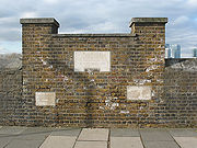
Damage resulting from the flood
A considerable area of the city centre was flooded by this unprecedented combination of events. The most serious incident occurred at MillbankMillbank
Millbank is an area of central London in the City of Westminster. Millbank is located by the River Thames, east of Pimlico and south of Westminster...
, where a 75-foot (25 m) section of the Chelsea Embankment collapsed, sending a wall of water through a generally poor and run-down area. Fourteen people were drowned, unable to escape from the basements in which they were living. Another 4,000 people were made homeless as water filled the streets to a depth of four feet (1.2 m). Elsewhere, the Tate Gallery
Tate Gallery
The Tate is an institution that houses the United Kingdom's national collection of British Art, and International Modern and Contemporary Art...
was flooded to a depth of between five and eight feet (1.5 to 2.8 m), causing extensive damage to its collections. Westminster Hall and the House of Commons were also flooded, as were the London Underground
London Underground
The London Underground is a rapid transit system serving a large part of Greater London and some parts of Buckinghamshire, Hertfordshire and Essex in England...
stations and lines along the riverside. The moat at the Tower of London
Tower of London
Her Majesty's Royal Palace and Fortress, more commonly known as the Tower of London, is a historic castle on the north bank of the River Thames in central London, England. It lies within the London Borough of Tower Hamlets, separated from the eastern edge of the City of London by the open space...
, which had been empty for over 80 years, was refilled by the river, and the Blackwall
Blackwall Tunnel
The Blackwall Tunnel is a pair of road tunnels underneath the River Thames in east London, linking the London Borough of Tower Hamlets with the London Borough of Greenwich, and part of the A102 road. The northern portal lies just south of the East India Dock Road in Blackwall; the southern...
and Rotherhithe Tunnel
Rotherhithe Tunnel
The Rotherhithe Tunnel is a road tunnel crossing beneath the River Thames in East London. It connects the Ratcliff district of Limehouse in the London Borough of Tower Hamlets north of the river to Rotherhithe in the London Borough of Southwark south of the river. It is designated as the A101...
s were submerged. The Manchester Guardian
The Guardian
The Guardian, formerly known as The Manchester Guardian , is a British national daily newspaper in the Berliner format...
described the scene on the morning of 7 January:
The flood was short-lived, and the waters subsided by the end of the day. However, it took considerably longer to drain the many roads, tunnels, basements and cellars that had been flooded.
Consequences
The damage caused by the flood took several years to repair. The most seriously affected area, in Millbank, was largely rebuilt from scratch; the run-down dwellings and warehouses that had characterised the area were so badly damaged that they had to be demolished. They were replaced with modern office blocks and apartment buildings. The current headquarters of MI5MI5
The Security Service, commonly known as MI5 , is the United Kingdom's internal counter-intelligence and security agency and is part of its core intelligence machinery alongside the Secret Intelligence Service focused on foreign threats, Government Communications Headquarters and the Defence...
, Thames House
Thames House
Thames House is an office development in Millbank, London, on the north bank of the River Thames adjacent to Lambeth Bridge, designed originally as commercial head offices...
(designed by Sir Frank Baines
Frank Baines
Sir Frank Baines, KCVO, CBE, FRIBA was at one time the architect heading Her Majesty's Office of Works.His most famous work was Thames House and its neighbour Imperial Chemical House in London, England...
, the Principal Architect of the Government's Office of Works
Office of Works
The Office of Works was established in the English Royal household in 1378 to oversee the building of the royal castles and residences. In 1832 it became the Works Department within the Office of Woods, Forests, Land Revenues, Works and Buildings...
), was one of the new buildings constructed in the area in 1929–30. Imperial Chemical House
Imperial Chemical House
Imperial Chemical House is a building situated on Millbank, London, United Kingdom. It was built between 1928 and 1931 by Sir Frank Baines in the neoclassical style of the inter-war years, at the same time as Thames House, also on Millbank....
, built to a very similar (though not identical) design, was constructed on other side of Horseferry Road
Horseferry Road
Horseferry Road is a street in the City of Westminster in central London, England, running between Millbank and Greycoat Place. It is perhaps best known as the site of City of Westminster Magistrates' Court...
to form a landmark pair of office blocks facing the river.
A new bridge, Lambeth Bridge
Lambeth Bridge
Lambeth Bridge is a road traffic and footbridge crossing the River Thames in an east-west direction in central London, England; the river flows north at the crossing point...
, was constructed to replace its dilapidated predecessor and Horseferry Road was widened to afford access to the bridge. The height of the Embankments was raised and the river wall was strengthened along substantial parts of the river. Proposals were made for the construction of a Thames flood barrier
Flood barrier
A flood barrier, surge barrier of storm surge barrier is a specific type of floodgate, designed to prevent a storm surge or spring tide from flooding the protected area behind the barrier...
but these came to nothing, due to concerns that such a barrier would impede shipping access to the London docks.
The flood of January 1928 was the last major flood in the city centre, although the North Sea flood of 1953
North Sea flood of 1953
The 1953 North Sea flood was a major flood caused by a heavy storm, that occurred on the night of Saturday 31 January 1953 and morning of 1 February 1953. The floods struck the Netherlands, Belgium, England and Scotland.A combination of a high spring tide and a severe European windstorm caused a...
came within millimetres of overtopping the Embankment and did flood Bermondsey
Bermondsey
Bermondsey is an area in London on the south bank of the river Thames, and is part of the London Borough of Southwark. To the west lies Southwark, to the east Rotherhithe, and to the south, Walworth and Peckham.-Toponomy:...
and some other low-lying parts of the city. Another flood affected the lower Thames in 1959. In response to the threat of such floods happening again, plans were made in the mid-1960s to build a flood barrier on the Thames to guard against the threat of storm surges. By then, much of London's shipping had moved to Tilbury
Tilbury
Tilbury is a town in the borough of Thurrock, Essex, England. As a settlement it is of relatively recent existence, although it has important historical connections, being the location of a 16th century fort and an ancient cross-river ferry...
further downriver, greatly reducing the navigational difficulties that a barrier would present. The Thames Barrier
Thames Barrier
The Thames Barrier is the world's second-largest movable flood barrier and is located downstream of central London. Its purpose is to prevent London from being flooded by exceptionally high tides and storm surges moving up from the sea...
project finally got under way in 1974, with the barrier officially opening in 1984.