xyzmapdotcom
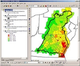
XYZMAP Company has developed new extension to use Google maps like a layer in arcgis 9.x software.It will help you to view google maps as bacground images under your shp layers.you can download google maps , satellites or hybrids into your local or you can use it dynamically in your arcgis software.www.xyzmap.com
Some Properties of this google maps extension :
Heads-up digitizing on satellites
Searching address on google maps and viewing address zone
Using mashup technique to view google maps under your SHP layers
Making geometric correction on google maps.
Using dynamic google maps option to view google maps online
Using static google maps option to download images tile by tile to your local and gives fast viewing option


